The organism
A cell that builds its own roads
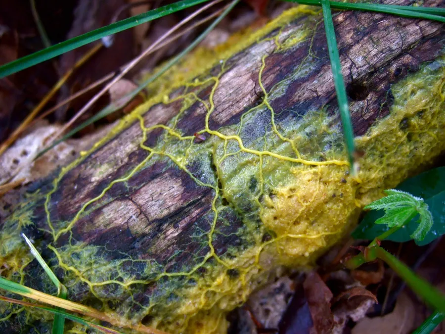
Physarum polycephalum lives on rotting wood and wet leaves. It is called a slime mould, but it is a myxomycete: not a plant, not a fungus, not an animal. While it feeds, it is a single large cell spread out as a network of yellow tubes, without a single neuron.
Inside the tubes the cell's contents flow one way, then back, about once every 100 seconds. Researchers have observed that tubes carrying a lot of flow thicken, while the others thin out.

What moves on the screen is a model, not the organism: more than a hundred thousand particles following the trails the others leave, after Jeff Jones's model (2010).
The maze, 2000
The shortest path, found without a brain
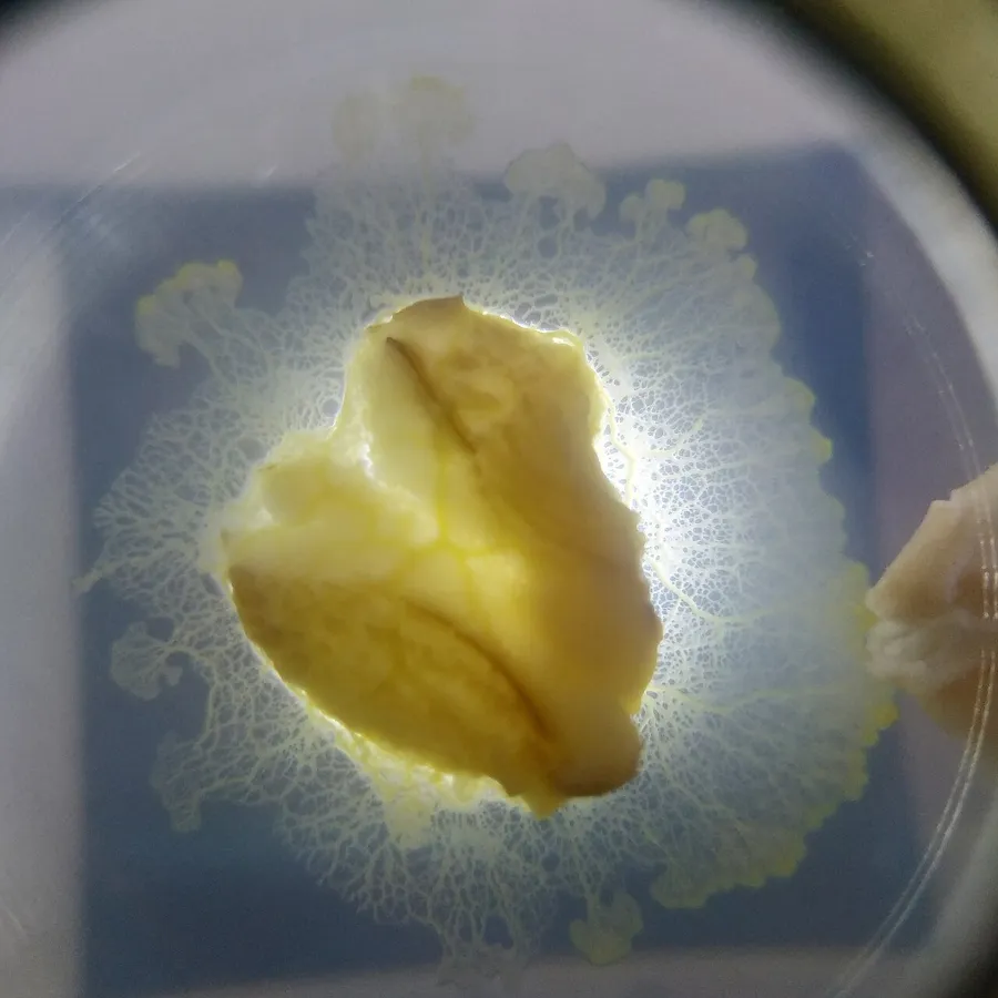
Toshiyuki Nakagaki and colleagues filled an agar maze with pieces of Physarum, which merged into a single cell. Then they put oats at the entrance and the exit. The branches in the dead ends withdrew and, in most trials, one thick tube remained along the shortest path.
The maze had four routes. In the first half, the tube went through the option about 22% shorter every time; in the second, where the options differ by only 2%, it used each about equally often.
On screen runs the model Atsushi Tero and colleagues wrote in 2007 for this experiment, on a maze drawn for this page: a tube thickens when a lot flows through it and thins when little does.
Tokyo, 2010
One cell grew a network resembling the trains around Tokyo
In 2010, Tero and Nakagaki's team placed the organism on a map of the Tokyo region, at the capital, with oats at 36 points representing the region's cities. In some trials, mountains and lakes were lit, because Physarum shies away from light. Within about a day, what remained was a network that resembled the region's railways.

The rail network was 1.8 times longer than the shortest network linking the cities; the organism's networks were 1.75 times on average, over 21 trials. The trains coped better with a break, though: 4% of their links, if cut, would isolate part of the network, against 14% for the organism grown under the light mask and 20% for the one grown without it.
The researchers wrote the rule as an equation: a tube thickens according to how much fluid passes through it. On screen, the equation runs on the Kantō plain, with oats at the 36 largest places at least 12 km apart; the paper does not list the experiment's exact points.
Romania
The same rule, across the Carpathians
The oats sit at Romania's 41 county capitals, Bucharest included, all with the same helping. At the start the country is covered by a fine web of about 22,000 tubes, each about 6 km long.
At each step a city chosen at random sends fluid to another city chosen at random, and every tube thickens or thins according to how much flowed through it.
The mountains take the place of the light in Tokyo: in the version on screen, a tube that crosses 1,500 m costs four times as much as one on the plain.
- the model’s tubes
- county capitals
Growth
Unused tubes withdraw
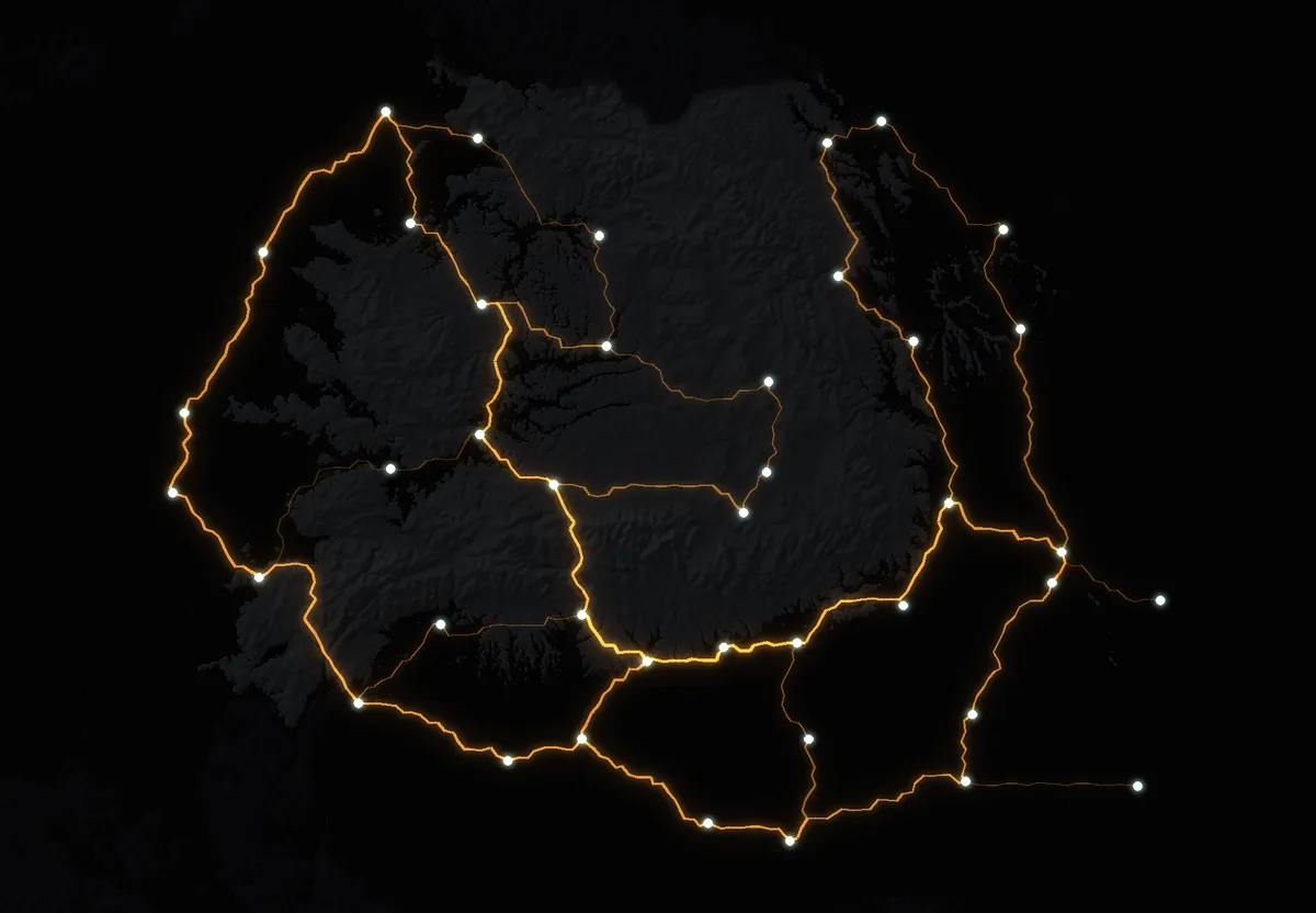
As you scroll, the map runs through the model's 15,000 steps. Out of the fine web, 642 tubes remain, 3,840 km in all, linking all 41 cities.
The dots flowing in the tubes show the fluid moving back and forth, as in the organism, only much faster.
The mountains
Where it crosses the mountains
The lighter areas are those the model avoids. Between Transylvania and the south, the network crosses the Southern Carpathians, in all nine runs, between Sibiu and Râmnicu Vâlcea: beside the railway there and close to the Sibiu–Pitești motorway, partly open and the rest under construction. Only two runs add a second crossing, between Drobeta-Turnu Severin and Deva. Between Brașov and Ploiești it never crosses.
Moldavia, the north-east of the country, joins the rest from the south-east, through Focșani–Buzău and Galați–Brăila, in every run. Across the Eastern Carpathians, the most frequent crossing, between Bacău and Sfântu Gheorghe, appears in five of nine.
Railways
83% of the network runs beside a railway
Blue: main and branch railway lines, from OpenStreetMap. 83% of the length of the model's network lies within 10 km of one of them.
Read that number with care: Romania has many lines, and 59% of the country's land lies within 10 km of a railway.
- the model’s tubes
- railways
The test
The shortest possible network stays just as close to the trains
White: the shortest network linking the 41 cities, drawn over the same terrain. It is 2,770 km long, and 86% of it lies within 10 km of a railway, against 83% for the model. With no mountains at all, the model still reaches 76%.
So the resemblance comes mostly from where the cities are: the railways link the same cities, and a network joining them by short routes passes beside the lines. The mountains add only a few percentage points.
What the model adds is loops. Its network is 1.39 times the minimum length. In the minimal one any broken link splits the country in two; on the map, only 6% of the links between junctions would, and across the nine runs between 6% and 21%.
- shortest possible network
- railways
Motorways
22 of the 41 county capitals have no motorway within 20 km
Red: open motorways, from OpenStreetMap on 25 October 2026; dashed red: those under construction. Even with those finished, 20 county capitals would remain more than 20 km from a motorway.
Against the motorways, the model matches less well than the shortest network, in all nine runs. It does link every city, with 3,840 km of tubes. It is not a motorway plan: it does not know how many people travel between two cities, what a viaduct costs, or where building is allowed.
- the model’s tubes
- open motorways
- motorways under construction
What stays
The links that appear in every run
The model starts from a random web and picks cities at random, so no two runs give the same map. It was run nine times: three starting webs, each with the mountains weighing little, medium and a lot. The glow shows how often a tube passed each place.
41 links between cities appear in all nine runs. For 24 of them, less than 30% of the way has a motorway, open or under construction, within 10 km; for example Iași–Vaslui, Brașov–Sfântu Gheorghe and Craiova–Drobeta-Turnu Severin. The full list is below.
- the model’s tubes
- open motorways
- motorways under construction
Try it
Put oats wherever you like
Here the model runs on your device, on a sparser web with tubes 12 km apart. Tap or click the map to add oats or to remove a city. The network rebuilds itself in a few seconds.