Wooden churches belong to the hills
Romania lists 1,256 wooden churches as historic monuments. Between 200 and 500 metres above sea level, nearly one locality in ten still has one. On the plain, one in ninety. The curve rises the same way on both sides of the Carpathians.
A ring of hills around the mountains
The oldest buildings in a Romanian village are made of squared logs laid one on another. They have lasted three centuries because someone replaced the roof every second generation, and the national list of historic monuments now holds 1,256 of them, each tied to the settlement it stands in.
Plotted, they do not cover the country. They gather in a ring around the outside of the Carpathians: Maramureș, Sălaj and Cluj in the north, then under the mountains through Hunedoara, Gorj and Vâlcea, then north again through Vaslui and Suceava. The Wallachian plain and Dobruja are almost empty. So is the mountain crest.
Loading the atlas…
Three quarters of the churches are placed at village level rather than building level: the point marks the settlement, not the churchyard gate.
The band has a single peak
For every 100-metre band of altitude I counted how many localities Romania has there and how many listed wooden churches fall to them. The result climbs quickly, holds high for three bands and falls away.
Transylvania, Banat, Crișana, Maramureș Wallachia, Oltenia, Moldavia, Dobruja
| Altitude (m) | Localities | Churches | Per 100 localities | Per 100,000 people | Share of listed churches (%) |
|---|---|---|---|---|---|
| 0–99 | 2,839 | 32 | 1.1 | 0.3 | 4.2 |
| 100–199 | 3,806 | 182 | 4.8 | 3.3 | 17.5 |
| 200–299 | 3,481 | 359 | 10.3 | 8.9 | 34.4 |
| 300–399 | 2,930 | 317 | 10.8 | 9.5 | 33.2 |
| 400–499 | 1,895 | 195 | 10.3 | 10.6 | 26.4 |
| 500–599 | 1,075 | 89 | 8.3 | 8.7 | 20.9 |
| 600–699 | 731 | 40 | 5.5 | 4.2 | 16.9 |
| 700–799 | 607 | 19 | 3.1 | 5.3 | 23.5 |
| 800–899 | 402 | 11 | 2.7 | 6.2 | 26.2 |
| 900–999 | 229 | 7 | 3.1 | 7.9 | 50.0 |
| 1,000–1,099 | 142 | 4 | 2.8 | 11.0 | 50.0 |
| 1,100–1,199 | 49 | 1 | 2.0 | 8.3 | 50.0 |
The highest bands hold few localities, so one building more or less moves their rate a long way.
The border shows, but explains little
Public memory ties the wooden church to Transylvania and Maramureș, and the raw figure supports it: Transylvania, the Banat, Crișana and Maramureș hold 9.03 wooden churches per 100 localities, while Wallachia, Oltenia, Moldavia and Dobruja hold 5.72.
The counties contradict it at once. Gorj, a county of the old Romanian kingdom, has 18.2 wooden churches per 100 localities — more than Cluj with 14.1 and Bihor with 11.5. Vaslui has 12.5. And when the rate is drawn by altitude band separately for the two halves of the country, both curves have the same shape: rising to 300–400 metres, falling away after 600.
| County | Localities | Wooden churches | Per 100 localities |
|---|---|---|---|
| Maramureș | 341 | 89 | 26.1 |
| Sălaj | 315 | 69 | 21.9 |
| Gorj | 630 | 115 | 18.2 |
| Cluj | 541 | 76 | 14.1 |
| Vaslui | 570 | 71 | 12.5 |
| Bihor | 512 | 59 | 11.5 |
| Mureș | 579 | 66 | 11.4 |
| Vâlcea | 947 | 92 | 9.7 |
| Hunedoara | 695 | 60 | 8.6 |
| Mehedinți | 442 | 38 | 8.6 |
How much of the gap between the two halves comes from the terrain? I recalculated both rates as if each half had its localities spread across altitude in the same way. The difference narrows from 9.03 against 5.72 to 8.38 against 6.03: terrain accounts for 29% of it. The rest stays. At equal altitude the western half still has nearly 40% more, and the data here does not say why.
Choose “The 1918 border” on the map to see the two halves coloured separately. The points stay where they are: the line runs through the middle of the ring without breaking it.
Rainfall rises with altitude
Annual rainfall gives the same ordering: 0.4 churches per 100 localities in the 400–500 mm band, 5.1 at 500–600, 9.1 at 600–700 and 10.2 at 700–800. The driest band is the Bărăgan plain and Dobruja; the wettest, the sub-Carpathian hills.
The two explanations cannot be fully separated, because in Romania altitude and rainfall rise together: across localities the correlation is 0.61. What can be tested is whether damp shortens a building’s life. If it were the main cause of decay, churches in wet places would be younger on average, the old ones having rotted. They are older: the median year of construction is 1779 in the 500–600 mm band and 1717 in the 800–900 mm band.
| Rainfall (mm/yr) | Localities | Churches | Per 100 localities |
|---|---|---|---|
| 400–499 | 929 | 4 | 0.4 |
| 500–599 | 8,453 | 431 | 5.1 |
| 600–699 | 6,347 | 579 | 9.1 |
| 700–799 | 1,929 | 197 | 10.2 |
| 800–899 | 379 | 33 | 8.7 |
| 900–999 | 144 | 12 | 8.3 |
The church band is the oak band
The European forest inventory holds 13,840 records for Romania, each with a species and a position. Grouped by altitude, the three species groups fall into storeys: oak has its median at 263 metres and nine records in ten below 554; beech has its median at 700 metres; fir and spruce at 1,008.
The median wooden church sits at 322 metres. It stands in the oak storey, and the peak of its curve falls where oak still dominates the woodland and beech is only beginning.
oak beech fir and spruce
The plain is the exception: oak grows there too, and wooden churches almost do not. Lowland woodland was cleared for the plough, and the villages there built their churches in masonry earlier. The presence of oak alone does not explain the empty plain.
What the churches say about their own timber
Romanian Wikipedia carries 1,316 articles on the country's wooden churches. 847 of them match a building on the monuments list, and 186 state what the walls are made of: oak in 135 cases, fir or spruce in 51.
The ratio holds across every province. In Maramureș, where the popular image is of a fir church, the texts give 11 to 3 for oak. In the Banat and in Wallachia every recorded mention is oak. Fir becomes the majority only above 800 metres, where the ratio inverts to 3 against 5 — too few cases to carry weight alone, but pointing the same way as the woodland.
oak fir and spruce
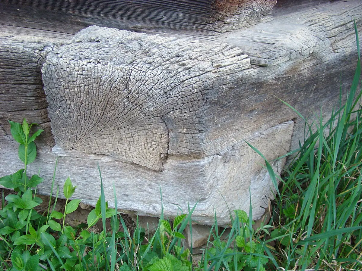
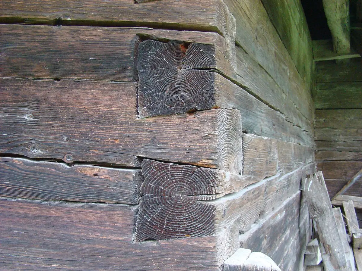
When a text names both species, they are not in the same part of the building. In ten cases an oak sill carries fir walls. The heavy, rot-resistant timber sits at the bottom, where the building touches the ground, and fir is used higher up. The recorded cases are few — ten — but they all point the same way.
Two roofs, one band
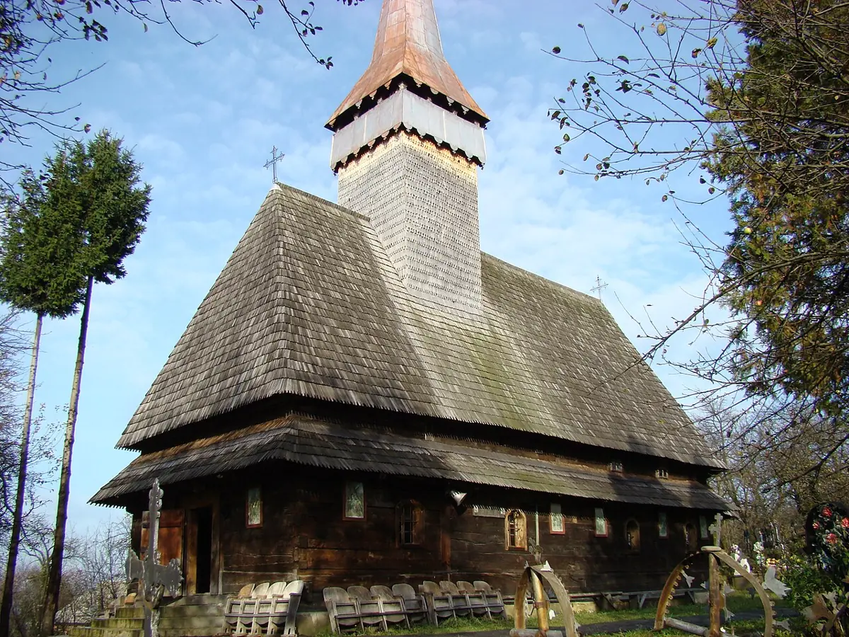
The silhouette changes a great deal from one end of the ring to the other, more than the altitude or the timber does. In the north the bell tower rises over the nave and ends in a sharp spire. In Gorj the belfry sits low over the porch, and the roof reaches almost to the ground above an open verandah.
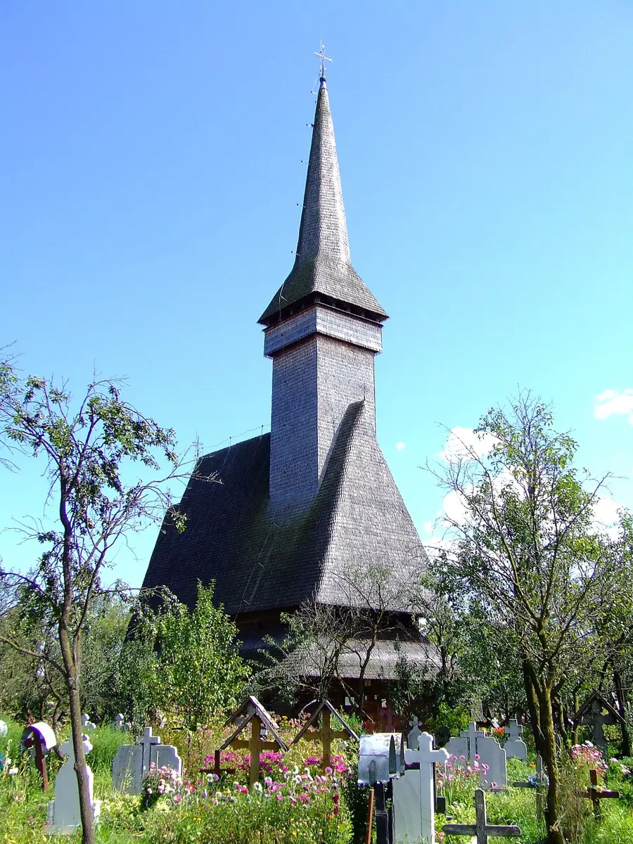
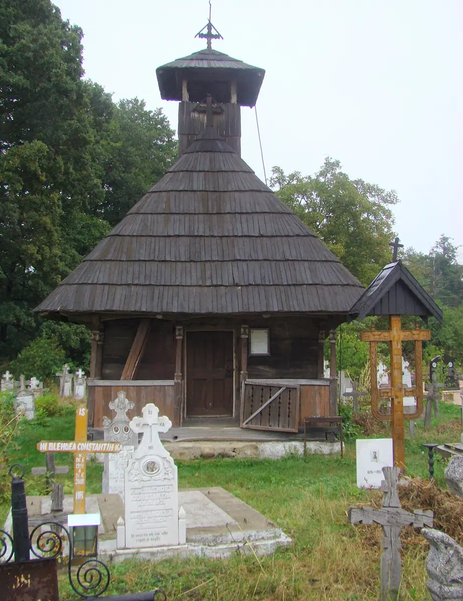
Roof pitch is not recorded anywhere at the scale of the whole list: none of the 1,316 articles gives a figure in degrees, and the monuments list does not describe the buildings. The difference between the two silhouettes above is visible, but it cannot be counted across the country.
Your village
Type the name of a Romanian locality to see how high it sits, how much rain falls there in a year, and which listed wooden church is nearest.
The list holds 18,214 localities from the GeoNames gazetteer, hamlets included. The distance is measured in a straight line, and the church may be over a hill rather than along a road.
What survives is what was built last
Of the 1,252 churches with a date, 697 belong to the eighteenth century and 385 to the nineteenth. Only 155 are seventeenth century or older. Timber is replaced: on the same spot, in the same graveyard, a village built more than once, and the list records the last building rather than the first church.
84 of the articles tied to a listed church say it was brought from somewhere else: bought from a neighbouring village, taken apart, carted and raised again. The oldest date in the list, the fourteenth century, belongs to one of these: the church at Putna, brought by tradition from Volovăț.
How the counting was done
- The churches. From the transcription of the list of historic monuments I kept the 1,256 entries whose name contains both “church” and “wood” in Romanian and which have coordinates. A quarter carry their own coordinates; the rest take the point of their locality.
- The denominator. 18,214 localities with coordinates and a population figure, from the GeoNames gazetteer. The gazetteer includes hamlets, and hamlets are denser in hill country than on the plain; that is why the same rate was recalculated against population and, separately, against the total of listed churches in each band. The shape does not change. The 1,256 churches stand in 1,149 distinct localities, so the rate per 100 localities and the share of localities holding at least one nearly coincide.
- Altitude and rain. Every point was read from a 30 arc-second terrain model and from the WorldClim map of mean annual rainfall at 5 arc-minutes. At 5 arc-minutes a cell is nearly 9 kilometres across, so the value belongs to the area rather than to the village.
- Standardisation. Each half's rate was recalculated by applying its own band rates to the shared distribution of localities.
- The woodland. From the EU-Forest inventory I kept the Romanian records, converted their coordinates from the European projection into degrees and read their altitude from the same terrain model. The inventory describes today's woodland; the forest the beams came from two centuries ago was wider, especially on the plain.
- Timber and joints. From the article texts I extracted species mentions tied to a part of the building (“oak beams”, “oak sills”, “built of fir”). The articles cover part of the list, and those describing the material are the best documented, so the ratio of 135 to 51 describes the buildings that were written about rather than the whole stock.
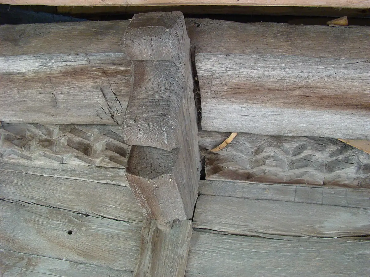
What the available sources cannot support: a national map of roof pitch or of joint type. The first appears in no source covering the country; the second is recorded for 64 buildings out of 1,256.
Sources
- The list of historic monuments, 2015 edition with updates, in the transcription on Romanian Wikipedia — 30,197 entries, of which 1,256 wooden churches with coordinates.
- The “Biserica de lemn din …” articles on Romanian Wikipedia, 1,316 pages retrieved on 10 September 2026, CC BY-SA 4.0.
- A. Mauri, G. Strona, J. San-Miguel-Ayanz, EU-Forest, a high-resolution tree occurrence dataset for Europe, Scientific Data 4, 2017, CC BY 4.0 — 13,840 records for Romania.
- WorldClim 2.1, mean annual precipitation 1970–2000, 5 arc-minute resolution.
- A 30 arc-second digital terrain model derived from SRTM.
- GeoNames, Romanian localities with coordinates and population, CC BY 4.0.
- Photographs from Wikimedia Commons, with author and licence given at each image.