At Dobrovăț, the church and its walls belong to different centuries
At Dobrovăț Monastery near Iași in north-eastern Romania, the church was begun on 27 April 1503 under Stephen the Great, ruler of Moldavia. The enclosure wall is dated to the 17th century; the tower’s upper storeys to 1743. Follow the plan to see which period each part belongs to.
Then choose a nearby road and compare two observer heights in an elevation model.
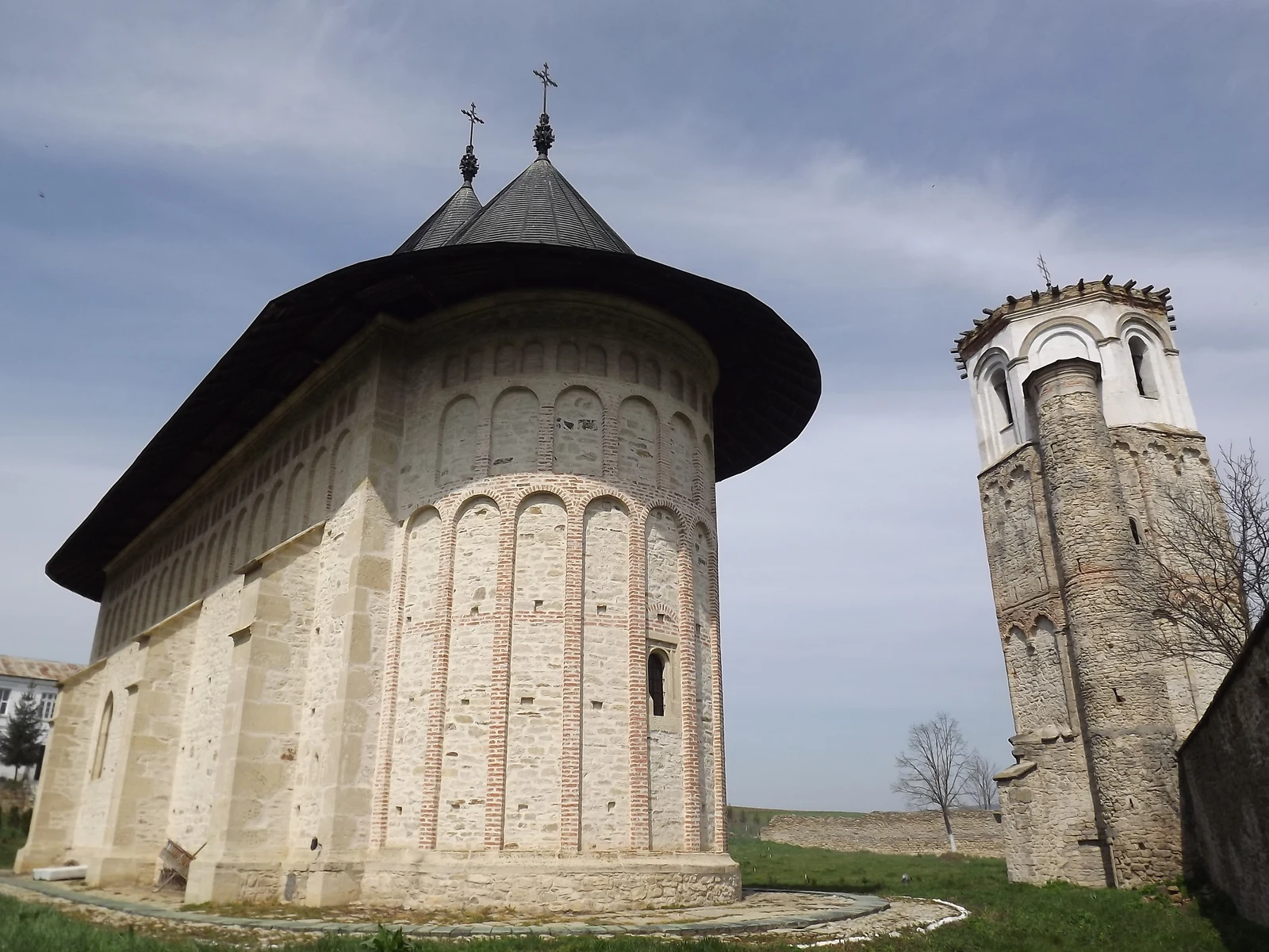
The Church of the Descent of the Holy Spirit and the bell tower at Dobrovăț, in April 2014. Photograph: Stefanoleaota, CC BY-SA 4.0, Wikimedia Commons.
Plan of the Dobrovăț enclosure over the valley relief, with the church, chapel, wall and gate tower datedWhat the plan shows
Today’s OpenStreetMap outlines extend about 119 metres east to west and 87 metres north to south. The irregular enclosure line is about 374 metres long. These are measurements of the mapping, rather than an architectural survey.
The enclosure plan, element by element
Today’s OpenStreetMap outlines extend about 119 metres east to west and 87 metres north to south. The irregular enclosure line is about 374 metres long. These are measurements of the mapping, rather than an architectural survey.
27 April 1503
Stephen the Great’s church
The inscription, in the local authority’s transcription, dates the start to 27 April 1503 and completion to 1504. The white outline locates the church on today’s map. Its bounding rectangle extends about 30 metres east to west and 15 metres north to south; those are not surveyed wall dimensions.
Between the entrance chamber, or pronaos, and the nave lies the burial chamber. The heritage record gives its dimensions as 5.80 by 4.00 metres. It also describes Racoviță family tombstones preserved in secondary positions: a stone’s current position need not mark its original grave.
1527–1531
Painting under Petru Rareș
The heritage record dates the interior painting to 1527–1531 and points to the painted inscription above the votive portrait. The local authority identifies Stephen the Great, his successor Bogdan III and the later Moldavian ruler Petru Rareș in that portrait. The paintings belong to a later phase than the church’s construction.
The exterior has an elongated form, while the three internal apses produce the plan called triconch. Its pointed portal and buttresses belong to church architecture; their presence alone does not date a fortification.
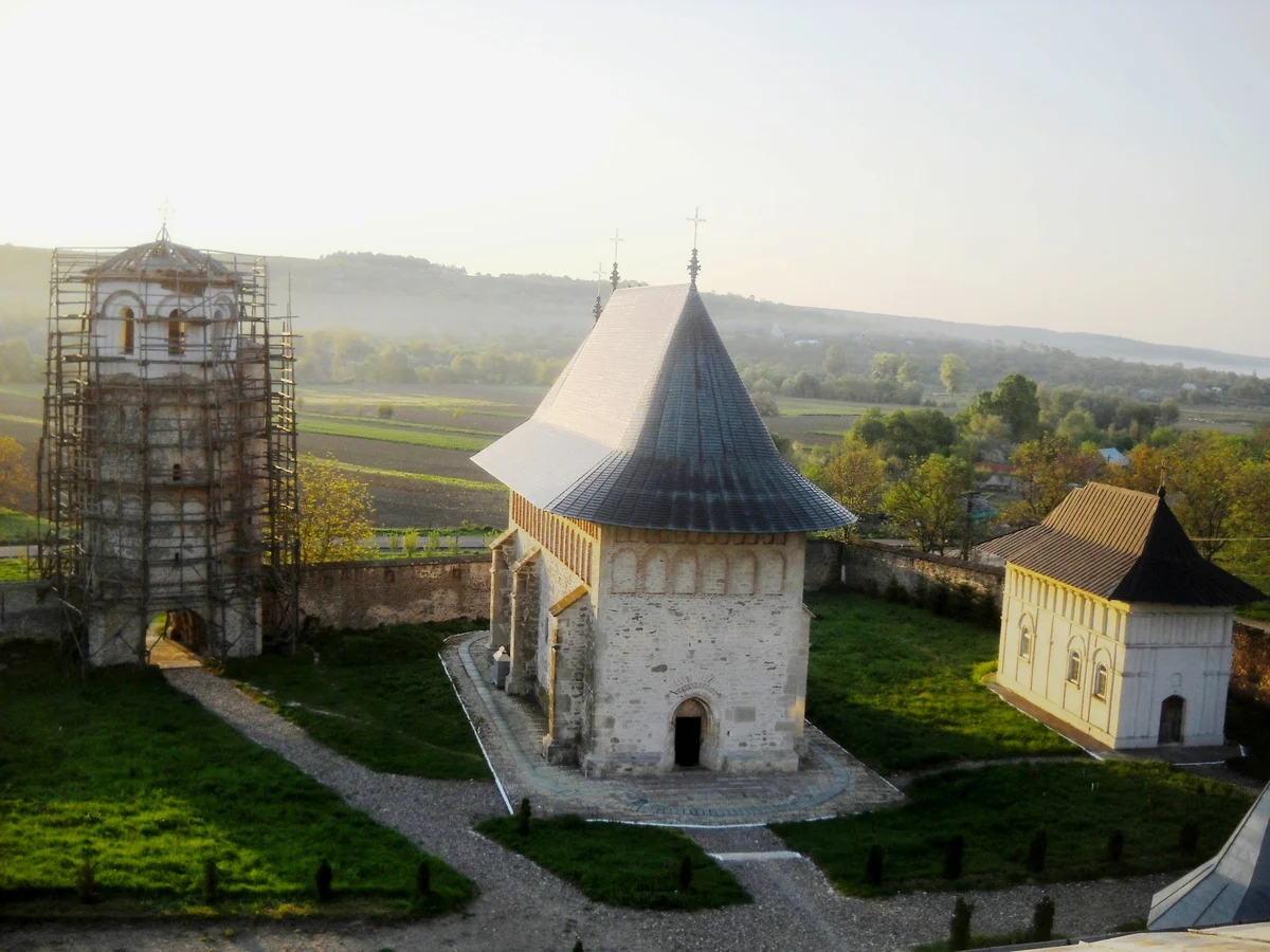
The ensemble in May 2012, with scaffolding around the tower. The main church was built in 1503–1504; the chapel on the right was rebuilt after its collapse in 1986. Photograph: Mihaitudorsky, CC BY-SA 3.0 ro, Wikimedia Commons.
1607 · later rebuilding
The chapel beside the main church
South of the church stands the chapel associated with the foundation of Simion Movilă, a Moldavian ruler, for his son Pavel, who died in 1607. Its drawn position is approximate: published sources disagree about its distance from the main church.
The structure in the photograph includes later rebuilding. The date 1607 identifies a foundation, rather than every surviving wall. In 1658 the monastery was pillaged by Tatars, according to the local authority’s history. The enclosure’s broad dating does not establish whether the wall preceded or followed that attack.
17th century
The wall and lower tower
The heritage record dates the enclosure wall and rectangular lower tower to the 17th century. It describes their bonded masonry as evidence for construction in the same phase. That dates these structures; it does not establish that no boundary existed in 1504.
The same record describes parts of the wall dismantled, destroyed and rebuilt. The OpenStreetMap outline represents today’s mapped enclosure. The long western building is associated with the Racoviță family; documentation before 1663 does not date every alteration to its present form.
5 March 1743
The tower’s octagonal storeys
The tower inscription is dated 5 March 1743. The heritage record distinguishes the older rectangular base from the two octagonal storeys added in the 18th century. It describes the guards’ lodging, chapel and bell chamber on successive levels.
Published sources disagree about total height: the local authority’s history gives about 25 metres; the heritage record gives about 30 metres. Neither establishes an observer’s eye level at a window. The diagram shows the range between those estimates.
An experiment on present elevations
How does height change a sight line?
Choose one of three points on today’s roads. The model compares an observer 1.7 metres above the elevation grid with a hypothetical observer at 25 metres. The target is 1.7 metres high in both cases. The verdict changes for the southern road.
These are point-to-point tests, rather than maximum viewing distances. Elevations may contain vegetation effects; individual trees, walls and windows are not represented. The result explains terrain geometry and does not establish what a guard could see in any historical period.
The approach road
Observer at 1.7 m:The point is about 880 metres away. In the model, the grid intersects the target line about 360 metres from the observer.
Hypothetical observer at 25 m:At 25 metres, the line to the same point stays above the grid. This is a model assumption, rather than an observation from the bell chamber.
What does the inscription establish?
The transcription published by Dobrovăț’s local authority gives the starting day and completion year of the church. Its reproduced text stops after the word “month”. An incomplete transcription does not establish why that month is missing.
Work begun
Year 7011, 27 April
1503 in the published transcription
Work completed
Year 7012
1504; the month is not supplied
Accounts of the monastery call it Stephen’s “last foundation”. That could mean the last church begun, the last completed or the last monastic institution founded. Each needs different evidence. The starting date is precise; priority over his other foundations is not established here.
Stephen the Great died on 2 July 1504. A completion year without a month cannot establish whether the church was finished before or after his death. The local authority’s history places completion under his successor Bogdan III; that is a historical account, rather than a conclusion derived from the missing month.
After 1504: prison, school, restorations
The local authority’s history records a prison in the buildings from 1865 to 1900, a girls’ orphanage from 1900 to 1903 and an agricultural school from 1903 to 1930. It dates legal re-establishment by royal decree to 14 May 1913 and the monks’ return to 1930. Those dates distinguish institutional restoration from the resumption of monastic life.
The heritage record signed by museum specialist Sorin Iftimi describes the 1974–1976 restoration: the three domed towers added to the church in 1851 were removed and a single roof followed the model in the votive portrait. Today’s appearance includes that restoration; the building has changed substantially since its foundation.
For the small chapel south of the church, 1607 dates the foundation associated with Pavel Movilă. The heritage record also documents remodelling in 1851, collapse in 1986 and subsequent rebuilding. A foundation date does not automatically date every wall now visible.
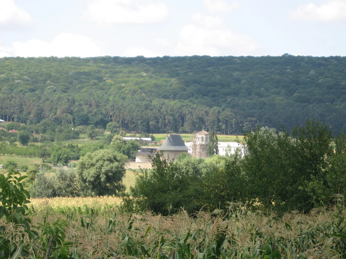
The monastery and wooded slope in 2009. Trees affect a view from ground level; the elevation experiment above does not reproduce their shapes. Photograph: Cezar Suceveanu, CC BY 3.0, Wikimedia Commons.
On a visit, look for the inscription beside the main church entrance and the votive portrait inside. Then compare the tower’s rectangular lower part with its octagonal upper storeys, added in 1743. The monastery is in Dobrovăț commune, Iași County. Access to the tower is unconfirmed; ask the monastic community before planning to climb it.
Method, sources and limits
Construction dates follow the Iași County heritage record, signed by museum specialist Sorin Iftimi, and the local authority’s history. The record dates the wall and rectangular lower tower to the 17th century, and the octagonal upper storeys to 1743. The sources do not establish a precise construction year for the wall.
The plan uses OpenStreetMap outlines and AWS Terrain Tiles elevations encoded as Terrarium. That encoding does not guarantee removal of vegetation from the measurements. The experiment compares observers 1.7 and 25 metres above the grid elevation with a target 1.7 metres high, allowing for Earth curvature without refraction. Individual trees and buildings are not modelled.
The observer starts at the approximate centre of the tower footprint in the north-east of the enclosure, identified on today’s mapping and the ensemble photograph. The position and elevations are not surveyed. Each verdict concerns one selected point under the stated assumptions; it is neither a maximum viewing distance nor a reconstruction of a medieval guard’s view.
Sources: Sorin Iftimi’s heritage record for Dobrovăț; the local authority’s history; OpenStreetMap; AWS Terrain Tiles. Photograph authors and licences accompany the images.