West, then back east
The Mureș collects water from Transylvania and carries it into the Tisza in Hungary. The Tisza joins the Danube in Serbia. For water near Arad, the sea lies east and the journey starts west.
THE PATH OF RAIN · A WATER ATLAS
At Arad, the Mureș flows west: through the Tisza, then into the Danube and the Black Sea. Pick a place to follow the water, then discover the land that feeds it.
Terrain-based flow model · HydroSHEDS · roughly 1 km grid
What the map can tell you ↗
Terrain-based route
Terrain-based flow model · HydroSHEDS · roughly 1 km grid
Before the first river, the line shows estimated overland flow. Gutters, sewers and infiltration need other data.
THE GEOGRAPHY OF A JOURNEY
Terrain divides water into catchments. National borders cut across them.
The Mureș collects water from Transylvania and carries it into the Tisza in Hungary. The Tisza joins the Danube in Serbia. For water near Arad, the sea lies east and the journey starts west.
A watershed divide is the boundary between two catchments. Drops falling on opposite sides of a ridge can set off towards different rivers. Move your selected point on the map and compare the routes.
Most of Romania lies within the Danube basin. Along the coast, some catchments drain directly towards the Black Sea. The model may also end some routes at an inland depression.
The Mureș–Tisza–Danube connection: ICPDR · Tisza basin
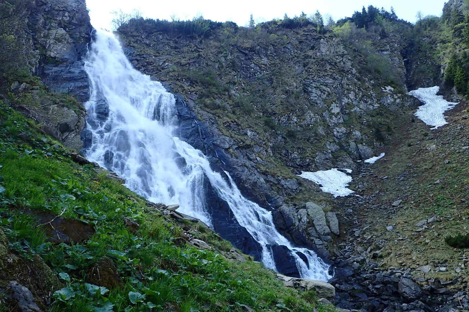
REVERSE THE QUESTION
In “Where it gathers” mode, the map finds every terrain cell whose flow directions lead to the selected point. On a hillside, that area may be small. On a large river, it can include mountains, fields and towns in several countries.
To explore a nearby river’s catchment, choose “At the first river downstream”. The map follows the flow to that river and separately marks the new calculation point. The shaded area describes a potential surface connection; it does not measure how much rainfall actually arrives.
THE MEETING WITH THE SEA
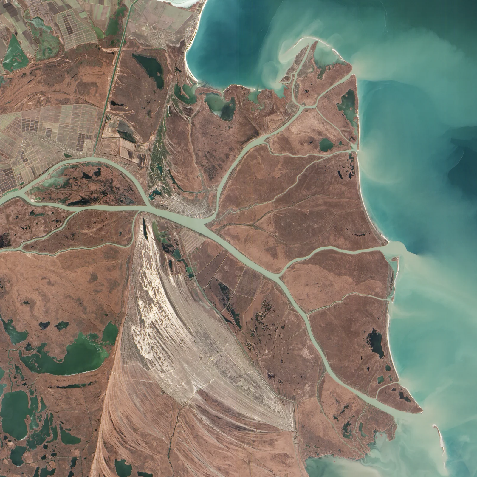
In its delta, the Danube divides its water between distributaries. The satellite image shows the branches and sediment carried towards the sea. Our map’s model assigns one direction to each cell, so its final line is a simplification.
WHAT THE MAP KNOWS
The map follows HydroSHEDS v1 flow directions for Europe on a 30 arc-second grid. In Romania, a cell measures roughly 0.6 × 0.9 km. Terrain is represented at this scale; individual roofs and ditches cannot be identified.
Each cell points to one of its eight neighbours. We follow these links to a model endpoint. The animated drop illustrates the order of places; its speed does not represent actual water travel time.
Starting at the selected cell, we recursively find neighbours that send water to it. We add the areas of the cells, accounting for latitude. Endpoints and results near the data boundary are labelled accordingly.
Infiltration, evaporation, sewers, dams, diversions and branching channels can alter water movement. The map does not calculate flood risk, flow volume, travel time or drainage from a street address.
Blue lines come from accumulated flow in the same model. Names and borders provide orientation and are cartographically generalised. The study area includes the Danube basin outside Romania; point selection starts inside Romania.
Data and imagery accessed 7–8 September 2026.
This product Drumul ploii incorporates data from the HydroSHEDS version 1 database which is © World Wildlife Fund, Inc. (2006-2022) and has been used herein under license. WWF has not evaluated the data as altered and incorporated within Drumul ploii, and therefore gives no warranty regarding its accuracy, completeness, currency or suitability for any particular purpose. Portions of the HydroSHEDS v1 database incorporate data which are the intellectual property rights of © USGS (2006-2008), NASA (2000-2005), ESRI (1992-1998), CIAT (2004-2006), UNEP-WCMC (1993), WWF (2004), Commonwealth of Australia (2007), and Her Royal Majesty and the British Crown and are used under license. The HydroSHEDS v1 database and more information are available at https://www.hydrosheds.org.
Incorporated data are subject to the HydroSHEDS licence, including its restrictions, disclaimers and attribution requirements. Standalone redistribution is prohibited. HydroSHEDS licence.
