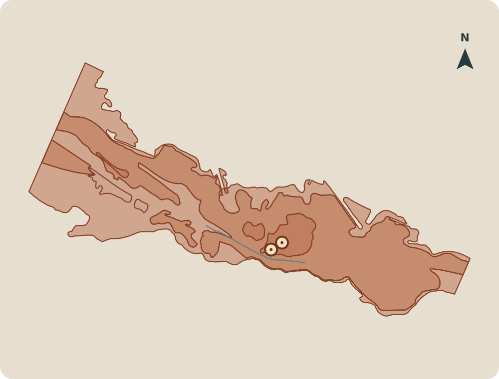
3–4 November 1966 · Arno basin
¶Rain fell across several basins, and river flow depends on the station
Exceptional rain on 3 and 4 November 1966 swelled the Arno and rivers in neighbouring Tuscan basins. V01 V13
The Comune di Firenze reports a basin average of 160 mm over 24 hours. Local peaks reached 250–300 mm. V01
The De Marchi commission gives a little over 200 mm basin-wide over about 28 hours. Its window and method differ; both sources describe the same storm. V13
The 751 mm maximum over 48 hours belongs to Barcis, in the northeastern Alps — not Casentino. For the Arno basin, the study gives more than 300 mm over two days. V01
Peak flow changes with the station. The Comune di Firenze reports 4,100 m³/s at Nave di Rovezzano; the official hydrological yearbook records 3,540 m³/s at Nave di Rosano. These are different stations, and the published records do not support reading them as one settled flow for the city. V08
- 4,100m³/sNave di RovezzanoComune di Firenze
- 3,540m³/sNave di RosanoOfficial hydrological yearbook, 1969
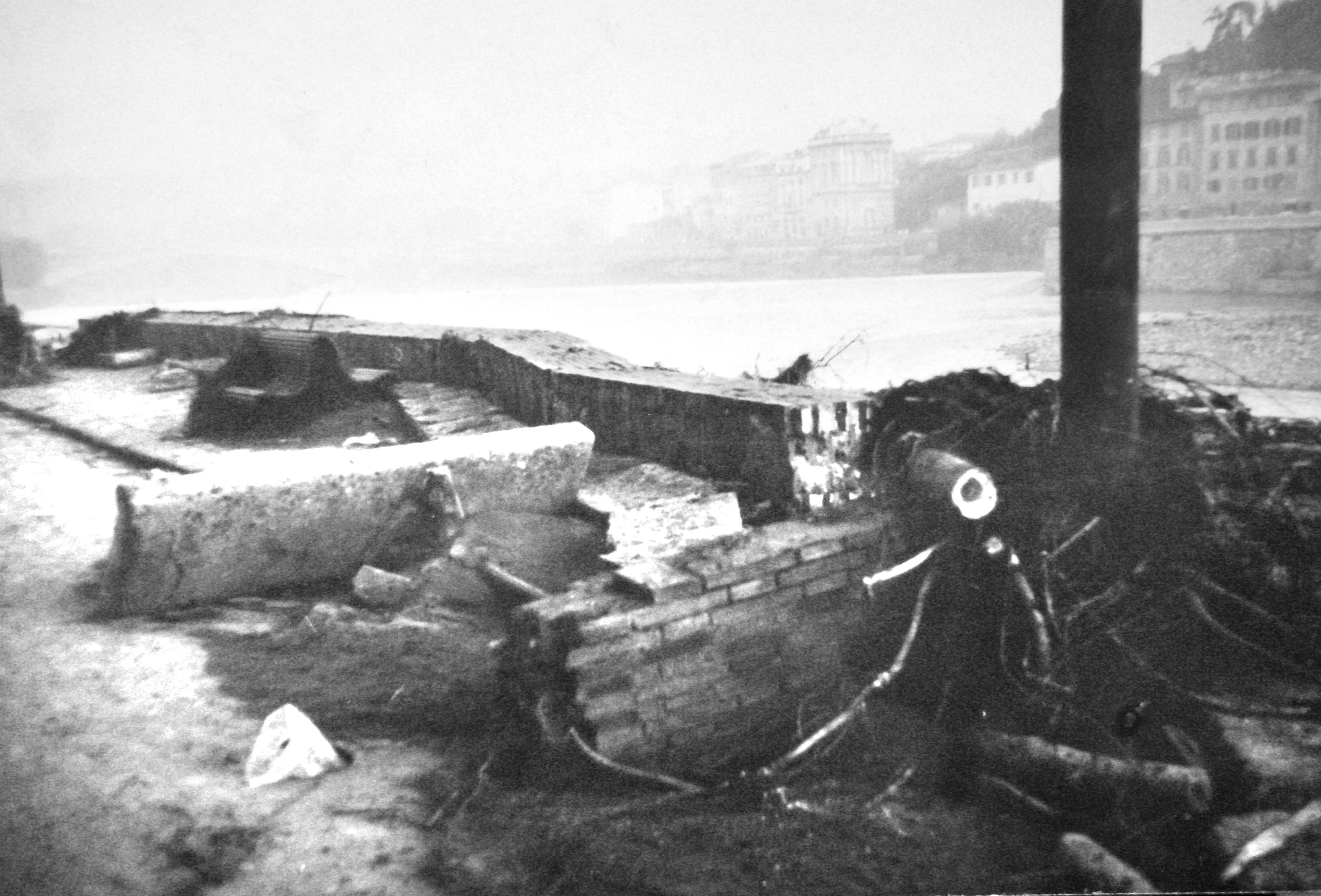
Ricce · file dated 29 May 2009 · 3264 × 2214 pxWikimedia Commons · Public domain · live PD template and visible status verified
The city, measured street by street
¶Water reached different heights; the death toll also depends on the register
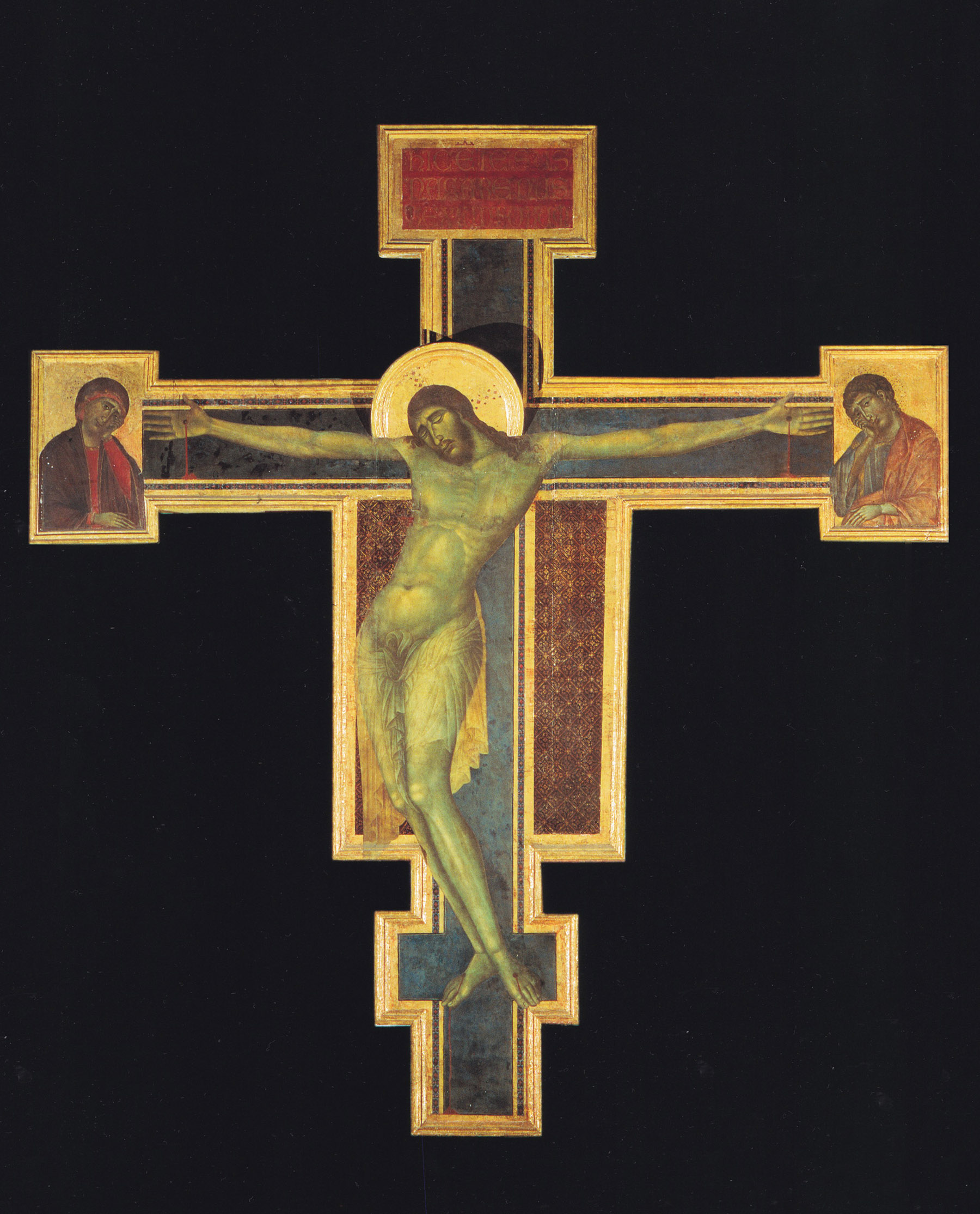
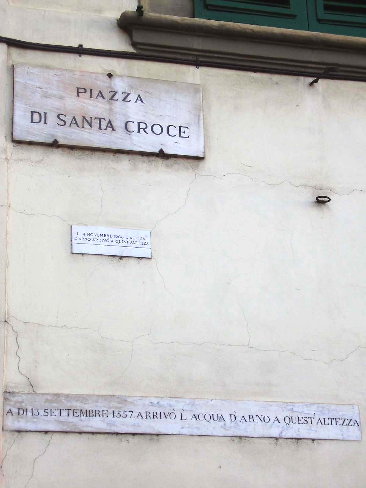
Water left marks at different heights. Civil Protection records 4.92 m on Via dei Neri; at Santa Croce’s refectory, the level is 5.02 m. The Uffizi reports about 6 m at the Cimabue Crucifix’s location. Each height stays tied to its place. V03 V16
The prefectural list commemorated by the municipality counts 35 deaths in Florence and its province: 17 in the city, 18 in the province. V11
CNR-IRPI counts 47 in Tuscany, including 38 in Florence province. Venice stays outside both totals. V11
35
Florence and its province
Prefectural list: 17 in the city, 18 in the province.
47
Tuscany
CNR-IRPI count includes 38 in Florence province.
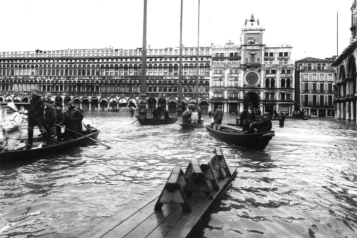
Unknown author · file dated 4 November 1966 · 1200 × 800 pxWikimedia Commons · Public domain · live PD template and visible status verified
Biblioteca Nazionale Centrale di Firenze
¶Almost one million bibliographic units, of several kinds
The Biblioteca Nazionale Centrale di Firenze (BNCF), Florence’s central national library, describes almost one million affected bibliographic units. V11
Its 2026 breakdown: about 300,000 books, 460,000 volumes of newspapers and periodicals, and 400,000 pamphlet units. The library does not call all of them “books”; the categories stay separate, without a more precise total than the one it publishes. V11
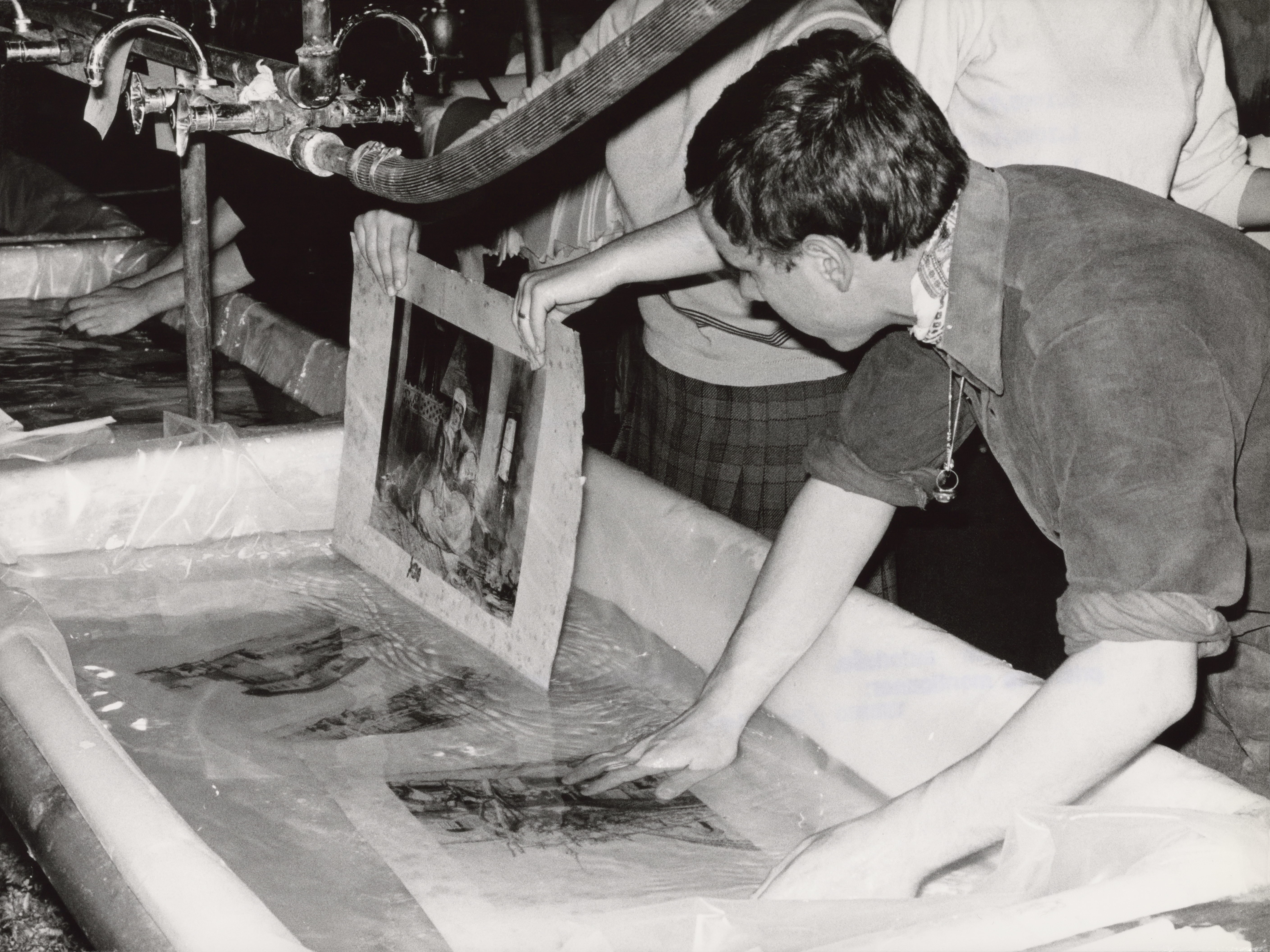
The first washing and drying began at Florence railway station’s central heating plant. V03 V06
The books were then dried and stored at Forte Belvedere. Fortezza da Basso hosted the separate art-restoration operation. V03 V06
Rescue took the shape of a work sequence: sorting and collation, disbinding, washing and other wet treatments, paper repair, sewing, rebinding. This production-line effort helped make high-volume book conservation an institutional practice. V05
- 01Railway heating plantThe first washing and drying operation.
- 02Forte BelvedereSubsequent drying and storage.
Separate art-restoration operation: Fortezza da Basso
Dominique Roger / Adam Cuerden · file dated 1966 · 5635 × 4225 pxWikimedia Commons · CC BY-SA 3.0 igo
Santa Croce · Uffizi
¶Cimabue’s Crucifix lost about 60% of its painted surface
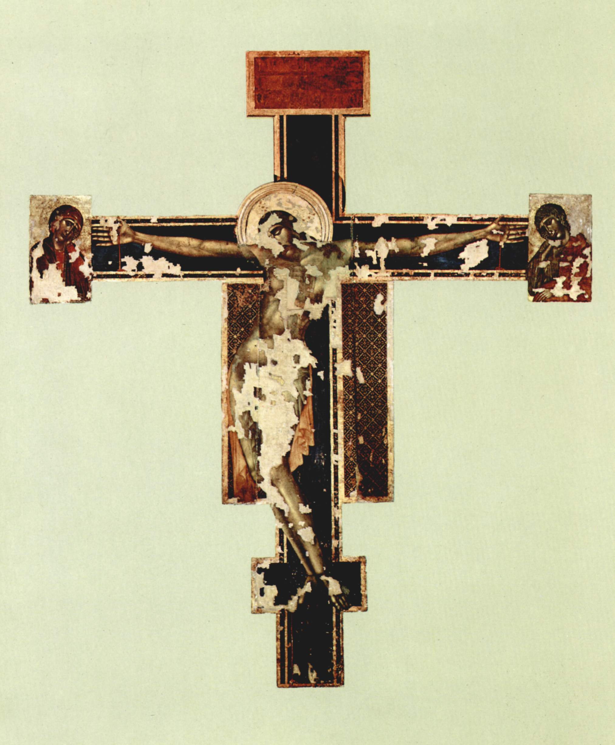
Water, fuel oil and mud left different marks on the artworks. Santa Croce and the Uffizi estimate that the Crucifix by Cimabue, a Florentine painter, lost about 60% of its painted surface. The figure describes this one work. V02
For movable works as a whole, CNR uses a broad estimate: about 1,500 affected objects. V06 V11
The inventory has limits. It does not automatically include frescoes, furnishings, liturgical objects or every architectural surface. V06 V11
The Uffizi’s photographs and recovery lists preserve uneven damage and specific interventions. They show the scale without combining unlike collections and categories under one denominator. V05 V06
Ismoon · file dated 26 June 2019 · 1800 × 2228 pxWikimedia Commons · CC BY-SA 4.0
The Yorck Project · file dated file date not stated · 2024 × 2449 pxWikimedia Commons · Public domain · reproduction and underlying term checked
Thousands from Italy and abroad
¶“Mud Angels” became the name for a mass mobilisation
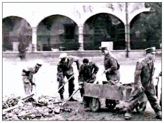
Thousands of volunteers came from Italy and abroad. They cleared mud and recovered books and artworks. Institutional accounts support the scale of the mobilisation, not a complete census. V04
Angeli del fango — “Mud Angels” — became their name later. Giovanni Grazzini is often credited with the phrase, but its exact first use remains disputed. V04
The name’s origin remains disputed; institutional accounts preserve the documented work: mud cleared, books and artworks recovered. V04
angeli
del fango
Thousands of volunteers cleared mud and recovered material. There is no complete census of their exact number or countries of origin.
Raga Salvatore · file dated 23 January 2018 · 536 × 401 pxWikimedia Commons · Public domain · live PD template and visible status verified
A process that began before the flood
¶The flood accelerated modern conservation; it did not create it
Ugo Procacci’s modern restoration cabinet had existed at the Opificio delle Pietre Dure, Italy’s state restoration institute, since 1932, more than three decades before the flood. V07
The works’ immersion sharply increased the volume of work and collaboration. Pressure also grew to formalise scientific and high-volume conservation methods. V07
The modern Opificio took shape in 1975 by merging the historic institution with Procacci’s cabinet. V07
Vasari’s Last Supper at Santa Croce spent more than 48 hours underwater. Its restoration ended with the work’s return in 2016. V07
- Ugo Procacci’s modern restoration cabinet
- Exceptional volume and wider collaboration
- Merger that forms the modern Opificio
The BNCF project in 2026
¶30,000 units remain inaccessible because their identities were lost
The BNCF says about 30,000 miscellany units remain inaccessible: their shelfmarks or bibliographic identities were lost. V14
A project begun in 2026 is working to identify them and restore their place in the catalogue. V14
The figure tracks identification and access; it does not count material left physically unrestored. Physical treatment and bibliographic recovery are different kinds of work. V14
The BNCF is working on identification and access; this is not a count of material left physically unrestored.
Status on 30 September 2026
¶Urban protection was declared complete; the Arno basin was not
On 30 September 2026, the Comune di Firenze declared its urban Arno protection system complete. V15
The package covers about 4.5 km of riverbank interventions, parapets, permanent containment and removable panels. The panels depend on forecasts and timely installation. V15
Upstream, works around Figline — Restone, Pizziconi, Prulli and Leccio — and the raising of Levane remain in design or implementation. Protection has improved and risk has been reduced; risk has not been eliminated, and the whole basin has not been declared safe against every event. V15 V09
In Venice, the tide separately reached 194 cm at 18:00 on the same day. Another city, another water system: that figure stays outside Florence’s flood tally. V10
Urban system declared complete
About 4.5 km of interventions, parapets and removable panels.
Upstream work continues
Protection has improved; risk has not been eliminated.
Sailko · file dated 1 January 2005 (according to EXIF data) · 1200 × 1600 pxWikimedia Commons · CC BY-SA 3.0
Reading the traces
Sources and their limits
The figures retain each source’s geography and method. The selected photographs have verified file records and credits; the register shows what each source supports and where it stops.
Measurements are kept by station, counts by geography, and physical damage apart from problems of identification and access. The historic map uses the Comune di Firenze’s official layer; OpenStreetMap geometry is for present-day orientation only, labelled current and dated at extraction. V12 V15
- V01
Flood archive photographs and rainfall context
The Uffizi archive guides image selection; the Comune’s official figures and the meteorological reconstruction give the rainfall context.
- V02
Cimabue’s Crucifix
Santa Croce and the Uffizi document the loss of painted surface and the work’s history.
- V03
Water mark and book rescue
Civil Protection identifies the Via dei Neri mark; the BNCF documents the rescue locations.
- V04
Volunteers and their name
Institutional accounts support the participation of thousands of volunteers; the phrase’s exact origin remains disputed.
- V05
Photographs and the art recovery inventory
The Uffizi photographic archive and recovery list provide visual and inventory evidence with defined scope.
- V06
BNCF’s damaged material and rescue route
The BNCF’s institutional history describes the material, treatment sequence and locations used.
- V07
Opificio history and Vasari’s Last Supper
The Opificio describes modern restoration’s antecedents and the restoration of Vasari’s work.
- V08
Peak flow at two stations
The Comune di Firenze and the official hydrological yearbook publish values at different stations.
- V09
Levane allegations and the experts’ conclusion
Sources show that allegations existed and relay the experts’ conclusion; the original report was not located.
- V10
Venice, 4 November 1966
The Comune di Venezia records the exceptional tide level separately.
- V11
Victim and damaged-material figures
The Comune, CNR, BNCF and Uffizi publish counts with their own geographies and categories.
- V12
Official 1966 flood GIS footprint
The Comune dataset derives the historic water footprint from depth contours and declares a CC BY 4.0 licence.
- V13
Timeline of rain, flood and inquiry
The De Marchi report, hydrological yearbook and parliamentary record distinguish event dates from report dates.
- V14
BNCF project for still-inaccessible units
The BNCF’s May 2026 notice describes lost shelfmarks and identification and cataloguing work.
- V15
Urban defences and basin works
The municipality’s 30 September notice and regional acts describe different areas and project stages.
- V16
Flood-level plaques
Physical points must be matched to the official Via dei Neri level and the plaques’ actual locations.