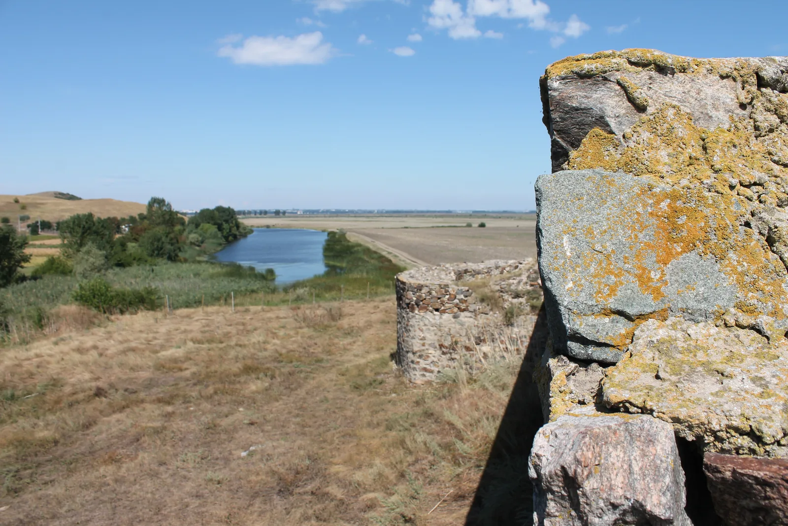
On the right bank of the Danube, between Galați and the delta, stand two Roman forts: Noviodunum, at Isaccea, seat of the fleet, and Dinogetia, at Garvăn, an island fort in a marsh, today fields. Between them lie 30.1 km of floodplain — a long gaze.
What could a sentry have seen? Six points — three at Noviodunum and three at Dinogetia — estimate the view from an eye 1.7 m above a hypothetical wall-walk, 6 m above ground. The calculation uses today's relief and leaves out trees and buildings; it is not a historical observation.
The Noviodunum watch
Noviodunum stands on a promontory, 2.5 km north-east of Isaccea. By Lockyear’s account this was the last easy crossing of the Danube; Rome kept its fleet here — the Classis Flavia Moesica.
The fleet's port is sought underwater: in 2016, underwater survey found a deep channel along the north side, parallel to the bank — the harbour hypothesis rests on it.
The walls are 3 m thick. The north curtain, mostly under the Danube’s water, had 7 towers; the south side, the visible one, shows three excavated towers, one fan-shaped. On the fortress walls stand the first three watches.
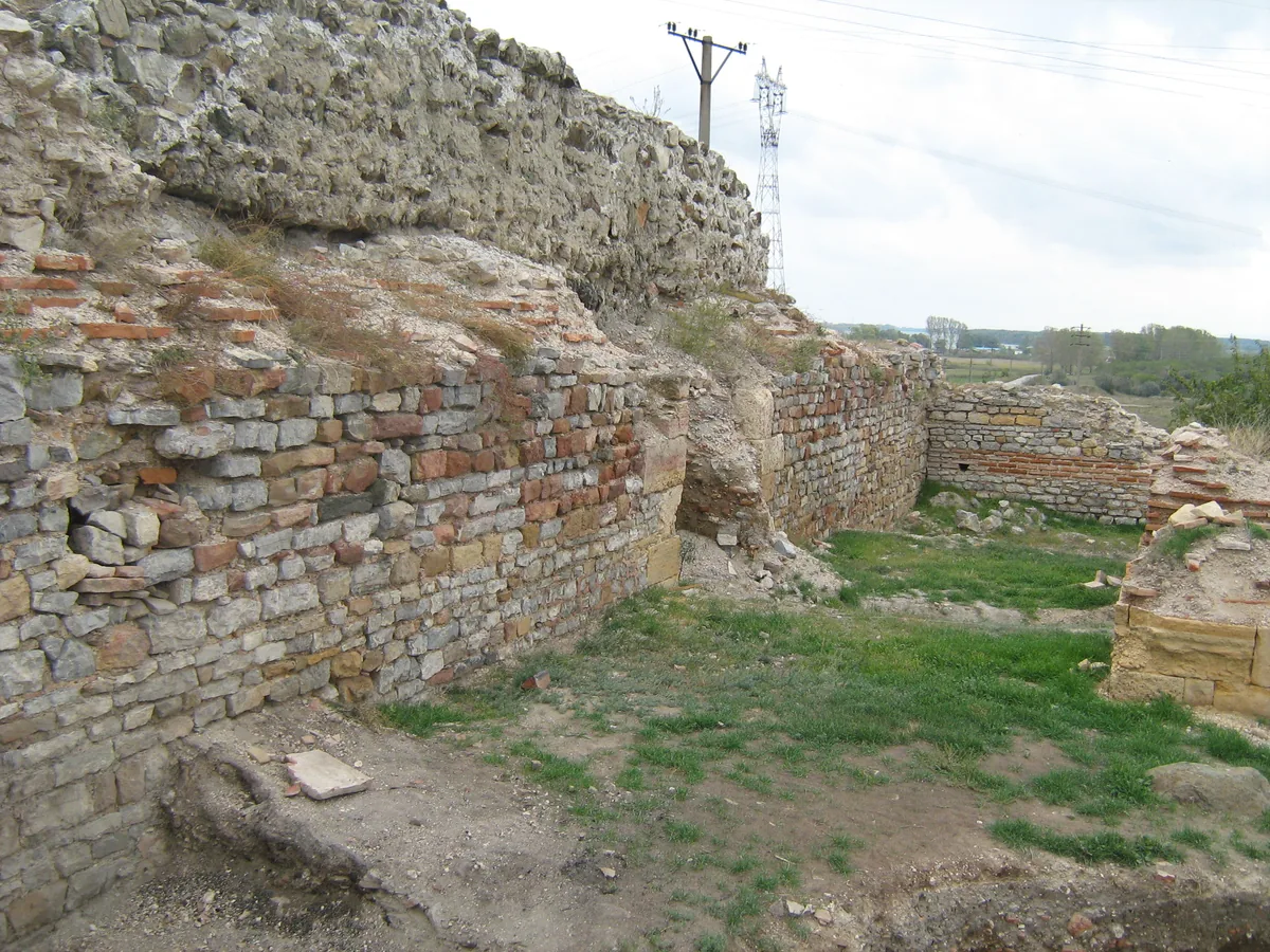
On the crown: eleven
From the crown — eye at 27.9 m above the sea — show the Danube north and the fleet harbour west-north-west, then Orlivka across, 6.60 km out. Eleven named things are in sight here.
Among them, 30.14 km west-north-west, Dinogetia: its walls clear the line by 8.7 m, its towers by 14.7 m — and 47.4 km east-south-east shows Beștepe. Hidden: Ceatal Ismail — the fork where the delta begins, 19.6 km out — 3.9 m under the line. The delta begins four metres below the sentry's horizon.
At the south-west wall: six
Behind this wall the archaeologists opened Area 1. From 7.7 m, the count falls to six: the near waters slide to the limit, 2–3 m above the line.
The sister fort is out of sight: the line to Dinogetia passes 6.1 m under the ground. Beștepe too — the crown stands in the way: the wall was blind to the east.
At the shore: seven
At the 1950s bastions, the eye stands at 9.2 m — yet the count climbs to seven, one more than at the wall. Beștepe returns, the farthest thing counted: the crown no longer blocks the east.
Dinogetia, though, sinks away entirely: −21.8 m — distance and the Earth's curve swallow the walls.
The line between the forts: 30.1 km
Crown to Dinogetia: a 30.14 km line across 1–5 m floodplain. In the Terrarium model, the line clears the crown by 8.7 m and the south-east and west gates by 6.0 and 4.2 m. If the target is placed 12 m above Dinogetia's ground, the calculation gives +14.7 m; FABDEM gives −37.1 m for the same target.
The line crosses two woods mapped today. At the 4.2 by 2.5 km forest, Terrarium reads 1.5–7.5 m while FABDEM reads 23–25 m; the Crapina gallery wood produces a similar mismatch. The difference between the grids alone does not establish canopy height or visibility on the ground.
The Dinogetia watch
Dinogetia stands on the Bisericuța popină, a knoll at 8–10 m, 6–7 m above the Lățimea marsh, drained today. The site record: by Garvăn, 3.5 km from the Danube bend at Galați. It was a rocky island in the Danube marshes; today it is a knoll in fields — the fort on its mound, fields to the horizon.
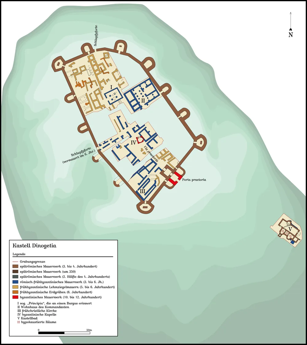
Diocletian's wall rings some 10,000 m²: 3 m thick, 14 horseshoe towers, the main gate on the south-east side (Princeton alone says the middle of the south side), two more gates west and north. The burning of 559 — Zabergan's Kutrigurs — closed the sixth century; between 600 and 970 the layer is thin and empty. Then coins of John Tzimiskes: the tenth–twelfth centuries live in the fort again.
On these walls stand the other three watches.
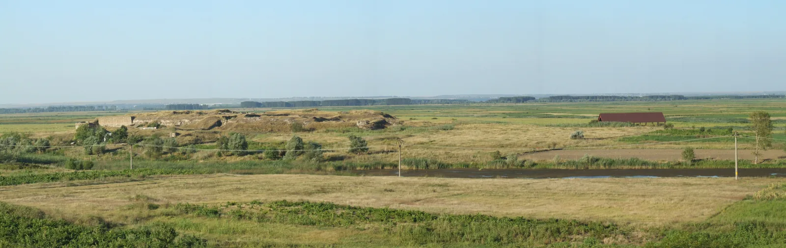
At the main gate: six
From the main gate — eye at 17.2 m — six are counted: Crăcănele, Văcăreni, Galați, Sulucu, Boclugea and Noviodunum 30.1 km east-south-east, 6.0 m above the line.
At the limit, Țuțuiatu, the 467 m Măcin peak, clears by 5.0 m, but on an edge: a 50 m shift overturns it. And the Danube itself, 5.11 km north-north-east, sits a tenth of a metre off the line.
At the west gate: seven
Only from the west gate do the numbers work out for the Măcin summit: Țuțuiatu, 467 m, 21.7 km south-south-east, 6.8 m above the line — positive at all three refraction values. FABDEM leaves it doubtful (−1.0 m in the middle): the maps disagree. With it the count rises to seven.
Noviodunum shows too, by 4.2 m — nearer the limit than from the main gate. And the Danube stays in doubt: −0.3 m at 5.09 km north-north-east, −2.4 m toward Galați.
At the north gate: five
The north gate is the lowest — 4.2 m — and the count falls to five: Galați stays, but Noviodunum slides to the limit at 2.3 m, and Țuțuiatu joins it, refraction split.
Five, six, seven — the more open the spot to the south and west, the more of the Măcin side and the sister side joins the list. Dinogetia's wall is a graduated instrument.
Which system? No “last fort”
“The last fort before the delta” dies on the map: downstream of Noviodunum stand Tulcea — ancient Aegyssus — and Murighiol — ancient Halmyris. Noviodunum was not the last fort; it was the last easy crossing of the river. And the crossing runs today: the Orlivka–Isaccea ferry cuts the Danube by the fort.
So what was Noviodunum? The fleet's seat — the Classis Flavia Moesica — with inscriptions and stamps found in the fort. Across the water stood its pair, Fort Aliobrix — and Orlivka showed from the crown, 6.60 km out.
Both forts stand on late Roman walls, abandoned in the first half of the seventh century and lived in again from the second half of the tenth. At Dinogetia the main gate was rebuilt in the tenth–twelfth centuries; at Noviodunum Byzantine pits kept about 160,000 fish bones. The fort ate from the river it guarded.
A clear morning on the wall
On a clear morning, from Noviodunum's crown, look for the Danube north, Orlivka across — and on azimuth 294, Dinogetia: you probably will not make it out: the woods hide it, though the terrain in the model does not stand in the way.
From the main gate: Crăcănele 1.2 km west-south-west, then Galați north-west.
How it was measured
The calculation uses today's Terrarium elevation grid (360 cells per degree) and z14 heights at the chosen points (crown 20.2 m, shore 1.5 m, gates 9.5/7.0/4.2 m). It places the eye 1.7 m above a hypothetical wall-walk, 6 m above ground; Dinogetia's record gives 2–3 m for the wall, and even that is probable, so the table also shows 2 and 10 m assumptions.
Standing points are derived: the mapped ruin edge plus the published side. Every verdict was shifted ±50 m: whatever flipped went to the limit. Counting rule: “seen” means positive clearance at all three refractions (0.07/0.13/0.17); “at the limit” means split refractions or at most 3 m in the middle — shown, never counted.
Trees and buildings are not separate obstacles in the calculation; the two elevation grids disagree across mapped woods. Terrarium samples there range from 1.5 to 7.5 m; FABDEM gives 23–25 m. The difference is a model mismatch, not a measurement of local canopy or proof of a blocked view.
Limits: what trees stood here in the fourth century the opened sources do not say; old banks were not drawn; the Siret's mouth stayed out: the water map is incomplete there. The sources — RAN, Princeton, Lockyear, the OSM maps, both terrain models — are below.
Sources
Excavations and site records
- RAN 159696.05 — Noviodunum, La Pontonul Vechi (ran.cimec.ro)
- RAN 160635.03 — Dinogetia, Bisericuța (ran.cimec.ro)
- Princeton Encyclopedia: Dinogetia (I. Barnea, via Perseus)
- Dinogetia plan — Mediatus, CC BY-SA 3.0, via Wikimedia Commons
Fleet, frontier, crossing
- Lockyear, At the edge of empires: the Noviodunum project (UCL, 2002/03)
- Lockyear et al., Noviodunum report 2005–2008 (UCL)
- Opriș–Țentea–Călina, the Roman frontier in Dobrudja (JAHA)
- Ceatal Ismail Mm 42.75 — the Maritime Danube ILO document
Terrain and maps
- The horizon project's elevation model (Terrarium)
- z14 ground heights measured at the forts (Mapzen/AWS)
- FABDEM v1.2, tile N45E028 — cross-check
- OpenStreetMap — fort polygons, waters, ferry, woods (ODbL)
Photographs
- Cipriansandu, CC BY-SA 3.0 ro — hero and walls
- CristianChirita, CC BY 2.5 — panorama
- Wikimedia Commons — Noviodunum masonry
See also: atlasul-istoriei-romaniei · enisala · se-vad-muntii · dunarea-kilometri · cele-mai-vechi-ruine.
Marius Comper · October 2026
