Antarctica
A flake of snow
Every iceberg begins as snow. In the middle of Antarctica it is dry and fine, it falls a little at a time, and it never melts.
No one knows where the snow of A23a fell. This flake stands for any snow in Antarctica.
Antarctica · 1986–2026 · iceberg A23a
It began as snow. In 1986 it broke off Antarctica as an iceberg twice the size of Greater London. It sat on the sea floor for more than thirty years, then wandered north and ended about 3,000 kilometres from where it had sat.
Antarctica
Every iceberg begins as snow. In the middle of Antarctica it is dry and fine, it falls a little at a time, and it never melts.
No one knows where the snow of A23a fell. This flake stands for any snow in Antarctica.
Under the snow
The next snowfall lands on top, then the next. At one drilling site in West Antarctica, a year of snow ends up as 22 centimetres of ice.
Under that weight the flakes lose their shape and pack together. Each pale band you pass is one year.
About 67 metres down
From about 67 metres down, air from the surface stops mixing in. In a zone about 10 metres thick the snow turns to ice and the air is sealed into bubbles.
A great deal of Antarctic ice was made this way. Each bubble is a small sample of old air.
Inland to coast
Ice is heavy and it slowly spreads. It flows from the interior toward the coast, in streams too slow to see. Where it leaves the ground and floats on the sea, it becomes an ice shelf.
A23a came from the Filchner Ice Shelf, in the Weddell Sea.
10 November 1986
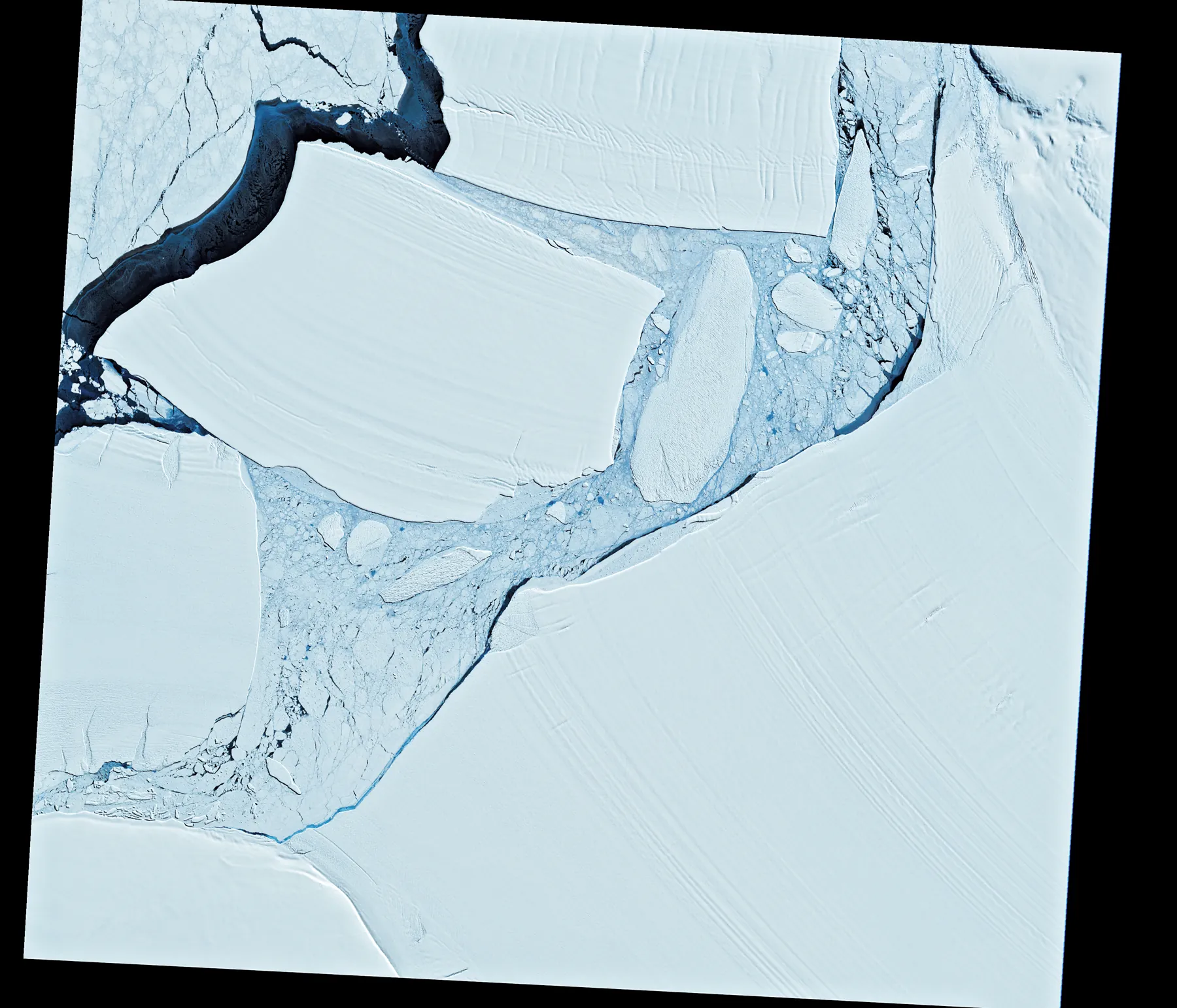
On 10 November 1986 the Landsat 5 satellite photographed the front of the Filchner Ice Shelf, shortly after a piece had broken away. It was named A23. Its largest part is A23a.
In 2023 it covered about 3,900 square kilometres, most of its thickness under water. That is twice the size of Greater London.
1986–2020
It did not get far. Its underside caught on the bottom of the Weddell Sea, and there it sat. The British Antarctic Survey says it was aground for over thirty years.
From 2014 to 2020 the weekly lists of the US National Ice Center, which tracks large icebergs, place it near 75.9° south, 41.2° west. It never moved more than 11 kilometres.
July 2020
In July 2020 the National Ice Center’s list stopped calling it grounded, though the word came back for about four weeks in December 2022.
For two more years it barely moved: never more than 191 kilometres from where it had sat.
2022–2024
Currents in this sea run west along the coast, then north. A23a followed them. By late 2023 it was leaving the Weddell Sea, and on 1 December a research ship, the RRS Sir David Attenborough, sailed beside it and took water samples.
In about 16 months, from September 2022 to December 2023, it ended up 1,422 kilometres away, in a straight line, from 74° south to 62°.
April–December 2024
Near the South Orkney Islands it stalled. From April to December 2024 its weekly positions stay inside an area 231 kilometres across. The British Antarctic Survey says it was caught in a Taylor column: water that turns slowly above an undersea bank.
It broke out in December 2024 and headed north-east.
March 2025
Around 1 March 2025 it ran aground near South Georgia, an island where penguins and seals breed, about 90 kilometres from land. Its listed position moved less than 5 kilometres from 6 March to 29 May.
A British Antarctic Survey oceanographer said that, if it stayed grounded, it was not expected to affect the island’s wildlife significantly.
2025
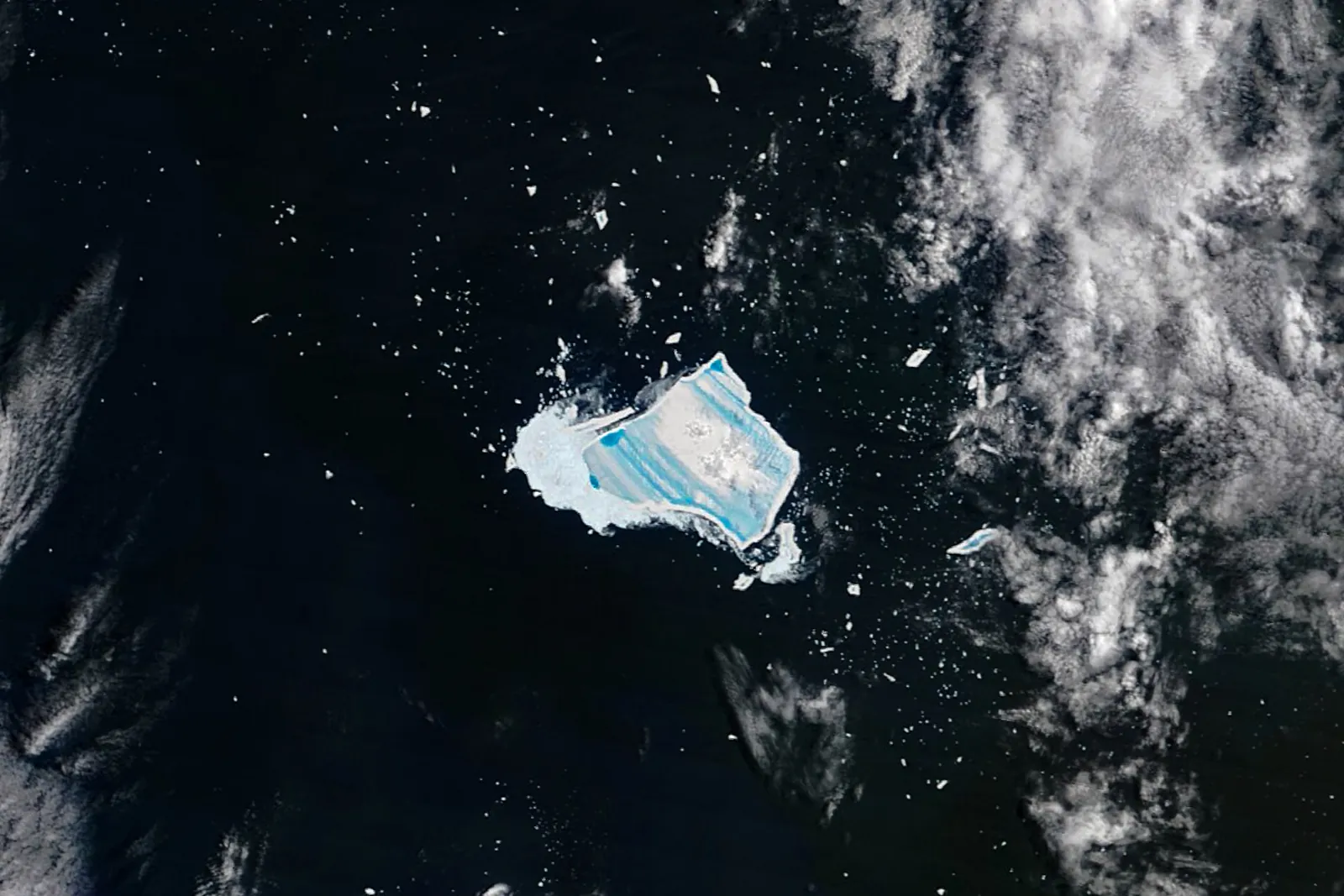
In one year it lost two thirds of its area. On the National Ice Center’s list it falls from 3,640 square kilometres in January 2025 to 1,182 on 26 December, in water that is warm for an iceberg.
Pieces broke off. In July NASA counted two named fragments, A23D and A23E, beside the main body.
27 December 2025
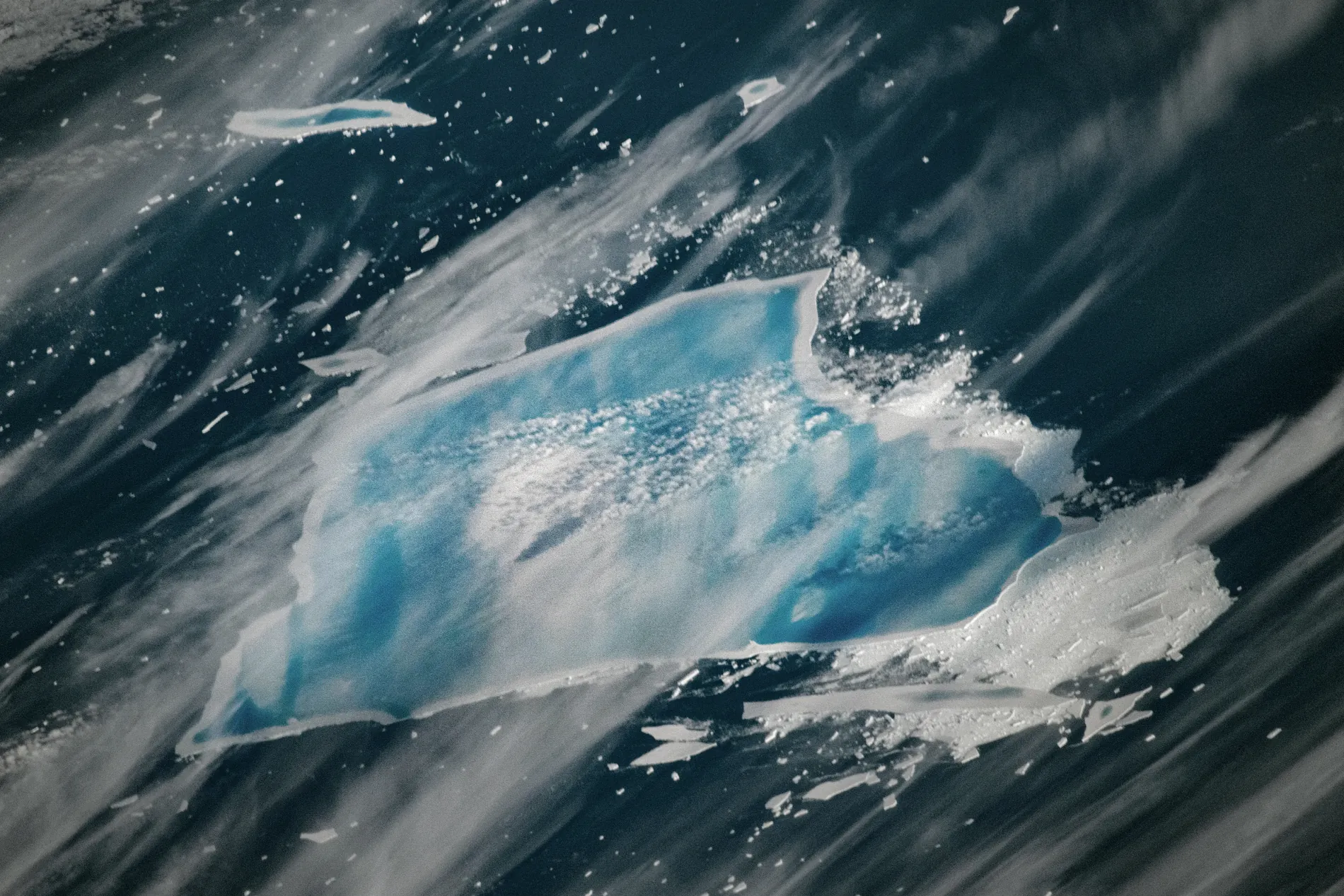
By late December the top was covered in pools of blue meltwater. Ted Scambos told NASA that water sitting in cracks forces them open. Chris Shuman said he did not expect the iceberg to last the southern summer.
An astronaut on the International Space Station took this photograph.
March–April 2026
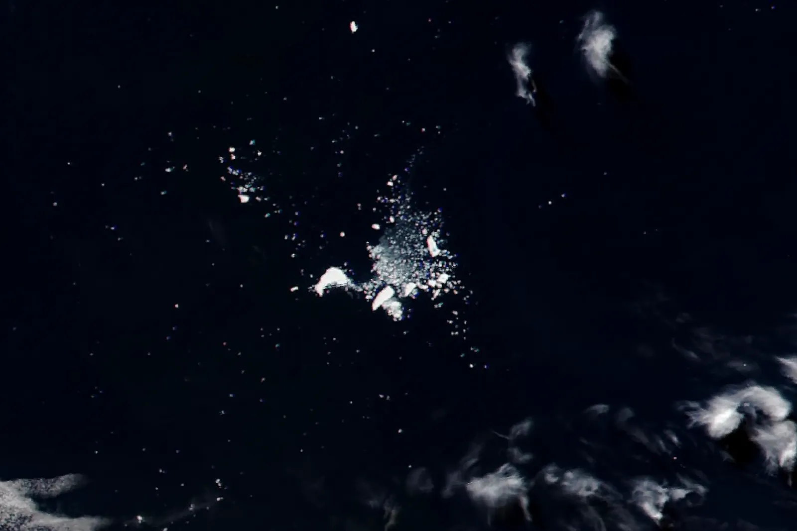
The National Ice Center’s last entry for A23a is dated 20 March 2026: 141 square kilometres, near 49° south, 32° west, in the open South Atlantic. NASA’s own measurement a week later was just over 170.
A NASA satellite image from 3 April shows scattered ice on dark water.
What it left
Its weight, which the British Antarctic Survey put at nearly 1,000 billion tonnes, ended up as fresh water in the sea. Whether that fed the sea’s plankton is still argued: NASA satellites saw chlorophyll near the fragments in January 2026, but samples taken beside the whole iceberg in December 2023 found little meltwater around it.
A 2024 study of 589 pieces of ice from other icebergs found only small amounts of the main nutrients that plankton need, but elevated iron and manganese, which they need in smaller amounts.
The scale
Published estimates of everything Antarctica loses as icebergs in a year run from about 750 to about 1,300 billion tonnes. A23a alone weighed nearly 1,000.
Scroll on and the map runs backwards. Each small mark is an iceberg the National Ice Center listed that week, at the length and width it gave. A23a is the gold one: it began as snow and ended as water in the South Atlantic.
Type the year. The answer comes from the National Ice Center’s weekly list.
Four photographs from NASA’s Earth Observatory, used on the page above.
What is measured and what is drawn. The map’s relief, the positions and the areas are real data. The outline of the iceberg is drawn: the National Ice Center gives its length and width, not its shape. The first four steps are not about A23a’s own snow, because no one has published where it fell, or how old its ice is. The flake, the layers and the bubbles show what happens to any snow that turns into ice, with figures from one drilling site in West Antarctica, not from the Filchner Ice Shelf.
What the sources do not agree on. The year it came free: 2020 (the National Ice Center, BAS, Taylor et al.) or 2022 (NASA). Its size: about 3,900 square kilometres (BAS), 4,120 in 2020 (Taylor et al.), and more than 6,000 in NASA’s 2026 text, which looks like an error. Its thickness: ESA and BAS say about 400 metres and one report says less, which does not fit BAS’s weight, so the page gives none. Reports differ on the dates and causes of its stops. The last position on the page is the last one in the National Ice Center’s list; NASA says it left the Center’s area of analysis in February 2026 and put it at just over 170 square kilometres on 27 March. It is not a day on which the ice was seen to be gone.
How the numbers were made. The counter on the map runs from 10 November 1986 to the July 2020 list (34 years); the British Antarctic Survey says “over 30 years”, and Taylor et al. say it was fully aground by 1987–1989. The 11 kilometres, 191, 1,422, 231 and the 3,000 in a straight line are great-circle distances between listed positions, which are rounded to a hundredth of a degree and updated once a week. The listed area before April 2024 is a bounding rectangle, so the page does not use it.
What is missing. Reports say a Soviet research station was on the ice when it broke off, but they cite no source, so it is left out. No measurement of the iceberg’s effect on the animals of South Georgia was found.