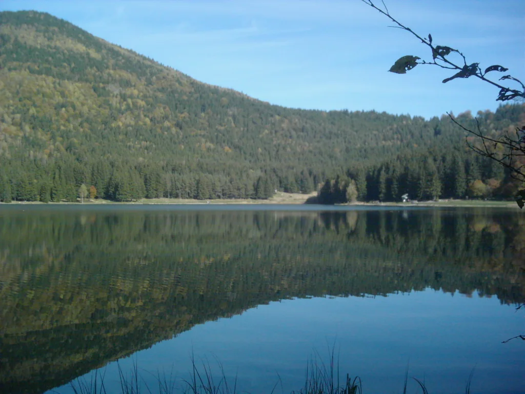
Ciomadul · Lake Sfânta Ana
Romania’s “extinct” volcano may still have molten rock beneath its lake
Ciomadul last erupted 27,000–32,000 years ago. In the literature on Ciomadul, “extinct” usually means it has been quiet for more than 10,000 years: a convention, not a measurement. Beneath the crater, instruments point to partly molten rock, estimated at anywhere from 5 to 58 percent. The studies do not point to an imminent eruption, and none can predict one.
See how big the crater is
Scale
How big is the crater, really?
Lake Sfânta Ana fills a crater about 1.6 km wide, shaped by the last eruption. The rim stands 300–400 m above the water; the lake is 6–7 m deep and roughly 500 m across. The drawing below uses the same scale horizontally and vertically, so the proportions are the real ones.
Move right to look further from the crater; the value is the distance the drawing covers.
Example shown: Brașov. Type your own place above.
The crater is about 1.6 km from one rim to the other. On its highest side the rim stands 300–400 m above the water.
Both axes are at the same scale.
Straight-line distances from the lake to some cities
- Brașov57 km · south
- Iași175 km · north-east
- București189 km · south
- Cluj-Napoca189 km · north-west
- Constanța305 km · south-east
- Timișoara363 km · west
The distance shows where ash fell in the past, not what would happen in a future eruption.
The lake is filling with silt. It was 12 m deep in 1867, 8.5 m in 1907 and 6.5 m in 2006. Under the water lie more than ten metres of sediment: one core reached 17 m.
The terrain comes from a surface model that includes treetops, so forested rims read a few metres too high. The water is drawn at the published lake level, 950 m. Around the crater the terrain has a 40 m step; at longer distances cells of about a kilometre smooth the peaks.
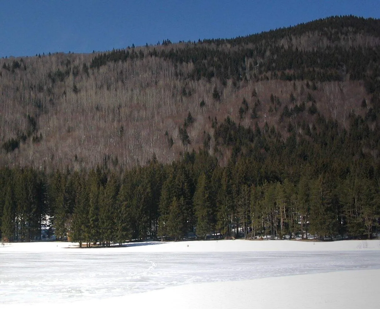
When
Thirty thousand years ago: how far back is that?
Three dating methods have given published ages for the last eruption between 26,000 and 35,000 years ago; their central values fall between 27,000 and 32,000. The results overlap but do not coincide, and the teams disagree about which ash bed is the last one. So “30,000” is a rounding of a range.
- Lava block, potassium–argonKarátson et al. 201926.3–29.1
- Sediment above the final ash, radiocarbon (minimum age)Karátson et al. 201629–30.2
- Zircon crystals in the ashHarangi et al. 202027.9–31.1
- Bixad charcoal, recalibrated: called the last eruption in 2010, but about 2,000 years older than the last one according to KarátsonHarangi et al. 2010; Karátson et al. 2016≈ 31.5
- Final stage (span), zirconMolnár et al. 201929.5–34
- Charcoal and soil, radiocarbon (loose bracket)Szakács et al. 201527–35
Bars show, as the case may be, the published value with its error, a minimum age or the published span of an eruptive stage; each row says which. The kind of error differs between studies. The shaded band marks 27–32 thousand years, a summary of the central values, not a published value.
A 2010 study measured 27,200 years on charcoal from the Bixad ash flow. Those are radiocarbon years; in calendar years the same sample is about 31,500.
The teams divide the final eruptions differently. One dates the Târgu Secuiesc ash to about 31,500 years and keeps 29,600 for a later eruption; another dates it to 29,500 ± 1,600, within the latest eruptive episode, 29,000–33,000 years ago.
The axis below shows, to scale, how far back the last eruption lies. Change the span to see how little room the Roman era takes.
- Today: today
- Rome conquers Dacia (AD 105–106): 1,920 years ago
- Early Neolithic (Starčevo–Criș): 7,500–8,500 years ago
- Ice sheets at their maximum: 19,500–26,500 years ago
- Ciomadul’s last eruption: 27,000–32,000 years ago
- The Oase man: 37,000–42,000 years ago
- Today: today
- Rome conquers Dacia (AD 105–106): 1,920 years ago
- Early Neolithic (Starčevo–Criș): 7,500–8,500 years ago
← the last eruption, 27,000–32,000 years ago, is out of frame
- Today: today
- Rome conquers Dacia (AD 105–106): 1,920 years ago
← the last eruption, 27,000–32,000 years ago, is out of frame
The last eruption lies more than 14 times further back than the Roman conquest of Dacia, and more than 3 times further back than the start of the Neolithic in Romania.
The eruption came while the ice sheets were still growing: they reached their maximum extent between 33,000 and 26,500 years ago.
When Ciomadul erupted, modern humans had already reached Romania. The Oase jaw, from the south-west of the country, is 37,000–42,000 years old by the latest estimate, so it is older than the last eruption by several thousand years.
The word “extinct”
Extinct, dormant or active: who says what
The usual rule: a volcano is “active” if it erupted in the last 10,000 years, the Holocene, and “extinct” once it has been quiet for longer. Ciomadul has been quiet for about three times the threshold. But the classification is itself debated in the papers about it.
What each one says
- uses “extinct”
- cannot call it extinct
- potentially active magma
- another position
uses “extinct”
Romanian press, 2019
Adevărul writes “an extinct volcano” and adds, in the same sentence, that it “does not seem entirely dead”. The same article gave the wrong melt volume (see below).
uses “extinct”
The 10,000-year convention
An “extinct” volcano has been quiet for more than 10,000 years; a “potentially active” one erupted in the Holocene. Harangi et al. (2010) attribute it to Simkin and Siebert (1984); Laumonier et al. cite it as a general rule without naming anyone.
another position
Smithsonian Global Volcanism Program
Lists Ciomadul (as “South Harghita Mountains”) among Pleistocene volcanoes with no known Holocene eruption. On the page consulted it uses neither extinct, dormant nor active.
cannot call it extinct
Kis et al., 2019
They note it is “usually considered inactive” because of the 30,000 quiet years, and conclude that this long-dormant volcano cannot be considered extinct.
cannot call it extinct
Lahitte et al., 2019
The present quiet is shorter than earlier ones in the volcano’s history, so Ciomadul cannot be considered extinct. The first pause was about 250,000 years.
potentially active magma
Harangi et al., 2015
They propose the term “volcano with potentially active magma storage”. They add that melt alone does not make it “potentially active” under the 10,000-year rule, because no unrest has been detected.
cannot call it extinct
Laumonier et al., 2019
“Apparently extinct” in the title, “capable of erupting” in the abstract; in the conclusions they call it “potentially active”. The first author writes on a blog that a volcano’s status should depend on the system beneath it, not on the absence of activity.
another position
Szakács et al., 2015; Popa et al., 2012
The papers suggest that the magma plumbing is not completely frozen (Szakács et al.) and that future activity cannot be ruled out (Popa et al.).
another position
Szakács and Kovács, 2023
They challenge the thermal model in the Laumonier study: the starting conditions are unrealistic, and the conductive zones might come from small amounts of fluid rising from the mantle. Only the abstract could be read; no published reply was found.
another position
Geological Institute of Romania, 2015
A radio station reported that the institute said the volcano “shows no signs of reactivation” (in Romanian: „nu prezintă semne de reactivare”). It is a second-hand report: no document from the institute was found.
another position
Janine Krippner, Smithsonian volcanologist, 2019
In an interview with National Geographic, “extinct” is “a very iffy word” and, as the magazine reports it, the 10,000-year line is somewhat arbitrary. She was not on the study team.
Among the papers whose full text could be read, none argues from measurements that Ciomadul is extinct. Szakács’s 2022 chapter, “Dormant or Extinct?”, is available only as an abstract, and its conclusion is not known here.
Two numbers from the press that are not in the study
Romanian press wrote that Ciomadul holds “between 8 and 24 cubic kilometres” of magma. The study gives 20–58 km³ of melt in its abstract and about 15–58 in its text. The 8–14 km³ is everything the volcano has erupted in its history.
English-language press wrote that in places the rock is molten up to 45 percent. The figure 0.45 in the study is the threshold above which magma is treated as eruptible. The thermal model gives 14 percent on average and at most about 40 locally; the conductivity experiments give 20–58 percent in parts of the mass.
Beneath the lake
What lies beneath the lake: a few metres of water and, far below, partly molten rock
The lake is 6–7 m deep. Five kilometres lower, instruments show something no one can see from the surface: rock that conducts electricity like partly molten rock. Descend on one scale, from metres to tens of kilometres.
depth 0 m
measured · depth 0 m
Lake surface · 950 m elevation
The crater rim stands 300–400 m above the water. The scale starts here: each step below goes deeper than the one before.
measured · depth 6.5 m
Lake floor · 6–7 m
The depth was 12 m in 1867, 8.5 m in 1907 and 6.5 m in 2006: the lake is filling. Other authors give 6 or 7.1 m.
measured · depth 20 m
The silt · more than 10 m
A 17 m core went through the lake’s sediment. The oldest dated layer is almost 27,200 years old, so the lake is at least that old.
inferred · depth 5,000 m
5 km · the zone that conducts current begins
The magnetotelluric method measures how well rock conducts the Earth’s natural electric currents, to find partly molten rock or fluids. Beneath the volcano, between 5 and 25 km, the rock conducts far better than solid rock. Those who measured it say telling melt from fluid is not easy. The depths come from a model calculated from the measurements.
inferred · depth 10,000 m
8–12 km · where the magma sat before the eruptions
Minerals in the lava of the last eruptions show that a mass of crystals with a little melt between them sat at 8–12 km. Seismic tomography shows a slow zone below, with a possible reservoir between 8 and 20 km.
model · depth 12,000 m
5–18 km · how much melt?
Here the estimates split. Electrical measurements and petrology give at least 5–15 percent melt; Laumonier’s experiments and model give 15–58 km³ of melt in total. A 2023 paper challenges the model. The charts below put them side by side.
inferred · depth 35,000 m
30–40 km · the base of the crust
A second conductive body appears at 30–40 km, in a two-dimensional model. The authors infer hot magma rich in iron and magnesium there, down to the crust–mantle boundary at about 40 km. They have no evidence that it connects to the reservoir above.
The zone that conducts current begins more than 700 lake depths down.
How much melt? The estimates side by side
- Magnetotellurics and petrology (Harangi et al. 2015), at least5–15
- Thermal model (Laumonier et al. 2019): average 14, locally up to 4014–40
- Laboratory conductivity (Laumonier et al. 2019)20–58
- Everything the volcano has erupted8–14
- Melt estimated now (Laumonier et al.)15–58
- Crystal mush still present (Lukács et al. 2021)≈ 35
- Melt-bearing crystal mush, total (Laumonier et al.)≈ 100
If Laumonier’s model is right, the melt now present would exceed everything the volcano has erupted. Its abstract says the reservoir “may still hold” 20–58 km³; the text says 15–58. The lowest value, 15, is a little above the highest estimate of everything erupted, 14; both are approximate.
Other estimates are smaller. A 2021 model (Lukács et al.), with several of the same authors, finds only about 35 km³ of crystal mush, not pure melt, and writes that renewed magma injection could lead to rapid reawakening. Laumonier et al. state that the melt does not mean an imminent eruption.
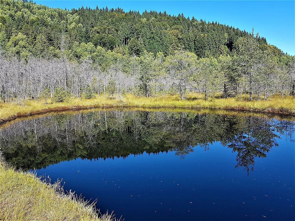
The gas
The gas that leaves the mountain and cannot be seen
Around Ciomadul, cold carbon dioxide leaves the ground through pits and caves called mofettes. One study estimates at least 8,700 tonnes a year for the whole area. Carbon dioxide can be neither seen nor smelled, and in the wrong place it kills.
The gas’s isotopes suggest a component from the mantle and one from limestone. Mofettes occur in the southern part of the Călimani–Gurghiu–Harghita volcanic chain, including at Covasna, 38 km from the lake. In the sources consulted, nobody ties the Covasna gas specifically to Ciomadul’s magma.
Carbon dioxide is heavier than air and collects in pits, caves and cellars. Researchers who counted dead animals in the caves at Turia, on the massif’s south-eastern flank, write that the gas forms “deadly traps” at the bottom of pits.
A 2018 paper describes the CO₂ pits there as “suffocation traps for insects, birds and mammals”; bats that fly below the gas layer die. Between 1997 and 2012, 204 dead edible dormice were counted in the caves. The count stops in 2012. For the town of Covasna, the sources consulted contain no scientific account of dead animals.
At Covasna the gas is used to treat cardiovascular disease at the rehabilitation hospital, in a medical setting with contraindications. The gas of natural mofettes is 90–98% CO₂.
What isn’t known
What nobody can say
How likely is another eruption? No source gives a number: no probability, no recurrence interval. The authors say they cannot predict an eruption and that melt does not mean an imminent one.
Thirty thousand quiet years say little. The volcano has had pauses of 100,000–200,000 years, and one of about 250,000. The authors warn that a long quiet can mislead when estimating how often it erupts.
There is no answer to “when”. After reheating, an eruption can follow within weeks or months, and the signs can go unnoticed at an unmonitored volcano. These are petrological scenarios, not forecasts: they give neither a probability nor a date.
The Smithsonian database holds no ground-deformation or emission data for this volcano, although CO₂ has been measured in published studies. In 2015 researchers called for closer gas monitoring and detected no unrest. The sources consulted describe no permanent monitoring network.
A solidified chamber would have much less chance of erupting again. The question every study starts from is whether melt remains, and the answers so far differ.
What can be said without reserve: Ciomadul is the youngest volcano of the Carpathian–Pannonian region, and by most dates it last erupted about 30,000 years ago.
Sources
Sources and limits
The claims on the page rest on scientific papers and official sources, and the calculations can be redone from the published numbers. Where only the abstract could be read, the list below says “abstract”. The press is used only for the word “extinct”, two wrong numbers, one statement by the Geological Institute and the advice on mofettes, and is marked separately.
Terrain: Copernicus DEM GLO-30 (30 m) around the crater and GLO-90 (averaged to about 1 km) at longer distances; it is a surface model that includes treetops. The outlines of the lake and of Mohoș come from OpenStreetMap. Places (over 1,000 inhabitants) come from GeoNames. Distances are straight lines from the centre of the lake.
The page is due for review by 20 March 2027, or sooner if a published reply to Szakács and Kovács (2023), a Ciomadul monitoring bulletin or a new date for the last eruption appears.
When it erupted and how it was dated
- Harangi, Sz. et al. 2010. Radiocarbon dating of the last volcanic eruptions of Ciomadul volcano. Radiocarbon 52. doi.org/10.1017/S0033822200046580
- Karátson, D. et al. 2016. The latest explosive eruptions of Ciomadul volcano: a tephrostratigraphic approach for the 51–29 ka BP time interval. J. Volcanol. Geotherm. Res. 319. doi.org/10.1016/j.jvolgeores.2016.03.005
- Karátson, D. et al. 2019. Eruptive history of the Late Quaternary Ciomadul volcano, part II: magma output rates. Bull. Volcanol. 81: 28. doi.org/10.1007/s00445-019-1287-8
- Harangi, S. et al. 2020. Fingerprinting the Late Pleistocene tephras of Ciomadul volcano. J. Quaternary Sci. 35. doi.org/10.1002/jqs.3177
- Molnár, K. et al. 2019. Episodes of dormancy and eruption of the Late Pleistocene Ciomadul volcanic complex constrained by zircon geochronology. J. Volcanol. Geotherm. Res. 373. doi.org/10.1016/j.jvolgeores.2019.01.025
- Szakács, A., Seghedi, I., Pécskay, Z., Mirea, V. 2015. Eruptive history of a low-frequency and low-output rate Pleistocene volcano, Ciomadul. Bull. Volcanol. 77: 12. doi.org/10.1007/s00445-014-0894-7 abstract
- Túri, M. et al. 2021. Holocene paleoclimate inferred from stable isotope values in Sphagnum cellulose, Mohos peat bog. J. Paleolimnol. 66. doi.org/10.1007/s10933-021-00202-z
The volcano’s history, the craters and the lake
- Lahitte, P. et al. 2019. Eruptive history of the Late Quaternary Ciomadul volcano, part I: timing of lava dome activity. Bull. Volcanol. 81: 27. doi.org/10.1007/s00445-019-1286-9
- Molnár, K. et al. 2018. The onset of the volcanism in the Ciomadul Volcanic Dome Complex. J. Volcanol. Geotherm. Res. 354. doi.org/10.1016/j.jvolgeores.2018.01.025
- Wulf, S. et al. 2016. The ‘Roxolany Tephra’ (Ukraine): new evidence for an origin from Ciomadul volcano. J. Quaternary Sci. 31. doi.org/10.1002/jqs.2879
- Begy, R. et al. 2011. A sedimentation study of St. Ana Lake applying the 210Pb and 137Cs dating methods. Geochronometria 38. doi.org/10.2478/s13386-011-0017-6
- Magyari, E.K. et al. 2009. Palaeolimnology of the last crater lake in the Eastern Carpathian Mountains. Hydrobiologia 631. doi.org/10.1007/s10750-009-9801-1 abstract
- Longman, J. et al. 2017. Periodic input of dust over the Eastern Carpathians during the Holocene. Clim. Past 13. doi.org/10.5194/cp-13-897-2017
- Smithsonian Institution, Global Volcanism Program. South Harghita Mountains (volcano 210801), archived 22 December 2024. web.archive.org/web/20241222202502/volcano.si.edu/volcano.cfm?vn=21080
The word “extinct”
- Szakács, A. 1994. Redefining active volcanoes: a discussion. Bull. Volcanol. 56. doi.org/10.1007/BF00326458 abstract
- Szakács, A. 2022. Ciomadul volcano: dormant or extinct? In: Ciomadul (Csomád), the youngest volcano in the Carpathians. Springer. doi.org/10.1007/978-3-030-89140-4_7 abstract
- Szakács, A., Kovács, I.J. 2023. Is the most recently active volcano in the Carpathian–Pannonian Region capable of further eruptions? J. Volcanol. Geotherm. Res. 440. doi.org/10.1016/j.jvolgeores.2023.107868 abstract
- Laumonier, M. 2019. Extinct or asleep volcanoes: hints from Ciomadul. VIPS Commission blog. vipscommission.org/extinct-or-asleep-volcanoes-hints-from-ciomadul-rom
- Wei-Haas, M. 2019. Magma found simmering under an ‘extinct’ volcano. National Geographic. www.nationalgeographic.com/science/article/magma-found-simmering-under press or reference
- Adevărul, 19 iulie 2019. Un vulcan din România considerat stins „clocotește” până la pragul de erupție. adevarul.ro/stiri-interne/evenimente/un-vulcan-din-romania-considerat- press or reference
- Europa FM, 16 iunie 2015. Institutul Geologic: Vulcanul Ciomatu nu se va reactiva. www.europafm.ro/institutul-geologic-vulcanul-ciomatu-nu-se-va-reactiva press or reference
What lies beneath
- Laumonier, M. et al. 2019. Evidence for a persistent magma reservoir with large melt content beneath an apparently extinct volcano. Earth Planet. Sci. Lett. 521. doi.org/10.1016/j.epsl.2019.06.004
- Harangi, S. et al. 2015. Combined magnetotelluric and petrologic constraints for the nature of the magma storage system beneath Ciomadul. J. Volcanol. Geotherm. Res. 290. doi.org/10.1016/j.jvolgeores.2014.12.006
- Lukács, R. et al. 2021. Zircon geochronology suggests a long-living and active magmatic system beneath the Ciomadul volcanic dome field. Earth Planet. Sci. Lett. 565. doi.org/10.1016/j.epsl.2021.116965
- Cserép, B. et al. 2023. Constraints on the pre-eruptive magma storage conditions of the 56–30 ka explosive volcanism of Ciomadul. Contrib. Mineral. Petrol. doi.org/10.1007/s00410-023-02075-z
- Kiss, B. et al. 2014. Amphibole perspective to unravel pre-eruptive processes and conditions: Ciomadul volcano. Contrib. Mineral. Petrol. 167. doi.org/10.1007/s00410-014-0986-6 abstract
- Popa, M. et al. 2012. New seismic and tomography data in the southern part of the Harghita Mountains. Pure Appl. Geophys. 169. doi.org/10.1007/s00024-011-0428-6 abstract
The gas and its hazard
- Kis, B.M. et al. 2017. Quantification of carbon dioxide emissions of Ciomadul. J. Volcanol. Geotherm. Res. 341. doi.org/10.1016/j.jvolgeores.2017.05.025 abstract
- Kis, B.M. et al. 2019. Noble gas and carbon isotope systematics at the seemingly inactive Ciomadul volcano. Geochem. Geophys. Geosyst. 20. doi.org/10.1029/2018GC008153
- Vaselli, O. et al. 2002. A geochemical traverse across the Eastern Carpathians. Chem. Geol. 182. doi.org/10.1016/S0009-2541(01)00348-5 abstract
- Kis, B.M. et al. 2026. Geochemistry of CO₂-rich gas emissions in the Carpathians. Earth-Sci. Rev. 279. doi.org/10.1016/j.earscirev.2026.105528 abstract
- Sarbu, S.M. et al. 2018. Sulfur Cave (Romania), an extreme environment with microbial mats. Int. J. Speleol. 47. doi.org/10.5038/1827-806X.47.2.2164
- Barti, L. 2012–2013. The edible dormouse (Glis glis) as a cave-dwelling species in Romania. Acta Siculica.
- Health and Safety Executive (UK). General hazards of carbon dioxide. www.hse.gov.uk/coshh/basics/carbondioxide.htm
- NIOSH (US). Carbon dioxide: immediately dangerous to life or health concentrations. www.cdc.gov/niosh/idlh/124389.html
- Suceveanu, M. et al. 2015. Role of mofette therapy in cardiovascular rehabilitation: the Covasna model. Balneo Res. J. 6. doi.org/10.12680/balneo.2015.1089
- Bencze, E. 2026. Interviu cu geologul Csaba Jánosi despre mofete. Székelyhon, 15 septembrie 2026. szekelyhon.ro/aktualis/amikor-a-gyogyito-gaz-eletveszelyesse-valik-ezt press or reference
- Miulescu, A., directorul Institutului Național de Balneologie, declarație pentru ProTV News, 14–15 septembrie 2026: mofete autorizate și neautorizate. stirileprotv.ro/stiri/actualitate/locatia-din-harghita-unde-a-murit-un press or reference
The time axis
- Trinkaus, E. et al. 2003. An early modern human from the Peștera cu Oase, Romania. PNAS 100. doi.org/10.1073/pnas.2035108100
- Fu, Q. et al. 2015. An early modern human from Romania with a recent Neanderthal ancestor. Nature 524. doi.org/10.1038/nature14558
- Clark, P.U. et al. 2009. The Last Glacial Maximum. Science 325. doi.org/10.1126/science.1172873 abstract
- Hervella, M. et al. 2015. Ancient DNA from South-East Europe reveals different events during Early and Middle Neolithic. PLoS ONE 10. doi.org/10.1371/journal.pone.0128810
- Chilver, G.E.F. Dacia. Encyclopaedia Britannica. www.britannica.com/place/Dacia press or reference
Data and photographs
- Copernicus DEM GLO-30 and GLO-90. Produced using Copernicus WorldDEM-30 © DLR e.V. 2010–2014 and © Airbus Defence and Space GmbH 2014–2018, provided under COPERNICUS by the European Union and ESA; all rights reserved. spacedata.copernicus.eu/collections/copernicus-digital-elevation-model
- © OpenStreetMap contributors, Open Database Licence: lake outline (way 27742482) and Mohoș bog outline (way 88161521). www.openstreetmap.org/copyright
- GeoNames, places of Romania with over 1,000 inhabitants, Creative Commons Attribution 4.0. www.geonames.org/
Photographs
- File:Szent Anna-tó - panoramio.jpg: Tokes Laszlo, Wikimedia Commons, CC BY 3.0
- File:Nagy-Csomád.jpg: Lakeof, Wikimedia Commons, CC BY-SA 3.0
- File:Tinovul Mohoș lacul 1.jpg: RodicaB, Wikimedia Commons, CC BY-SA 4.0


Silhouettes
- Adult, as a size reference: Cagri CEVRIM, PhyloPic, CC0 1.0