A visual essay on the Amazon river

The Amazon: the world's greatest river by discharge, with its most disputed length

From Apacheta Creek to the Atlantic plume: eight chapters on how the world's greatest river is measured — and where the measures stop. M01 M04 M10

Length is a convention, discharge is a machine, and the forest has two measuring systems that must not be confused. M03 M09

172,100 m³/s · Óbidos mean

Live counter — cubic metres past Óbidos since you opened this page, at the station mean rate M03

6,400 kmrecognized length · not a new measurement M01
172,100 m³/sÓbidos · annual mean · Vörösmarty et al. M03
5,796 km²PRODES Aug 2024 – Jul 2025 · −11% M10
12.66 mManaus · 4 Oct 2024 · 122-year low M09
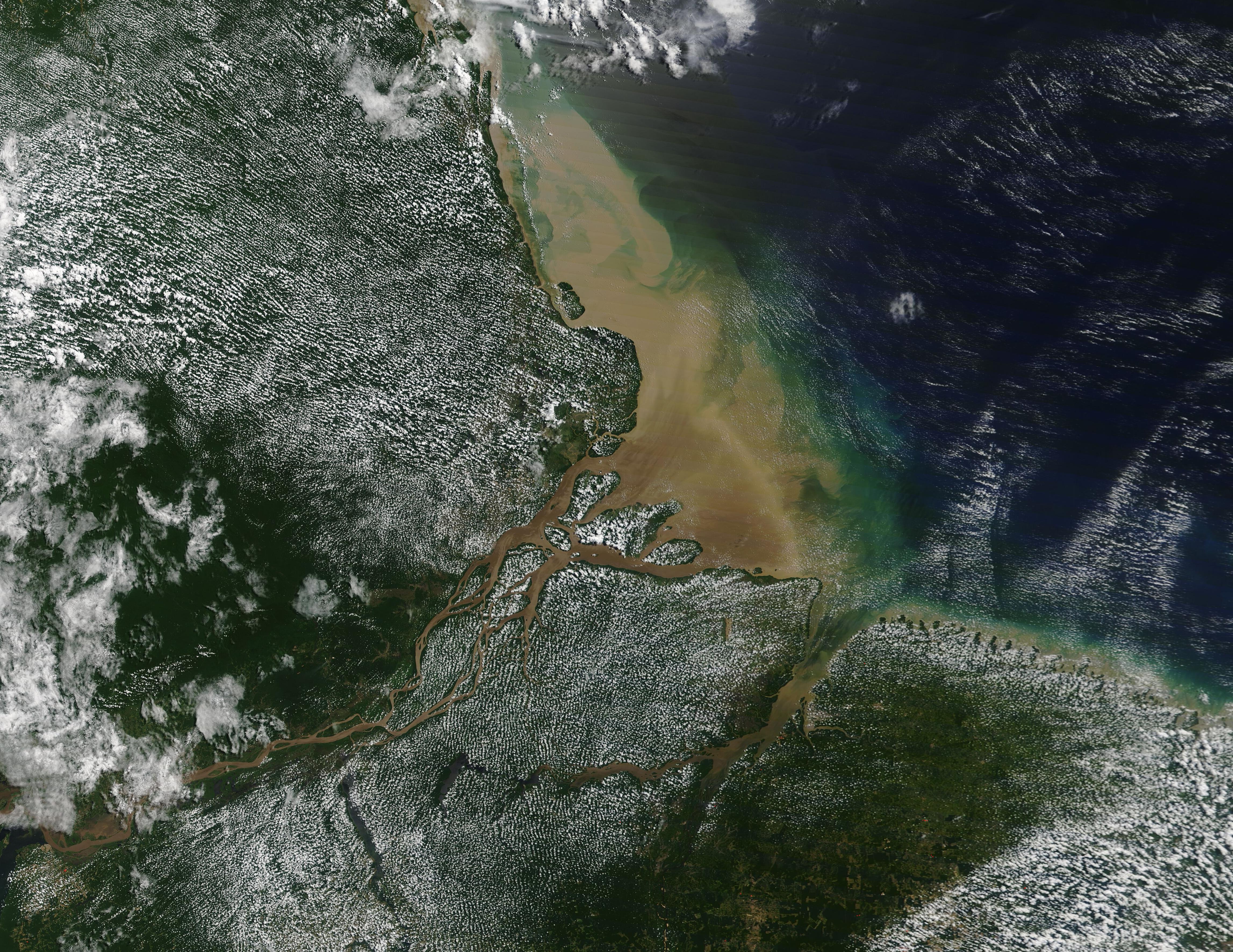
The Amazon delta seen by the MODIS satellite, August 2020

The Amazon delta (MODIS, 3 August 2020). A modern satellite frame, plume-adjacent — not a measured plume boundary. M18MODIS Land Rapid Response Team, NASA GSFC · Taken · Public domain

LENGTH

How long is the Amazon? Depends who you ask

'Which is the longest river in the world?' — the Nile or the Amazon? The answer shifts with the chosen source and the chosen mouth. Three numbers, three conventions — while Britannica, in 2020, left the Amazon's length 'open to interpretation and continued debate'. M01 M02

No ranking can hold without a named source and an endpoint rule. M01 M02

THE RECOGNIZED MEASURE

6,400 km, the recognized number

Wikipedia, citing Britannica: 'recognized length of 6,400 kilometers'. M01

The 6,400 km are a recognized length, not a new measurement. The same page notes that, according to some reports, reported values vary from 6,575 to 7,062 km — while Britannica's 2020 verdict keeps the ranking open to interpretation and continued debate. M01

THE 2008 INPE CLAIM

6,992 km from Apacheta Creek

INPE, July 2008: the Amazon, 140 km longer than the Nile. M02

Brazil's space research institute calculated 6,992 km taking Apacheta Creek as the source — with the Nile coming out at 6,853 km by the same techniques. A different source, a different total: length is an endpoint convention, with a tidal-estuary endpoint. M02

THE 2007 IBGE CLAIM

6,800 km, claimed in 2007

NatGeo: the IBGE team announced 6,800 km against 6,695 km for the Nile. M02

After a 14-day expedition, the Brazilian team announced 6,800 km for the Amazon and 6,695 km for the Nile — then-unpublished results, after choosing a farther source. Study author Guido Gelli (IBGE): 'Today, we can consider the Amazon the longest river in the world'. A then-unpublished claim remains a claim, not a measurement. M02

Photographs and maps · credit and date on every image

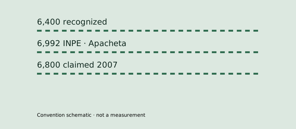
Length-convention schematic: recognized 6,400 km, INPE 6,992 km from Apacheta, 6,800 km claimed in 2007.
The length-convention schematic is a conceptual drawing, made apart from OSM geometry; not a measurement. M01 M02

DISCHARGE

Here the Amazon has no rival: the water passing Óbidos

Where length is negotiated, discharge is not: Óbidos station passes on average 172,100 m³/s — rising to a 223,700 m³/s average at the delta. Every figure arrives with its station, period and scope; mixed, they say nothing. M03 M04

Station + period + unit + scope — otherwise discharge is just a pretty number. M03 M04

ÓBIDOS STATION

172,100 m³/s, the station mean

Óbidos: the infobox mean, after Vörösmarty et al. M03

Óbidos station is the anchor of Amazon hydrology: the cited annual mean is 172,100 m³/s. Read it always with station, period and unit beside it — otherwise it blurs into the delta mean. M03

FOUR PERIODS

Four means, four compilers

165,829.6 (1903–2023, ANA) · 173,272.6 (1971–2000) · 176,177 (1928–1996, GRDC) · 178,193.9 (1997–2015). M03

The period means come from different compilers and are not interchangeable: 1903–2023 from ANA, 1928–1996 from GRDC, the other two with no compiler named in the extract. Each holds only with its own period. M03

DELTA AND TOCANTINS

223,700 m³/s at the delta

The delta mean; without the Tocantins: 209,000 m³/s in 1973–1990. M04

At the delta, total discharge averages 223,700 m³/s — 220,800 in 1973–1990 and 230,000 in 2003–2015. Without the Tocantins, the 1973–1990 mean is 209,000 m³/s, inside the 206,000–215,000 range. With or without the Tocantins are two different scopes — never the same number. M04

THE GLOBAL SHARE

20% of the oceans' river water

'The Amazon represents 20% of the global riverine discharge into oceans'. M04

A fifth of all the water the world's rivers carry to the oceans passes here — which is why discharge, not length, is the undisputed title. And the measure of growth: 'The Amazon enters Brazil with only one-fifth of the flow it finally discharges into the Atlantic Ocean'. M04

THE RIVER MOUTH

Where does the Amazon end? On an island the size of a country

The Amazon mouth is not a point but an archipelago of waters: Marajó island, at 40,000 km2, divides the main channel — which meets the Atlantic north of the island — from the waters passing south through Marajó Bay, carrying a huge load of sediments. M05 M06 M07

The mouth is over 180 km or about 15 km wide — by the endpoints you choose. M05 M06 M07

THE BASIN

About 7,000,000 km² of basin

The largest drainage basin in the world; the Brazil portion alone exceeds any other basin. M05

The Amazon basin is the largest drainage basin in the world, at approximately 7,000,000 square kilometers — and its Brazil portion alone is larger than any other river's basin. The variants are separate scopes: the entire Amazon–Tocantins basin, 6,743,000–7,050,000 km²; with Rio Pará as a water system, 6,925,674 km². M05

MARAJÓ ISLAND

40,000 km2 divide the waters

The estuary centers on giant Marajó island; the main channel passes north. M06

The Amazon estuary centers on the giant island of Marajó, at 40,000 km2: the river's main channel meets the Atlantic north of Marajó Island, while part of the waters pass south through Marajó Bay. An island the size of a country decides where the river ends. M06

THE WIDTH

Over 180 km — or about 15

Araguari to Ponta do Navio: over 180 km; the main channel alone, between Curuá and Jurupari: about 15 km. M07

From the mouth of the Araguari River to Ponta do Navio on Marajó's north coast, the Amazon mouth still exceeds 180 km — a figure that already excludes the Pará estuary. But counting only the main channel, between the islands of Curuá and Jurupari, the width falls to about 15 km. Always state which endpoints you chose. M07

MUD AND PLUME

754 × 10⁶ tons of mud a year

Sediment at Óbidos (1996–2007); the freshwater plume covers up to 1.3 million km². M06

At Óbidos station the sediment load is 754 × 10⁶ ton/year in 1996–2007 — exact station, period and unit. And the plume generated by the river's discharge covers up to 1.3 million km², laying muddy bottoms across a wide tropical North Atlantic: salinity, pH, light penetration, sedimentation. 'Up to' is an extent ceiling, not a constant area. M06
Photographs and maps · credit and date on every image

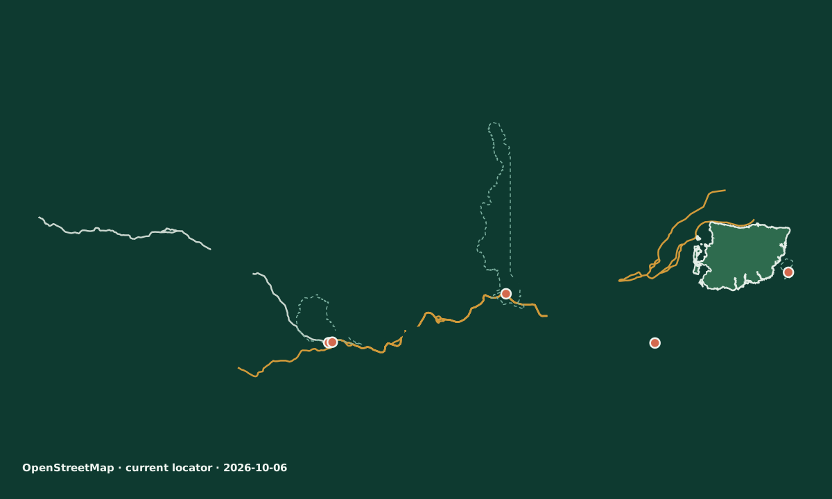
Current Amazon locator, with the Amazon and Negro reaches, the Encontro das Águas confluence, Marajó island, the cities of Manaus, Belém and Óbidos, and the Belo Monte dam.
OpenStreetMap geometry from the dated 2026-10-06 extract. Locator, not a nautical chart. The river trunk is assembled from small per-chapter bbox geometries; the city labels are geometry-derived, not named OSM points. The Óbidos gauge has no verified OSM point and none is invented. · © OpenStreetMap contributors · ODbL 1.0 M17
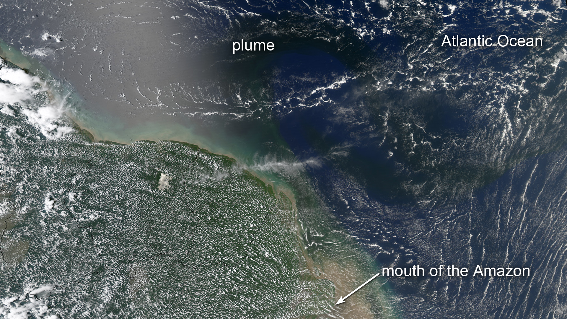
Algal bloom in the water plume at the Amazon mouth
Blooms flourishing in the dark plume of nutrient-rich water at the Amazon mouth, seen by NASA's Aqua satellite (8 May 2012). About the plume–bloom process, not the river course. M19NASA Goddard Space Flight Center · 8 May 2012 · Public domain
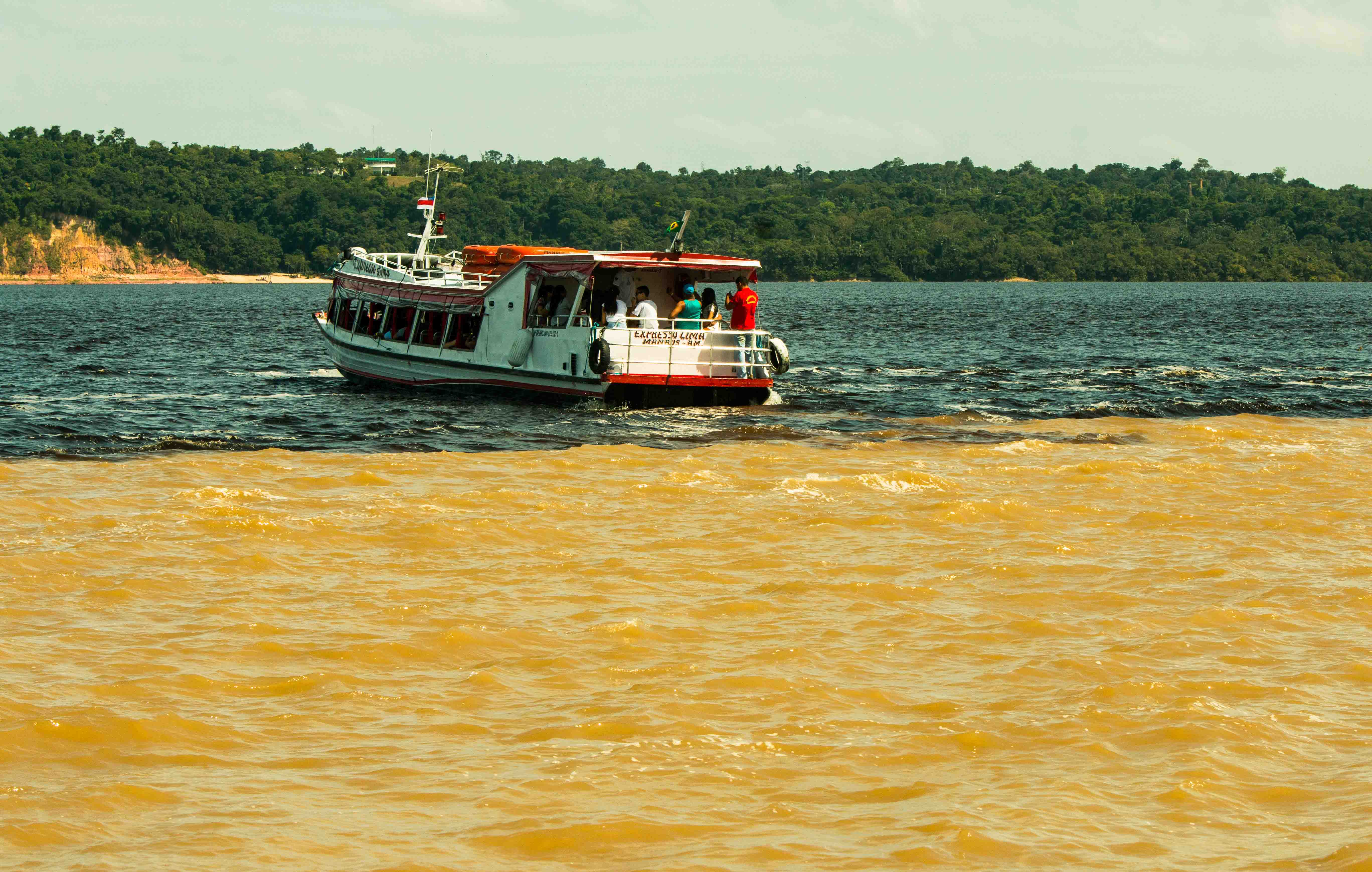
The Meeting of Waters at Manaus
Meeting of Waters, a tourist attraction in Manaus, Amazonas state, Brazil (10 February 2018). The highest-resolution confluence candidate. M20Ana Claudia Jatahy - MTUR · 10 Feb 2018 · CC0

DROUGHT

The master of waters, measured in centimeters: 13.5 m, then 12.66 m

At Manaus, where the Rio Negro joins the Amazon, the port gauge wrote history two years running: 13.5 m on 16 October 2023, then 12.66 m on 4 October 2024 — each time the lowest since official measurements began. M08 M09

The verified record sequence stops at 4 October 2024: 12.66 m. M08 M09

OCTOBER 2023

13.5 m, the 121-year low

16 October 2023: the lowest since measurements began 121 years ago. M08

In the city's port the water level went as low as 13.5 metres on Monday — against the record level of 30.02 metres in June 2021. One of the Amazon's largest tributaries had reached its lowest since official measurements began 121 years ago. The event is Monday 16 October 2023; the PA report, Tuesday 17 October. M08

OCTOBER 2024

12.66 m, the 122-year low

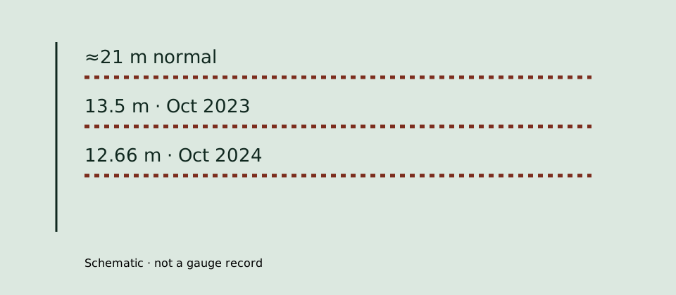
4 October 2024: 12.66 m at Manaus, against a normal level of about 21 meters. M09

The level of the Negro river at the port of Manaus was at 12.66 metres on Friday — the lowest since measurements started 122 years ago. The previous record low was last year, but toward the end of October. SGB hydrology manager Andre Martinelli expected the river to keep receding until the end of the month — a quoted forecast, not an outcome. And no October 2025 record low could be verified from bot-readable sources: the sequence stops here. M09

THE PEOPLE

55 of 62 municipalities in emergency

The Santo Antonio dam halted; hundreds of riverside communities isolated. M08 M09

The Madeira too recorded historically low levels, which halted the Santo Antonio hydroelectric dam, Brazil's fourth largest. Low river levels left hundreds of riverside communities isolated, struggling for drinkable water; 55 of 62 municipalities entered states of emergency. Manaus, at two million people, is the largest city and capital of Amazonas — where the Negro, the world's sixth-largest by water volume, joins the Amazon. M08 M09

Photographs and maps · credit and date on every image

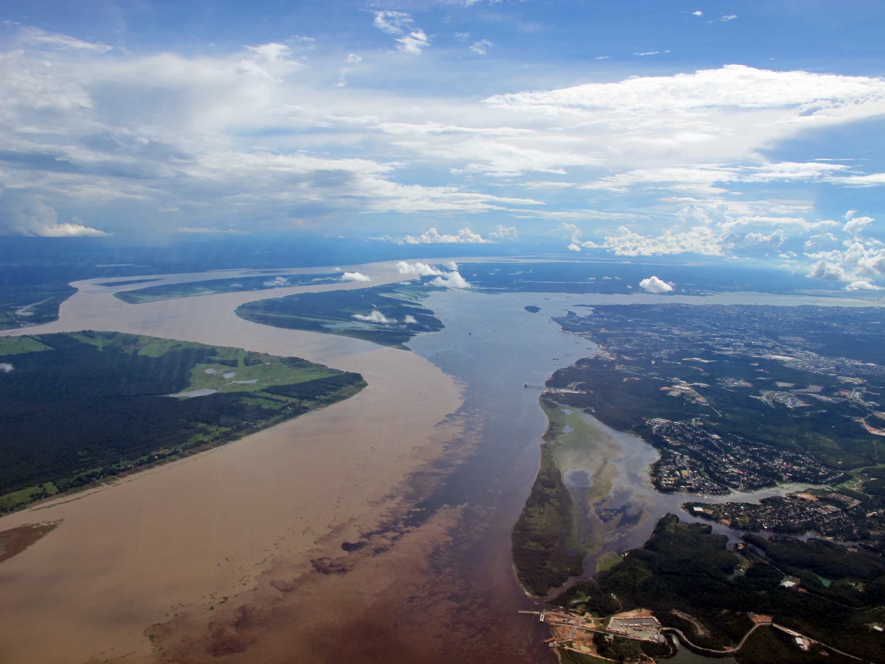
The Meeting of Waters from the air near Manaus
Aerial view of the 'Meeting of Waters' just after departing Manaus, Brazil (19 February 2011). Water colors are 2011 conditions, not the drought years. M21Immelman284 · 19 Feb 2011 · CC BY-SA 3.0
A riverboat on the Amazon at Manaus
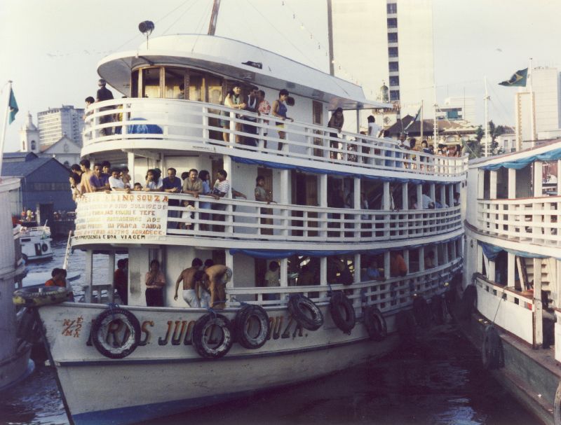
A riverboat on the Amazon in Manaus, Brazil (26 July 2008). A modern boat scene at modest resolution — river life only. M22Nick from Bristol, UK · 26 Jul 2008 · CC BY 2.0
Schematic Manaus gauge ladder: normal level about 21 m, 13.5 m in October 2023, 12.66 m in October 2024.
Schematic, not a gauge record; the record sequence stops at 4 October 2024. M08 M09

FOREST

Two systems, two readings: PRODES sets the rate, DETER raises the alarm

Amazon deforestation reads through two INPE systems that must not be confused: PRODES sets the final annual rate, while DETER issues near-real-time alerts that guide inspections. Mixed, the two readings lie. M10 M11

Alerts guide inspections; the final rate is set by PRODES. M10 M11

PRODES 2024–2025

5,796 km², the decade's low

August 2024 – July 2025: down 11 percent, the lowest level in nearly a decade. M10

Between August 2024 and July 2025, 5,796 square kilometers of forest were cleared — down 11 percent, the lowest level in nearly ten years. For comparison, in the August 2020 – July 2021 PRODES year INPE reported 13,038 square kilometers (via Xinhua, December 2022) — a same-system comparison, never 'the 2021 peak'. M10

DETER 2025–2026

2,874 km² under alert

August 2025 – July 2026: over a third less; the low since 2016. M11

In 2026, DETER alerts covered 2,874 square kilometres — over a third less than the year before, at 4,495 square kilometres. DETER data is measured over the 12 months from August 2025 to July 2026, the lowest since 2016, when the current DETER series began. Alerts, not a final rate. M11

MAY 2026

−61.4% in May, year on year

Still 370 square kilometers cleared; over 10 months, August 2025 to May 2026: −37.5%. M11

In May, Amazon deforestation was 61.4% lower than in the same month in 2025 — yet still 370 square kilometers of rainforest were cleared. Over the 10 months from August 2025 to May 2026, the fall is 37.5%. Large percentages on a still-violent base. M11

ALARMS AND TARIFFS

Alerts are not the rate, and the figures have sides

'The final total deforested area is calculated by another INPE system, PRODES' — and the tariff dispute stays attributed. M11

DETER measures low-resolution, near-real-time alerts; the rate is set by PRODES. And the figures entered a tariff dispute with the US: minister Capobianco says they 'debunk the unfair and unfounded accusation by the United States', while Lula says 'they don't understand the work we are doing to bring deforestation down to zero by 2030'. Attributed positions, never neutral narration. M11

Photographs and maps · credit and date on every image

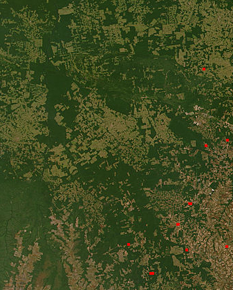
Satellite view of deforestation in Mato Grosso
Satellite observation of deforestation in the Brazilian state of Mato Grosso (8 August 2006). Low resolution (337 × 420) — thumbnail strip use only, never as a hero image. M24Imagery from LANCE FIRMS operated by NASA 's Earth Science Data and Information System (ESDIS) with funding provided by NASA Headquarters. · 8 Aug 2006 · Public domain
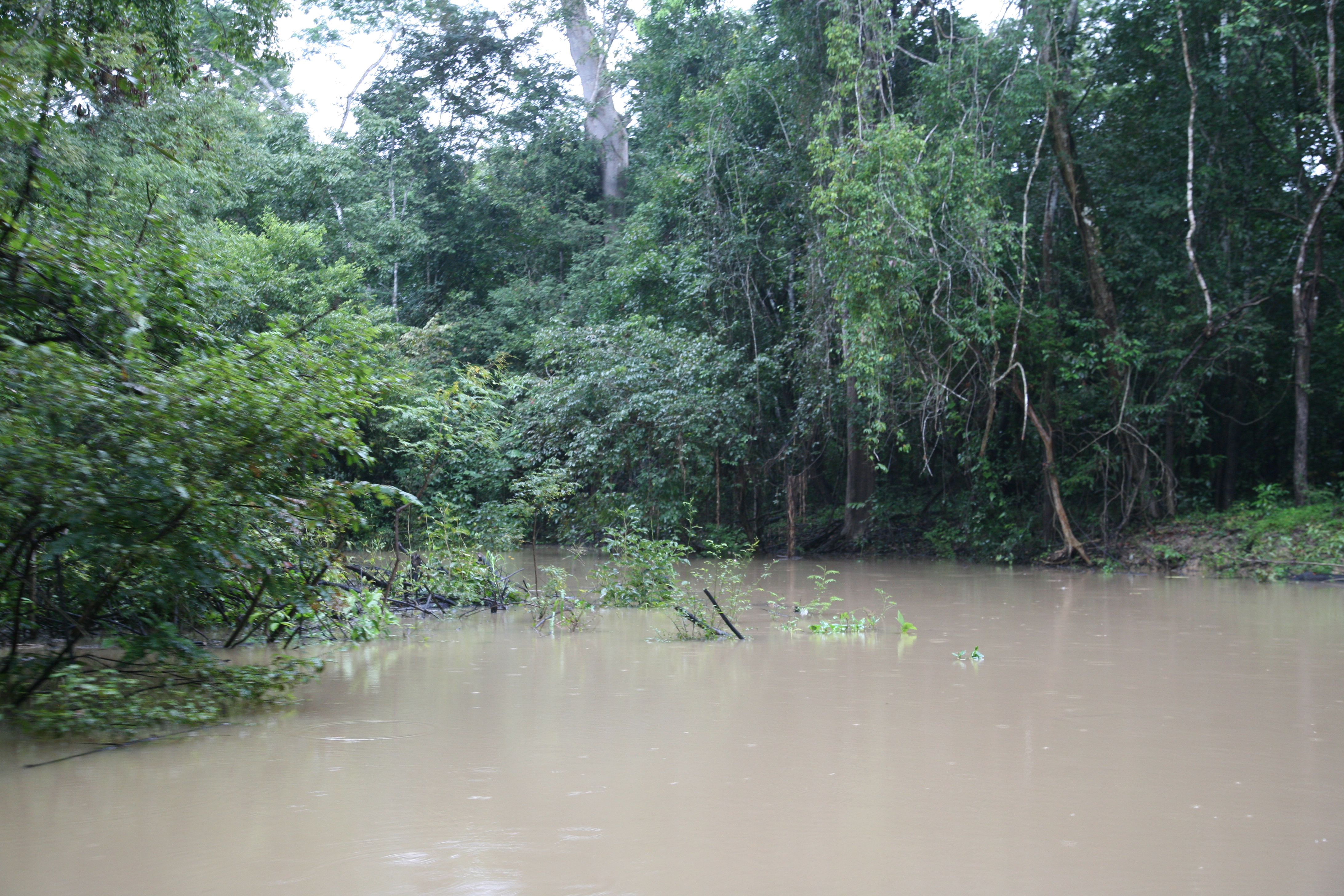
Flooded forest (várzea)
'Floresta inundada' — flooded forest, a generic várzea texture (23 January 2009). Location within the basin is unverified — no reach caption. M26James Martins · Taken · CC BY 3.0

BELÉM 2025

COP30: big money on paper, the forest roadmap outside the text

The COP30 climate conference met at Belém, Pará, Brazil, from 10 to 21 November 2025 — with talks stretched into Saturday dawn on the 22nd. The forest outcomes come from different reporters and stay attributed to each. M12

The deforestation roadmap was promised outside the formal text — never adopted. M12

PLACE AND DATES

Belém, 10–21 November 2025

11 days at the Amazon rainforest's edge; talks ran into the 22nd. M12

COP30 ran 11 days, 10–21 November 2025, at Belém, Pará, Brazil — a city 'on the edge of the Amazon rainforest'. Talks stretched into sunrise Saturday. Both datings are attributed; no contradiction is claimed. M12

THE MUTIRÃO PACKAGE

$1.3 trillion a year by 2035

'Mobilise $1.3 trillion annually by 2035'; adaptation: doubled by 2025, tripled by 2035. M12

Countries agreed a sweeping package to scale up climate finance — 'but without a clear commitment to move away from fossil fuels'. With it: the Global Implementation Accelerator and the Belém Mission to 1.5°C. The finance figures are UN-News-reported outcomes. M12

THE FOREST MONEY

$6.6bn for the forest fund

The TFFF raised $6.6bn, over half from Norway and Germany; $1.8bn for land rights. M12

Brazil's tropical forest fund, launched just before COP30 began, raised $6.6bn — more than half from Norway and Germany. Another $1.8bn was pledged for land rights, and Brazil announced new Indigenous territories. The forest details are Carbon-Brief-reported. M12

THE ROADMAP OUTSIDE THE TEXT

The roadmap that never entered the text

Dozens of countries backed fossil and deforestation roadmaps — but they never entered the final text. M12

Dozens of countries backed plans for fossil-fuel and deforestation roadmaps — 'although these roadmaps did not make it into the final negotiated text', COP30 president André Corrêa do Lago said they will be developed outside the formal UN process. A promise outside the text is not an adoption. M12

Photographs and maps · credit and date on every image

The Ver-o-Peso market in Belém
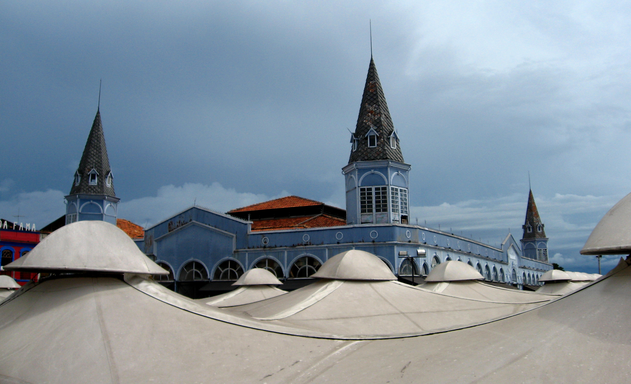
The 'See-the-weight' Market, Belém – Pará (10 April 2007). City color for the COP30 section — 2007, not the summit itself. M23marcusrg - Hello, nice to meet you! · 10 Apr 2007 · CC BY 2.0

OIL

500 km from the river mouth, the 2026 wells

While Belém negotiated the climate, the rigs negotiated offshore: the Foz do Amazonas basin, 500 km from the river mouth, delivered its first hydrocarbons in 2026 plus a new three-well license. Each peg is dated to its report. M13

Appraisal purpose only: the reservoir's size, not commercial viability. M13

THE MORPHO WELL

Hydrocarbons at Morpho, August 2026

The first Equatorial Margin exploration well since 2015; the October 2025 Ibama license. M13

Morpho marks the first exploration well drilled in the Equatorial Margin since 2015 — after Petrobras received Ibama's October 2025 environmental license to drill in the Foz do Amazonas Basin, 500 km from the mouth of the Amazon River. Block FZA-M-59 had been acquired under the concession regime in ANP's 11th Licensing Round in 2013. The October 2025 license is reported retrospectively in the August 2026 piece: event and report dates are distinguished. M13

THE THREE-WELL LICENSE

Manga, PAD Morpho and Crotalus

September 2026: Ibama approves three new wells in block FZA-M-59. M13

Ibama gave Petrobras approval to drill three new wells in the FZA-M-59 block: Manga, PAD Morpho and Crotalus. The license prohibits the disposal at sea of drill cuttings from the 'reservoir phase'. The wells 'will be crucial to determine the reservoir's size and assess the area's commercial potential'. M13

THE LIMIT

Appraisal, not viability

No commercial-viability claim: determining the reservoir's size only. M13

The trade press speaks of appraisal purpose: determining the reservoir's size and assessing the area's commercial potential. No commercial-viability claim is made — and the September 2026 license is the current peg. M13

ENERGY

Belo Monte: 11,233 MW installed, 4,571 MW guaranteed

On the northern Xingu River in Pará state, the Belo Monte hydroelectric complex is Brazil's second largest and the world's fifth by installed capacity — but installed and guaranteed capacity are two different numbers, and the line carrying the power southeast has its own story. M14 M15

11,233 MW installed are not 4,571 MW guaranteed — never one number. M14 M15

THE CAPACITY

11,233 MW installed, 4,571 MW guaranteed

With the 18th turbine, November 2019: 11,233 MW installed; the guaranteed minimum: 4,571 MW, 39% of maximum. M14

After completion, with the installation of its 18th turbine in November 2019, installed capacity is 11,233 MW — Brazil's second hydroelectric complex, the world's fifth. Guaranteed minimum capacity generation would measure 4,571 MW, 39% of maximum capacity. Two numbers, two meanings. M14

THE DISPUTE

Volta Grande and Article 176

Opposition in Brazil and abroad; a dispute over Indigenous peoples' territories. M14

There was opposition both within Brazil and among the international community 'regarding its impacts on the region's people and environment'. The Article 176 dispute concerns 'indigenous peoples' territories, as is the case for the Big Bend (Volta Grande) region'. Documented controversy, not adjudicated. M14

THE UHV LINE

2,534 kilometers of line, says State Grid

Belo Monte UHV Phase II: a 30-year concession, direct current to the southeast. M15

The 'Belo Monte Ultra-High Voltage Direct Current Phase II project', 'independently invested, constructed, and operated by State Grid Corp of China under a 30-year concession agreement', spans 'a staggering 2,534 kilometers' — 'one of the longest of its kind in the world'. The line continuously transmits 'massive volumes' of clean hydropower from Belo Monte to southeastern load centers including Rio de Janeiro — said State Grid. Attributed claims, not independent engineering verification. M15

Photographs and maps · credit and date on every image

The Belo Monte dam on the Xingu River
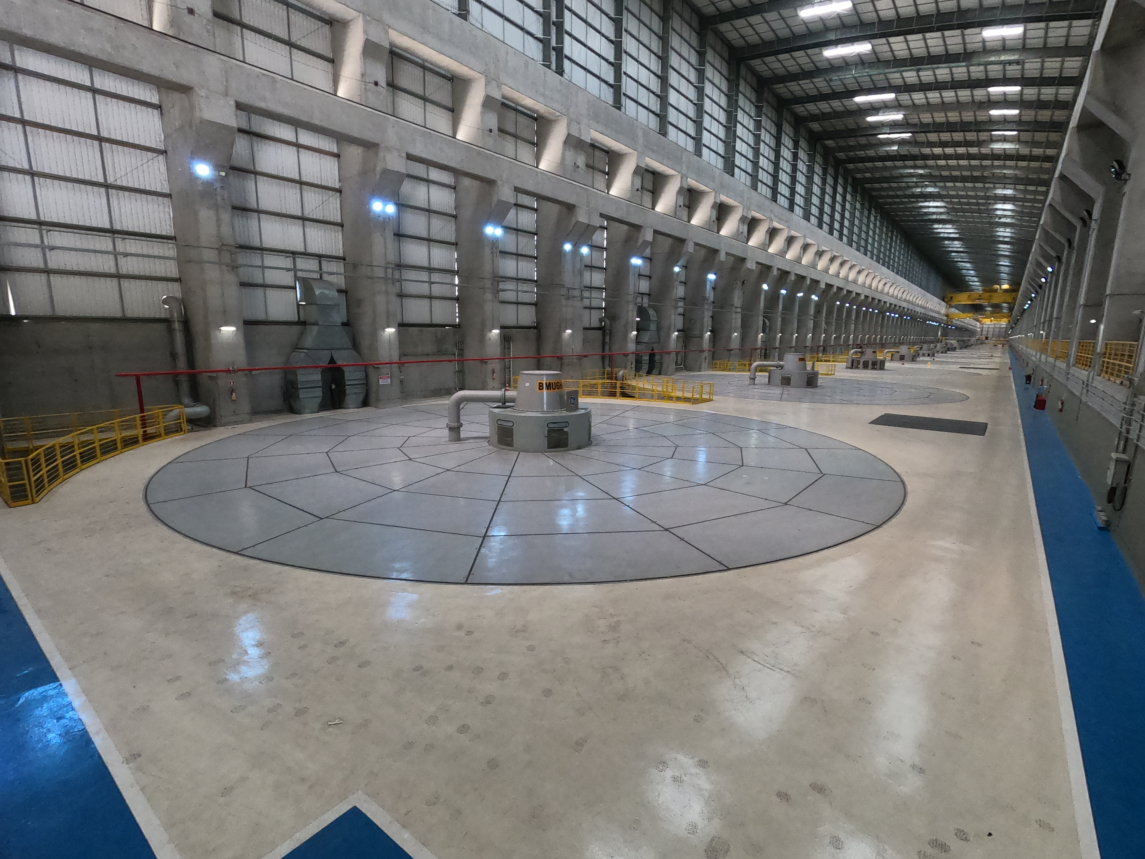
Usina Hidrelétrica de Belo Monte on the Xingu River (5 October 2023). A modern dam view. M25Túllio F · 5 Oct 2023 · CC BY-SA 4.0

Sources for this passage

Sources and limits

Annotations retain the status in the source ledger.

  1. M01 · Wikipedia — the recognized 6,400 km length

    tertiary summary with cited provenance · official-link-unverified

    https://en.wikipedia.org/wiki/Amazon_River

  2. M02 · The INPE 2008 and IBGE 2007 claims

    attributed length-debate claims · official-link-unverified

    https://en.wikipedia.org/wiki/Amazon_River · https://www.nationalgeographic.com/science/article/amazon-longer-than-nile-river

  3. M03 · Discharge at the Óbidos gauge

    gauging-station means with periods · official-link-unverified

    https://en.wikipedia.org/wiki/Amazon_River

  4. M04 · Delta discharge and the global share

    delta-scope means with periods · official-link-unverified

    https://en.wikipedia.org/wiki/Amazon_River

  5. M05 · Basin area

    approximate basin figures, scopes kept apart · official-link-unverified

    https://en.wikipedia.org/wiki/Amazon_River

  6. M06 · Sediment, plume and estuary

    station sediment + estuary geography · official-link-unverified

    https://en.wikipedia.org/wiki/Amazon_River · https://en.aguasamazonicas.org/basins/estuary-coast/the-estuary

  7. M07 · Mouth width, two conventions

    two mouth-width conventions · official-link-unverified

    https://en.wikipedia.org/wiki/Amazon_River

  8. M08 · The October 2023 record low

    dated news report (PA) · official-link-unverified

    https://www.glasgowtimes.co.uk/news/national/23859745.major-amazon-tributary-reaches-record-low-drought-takes-hold/

  9. M09 · The October 2024 record low

    dated SGB-attributed report (PA) · official-link-unverified

    https://www.leighjournal.co.uk/news/national/24631943.major-tributary-amazon-lowest-level-ever-following-drought/

  10. M10 · PRODES 2024–25 and the 2020–21 year

    PRODES reports, verdict swap + scaffold-time re-source · official-link-unverified

    https://www.warpnews.org/human-progress/amazon-deforestation-reaches-lowest-level-in-a-decade/ · https://en.people.cn/n3/2022/1201/c90000-10178649.html

  11. M11 · 2026 DETER alerts and the tariff dispute

    DETER alerts + dated attributed dispute · official-link-unverified

    https://www.edie.net/amazon-deforestation-alerts-reach-record-lows/ · https://srnnews.com/brazil-reports-drop-in-amazon-deforestation-rates-pushing-back-on-us-tariff-accusations/

  12. M12 · COP30 outcomes at Belém

    finance package + forests detail + date/venue frame · official-link-unverified

    https://news.un.org/en/story/2025/11/1166433 · https://www.carbonbrief.org/cop30-key-outcomes-for-food-forests-land-and-nature-at-the-un-climate-talks-in-belem · https://en.wikipedia.org/wiki/2025_United_Nations_Climate_Change_Conference

  13. M13 · Foz do Amazonas drilling 2025–26

    trade-press regulatory reports · official-link-unverified

    https://offshoresource.com/news/oil-gas/petrobras-confirms-hydrocarbons-at-morpho-well-in-foz-do-amazonas-basin/ · https://offshoresource.com/news/oil-gas/petrobras-wins-ibama-approval-for-three-wells-in-foz-do-amazonas-basin/ · https://brazilenergyinsight.com/2026/09/07/ibama-grants-petrobras-license-with-conditions-to-drill-3-new-wells-in-the-foz-do-amazonas-basin/

  14. M14 · The Belo Monte dam

    tertiary dam summary · official-link-unverified

    https://en.wikipedia.org/wiki/Belo_Monte_Dam

  15. M15 · The Belo Monte UHV Phase II line

    dated industry-source ZH peg · official-link-unverified

    https://bccci.net/blog/mega-green-project-in-brazil-a-milestone/

  16. M17 · Verified OSM geometry

    OpenStreetMap records, locator only · official-link-unverified

    https://www.openstreetmap.org/relation/2295651 · https://www.openstreetmap.org/relation/275660 · https://www.openstreetmap.org/node/206147977 · https://www.openstreetmap.org/relation/332493 · https://www.openstreetmap.org/node/195594311 · https://www.openstreetmap.org/relation/185567 · https://www.openstreetmap.org/relation/9774806 · https://www.openstreetmap.org/relation/185569 · https://www.openstreetmap.org/node/415524086 · https://www.openstreetmap.org/way/515537184

  17. M18 · Commons V01 — the MODIS delta

    Commons original, researcher-read file page · official-link-unverified

    https://commons.wikimedia.org/wiki/File:Amazon%20River%20Delta%20%28MODIS%202020-08-07%29.jpg

  18. M19 · Commons V02 — the algal bloom

    Commons original, researcher-read file page · official-link-unverified

    https://commons.wikimedia.org/wiki/File:Algal%20blooms%20at%20the%20mouth%20of%20the%20Amazon%20River.jpg

  19. M20 · Commons V03 — Meeting of Waters

    Commons original, researcher-read file page · official-link-unverified

    https://commons.wikimedia.org/wiki/File:Meeting%20of%20Waters%20%28Manaus%29.jpg

  20. M21 · Commons V04 — Meeting of Waters from the air

    Commons original, researcher-read file page · official-link-unverified

    https://commons.wikimedia.org/wiki/File:Meeting%20of%20waters%20from%20the%20air%20manaus%20brazil.JPG

  21. M22 · Commons V05 — riverboat at Manaus

    Commons original, researcher-read file page · official-link-unverified

    https://commons.wikimedia.org/wiki/File:Riverboat%2C%20Manaus.jpg

  22. M23 · Commons V06 — Ver-o-Peso, Belém

    Commons original, researcher-read file page · official-link-unverified

    https://commons.wikimedia.org/wiki/File:Ver-o-Peso%20-%20Bel%C3%A9m%20do%20Par%C3%A1%20%28454611567%29.jpg

  23. M24 · Commons V07 — deforestation in Mato Grosso

    Commons original, researcher-read file page · official-link-unverified

    https://commons.wikimedia.org/wiki/File:DeforestationinBrazil2.jpg

  24. M25 · Commons V08 — Belo Monte

    Commons original, researcher-read file page · official-link-unverified

    https://commons.wikimedia.org/wiki/File:UHE%20Belo%20Monte%2004.jpg

  25. M26 · Commons V09 — flooded forest

    Commons original, researcher-read file page · official-link-unverified

    https://commons.wikimedia.org/wiki/File:Floresta%20inundada%20-%20panoramio%20(1).jpg