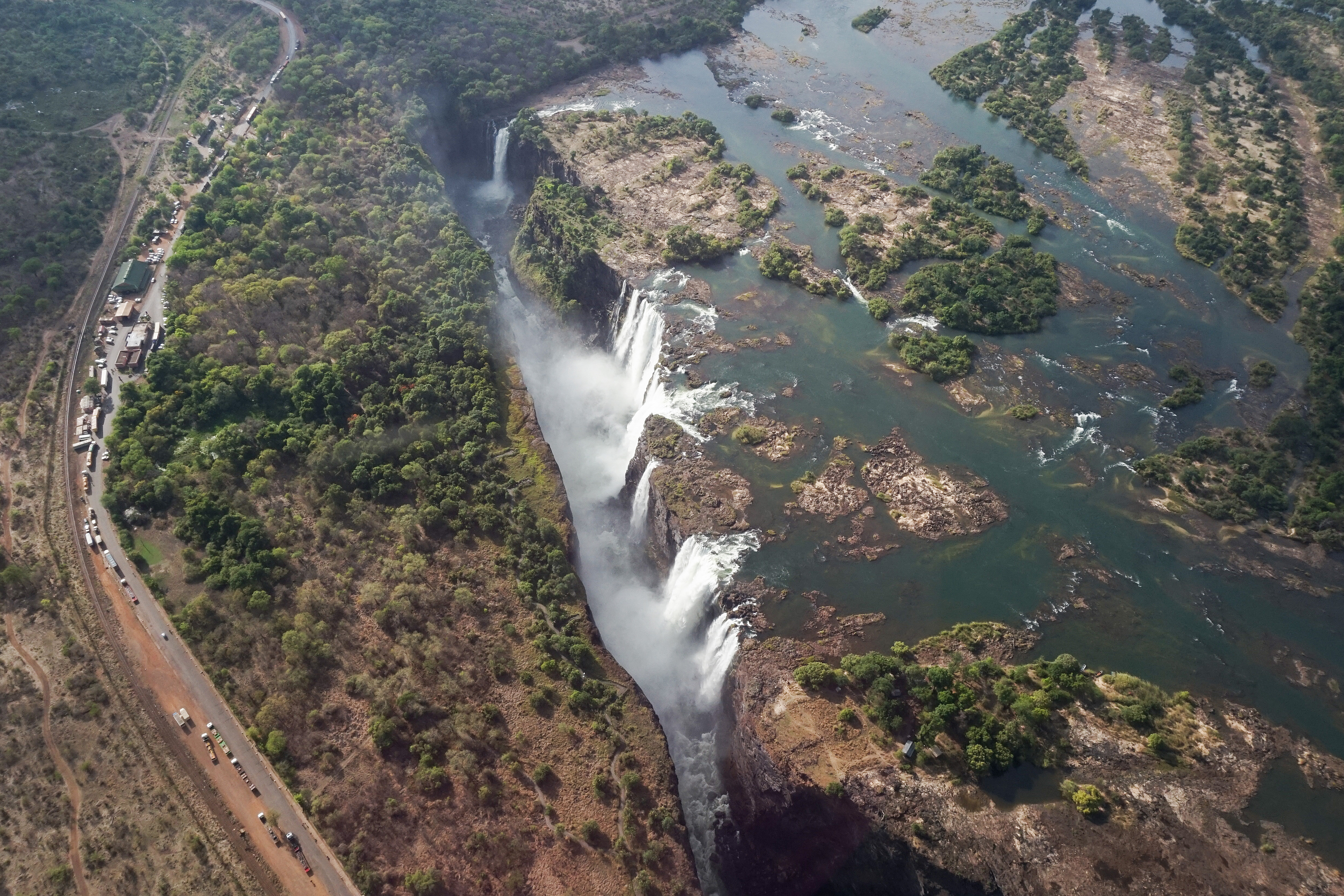
Aerial view of Victoria Falls, portrait frame, 2018

Visual essay · eight chapters · Zambia Tourism figures

Victoria: the smoke that thunders — a 1,688 m curtain on Zambia Tourism figures

A 1,688 m curtain dropping 108 m at 1,088 m³/s — the official Zambia Tourism figures — between Zambia and Zimbabwe, under the name Mosi-oa-Tunya, the smoke that thunders. Eight chapters, from flood to drought, from the walking gorges to the Chinese thread. M01 M02 M03

In November 2019 the flow fell to 109 m³/s — the lowest since 1995 — and the 1,688 m curtain shredded on the Zambian side. Yet the absolute record is older: October 1986, 3,496 cfs. M04 M05

Down the curtain

Four marks · one curtain

1,688 mcurtain width, Zambia Tourism M01
108 mdrop height M01
1,088 m³/smean flow M01
109 m³/sNov 2019, lowest since 1995 M04
The aerial portrait (2018, Diego Delso): the 4,203 px CC BY-SA 4.0 frame that opens this essay — spectacle, not a survey. M20Diego Delso · 27 Jul 2018 · CC BY-SA 4.0

Chapter 1 · One waterfall, four names

The 1,688 m curtain

Between Zambia and Zimbabwe, the full width of the Zambezi drops at once into a transverse basalt rift: the First Gorge. The Zambian side is Mosi-oa-Tunya National Park — “the smoke that thunders” in Lozi, “Shungu Namutitima,” boiling water, in Tonga — and the whole is World Heritage 509 since 1989 (13th session, criteria vii+viii). M01 M02

Is it “the largest”? The World Waterfall Database says it honestly: usually thought of as the largest on the planet, while that may be disputable — but that it is one of the best, no doubt. This essay keeps the careful framing and never turns dispute into record. M03

Four named streams, west to east — and a datum note that hides nothing. M02 M01 M03

THE WIDTH

1,688 m of curtain

The official Zambian figure, with its imperial foot: 5,538 ft. M01

1,688 m (5,538 ft) of curtain on the official Zambia Tourism page — the anchor of this whole essay. Other sources measure differently, and the datum note keeps every one of them in view. M01

THE DROP AND THE FLOW

108 m down, 1,088 m³/s on

108 m of drop, 1,088 m³/s mean — Zambia Tourism again. M01 M02

108 m (354 ft) of drop and 1,088 m³/s of mean flow. The First Gorge runs 80–108 m deep, and its only outlet is a 110 m cleft about two-thirds of the way from the western end. M01 M02

WEST TO EAST

Four names on one water

Four named streams, two islands on the crest. M02

From Zimbabwe (west) to Zambia (east): Devil's Cataract (“Leaping Water”), Main Falls, Rainbow Falls (the highest) and Eastern Cataract. Two islands sit on the crest: Boaruka (Cataract) near the western bank and Livingstone in the middle. M02

THE DATUM NOTE

Why the figures differ: not errors

This essay standardizes on Zambia Tourism and notes every variant. M01 M02 M03

Width reads as 1,688 m (Zambia Tourism), 1,707 m (WWD) or 1,708 m (Wikipedia); height as 105 m (WWD) or 108 m. WWD adds 1,951 m maximum width and 42 m³/s low flow. Different datums and conventions — the figure here is always Zambia Tourism's, with the variant beside it. M01 M02 M03

Image gallery

Current Victoria Falls locator, with the river, the three crests, Livingstone Island, Main Falls, the bridge and the town.
OpenStreetMap geometry from the dated 2026-10-07 extract. Locator, not a nautical chart. River linework is merged member-way geometry from one bbox pull; the three cliff-crest ways and the island are pinned OSM ways; Main Falls, the bridge and the town are verified OSM point records. Figures never come from OSM tags. · © OpenStreetMap contributors · ODbL 1.0 M19
Aerial panorama of the full Victoria Falls curtain, 2018
The full-curtain panorama (2018, Diego Delso): 11,686 px of CC BY-SA 4.0 falling water, Zambia left, Zimbabwe right. M21Diego Delso · 27 Jul 2018 · CC BY-SA 4.0
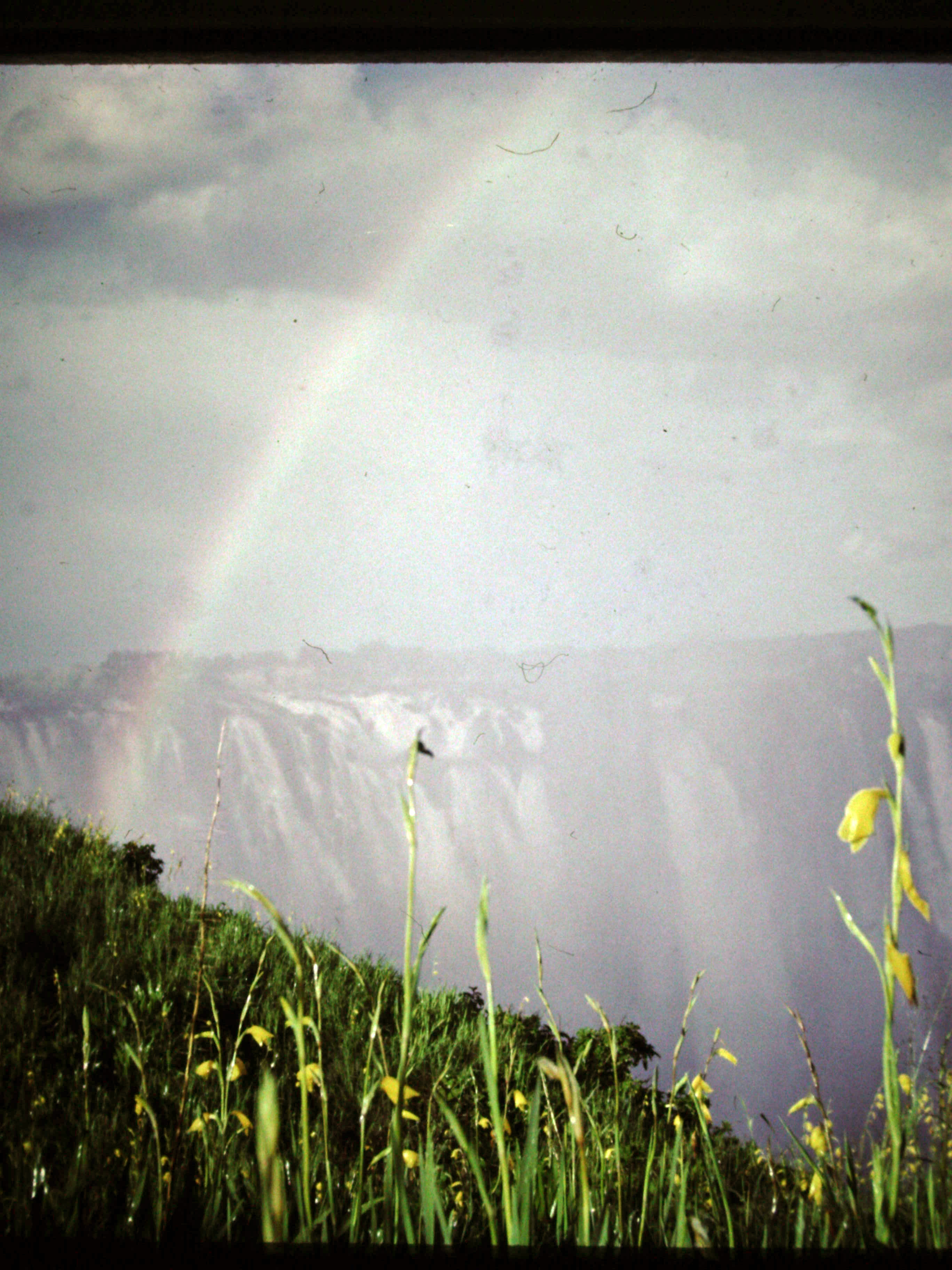
The Rainbow Falls section in 1972, a vintage view
A 1972 view (Gypsy Denise): the Rainbow Falls section half a century ago — CC BY-SA 4.0, captioned as its year, never as today. M27Gypsy Denise · 1972 · CC BY-SA 4.0

Chapter 2 · From flood to drought

The river's year

The river's year has two faces: February to May, peaking in April, the falls are a wall of water; September to January, up to half the rocky face may dry, and the November minimum drops to about a tenth of the April figure. M01 M02

The 2019 drought took the flow to 109 m³/s in November — the lowest since 1995, on the Zambezi River Authority — and threatened tourism, rafting and Kariba energy. Below it in the archive sits only October 1986: 3,496 cfs. M04 M05

The November minimum runs about a tenth of the April figure. M02

THE WATER SEASON

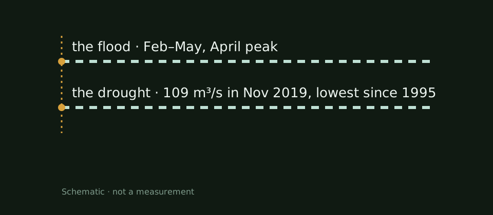
The flood: February–May, April peak

Rains from November; the flood swells the falls in spring. M01 M02

The rainy season runs November to early April; the flood swells the falls February to May, peaking in April — March–April on Zambia Tourism. M01 M02

THE SWING

November is a tenth of April

The mean hides the swing: November is a tenth of April. M01 M02

The 1,088 m³/s mean hides the swing: the November minimum runs about a tenth of the April figure, and from September to January up to half the rocky face may go dry. M01 M02

NOVEMBER 2019

2019: 109 m³/s, lowest since 1995

3,850 cfs per Bloomberg — tourism, rafting and power at risk. M04 M05

In November 2019 the flow fell to 109 m³/s (3,850 cfs), the lowest since 1995 on the Zambezi River Authority — tourism, gorge rafting and Kariba power all at risk. M04 M05

THE ABSOLUTE RECORD

1986: 3,496 cfs, lowest ever

A snapshot, not an annual mean — conventions never mix. M05

The absolute record stays October 1986: 3,496 cfs on the same Authority. An instantaneous flow, not an annual mean, so it stands beside 2019 without ever blending into it. M05

Image gallery

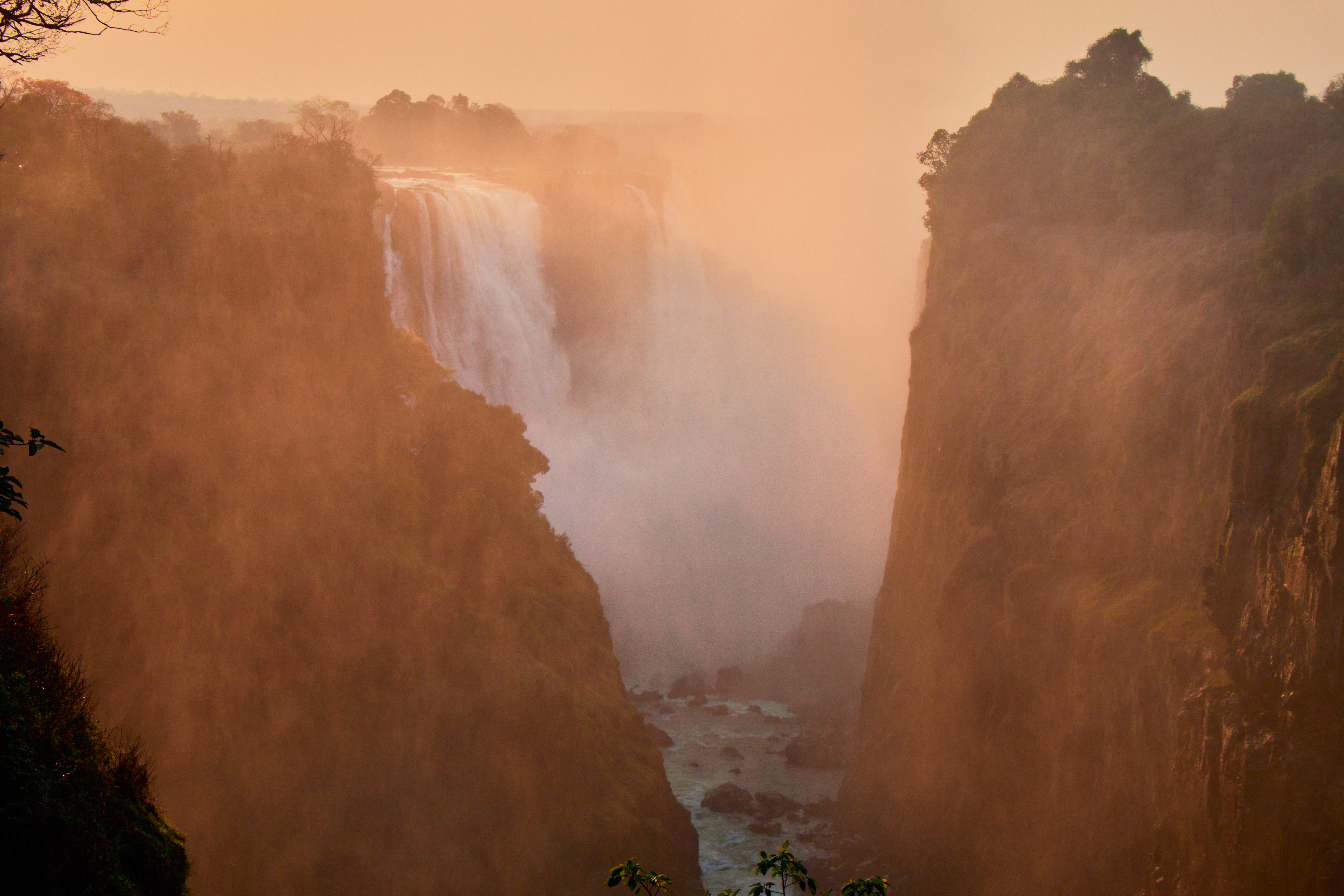
Victoria Falls seen from the Zimbabwe side, 2017
The Zimbabwe-side curtain (2017, Bernard Gagnon): CC BY-SA 4.0 falling water — one season's face, not every season's. M24Bernard Gagnon · 20 Nov 2017 · CC BY-SA 4.0
River-year schematic: Feb–May flood, 109 m³/s drought in Nov 2019.
The river-year and machine diagrams are conceptual drawings, not measurements and not maps. M02

Chapter 3 · The waterfall walks upstream

The walking gorges

The whole Zambezi squeezes through the First Gorge's 110 m exit for about 150 m, then enters a zigzag series of gorges numbered in the order the river reaches them. It is a waterfall that walks: every gorge is an older position of the drop. M02

The mechanism is millions of years old: headward erosion along weak lines in the basalt moves the fall line and abandons the earlier one. That is how the six gorges and eight past positions were written — and the ninth is being written now, in the west. M02

Eight past positions of the falls stand written in the six gorges. M02

THE SERIES

Six gorges, in river order

Six zigzag gorges, in the order the river reaches them. M02

Second Gorge: 250 m south, 2.15 km long, spanned by the Bridge; Third: 600 m, 1.95 km, with the Power Station inside; Fourth: 1.15 km, 2.25 km; Fifth: 2.25 km, 3.2 km; Songwe: 5.3 km, 3.3 km, deepest at 140 m, the river level swinging up to 20 m between wet and dry. M02

THE POT

Boiling Pot: the 150 m cauldron

Smooth at low water, huge slow swirls at flood. M02

In the Second Gorge the water takes a sharp right and digs the Boiling Pot — a pool about 150 m across, reached by a steep footpath from the Zambian side. Smooth at low water; at flood, enormous slow swirls and heavy turbulence. M02

DEEP TIME

The lake that cut the gorges

A vanished lake cut the gorges through basalt. M02

About 2 million years ago, land uplift blocked drainage to the Limpopo and formed paleolake Makgadikgadi; about 20,000 years ago, in a wetter climate, its overflow cut Batoka Gorge through the basalt. Their shape keeps six gorges and eight past positions of the falls. M02

THE NEXT GORGE

Capture runs west

The lowest lip carries the most water at flood. M02 M19

The next gorge is already being cut: at the dip between the western bank and Cataract Island, toward Devil's Cataract (way 579843538), the lip is lowest and carries the greatest concentration of water at flood stage. M02 M19
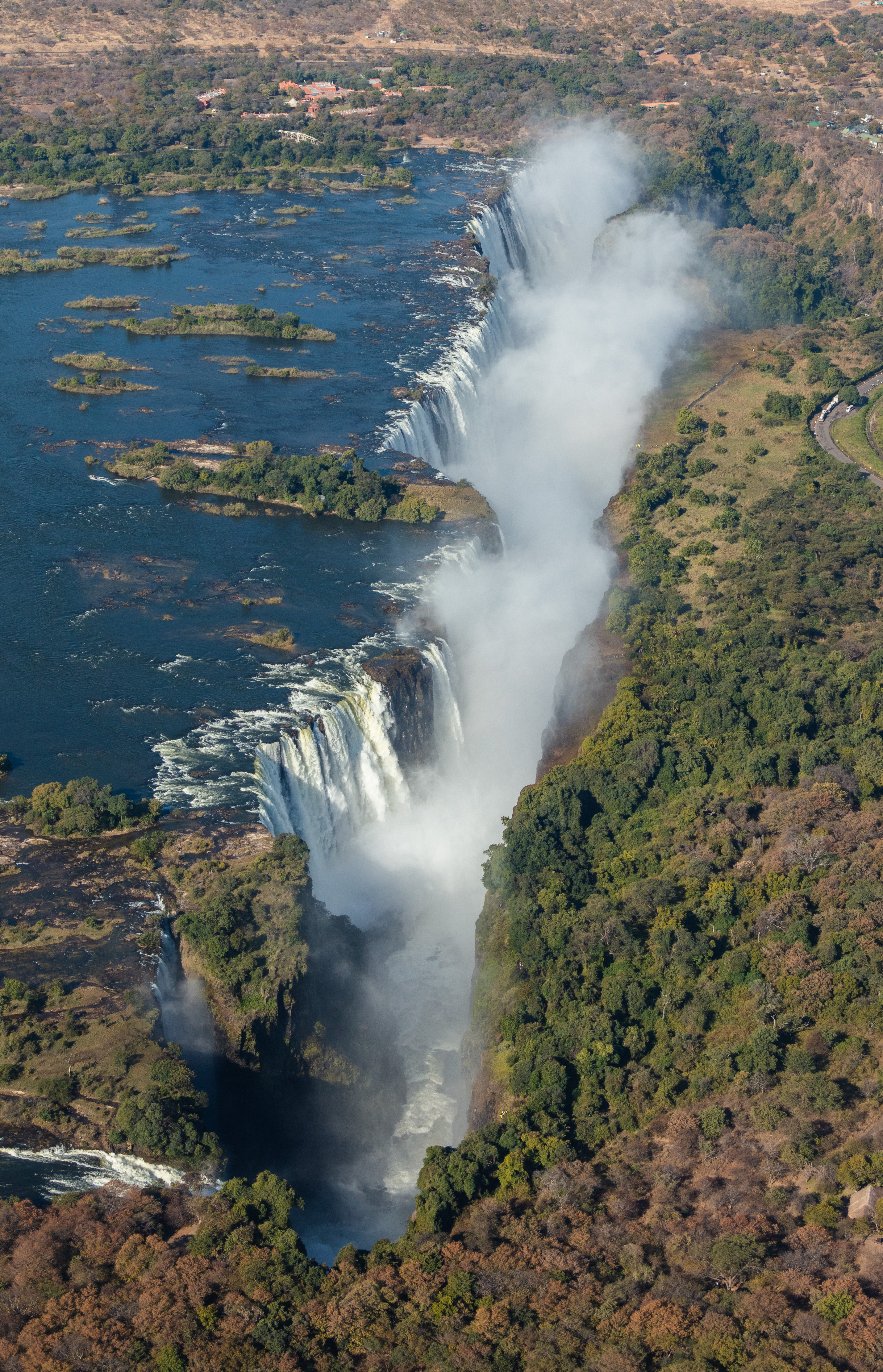
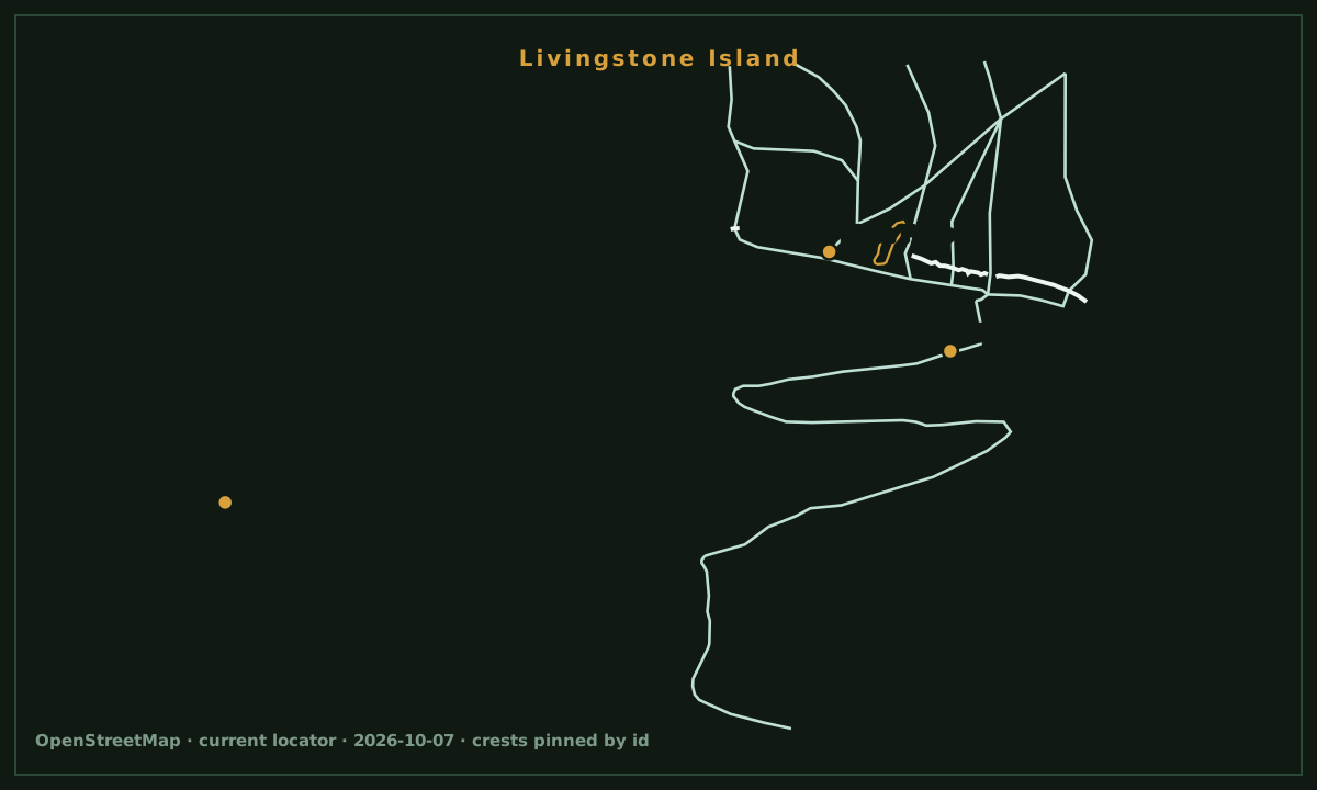
Image gallery

Victoria Falls plunging into the Batoka Gorge
The plunge into the gorge (lumoplank, uploaded before 20 March 2025; capture date unrecorded): CC0 falling water — the upload bound is honest, no capture year is claimed. M25lumoplank · before 20 Mar 2025 · CC0
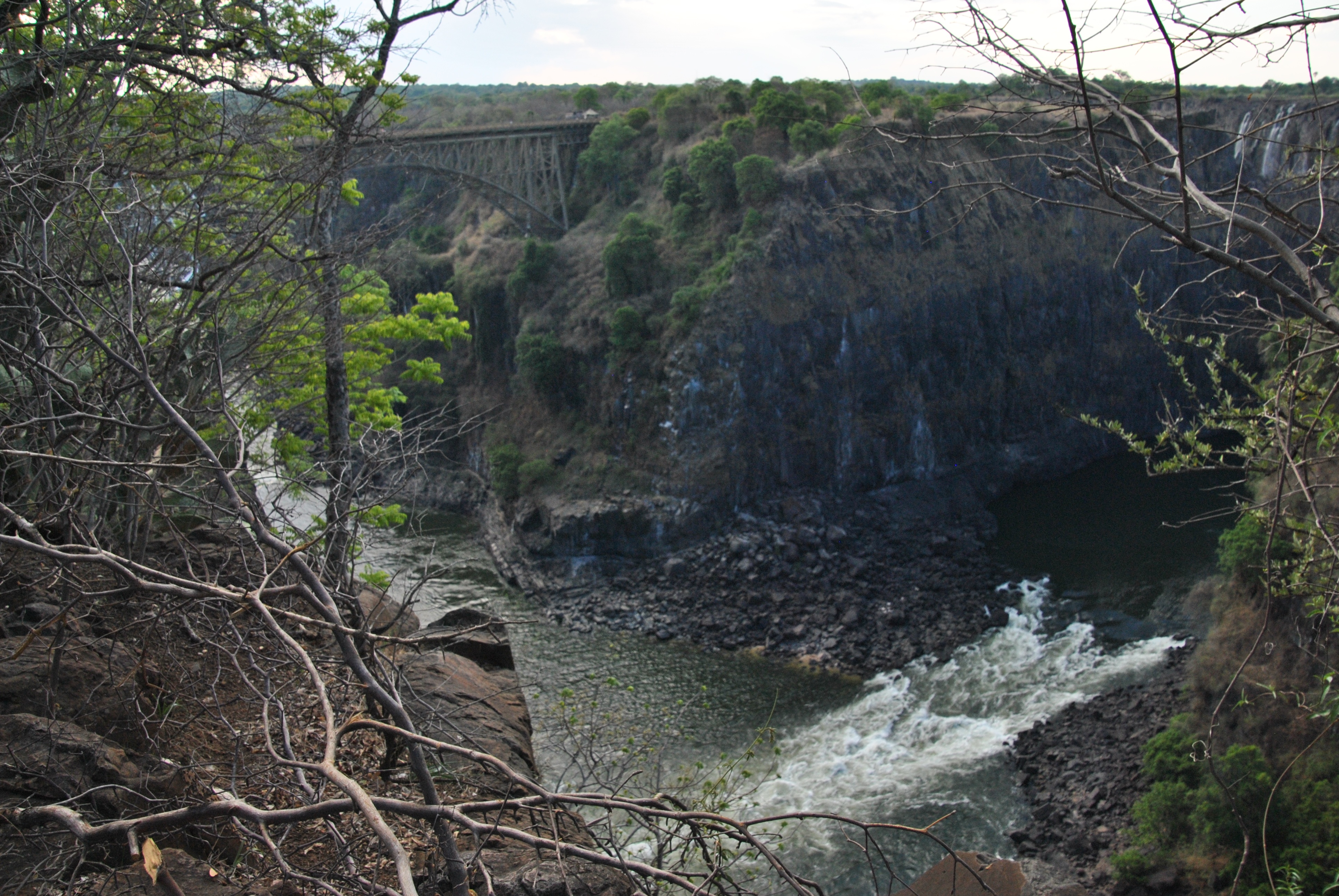
The Zambezi river and gorge in Zambia, 2011
River and gorge (diego_cue, 17 November 2011): the Zambezi past the falls — CC BY-SA 3.0, Panoramio-era honest dating. M28diego_cue · 2011 · CC BY-SA 3.0

Chapter 4 · Three stations in the gorge, one giant lake

The machine

Below the falls, the river works: in the Third Gorge, 600 m south of the drop, Victoria Falls Power Station draws 108 MW from the run of the river, in three historic slices — A from 1936, B and C from 1968, with B buried in rock. M08 M02

Downstream, Kariba holds two nations' lights: a 128 m arch and a 185 km³ lake, built 1955–59. Drought took it to 9.46% usable in August 2024; rains brought it back to 48.09% in June 2026 — the full arc is in the markers. M09 M06 M07

The falls are spectacle; behind them, the river is a machine. M08 M09

THE GORGE STATION

108 MW under the lip

A (1936, 8 MW) + B (1968, 60 MW) + C (1968, 40 MW). M08 M02

Victoria Falls Power Station: 108 MW in the Third Gorge — A (1936, 8 MW: 2×1 + 2×3), B (1968, underground, 60 MW: 6×10), C (1968, 40 MW: 4×10). A run-of-river station run by ZESCO. M08 M02

THE GIANT LAKE

Kariba: 128 m of arch, 185 km³ of lake

Both countries' largest hydro plants stand at Kariba. M09 M05

Kariba Dam: a double-curvature arch, 128 m tall and 579 m long, holding a 280 km, 185 km³ lake, built 1955–59. Both countries' largest hydroelectric plants stand at Kariba — the north/south capacity split is not citable here. M09 M05

CRISIS AND RECOVERY

From 9.46% to 48%: the Kariba arc

From ~214 MW allocated to 36 billion m³. M06 M07

In August 2024 usable storage sat at 9.46% (476.87 m against 479.46 m a year before), allocation cut to about 214 MW — both nations load-shedding. In 2026: a 36 billion m³ allocation, and on 22 June 482.15 m reads 48.09% usable, inside the 475.50–488.50 m operating band. M06 M07

Image gallery

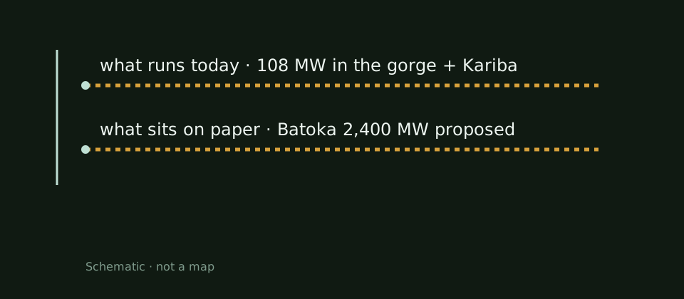
Machine schematic: 108 MW in the gorge today, Batoka 2,400 MW on paper.
The river-year and machine diagrams are conceptual drawings, not measurements and not maps. M08

Chapter 5 · 2,400 MW on paper

The dam that isn't

54 km downstream, a giant has sat on the drawing board since 2019: 2,400 MW in two 1,200 groups, a 181 m arch, $4–5 billion. The General Electric and PowerChina deal broke in 2023/24, when Zambia canceled it on procurement grounds. M10

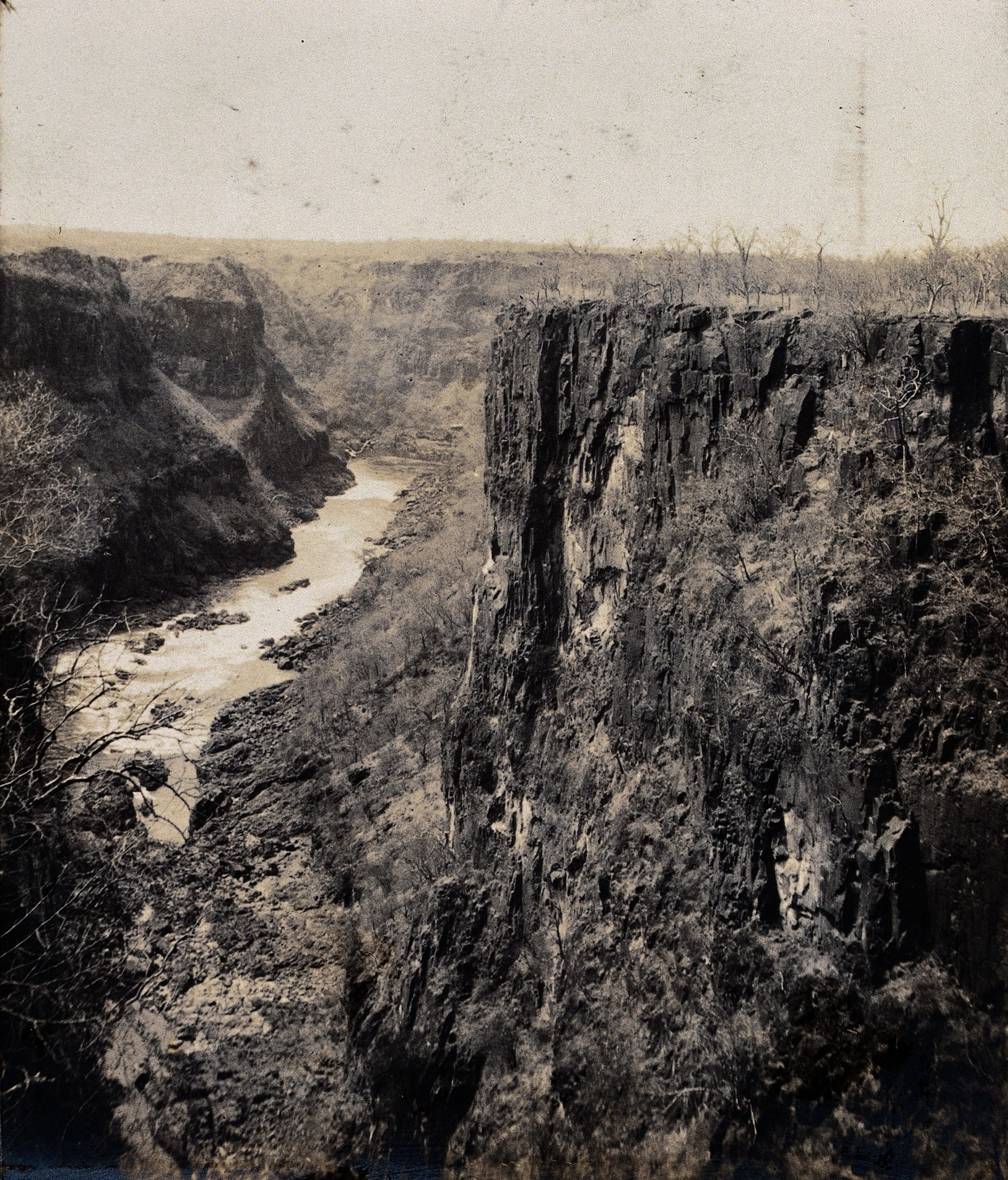
The question remains what would drown: Batoka Gorge rafting, Zambia's third-largest contributor, with its Tokaleya porters paid by the kayak-dollar. Prof. Davis's 1905 photograph shows the gorges before any dam — that is what “before” looks like. M10 M11

A proposed dam, never built: its paper weighs what others' concrete weighs. M10

THE PROPOSAL

2,400 MW that do not exist

2×1,200 MW, $4–5 billion — on paper. M10

Batoka Gorge HPP: 2,400 MW proposed (2×1,200), 54 km downstream of the falls, a 181 m arch-gravity dam by the Zambezi River Authority — a $4–5 billion project, proposed, never poured. M10

THE BROKEN DEAL

Signed, canceled, cleared — unbuilt

The UNESCO greenlight (Sept 2023) is not a build permit. M10

In 2019 General Electric and PowerChina signed for Batoka; Zambia canceled the deal in 2023/24 on procurement grounds. In September 2023 UNESCO gave the greenlight anyway — an opinion, not a construction permit: the dam stays proposed. M10

WHAT WOULD DROWN

The run that pays today

The Tokaleya porters, via Earth Island Journal (advocacy). M10 M11

Gorge rafting is the third-largest contributor to Zambia's economy; Tokaleya porters carry 3 kayaks each at $1 a kayak, and the dam would drown their run, villages and wildlife — via Earth Island Journal, an advocacy voice. M10 M11

Image gallery

The Batoka Gorge in 1905, photographed by Prof. Davis
A 1905 catalog view (Wellcome Collection, Prof. Davis): the Batoka Gorge before the dams — CC BY 4.0, the year is the catalog's, not a machine date. M29Wellcome · CC BY 4.0

Chapter 6 · Angels, arches and the lip

The people

On 16 November 1855 David Livingstone saw the drop from the island that bears his name today, and named it for the queen. In Missionary Travels (1857) he notes “Mosi oa tunya” — smoke does sound there — and the older name, “Shongwe,” then returns: chapter XXVI holds the “Second Visit to the Falls.” M12 M02

The twentieth century put the steel arch over the Second Gorge (1904–05) and opened the area by rail. The twenty-first sells the void at $194 a jump and the lip of the falls on a low-water schedule: August–December, guided only. M13 M14 M15

“…scenes so lovely must have been gazed upon by angels in their flight.” M12

16 NOVEMBER 1855

Livingstone's angels: MUST

MUST, not would — the exact 1857 wording. M12 M02

“…scenes so lovely must have been gazed upon by angels in their flight” — MUST, as Livingstone writes in Missionary Travels (1857), ch. XXVI with its “Second Visit to the Falls.” Locally: “Mosi oa tunya” (smoke does sound there), earlier “Shongwe”; the first European saw the drop from Livingstone Island on 16 November 1855. M12 M02

THE STEEL ARCH

The 1905 bridge: 156.5 / 198 / 128 m

Cleveland Bridge & Engineering; a border at both ends. M13 M19

Victoria Falls Bridge (way 1425593384): a steel arch over the Second Gorge — 156.5 m span, 198 m long, 128 m high, built 1904–05 by Cleveland Bridge & Engineering, with border posts at both ends. The railway opened the area to Europeans in 1905. M13 M19

THE VOID

111 m of elastic over the Second Gorge

Official Shearwater price, per person. M14

Bridge bungee: 111 m of void, US$194 per person, Zimbabwe-side check-in (Shearwater). The 1905 arch holds the border and the adrenaline today. M14

ON THE LIP

Devil's Pool: August–December

At low water, 2–3 hours with the island tour. M15

Devil's Pool: a natural rock pool on the lip of the falls, Zambian side only, at low water typically August to December — the boat from the Royal Livingstone jetty, 2–3 hours with the island tour, guided only. M15

Image gallery

The Victoria Falls Bridge from the Knife Edge trail, 2022
The 1905 arch (2022, Dicklyon): the bridge from the Zambian Knife Edge trail — CC BY-SA 4.0, still carrying the border. M26Dicklyon · 21 Apr 2022 · CC BY-SA 4.0

Chapter 7 · Spray, moon and park

The smoke that thunders

The Lozi name is no empty metaphor: spray rises past 400 m and shows from 50 km, and at full moon a moonbow lights over the curtain. At flood, paradoxically, the falls hide — foot and face dissolve into their own smoke. M02

Around the drop, both countries keep national parks and tourism infrastructure under the World Heritage umbrella. A light chapter, held to what the sources cite: no uncited ecology. M01 M02

Spray rises 400 m and shows from 50 km — the smoke that thunders. M02

THE SMOKE

Smoke visible from 50 km

Sometimes twice as high; at flood the face hides. M02

Spray typically rises past 400 m, sometimes twice as high, and shows from up to 50 km away. At flood, though, the foot and face of the falls vanish — the curtain hides inside its own smoke. M02

THE MOON

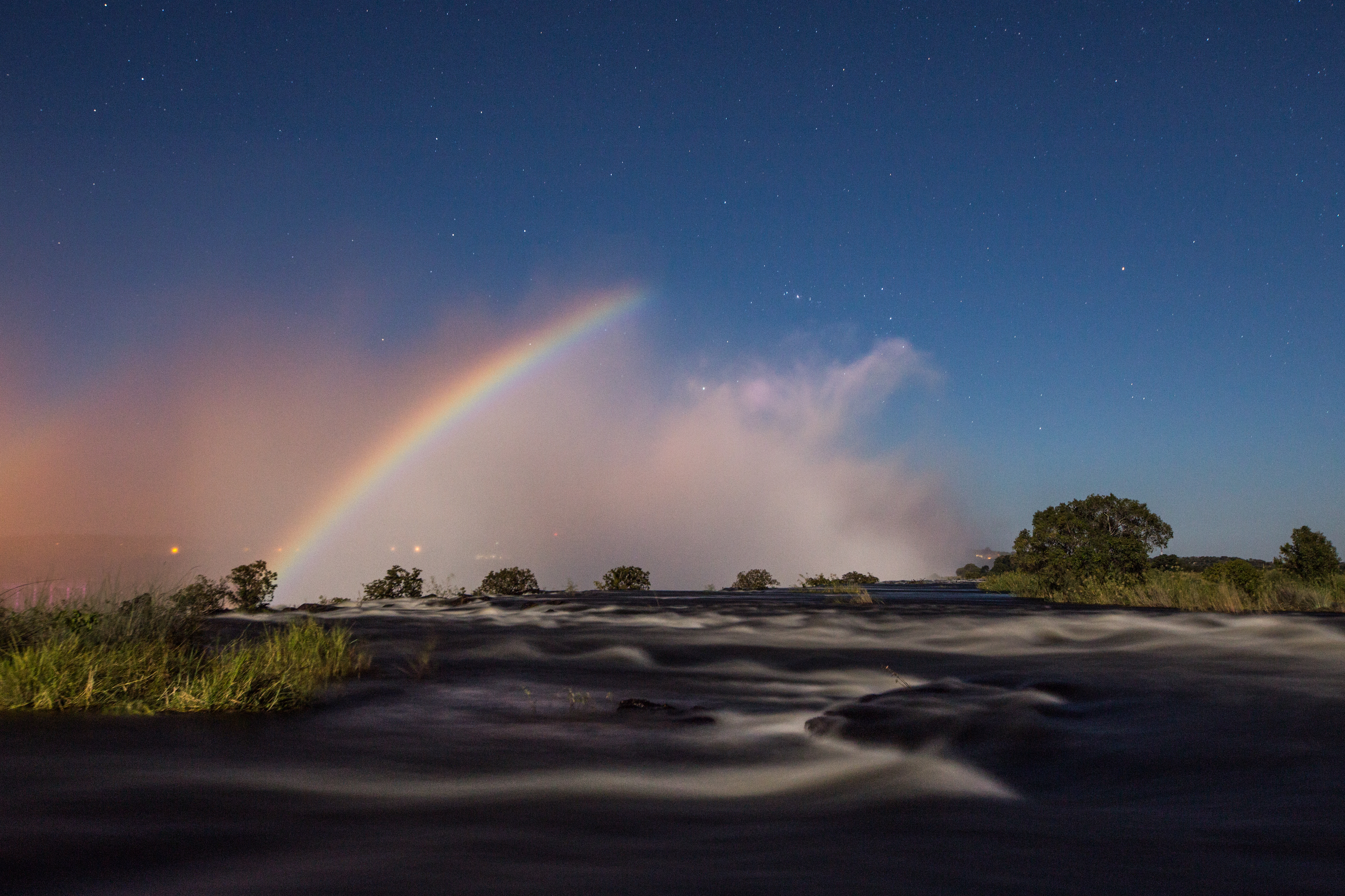
At full moon: moonbow

Day geometry, with the moon for a sun. M02

At full moon a moonbow stands over the curtain — day geometry, with the moon for a sun. The 2014 photograph catches it exactly so: night, moon, water. M02

THE PARKS

Two parks, one heritage

A light chapter: no uncited ecology. M01 M02

The Zambian side is Mosi-oa-Tunya National Park; both countries keep national parks and tourism infrastructure on site, under World Heritage 509. The rest is the guides' business — this essay inventories no wildlife. M01 M02

Image gallery

A moonbow over Victoria Falls at night, 2014
The moonbow (2014, Scolopendra33): moonlight does what sunlight does — CC BY-SA 4.0, 5,472 px, full-moon geometry only. M22Scolopendra33 · 14 May 2014 · CC BY-SA 4.0
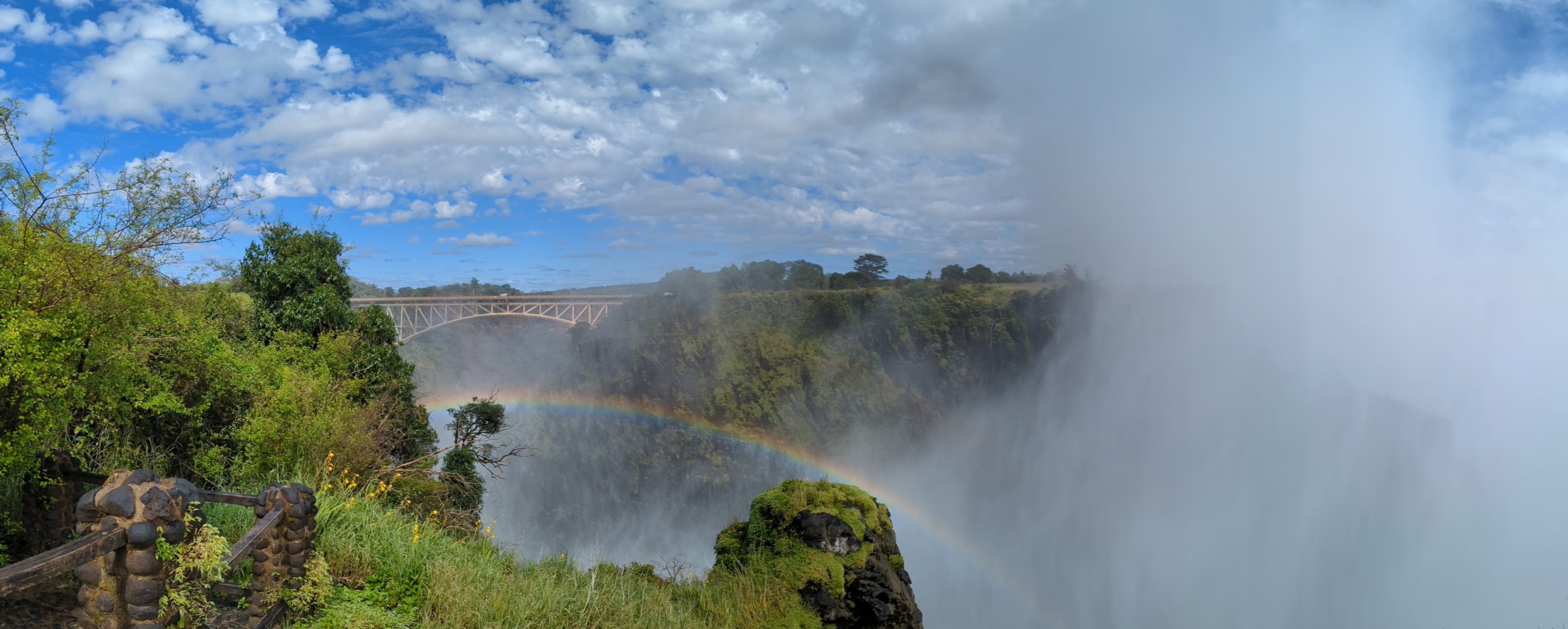
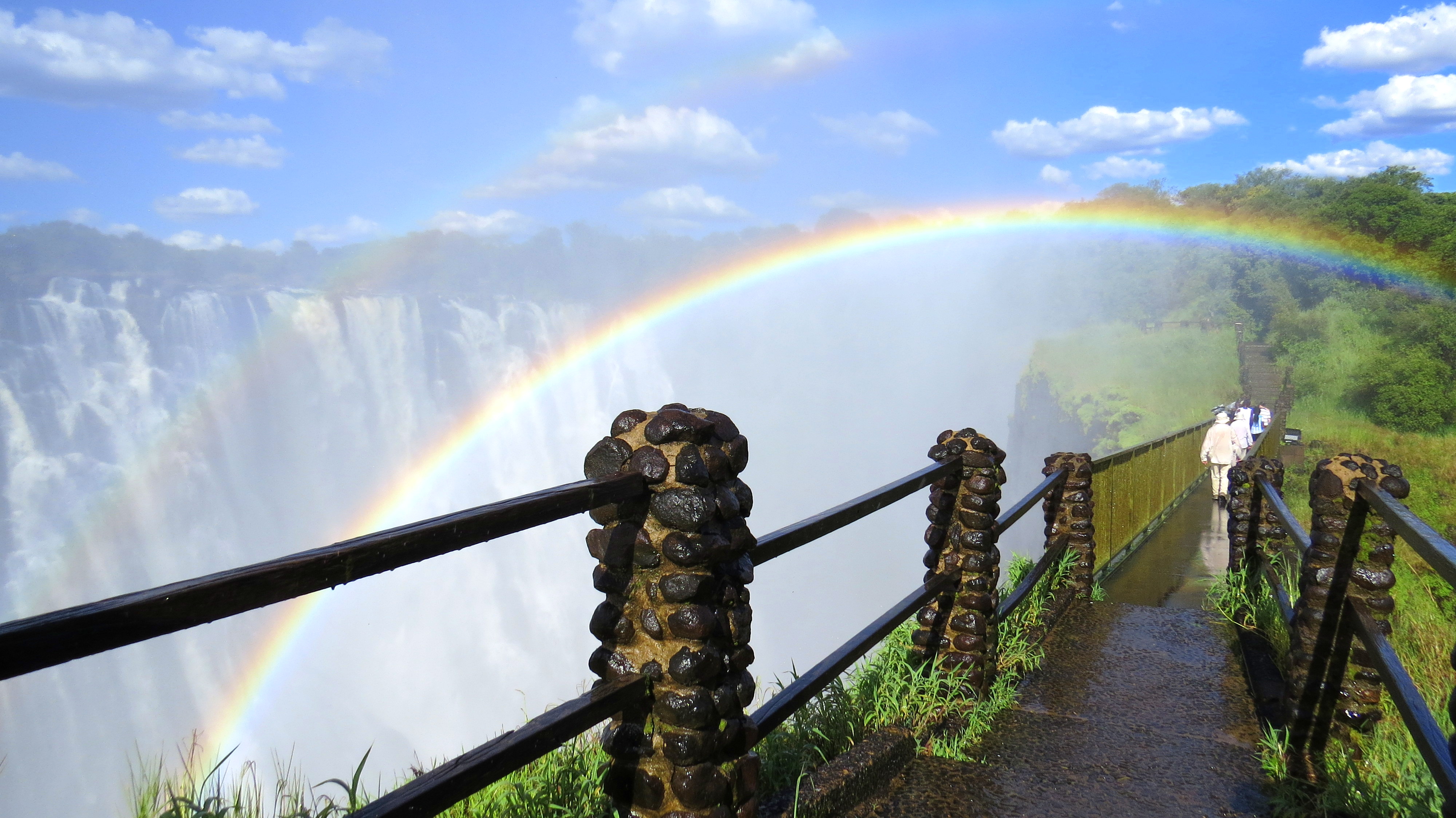
A rainbow over Victoria Falls on the Zambian side, 2019
The daylight rainbow (2019, Saraessop): the Livingstone-side arc in CC BY-SA 4.0 — spray plus sun, no filter. M23Saraessop · 17 Mar 2019 · CC BY-SA 4.0

Chapter 8 · The Chinese thread

The Chinese at the falls

The Chinese thread is countable: 22,000 visitors from China in 2019, 3,600 in 2020, then 23,422 in 2022 — past the peak year, on the Zimbabwe Tourism Authority via Xinhua. On 16 May 2023 the first organized post-pandemic 20 were met with ceremony at the falls' airport. M16

The surge continues: 10,366 in Q1 2026 against 8,373 a year before, Chinese-speaking guides in hot demand, the falls a “top priority.” On the bank rises LUX* Xinii (2028, with Chinese money); in the gorge, the PowerChina thread at Batoka broke with the 2023/24 cancellation. M17 M18 M10

From 22,000 to 3,600 and back past 2019: the waterfall's Chinese thread. M16 M17

BACK

22,000 → 3,600 → 23,422 → 20

On 16 May 2023 the first group of 20 landed at VF. M16

22,000 visitors from China in 2019, 3,600 in 2020 — then 23,422 in 2022, past the peak year. On 16 May 2023 the first organized post-pandemic group of 20 Chinese tourists landed at Victoria Falls International Airport, with ceremony. M16

THE 2026 SURGE

10,366 in Q1 2026: the surge

Chinese-speaking guides, after the May Day break. M17

In the first quarter of 2026: 10,366 tourists from China, against 8,373 in the same period last year. Groups stay 8–10 days, Chinese-speaking guides run hot after the five-day May Day holiday, and Victoria Falls “remains a top priority.” M17

WHAT COMES NEXT

2028: LUX* Xinii on the Zambezi

Chinese investment partners; the PowerChina thread broke. M18 M10

LUX* Xinii Victoria Falls — an eco-luxury estate on the Zambezi, opening 2028, with Chinese investment partners, the second in Southern Africa after Mababe (Botswana). The other Chinese thread, PowerChina at Batoka, broke with the 2023/24 cancellation. M18 M10

Sources and limits

Sources and limits

Annotations retain the status in the source ledger.

  1. M01 · Zambia Tourism — Victoria Falls official facts (dimensions anchor)

    official tourism facts page · official-link-unverified

    https://www.zambiatourism.com/destinations/waterfalls/victoria-falls/

  2. M02 · EN Wikipedia — Victoria Falls (names, streams, gorges, seasons)

    tertiary encyclopedia · official-link-unverified

    https://en.wikipedia.org/wiki/Victoria_Falls

  3. M03 · World Waterfall Database — Victoria Falls (datum variants)

    waterfall database · official-link-unverified

    https://www.worldwaterfalldatabase.com/waterfall/Victoria-Falls-111

  4. M04 · Moneyweb/Bloomberg — Nov 2019 drought low

    financial news apud ZRA · official-link-unverified

    https://www.moneyweb.co.za/news/africa/africas-biggest-waterfall-at-risk-from-drought/

  5. M05 · Weather Channel — 1986 record low (re-verified at build)

    weather news apud ZRA/Bloomberg · official-link-unverified

    https://weather.com/science/environment/news/2019-11-04-africa-drought-puts-victoria-falls-at-risk

  6. M06 · Equity Axis — Aug 2024 Kariba crisis

    African business news · official-link-unverified

    https://equityaxis.net/post/18027/2024/8/water-levels-at-critical-point-kariba-dam-on-brink-of-collapse-leave-millions-in-darkness

  7. M07 · Energy News Network — 2026 Kariba recovery

    energy-industry news · official-link-unverified

    https://energy-news-network.com/industry-news/kariba-power-generation-water-allocation-2026/

  8. M08 · EN Wikipedia — Victoria Falls Power Station (108 MW)

    tertiary summary with cited provenance · official-link-unverified

    https://en.wikipedia.org/wiki/Victoria_Falls_Power_Station

  9. M09 · EN Wikipedia — Kariba Dam

    tertiary summary with cited provenance · official-link-unverified

    https://en.wikipedia.org/wiki/Kariba_Dam

  10. M10 · EN Wikipedia — Batoka Gorge HPP (proposed)

    tertiary summary with cited provenance · official-link-unverified

    https://en.wikipedia.org/wiki/Batoka_Gorge_Hydroelectric_Power_Station

  11. M11 · Earth Island Journal — Batoka opposition

    environmental advocacy journal · official-link-unverified

    https://www.earthisland.org/journal/index.php/articles/entry/dam-threatens-batoka-gorge-zambezi-river/P114

  12. M12 · Livingstone, Missionary Travels (1857) — the angels passage

    primary 1857 travelogue · official-link-unverified

    https://archive.org/download/missionarytrave09livigoog/missionarytrave09livigoog_djvu.txt

  13. M13 · EN Wikipedia — Victoria Falls Bridge

    tertiary summary with cited provenance · official-link-unverified

    https://en.wikipedia.org/wiki/Victoria_Falls_Bridge

  14. M14 · Shearwater — bridge bungee 111 m

    operator page (official price) · official-link-unverified

    https://www.shearwatervictoriafalls.com/experience/victoria-falls-bridge-adventures/

  15. M15 · African Sky — Devil's Pool Aug–Dec

    operator page · official-link-unverified

    https://www.africansky.com/safaris/activities/devils-pool

  16. M16 · First post-COVID Chinese tour group, May 2023 (20 tourists; 22k/3.6k/23,422)

    trade press + ZW press (Xinhua-sourced) · official-link-unverified

    https://www.tourismupdate.com/article/chinese-tourists-return-to-zimbabwe · https://www.thezimbabwean.co/2023/05/zimbabwe-1st-chinese-tour-group-after-covid-19-pandemic/

  17. M17 · Xinhua — Chinese arrivals surge, May 2026

    Xinhua wire via ZW press · official-link-unverified

    https://www.thezimbabwean.co/2026/05/zimbabwe-eyes-tourism-boost-as-chinese-visitor-numbers-surge/

  18. M18 · shore.africa — LUX* Xinii 2028 (re-verified at build)

    African travel news · official-link-unverified

    https://shore.africa/2025/12/12/lux-collective-new-victoria-falls-lodge-zimbabwe-tourism/

  19. M19 · OSM — pinned falls, island, bridge, river and town ids

    OpenStreetMap records · official-link-unverified

    https://www.openstreetmap.org/way/579843538 · https://www.openstreetmap.org/node/299131927 · https://www.openstreetmap.org/way/585168375 · https://www.openstreetmap.org/way/584420041 · https://www.openstreetmap.org/way/676841771 · https://www.openstreetmap.org/way/1425593384 · https://www.openstreetmap.org/relation/318455 · https://www.openstreetmap.org/node/241500809

  20. M20 · Commons V01 — Delso aerial portrait, CC BY-SA 4.0

    Commons original · official-link-unverified

    https://commons.wikimedia.org/wiki/File:Cataratas_Victoria,_Zambia-Zimbabue,_2018-07-27,_DD_04.jpg

  21. M21 · Commons V02 — Delso aerial panorama, CC BY-SA 4.0

    Commons original · official-link-unverified

    https://commons.wikimedia.org/wiki/File:Cataratas_Victoria,_Zambia-Zimbabue,_2018-07-27,_DD_16-20_PAN.jpg

  22. M22 · Commons V03 — moonbow, CC BY-SA 4.0 (swapped at build)

    Commons original · official-link-unverified

    https://commons.wikimedia.org/wiki/File:Moonbow_at_Victoria_Falls.jpg

  23. M23 · Commons V04 — rainbow, CC BY-SA 4.0

    Commons original · official-link-unverified

    https://commons.wikimedia.org/wiki/File:Rainbow_over_Victoria_Falls.jpg

  24. M24 · Commons V05 — falls from Zimbabwe, CC BY-SA 4.0

    Commons original · official-link-unverified

    https://commons.wikimedia.org/wiki/File:Victoria_Falls,_Zimbabwe_04.jpg

  25. M25 · Commons V06 — gorge plunge, CC0

    Commons original · official-link-unverified

    https://commons.wikimedia.org/wiki/File:Victoria_Falls_-_VicFalls3473.jpg

  26. M26 · Commons V07 — bridge from Knife Edge, CC BY-SA 4.0

    Commons original · official-link-unverified

    https://commons.wikimedia.org/wiki/File:Victoria_Falls_Bridge_from_the_Knife_Edge_Bridge_trail.jpg

  27. M27 · Commons V08 — 1972 Rainbow Falls view, CC BY-SA 4.0

    Commons original · official-link-unverified

    https://commons.wikimedia.org/wiki/File:Victoria_Falls_Rainbow_Falls.JPG

  28. M28 · Commons V09 — Zambezi gorge 2011, CC BY-SA 3.0

    Commons original · official-link-unverified

    https://commons.wikimedia.org/wiki/File:Zambeze_river_and_gorge_-_Zambia_-_panoramio.jpg

  29. M29 · Commons V10 — Batoka Gorge 1905, CC BY 4.0

    Commons original · official-link-unverified

    https://commons.wikimedia.org/wiki/File:Zimbabwe;_the_Batoka_Gorge._Photograph_by_Prof._Davis,_1905._Wellcome_V0038013.jpg