Seismic hazard · Romania’s official table RTC 18-2026
How hard the ground shakes where you live
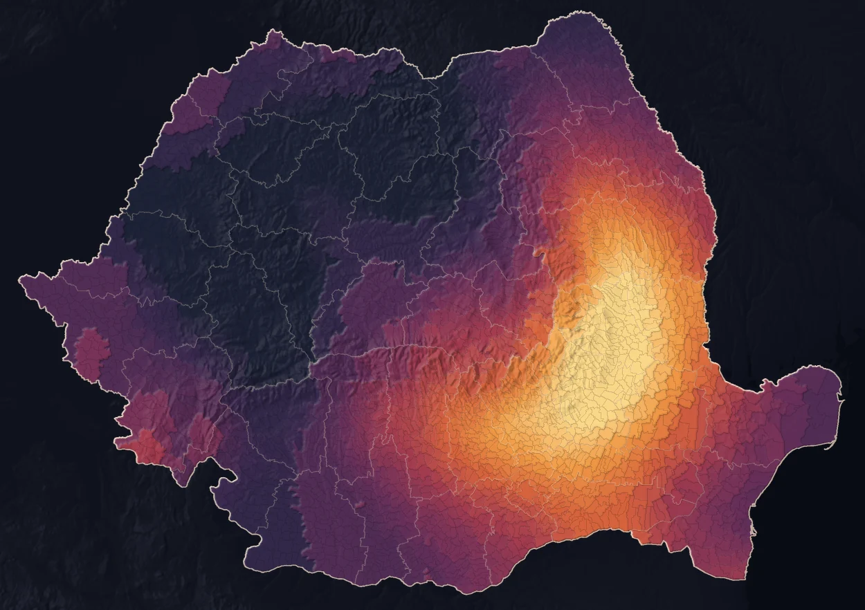
Table A.1 in Annex A of RTC 18-2026 has 3,181 rows for communes, towns and cities, including one row for Bucharest and all its sectors. Villages have no separate value; look up their commune, town or city. On the map, each listed unit is coloured by its value, from 0.10 g to 0.50 g. More than half the population, 51%, lives in listed units with a value of 0.26 g or more.
Tap the map or type a place name.
Or try:
What 0.37 g means
The value in the table describes the ground motion for the whole listed unit — commune, town or city — in the design earthquake. It is measured in g, the acceleration of an object in free fall: at 0.37 g, Bucharest’s value, the ground is jolted sideways with an acceleration of 37% of g. On the USGS instrumental scale, 0.10 g is “moderate” shaking, 0.37 g “very strong”, and 0.50 g, the table’s maximum, “severe”. The value describes the ground motion in the listed unit. It does not say how well a particular building holds up.
The table uses only 41 values, from 0.10 g to 0.50 g. 430 administrative units in the table have the minimum: 421 in Transylvania, Crișana, Banat and Maramureș, the west and north-west of the country, and 9 in Suceava county in the north-east. 126 administrative units in the table have the maximum: 59 in Buzău county, 55 in Vrancea, 10 in Galați and 2 in Brăila, the Vrancea epicentral zone at the bend of the Carpathians and the plain south and east of it. 1,080 administrative units, about a third of the table’s 3,181 rows, have at least 0.30 g, the upper half of the scale.
By population, the values shift higher: 8.05 million residents, 42% of the population, live in listed units with a value of 0.30 g or more, 1.72 million of them in Bucharest. 692,709 people live in units with 0.50 g, 1.69 million in units with 0.10 g.
Where the table jumps
The table gives one value to each listed unit — commune, town or city — so the map is made of steps: at the border between two neighbouring units, the value stays the same or jumps. Of the 9,280 borders between neighbouring units, 4,591 have no step at all, 2,847 have one of 0.01 g, and 271 have one of 0.05 g or more.
The 13 biggest steps, from 0.08 g to 0.11 g, all lie on county borders in the mountains: on each, the median altitude of the points along the shared border is above 1,000 metres. That is where units with large territories meet, their centres 16–28 km apart; at a typical border the distance is 9 km. The biggest step, 0.11 g, is between Zăbala (Covasna county, 0.33 g) and Nistorești (Vrancea county, 0.44 g), on either side of the Vrancea Mountains.
The step belongs to the table, not to the ground: acceleration does not change abruptly at the edge of a commune. A large mountain commune gets one value, which covers both the villages in the valley and the ridges towards its neighbours.
The biggest steps; tap one to see it on the map
Counties, from the highest mean to the lowest
A county (județ) is Romania’s regional administrative division. For each of the 41 counties and Bucharest: the lowest value, the highest value and the mean across listed units, in descending order of the mean. Bucharest is a single row in the official table, for all its sectors.
| County | Units | Lowest | Highest | Mean |
|---|---|---|---|---|
| Vrancea | 73 | 0.42 g | 0.50 g | 0.49 g |
| Buzău | 87 | 0.41 g | 0.50 g | 0.49 g |
| Galați | 65 | 0.38 g | 0.50 g | 0.45 g |
| Prahova | 104 | 0.33 g | 0.49 g | 0.44 g |
| Brăila | 44 | 0.34 g | 0.50 g | 0.43 g |
| Ialomița | 66 | 0.28 g | 0.47 g | 0.40 g |
| Bacău | 93 | 0.25 g | 0.49 g | 0.40 g |
| Dâmbovița | 89 | 0.33 g | 0.44 g | 0.39 g |
| Ilfov | 40 | 0.34 g | 0.45 g | 0.38 g |
| Bucharest | 1 | 0.37 g | 0.37 g | 0.37 g |
| Călărași | 55 | 0.29 g | 0.41 g | 0.37 g |
| Vaslui | 86 | 0.29 g | 0.46 g | 0.36 g |
| Argeș | 102 | 0.26 g | 0.37 g | 0.32 g |
| Giurgiu | 54 | 0.26 g | 0.38 g | 0.32 g |
| Covasna | 45 | 0.22 g | 0.39 g | 0.30 g |
| Neamț | 83 | 0.17 g | 0.37 g | 0.29 g |
| Tulcea | 51 | 0.20 g | 0.38 g | 0.28 g |
| Brașov | 58 | 0.21 g | 0.35 g | 0.28 g |
| Iași | 98 | 0.22 g | 0.33 g | 0.27 g |
| Constanța | 70 | 0.22 g | 0.35 g | 0.26 g |
| Teleorman | 97 | 0.20 g | 0.34 g | 0.25 g |
| Vâlcea | 89 | 0.20 g | 0.30 g | 0.24 g |
| Olt | 112 | 0.20 g | 0.29 g | 0.22 g |
| Caraș-Severin | 77 | 0.14 g | 0.30 g | 0.22 g |
| Sibiu | 64 | 0.15 g | 0.25 g | 0.19 g |
| Timiș | 99 | 0.10 g | 0.25 g | 0.19 g |
| Botoșani | 78 | 0.15 g | 0.23 g | 0.19 g |
| Harghita | 67 | 0.11 g | 0.27 g | 0.18 g |
| Suceava | 114 | 0.10 g | 0.26 g | 0.18 g |
| Dolj | 111 | 0.15 g | 0.20 g | 0.18 g |
| Mehedinți | 66 | 0.15 g | 0.25 g | 0.17 g |
| Gorj | 70 | 0.15 g | 0.20 g | 0.17 g |
| Satu Mare | 65 | 0.11 g | 0.20 g | 0.17 g |
| Maramureș | 76 | 0.10 g | 0.20 g | 0.14 g |
| Arad | 78 | 0.10 g | 0.20 g | 0.13 g |
| Mureș | 102 | 0.10 g | 0.20 g | 0.13 g |
| Bihor | 101 | 0.10 g | 0.20 g | 0.13 g |
| Alba | 78 | 0.10 g | 0.16 g | 0.11 g |
| Cluj | 81 | 0.10 g | 0.14 g | 0.11 g |
| Sălaj | 61 | 0.10 g | 0.15 g | 0.11 g |
| Hunedoara | 69 | 0.10 g | 0.13 g | 0.10 g |
| Bistrița-Năsăud | 62 | 0.10 g | 0.10 g | 0.10 g |
What the value says, and what it does not
The value in the table is peak ground acceleration, written as a fraction of the acceleration of gravity, g. The methodology defines it as the scenario II value: the probability that ground acceleration exceeds it is 10% in 50 years, and the mean interval between two exceedances is 475 years. The interval does not say when the next earthquake comes.
The value characterises the ground motion. It does not account for individual buildings: two apartment blocks in the same locality have the same hazard value, but the value does not say how well either holds up. That depends on the year it was built, its structure and its condition. The risk of a particular building is calculated separately, from hazard, exposure and vulnerability, and this table covers only the first term.
The value is not a forecast. The three scenario earthquakes are conventional design events, chosen so that the units in the table can be compared with one another; the methodology says plainly that its results are relevant in relative terms, for comparison between administrative units. A real earthquake can produce, at a given spot, an acceleration above or below the value in the table.
Buildings in Bucharest with an official seismic-risk classification (the “red dot” and the other classes) are mapped by address in Buildings at seismic risk in Bucharest. The other earthquake pages, from 1977 to the seconds before strong shaking arrives, are gathered in All the earthquake pages.
Method
Table A.1 in Annex A of RTC 18-2026 has 3,181 rows: one for each level-IV administrative unit (commune, town or municipality) and one for Bucharest as a level-III unit, covering all six sectors. Villages have no separate row; look up their commune, town or city. For each row, the table gives three numbers: the PGA with a 10% probability of exceedance in 50 years (the value on this page), the hazard scaling factor FHS, used only to compute the fragility of buildings built between 1978 and 2006, and the slope of the hazard curve k, which is 2 for 1,014 listed units and 3 for 2,167.
The values for scenarios I and III are not in the table. They are computed here with equations 2.5 and 2.6 of the methodology, from the scenario II value and the slope k:
PGA(I) = (225/475)^(1/k) × PGA(II) PGA(III) = (975/475)^(1/k) × PGA(II)
Check: for Iași, the methodology’s Annex C works out 0.20 g and 0.33 g from 0.26 g and k = 3; the same calculation here gives the same numbers. For Bucharest, from 0.37 g and k = 3, it gives 0.29 g and 0.47 g. Results are rounded to two decimals, as in the source. One discrepancy: for Târgu Mureș, the methodology’s example C.2 prints 0.22 g for scenario III, while the calculation gives 0.2149, rounded here to 0.21 g.
For the chosen unit, the page counts the listed units with a higher, equal or lower value. A plain rank would mislead: the table has only 41 distinct values, and 126 units share first place. Names are kept as in the source, with two exceptions: capitalised particles (“Ștefan Cel Mare”) were given their standard spelling, and three names with commas in place of full stops (“C,A, Rosetti”) were corrected. The county appears as “Satu Mare”, its official form. 256 names recur in different counties, which is why every result also shows the county.
The map: each row of the table is matched to the outline of its administrative unit in geo-spatial.org’s LAU (Local Administrative Units) set, dated 26 March 2025, by its SIRUTA code (Romania’s official code for each unit), found in the 2021 census list by county and name; a separate match by name must find the same administrative unit for every row. Three names differ between the census list and the table (Râmetea and Rimetea, Abrămuț and Petreu, Râșca and Rișca), and the LAU set spells Silivașu de Câmpie differently; all four are joined by code. Bucharest’s six sectors are merged into one shape, because the table has a single row. Each listed unit is filled flat with its value, with no smoothing across a border. The relief underneath is there for orientation only; lit edges appear only where the value changes, stronger where the step is bigger.
The steps: two listed units are neighbours if they share a stretch of border in the LAU set (9,280 pairs). For each pair, the page takes the difference between the values, the distance between the two units' centres (centroids of the geo-spatial.org outlines) and the median altitude of the points along the shared border, from the Terrarium relief model. Residents are those of the 2021 census (19,053,815 in all), by administrative unit.
The seismic map the ministry publishes shows the design zoning of the P100-1/2013 code, with a different parameter and a different scenario definition. The values here are not directly comparable with that map and do not describe a rise or fall in hazard relative to it.
Sources
- monitorlegal.ro: Order of the Ministry of Development no. 1,037/2026 approving the technical regulation “Methodology for drawing up seismic risk maps, code RTC 18-2026”, Official Gazette of Romania, Part I, no. 771 bis, 11 September 2026. Annex A, Table A.1, pages 32–112; equations 2.5 and 2.6 on page 15; worked examples in Annex C. The order enters into force 30 days after publication, on 11 October 2026.
- monitorlegal.ro: The act’s page on monitorlegal.ro, with the order’s text and the PDF of the bis issue.
- observator.mdlpa.ro: The ministry’s map service for seismic zones, based on P100-1/2013, with which the values here are not directly comparable.
- en.wikipedia.org: The USGS instrumental intensity scale (Worden et al., 2012), as tabulated in the Wikipedia article “Peak ground acceleration”: “moderate” up to 0.115 g, “strong” up to 0.215 g, “very strong” up to 0.401 g, “severe” up to 0.747 g. The labels are indicative; the USGS scale relates acceleration to perceived shaking, not to the Romanian table.
- www.geo-spatial.org: Boundaries of Romania’s administrative units (the ro_admin_lau_polygon set), processed by the geo-spatial.org community from public data of ANCPI, Romania’s cadastre agency, for the 2025 organisation (file version 26 March 2025); the site’s licence, CC BY-SA 4.0.
- www.recensamantromania.ro: Romania’s 2021 Population and Housing Census, National Institute of Statistics: resident population by administrative unit.
- registry.opendata.aws: Relief: Terrain Tiles (Terrarium), Mapzen on AWS Open Data; neighbouring countries and the Black Sea from Natural Earth, public domain.
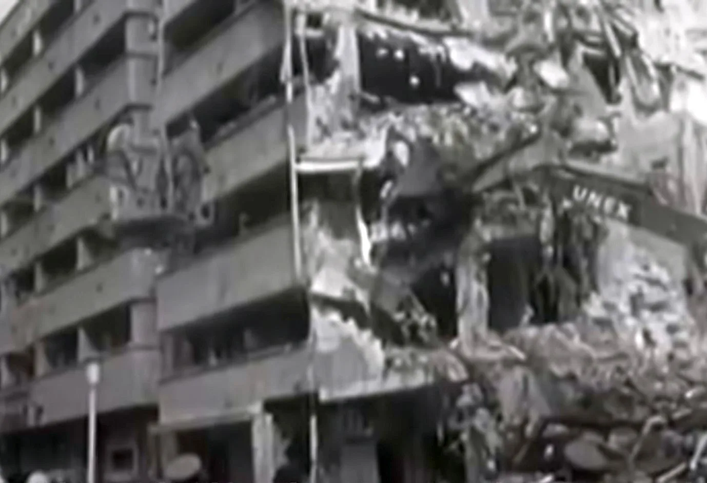
- commons.wikimedia.org: Photo: “Bucharest-1977”, Sorin Dek, CC0, Wikimedia Commons.
