Izmail Fortress: what remains beside the Danube
At Izmail, present-day Ізмаїл, Ukraine, a mosque and remains in the ground preserve the fortress’s history. Put the military plans beside today’s Danube bank.
Separate panels · the historic outline is not overlaid on today’s ground.
Danube · plans · mosque
Reading the fortress from the Danube
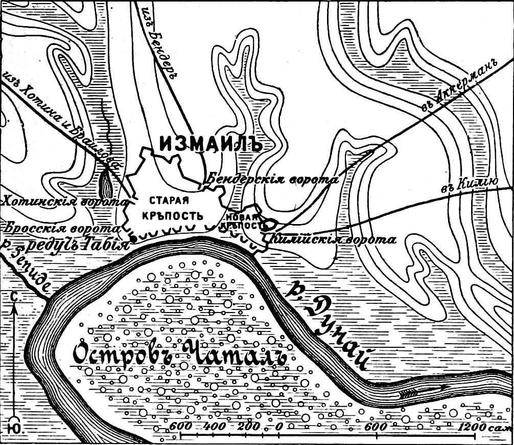
The plan published in Sytin’s military encyclopedia separates the old fortress from the new fortress. The river closes the southern front. Beside it, the modern map shows water and streets around the former fortress ground. The two images use different scales.
An old enclosure, an extension to the east
The retrospective plan names the two sectors and their gates. It preserves the relationship between enclosure and river; by itself it cannot locate each rampart on today’s map. The available plans lack enough fixed points for a verifiable alignment.
Nine columns, three approach fronts
On 11 December 1790 in the Julian calendar, 22 December in the Gregorian, Russian troops led by Suvorov took the Ottoman fortress. Sytin describes three detachments of three columns each, approaching from the west, east and Danube. The times below are approximate phases from this retrospective account.
- Approach signal
- Assault begins
- Russian troops hold the ramparts
- Fighting subsides
Approximate phases after Sytin, vol. 10, pp. 572–577. Approach sectors, without exact troop tracks.
The fortress was rebuilt
The 1790 assault did not end the enclosure’s history. After its return to Ottoman rule, Russian troops captured it again in 1809; it passed into Russian possession in 1812. Engineering descriptions and the later plan published by Sytin show rebuilt defences with a citadel. This plan belongs to a different phase.
Dismantling becomes a diplomatic dispute
On 21 July 1856, Clarendon told the House of Lords that dismantling had taken place after peace was signed. Russia asserted a right to demolish before transfer. The minister said the treaty had made no regular arrangements for surrendering these fortresses, and that he still lacked a definitive account of the extent of the work.
The mosque, the earth and the site’s memory
Scholarship published in 2022 describes foundations, ditches, ramparts and gates, and the preservation and study of the ground as a park-museum. The mosque houses a diorama opened in 1973. The institution’s presentation calls the department “Defence of Turkish Izmail in 1790”. The 2021 exterior photograph shows the surviving building; it does not certify the whole site’s condition in 2026.
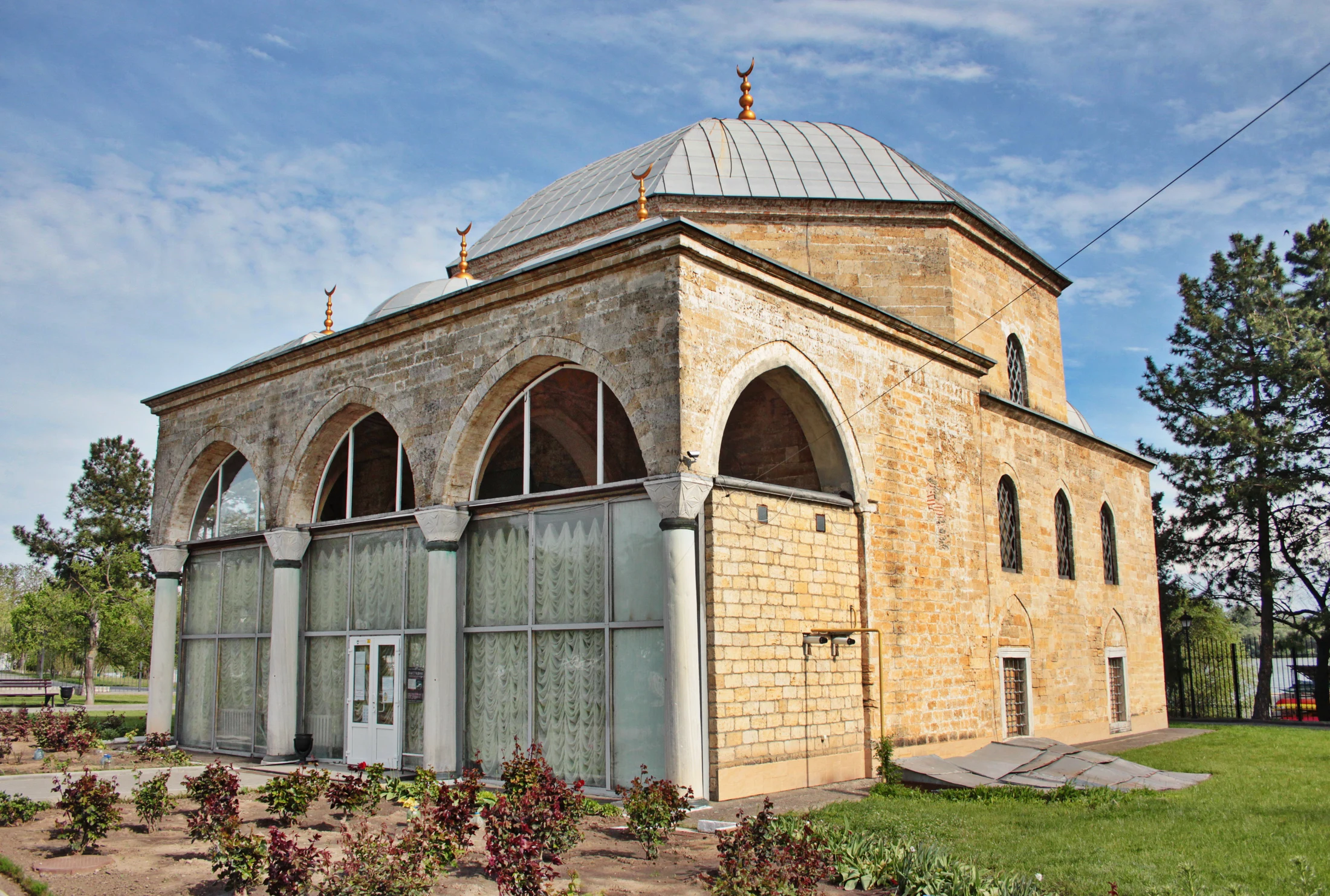
Oleksandr Malyon, “Мала мечеть (Ізмаїл)”, 8 May 2021. Wikimedia Commons · CC BY-SA 4.0. Resized and converted to WebP; no crop or colour changes. Adapted image: CC BY-SA 4.0. Original file · CC BY-SA 4.0
.jpg)
What remains in literature?
Byron made Izmail an episode in Don Juan, cantos VII–VIII. After the assault, the poem’s voice returns to the town:
“There was an end of Ismail—hapless town!”
Lord Byron, Don Juan, canto VIII. Original English text. This literary passage does not measure losses or the enclosure. Project Gutenberg
How do the plans sit beside the remains?
The Danube is the shared reference. The drawn gates have no verified modern counterparts here; the mosque photograph records a camera position, not a surveyed building point. Sytin’s two plans come from the same publication; the detailed assault scan’s exact edition remains unidentified. Without three independent, stable anchors, we calculate neither a transformation nor a metric error. The outline stays in the document panel as a ghost of the enclosure.
The complete plates
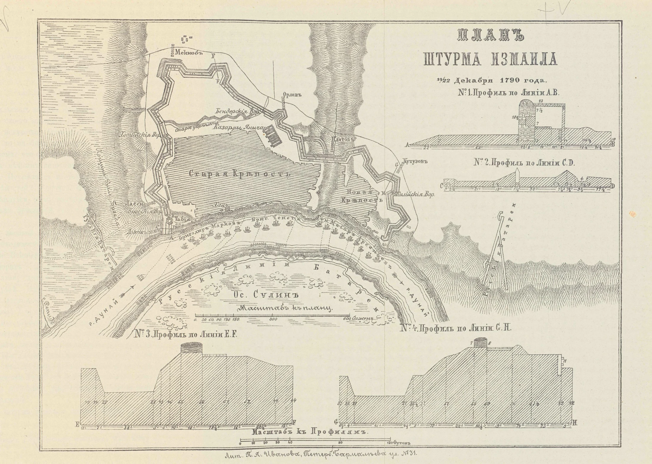
Unknown author, “Izmail-1790.jpg”. Scan: Wikimedia Commons, public domain. Exact edition unidentified; the title dates the event. Resized and converted to WebP. Original file

Sytin, Военная энциклопедия, vol. 10, pp. 572–577; 1911–1915 series. Scan: Wikimedia Commons, public domain. Resized and converted to WebP. Original file
.jpg)
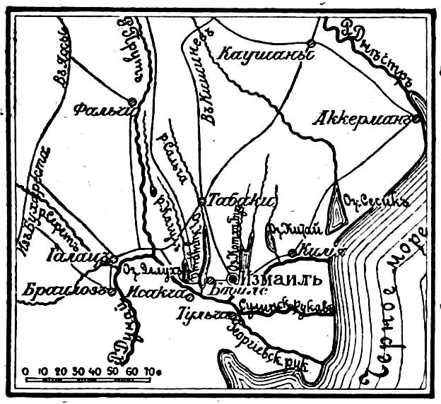
Sytin, Военная энциклопедия, vol. 10, pp. 572–577; 1911–1915 series. Scan: Wikimedia Commons, public domain. Resized and converted to WebP. Original file
.jpg)
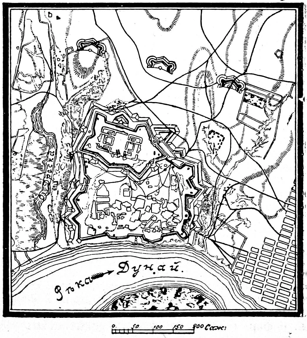
Sytin, Военная энциклопедия, vol. 10, pp. 572–577; 1911–1915 series. Scan: Wikimedia Commons, public domain. Resized and converted to WebP. Original file
.jpg)
Sources for this comparison
The military account, diplomatic debate and scholarship on the remains describe different phases. Opening hours and the park’s administrative boundary are not established here.
- Sytin · Военная энциклопедия, vol. 10, pp. 572–577 · V01
- Presidential Library · 11/22 December 1790 · V02
- Igor Sapozhnikov · Tyragetia, 2016, pp. 97–116 · V02
- Hansard · 21 July 1856 · V04
- Liliia Tsyganenko & Galina Oleinikova · Acta Poloniae Historica, 2022, pp. 29–48 · V05
- Ізмаїльський військово-історичний музейний комплекс · V05
- Lord Byron · Don Juan, VII–VIII · V06