The whole fortress, in words
All 24 stops of the walk, from the outer plain and vanished moat up onto the covered wall-walk and facing the church.
How each material and marker is read
- Stone, limewash and timberwhat stands today, including the 1962–1970 and 1992–1997 restorations
- Carved limewood and watervanished structures documented in surveys, trenches, written records or old prints
- Ink on parchmentsiege provisions and daily life supported by custom, not site remains
- Charters and chroniclesmedieval charters and Brașov town chronicles
- Checked against sourcespopular legends tested against surviving records
The gate, the moat and the bakers’ courtyard
1 Standing today
The ring wall on the Burzenland plain
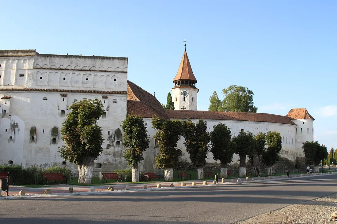

Prejmer stands at the mouth of the Buzău Pass. Mariana Angelescu records an outer diameter of roughly 80 metres and a thickness of four to five metres for the near-circular curtain, whereas the national archaeological register gives about 72 metres and three to four metres without specifying the measurement line.
Before excavations lowered the surrounding grade, Angelescu recorded a 12-metre outer wall rising to roughly 14 metres above the medieval paving uncovered in the 1960s.
2 Recorded in historical sources
The former water moat and inner wall
Mariana Angelescu’s architectural report records a water-filled ditch 17 to 18 metres wide and three to four metres deep outside the wall, while Orbán Balázs notes nearby springs that could feed it. Radu Heitel’s trenches also recorded a low inner retaining wall roughly 2.5 metres ahead of the main enclosure.
No dated drainage charter survives; the municipal record notes the moat remained in defensive use into the seventeenth century.
Sources
3 Recorded in historical sources
The drawbridge and removed gatehouse tower
A lifting bridge likely spanned the southern moat. When Orbán Balázs visited in the nineteenth century, the bridge was gone, though he described what he took to be surviving pulleys at the entrance; Angelescu’s 1960s trenches had not yet uncovered bridge remains.
A seventeenth-century bell tower also rose above the barbican entrance until its removal during the 1962–1970 restoration.
Sources
- Orbán Balázs, Description of Székely Land, vol. VI, "Prázsmár", pp. 56–57
- Mariana Angelescu, DMI architectural report on Prejmer (1963), pp. 40–49
- Siebenbürgisch-Sächsische Stiftung, conservation report (Romanian edition, pp. 16–19)
- Siebenbürgisch-Sächsische Stiftung, conservation report (English edition, pp. 16–19)
4 Standing today
The 1856 arcaded entry gallery
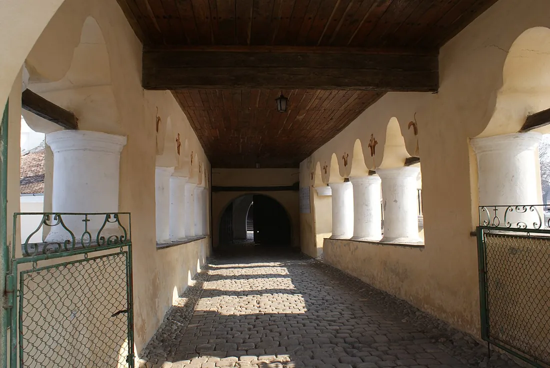

Before reaching the medieval tunnel, visitors pass through an arcaded gallery on stout columns dated to 1856 in the national monument register.
Above the entrance wing, the municipal fiscal storehouse was added in 1793, recognisable from the blind arcade frieze beneath its eaves.
5 Standing today
The vaulted passage and its portcullis
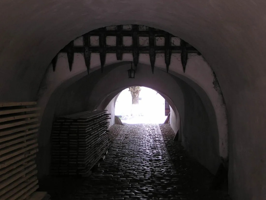

Entry runs through a vaulted stone passage measured at 30 metres by Angelescu and at 32 metres in the RAN register and parish history (the 30 to 32-metre bottleneck shown here), defended by two sets of oak gates over river cobbles.
Near mid-passage hung the portcullis (hersă), a heavy timber grille shod with iron spikes that dropped across the passage.
6 Siege-day reconstruction
The Bakers’ Courtyard beside the gate
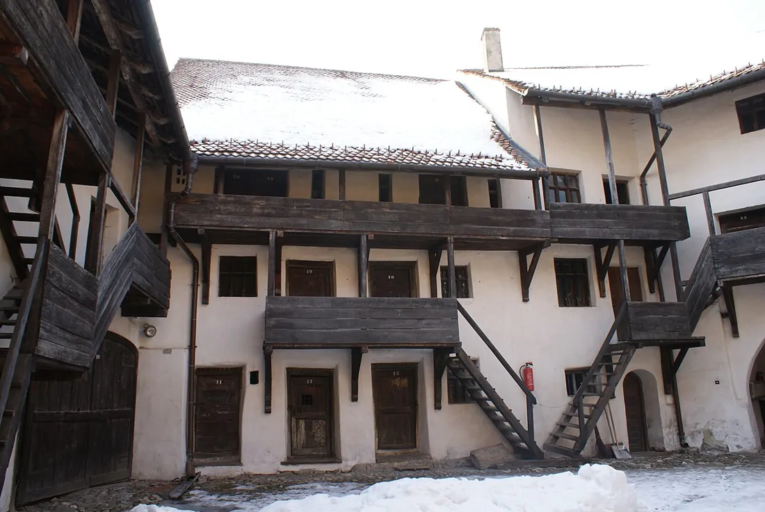

West of the gate wing lies the Bakers’ Courtyard (zwinger), a secondary enclosure lined with two storeys of timber galleries. Thomas Tartler’s chronicle entry for 1705 mentions a bakery oven at Prejmer without pinning down its exact bay.
The wagons, flour sacks and hearth illustrate plausible siege provisioning rather than excavated oven foundations.
Sources
- List of Historic Monuments 2015 — Brașov County (BV-II-a-A-11745)
- Mariana Angelescu, DMI architectural report on Prejmer (1963), pp. 40–49
- Siebenbürgisch-Sächsische Stiftung, conservation report (Romanian edition, pp. 16–19)
- Siebenbürgisch-Sächsische Stiftung, conservation report (English edition, pp. 16–19)
- Quellen zur Geschichte der Stadt Brassó, vol. IV (1903): Sutor, Joseph Teutsch, Thomas Tartler
Over 270 refuge chambers
7 Standing today
The honeycomb of over 270 chambers
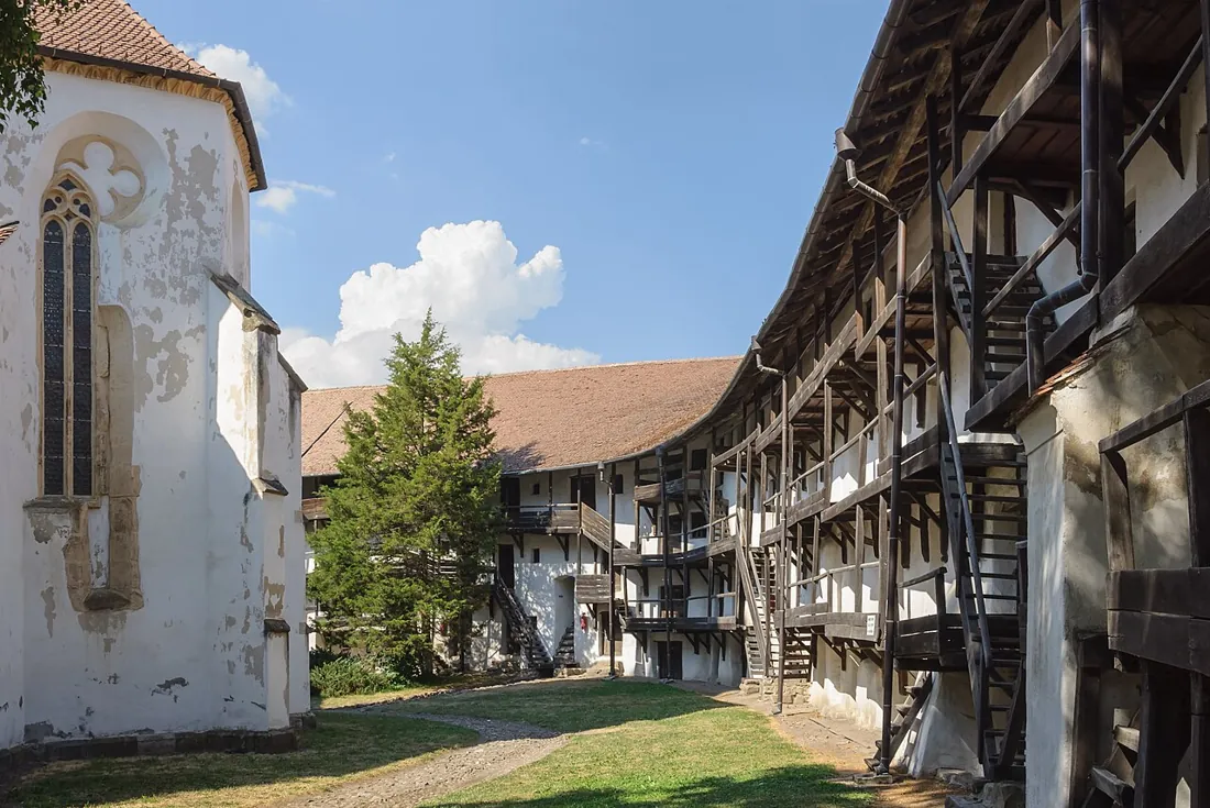

Stepping out of the tunnel reveals the entire courtyard ring lined with stacked storage and refuge rooms on three to four storeys. The municipality gives 272 chambers, the national museum inventory cites 275, and the Saxon foundation records 278.
No published survey explains the spread between those three counts.
Sources
- Prejmer Municipality — historic and cultural monuments
- INP (cIMeC), Museums and Collections in Romania — Prejmer Peasant Fortress
- Siebenbürgisch-Sächsische Stiftung, conservation report (Romanian edition, pp. 16–19)
- Siebenbürgisch-Sächsische Stiftung, conservation report (English edition, pp. 16–19)
- Fortified Churches Foundation, Prejmer / Tartlau profile
8 Standing today
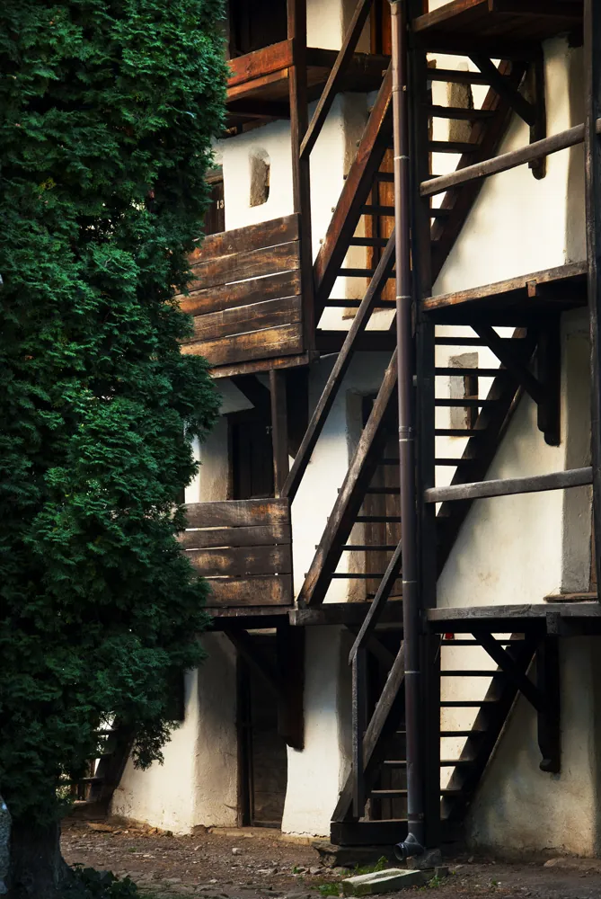
Cantilevered timber galleries and stairs
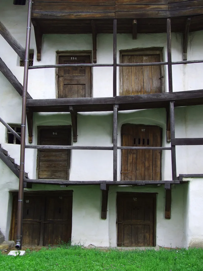

Upper chambers connect along cantilevered timber walkways with landings and exterior stairs. While the layout is medieval, restoration records document major timber renewals in 1962–1970 and 1992–1997.
Available archives do not provide a bay-by-bay schedule separating older members from twentieth-century replacements.
Sources
- Mariana Angelescu, DMI architectural report on Prejmer (1963), pp. 40–49
- Siebenbürgisch-Sächsische Stiftung, conservation report (Romanian edition, pp. 16–19)
- Siebenbürgisch-Sächsische Stiftung, conservation report (English edition, pp. 16–19)
- Daniela Marcu Istrate, after Radu Heitel’s excavations (Ars Transsilvaniae XXI, 2011), pp. 135–152
9 Standing today
Numbered doors and village house numbers
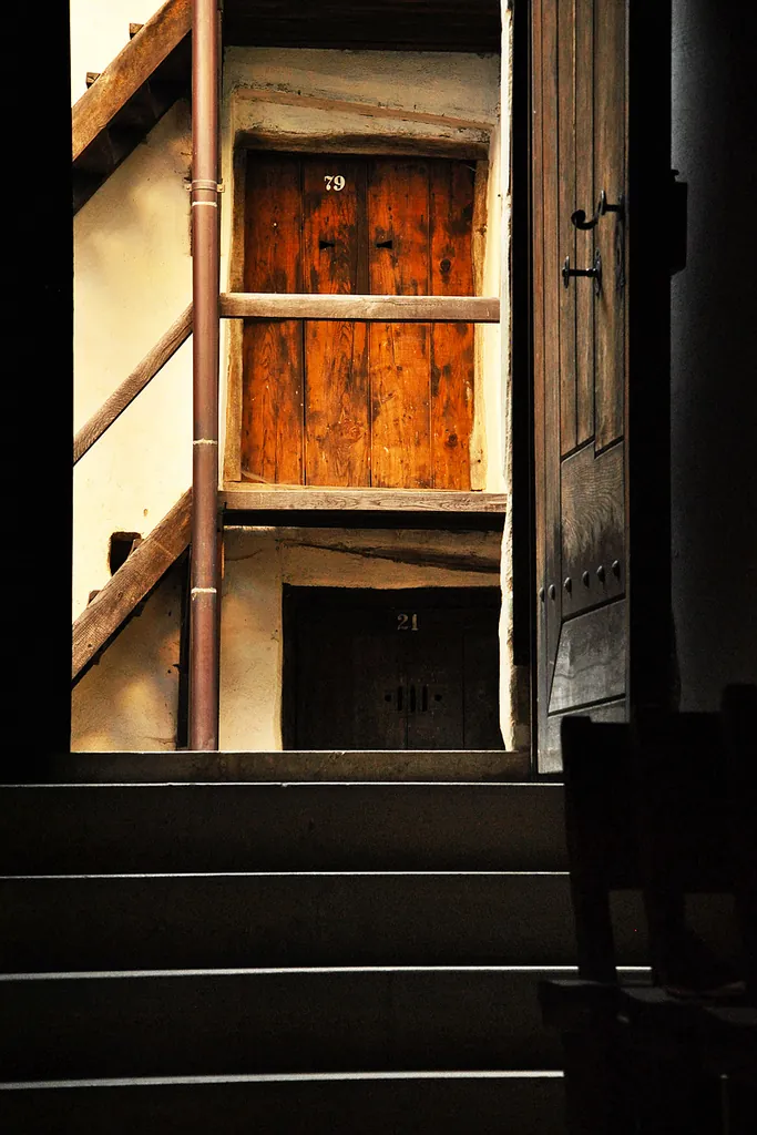

White numbered plates sit above the low chamber doors. Municipal strategy links chamber numbers to Prejmer’s house numbers, and the conservation foundation records the rule of one chamber per family.
However, the sources consulted do not identify which village household held any given numbered door on the galleries today.
10 Siege-day reconstruction
Grain, chests and winter bacon stores

Into the early part of the twentieth century, Prejmer villagers still stored grain and cured bacon inside these thick-walled chambers for safety against fire and raids. Around 1,600 people could shelter here during an attack, per the Fortified Churches Foundation.
The sacks, chests and hanging bacon slabs illustrate how the wall stored food and sheltered villagers rather than a specific room inventory.
11 Siege-day reconstruction
The siege schoolroom inside the wall
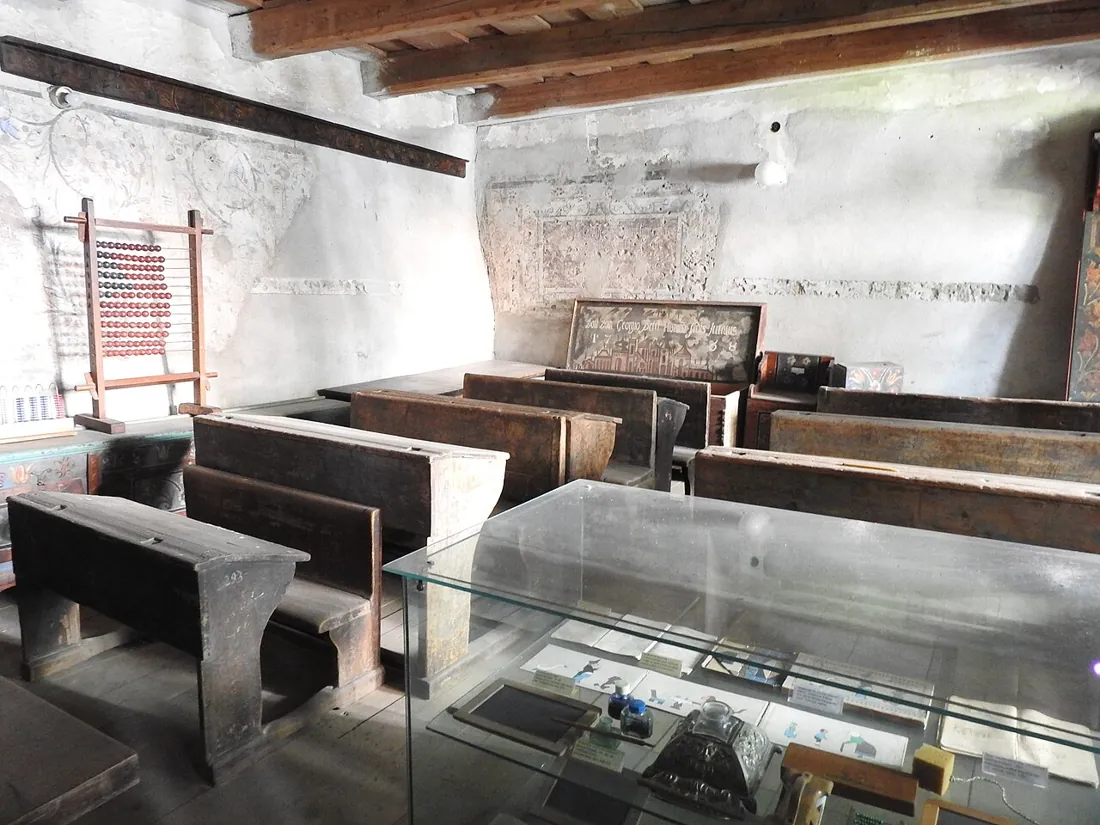

The national museum inventory records teachers in 1460 and 1556 and schooling inside the fortress during sieges; it gives 1853 for a replacement school, whereas the monument register dates the confessional school at Str. Mare 8–10 to 1846–1848 without confirming both dates describe one building.
The furnished classroom open today holds later benches; the foreground desks recall that documented tradition without fixing a medieval room number.
The wall-walk and defence
12 Standing today
The covered wall-walk at roughly 12 metres
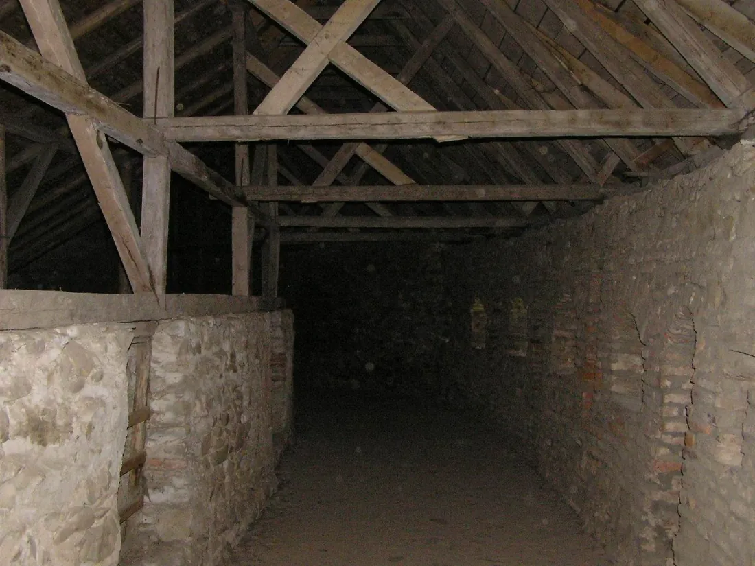

Near the top of the curtain wall at roughly 12 metres, a covered corridor linked directly to the upper storage rooms so defenders could circulate along the perimeter.
Today visitors walk beneath stout timber rafters between the loopholed outer stone parapet and the courtyard chamber wall.
13 Recorded in historical sources
Single-slope and two-slope wall-walk roofs
In this south-eastern bay, the modern two-slope tile roof breaks to illustrate an earlier single-slope profile pitching toward the courtyard.
The parish history and an 1898 engraving in "Das Sächsische Burzenland" indicate an inward single-slope roof, whereas the RAN summary preserves conflicting accounts of the wall-walk’s earliest phase.
14 Siege-day reconstruction
Loopholes, machicolations and water casks
The outer parapet is pierced by splayed loopholes and projecting machicolation chutes above the wall foot.
The water casks and cauldrons illustrate firefighting and vertical-defence supplies rather than surviving medieval hardware.
15 Siege-day reconstruction
The exhibit called the "Death Organ"
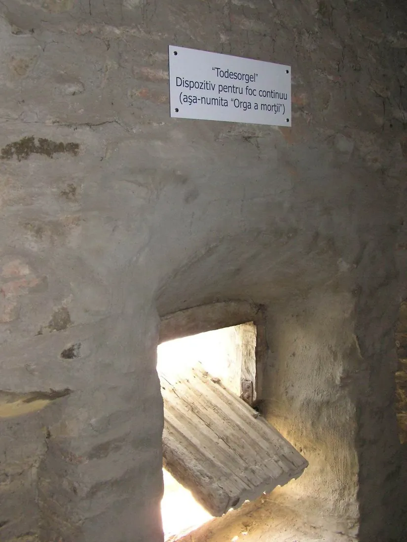

Set in a wall embrasure is a thick timber plank on a metal pivot, displayed as the "Death Organ" (Todesorgel) and associated with multiple firearm barrels that could be rotated to fire in turn.
A January 1966 report in Flacăra already mentions an exhibit under this name at Prejmer, yet no archival inventory verifies its continuity with the piece shown today, a sixteenth- or seventeenth-century date, or an original ten-barrel layout.
16 Standing today
Looking over Burzenland toward the Buzău Pass
From the elevated wall-walk, above Prejmer’s gabled village roofs, the surrounding Burzenland terrain opens toward Postăvaru, Piatra Mare and Ciucaș guarding the approach from the Buzău Pass.
As noted by the Fortified Churches Foundation, standing along this major invasion route out of the Carpathian bend explains why Prejmer faced repeated attacks.
The cross-plan church at the centre
17 Standing today
The Greek-cross church (1211–1240 charters)
In 1211 King Andrew II granted Burzenland to the Teutonic Knights; a papal charter of 19 April 1218 confirmed Bishop Wilhelm’s earlier grant, and Prejmer’s church foundation is traditionally linked to 1218, though archaeology cannot establish when construction began.
After the Order’s expulsion in 1225, King Béla IV donated the churches of Feldioara, Sânpetru, Hărman and Prejmer directly to Cîteaux in March 1240 (Michel Tánase explicitly rejects administration via Cârța). Its original plan pairs a 6×6-metre crossing with equal cross arms and polygonal apses.
Sources
- Urkundenbuch, vol. I, no. 19 (1211): Burzenland grant to the Teutonic Order
- Urkundenbuch, vol. I, no. 28 (19 April 1218): papal confirmation
- Urkundenbuch, vol. I, no. 45 (12 June 1225): papal demand on the Order
- Urkundenbuch, vol. I, no. 51 (27 October 1225): letter on the Order’s recall
- Urkundenbuch, vol. I, no. 76 (March 1240): King Béla IV’s donation to Cîteaux
- Michel Tánase, "Avatarurile unui act de donație" (Revista istorică IV, 1993), pp. 55–80
- National Archaeological Record (INP), site 41676.12 — Prejmer
- Daniela Marcu Istrate, after Radu Heitel’s excavations (Ars Transsilvaniae XXI, 2011), pp. 135–152
18 Recorded in historical sources
The 1511–1515 west extension and buried entrance
Between 1511 and 1515 the western arm was lengthened by six metres to 15 metres total, ending in a flat gable wall and late-Gothic net vaulting.
Ahead of this wall, Radu Heitel uncovered thick foundations of an earlier structure measuring roughly 3 × 3 metres internally—interpreted either as an entrance porch (pridvor) or an entrance tower, with its upper height unresolved.
19 Standing today
The 39-metre octagonal bell tower
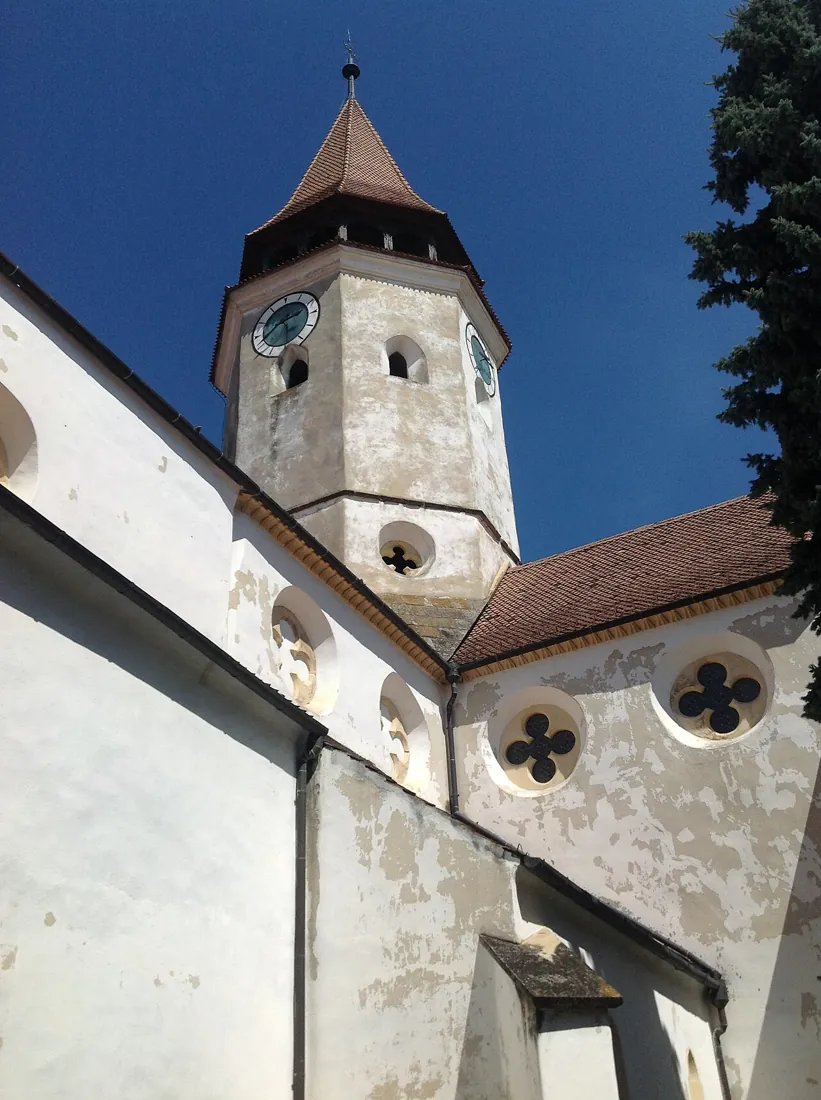

Above the central crossing rises a 39-metre octagonal bell tower flanked by four corner spirelets and a flared terracotta roof.
Literature associates the date 1461 with the tower’s construction or raising. During the 1964–1970 restoration, the crossing piers and tower were dismantled stone by stone and rebuilt around a concealed reinforced-concrete core.
20 Standing today
Gothic rib vaults and winged altarpiece (c. 1440–1460)
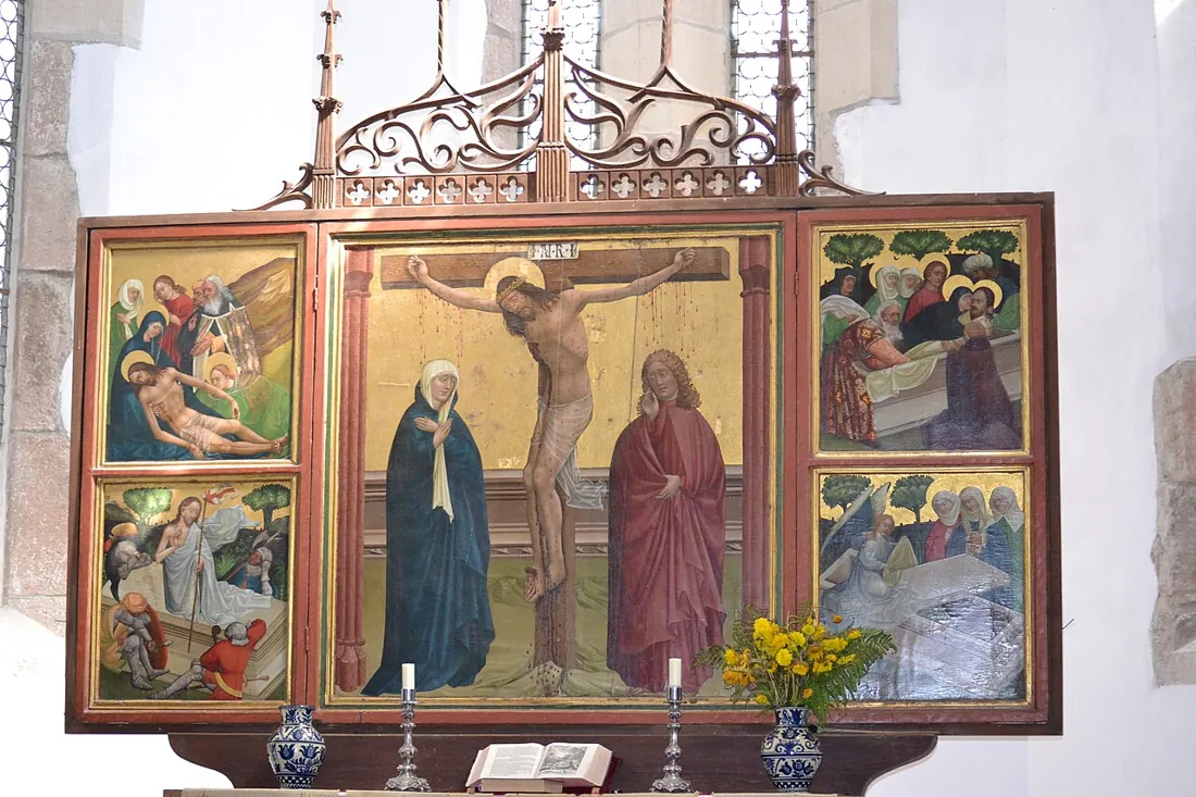

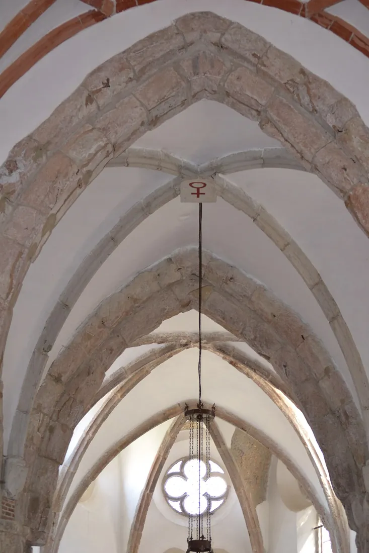
Through the west portal lies an early Gothic interior stripped of nineteenth-century overpaint, spanning from stone rib vaults in the choir and transepts to ceramic-ribbed vaulting in the west arm.
Its centrepiece is one of Transylvania’s earliest surviving winged altarpieces (c. 1440 in Gheorghe Mitran’s catalogue; 1450–1460 per INP), with a 176 × 168.5 cm Crucifixion centre flanked on the wings by four Passion and Resurrection panels.
Sieges, myths and restoration
21 Charters and chronicles
Fifteenth-century raids and the curtain wall

Brașov chronicles record devastation at Prejmer and across Burzenland in 1421 (Tartler) or 1422 (Hegyes), and renewed regional raids in 1431 (Tartler) or June 1432 (Brukenthal MS 683, edited by Adinel C. Dincă).
Although the museum inventory dates the ring "after 1427", no 1427 charter names Prejmer and construction start dates vary; a 1519 letter notes—subject to identifying the structure named—that repairs were already needed.
Sources
- Quellen zur Geschichte der Stadt Brassó, vol. IV (1903): Sutor, Joseph Teutsch, Thomas Tartler
- Thomas Tartler / Theodor Ludu, Prejmer chronicle, Țara Bârsei (1932–1934)
- Andreas Hegyes, manuscript chronicle (ed. Ioan Câmpeanu, Alt-Schäßburg 2008), p. 25
- Adinel C. Dincă, Brukenthal MS 683 on the June 1432 raid
- INP (cIMeC), Museums and Collections in Romania — Prejmer Peasant Fortress
- Daniela Marcu Istrate, after Radu Heitel’s excavations (Ars Transsilvaniae XXI, 2011), pp. 135–152
22 Legend checked against records
The legend of 50 sieges against the town chronicles
Popular summaries repeat that Prejmer withstood over 50 sieges and fell only once, in 1611, when Gabriel Báthory supposedly severed a hidden water conduit.
However, the Fortified Churches Foundation gives "over 50" for attacks on the village without an event list. In Brașov chronicles ("Quellen zur Geschichte der Stadt Brassó"), the fortress was taken by Mailat in 1531, surrendered in 1658 and plundered in June 1704; against Báthory (encamped here in 1611), the community submitted in February 1612 due to winter cold and shortages, with no chronicle mention of a severed water pipe.
Sources
23 Recorded in historical sources
The pentagonal tower lost in 1838
On the south-western flank, an earlier corner bastion had been rebuilt as a pentagonal tower, which Mariana Angelescu records as collapsing during a strong earthquake in 1838.
Only its breach in the main ring remained; the vanished pentagonal plan follows Angelescu’s DMI architectural report.
24 Standing today
The 1962–1970 campaign: medieval fabric vs. restoration
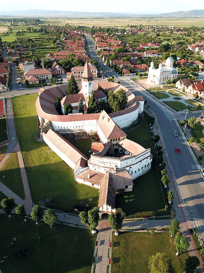

Between 1962 and 1970 (with archaeological excavations by Radu Heitel in 1962–1964), Romania’s Directorate of Historic Monuments lowered the exterior grade around the ring, cleared courtyard debris, dismantled and rebuilt the 39-metre bell tower on reinforced concrete, and renewed the timber galleries and roofs.
The standing fortress combines surviving medieval masonry with that extensive 1962–1970 rebuilding and a 1992–1997 conservation campaign on roofs, entrance galleries and drainage by the Transylvanian Saxon foundation.
Sources
- Mariana Angelescu, DMI architectural report on Prejmer (1963), pp. 40–49
- Daniela Marcu Istrate, after Radu Heitel’s excavations (Ars Transsilvaniae XXI, 2011), pp. 135–152
- National Archaeological Record (INP), site 41676.12 — Prejmer
- Siebenbürgisch-Sächsische Stiftung, conservation report (Romanian edition, pp. 16–19)
- Siebenbürgisch-Sächsische Stiftung, conservation report (English edition, pp. 16–19)
What the records show
An approximate reconstruction of the circular curtain, bastions, gate tunnel, Bakers’ Courtyard, Greek-cross church and surrounding village houses based on OpenStreetMap outlines (ODbL) centred on the church crossing (45.721996 N, 25.773780 E), set within Burzenland terrain and Carpathian ridges (Postăvaru, Piatra Mare, Ciucaș) from Copernicus GLO-30 elevation (30 m grid).
Published heights and counts follow the 1963 DMI architectural report (Mariana Angelescu), the National Archaeological Record (RAN 41676.12), INP museum archives, ICOMOS evaluation 596bis and Radu Heitel’s excavation findings published by Daniela Marcu Istrate (2011), keeping institutional discrepancies separated (272, 275 or 278 chambers; Angelescu’s 80 m vs. RAN’s c. 72 m; 12 m pre-restoration wall height vs. 14 m above lowered medieval paving).
Chamber bays subdivide the mapped ring across three and four tiers plus two tiers in the Bakers’ Courtyard; sequential door plates 1–272 illustrate the allocation tradition without claiming a surveyed family-by-door match.
At night, tunnel lanterns, church lancets, the siege schoolroom, bakery hearth glow and selected chambers provide warm illumination without claiming historical lighting levels, while ambient wind, footstep, fire and bell audio is background atmosphere rather than field recordings.
Practical visiting hours and a map of 162 fortified churches from the foundation’s inventory appear in the companion directory on this site.
Sources
Dimensions, medieval charters, siege chronicles and restoration records come from primary archival editions and heritage inventories.
- Mariana Angelescu, DMI architectural report on Prejmer (1963), pp. 40–49
- National Archaeological Record (INP), site 41676.12 — Prejmer
- Daniela Marcu Istrate, after Radu Heitel’s excavations (Ars Transsilvaniae XXI, 2011), pp. 135–152
- Orbán Balázs, Description of Székely Land, vol. VI, "Prázsmár", pp. 56–57
- Prejmer Municipality — historic and cultural monuments
- Siebenbürgisch-Sächsische Stiftung, conservation report (Romanian edition, pp. 16–19)
- Siebenbürgisch-Sächsische Stiftung, conservation report (English edition, pp. 16–19)
- List of Historic Monuments 2015 — Brașov County (BV-II-a-A-11745)
- Prejmer Evangelical Parish — official history
- Fortified Churches Foundation, Prejmer / Tartlau profile
- Quellen zur Geschichte der Stadt Brassó, vol. IV (1903): Sutor, Joseph Teutsch, Thomas Tartler
- INP (cIMeC), Museums and Collections in Romania — Prejmer Peasant Fortress
- Prejmer Municipality — Sustainable Development Strategy (§1.1)
- ICOMOS, UNESCO 596bis Evaluation (1999), pp. 177–180
- I. Safir, "Cetatea țărănească de la Prejmer", Flacăra, January 1966, p. 14
- Urkundenbuch, vol. I, no. 19 (1211): Burzenland grant to the Teutonic Order
- Urkundenbuch, vol. I, no. 28 (19 April 1218): papal confirmation
- Urkundenbuch, vol. I, no. 45 (12 June 1225): papal demand on the Order
- Urkundenbuch, vol. I, no. 51 (27 October 1225): letter on the Order’s recall
- Urkundenbuch, vol. I, no. 76 (March 1240): King Béla IV’s donation to Cîteaux
- Michel Tánase, "Avatarurile unui act de donație" (Revista istorică IV, 1993), pp. 55–80
- Gheorghe Mitran, Medieval Winged Altarpieces of Brașov County (2018), pp. 70–72
- Thomas Tartler / Theodor Ludu, Prejmer chronicle, Țara Bârsei (1932–1934)
- Andreas Hegyes, manuscript chronicle (ed. Ioan Câmpeanu, Alt-Schäßburg 2008), p. 25
- Adinel C. Dincă, Brukenthal MS 683 on the June 1432 raid