The whole road, in words
The eight stops, from south to north. Each figure says who gives it.
How to read the figures
- Official voice, then or now
- Witness, memoir, later press
- Measured on the map or the relief
- Not found
- Documented at the time
- Sources disagree
- One later source
- Not found
01
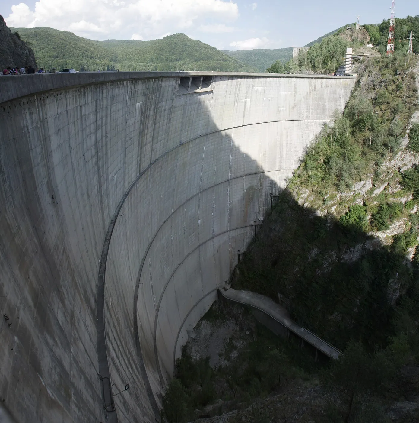
Vidraru dam: where the new road begins
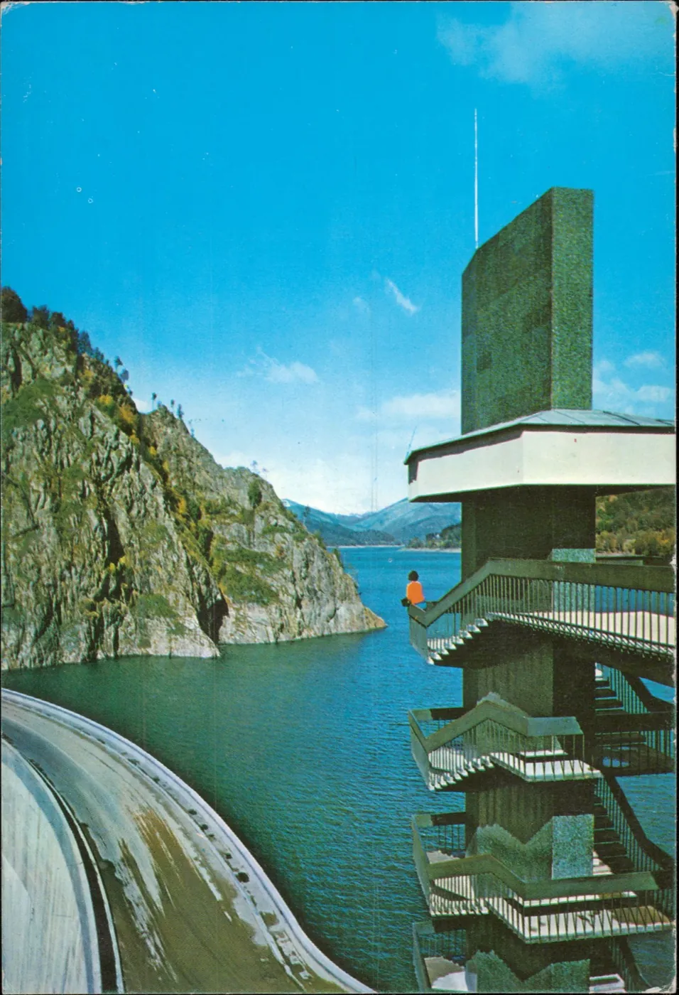
The dam was finished in 1966, eight years before the road. The road up to it, with four short tunnels, is dated 1962 in the road company’s table. A single-lane forestry road already ran round the reservoir, says Alexandru Teodorescu, an engineer who worked on the site.
The road built between 1970 and 1974 starts beside the dam and ends on the Sibiu–Brașov road near the village of Cârțișoara. This is the source of the first confusion about its length: about 151 kilometres is the whole of national road DN7C, from Bascov, near Pitești, according to Adevărul. The new road is about 90 kilometres; how much exactly, the sources do not agree, as below.
The figures at this stop
How long the new road is Sources disagree
- Official voice, then or now: “the 90 km” the inauguration report p. 2
- Official voice, then or now: 91 km CNAIR, the road administrator, 2025 source
- Witness, memoir, later press: 90.167 km Major Sorin Pancu, the land forces’ magazine source
- Witness, memoir, later press: “about 91.5 kilometres”, from kilometre 61 of DN7C Jurnalul Național, 2005 source
- Measured on the map or the relief: about 87 km the road line in OpenStreetMap, from the dam to road DN1 source
- Not found: Which survey gave 90.167 km is not known.
How high the dam is Sources disagree

02
Piscu Negru: working from both ends
Work began in March 1970 from both ends: in the south from the tail of Lake Vidraru, in the north from Glăjărie, above Cârțișoara. Army engineers did it under Colonel Nicolae Mazilu, “commander of the detachment for building the road”, as the 1974 decree called him, with civilian builders beside them.
A forestry road had been under way up the Capra valley since 1967, and eight kilometres were done by December 1969, says the engineer Teodorescu. Where it ran is not known, so the scene does not show it. The first version of the road also had a single lane. In 1971 it was decided to rebuild it as a two-lane national road, and part of the previous year’s work was demolished.
The sources below do not say in what order the stretches were cut. So at “1970–1974” only the route is shown, with the dates a source gives.
The figures at this stop
When work began Documented at the time
- Official voice, then or now: “Since March 1970” Scînteia, June 1971 p. 1
- Witness, memoir, later press: 10 March 1970 Jurnalul Național, 2005; the land forces’ magazine source
- Witness, memoir, later press: “the end of February 1970” engineer veterans from Râmnicu Vâlcea, 2024 source
- Not found: The press of the time says only “since March”; the exact day is not documented.
How many people worked Not found
- Official voice, then or now: “tens of thousands of soldiers” Defence Minister Ion Ioniță at the inauguration p. 3
- Official voice, then or now: “more than two and a half million man-days” the same minister, on the soldiers’ labour p. 3
- Witness, memoir, later press: “about 3,000 people” Colonel Vasile Dabu, on how many worked at one time, 2024 source
- Witness, memoir, later press: 50,000 Jurnalul Național, 2005, no source given source
- Not found: No total and no return of strength by year was found.
03
Capra valley: how much explosive, how much rock
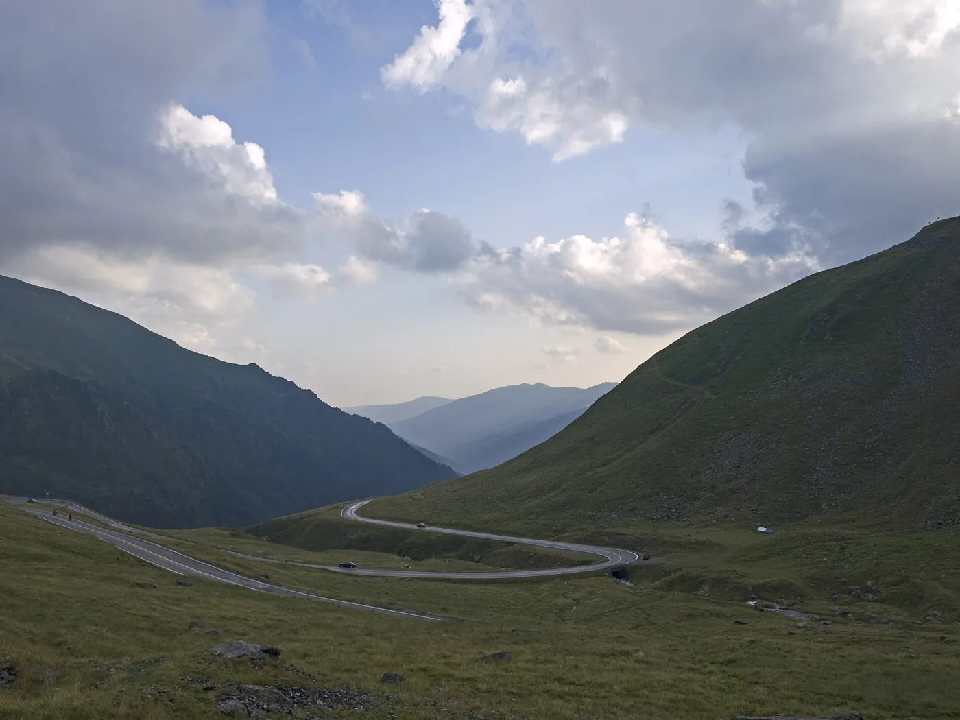
On the southern climb the road is cut into the mountainside. The rock face stays above it; below it stand the retaining walls and the stone pushed downhill. At the opening in 1974 the cuts were fresh and pale; today grass has closed over them in places.
The most repeated figure, 6,520 tonnes of dynamite, first appears in a 2008 newspaper article, with no source. The press of 1974 prints no tonnage. On the site the talk was of something other than dynamite: in 1971 Scînteia mentioned a sack of ammonium nitrate, and Colonel Vasile Dabu remembers ammonium nitrate mixed with diesel.
The figures at this stop
How much explosive was used Sources disagree
- Witness, memoir, later press: “6,520 tonnes of dynamite” România liberă, 2008, no source given source
- Witness, memoir, later press: “six million kilograms of explosive” engineer veterans, 2024 source
- Witness, memoir, later press: “ammonium nitrate and diesel” Colonel Vasile Dabu, then a lieutenant, 2024 source
- Official voice, then or now: “a sack of ammonium nitrate” Scînteia, June 1971, about a blast on the site p. 2
- Not found: The inauguration press gives no tonnage. Where 6,520 comes from is not known.
How much was dug Sources disagree
- Official voice, then or now: “more than 3.8 million cubic metres of excavation, more than half of it in rock” Vasile Patilineț, minister for forestry, at the inauguration p. 3
- Official voice, then or now: “about 4 million cubic metres of blasting and earthworks” the panel shown on the site the same day p. 2
- Witness, memoir, later press: “3 million tonnes of rock” Jurnalul Național, 2005 source
How many bridges and culverts Sources disagree
- Official voice, then or now: “more than 830 cross structures, of which 27 viaducts and bridges” Minister Vasile Patilineț, 1974 p. 3
- Official voice, then or now: “28 bridges and viaducts, 550 culverts” the panel on the site, 1974 p. 2
- Official voice, then or now: 28 bridges and viaducts, 515 culverts CNAIR, 2025 source
- Witness, memoir, later press: “830 culverts and 27 viaducts” the press after 2008: the minister’s sentence, misread source

04
The Capra–Bâlea tunnel: four lengths for one tunnel
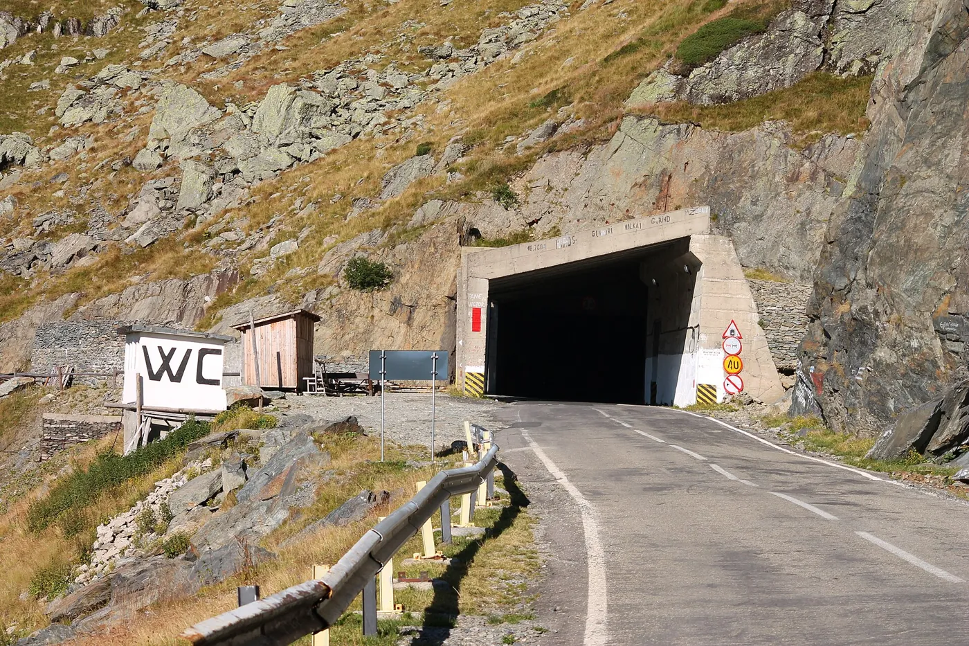
The tunnel passes under the main ridge and joins Wallachia to Transylvania. It was dug by the state hydro-construction trust, with civilian miners and soldiers. The crew first went up in October 1971 and was turned back by a blizzard; it returned in June 1972, says Simion Gheață, the mining foreman.
On the carriageway, a line shows where the tunnel would end for each length the sources give, counted from the southern mouth: 860, 884 and 887 metres. The stretch drawn as a tunnel on the map is about 975 metres, entrances included.
The figures at this stop
How long the tunnel is Sources disagree
- Official voice, then or now: 884.00 m the road company’s table of tunnels, copy of 2014 source
- Official voice, then or now: “a tunnel of 860 m” Minister Vasile Patilineț at the inauguration p. 3
- Official voice, then or now: “almost a kilometre” the inauguration report p. 2
- Witness, memoir, later press: 887 metres the press, from 2005 on source
- Measured on the map or the relief: about 975 m the stretch tagged as a tunnel in OpenStreetMap source
- Not found: No as-built drawing showing what exactly was measured was found.
When the mountain was pierced Sources disagree

05
Bâlea Lac: 20 September 1974
On Friday 20 September 1974 Nicolae Ceaușescu cut the ribbon here, by the lake, walked through the tunnel and drove down towards Vidraru. The road then had only a gravel surface, writes Jurnalul Național; asphalt came between 1976 and 1980.
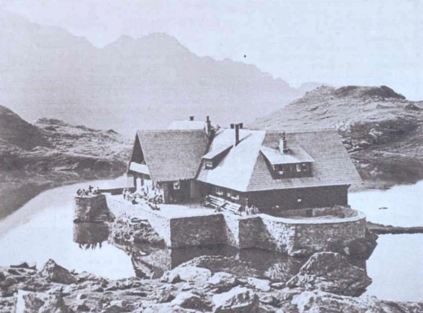
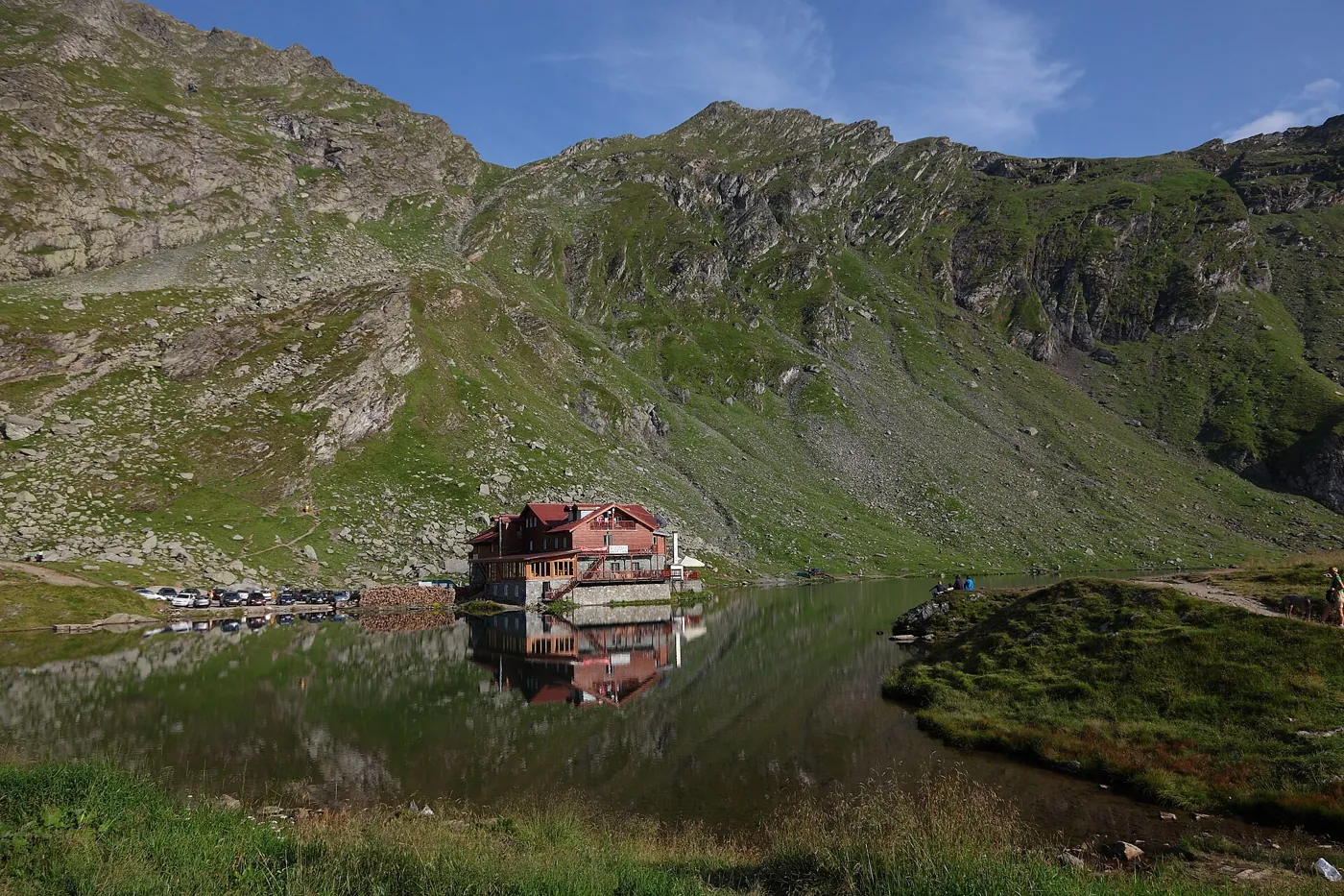
The first bulldozer had reached the lake on 2 August 1971, writes Jurnalul Național. A chalet already stood here in 1968, as the photograph below shows. In his speech that day Ceaușescu called it “the highest road”; today the administrator ranks it second, after the Transalpina.
The figures at this stop
The day of the opening Documented at the time
- Official voice, then or now: “inaugurated yesterday”, in the paper of 21 September 1974 Scînteia, front page p. 1
The highest point of the road Sources disagree
- Official voice, then or now: “level 2 040 m” the inauguration report p. 2
- Official voice, then or now: 2,042 metres CNAIR, 2024 and 2025 source
- Witness, memoir, later press: “2 042 m at the entrance to the tunnel” Major Sorin Pancu, the land forces’ magazine source
- Witness, memoir, later press: the tunnel runs between 2,025 and 2,042 m Jurnalul Național, 2005 source
- Measured on the map or the relief: 2,034 m the lake shore, from the OpenStreetMap outline on the Copernicus relief, give or take a few metres source
What the road cost Not found
- Not found: The sources below print no cost: not the press of 1974, not the army, not the road administrator.
- Not found: Council of Ministers Decision no. 2259 of 10 December 1969, which approved the works, has four annexes kept in the National Archives; their content is not published. source


06
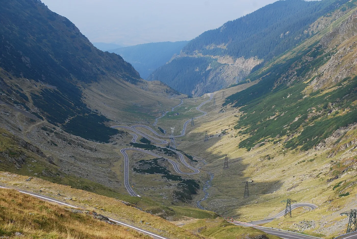
The Bâlea serpentines: why the road was built
From the lip of the cirque the whole descent towards Transylvania is in view. Move the handle from 1969 to 1974: the mountain stays the same, and the cut appears on it.
On the motive the sources differ. The government decision of 10 December 1969 is known only by its title. A history of the works written by its technicians lists forests, alpine pastures and tourism, and places the first studies in 1967–1969, that is, before August 1968. The link to the invasion of Czechoslovakia is made much later, by an officer from the site, a historian and the road administrator.
The figures at this stop
Why it was built Sources disagree
- Official voice, then or now: “of economic and tourist importance” Scînteia, June 1971 p. 1
- Official voice, then or now: “preparing the territory for the defence of the homeland” Defence Minister Ion Ioniță at the inauguration, after forests and tourism p. 3
- Official voice, then or now: “the geopolitical context of the invasion of Czechoslovakia” CNAIR, 2023, no document shown source
- Witness, memoir, later press: the invasion of Czechoslovakia was “the trigger” Colonel (ret.) Ion Bratu, an officer on the site, 2024 source
- Witness, memoir, later press: “a tourist route… which could, if needed, also be a strategic road” the memoirs of the commander, Nicolae Mazilu, quoted by Adevărul, 2015 source
- Witness, memoir, later press: forests, alpine pastures, a mountain resort at Bâlea the technicians’ history of the works, quoted by Jurnalul Național, 2005 source
- Not found: In 1974 the defence minister also spoke of defence, after forests and tourism. The text of the 1969 decision, which would say why the works were decided, is not published.


07
Poarta Întâlnirii, the Meeting Gate: 16 August 1971
The plaque here says that on 16 August 1971 two engineer units working from opposite directions met. Both were on the northern slope: one climbing from the valley, the other coming down from the Bâlea cirque, where two bulldozers had been carried up in pieces.
How many people died on the works
It is not known.
The commander of the works, Nicolae Mazilu, wrote in his memoirs, as quoted by Adevărul: “Almost 40 dead and as many wounded”. The Ministry of Defence repeated the phrase in 2009, and in 2025 the road administrator spoke of “about 40 human lives”. The press of 1974 mentions no deaths.
Colonel Vasile Dabu, then a platoon leader on the southern slope: “Officially, seven people died, but unofficially there are more… they did not exceed 15–16”.
Gheorghe Buzoiu, a shepherd from the village of Corbeni, in 2007: “I think hundreds of people died.”
The figure of 400, often quoted for the road, refers to the Vidraru dam in the article it comes from.
The sources below give eight names. Seven soldiers died on 8 July 1970 at the bridge over the Aluniș stream, taken by a flash flood: Cornel Florea Munteanu, Damian Dimitrie Laza, Gheorghe Elena Ursu, Vasile Pavel Negrea, Ilie Sanda, Nicolae Alexandru Turtuba and Simion Cut, spelt as in Jurnalul Național. Ion Moroșan was taken by a small avalanche near the tunnel camp, says the foreman Simion Gheață.
No list of all the dead was found.
The figures at this stop
How many people died Sources disagree
- Witness, memoir, later press: “Almost 40 dead and as many wounded” Nicolae Mazilu’s memoirs, quoted by Adevărul, 2015 source
- Official voice, then or now: “almost 40 dead and as many wounded” Ministry of Defence, 2009, quoted by Agerpres source
- Official voice, then or now: “about 40 human lives” CNAIR, 2025 source
- Official voice, then or now: no deaths mentioned the inauguration press p. 1
- Witness, memoir, later press: “Officially, seven… unofficially… not more than 15–16”, on the southern slope Colonel Vasile Dabu, 2024 source
- Witness, memoir, later press: “I think hundreds of people died” Gheorghe Buzoiu, a shepherd from Corbeni, 2007 source
- Witness, memoir, later press: “some 400”, at the dam, not the road Ion Răducanu, a carpenter from Arefu, 2008 source
- Not found: No list of names and no count from the archives was found.
08
Bâlea Cascadă: the road today
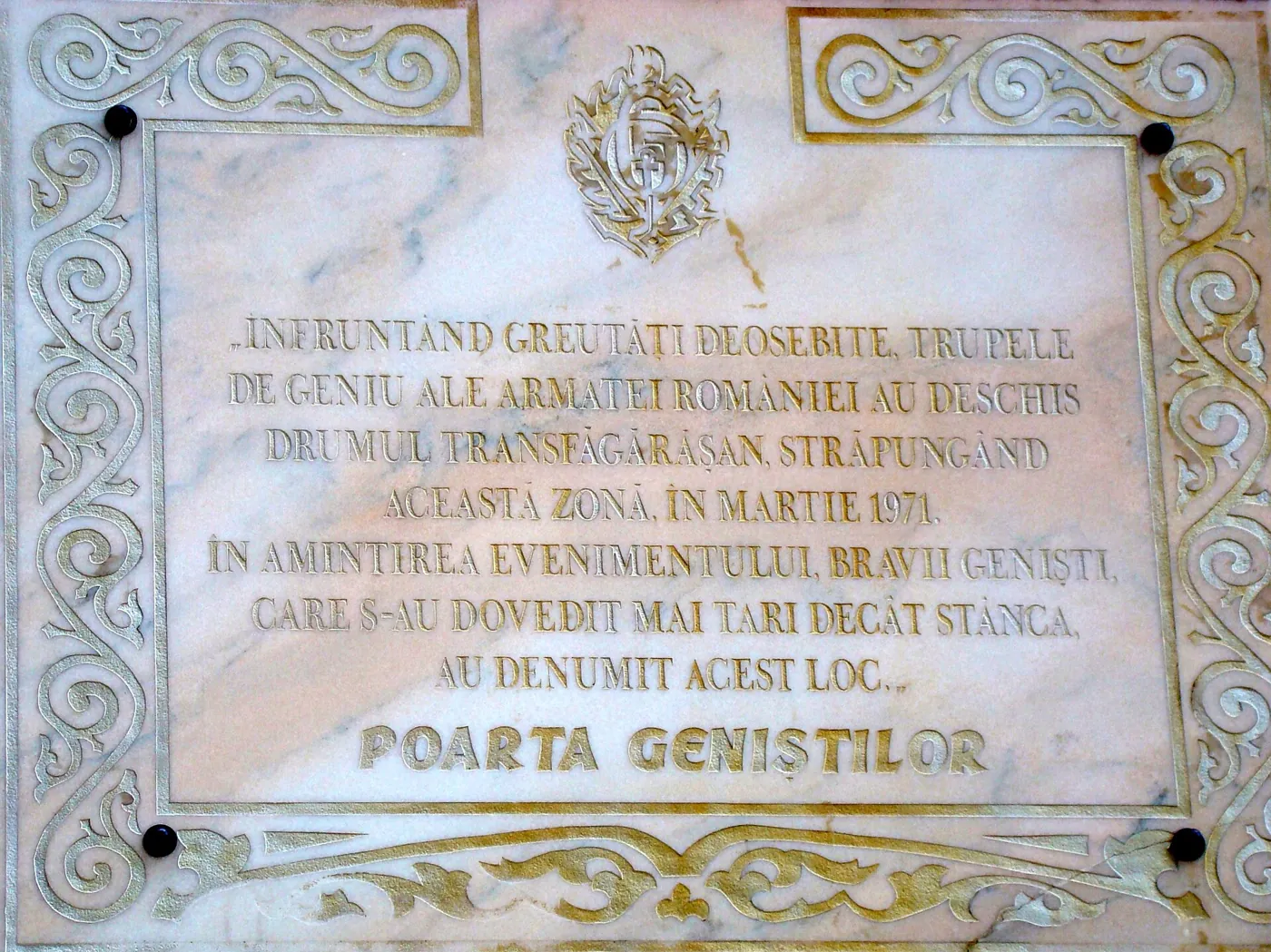
In March 1970, 66 soldiers walked up from Cârțișoara to the chalet here; it was the first camp of the northern site, writes Jurnalul Național. Lower down, the engineers broke through the rock known since as Poarta Geniștilor, the Engineers’ Gate. The plaque there carries the date “March 1971”.
In winter the road closes between Piscu Negru and Bâlea Cascadă, from kilometre 104 to kilometre 130+800, as the administrator’s notice of 2020 sets out.
The figures at this stop
When it was asphalted One later source
- Witness, memoir, later press: “during the modernisation of the road (1976-1980)” Jurnalul Național, 2005 source
- Witness, memoir, later press: the last six kilometres, unfinished in spring 1979 General Constantin Tănase, who led the works from 1975, in Jurnalul Național source
- Not found: The day the last asphalt was laid was not found.
Where it closes in winter Documented at the time
- Official voice, then or now: between km 104+000 (Piscu Negru) and km 130+800 (Bâlea Cascadă) CNAIR, 2020 source


About the road today: Is the Transfăgărășan open now? The season guide · Lake Bâlea · The Vidraru dam
What the picture shows and what it does not
The relief is that of the Copernicus GLO-30 model, one point every 30 metres, without the forest canopy. Along the road it is matched by a few metres to the level of the carriageway. Below the Vidraru dam, where the model smears the face of the dam into a slope, the gorge is deepened to the foot of the dam and the ends of the crest are brought to its level; at this stop the view is raised above the gorge, away from the road.
The route, tunnels, bridges, lakes and buildings are those in OpenStreetMap. The banks, retaining walls and parapets follow the usual form of a mountain road, not the construction drawings, which were not found. The forest stands where the ESA WorldCover map shows it; tree species and heights are not measured.
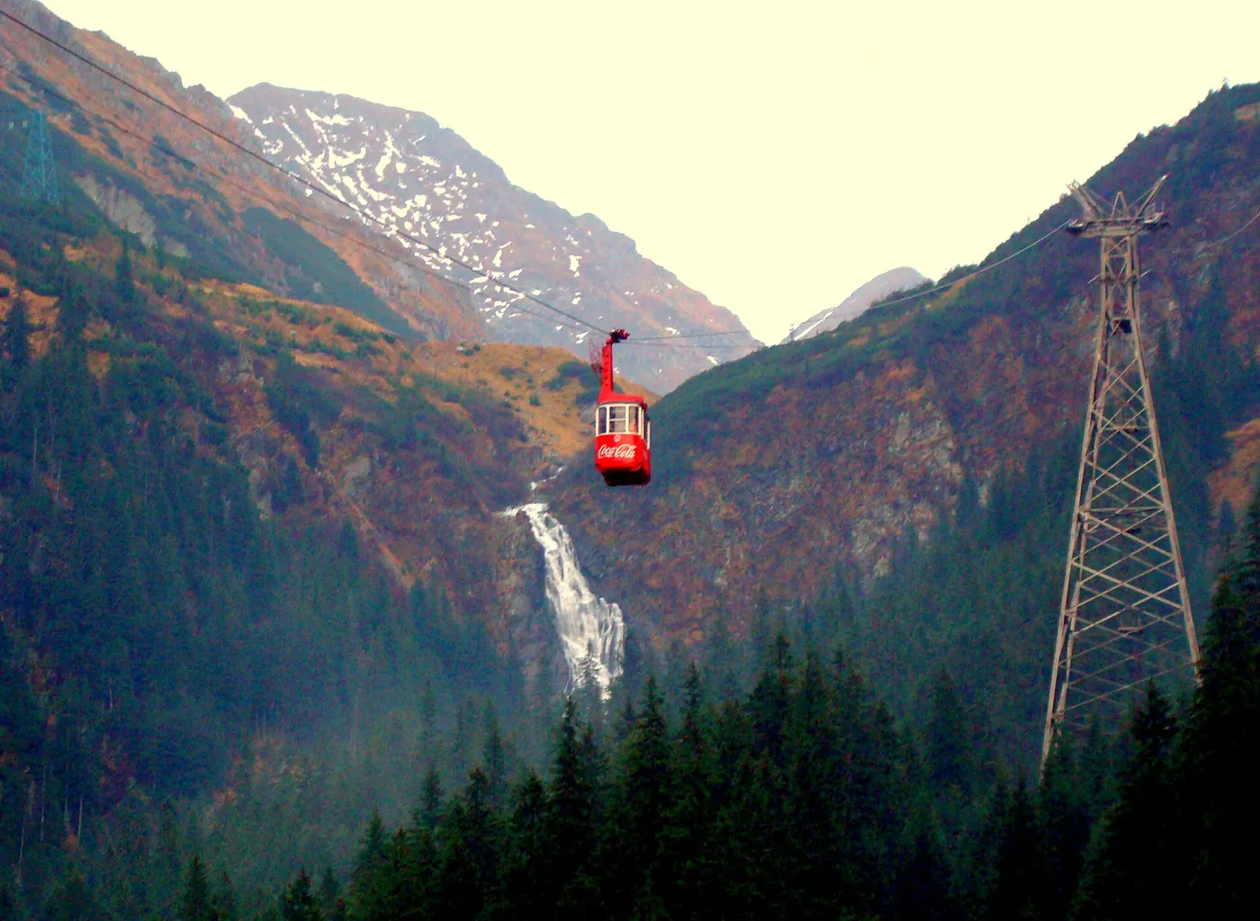
Buildings appear only in today’s picture, because there is no dated source for each one. So does the cable car, although a photograph dated 1974 already shows its lower station. The forestry road up the Capra valley, begun in 1967, is missing, because where it ran is not known.
The light is that of 20 September at nine in the morning, at Bâlea Lac. The first snow on the ridges and the fog over Transylvania belong to such a morning, not to the day of the opening.
At “1970–1974” the route is shown, not the order of the work. The dates on it come from the sources at each stop.
Sources
The press of 1966, 1971 and 1974 is read from the digital collection of the Hunedoara County Library. The officers’ books (Nicolae Mazilu, Eugen Boc, Ion Bratu) are quoted through the articles that reproduce them. Scînteia was the Communist Party daily; CNAIR is Romania’s national road administrator.
- Scînteia, 21 September 1974, no. 9979, pp. 1–3: the inauguration report, the decree and the speeches
- CNAIR statement on the 51st anniversary, 20 September 2025 (Digi24)
- Revista Forțelor Terestre, Major Sorin Pancu’s preface to the book by Colonel (ret.) Ion Bratu
- Jurnalul Național, “Caravana Jurnalului, pe Transfăgărășan”, 23 June 2005
- Road line, tunnels, bridges, lakes and buildings: © OpenStreetMap contributors, extract of 30 October 2026
- Scînteia, 10 December 1966, no. 7188, pp. 1 and 3: the opening of the Argeș hydro plant
- welcometoromania.ro, “Lake Vidraru and its dam”
- Scînteia, 17 June 1971, no. 8819, pp. 1–2: “Transfăgărășanul”, by Colonel Gh. Bejancu
- Jurnalul Național, “Măruntaiele Făgărașului”, 23 June 2005
- Agerpres, feature with the engineer veterans Vasile Dabu and Ion Marinescu, 21 September 2024
- România liberă, “Ultimii șantieriști de pe Transfăgărășan”, 11 August 2008
- CNAIR statement on the 51st anniversary, as carried by Capital, 20 September 2025
- National road company (CNADNR), table “Tunnels on the national road network”, copy of 9 February 2014
- Jurnalul Național, “Opt ani la tunel”, 25 June 2005
- Adevărul, “Cel mai frumos drum din lume, la aniversare”, 20 September 2023
- The head of CNAIR, quoted by Agerpres, 20 September 2024
- Relief: Copernicus GLO-30 digital surface model, © DLR e.V. 2010–2014 and © Airbus Defence and Space GmbH 2014–2018, provided under COPERNICUS by the European Union and ESA
- Adevărul, “Povestea inaugurării…”, with photographs from the National Archives, 25 September 2021
- CNAIR statement on the 49th anniversary, 20 September 2023 (Economica)
- Radio Free Europe Romania, 20 September 2024: Colonel (ret.) Ion Bratu, the historian Cosmin Popa
- Adevărul, “Enigma Transfăgărășanului”, with passages from Nicolae Mazilu’s memoirs, 3 September 2015
- Agerpres, documentary on the 45th anniversary, 20 September 2019 (TVR copy)
- Evenimentul zilei, “Drumul care împunge cerul”, 2007
- CNAIR notice on the winter closure, with kilometre posts, 16 October 2020 (Economica)
- Forest: ESA WorldCover 2021 v200, © ESA WorldCover project, CC BY 4.0
Photographs
- The Argeș dam on a postcard of 1966, the year it opened. Al. Florescu, CC BY-SA 4.0, Europeana
- The Vidraru dam seen from downstream. Zeugma fr (Antoine FLEURY-GOBERT), CC BY-SA 3.0, Wikimedia Commons
- The southern climb, in the Capra valley. Ymblanter, CC BY-SA 4.0, Wikimedia Commons
- The southern mouth of the Capra–Bâlea tunnel. Draceane, CC BY-SA 4.0, Wikimedia Commons
- The Bâlea Lac chalet in 1968, two years before work on the road began. Aurel Dula, Public domain, Wikimedia Commons
- Lake Bâlea and the chalet on its peninsula. Mihaiteo, CC BY 3.0, Wikimedia Commons
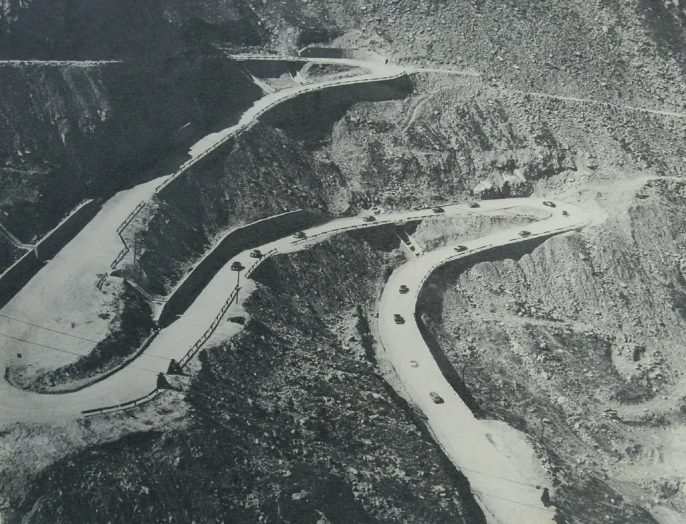
- Stone-paved hairpins and a column of cars in 1974. The photograph does not say on which side of the mountain. MApN (Romanian Ministry of National Defence); photographer not named, CC BY-SA 3.0, Wikimedia Commons
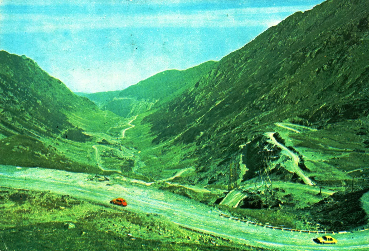
- The Bâlea valley on a postcard of 1977: the road, not yet asphalted. S. Mendrea, CC BY-SA 4.0, Europeana
- The same valley today, from beside Bâlea Lac. Andrei Stroe, CC BY-SA 3.0, Wikimedia Commons
- The plaque at Poarta Geniștilor, the Engineers’ Gate. Țetcu Mircea Rareș, CC BY-SA 3.0, Wikimedia Commons
- The cable car between Bâlea Cascadă and Bâlea Lac. Țetcu Mircea Rareș, CC BY-SA 4.0, Wikimedia Commons