mariuscomper.uk Română

Seven travellers and an epilogue · 1000–1488

Seven people who drew the world

They left Europe with ships, horses, and caravans, and came back — when they came back — with a larger planet. Below you can replay their routes step by step, on lines drawn to scale.

Start the first voyage See the whole map

  • 7true voyages
  • 488years, Vinland to the Cape
  • 144,000km drawn on the map
All eight routes drawing themselves, in order: 1000–1488.

The map

Every road on a single map

Each route joins the halts attested in contemporary accounts: 92 stops linked by lines drawn to scale, adding up to nearly 144,000 kilometres. Choose a traveller to follow their route, then open their chapter.

Coastlines are simplified; legs between halts are schematic. The Caspian Sea is shown because one of these travellers proved it a lake.

All 8 routes: 92 halts, nearly 144,000 kilometres.

The voyages

Seven roads out — six roads home

Each chapter replays itself: press “play” and the route draws at its own pace, with halts, distances, and story. A seal awaits at the end.

Voyage I

Leif Erikson

around the year 1000

The first European in America, five centuries before Columbus.

Time away: a single voyage On this map: 3,600 km

Sources: Britannica, UNESCO

Brattahlid, GreenlandHellulandMarklandVinland

0 of 3,600 km · Halt 1 of 5

Brattahlid, Greenland — From home, westward, under a single sail.

The halts, in brief (5)
  1. Brattahlid, Greenland — From home, westward, under a single sail. 1000
  2. Helluland — “Land of flat rocks” — probably Baffin Island. 1000
  3. Markland — “Land of forests” — the Labrador coast. 1000
  4. Vinland — “Land of wine”. L'Anse aux Meadows would be found here. 1000
  5. Brattahlid, Greenland — Home again, with the story. 1000

Around the year 1000, a Norse seafarer leaves Greenland for the west, following a story: an Icelander blown off course had glimpsed land beyond the sea. Leif, son of Erik the Red, names what he finds for how it looks: Helluland, land of flat rocks; Markland, land of forests; Vinland, land of wine.

The story survives in two Icelandic sagas written two centuries later. And the proof sits in a Newfoundland meadow: at L'Anse aux Meadows, eight Norse timber-and-turf houses from the 11th century came to light — the earliest European trace in North America.

The settlement did not last, and the road was forgotten. But the route remains: some 3,600 kilometres there and back across the North Atlantic, the first European crossing we know of.
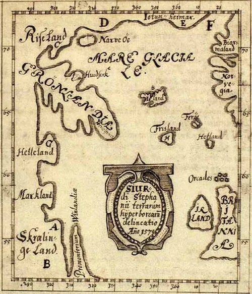
The Skálholt Map, with Vinland at the western edge of the Norse known world.
The Skálholt Map: Vinland at the edge of the world the Norse knew. Public domain, via Wikimedia Commons.

Next voyage: John of Plano Carpini →

Voyage II

John of Plano Carpini

1245–1247

The friar who carried the Pope's letter to the Great Khan's court.

Time away: 2½ years On this map: 14,700 km

Sources: Rockhill (1900), via Silk Road Seattle, Güyük's letter

LyonBohemiaKrakówKievBatu's camp, VolgaKarakorum

0 of 14,700 km · Halt 1 of 7

Lyon — 16 April 1245: two Franciscans set out for the Tatars.

The halts, in brief (7)
  1. Lyon — 16 April 1245: two Franciscans set out for the Tatars. 1245
  2. Bohemia — The King of Bohemia sends them via Poland. 1245
  3. Kraków — Letters and escort from the dukes of Poland. 1245
  4. Kiev — The last Christian city. Beyond it, the steppe.
  5. Batu's camp, Volga — The Khan sends them onward, to Karakorum. 1246
  6. Karakorum — 24 August 1246: they witness Güyük’s proclamation. 1246
  7. Lyon — 1247: the report reaches the Pope. 1247
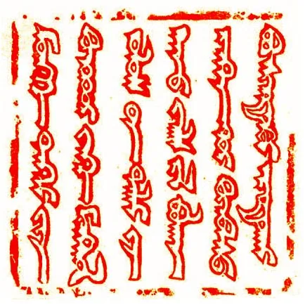
Güyük Khan's seal, in Mongolian script.
Güyük's seal, from the 1246 letter in which the Khan demanded the Pope's submission. Public domain, via Wikimedia Commons.

In 1245, Pope Innocent IV makes an unprecedented gesture: he sends the Franciscans John of Plano Carpini and Benedict the Pole with a letter all the way to the Great Khan's court. Carpini is past 60; he leaves Lyon on 16 April, through Germany, Bohemia, Poland, and Kiev.

Beyond Kiev there is only steppe: Batu's camp on the Volga, then thousands of kilometres eastward. On 24 August 1246, the two witness the proclamation of the new Khan, Güyük — Europeans at the enthronement of Asia's master.

They return in 1247 with Güyük's answer: a sealed letter demanding the Pope's submission, not peace. Carpini's report circulated across Europe — the first direct description of Asia ever read here, gathered over 14,700 kilometres of road.

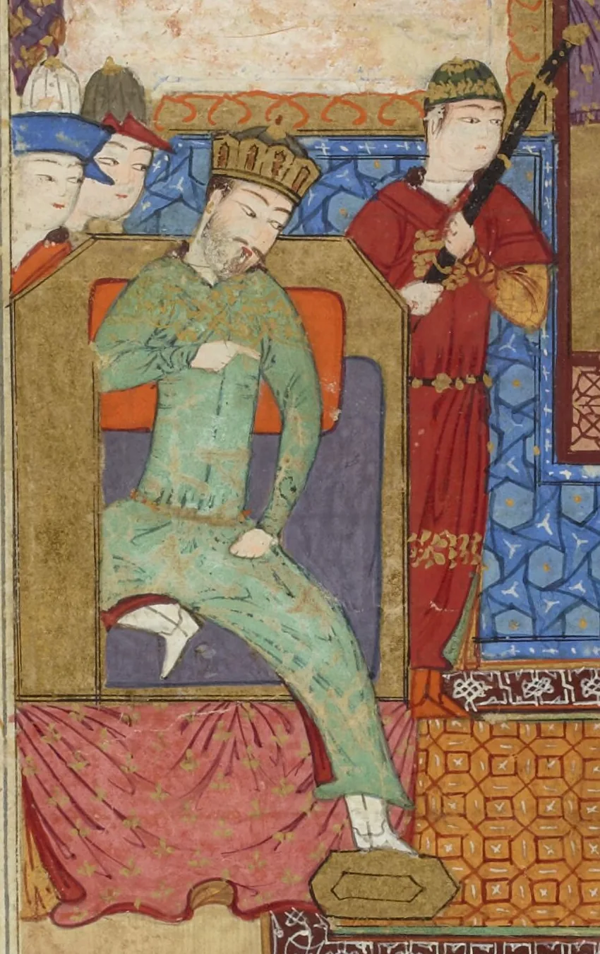
Persian miniature: Güyük Khan enthroned, surrounded by courtiers.
Güyük Khan enthroned, a Persian miniature (Bibliothèque nationale de France). Carpini witnessed his proclamation on 24 August 1246. Public domain, via Wikimedia Commons.

Next voyage: William of Rubruck →

Voyage III

William of Rubruck

1253–1255

St Louis's envoy, who proved the Caspian Sea is a lake.

Time away: 2 years On this map: 12,100 km

Sources: Catholic Encyclopedia (1913)

ConstantinopleCrimeaDonVolga, BatuLake AlakulKarakorumCyprusTripoli

0 of 12,100 km · Halt 1 of 8

Constantinople — 1253: departs on the French king's orders.

The halts, in brief (8)
  1. Constantinople — 1253: departs on the French king's orders. 1253
  2. Crimea — Crosses the Black Sea, then Crimea northward. 1253
  3. Don — Nine days past the Don, the meeting with Sartach. 1253
  4. Volga, Batu — Batu sends them to Great Khan Möngke. 1253
  5. Lake Alakul — In midwinter, at the Khan's court.
  6. Karakorum — Easter 1254: reaches the Mongol capital. 1254
  7. Cyprus — Spring 1255: homeward via Cyprus. 1255
  8. Tripoli — The report reaches the king: a masterpiece. 1255

Eight years later, King Louis IX of France tries his luck with the same Mongols: he wants them christened and won as allies against the Saracens. He sends the Franciscan William of Rubruck, a Fleming from near Paris.

Departing Constantinople in 1253, Rubruck crosses the Black Sea and Crimea, passes the Don, presents himself to Sartach and to Batu on the Volga, and reaches the court of Great Khan Möngke in midwinter. At Easter 1254 he enters Karakorum.

He obtains nothing the king asked for. But his report is still a geographical masterpiece of the Middle Ages: it describes China, paper money, and printing — and settles a scholars' dispute by proving the Caspian an inland sea, not a gulf of the Arctic Ocean.

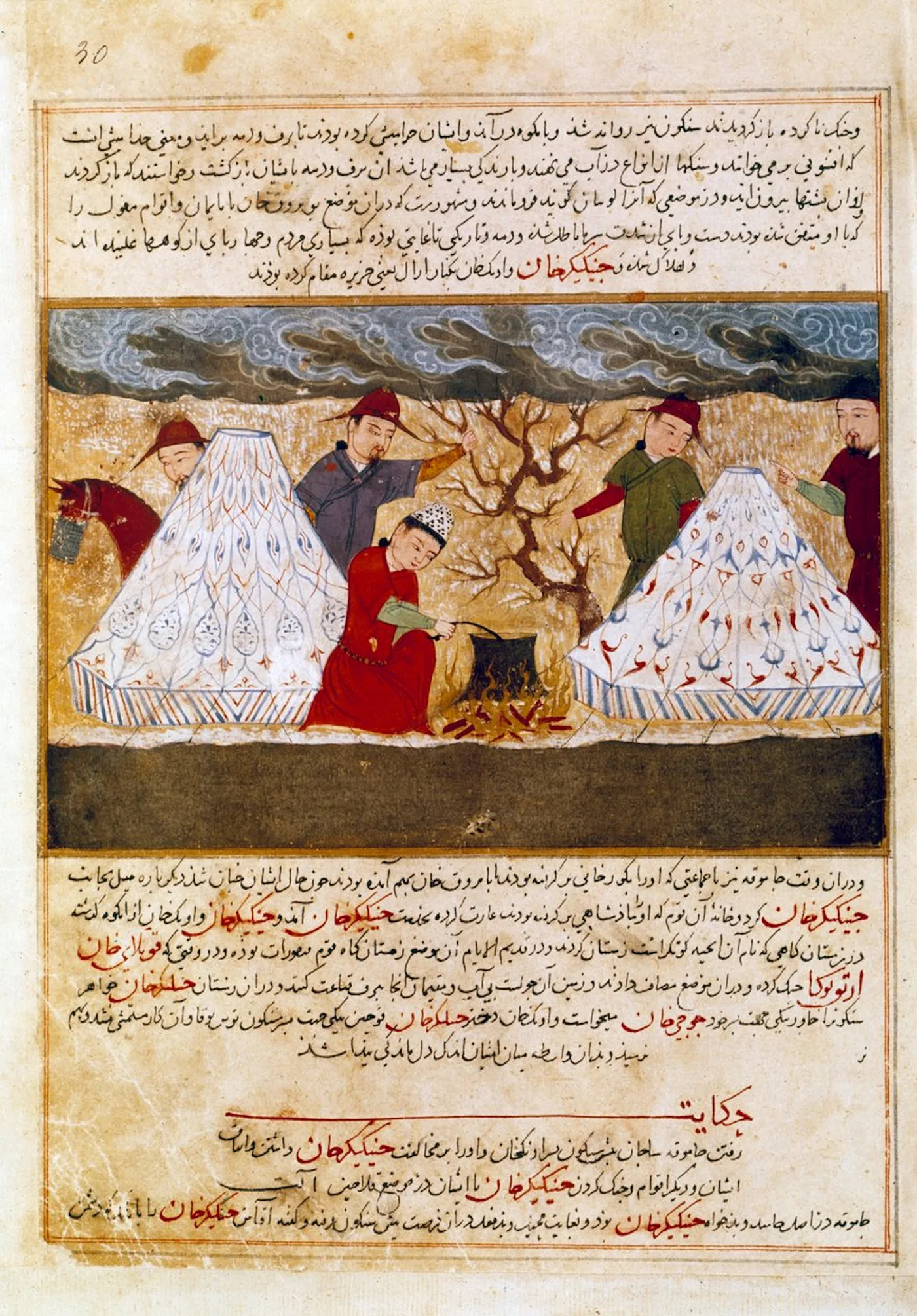
Persian miniature: Mongols cooking in camp.
The camp life Rubruck described in circumstantial detail: food, drink, custom. Persian miniature, about 1430 (Bibliothèque nationale de France). Public domain, via Wikimedia Commons.

Next voyage: Marco Polo →

Voyage IV

Marco Polo

1271–1295

Twenty-four years gone. Seventeen of them spent in China.

Time away: 24 years On this map: 26,400 km

Sources: Britannica, Yule-Cordier, via Gutenberg

VeniceAcreAyasErzurumTabrizHormuzKhorasanBadakhshanKashgarDunhuangZhangyeShangduBeijingHangzhouQuanzhouSumatraCeylon

0 of 26,400 km · Halt 1 of 19

Venice — 1271: Marco, aged 17, leaves with father and uncle.

The halts, in brief (19)
  1. Venice — 1271: Marco, aged 17, leaves with father and uncle. 1271
  2. Acre — Papal letters for the Mongol emperor. 1271
  3. Ayas — Lands on the Cilician coast. 1271
  4. Erzurum — Through Anatolia, towards Persia. 1272
  5. Tabriz — A stop in north-west Persia. 1272
  6. Hormuz — Gives up on ships: onward overland. 1272
  7. Khorasan — Deserts “of surpassing aridity”.
  8. Badakhshan — They stay a year; Marco recovers here.
  9. Kashgar — The gate of the Tarim Basin.
  10. Dunhuang — Shazhou: the end of the Great Wall.
  11. Zhangye — Ganzhou, in Tangut.
  12. Shangdu — 1275: at Kublai Khan's court. 1275
  13. Beijing — Dadu: 17 years in the Khan's service.
  14. Hangzhou — Quinsay, the great city of the south.
  15. Quanzhou — Zayton: embarking for home, by sea. 1292
  16. Sumatra — Escorting a Mongol princess.
  17. Ceylon — Rounding India, westward.
  18. Hormuz — Overland again, towards Khorasan.
  19. Venice — 1295: home, after 24 years. 1295

Venice, 1271. Marco is 17 when he leaves for the East with his father and uncle, merchants who had seen Asia once before. At Acre they receive papal letters for the Mongol emperor, then pass through Ayas, Erzurum, and Tabriz to Hormuz — where they decide to go on overland, not by sea.

The road takes four years: Khorasan, a year of sickness and recovery in Badakhshan, Kashgar, Dunhuang, Ganzhou — and, in 1275, the court of Kublai Khan. Then 17 years in China, with missions for the Khan as far as Yunnan and Hangzhou.

Early in 1292 they sail from Zayton for home: escorting a Mongol princess to Hormuz, then crossing Persia towards Venice, reached in 1295. Three years later Marco is a Genoese prisoner, dictating to his cellmate Rustichello of Pisa the book that would be called Il milione.

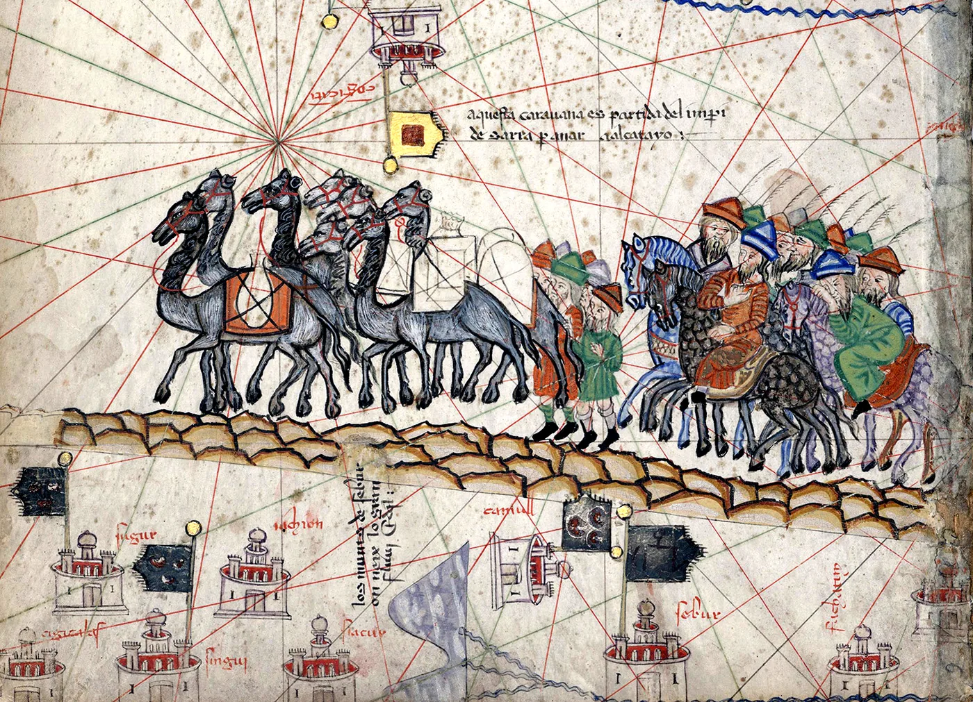
Marco Polo's caravan on the road east, detail from the Catalan Atlas.
Marco Polo's caravan in the Catalan Atlas (1375) — the map that drew his journey less than a century on. Public domain, via Wikimedia Commons.

Next voyage: Odoric of Pordenone →

Voyage V

Odoric of Pordenone

1318–1330

The friar who entered Tibet and Lhasa first.

Time away: 12 years On this map: 27,900 km

Sources: Catholic Encyclopedia (1913)

PaduaTrebizondTabrizSoltaniyehYazdPersepolisHormuzSalsetteMalabar CoastMadrasCeylonNicobar IslandsSumatraJavaBanjarmasin, BorneoChampaCantonBeijingLhasa, Tibet

0 of 27,900 km · Halt 1 of 20

Padua — April 1318: sets out for the Asian missions.

The halts, in brief (20)
  1. Padua — April 1318: sets out for the Asian missions. 1318
  2. Trebizond — Crosses the Black Sea. 1318
  3. Tabriz — Tauris: first stop in Persia. 1318
  4. Soltaniyeh — John XXII's new archbishopric. 1318
  5. Yazd — Through the heart of Persia.
  6. Persepolis — The ruins of ancient kings.
  7. Hormuz — The gate of the Indian Ocean.
  8. Salsette — Gathers the martyred friars' remains.
  9. Malabar Coast — Calicut: the pepper country.
  10. Madras — Meliapur, on the Coromandel Coast.
  11. Ceylon — The isle of cinnamon and rubies.
  12. Nicobar Islands — A staging post towards Sumatra.
  13. Sumatra — The kingdom of Lamori.
  14. Java — Ever further east.
  15. Banjarmasin, Borneo — On Borneo's southern coast.
  16. Champa — The Cham kingdom, on today's Vietnamese coast.
  17. Canton — Lands in China.
  18. Beijing — Buries the martyrs in China.
  19. Lhasa, Tibet — The first European to enter Lhasa.
  20. Padua — 1330: home. Dictates his story. 1330

Padua, April 1318. The Franciscan Odoric of Pordenone sets out for the Asian missions in the footsteps of Carpini and Rubruck — but goes far beyond them: across the Black Sea, through Persia via Tabriz, Soltaniyeh, Yazd, and Persepolis, to Hormuz.

Then the unbelievable part begins: India, carrying martyred friars' bones gathered at Salsette for burial in China; Ceylon; Sumatra; Java; Borneo; Champa — and China itself, where his mission ends.

On the way home he crosses Tibet and enters Lhasa — the first European to do so. In May 1330, at Padua, he dictates his account; he dies eight months later, at Udine. His story would be widely copied by the celebrated “Mandeville”, whose book of borrowings became the late Middle Ages' geography manual.

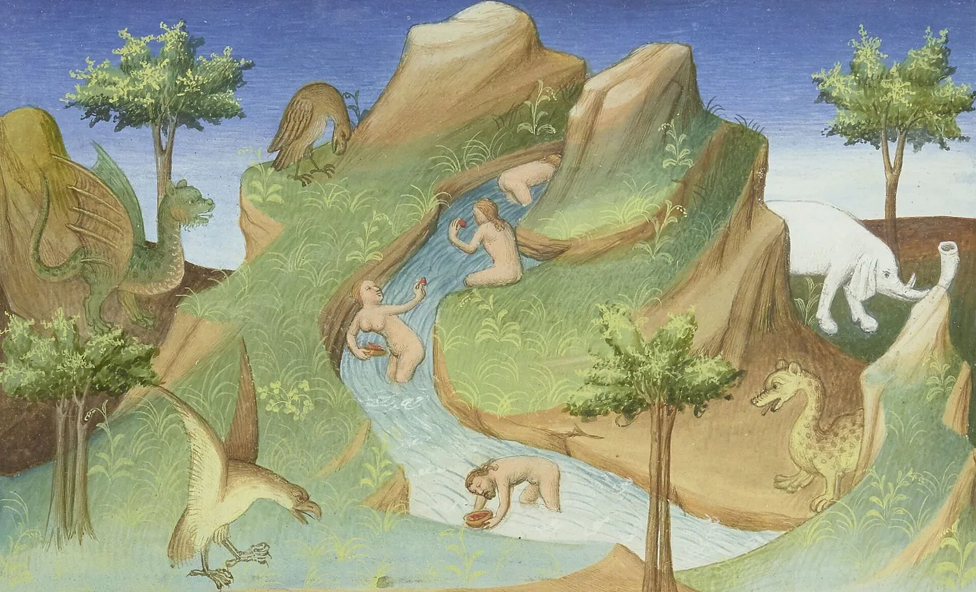
Medieval miniature from a manuscript of Odoric's account.
A miniature from a manuscript of Odoric's account (Bibliothèque nationale de France). Public domain, via Wikimedia Commons.

Next voyage: Niccolò de' Conti →

Voyage VI

Niccolò de' Conti

1419?–1444

Twenty-five years in Asia. The story, dictated as penance to the Pope.

Time away: 25 years On this map: 26,200 km

Sources: Major (1857), via Internet Archive

DamascusEuphratesHormuzCambayVijayanagarMalabar CoastCeylonSumatraJavaSouth ChinaCairoVenice

0 of 26,200 km · Halt 1 of 12

Damascus — A merchant in Damascus. Learns Arabic, then leaves.

The halts, in brief (12)
  1. Damascus — A merchant in Damascus. Learns Arabic, then leaves.
  2. Euphrates — A caravan of 600 merchants through the desert.
  3. Hormuz — Through Persia, to the sea.
  4. Cambay — Lands in Gujarat.
  5. Vijayanagar — The mighty empire of south India.
  6. Malabar Coast — Along the pepper coast.
  7. Ceylon — The cinnamon isle.
  8. Sumatra — Taprobana: pepper, durian, cannibals.
  9. Java — Beyond Taprobana.
  10. South China — Further than any European before him.
  11. Cairo — Here he loses his wife and two children.
  12. Venice — 1444: home after 25 years. Then the penance. 1444

Niccolò de' Conti is a Venetian merchant settled in Damascus. He learns Arabic, then leaves for the East with a caravan of 600 merchants, through the desert to the Euphrates. In which year? Nobody knows exactly — his narrative's editor says so plainly.

Then Persia, the Malabar Coast, the Indian interior — Vijayanagar included — Ceylon, Sumatra, Java, and south China: further than any European before him. Twenty-five years on the road.

The return passes the coasts of Ethiopia, the Red Sea, and the desert to Cairo — where he loses his wife and two children. In 1444 he reaches Venice. Forced on the way to renounce his faith, he begs forgiveness of Pope Eugenius IV — and receives it with a penance: to tell his life to the papal secretary, Poggio Bracciolini.

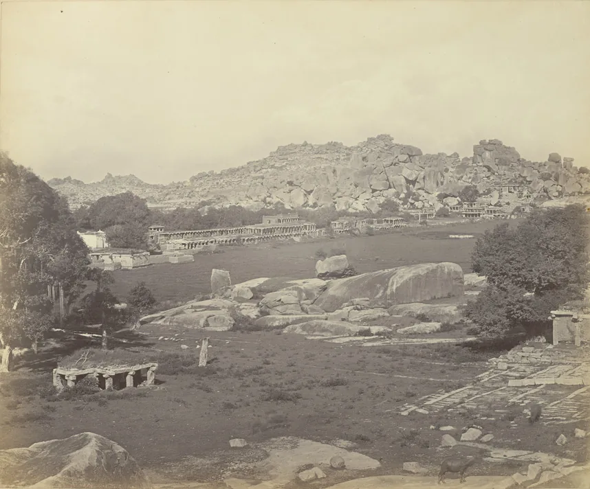
The Hampi bazaar before the Virupaksha temple, in an 1868 photograph.
The Hampi bazaar before the Virupaksha temple — the heart of the Vijayanagara Conti saw in splendour. Photograph from 1868. Photograph by Edmund David Lyon, public domain, via Wikimedia Commons.

Next voyage: Afanasy Nikitin →

Voyage VII

Afanasy Nikitin

1466–1472

The Tver merchant who left for furs and never made it home.

Time away: 6 years On this map: 12,700 km

Sources: Raduga (1985), via Internet Archive, Maxwell (2006), via Medievalists.net

other scholars date it 1468–1475

TverAstrakhanHormuzMuscatCambayChaulJunnarBidarErzincanTrebizondKaffa, CrimeaSmolensk

0 of 12,700 km · Halt 1 of 12

Tver — 1466: sets off down the Volga, after furs.

The halts, in brief (12)
  1. Tver — 1466: sets off down the Volga, after furs. 1466
  2. Astrakhan — Tatars rob him of everything. He does not turn back.
  3. Hormuz — Two years through Persia. Then the sea.
  4. Muscat — A staging post in Arabia.
  5. Cambay — Indigo and lac in Gujarat.
  6. Chaul — Six weeks at sea to reach India.
  7. Junnar — Inland, among temples and markets.
  8. Bidar — A month on the road to Bidar.
  9. Erzincan — The way home, through Anatolia.
  10. Trebizond — Five days. Robbed again.
  11. Kaffa, Crimea — Here he finishes his notes.
  12. Smolensk — Dies before arriving. His companions carry the notes to Moscow. 1472

Tver, 1466. The merchant Afanasy Nikitin goes down the Volga for furs with a band of companions. Near Astrakhan, Tatars rob them of everything. Others would have turned back; he heads for Persia, to recoup his losses.

Two years through Persia, then the sea: Hormuz, Muscat, Cambay, Chaul — six weeks on the water to India. He sees Junnar and Bidar and writes down everything he lives through, with rare frankness.

The way home takes him through Erzincan and Trebizond — where he is robbed again — and Kaffa, where he finishes his notes. Home he never reaches: he dies near Smolensk. His companions carry the notes to Moscow; found in 1817 by the historian Karamzin, they become the “Journey Beyond Three Seas”.

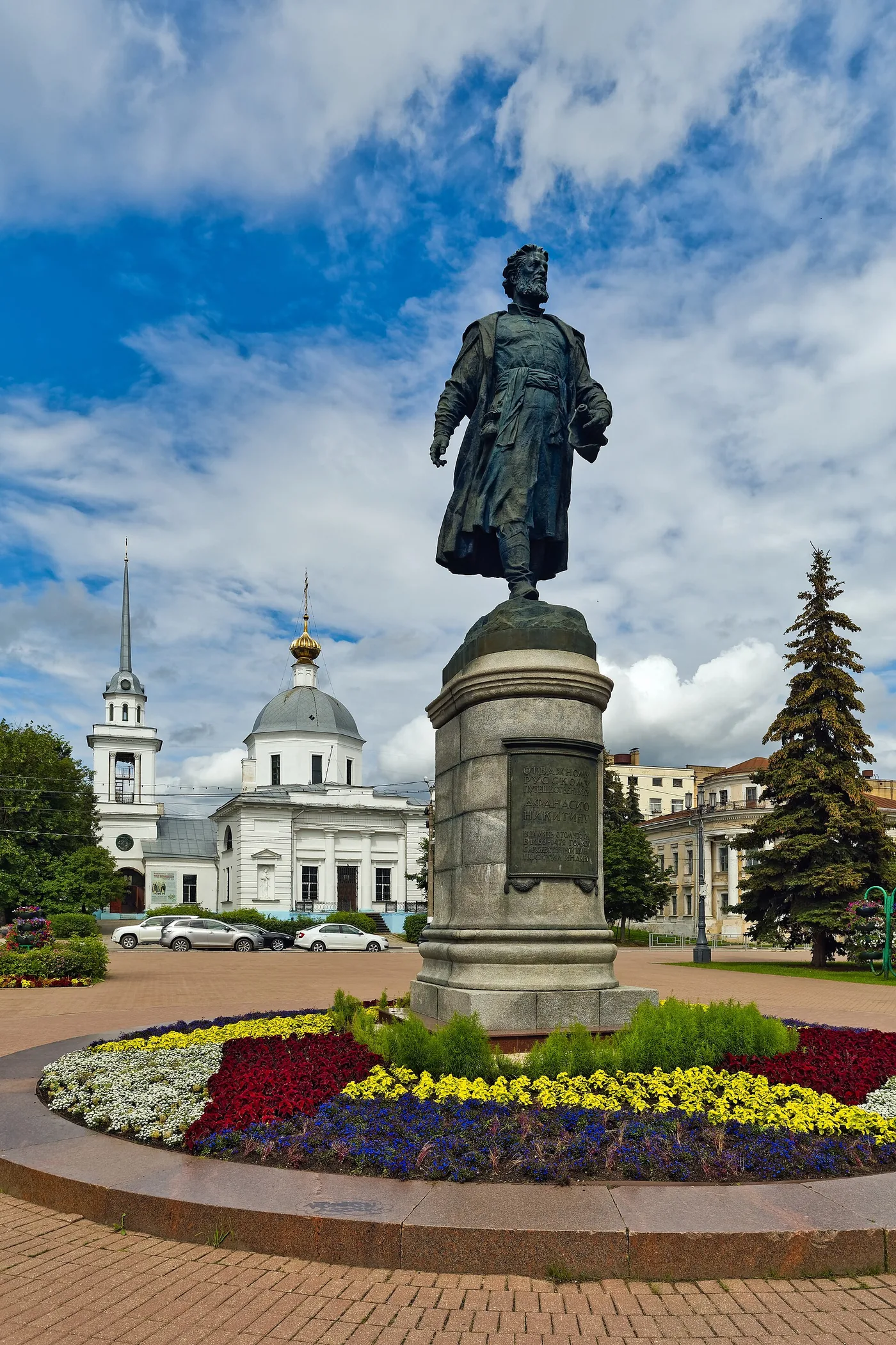
Afanasy Nikitin's monument in Tver, on the Volga bank.
Nikitin on the Volga bank he left from: the Tver monument. Photograph: Alexxx1979, CC BY-SA 4.0, via Wikimedia Commons.

Next voyage: Bartolomeu Dias →

Epilogue

Bartolomeu Dias

1487–1488

Epilogue: the man who found the ocean door.

Time away: 16 months and 17 days On this map: 20,100 km

Sources: South African History Online, Portuguese Historical Museum

River Tagus, LisbonMina, Gold CoastWalvis BayLüderitzMossel BayAlgoa BayRio do InfanteCape of Good Hope

0 of 20,100 km · Halt 1 of 9

River Tagus, Lisbon — August 1487: three ships weigh anchor.

The halts, in brief (9)
  1. River Tagus, Lisbon — August 1487: three ships weigh anchor. 1487
  2. Mina, Gold Coast — Provisions at the Portuguese fortress. 1487
  3. Walvis Bay — 8 December: anchor in the desert bay. 1487
  4. Lüderitz — The storeship stays behind with nine men. 1487
  5. Mossel Bay — February 1488: they rounded Africa unseen. 1488
  6. Algoa Bay — Ever further east. 1488
  7. Rio do Infante — The journey’s furthest point east. 1488
  8. Cape of Good Hope — 6 June 1488: the São Filipe padrão. 1488
  9. River Tagus, Lisbon — December 1488: 350 leagues of unknown coast. 1488

Lisbon, August 1487. Three ships under Bartolomeu Dias leave the Tagus on King João II's money with a simple mission: the end of Africa. They provision at Mina, leave the storeship at Lüderitz with nine men, and sail into the unknown.

Driven south by storms, the ships round the cape without seeing it: only at Mossel Bay, in February 1488, does the crew grasp that Africa lies behind. They press on to Rio do Infante — the furthest east — and turn for home.

On the way back they sight the cape and raise the São Filipe pillar on 6 June 1488. In December they enter the Tagus, after 16 months and 17 days, with 350 leagues of unknown coast on the charts. The original log would perish in the fire after the 1755 earthquake; we know the route from chronicles, maps, and the stone padrões.

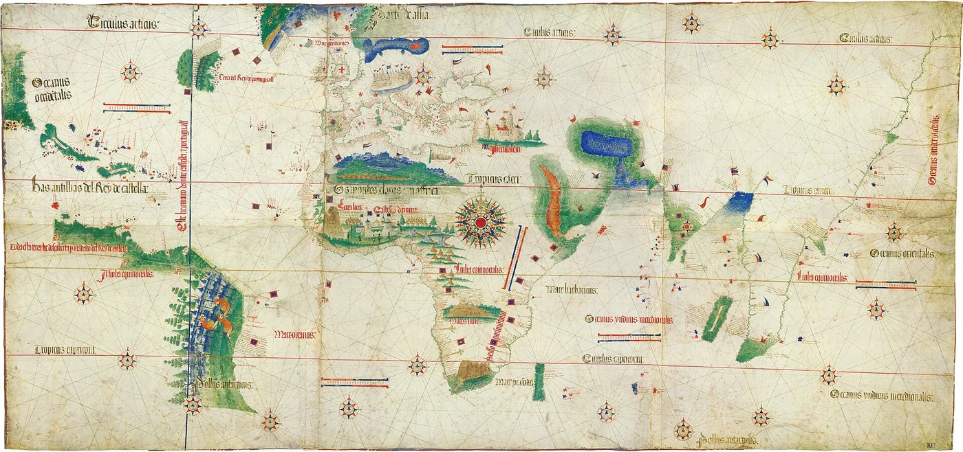
The Cantino planisphere, the 1502 Portuguese map showing the world after Dias.
The Cantino planisphere (1502): the world after Dias, with the road to India drawn. Public domain, via Wikimedia Commons.

Here the Middle Ages of maps end and the ocean age begins: ten years later, Vasco da Gama reaches India by the road Dias opened.

Next voyage →

Time

488 years, at a glance

From the first North Atlantic crossing to the first rounding of Africa.

  1. Leifaround the year 1000
  2. Carpini1245–1247
  3. Rubruck1253–1255
  4. Polo1271–1295
  5. Odoric1318–1330
  6. Conti1419?–1444
  7. Nikitin1466–1472
  8. Dias1487–1488

Conti's and Nikitin's dates are debated; the bars show the chronologies used on this page.

Legend or record

What is tale, what is evidence

Four things worth knowing before you share.

Was Vinland just a legend?

Icelandic sagas from the 13th and 14th centuries tell Leif's voyage — and at L'Anse aux Meadows in Newfoundland stand eight Norse houses from the 11th century: the earliest European evidence in North America.

Did “Mandeville” really travel in Asia?

His celebrated book is largely assembled from borrowings — including Odoric, whom it copies at length. Odoric was there; of Mandeville we know for certain only that he copied.

When did Conti leave for the East?

Nobody knows exactly — the 1857 editor of the narrative says so plainly. Only the ending is certain: Venice, 1444, after 25 years away.

Did Dias's log survive?

No. The voyage's papers perished in the fire after the 1755 earthquake. The route is reconstructed from 16th-century chronicles, old maps, and the padrão pillars raised on the coast.

Your logbook

How many seals will you collect?

Replay a voyage to its end and its seal sticks here, in your log. Seven seals mean the complete atlas.

0 of 7 seals

  1. Leif Erikson — unstamped
  2. John of Plano Carpini — unstamped
  3. William of Rubruck — unstamped
  4. Marco Polo — unstamped
  5. Odoric of Pordenone — unstamped
  6. Niccolò de' Conti — unstamped
  7. Afanasy Nikitin — unstamped

No seals yet. The first voyage is one click away. Start with Leif →

Pass it on

Method and sources

How the map is made

Dates and halts come from contemporary accounts and their scholarly editions: Britannica for Polo and Leif, UNESCO for L'Anse aux Meadows, the Rockhill translation (1900) for Carpini, the 1913 Catholic Encyclopedia for Rubruck and Odoric, the Major edition (1857) for Conti, the Raduga translation and Maxwell's study (2006) for Nikitin, South African History Online for Dias. Each chapter names its sources.

Distances are measured here, along the lines drawn between each route's halts — which is why the page says “on this map”, not “in reality”. Coastlines are simplified from Natural Earth, and legs between halts are schematic: they show direction, not the exact track. Intermediate years follow the sources' probable chronology; where it is missing, the halt appears without a year.

Two datings are debated among scholars and appear as such: Conti's departure year is unknown, and Nikitin's journey is dated now 1466–1472, now 1468–1475. The page computes on 1466–1472 and notes the alternative in his chapter.

The sources, in brief

  1. Britannica — Marco Polo
  2. Britannica — Leif Erikson
  3. UNESCO — L'Anse aux Meadows
  4. Rockhill (1900) — Carpini, via Silk Road Seattle
  5. Catholic Encyclopedia (1913) — Rubruck
  6. Catholic Encyclopedia (1913) — Odoric
  7. Major (1857) — Conti, via Internet Archive
  8. Yule-Cordier — Polo, via Gutenberg
  9. Maxwell (2006) — Nikitin, via Medievalists.net
  10. Raduga (1985) — Nikitin, via Internet Archive
  11. South African History Online — Dias
  12. Portuguese Historical Museum — Gama, 1498
  13. Güyük's letter to Innocent IV

The images

Old miniatures and maps are public-domain files from Wikimedia Commons; two contemporary photographs (the Nikitin monument, the Fra Mauro map) are used with attribution under their licences. Each image carries its credit in the caption.

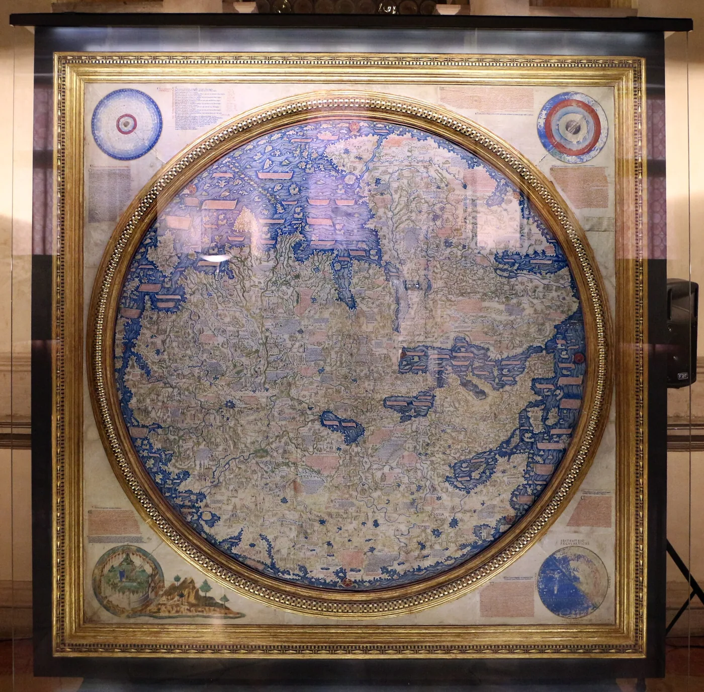
Detail from Fra Mauro's world map, about 1450.
The world as Europe knew it around 1450: Fra Mauro's map, Venice. Photograph: Sailko, CC BY 3.0, via Wikimedia Commons.

Ibn Battuta and Zheng He are missing on purpose: they were not Europeans, and the page keeps its title's promise.