The Milcov line: the border that cut Focșani in two
From the Carpathian crest to the Siret's mouth, 159.0 km of border divided Moldavia from Wallachia. Through Focșani it ran down the middle of town, along a canal. The line here is read off the Austrian map of 1855 and 1856, point by point: look up your town and see which side it fell on.
The line measures 159.0 km, in 72 points read off the map.
The maths runs locally, in your browser, over the line's 72 points.
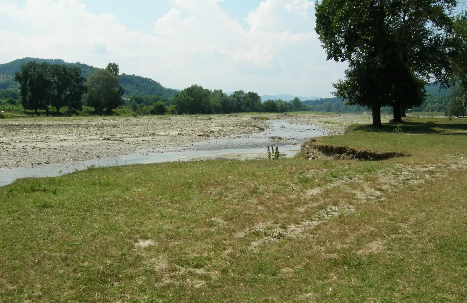
The Milcov at low water: a thread of water in a wide gravel bed. Photo: Constantzeanu, public domain, via Wikimedia Commons.
Send it on
A water border, from the mountains to the Siret
For nearly four hundred years the Milcov was the Moldavia–Wallachia border. After Stephen the Great's victory over Radu the Handsome, Moldavia's frontier stretched to the Milcov: valley, then a canal drawn from the river, then the Siret down to the Danube.
The line is read point by point from the Austrian survey of Wallachia of 1855–1856. Its 72 points follow the mapped edge, rivers, and red frontier band. Each records its map frame, pixel, and feature: edge, river, band, canal, or town plan. The printed error budget is ±1.0 km in the lowlands and ±1.5 km in the mountains.
From the Transylvanian spur to the Siret's mouth the line measures 159.0 km. It climbs the Milcov from its springs to Focșani, takes the canal at Pățești, crosses the town's northern rim, descends past Mândrești and Răstoaca, holds the water past Hângulești, Râmniceni, and Bolboaca, then the Siret to the Danube, north-east of Brăila.
Today's river courses differ from those shown in 1856. The Milcov shifted course and left Focșani to its north as early as the eighteenth century; today its lower loop runs south of the line, and the modern Putna cuts the old border.
The calculation returns a verdict for 71 lookup records across 68 distinct places: 10 on the line, 6 borderline, 30 clear, 22 out of reach, and three documented by attribution. Răstoaca remains the separate case: the commune is listed in Putna, while the village lies south of the water.
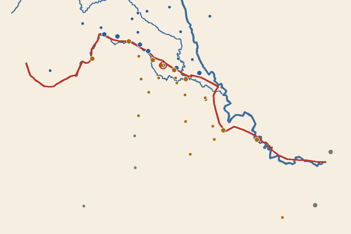
The red 1856 line, today's rivers (Milcov, Putna, Siret), and the verdict towns: blue Moldavia, ochre Wallachia.
Focșani: one town, two countries
A brook ran through the middle of Focșani, wrote Paul of Aleppo around 1650: it was Moldavia's last point, and across the water Wallachia began. He had spent 31 days there and seen the border himself. In 1687 del Monte found half the town subject to Wallachia and half to Moldavia.
The dividing canal was drawn from the Milcov, said Fotino of Wallachian Focșani: a Milcov channel making the Moldavia–Wallachia border. From Pățești down it was Stephen's own ditch, parted — says Ureche — from the great Milcov, past Odobești into the Putna water.
So Focșani remained divided until 1859, when the Milcov ceased to mark the border between the two principalities. The old division still appeared in the names of two market squares: Moldova and Munteni. Lahovari’s dictionary records these names in 1900.
The Convention of Paris seated the Central Commission of the Principalities at Focșani — “the Central Commission shall have its seat at Focșani” — and it worked there from 10 May 1859 to 12 February 1862, when the institutional union was completed. It drafted a town-authorities merger; whether enacted, the opened records do not say.
So the division's end has two dates, and the page keeps both: 1859, when the border ceased as a border, and 1862, when the joint institutions finished at Focșani. The act merging the town's two administrations was not found; whoever opens it is asked to bring it in.
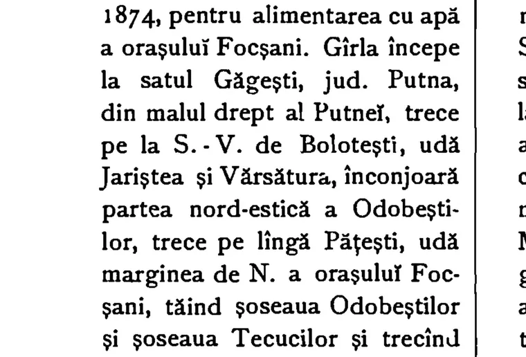
The Cacaina canal in 1899: from Găgești past Pățești, along Focșani's northern rim, into Mândrești lake. Lahovari, vol. 2, pp. 241–242.
Town: —
Tap a dot on the map: it tells its verdict.
The line from the record
“To the S., R.-Sărat county, from which it is divided by the Milcov river, from its source to Focșani, and from there by the canal drawn from the Milcov by Stephen the Great, as the demarcation line between Muntenia and Moldova.”
Lahovari, Marele dicționar geografic, vol. 5: Putna county (translated).
The line from the record
“Șindrilari-de-Jos, hamlet, in Putna county, … settled on the Milcov's course, from Odobești toward Monteoru.”
Lahovari, vol. 5: Șindrilari-de-Jos (translated). Computed verdict: on the line, 0.45 km.
The line from the record
“They parted from the great Milcov a branch stream, which comes past Odobești and passes to fall into the Putna water, and that to this day is the border…”
Ureche, Letopiseț, via Lahovari, vol. 2: Cacaina (translated).
The line from the record
“It passes Pățești, waters the N. rim of Focșani, cutting the Odobești road and the Tecuci road and passing the Ocol and the Chasseurs' barracks.”
Lahovari, vol. 2: Cacaina, pp. 241–242 (scan verified; translated).
The line from the record
“Hîngulești, rural commune, in R.-Sărat county, … at the county's border toward Putna district, on the Leica stream.”
“So divided Focșani stayed until 1859, when the Milcov ceased to form the border between the 2 sister lands.”
Lahovari, vol. 3: Focșani (translated).
The line from the record
“15000 hectares or 160 square km” — the county basin, its arithmetic broken inside the source itself.
Lahovari, vol. 4: the Milcov (Râmnicu-Sărat portion only; 15,000 ha make 150, not 160).
The line from the record
“Even today the trace of the town's old division has not been wholly erased.”
Lahovari, vol. 3: Focșani (1900).
What the figure shows
Static map of the 1856 line with today's rivers and the verdict towns; their list below.
Focșani — Focșani was two towns: Moldavian Focșani north of the canal and Wallachian Focșani south of it, divided until 1859.
Mândrești — Mândrești is on the line: 0.48 km from the 1856 border, on the canal (±1.0 km).
Odobești — Odobești is on the line: 0.75 km from the 1856 border, on the Milcov (±1.0 km).
Pățești — Pățești is on the line: 0.00 km from the 1856 border, on the canal (±1.0 km).
Răstoaca — Răstoaca is too close to call: 1.29 km from the line, in the 2 km band (±1.0 km error).
Hângulești — Hângulești was in Wallachia, 3.16 km south of the line (±1.0 km).
Râmniceni — Râmniceni was in Wallachia, 2.74 km south of the line (±1.0 km).
Bolboaca — Bolboaca is on the line: 0.43 km from the 1856 border, on the lower water (±1.0 km).
Mera — Mera is too close to call: 1.34 km from the line, in the 2 km band (±1.5 km error).
Șindrilari — Șindrilari is on the line: 0.45 km from the 1856 border, on the Milcov (±1.5 km).
Broșteni — Broșteni is on the line: 0.01 km from the 1856 border, on the Milcov (±1.5 km).
Andreiașu de Jos — Andreiașu de Jos is on the line: 0.34 km from the 1856 border, on the Milcov (±1.5 km).
Every distance is recomputed in the browser from the same points.
The line, stop by stop
Each stop draws one stretch of border beside the record line that names it.
The line
159.0 km of border
From the mountain spur to the Danube, the border divided two counties that were two countries: Putna to the north and east, Râmnicu-Sărat to the south and west. Putna county is divided from Râmnicu-Sărat by the Milcov river, from its source to Focșani, and from there by Stephen's canal — the county's southern border.
Down: the mountains.
Mountains
The rim, the springs, and the bend
The border enters on the survey's rim, passes the Milcov's springs, and holds the river north, then east, past Șindrilari and past Mera, 1.34 km north of the water, in Moldavia. Reghiu stands 2.23 km off the bend; Broșteni on the river itself. In the mountains the error is larger, ±1.5 km, printed alongside every verdict.
Down: the valley.
Valley
The river loops past Andreiașu
Before the eastward bend the Milcov loops past Andreiașu — a Râmnicu-Sărat village by the records, on the border water itself, 0.34 km from the line. Lower down, Ureche tells the parting: from the great Milcov a branch was parted, past Odobești into the Putna. Odobești, a Putna town, stands 0.75 km off the branch, on Moldavia's side.
Down: the town.
Town
The canal cuts Focșani on the north
From Pățești down runs the old canal: past Pățești — on the line, 0.00 km — watering the town's northern rim, cutting the Odobești and Tecuci roads, past the Ocol and the Chasseurs' barracks, out of Focșani into Mândrești lake. Proof the line sits well: it cuts Mândrești on its quarter names — Mândrești-Moldova 0.48 km toward Moldavia, Mândrești-Munteni 0.48 km toward Muntenia.
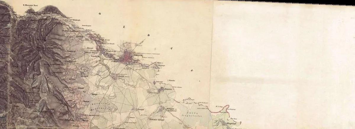
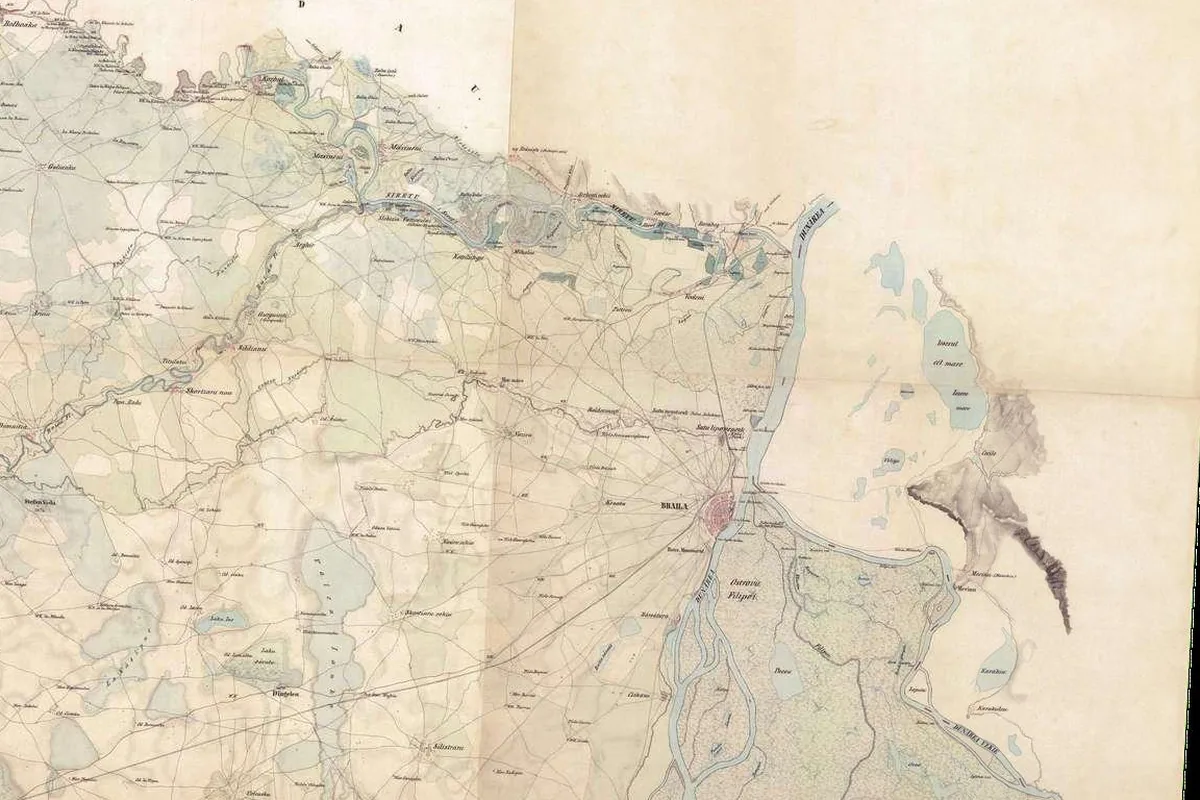
Focșani's northern rim: the canal leaves town toward Mândrești. Fligely 1855–1856, via Arcanum.
Down: the lower water.
Lower water
The canal villages, on the Râmnic bank
From Răstoaca toward the Siret the border water holds the dictionary's string of villages: Gologanu, Hângulești, Malurile, Râmniceni, Bolboaca, all on Muntenia's side. Răstoaca comes out a paradox: a Putna commune on the Milcov's left bank — but its houses, 1856's and today's, stand south of it, 1.29 km from the line.
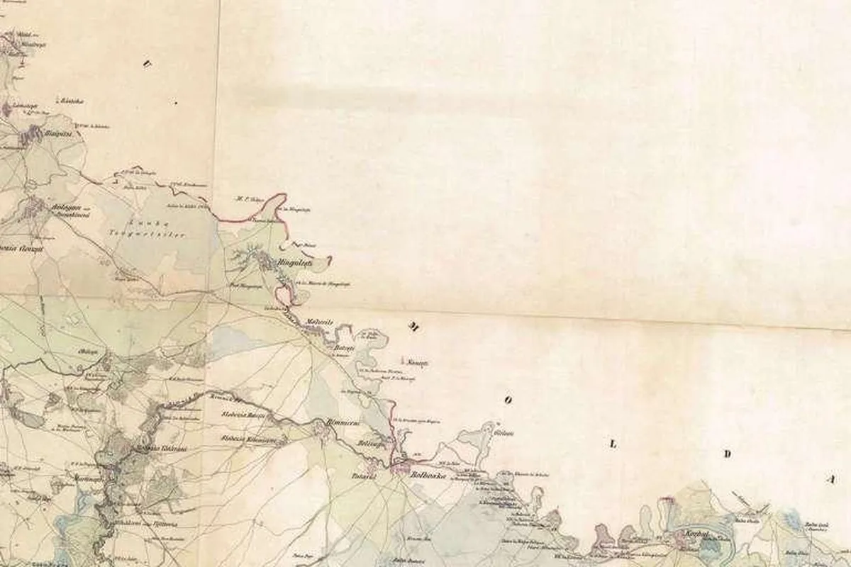
Hângulești village (then Țuguiați) and the border's red band, east of the village. Fligely 1855–1856.
Down: the Siret.
Siret
The canal falls into the Siret at Blehani
The lower water meets the Siret at Blehani — the dictionary lists two places of that name: one in Putna, on the Siret east of Nămoloasa, one a Corbu hamlet in Râmnicu-Sărat's eastern part. A Nominatim search returns neither under the dictionary name; the map shows the junction, not a village position. From there the border follows the Siret south to its Danube mouth north-east of Brăila, the traced end.
The Siret falls into the Danube north-east of Brăila: the traced line's southern end. Fligely 1855–1856.
Down: the water leaves.
The water leaves
The river left; the line stayed
Past Vârteșcoiu it changed course — its lower loop runs south of the line. At Golești the mean discharge is 1.16 m³/s (1952–1967); mineralization, 2,860 mg/l when low — a whole-river value, no station or period given. On length, the sources do not agree: Ujvari gives 73.5 km and 458 km²; the water cadastre at second hand, 79 km and 444 km²; OpenStreetMap, 79.4 km.
Down: your town.
Your town
Look it up and see which side you fell on
Type your town in the field under the title: the maths finds the nearest point of the 1856 line and tells the side, the distance, and the band — on the line under 1 km, borderline under 2 km, out of reach past 25 km or past the ends. Every verdict carries its error: ±1.0 km lowland, ±1.5 km mountain. And Focșani gets no single side computed: it gets both, told.
Down: the method.
Method
How the line was drawn, error and all
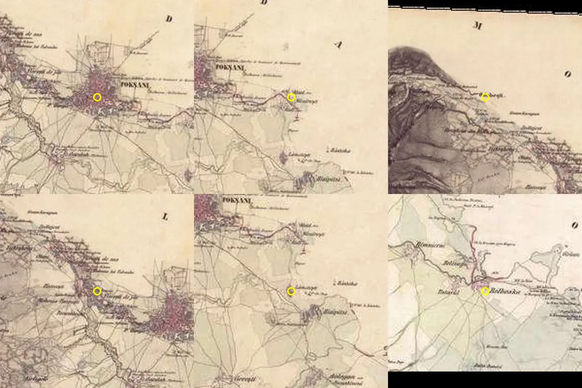
72 documented points on the Austrian map. Thirteen control villages: mean offset 0.4 km; budget ±1.0 km plain, ±1.5 km mountains. Checks: Mândrești by name, canal villages by bank, the Milcov mouth lands 11 metres off its Wikipedia coordinate (EN; coordinate check only), the line end 16 m from the OSM Siret mouth. The dictionary confirms 12 localities; Răstoaca is documented. Differences 1473 against 1475, 1859/1862 and 1874/Sturdza remain open.
Thirteen villages overlay their 1856 symbols on today's centres with a mean offset of 0.4 km.
Down: today.
Today
What is left of the border
The Milcov stopped marking the border in 1859. The Central Commission worked in Focșani until February 1862. Lahovari's 1900 entry records the Moldova and Munteni squares; the Mândrești-Moldova and Mândrești-Munteni quarter names still mark both sides of the old line.
Down: today, in short.
Today, in short
Two things still visible today.
The quarter names
Mândrești-Moldova and Mândrești-Munteni preserve the names of the town's two former sides; both lie less than half a kilometre from the 1856 line.
Your town's verdict
Look up a town, read its distance and error band, and include the warning if you share a borderline result.
End
The river changed course; the 1856 line remains on the survey and in the Mândrești-Moldova and Mândrești-Munteni quarter names.
Sources and method
How the work was done
The line: 72 points documented from the 1855–1856 Austrian survey (z11, 53.5 m/px), each with its frame, pixel and noted feature; length 159.0 km.
Error: 13 control villages, mean offset 0.4 km; printed budget ±1.0 km lowland, ±1.5 km mountain; bands: on the line <1 km, borderline <2 km, out of reach >25 km. Three villages fall on blank paper (Suraia, Vânători, Reghiu); Răstoaca and Golești land 1.5 km off (commune centroid vs village symbol).
Verdicts: 71 lookup records for 68 distinct places — three villages appear under two spellings (Mândrești, Șindrilari, Vârteșcoiu); Focșani a documented SPLIT; Galați/Brăila by county attribution.
Checks: Mândrești by name; canal villages on the right side; the Milcov mouth 11 m from the EN Wikipedia coordinate, used only as a coordinate reference; the line end 16 m from the OSM Siret mouth; 12 localities match the dictionary; Răstoaca documented.
Historical and river-measure differences are shown with their sources: 1473/1475, 1859/1862, the hrisov's printed 1874, two length–basin pairs and the OSM geometry length.
English renderings are translations (marked as such); omissions are marked with ….
Maps and measures
The Francisco-Josephinian survey of Wallachia, 1855–1856, via Arcanum (z11; 84 valid tiles).
EN Wikipedia, Milcov (Siret): the mouth's coordinate 45.6626N 27.3052E (opened 2026-10-12; coordinate check only).
Nominatim / OpenStreetMap: geocoding for the 71 lookup records.
Books and articles (opened)
Lahovari et al., Marele dicționar geografic al României, vols. 1–5 (1898–1902), via archive.org: the Cacaina, Focșani, Milcovul, Putna, Hângulești, Râmniceni, Răstoaca, Suraia, Biliești, Nereju, Mera, Șindrilari, Odobești, Vânători, Gologanu, Lămotești, Blehani, and Bolboaca entries.
Ujvari, Geografia apelor României (1972): Milcov S = 458 km², L = 73.5 km; Golești discharge 1.16 m³/s (1952–1967); mineralization 2,860 mg/l when low, no station; Canalul Sturza.
Kogalniceanu, Cronicele României, vol. 1: Ureche's text (confirmed present).
“Comisia Centrală de la Focșani” (Cuza University): art. 27, 10 May 1859 – 12 February 1862, the town-authorities unification draft.
What was not opened (and is not used)
The 1992 water cadastre (the 79 km / 444 km² pair is quoted second-hand, unopened here).
ANAR / rowater.ro: the server does not answer (2026-10-11). The act merging the two Focșanis: not found.
The Central Commission's protocols: cited, unopened. Gallica/LoC: blocked.
Rights
The 1855–1856 map: public domain (Austrian survey); tiles via Arcanum, with thanks.
Lahovari, Kogalniceanu: public domain. Ujvari 1972: short data quotations, sourced.