mariuscomper.uk Română

An atlas of World Heritage

Romania has 11 UNESCO sites. The map shows 323 places.

Everyone knows Sighișoara and the painted monasteries. Few know that 86% of Romania's UNESCO points belong to a single site, the Roman frontier, that the beech forests are 12 parcels of a site shared by 18 countries, or that one site entered the list already 'in danger'. All 323 places, with year, criteria, coordinates and area, from one source: the UNESCO dossiers.

AlbaAradArgesBacauBihorBistrita-NasaudBotosaniBrailaBrasovBuzauCalarasiCaras-SeverinClujConstantaCovasnaDambovitaDoljGalatiGiurgiuGorjHarghitaHunedoaraIalomitaIasiIlfovMaramuresMehedintiBucurestiMuresNeamtOltPrahovaSalajSatu MareSibiuSuceavaTeleormanTimisTulceaValceaVasluiVranceaDanube DeltaPainted churches of MoldaviaHorezu MonasterySaxon fortified churchesDacian fortressesSighișoaraWooden churches of MaramureșBeech forestsRoșia MontanăBrâncuși EnsembleDacian Limes

culturalnaturalin danger

Positions are the coordinates in each site's UNESCO tables, with two documented corrections described in the method. Scroll to zoom, drag to pan; pinch on a phone. The + − 0 keys do the same.

How many UNESCO World Heritage Sites does Romania have?

11: 9 cultural and 2 natural, inscribed between 1991 and 2024. The number people search for hides a more interesting one: together the 11 sites have 323 components with their own coordinates in the UNESCO dossiers, spread across 20 counties. A site can be a single place, like Sighișoara, or 277 places, like the Dacian Limes.

11sites
9cultural sites
2natural sites
323places with coordinates
20counties
1site in danger

The last two sites joined in July 2024, at the New Delhi session: the Brâncuși Ensemble and Frontiers of the Roman Empire – Dacia. Romania had no new inscriptions at the 2025 and 2026 sessions. One site, Roșia Montană, is on the List of World Heritage in Danger.

Romania's 11 UNESCO sites, one profile each

In order of inscription. Each profile gives the year, the criteria met, the area and buffer zone declared by UNESCO, the counties and the list of components, with a link to the official dossier.

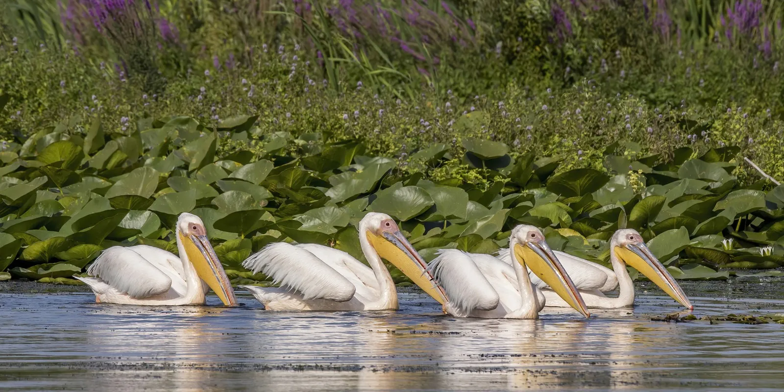
Danube Delta
natural
Photo: Charles J. Sharp, CC BY-SA 4.0, Wikimedia Commons

Danube Delta

river delta, biosphere reserve · Dobruja

The largest and best-preserved delta in Europe: 312,440 hectares of channels, lakes and reed beds, more than 300 bird species and 45 freshwater fish species.

The delta was Romania's first site on the UNESCO list, only a year after the country ratified the Convention in 1990. It is also the only Romanian site inscribed for natural beauty (criterion vii) and biodiversity (criterion x). The same area is a UNESCO biosphere reserve too, a separate programme with its own list, which is why the delta shows up twice in searches.

One point on the map, but more than a hundred times the area of the other ten sites put together.

(vii) a natural phenomenon of exceptional beauty(x) a habitat essential for biodiversity, including threatened species
Inscribed1991
Components1
Area312,440 ha
Buffer zone
CountyTulcea
Coordinates45.0833° N, 29.5000° E
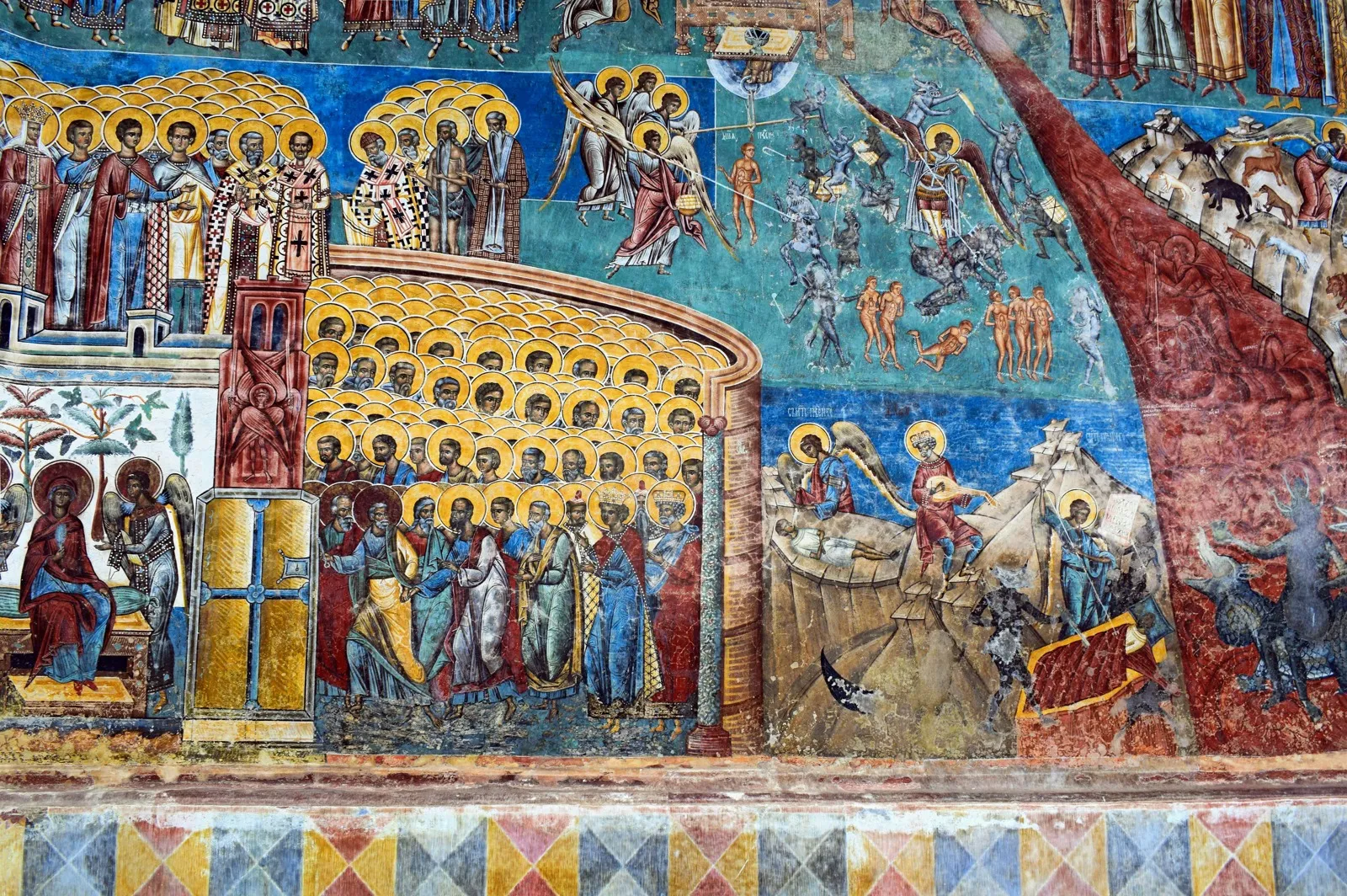
Churches of Moldavia
cultural
Photo: Jocelyn Erskine-Kellie, CC BY-SA 4.0, Wikimedia Commons

Churches of Moldavia

eight churches with exterior murals, 15th–16th centuries · Bukovina

Eight churches in northern Moldavia, built between the late 15th and the late 16th century, with every façade covered in fresco. UNESCO calls them unique in Europe.

They are the 'Bukovina monasteries' of the guidebooks, but the UNESCO list does not count them all: Putna, for instance, is not on it, because it has no surviving exterior painting. The seven inscribed in 1993 are Arbore, Humor, Moldovița, Pătrăuți, Probota, St George in Suceava and Voroneț. Sucevița, the most complete of all, joined only in 2010, seventeen years after the rest, through an extension of the site.

Sucevița waited 17 years to get on the list.

(i) a masterpiece of human creative genius(iv) an outstanding example of a type of building or ensemble from a stage in history
Inscribed1993 (extended 2010)
Components8
Area18.49 ha (sum of components)
Buffer zone
CountySuceava
All components (8)
  1. Arbore — Church of the Beheading of St John the Baptist · Suceava · 2.54 ha
  2. Humor — Church of the Assumption of the Virgin · Suceava · 4.27 ha
  3. Moldovița — Church of the Annunciation · Suceava · 4.00 ha
  4. Pătrăuți — Church of the Holy Cross · Suceava · 0.67 ha
  5. Probota — Church of St Nicholas · Suceava · 1.00 ha
  6. Suceava — Church of St George (St John the New Monastery) · Suceava · 1.34 ha
  7. Voroneț — Church of St George · Suceava · 3.27 ha
  8. Sucevița — Church of the Resurrection · Suceava · 1.40 ha
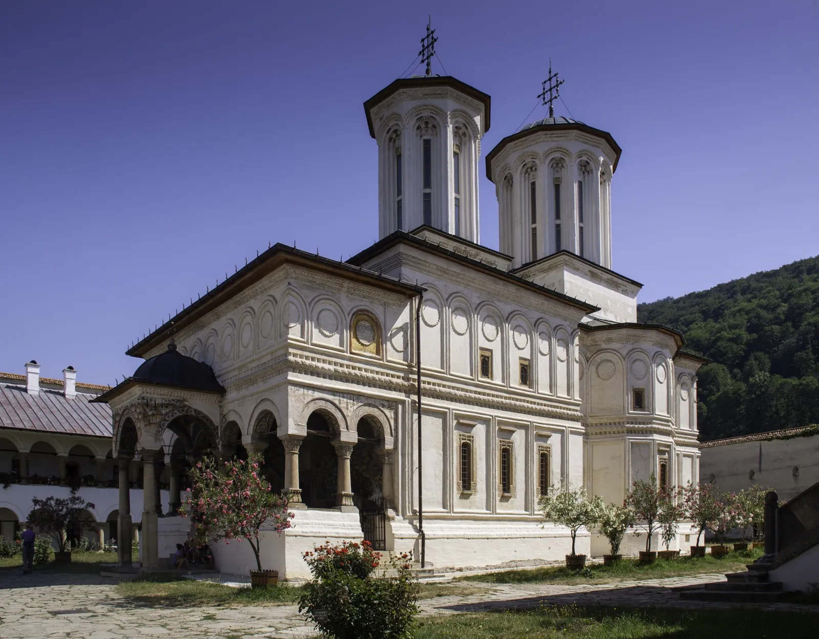
Monastery of Horezu
cultural
Photo: Alexandru Baboș, CC BY-SA 3.0 ro, Wikimedia Commons

Monastery of Horezu

Brâncovenesc monastic ensemble, 1690 · Oltenia

Constantin Brâncoveanu's foundation of 1690, which UNESCO calls the masterpiece of the Brâncovenesc style: architectural balance, rich stone and wood carving, votive portraits and a school of painting famous across the Balkans.

Horezu is the only Romanian site inscribed solely on the second criterion, interchange of values. UNESCO rewards the synthesis of Byzantine tradition, late Renaissance architecture and Oriental decoration that Brâncoveanu spread across Wallachia. The official name uses the form 'Horezu'; the monastery calls itself 'Hurezi'.

The only Romanian site inscribed solely for 'interchange of values'.

(ii) an interchange of human values, visible in architecture or art
Inscribed1993
Components1
Area22.48 ha
Buffer zone57.29 ha
CountyVâlcea
Coordinates45.1697° N, 24.0072° E
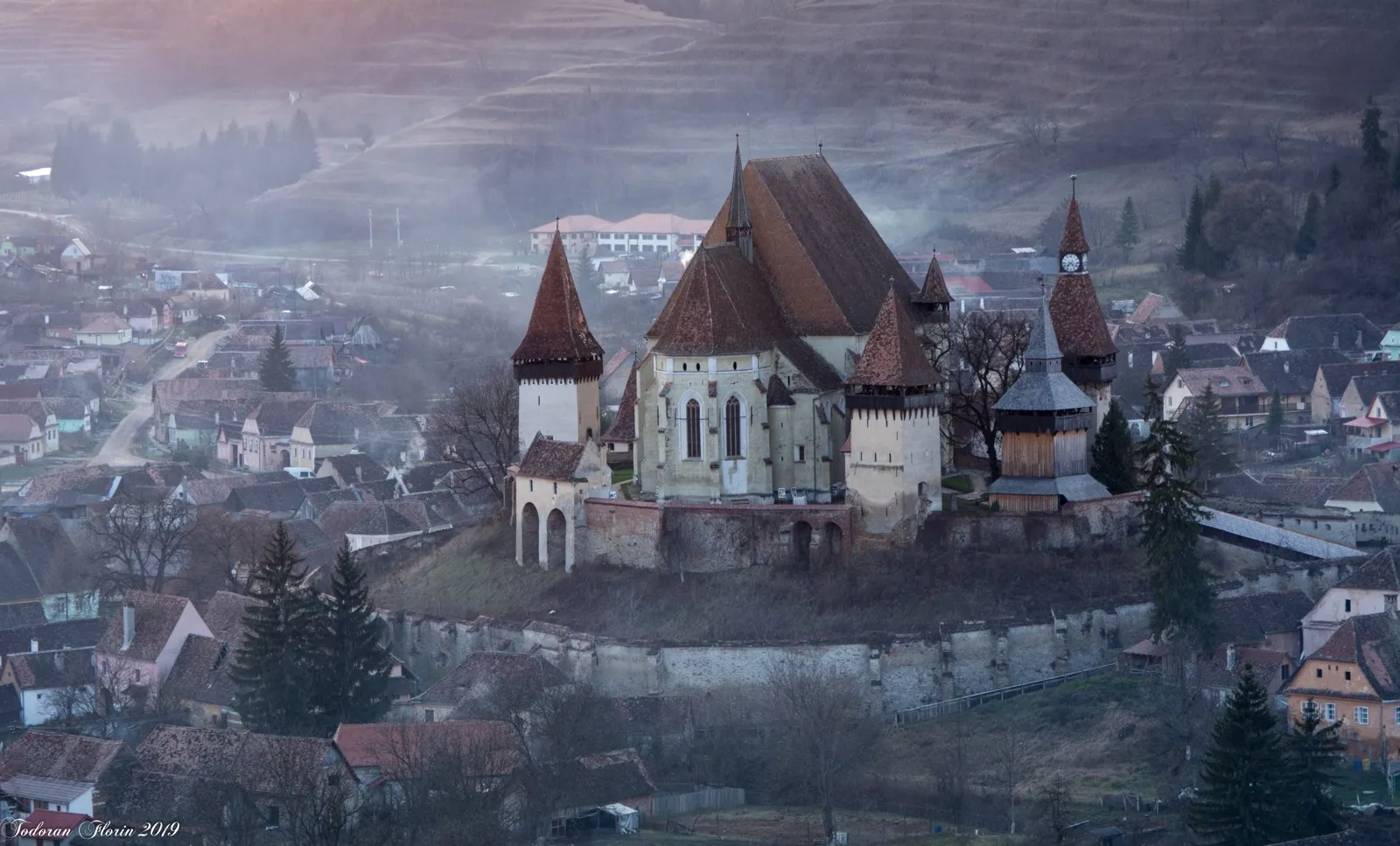
Villages with Fortified Churches in Transylvania
cultural
Photo: Florio1974, CC BY-SA 4.0, Wikimedia Commons

Villages with Fortified Churches in Transylvania

seven villages with fortified churches, 13th–16th centuries · Transylvania

Seven villages founded by the Transylvanian Saxons, dominated by their fortified churches and preserving a pattern of farmstead and land use kept since the late Middle Ages.

In 1993 a single village was inscribed, Biertan. The 1999 extension added six more: Prejmer, Viscri, Dârjiu, Saschiz, Câlnic and Valea Viilor. They are seven out of roughly 150 fortified churches surviving in southern Transylvania, chosen as a sample. Dârjiu is the exception: a Székely village with a Unitarian church, not a Saxon one.

Seven chosen out of roughly 150; one of them is not Saxon.

(iv) an outstanding example of a type of building or ensemble from a stage in history
Inscribed1993 (extended 1999)
Components7
Area553 ha
Buffer zone3,728 ha
CountyAlba, Brașov, Harghita, Mureș, Sibiu
All components (7)
  1. Biertan · Sibiu · 84.57 ha
  2. Prejmer · Brașov · 201 ha
  3. Viscri · Brașov · 48.40 ha
  4. Dârjiu · Harghita · 2.94 ha
  5. Saschiz · Mureș · 127 ha
  6. Câlnic · Alba · 33.79 ha
  7. Valea Viilor · Sibiu · 55.16 ha
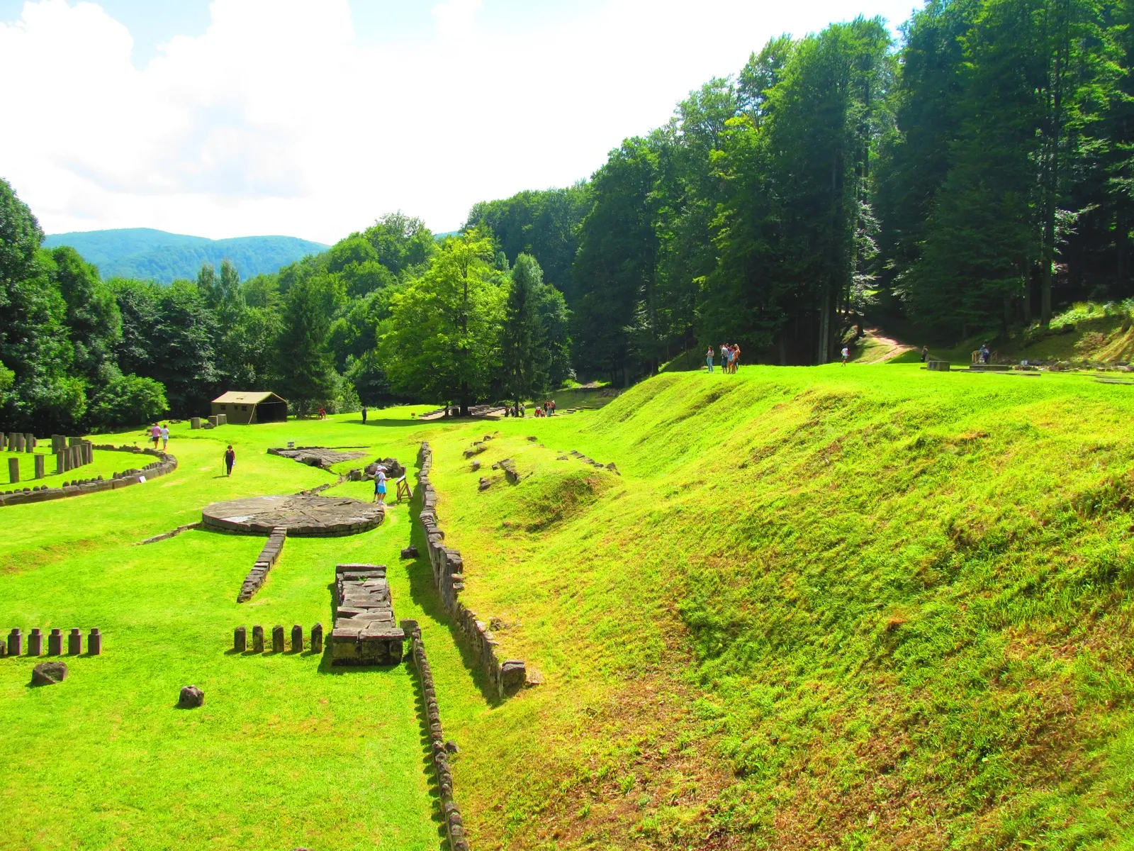
Dacian Fortresses of the Orăștie Mountains
cultural
Photo: LilianaWW, CC BY-SA 3.0 ro, Wikimedia Commons

Dacian Fortresses of the Orăștie Mountains

six fortresses, 1st century BC – 1st century AD · Transylvania

The core of the Dacian Kingdom: six fortresses built in the 1st centuries BC and AD, fusing military techniques from the classical world with late Iron Age sacred architecture, conquered by Rome at the start of the 2nd century.

Sarmizegetusa Regia is the famous one, but the site has six components: Costești-Cetățuie, Costești-Blidaru, Luncani-Piatra Roșie, Bănița and Căpâlna are scattered over 40 kilometres of mountain. Together with the Limes and Roșia Montană, it is one of three Romanian sites inscribed on three cultural criteria, all remains of the same war of 101–106.

Six fortresses, but almost everyone knows just one.

(ii) an interchange of human values, visible in architecture or art(iii) a unique testimony to a cultural tradition or civilisation(iv) an outstanding example of a type of building or ensemble from a stage in history
Inscribed1999
Components6
Area19.53 ha (sum of 3 of 6 components)
Buffer zone
CountyAlba, Hunedoara
All components (6)
  1. Sarmizegetusa Regia · Hunedoara · 17.83 ha
  2. Costești-Cetățuie · Hunedoara
  3. Costești-Blidaru · Hunedoara · 0.50 ha
  4. Luncani-Piatra Roșie · Hunedoara · 1.20 ha
  5. Bănița · Hunedoara
  6. Căpâlna · Alba
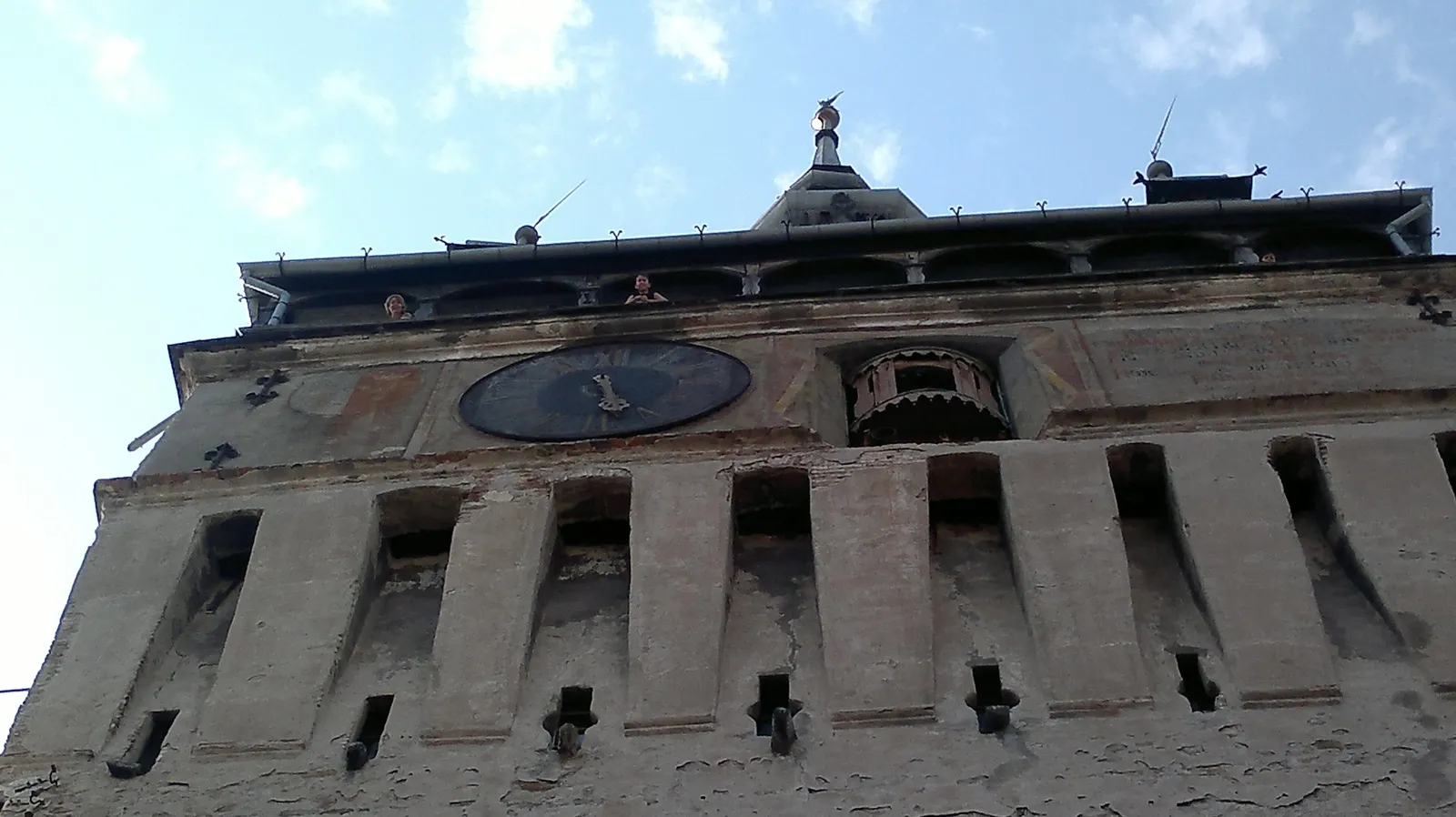
Historic Centre of Sighișoara
cultural
Photo: Albertdoris, CC BY-SA 4.0, Wikimedia Commons

Historic Centre of Sighișoara

inhabited fortified medieval town · Transylvania

A small fortified medieval town founded by Saxon craftsmen and merchants, which held a strategic and commercial role on the edge of Central Europe for centuries. The citadel is still inhabited.

UNESCO also inscribed Sighișoara on criterion (v), for traditional settlements that have become vulnerable: in the justification text, the culture of the Transylvanian Saxons 'is coming to a close after 850 years' and will survive only through its monuments. The site covers 33 hectares, the citadel on its hill.

Inscribed partly because the people who built it are disappearing.

(iii) a unique testimony to a cultural tradition or civilisation(v) an outstanding example of a traditional settlement that has become vulnerable
Inscribed1999
Components1
Area33.00 ha
Buffer zone145 ha
CountyMureș
Coordinates46.2178° N, 24.7922° E
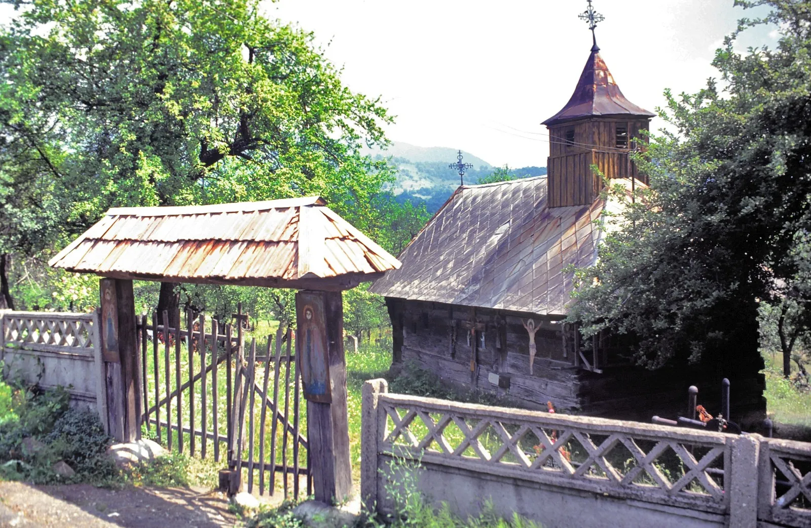
Wooden Churches of Maramureș
cultural
Photo: Alexandru Baboș, CC BY 2.5, Wikimedia Commons

Wooden Churches of Maramureș

eight wooden churches, 17th–18th centuries · Maramureș

Eight tall, narrow timber churches with slender western towers and shingle roofs, chosen as examples of the architectural solutions of different periods and areas of Maramureș.

Maramureș has more than a hundred wooden churches; eight are on the UNESCO list: Bârsana, Budești-Josani, Desești, Ieud-Deal, Plopiș, Poienile Izei, Rogoz and Șurdești. Rogoz is in the Lăpuș country, not historic Maramureș. The tower at Șurdești rises above 50 metres.

Eight out of more than a hundred; one is not in historic Maramureș.

(iv) an outstanding example of a type of building or ensemble from a stage in history
Inscribed1999
Components8
Area8.94 ha (sum of components)
Buffer zone
CountyMaramureș
All components (8)
  1. Bârsana — Church of the Presentation of the Virgin · Maramureș · 2.80 ha
  2. Budești-Josani — Church of St Nicholas · Maramureș · 0.60 ha
  3. Desești — Church of St Paraskeva · Maramureș · 1.23 ha
  4. Ieud-Deal — Church of the Nativity of the Virgin · Maramureș · 0.73 ha
  5. Plopiș — Church of the Holy Archangels · Maramureș · 0.29 ha
  6. Poienile Izei — Church of St Paraskeva · Maramureș · 0.98 ha
  7. Rogoz — Church of the Holy Archangels · Maramureș · 0.58 ha
  8. Șurdești — Church of the Holy Archangels · Maramureș · 1.73 ha
Ancient and Primeval Beech Forests of the Carpathians and Other Regions of Europe
natural
Photo: Cezar Suceveanu, CC BY 3.0, Wikimedia Commons

Ancient and Primeval Beech Forests of the Carpathians and Other Regions of Europe

twelve primeval forests, in a site spanning 18 countries · southern, western and northern Carpathians

A single UNESCO site spread across 18 countries and 93 parcels. Romania holds 12 of them, from Cheile Nerei and the Cerna valley to Slătioara and Țibleș: the largest primeval beech forests left in Europe.

The site began in 2007 with Slovakia and Ukraine, extended into Germany in 2011, and Romania joined in 2017 with 12 parcels of primeval forest in eight protected areas. The largest Romanian parcel, Domogled-Coronini-Bedina, covers 5,110 hectares. It is inscribed solely on criterion (ix), for an ecological process still under way: the beech recolonising the continent after the last ice age. The Romanian forests have been the subject of repeated UNESCO state-of-conservation reports, from 2018 to 2025, mainly over logging in their surroundings.

Twelve parcels, in a site shared with 17 other countries.

(ix) an outstanding example of ongoing ecological processes
Inscribed2017 (site since 2007; Romania since 2017)
Components12
Area23,983 ha (sum of components)
Buffer zone
CountyBrașov, Caraș-Severin, Gorj, Maramureș, Suceava, Vâlcea
All components (12)
  1. Cheile Nerei-Beușnița · Caraș-Severin · 4,292 ha
  2. Șinca old-growth forest · Brașov · 338 ha
  3. Slătioara old-growth forest · Suceava · 609 ha
  4. Cozia – Cozia Massif · Vâlcea · 2,286 ha
  5. Cozia – Lotrișor · Vâlcea · 1,103 ha
  6. Domogled – Cerna Valley – Domogled-Coronini-Bedina · Caraș-Severin · 5,111 ha
  7. Domogled – Cerna Valley – Iauna Craiovei · Caraș-Severin · 3,517 ha
  8. Domogled – Cerna Valley – Ciucevele Cernei · Gorj · 1,104 ha
  9. Groșii Țibleșului – Izvorul Șurii · Maramureș · 211 ha
  10. Groșii Țibleșului – Preluci · Maramureș · 136 ha
  11. Izvoarele Nerei · Caraș-Severin · 4,677 ha
  12. Strâmbu Băiuț · Maramureș · 598 ha
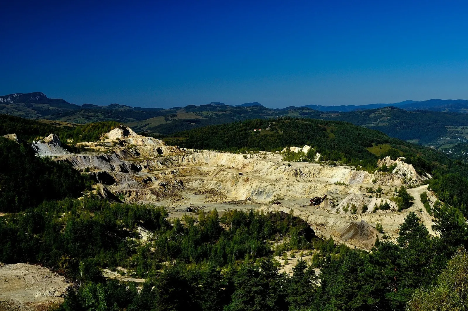
Roșia Montană Mining Landscape
culturalin danger · 2021
Photo: István Mihály, CC0, Wikimedia Commons

Roșia Montană Mining Landscape

Roman and modern mining landscape, in danger · Apuseni Mountains

The most significant, extensive and technically diverse underground Roman gold-mining complex known anywhere: 7 kilometres of galleries in four massifs, from which Rome extracted some 500 tonnes of gold over 166 years from AD 106.

Roșia Montană was inscribed in July 2021 on two lists at once: the World Heritage List and the List of World Heritage in Danger. It is Romania's only site in danger. The reason is the cyanide mining project that would have destroyed the Cârnic and Cetate massifs; the danger listing requires the state to produce a conservation plan and annual reports, which UNESCO examined in 2023, 2024 and 2025. The wax tablets found here are among the richest legal and linguistic documents of Roman Dacia.

It joined the list and the danger list on the same day.

(ii) an interchange of human values, visible in architecture or art(iii) a unique testimony to a cultural tradition or civilisation(iv) an outstanding example of a type of building or ensemble from a stage in history
Inscribed2021
Components1
Area
Buffer zone341 ha
CountyAlba
Coordinates46.3061° N, 23.1306° E
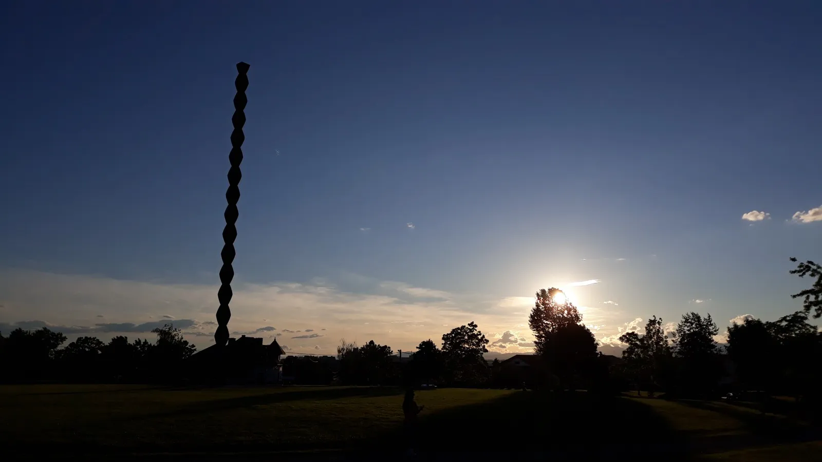
Brâncuși Monumental Ensemble of Târgu Jiu
cultural
Photo: Vlad Tamnos, CC BY-SA 4.0, Wikimedia Commons

Brâncuși Monumental Ensemble of Târgu Jiu

sculpture and urban ensemble, 1937–1938 · Oltenia

The Table of Silence, the Gate of the Kiss, the Alley of Chairs and the Endless Column, on a 1,500-metre axis through the town: Constantin Brâncuși's work of 1937–1938, in memory of those who fell defending Târgu Jiu in 1916.

It is one of two Romanian sites inscribed on criterion (i), a masterpiece of human genius, together with the painted churches of Moldavia, and the only one from the 20th century. The dossier was first submitted in 2015 and withdrawn before examination; it succeeded at the second attempt, in July 2024, in the same session as the Dacian Limes. The axis also includes the pre-existing Church of the Holy Apostles Peter and Paul, which Brâncuși built into the composition.

Romania's only 20th-century site, inscribed at the second attempt.

(i) a masterpiece of human creative genius(ii) an interchange of human values, visible in architecture or art
Inscribed2024
Components1
Area26.58 ha
Buffer zone78.05 ha
CountyGorj
Coordinates45.0383° N, 23.2788° E
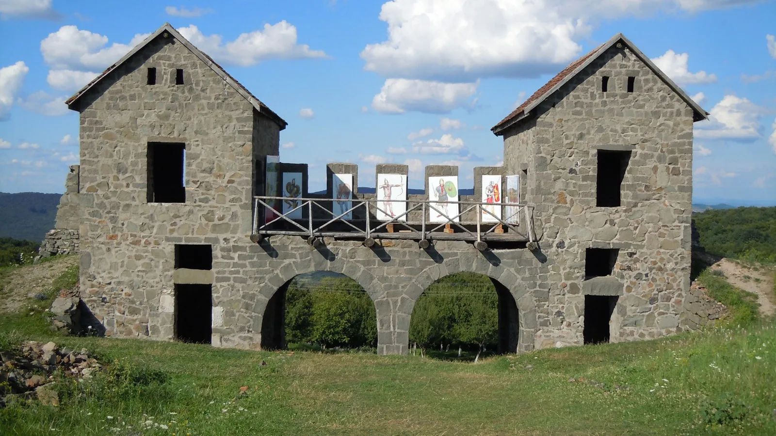
Frontiers of the Roman Empire – Dacia
cultural
Photo: Saturnian, CC BY-SA 3.0, Wikimedia Commons

Frontiers of the Roman Empire – Dacia

Roman frontier, 277 points, AD 106–271 · from the Danube to the Danube, through Banat, Transylvania and Muntenia

The longest and most complex land border of a Roman province in Europe: more than 1,000 kilometres from the Danube round to the Danube, with 277 inscribed components: legionary fortresses, auxiliary forts, earthen ramparts, towers, temporary camps.

The Dacian Limes accounts for 277 of Romania's 323 UNESCO places, 86% of the points. Most are traces in farmland with no visitor paths; UNESCO inscribed the archaeological evidence, not the tourist infrastructure. It is the Romanian part of the transnational 'Frontiers of the Roman Empire' series, alongside Hadrian's Wall, the German Limes and the Danube Limes. Romania's own Danube segment, nominated separately, is not yet inscribed.

One site, 277 points: 86% of everything Romania has on the map.

(ii) an interchange of human values, visible in architecture or art(iii) a unique testimony to a cultural tradition or civilisation(iv) an outstanding example of a type of building or ensemble from a stage in history
Inscribed2024
Components277
Area1,492 ha
Buffer zone14,198 ha
County16 counties
All components (277)
  1. Pojejena - Șitarnița · Caraș-Severin · 26.63 ha
  2. Vărădia - Arcidava / Pustă · Caraș-Severin · 3.57 ha
  3. Vărădia - Chilii · Caraș-Severin · 4.55 ha
  4. Surducu Mare – Centum Putea / Rovină · Caraș-Severin · 3.89 ha
  5. Berzovia - Berzobis · Caraș-Severin · 23.37 ha
  6. Brebu - Caput Bubali /Cetăţuie · Caraș-Severin · 0.48 ha
  7. Drobeta-Turnu Severin -Podul lui Traian · Mehedinți · 0.09 ha
  8. Drobeta-Turnu Severin -Drobeta · Mehedinți · 3.63 ha
  9. Mehadia - Praetorium / Zidină · Caraș-Severin · 13.33 ha
  10. Teregova - La Hideg · Caraș-Severin · 2.09 ha
  11. Jupa – Tibiscum / Cetate · Caraș-Severin · 23.01 ha
  12. Iaz – Tibiscum / Traianu · Caraș-Severin · 14.10 ha
  13. Iaz Tibiscum Dâmb · Caraș-Severin · 0.75 ha
  14. Iaz Tibiscum / Satu Bătrân · Caraș-Severin · 0.70 ha
  15. Zăvoi - Agnaviae / Balta Neagră-Fânețe · Caraș-Severin · 17.49 ha
  16. Voislova - Gara CFR · Caraș-Severin · 0.54 ha
  17. Sarmizegetusa – Colonia Ulpia Traiana Augusta Dacica Sarmizegetusa · Hunedoara · 63.05 ha
  18. Vețel – Micia / Grădiște · Hunedoara · 32.30 ha
  19. Vețel – Micia / Grădiște · Hunedoara · 19.47 ha
  20. Cigmău - Germisara / Cetatea / Dealul Urieșilor · Hunedoara · 30.13 ha
  21. … and 257 more in the full table

List of UNESCO sites in Romania by year

Everything Romania has inscribed since ratifying the Convention in 1990, in chronological order, with later extensions.

YearSiteTypeCriteriaComponentsArea
1991Danube Deltanatural(vii) (x)1312,440 ha
1993Villages with Fortified Churches in Transylvaniacultural(iv)7553 ha
1993Monastery of Horezucultural(ii)122.48 ha
1993Churches of Moldaviacultural(i) (iv)818.49 ha
1999Historic Centre of Sighișoaracultural(iii) (v)133.00 ha
1999Wooden Churches of Maramureșcultural(iv)88.94 ha
1999Dacian Fortresses of the Orăștie Mountainscultural(ii) (iii) (iv)619.53 ha
2017Ancient and Primeval Beech Forests of the Carpathians and Other Regions of Europenatural(ix)1223,983 ha
2021Roșia Montană Mining Landscapecultural · in danger(ii) (iii) (iv)1
2024Brâncuși Monumental Ensemble of Târgu Jiucultural(i) (ii)126.58 ha
2024Frontiers of the Roman Empire – Daciacultural(ii) (iii) (iv)2771,492 ha
  1. 1991
    Danube Delta
  2. 1993
    Villages with Fortified Churches in Transylvania
  3. 1993
    Monastery of Horezu
  4. 1993
    Churches of Moldavia
  5. 1999
    Villages with Fortified Churches in Transylvaniaextension: Prejmer, Viscri, Dârjiu, Saschiz, Câlnic, Valea Viilor
  6. 1999
    Historic Centre of Sighișoara
  7. 1999
    Wooden Churches of Maramureș
  8. 1999
    Dacian Fortresses of the Orăștie Mountains
  9. 2010
    Churches of Moldaviaextension: Sucevița
  10. 2017
    Ancient and Primeval Beech Forests of the Carpathians and Other Regions of Europe
  11. 2021
    Roșia Montană Mining Landscape
  12. 2024
    Brâncuși Monumental Ensemble of Târgu Jiu
  13. 2024
    Frontiers of the Roman Empire – Dacia

Natural UNESCO sites in Romania

Two: the Danube Delta (1991) and the 12 Romanian parcels of the Ancient and Primeval Beech Forests (2017). The Delta is the country's largest site, at 312,440 hectares; the forests are the most scattered, from Caraș-Severin to Suceava. Retezat and Pietrosul Rodnei, although biosphere reserves, are not World Heritage sites; they have sat on the tentative list since 1991.

Cultural UNESCO sites in Romania

Nine, in three waves: the painted churches of Moldavia, Horezu and the villages with fortified churches in 1993; the Dacian fortresses, Sighișoara and the wooden churches of Maramureș in 1999; then, after a 22-year gap, Roșia Montană in 2021, the Brâncuși Ensemble and the Dacian Limes in 2024. Three of them are remains of the same war: the Dacians' fortresses, the gold Rome took, and the frontier Rome then built.

What is Romania's newest UNESCO site?

Two sites share the title, inscribed at the same session on 26 and 27 July 2024: the Brâncuși Monumental Ensemble of Târgu Jiu and Frontiers of the Roman Empire – Dacia. The next candidate with a file in preparation is the Romanian segment of the Danube Limes, on the tentative list since 2020.

Which UNESCO site in Romania is in danger?

Roșia Montană, since 2021. Simultaneous inscription on the main list and the danger list is rare and was requested by Romania itself, as protection against the cyanide mining project. The danger list is not a sanction: it obliges the state to produce a conservation plan and annual reports, examined by the World Heritage Committee. The beech forests are not on the danger list, but have their own state-of-conservation reports, from 2018 to 2025, requested by UNESCO because of logging around the parcels.

What comes next: Romania's tentative list

A site can only be nominated if it has first sat on the country's tentative list. Romania has 19 entries, four of them added in April 2026. The 1991 entries have been waiting for 35 years.

ProposalListed since
Vânători Neamț Monastic Landscape2026
Coliboaia Cave2026
Extension to the Ancient and Primeval Beech Forests site2026
Cucuteni-Trypillia Civilization2026
Former Communist Prisons in Romania2024
Movile Cave2024
Princely religious foundations in Wallachia and Moldavia2024
Royal Residences of Sinaia2024
Frontiers of the Roman Empire – The Danube Limes2020
The old villages of Hollókő and Rimetea and their surroundings (with Hungary)2012
The Historic Centre of Sibiu and its Ensemble of Squares2004
Byzantine and post-Byzantine churches of Curtea de Argeș1991
The Basarabi rock-cut ensemble1991
The 'cule' tower-houses of Oltenia1991
The church of Densuș1991
The historic core of Alba Iulia1991
Retezat Massif1991
Pietrosul Rodnei (mountain peak)1991
Sânpetru (palaeontological site)1991

The UNESCO heritage that is not on this map

'UNESCO' means several lists, and searches mix them up. The map above covers only the World Heritage List, the one with coordinates. Separately there are:

All 323 UNESCO places in Romania, in one table

Search by name, county or site. The area is the one UNESCO declares for each component; where the dossier gives none, the cell stays empty.

PlaceSiteCountyArea
Danube DeltaDanube DeltaTulcea312,440 ha
Arbore — Church of the Beheading of St John the BaptistPainted churches of MoldaviaSuceava2.54 ha
Humor — Church of the Assumption of the VirginPainted churches of MoldaviaSuceava4.27 ha
Moldovița — Church of the AnnunciationPainted churches of MoldaviaSuceava4.00 ha
Pătrăuți — Church of the Holy CrossPainted churches of MoldaviaSuceava0.67 ha
Probota — Church of St NicholasPainted churches of MoldaviaSuceava1.00 ha
Suceava — Church of St George (St John the New Monastery)Painted churches of MoldaviaSuceava1.34 ha
Voroneț — Church of St GeorgePainted churches of MoldaviaSuceava3.27 ha
Sucevița — Church of the ResurrectionPainted churches of MoldaviaSuceava1.40 ha
Monastery of HorezuHorezu MonasteryVâlcea22.48 ha
BiertanSaxon fortified churchesSibiu84.57 ha
PrejmerSaxon fortified churchesBrașov201 ha
ViscriSaxon fortified churchesBrașov48.40 ha
DârjiuSaxon fortified churchesHarghita2.94 ha
SaschizSaxon fortified churchesMureș127 ha
CâlnicSaxon fortified churchesAlba33.79 ha
Valea ViilorSaxon fortified churchesSibiu55.16 ha
Sarmizegetusa RegiaDacian fortressesHunedoara17.83 ha
Costești-CetățuieDacian fortressesHunedoara
Costești-BlidaruDacian fortressesHunedoara0.50 ha
Luncani-Piatra RoșieDacian fortressesHunedoara1.20 ha
BănițaDacian fortressesHunedoara
CăpâlnaDacian fortressesAlba
Historic Centre of SighișoaraSighișoaraMureș33.00 ha
Bârsana — Church of the Presentation of the VirginWooden churches of MaramureșMaramureș2.80 ha

Method and limits

Every figure comes from the official pages of the UNESCO World Heritage Centre, read on 14 September 2026: the Romania page, each site's entry and each site's 'geographical data' table, which lists the components with identifier, coordinates, area and buffer zone. For the beech forests only the 12 rows with Romania as State Party were kept, out of the site's 93.

Two coordinates in the UNESCO tables are visibly wrong: Biertan appears 20 kilometres east of the village, in Mureș county, and Probota 65 kilometres east of the monastery, in Iași county. The map uses checked positions (Wikidata, the churches' own coordinates); the UNESCO values are kept in the project data. The other 321 points keep their UNESCO coordinates unchanged.

Each place's county is computed geometrically, from the coordinates and the county outlines, not copied from a list. A site's total area is the one UNESCO declares at site level; where UNESCO gives only component areas, the profile shows their sum, marked as such. Positions are component centres, not outlines: a 5,000-hectare forest parcel appears as a single point.

Site descriptions are summarised from the UNESCO texts (statements of Outstanding Universal Value and short descriptions, published under the CC BY-SA IGO 3.0 licence) and checked against the nomination files. Photographs come from Wikimedia Commons, with author and licence under each.

Sources

Photographs