Isfahan · AH 374 or 394 (984/5 or 1003/4) · Oxford, HSM 33767
The Isfahan astrolabe: an hour told by the Sun
Sight the Sun with the alidade, set its height on the plate, and the astrolabe tells you the hour. But each face of a plate is drawn for one latitude. Choose where you stand and when, and see what this thousand-year-old instrument from Isfahan would tell you.
Made in Isfahan
The brothers Aḥmad and Muḥammad, sons of Ibrāhīm, astrolabe makers of Isfahan, signed this instrument and dated it in the year 374 or 394 of the Hijra, AD 984/5 or 1003/4; the figure can be read either way. It is in the History of Science Museum in Oxford. Its openwork star map, the rete, is probably a later replacement.
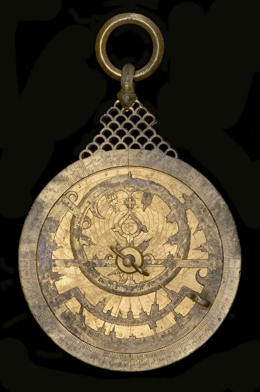
Under the rete sit three plates, engraved on both sides. Five of the faces carry the lines for one latitude each, 30°, 32°, 33°, 36° and 37°; the sixth carries a table of horizons for many latitudes. King takes the 32° face for Isfahan; 33° is close to Baghdad; 36° is near the latitudes of Rayy and Nishapur, and 37° lies further north.
How the plate tells the hour
A plate is a map of the sky seen from one latitude, drawn by projecting the sphere onto a flat disc. Its circles mark equal heights above the horizon. The observer sights the Sun through the two vanes of the alidade on the back and reads its height. On the front, the rete carries the Sun’s yearly path; with the Sun’s place for that date set on the circle of the height just sighted, east of the meridian in the morning and west in the afternoon, a rule laid across it shows the hour on the rim.
The same sighting on a face drawn for another latitude usually gives another hour. On the equinox at nine in the morning, local sun time, a reader in Isfahan using the nearest face, 33°, would read within a minute of the true hour, and with the 32° face about a minute and a half slow; in Oxford, with the 37° face, the reading would be 47 minutes slow.
Ptolemy’s number, engraved
Beside each latitude the makers engraved the length of the longest day of the year. That length depends on the latitude and on the tilt of the Earth’s axis, the obliquity of the ecliptic. Ptolemy, in the 2nd century, gave it as 23;51,20°. In Baghdad in 868–869, the brothers Muḥammad and Aḥmad, two of the Banū Mūsā, measured 23;35°, close to its value at the time.
| Face | Latitude | Engraved | With 23;51° | With 23;35° | Standard sunrise to sunset |
|---|---|---|---|---|---|
| 1a | 30° | 13h 58m | 13h 58m 18s | 13h 56m 47s | 14h 07m 02s |
| 2a | 32° | 14h 08m | 14h 08m 18s | 14h 06m 38s | 14h 17m 16s |
| 2b | 33° | 14h 13m | 14h 13m 29s | 14h 11m 45s | 14h 22m 35s |
| 1b | 36° | 14h 30m | 14h 29m 53s | 14h 27m 56s | 14h 39m 26s |
| 3a | 37° | 14h 36m | 14h 35m 41s | 14h 33m 39s | 14h 45m 24s |
All five engraved day lengths match, to the minute, what Ptolemy’s value rounded to 23;51° gives with the horizon taken as a geometric line. With the Baghdad value 23;35° every one of them comes out one to two minutes short. Counting sunrise and sunset the modern way, when the Sun’s upper edge touches the horizon and light is bent by the air, would make every day about nine minutes longer. The historian of astronomy David A. King made this observation in 2005: “The lengths of maximum daylight correspond to an obliquity of 23;51°.” The page repeats his check.
More than a century after Baghdad astronomers had measured a better value, the Isfahan plates still match Ptolemy’s.
What stays uncertain
The date can be read as 374 or 394 of the Hijra; King reads 374. The museum’s records give 38 or 41 stars on the rete, and its reports for two faces repeat 32°; the 36° face follows King’s examination.
The plate on this page is drawn from projection geometry, not traced from the instrument; it omits the seasonal-hour curves of the real plates. The Sun’s height uses today’s obliquity; the hour is local sun time, not clock time.
Sources
Every figure on this page is traced in the project’s source notes.
- History of Science Museum, Oxford, Astrolabe Catalogue, inv. 33767 and plate report.
- David A. King, In Synchrony with the Heavens, vol. 2, Instruments of Mass Calculation, Brill, 2005, §XIIIc.10, pp. 517–523 (and pp. 927, 948–950); author copy.
- Photograph: MHS 33767 Astrolabe, Wikimedia Commons, CC BY-SA 4.0 (History of Science Museum, University of Oxford).
- Claudius Ptolemy, Almagest I.12–15 (the obliquity, 23;51,20°).
