Atlas · Romania's virgin and quasi-virgin forests
All the virgin forest Romania has catalogued is smaller than Bucharest
Romania's national catalogue of virgin and quasi-virgin forests lists 72,279 hectares, split across 448 separately named forests. Of those, only 8,580 hectares are virgin forest in the strict legal sense — a little over a third of Bucharest's own surface. The combined area of the eight Romanian components on the UNESCO World Heritage list weighs in at roughly a third of everything catalogued.
A map of the 448 forests in the catalogue
The Ministry of Environment keeps the catalogue at parcel level — 4,690 rows, each with its own forestry-management code. The map groups them by name and county into 448 entries: a single forest can carry dozens of parcels scattered across a whole mountainside. Points are coloured by category — virgin or quasi-virgin — and the 12 circled ones also belong to a Romanian component of the UNESCO World Heritage list. Click any point for its area, altitude and county; the map zooms with the wheel or the buttons and pans by dragging.
Loading the map…
The eight forests on the UNESCO list
In 2017, Romania joined the transnational World Heritage site "Ancient and Primeval Beech Forests of the Carpathians and Other Regions of Europe" with eight components — 23,982.7 ha in total, almost all managed by Romsilva, the state forest authority. Each component covers only a strictly protected zone inside a national park or reserve, smaller than the park as a whole.
| Component | County | Hectares |
|---|---|---|
| Domogled – Valea Cernei National Park | Mehedinți / Caraș-Severin | 9,732.3 |
| Semenic – Cheile Carașului National Park | Caraș-Severin | 4,677.2 |
| Cheile Nerei – Beușnița National Park | Caraș-Severin | 4,292.3 |
| Cozia National Park | Vâlcea | 3,389.2 |
| Slătioara old-growth forest | Suceava | 609.1 |
| Groșii Țibleșului | Maramureș | 346.3 |
| Strâmbu-Băiuț old-growth forest | Maramureș | 598.1 |
| Șinca old-growth forest | Brașov | 338.2 |
.JPG)
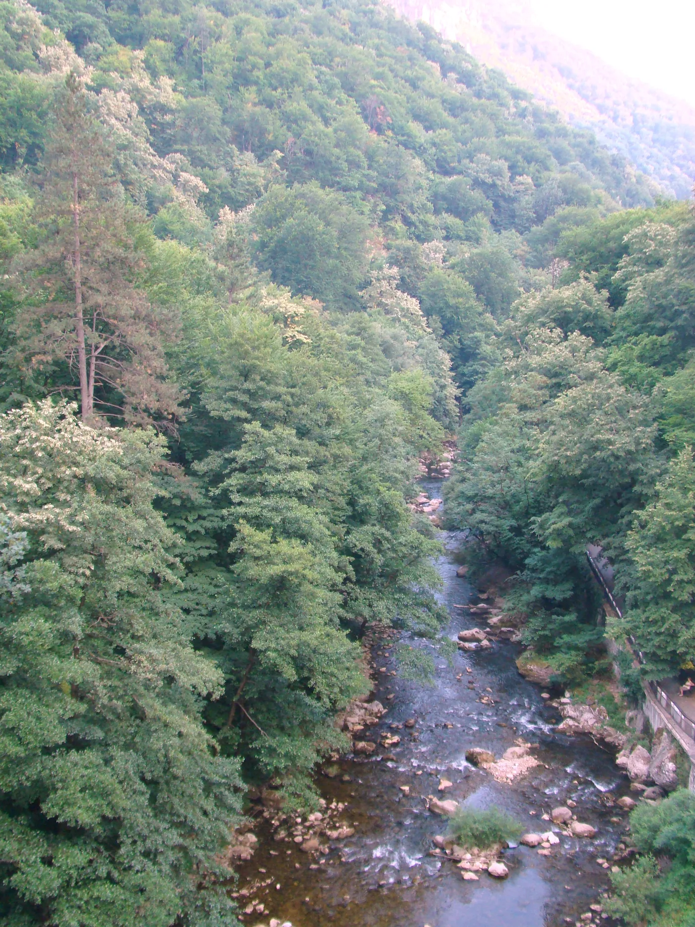
The catalogue's single largest forest, Coșava Mare, at 2,880.1 ha and entirely within Caraș-Severin county, is one piece of the Domogled – Valea Cernei component. Beside it on the map sit Nerganița, Beu, Iauna, Coșava Mică and Olteana — separate stretches of the same forest, each catalogued under its own parcel name.
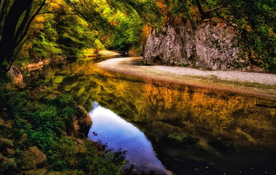

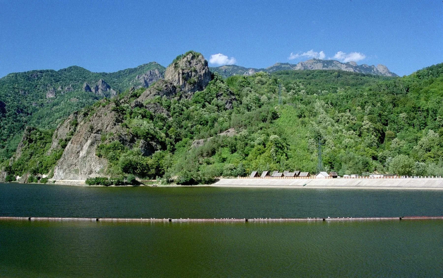

The map draws a direct line to the catalogue for five of the eight components — Domogled – Valea Cernei National Park, Semenic – Cheile Carașului National Park, Cheile Nerei – Beușnița National Park, Cozia National Park, Slătioara old-growth forest — wherever a parcel's name and county match the component exactly. The other three — Groșii Țibleșului, Strâmbu-Băiuț old-growth forest, Șinca old-growth forest — do not appear under an identical name in the catalogue; that does not mean they are missing from it, only that they cannot be matched automatically without checking boundaries on the ground.
The catalogue grew 5.5-fold since 2016. The strictest tier didn't
By the end of 2016, the catalogue held 13,126.9 ha. The edition of 12 May 2023, its fourteenth, holds 72,279.4 ha — 5.5 times as much, seven years later. Almost all of that growth comes from a single category.
Virgin forest in the strict sense — the tightest category — grew until 2021, to 8,579.8 ha, and that is the same figure in each of the last three editions, 2021, 2022 and 2023. All the growth in that stretch comes from the quasi-virgin category, for which the criteria are less strict.
One county holds a quarter of the catalogue
Caraș-Severin county alone holds 18,288.0 ha — 25.3% of everything catalogued nationwide. Together with Gorj and Hunedoara, the three counties hold 51.3% of the catalogue. At the other end, Dâmbovița has just 58.2 ha, across 2 parcels.
| County | Virgin (ha) | Quasi-virgin (ha) | Total (ha) | Share of catalogue |
|---|---|---|---|---|
| Caraș-Severin | 652.4 | 17,635.5 | 18,288.0 | 25.3% |
| Gorj | 118.0 | 11,585.7 | 11,703.7 | 16.2% |
| Hunedoara | 191.3 | 6,915.3 | 7,106.6 | 9.8% |
| Vâlcea | 736.5 | 5,533.3 | 6,269.8 | 8.7% |
| Brașov | 1,547.7 | 3,918.8 | 5,466.5 | 7.6% |
| Argeș | 24.7 | 4,147.1 | 4,171.8 | 5.8% |
| Maramureș | 1,372.2 | 1,985.5 | 3,357.7 | 4.6% |
| Sibiu | 1,836.7 | 1,422.0 | 3,258.7 | 4.5% |
| Prahova | 0.0 | 3,015.4 | 3,015.4 | 4.2% |
| Suceava | 474.7 | 2,491.5 | 2,966.3 | 4.1% |
| Mehedinți | 363.3 | 1,290.2 | 1,653.6 | 2.3% |
| Bihor | 921.0 | 692.1 | 1,613.1 | 2.2% |
| Buzău | 0.0 | 860.4 | 860.4 | 1.2% |
| Neamț | 0.0 | 557.3 | 557.3 | 0.8% |
| Bacău | 0.0 | 472.9 | 472.9 | 0.7% |
| Arad | 261.5 | 0.0 | 261.5 | 0.4% |
| Alba | 0.0 | 261.4 | 261.4 | 0.4% |
| Cluj | 0.0 | 233.3 | 233.3 | 0.3% |
| Timiș | 0.0 | 231.8 | 231.8 | 0.3% |
| Bistrița-Năsăud | 0.0 | 210.0 | 210.0 | 0.3% |
| Covasna | 79.7 | 57.2 | 136.9 | 0.2% |
| Harghita | 0.0 | 63.9 | 63.9 | 0.1% |
| Botoșani | 0.0 | 60.7 | 60.7 | 0.1% |
| Dâmbovița | 0.0 | 58.2 | 58.2 | 0.1% |
What "strict protection" means in Romanian law
The Forest Code (Law 46/2008, republished, Article 26(3)) requires the state to strictly protect the virgin and quasi-virgin forests entered in the catalogue. The catalogue itself was established by Order 1417/2016 of the Minister of Environment, Waters and Forests; the criteria for recognising a forest as virgin or quasi-virgin come from Order 3397/2012, and in forest management plans the two categories carry the codes 1.5j, for virgin forest, and 1.5o, for quasi-virgin.
Strict protection allows no work or activity that could affect the forest — logging included. Only research, education and visiting remain permitted, and only on condition that they do not disturb the site's natural state. Adding an area to the catalogue requires a specialist study, approved by the ministry's Technical Forestry Approval Commission; on the ground, enforcement falls to the territorial forest guards.
UNESCO's designation sits on top of the Forest Code's own protection: each of the eight components lies inside a strictly protected zone of a national park or scientific reserve — a category of protected area that already existed in Romanian law before 2017.
All 448 catalogue entries
The full table, sorted by area, largest first. Forests marked ★ have at least one parcel linked to a UNESCO component.
| Forest | County | Category | Hectares |
|---|---|---|---|
| Coșava Mare ★ | Caraș-Severin | quasi-virgin | 2,880.1 |
| Lăpușnic | Hunedoara | quasi-virgin | 2,499.2 |
| Nerganița ★ | Caraș-Severin | quasi-virgin | 1,884.7 |
| Cozia ★ | Vâlcea | quasi-virgin | 1,863.6 |
| Domogled ★ | Caraș-Severin | quasi-virgin | 1,792.2 |
| Cheile Nerei ★ | Caraș-Severin | quasi-virgin | 1,249.4 |
| Lotrișor | Vâlcea | quasi-virgin | 1,115.5 |
| Piatra Craiului | Brașov | quasi-virgin | 1,084.2 |
| Tr. Mare | Sibiu | virgin | 910.0 |
| Beu ★ | Caraș-Severin | quasi-virgin | 865.1 |
| Iauna Craiovei | Caraș-Severin | quasi-virgin | 821.3 |
| Slătioara ★ | Suceava | quasi-virgin | 820.6 |
| Boia Mică | Vâlcea | virgin | 736.5 |
| Iauna ★ | Caraș-Severin | quasi-virgin | 656.2 |
| Polatiște | Gorj | quasi-virgin | 639.2 |
| Coșava Mică ★ | Caraș-Severin | quasi-virgin | 610.7 |
| Valea Cărbunelui | Gorj | quasi-virgin | 609.7 |
| Arpașu Mare | Sibiu | virgin | 588.6 |
| Valea Cărbunelui I | Gorj | quasi-virgin | 580.7 |
| Aleu | Bihor | virgin | 555.6 |
| Mușeteica | Argeș | quasi-virgin | 555.0 |
| Glodeasa | Prahova | quasi-virgin | 525.6 |
| Codric | Vâlcea | quasi-virgin | 525.1 |
| Porumbacu | Sibiu | quasi-virgin | 485.3 |
| Rădoteasa | Gorj | quasi-virgin | 466.7 |
| Gemenele | Hunedoara | quasi-virgin | 455.8 |
| Gaieru | Hunedoara | quasi-virgin | 437.1 |
| Bucegi Râșnov | Brașov | virgin | 418.6 |
| Vârful lui Stan | Mehedinți | quasi-virgin | 409.7 |
| Preluca | Caraș-Severin | quasi-virgin | 394.1 |
| Pietrele | Hunedoara | quasi-virgin | 392.5 |
| Crasna | Maramureș | quasi-virgin | 380.6 |
| Zoruleasca - Piscul Răchitei | Argeș | quasi-virgin | 379.0 |
| Vl. Izvorului - Pl. Piatra Arsă | Prahova | quasi-virgin | 374.6 |
| Culmea Piatra Coșuștea | Mehedinți | quasi-virgin | 373.0 |
| Ciucaș | Brașov | quasi-virgin | 370.4 |
| Galbena | Bihor | virgin | 365.4 |
| Pojorta | Brașov | virgin | 363.9 |
| Iauna Gâsca | Caraș-Severin | quasi-virgin | 354.7 |
| Fața Gardului - Răchitiș | Suceava | quasi-virgin | 342.3 |
| Olanul | Gorj | quasi-virgin | 332.5 |
| Valea Buții | Hunedoara | quasi-virgin | 324.2 |
| Valea Cerbului | Prahova | quasi-virgin | 323.7 |
| Pr. Strâmbișoara | Brașov | quasi-virgin | 323.4 |
| Padina Mare | Gorj | quasi-virgin | 316.6 |
| Boceasa | Bihor | quasi-virgin | 315.8 |
| Pr. Viforâta-Pr. Gura Milii | Buzău | quasi-virgin | 315.5 |
| Chicera Izvorului | Hunedoara | quasi-virgin | 314.2 |
| Olteana ★ | Caraș-Severin | virgin | 313.7 |
| Arpășel | Sibiu | virgin | 308.2 |
| Colții Balei | Buzău | quasi-virgin | 306.5 |
| Stoicănelul I | Gorj | quasi-virgin | 299.0 |
| Valea Iadului | Bihor | quasi-virgin | 298.6 |
| Cariera | Gorj | quasi-virgin | 296.3 |
| Ramisrarului | Caraș-Severin | quasi-virgin | 295.3 |
| Peneșu | Argeș | quasi-virgin | 294.1 |
| Mija Mare | Hunedoara | quasi-virgin | 283.1 |
| Lutul Roșu | Neamț | quasi-virgin | 282.3 |
| Curmătura Tihului | Suceava | quasi-virgin | 281.2 |
| Cioara | Gorj | quasi-virgin | 278.4 |
| Frunți | Argeș | quasi-virgin | 278.0 |
| Piatra Mare | Brașov | quasi-virgin | 277.8 |
| Motru Mare VII | Gorj | quasi-virgin | 273.8 |
| Valea Stânii 2 | Prahova | quasi-virgin | 265.9 |
| Motru Mare I | Gorj | quasi-virgin | 264.9 |
| Cerbănașul Mare | Gorj | quasi-virgin | 263.8 |
| Dosul Pleșii | Gorj | quasi-virgin | 261.6 |
| Runcu-Groși | Arad | virgin | 261.5 |
| Giumalău | Suceava | quasi-virgin | 261.1 |
| Iuta | Caraș-Severin | quasi-virgin | 260.7 |
| Scurtu II | Gorj | quasi-virgin | 259.1 |
| Caraiman | Prahova | quasi-virgin | 258.0 |
| Mocirliu | Gorj | quasi-virgin | 257.1 |
| Runcu | Hunedoara | quasi-virgin | 257.0 |
| Viștea Mare - Ucișoara | Brașov | virgin | 244.6 |
| Cerbu | Caraș-Severin | quasi-virgin | 239.6 |
| Boia Mică | Vâlcea | quasi-virgin | 238.1 |
| Bistricioara | Gorj | quasi-virgin | 231.2 |
| Gârda Seacă | Alba | quasi-virgin | 227.1 |
| Poiana Cerbului - Culmea Cheii | Argeș | quasi-virgin | 211.1 |
| Brezcioara | Brașov | virgin | 209.2 |
| Drăgoi | Gorj | quasi-virgin | 209.0 |
| Mărișelu | Suceava | quasi-virgin | 207.2 |
| Muntele Roșu | Prahova | quasi-virgin | 197.7 |
| Paraul Rece | Caraș-Severin | quasi-virgin | 191.5 |
| Valea Buții | Hunedoara | virgin | 191.3 |
| Dealul Negrii | Caraș-Severin | quasi-virgin | 188.4 |
| Izvorul Alb | Mehedinți | virgin | 187.6 |
| Moașa | Sibiu | quasi-virgin | 185.2 |
| Ivanul I | Gorj | quasi-virgin | 183.4 |
| Rindibou | Sibiu | quasi-virgin | 183.1 |
| Zanoaga Bratocii | Prahova | quasi-virgin | 182.1 |
| Valea Ciumerna | Caraș-Severin | quasi-virgin | 181.9 |
| Peștera Ungurului | Caraș-Severin | quasi-virgin | 181.1 |
| Tarnița | Gorj | quasi-virgin | 178.6 |
| Vișa Vulturu | Caraș-Severin | quasi-virgin | 178.5 |
| Preluci | Maramureș | quasi-virgin | 178.5 |
| Izvoarele Carașului ★ | Caraș-Severin | quasi-virgin | 178.4 |
| Plescioara | Gorj | quasi-virgin | 177.4 |
| Silvei | Hunedoara | quasi-virgin | 176.6 |
| Obrejeru | Mehedinți | virgin | 175.7 |
| Șapte Izvoare | Buzău | quasi-virgin | 175.1 |
| Banca Gilort | Gorj | quasi-virgin | 175.0 |
| Vârful Pocenilor | Gorj | quasi-virgin | 174.2 |
| Culmea Căpăteșcii | Gorj | quasi-virgin | 172.0 |
| Râu Alb - Lăncițiu | Hunedoara | quasi-virgin | 167.4 |
| Izv. Alb | Maramureș | virgin | 166.7 |
| Padina Izvoarelor | Gorj | quasi-virgin | 165.7 |
| Varniței | Caraș-Severin | quasi-virgin | 165.4 |
| Staniștea | Bistrița-Năsăud | quasi-virgin | 165.1 |
| Cheile Zugrenilor | Suceava | quasi-virgin | 165.0 |
| Cisma Mare | Maramureș | virgin | 164.6 |
| Costițele | Argeș | quasi-virgin | 163.7 |
| Scărișoara | Vâlcea | quasi-virgin | 162.9 |
| Vârfu Sorani | Caraș-Severin | quasi-virgin | 162.8 |
| Unghia Mare | Prahova | quasi-virgin | 161.2 |
| Ciumerna - Scamnel | Caraș-Severin | quasi-virgin | 159.1 |
| Muntele Piatra și Cacova | Vâlcea | quasi-virgin | 159.1 |
| Straneac | Caraș-Severin | quasi-virgin | 156.8 |
| Valea Dăneasa | Vâlcea | quasi-virgin | 156.4 |
| Poiana Beletinii | Mehedinți | quasi-virgin | 155.5 |
| Valea Studena | Caraș-Severin | quasi-virgin | 154.7 |
| Izv. Șurii | Maramureș | quasi-virgin | 154.6 |
| Piatra Roșie | Brașov | quasi-virgin | 151.9 |
| Stânișoara | Brașov | quasi-virgin | 150.8 |
| Valea Padeș | Timiș | quasi-virgin | 150.5 |
| Prisăcele | Maramureș | virgin | 149.9 |
| Manioasa | Caraș-Severin | quasi-virgin | 148.7 |
| Râul Alb - Cozma | Hunedoara | quasi-virgin | 148.2 |
| Dobre | Caraș-Severin | quasi-virgin | 147.8 |
| Muntele Arnota | Vâlcea | quasi-virgin | 147.3 |
| Vl. Grosul - Pl Setului | Argeș | quasi-virgin | 146.4 |
| Valea Bucșoiului | Brașov | quasi-virgin | 144.5 |
| Culmea Beletinii | Mehedinți | quasi-virgin | 143.6 |
| Pietrele Zmeilor | Vâlcea | quasi-virgin | 143.0 |
| Culmea Carcanului | Gorj | quasi-virgin | 142.2 |
| Izv.Mehadicii | Caraș-Severin | quasi-virgin | 141.7 |
| Scurtu | Gorj | quasi-virgin | 141.5 |
| Pietrosul | Suceava | quasi-virgin | 141.3 |
| Vl. Mică | Hunedoara | quasi-virgin | 141.0 |
| Pârâul Lung | Gorj | quasi-virgin | 140.7 |
| Pârâul Repede | Maramureș | quasi-virgin | 139.6 |
| Ucea Mare | Brașov | virgin | 137.9 |
| Pr. Calului | Suceava | virgin | 137.7 |
| Meleia | Hunedoara | quasi-virgin | 137.4 |
| Olteț | Gorj | quasi-virgin | 137.3 |
| Vidraru 1 | Argeș | quasi-virgin | 135.3 |
| Gilortu | Gorj | quasi-virgin | 134.1 |
| Gâsca Mihoc | Gorj | quasi-virgin | 133.6 |
| Curmătura Tihului | Suceava | virgin | 133.0 |
| Ciormolina | Maramureș | virgin | 132.0 |
| V. Morii | Caraș-Severin | virgin | 130.9 |
| Capra | Suceava | quasi-virgin | 129.5 |
| Lăpușnicu Mare | Hunedoara | quasi-virgin | 127.7 |
| Cerna | Gorj | quasi-virgin | 125.7 |
| Zăganu | Prahova | quasi-virgin | 124.8 |
| Olteana ★ | Caraș-Severin | quasi-virgin | 124.4 |
| Mohorul | Gorj | quasi-virgin | 124.1 |
| Răoaia | Maramureș | virgin | 122.3 |
| Dosul Gutinului | Maramureș | quasi-virgin | 122.3 |
| Zăclean | Maramureș | quasi-virgin | 122.1 |
| Valea Curpănului | Vâlcea | quasi-virgin | 120.8 |
| Tătaru | Sibiu | quasi-virgin | 118.6 |
| Fața Pleșii | Gorj | virgin | 118.0 |
| Leoata 2 | Argeș | quasi-virgin | 117.7 |
| Culmea Murga Mică | Gorj | quasi-virgin | 117.3 |
| Oslea | Gorj | quasi-virgin | 116.8 |
| Stoicănelul II | Gorj | quasi-virgin | 115.4 |
| Scheiu | Hunedoara | quasi-virgin | 114.8 |
| Culmea Banciului | Brașov | quasi-virgin | 112.5 |
| Og. Ursului | Caraș-Severin | quasi-virgin | 111.8 |
| Fața Pietrei Craiului | Brașov | quasi-virgin | 111.4 |
| Pârâul Dumitrii | Gorj | quasi-virgin | 111.4 |
| Lainici | Gorj | quasi-virgin | 110.8 |
| Dosul Cernei | Gorj | quasi-virgin | 110.7 |
| Berivoi | Brașov | virgin | 110.4 |
| Corha | Maramureș | quasi-virgin | 107.9 |
| Cușmița - Bogdanogu | Caraș-Severin | quasi-virgin | 106.3 |
| Scurtu I | Gorj | quasi-virgin | 106.3 |
| Ghimbavu | Argeș | quasi-virgin | 104.6 |
| Izvorul Bigar | Caraș-Severin | quasi-virgin | 104.6 |
| Herculane | Caraș-Severin | quasi-virgin | 103.7 |
| Boii Mici | Caraș-Severin | quasi-virgin | 103.4 |
| Izvorul Alb | Bacău | quasi-virgin | 103.0 |
| Vl. Căldărașului-Izv. Boilor | Argeș | quasi-virgin | 102.9 |
| Comanu Mic | Maramureș | quasi-virgin | 102.4 |
| Pusta | Caraș-Severin | quasi-virgin | 101.8 |
| Culmea Dumitrii | Gorj | quasi-virgin | 100.5 |
| Dobrele - Fata Moartă | Bacău | quasi-virgin | 98.8 |
| Moiasa | Gorj | quasi-virgin | 98.2 |
| Valea Rașca Mare | Caraș-Severin | quasi-virgin | 97.9 |
| Măgura Jina | Sibiu | quasi-virgin | 96.2 |
| Pârâul Ploștina Dumitrei | Gorj | quasi-virgin | 95.8 |
| Sălătrucoasa | Maramureș | virgin | 95.6 |
| Poiana Maicilor | Neamț | quasi-virgin | 95.0 |
| Stănișoara | Brașov | quasi-virgin | 94.6 |
| Pleașa de Sebeș | Sibiu | quasi-virgin | 94.6 |
| Fabrica Veche Doftenița | Bacău | quasi-virgin | 94.2 |
| Contu | Sibiu | quasi-virgin | 93.8 |
| Chitu | Gorj | quasi-virgin | 93.0 |
| Vl. Copilului | Argeș | quasi-virgin | 92.2 |
| Valea lui Coman | Argeș | quasi-virgin | 92.1 |
| Postăvarul | Brașov | quasi-virgin | 91.4 |
| Lapusnicul Mic 1 | Hunedoara | quasi-virgin | 91.4 |
| Bulzuri-Dara | Cluj | quasi-virgin | 90.8 |
| Pârâul Antion | Vâlcea | quasi-virgin | 90.7 |
| Văratec | Maramureș | virgin | 90.3 |
| Muntele Oticu | Argeș | quasi-virgin | 89.7 |
| Ses 2 | Caraș-Severin | quasi-virgin | 89.7 |
| Pr. Calului | Brașov | quasi-virgin | 89.5 |
| Izv. Halaurilor | Maramureș | quasi-virgin | 89.1 |
| Culmea Varniței | Caraș-Severin | quasi-virgin | 88.9 |
| Helisag | Caraș-Severin | quasi-virgin | 87.7 |
| Frasinului | Hunedoara | quasi-virgin | 87.4 |
| Tabla | Hunedoara | quasi-virgin | 86.8 |
| Valea Stânii 1 | Prahova | quasi-virgin | 85.7 |
| Jderul | Cluj | quasi-virgin | 85.4 |
| Ursului | Hunedoara | quasi-virgin | 84.7 |
| Curmezișa | Gorj | quasi-virgin | 84.2 |
| Ungia Mică | Prahova | quasi-virgin | 84.2 |
| PN P. Craiului | Argeș | quasi-virgin | 82.1 |
| Corciova | Caraș-Severin | quasi-virgin | 81.7 |
| Pleșa | Caraș-Severin | quasi-virgin | 81.4 |
| Pârâul Fântânelor – Pârâul Bulvanului | Timiș | quasi-virgin | 81.4 |
| Vulturilor | Argeș | quasi-virgin | 81.0 |
| Vârful Petrișoiu | Gorj | quasi-virgin | 80.4 |
| Pârâul Buda | Neamț | quasi-virgin | 80.4 |
| Cernișoara I | Gorj | quasi-virgin | 80.3 |
| Raul Alb | Hunedoara | quasi-virgin | 80.3 |
| Cornul Pietrii | Mehedinți | quasi-virgin | 80.0 |
| Paulic | Maramureș | virgin | 79.9 |
| Pârâul Mehadica | Caraș-Severin | quasi-virgin | 79.8 |
| Tinovul Luci | Covasna | virgin | 79.7 |
| Ivanu | Gorj | quasi-virgin | 79.6 |
| Cireșu | Gorj | quasi-virgin | 78.8 |
| Iadolina | Bihor | quasi-virgin | 77.7 |
| Vârful Petriceaua | Gorj | quasi-virgin | 77.2 |
| Cisma Mică | Maramureș | virgin | 76.6 |
| Belia Mare | Brașov | quasi-virgin | 74.8 |
| Cuntu | Caraș-Severin | quasi-virgin | 74.5 |
| Cerna I | Gorj | quasi-virgin | 73.7 |
| Comarnici | Argeș | quasi-virgin | 73.5 |
| Balta | Caraș-Severin | quasi-virgin | 73.3 |
| Seceni | Gorj | quasi-virgin | 72.8 |
| Ivanul III | Gorj | quasi-virgin | 72.3 |
| Cracul Dragomir | Caraș-Severin | quasi-virgin | 71.9 |
| Cornereva | Caraș-Severin | quasi-virgin | 71.8 |
| Sărata | Sibiu | quasi-virgin | 71.7 |
| Groape | Maramureș | quasi-virgin | 71.5 |
| Pițigoi | Maramureș | virgin | 71.2 |
| Narota-Izvorul Bun | Caraș-Severin | quasi-virgin | 70.5 |
| Pârâul Scheiului | Hunedoara | quasi-virgin | 70.5 |
| Muntele Setu | Argeș | quasi-virgin | 70.4 |
| Mija | Hunedoara | quasi-virgin | 69.9 |
| Vl. Stânei | Prahova | quasi-virgin | 69.8 |
| Izv. Zimbrului | Maramureș | quasi-virgin | 69.2 |
| Valea Pietrii | Gorj | quasi-virgin | 68.7 |
| Valea Oboarelor | Argeș | quasi-virgin | 68.5 |
| Zoina - Iloca | Caraș-Severin | quasi-virgin | 68.2 |
| Valea Cherbelezu - Corhanu Rudăriei | Caraș-Severin | quasi-virgin | 68.1 |
| Motru Mare VIII | Gorj | quasi-virgin | 67.5 |
| Pereții Bratcului | Gorj | quasi-virgin | 67.3 |
| Lapusnicu Mic | Hunedoara | quasi-virgin | 66.7 |
| Mielușoaia | Suceava | virgin | 66.5 |
| Furnica | Prahova | quasi-virgin | 66.5 |
| Dungu | Brașov | quasi-virgin | 66.4 |
| Comarnici | Vâlcea | quasi-virgin | 66.3 |
| Bărzăuța | Bacău | quasi-virgin | 66.2 |
| Vl. Speriata | Argeș | quasi-virgin | 66.1 |
| Petroasa | Caraș-Severin | virgin | 65.7 |
| Funduri | Argeș | quasi-virgin | 65.6 |
| Dobreanu | Neamț | quasi-virgin | 65.1 |
| Ciribuc | Suceava | virgin | 64.6 |
| Olănelu | Gorj | quasi-virgin | 64.3 |
| Dealu Corbului | Maramureș | quasi-virgin | 64.3 |
| Motru Mare III | Gorj | quasi-virgin | 63.6 |
| Vârful lui Crai | Prahova | quasi-virgin | 62.9 |
| Pănicer | Brașov | quasi-virgin | 62.0 |
| Sterminosu | Gorj | quasi-virgin | 61.5 |
| Lutoasa | Maramureș | quasi-virgin | 61.5 |
| Varfu Visosca | Caraș-Severin | quasi-virgin | 61.3 |
| Viștișoara | Brașov | quasi-virgin | 60.8 |
| Stuhoasa | Botoșani | quasi-virgin | 60.7 |
| Sebeșu de Jos | Sibiu | quasi-virgin | 60.7 |
| Pr. Gongu | Brașov | quasi-virgin | 60.4 |
| Rădoteasa I | Gorj | quasi-virgin | 60.1 |
| Coada Lacului Poiana Ruscăi | Caraș-Severin | quasi-virgin | 60.0 |
| Zârnulița | Argeș | quasi-virgin | 59.9 |
| Măcăria | Gorj | quasi-virgin | 59.7 |
| Lacurel | Hunedoara | quasi-virgin | 59.5 |
| Brebenul | Argeș | quasi-virgin | 59.3 |
| Vl. Bătrână | Argeș | quasi-virgin | 59.1 |
| Merila Mică | Hunedoara | quasi-virgin | 59.1 |
| Vârful Pietrele Albe | Mehedinți | quasi-virgin | 58.8 |
| Valea Negrii | Prahova | quasi-virgin | 58.5 |
| Pîrgu Mare | Caraș-Severin | quasi-virgin | 58.3 |
| Valea Dulbanului | Dâmbovița | quasi-virgin | 58.2 |
| Vl. Cascadelor | Argeș | quasi-virgin | 58.1 |
| Cerna Vale | Caraș-Severin | quasi-virgin | 57.9 |
| Valea Rea | Vâlcea | quasi-virgin | 57.5 |
| Nămaia | Brașov | quasi-virgin | 57.3 |
| Pr. Șoimului | Covasna | quasi-virgin | 57.2 |
| Ponor | Cluj | quasi-virgin | 57.1 |
| Doftana | Brașov | quasi-virgin | 57.0 |
| Grota Haiducilor | Caraș-Severin | quasi-virgin | 56.9 |
| Muntele Ștevioara | Vâlcea | quasi-virgin | 56.8 |
| Valea Boia mare | Vâlcea | quasi-virgin | 56.5 |
| Grozea I | Bacău | quasi-virgin | 56.3 |
| Vârful Babeș | Prahova | quasi-virgin | 55.8 |
| Stoicănelu III | Gorj | quasi-virgin | 55.5 |
| Lupu | Caraș-Severin | quasi-virgin | 54.8 |
| Păcura | Bacău | quasi-virgin | 54.4 |
| Motru Mare VI | Gorj | quasi-virgin | 54.2 |
| Chiril_1 | Suceava | quasi-virgin | 53.4 |
| Fața Bună | Vâlcea | quasi-virgin | 53.4 |
| Vl. Ursului - Vl. Rapei | Argeș | quasi-virgin | 53.1 |
| Răcani | Caraș-Severin | quasi-virgin | 53.1 |
| Muroniului | Caraș-Severin | quasi-virgin | 53.1 |
| V. Craiului | Caraș-Severin | virgin | 52.5 |
| Gaura | Brașov | quasi-virgin | 52.4 |
| Berevoiu | Argeș | quasi-virgin | 51.2 |
| Peretele Gardului | Vâlcea | quasi-virgin | 51.1 |
| Valea lui Radu 1 | Argeș | quasi-virgin | 51.0 |
| Fețele Vârșavului | Gorj | quasi-virgin | 51.0 |
| La Cuceșu | Caraș-Severin | quasi-virgin | 50.8 |
| Paraul Alb | Caraș-Severin | quasi-virgin | 50.0 |
| Sălnița | Maramureș | quasi-virgin | 49.4 |
| Demacușa - Șfarosu | Suceava | quasi-virgin | 49.4 |
| Topologel | Vâlcea | quasi-virgin | 49.3 |
| Puturoasa | Vâlcea | quasi-virgin | 49.1 |
| Valea Largă | Argeș | quasi-virgin | 48.4 |
| Jneapăn | Maramureș | quasi-virgin | 48.3 |
| Afinaru Mare | Caraș-Severin | quasi-virgin | 48.1 |
| Vl. Mușătescu | Argeș | quasi-virgin | 48.0 |
| V.Mare | Caraș-Severin | virgin | 47.9 |
| Naiba | Gorj | quasi-virgin | 47.9 |
| Mânzu | Vâlcea | quasi-virgin | 47.7 |
| Stâna Mare | Brașov | quasi-virgin | 47.5 |
| Izv. Negru | Maramureș | quasi-virgin | 47.5 |
| Valea Pragului | Gorj | quasi-virgin | 47.1 |
| Valea Roșia | Vâlcea | quasi-virgin | 46.2 |
| Ogașul de la Nuc | Gorj | quasi-virgin | 45.9 |
| Gropșoara | Maramureș | virgin | 45.0 |
| Fușteica | Gorj | quasi-virgin | 45.0 |
| Valea Bilei | Bistrița-Năsăud | quasi-virgin | 44.9 |
| Grija | Gorj | quasi-virgin | 44.8 |
| Culmea Izvorului | Brașov | quasi-virgin | 44.7 |
| Varcipolea | Caraș-Severin | quasi-virgin | 44.6 |
| Savastru | Caraș-Severin | quasi-virgin | 44.5 |
| Muncelu | Hunedoara | quasi-virgin | 44.5 |
| Diham | Prahova | quasi-virgin | 44.5 |
| Rusca | Argeș | quasi-virgin | 44.4 |
| Frunți | Vâlcea | quasi-virgin | 44.2 |
| Valea Vâja | Argeș | quasi-virgin | 44.0 |
| Odăilor | Caraș-Severin | quasi-virgin | 43.9 |
| Motru Mare V | Gorj | quasi-virgin | 43.3 |
| Bărc | Brașov | quasi-virgin | 43.0 |
| Pietrele Albe | Caraș-Severin | quasi-virgin | 42.7 |
| Comisu | Argeș | quasi-virgin | 42.3 |
| Izv. Negru | Maramureș | virgin | 42.1 |
| Motru Mare XIII | Gorj | quasi-virgin | 41.8 |
| Valea Merișorului | Gorj | quasi-virgin | 41.7 |
| Albiile | Brașov | quasi-virgin | 41.1 |
| Culmea Mare | Gorj | quasi-virgin | 41.0 |
| Poetaua | Maramureș | virgin | 40.7 |
| Demacușa - Corhana | Suceava | quasi-virgin | 40.6 |
| Valea Căprăreasa | Vâlcea | quasi-virgin | 40.6 |
| Viștea Mare-Ucișoara | Brașov | quasi-virgin | 40.5 |
| Izvorul Bucurei | Hunedoara | quasi-virgin | 40.4 |
| Vârful Albiile | Brașov | quasi-virgin | 40.3 |
| V.Jejnita | Caraș-Severin | quasi-virgin | 40.2 |
| Valea Vladului 2 | Argeș | quasi-virgin | 39.6 |
| Oușoru Mare | Maramureș | quasi-virgin | 39.6 |
| V.Tomii | Caraș-Severin | quasi-virgin | 39.2 |
| Piciorul Mărului | Vâlcea | quasi-virgin | 39.1 |
| Motru Mare XII | Gorj | quasi-virgin | 38.9 |
| Hădaru | Vâlcea | quasi-virgin | 38.7 |
| Pr. Dracului | Gorj | quasi-virgin | 38.6 |
| Mocirliu I | Gorj | quasi-virgin | 38.5 |
| Păltineț | Prahova | quasi-virgin | 37.9 |
| Răchițeaua | Gorj | quasi-virgin | 37.8 |
| Bulz | Vâlcea | quasi-virgin | 36.9 |
| Pârâul Moisii | Gorj | quasi-virgin | 36.7 |
| D. Ses | Caraș-Severin | virgin | 36.6 |
| Schitul Colțul Chiliilor | Brașov | quasi-virgin | 36.3 |
| Văratec | Caraș-Severin | quasi-virgin | 36.2 |
| Predelul Mic | Mehedinți | quasi-virgin | 36.0 |
| Seaca Baiului | Prahova | quasi-virgin | 35.9 |
| Valea Marginea Domnească | Argeș | quasi-virgin | 35.8 |
| Vidraru 2 | Argeș | quasi-virgin | 35.7 |
| Pătrunsa | Gorj | quasi-virgin | 35.4 |
| Cozia | Maramureș | quasi-virgin | 35.2 |
| Jieț | Hunedoara | quasi-virgin | 35.1 |
| Pietroasa | Maramureș | virgin | 34.9 |
| Sebeș | Brașov | quasi-virgin | 34.7 |
| Vârful Pietriceaua | Vâlcea | quasi-virgin | 34.7 |
| Pârâul Dealului | Gorj | quasi-virgin | 34.6 |
| Valea lui Radu 2 | Argeș | quasi-virgin | 34.5 |
| Cerna | Caraș-Severin | quasi-virgin | 34.5 |
| Geamăna | Neamț | quasi-virgin | 34.5 |
| Ștersura | Gorj | quasi-virgin | 34.4 |
| Vârtop | Alba | quasi-virgin | 34.3 |
| Scăunel | Gorj | quasi-virgin | 34.2 |
| Fața Gardului - Răchitiș | Suceava | virgin | 33.9 |
| Ivanul II | Gorj | quasi-virgin | 33.7 |
| Frântura | Mehedinți | quasi-virgin | 33.6 |
| Jdimir | Caraș-Severin | quasi-virgin | 33.5 |
| Motru Mare XIV | Gorj | quasi-virgin | 33.5 |
| Pr. Ursului | Caraș-Severin | quasi-virgin | 33.4 |
| Capra | Argeș | quasi-virgin | 33.1 |
| Muchia Colților | Sibiu | quasi-virgin | 32.8 |
| Valea Cărbunelui IV | Gorj | quasi-virgin | 32.7 |
| Leoata 1 | Argeș | quasi-virgin | 32.2 |
| Motru Mare XI | Gorj | quasi-virgin | 32.2 |
| Delhia | Harghita | quasi-virgin | 32.2 |
| Râul Alb - Cozma | Hunedoara | quasi-virgin | 32.2 |
| Argintărie | Buzău | quasi-virgin | 32.1 |
| Pr. Ulmului | Maramureș | virgin | 32.0 |
| Valea Porcuia | Gorj | quasi-virgin | 31.8 |
| Mingheț | Maramureș | quasi-virgin | 31.8 |
| Fagu Mare | Harghita | quasi-virgin | 31.7 |
| Pârâul cu Apă | Brașov | quasi-virgin | 31.3 |
| Fântâna Ștefuroaia | Caraș-Severin | quasi-virgin | 31.3 |
| Valea Vladului 3 | Argeș | quasi-virgin | 31.2 |
| Ceapa | Buzău | quasi-virgin | 31.1 |
| Latorița | Vâlcea | quasi-virgin | 31.1 |
| Prăpăstiile Zărneștiului | Brașov | quasi-virgin | 31.0 |
| Og. Brezi | Caraș-Severin | quasi-virgin | 30.7 |
| Bârnău | Hunedoara | quasi-virgin | 30.5 |
| Pârâul Gongu | Brașov | virgin | 30.4 |
| Ignăteasa | Maramureș | quasi-virgin | 30.4 |
| V. Craiovei | Caraș-Severin | quasi-virgin | 30.3 |
| Crauri | Caraș-Severin | quasi-virgin | 30.1 |
| Joagăre- Dl. Dobrei | Sibiu | virgin | 29.8 |
| Pr. Laptelui | Brașov | quasi-virgin | 29.3 |
| Gura Socolou | Maramureș | virgin | 28.2 |
| Măgura Codlei | Brașov | virgin | 24.8 |
| Baicu | Maramureș | quasi-virgin | 24.8 |
| Vl. Meledicul Mic | Argeș | virgin | 24.7 |
| Hlibochi | Suceava | virgin | 21.1 |
| Stujinoasa | Suceava | virgin | 18.0 |
| Valea Vladului | Argeș | quasi-virgin | 17.1 |
| Pic. Paltinului | Maramureș | quasi-virgin | 14.8 |
| Boii Mari | Caraș-Severin | quasi-virgin | 13.7 |
| Balu | Vâlcea | quasi-virgin | 11.5 |
| Viștișoara | Brașov | virgin | 7.8 |
| Pirusca | Brașov | quasi-virgin | 5.6 |
| Gâsca | Caraș-Severin | virgin | 5.2 |
How the map was built
The national catalogue of virgin and quasi-virgin forests, 12 May 2023 edition, holds 4,690 parcel-level rows, each with coordinates in degrees-minutes-seconds, a minimum and maximum altitude, a county and an area. Coordinates were converted to decimal degrees, and rows were grouped by the combination of name and county, not by name alone: eight names — "Cozia" among them — repeat across entirely different counties, for forests with no relation to each other, and grouping by name alone would have merged them incorrectly. A forest with parcels in both categories shows up as two adjacent points on the map, one for its virgin share and one for its quasi-virgin share, rather than one point with a category picked at random.
Each forest's position on the map is the average of its parcels' coordinates. The link to the eight UNESCO components was made by comparing each catalogued forest's name and county against the ministry's official list — a text match, not a boundary check on the ground. Five of the eight components have at least one match; for the other three, the absence of an identical match does not mean they share no forest with the catalogue at all. The altitude range quoted in the text, 70–2,061 m, is bounded by the lowest and highest altitude recorded for any parcel in the catalogue.
Forest names are reproduced exactly as they appear in the catalogue; over half are written without diacritics in the source, and only a handful of spellings were corrected, where the correct form was independently verifiable on another row of the same table.
The country and county outlines are simplified from the same administrative geometry used elsewhere on this site.
Sources
- National catalogue of virgin and quasi-virgin forests in Romania, Ministry of Environment, Waters and Forests, 14th edition, 12 May 2023 — the parcel-level table and the 2016-onward evolution file, both published on mmediu.ro.
- Romania's components of the UNESCO site "Ancient and Primeval Beech Forests of the Carpathians and Other Regions of Europe", Ministry of Environment, Waters and Forests.
- Forest Code, Law 46/2008, republished, Article 26.
- Order 1417/2016 of the Minister of Environment, Waters and Forests, establishing the catalogue.
- Order 3397/2012 of the Minister of Environment and Forests, setting the identification criteria for virgin and quasi-virgin forests.
- National Institute of Statistics — the area of Bucharest municipality, 240 km².
- Wikimedia Commons — photographs, credited and licensed individually.
Numbers about the catalogue and the map are computed directly from the parcel table above. The eight UNESCO components' areas and Bucharest's own area come from the separate sources listed here, not from that table.