The Danube, from source to Sulina
How long does Danube water take from source to sea?
About a month in an average year: three weeks in flood, two months in drought. Choose where your drop starts and follow it through ten countries, on a clock built from measured current speeds.
Send the dropFirst, a guess
How long do you think the water takes to reach the sea?
From the Black Forest springs to Sulina is 2,860 kilometres. Pick an answer before you see the clock.
The middle answer: about a month. In an average year the drop takes 32 days from source to Sulina. In flood it manages three weeks; in drought it needs two months. The clock below shows where these numbers come from.
The journey
Send your drop downstream
Choose the starting point and the kind of year. The clock works out the distance to Sulina and the days on the road from speeds measured on each stretch of the river.
Distance to Sulina
2,860 km
Days on the road
32.4 days
Arrives on
…
Now in
Germany
Country borders on the profile are approximate: on some stretches the two banks belong to different countries.
The Iron Gate II dam's position on the profile is approximate: sources give different markers.
From the Breg spring: 57 days in drought, 32 in an average year, 20 in flood.
Ten countries, downstream
- Germanythe source and the first 637 kilometres
- AustriaVienna, at 1,920 cubic metres a second
- SlovakiaBratislava and the turn south
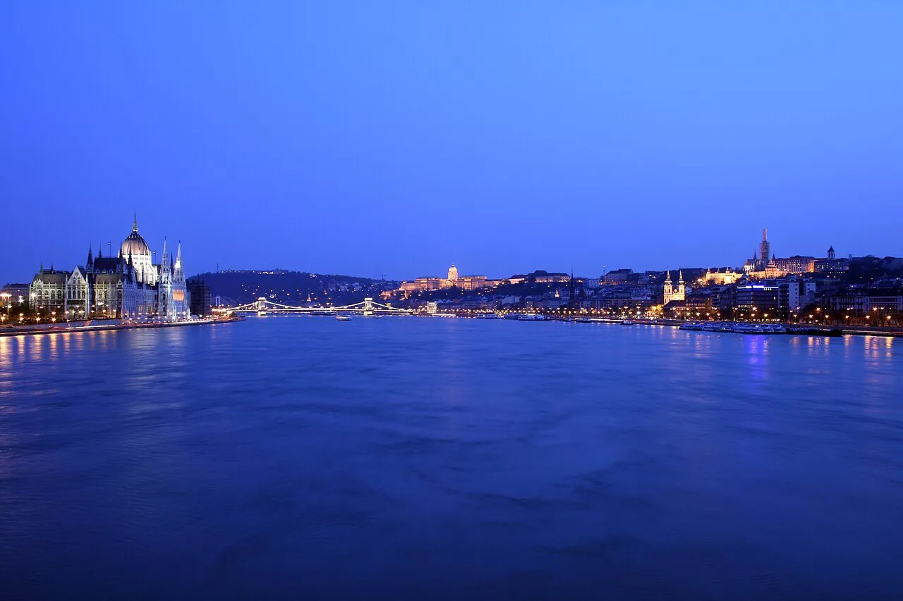
- HungaryBudapest and the Pannonian plain
- CroatiaOsijek and the Drava mouth
- SerbiaBelgrade, where the Sava brings 1,460 cubic metres a second
- Romania1,075 kilometres, the longest stretch
- Bulgariathe right bank, from the Timok to Silistra
- Moldovaat the Prut bend
- Ukrainethe Chilia arm and the sea
The hard question
How long is the Danube, really?
Three honest answers, depending on how you measure.
2,860 km
the hydrology figure, from the Breg spring
2,850 km
the Britannica figure
2,415 km
how far ships can sail, from Kelheim to Sulina
The difference comes from the starting point and from rounding. The Breg spring lies 46 kilometres above the Donaueschingen confluence, and ships count only the water they can sail, from Kelheim to Sulina. This page's clock starts at 2,860 and counts down.
The Danube's kilometre markers read backwards against the flow. Marker zero stands at Sulina, at the mouth, and the numbers grow towards the source: Belgrade is at kilometre 1,170, Vienna at 1,920, Passau at 2,225. The smaller the number, the closer your drop is to the sea.
Three sources, one river
Where does the Danube begin?
Three places claim the title of source. Pick yours before you hear what the hydrologists say.
The hydrologists pick the Breg spring: 5 kilometres longer and carrying almost twice as much water as the Brigach. The park spring stays the official source by tradition, and the confluence gives the river its name.
The quarrel between Furtwangen, the Breg spring's town, and Donaueschingen, the fountain's town, has run since the 1950s and reached the state government. As early as 1847 a German encyclopaedia wrote that the Danube rises at the Martinskapelle chapel, in the Black Forest.
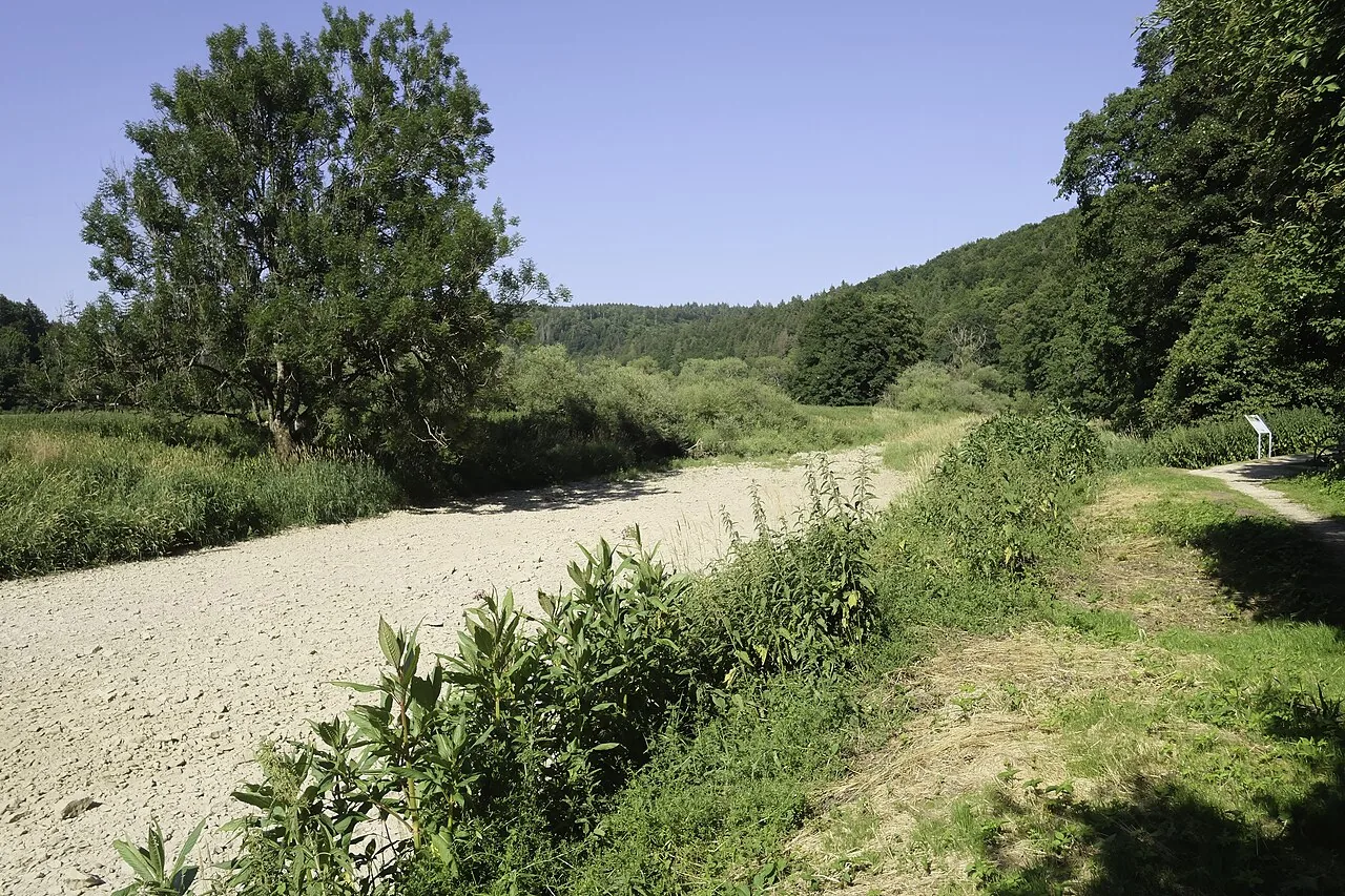
A little downstream, between Immendingen and Möhringen, something strange happens to the Danube: it runs dry. About 155 days a year the water sinks into limestone and resurfaces at the Aachtopf, 12 kilometres away, bound for the Rhine. Water lost here never reaches Sulina.
The growing river
At Passau the tributary beats the river
The Danube and the Inn meet at Passau. Which one brings more water?
The Inn wins by a distance: 810 cubic metres a second against the Danube's 660. Only together do they reach 1,470.
From Neu Ulm, where it gathers barely 124 cubic metres a second, to Sulina, where it discharges 6,495, the Danube's flow grows more than fiftyfold. The big jumps come from tributaries: the Drava, Tisza and Sava alone more than double the river before Baziaș.
At the mouth nine times more water can flow than in drought: between 1,790 and 15,900 cubic metres a second at Ceatal Chilia. That is why the journey clock lets you choose the kind of year.
The gorge
The Iron Gates: two dams in a 144-kilometre gorge
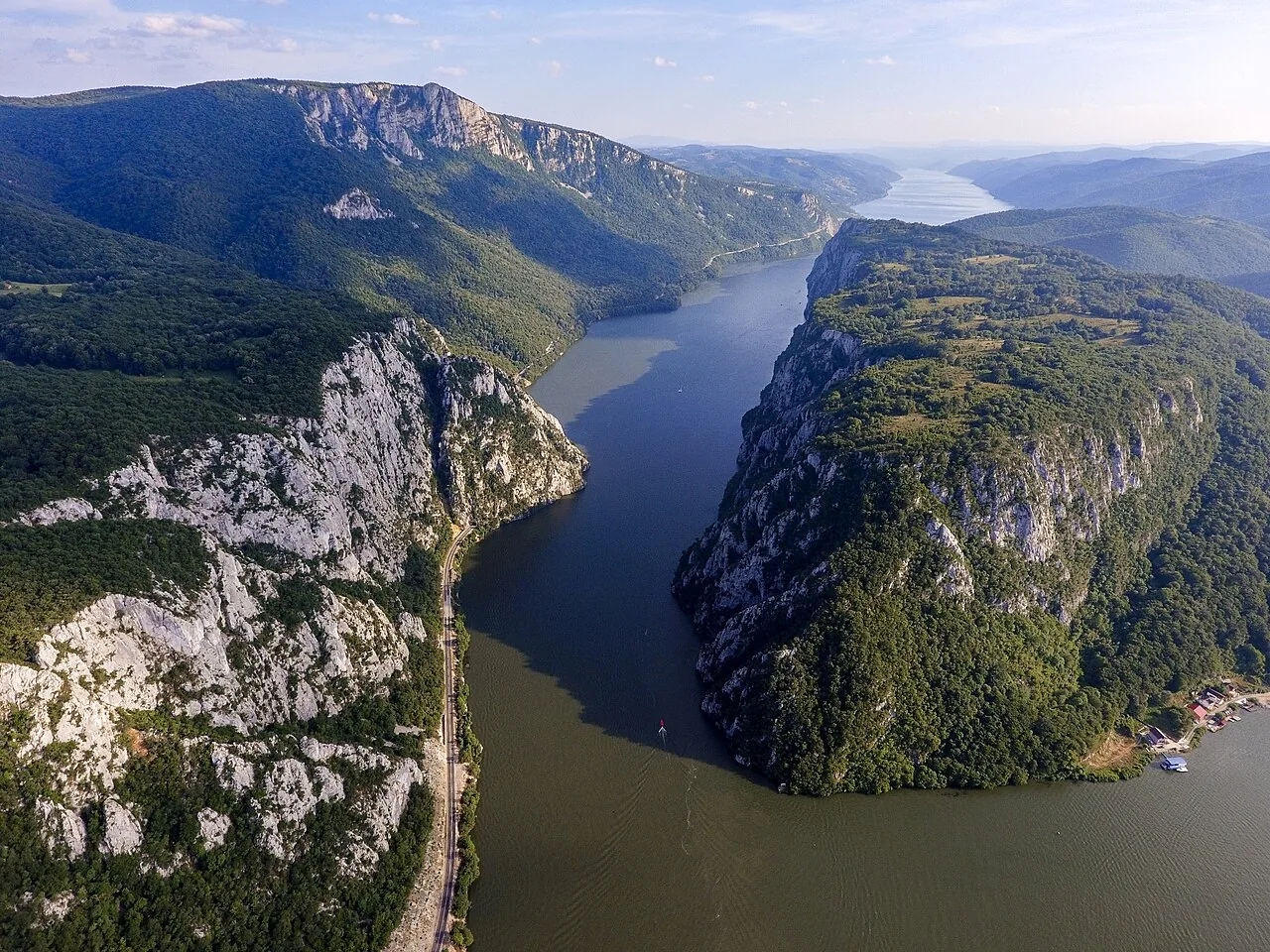
Between Baziaș and Gura Văii the Danube broke through the Carpathians in a 144-kilometre gorge. The narrowest part, the Cazane Mari and Cazane Mici, measures 3.5 and 5.5 kilometres.
Two dams wait here, not one. Iron Gate I, at kilometre 943, opened in 1972 and was then the tenth largest power station in the world. Iron Gate II was finished in 1984. In the reservoirs behind the dams the water barely moves: by the Austrian dam walls the speed falls to 0.1–0.3 metres a second at low water.
The mouth
At the end the Danube splits in three
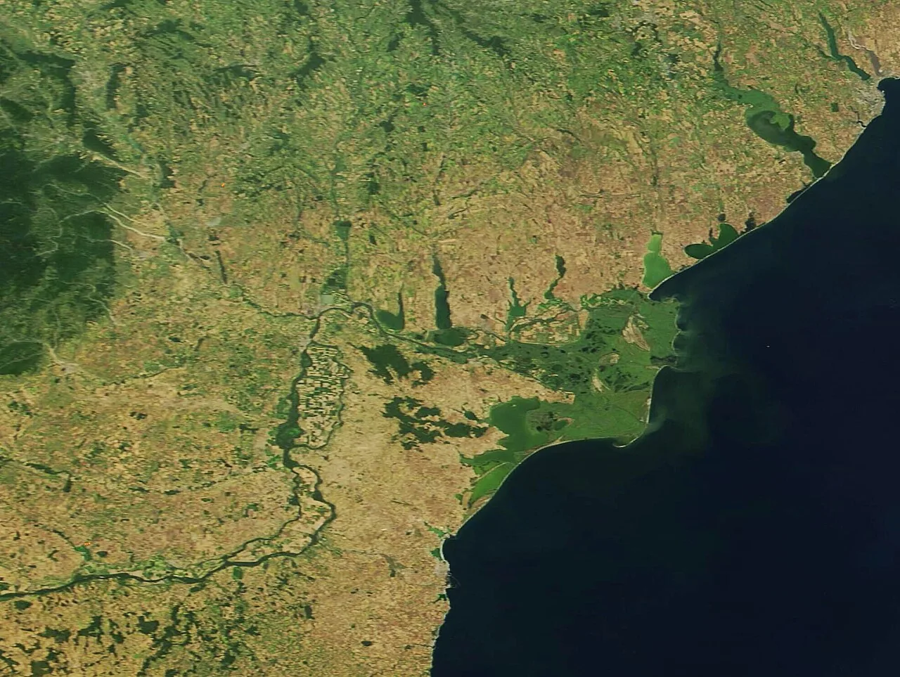
From Ceatal Chilia the water divides into three arms. The Chilia, the youngest and longest at 120 kilometres, carries 58 per cent of the water and sediment. The Sulina arm was cut from 92 kilometres to 63.7 between 1862 and 1902, for steamers, and carries under a fifth of the water. The Sfântu Gheorghe, the oldest arm, was shortened to 69.7 kilometres and carries 23 per cent.
The delta itself covers 4,152 square kilometres, 82 per cent of it in Romania. The river's marker zero stands at Sulina: this is where your drop's clock stops.
Romania's share
1,075 kilometres, the longest stretch
Of the river's 2,860 kilometres, 1,075 belong to Romania: 38 per cent, more than any of the other nine countries. From Baziaș the Danube runs 229 kilometres of border with Serbia, then 471 kilometres with Bulgaria, and the last 375 kilometres flow entirely inside the country, to Sulina.
This one river gathers the waters of 97 per cent of the country's land. Almost all the water that drains off Romania ends up in the Danube.
The game
True or false: seven questions about the Danube
Every answer is proven by a source at the foot of the page. At the end you get a score to share.
All the questions and answers:
- True. The Danube flows through four national capitals. True. Vienna, Bratislava, Budapest and Belgrade stand on its banks — more than on any other river in the world. articolul „Danube”
- False. The Danube has a single source at Donaueschingen. False. Three places claim the title: the palace-park spring, the Breg–Brigach confluence, and the Breg spring, which is the hydrologists' answer. articolul „Sources of the Danube”
- True. At Passau the Inn carries more water than the Danube. True. The Inn brings 810 cubic metres a second, the Danube only 660. The tributary beats the river. Gâștescu și Țuchiu (2020)
- False. Water travels from source to sea in a few days. False. It needs about a month in an average year. The year-2000 pollution plume took almost three weeks for 1,200 kilometres. raportul UNEP (2000)
- True. Some upper-Danube water leaves for the Rhine. True. At Immendingen the water sinks into limestone about 155 days a year and resurfaces at the Aachtopf, bound for the Rhine. articolul „Danube Sinkhole”
- False. The Iron Gates are a single dam. False. There are two: Iron Gate I, from 1972, and Iron Gate II, from 1984. Comisia Dunării
- True. The Chilia arm carries more than half the Danube's water. True. 58 per cent of the water and sediment goes down the Chilia arm, under a fifth down the Sulina arm. Gâștescu și Țuchiu (2020)
Sources and method
How we know
The journey clock is a model built for this page from measured speeds. The upper stretch uses the mean velocities measured on the Austrian Danube (velocities for the German Danube are missing from the accessible sources), the lower stretch the lower-Danube means (0.5, 0.85 and 1.40 metres a second at low, mean and high water), and the middle stretch a working value set between them. No published source gives the source-to-sea travel time. The model above fills the gap with measured speeds: about 32 days in an average year.
The model was checked against a real case. The January 2000 pollution plume covered 1,200 kilometres of Danube at 2.4–2.9 kilometres an hour: 17–21 days, exactly between this clock's dry and average years.
Some things the sources do not say. The middle-stretch speed is a working assumption. The exact marker of the Iron Gate II dam differs between sources, so the page does not print it. The split of water between the delta arms differs between papers too, which is why the page gives rounded percentages. And the much-quoted 2,857 kilometres for the river's length could not be checked in an accessible source, so the page uses 2,860 and 2,850, with the sources beside them.
The river and its measurements
- Gâștescu, P., Țuchiu, E. (2020). Hydrographic, hydrological and water-quality characteristics of the Danube, with reference to the Pontic sector. Riscuri și catastrofe, XX(27/2). textul integral (PDF) — The 2,860 km length, the 1,075 km in Romania, the discharges and the delta arms.
- UNEP/OCHA (2000). The cyanide spill at Baia Mare, Romania. Assessment mission report. textul integral (PDF) — The measured plume speeds: 2.1–2.4 km/h on the Tisza, 2.4–2.9 km/h on the Danube.
- viadonau (2024). Flow velocities of the Austrian Danube. Austrian waterway authority. viadonau.org — Mean velocities on the Austrian Danube at low, mean and high flow.
- Boamfă, I. Hydrology of the lower Danube. Annals of the University of Craiova, Geography. textul integral (PDF) — Mean speeds on the lower Danube: 0.5, 0.85 and 1.40 m/s.
- Sediment Balance Assessment for the Danube (2019). Interreg Danube Transnational Programme. programul Dunărea — Kilometre markers and mean discharges at the river stations.
- DIONYSUS fairway maintenance tool. Waterway sections Kelheim–Sulina. Comisia Dunării — The 624, 860 and 931 km of the navigable waterway.
Places and dams
- The articles “Danube”, “Sources of the Danube”, “Danube Sinkhole” and “List of tributaries of the Danube”, Wikipedia (accessed 21 September 2026). articolul „Danube” — Starting point for sources, capitals and tributaries; figures were checked against the primary sources cited on the page.
- The articles “Iron Gate I” and “Iron Gate II Hydroelectric Power Station”, Wikipedia, and the Danube Commission lock survey (2023). Comisia Dunării — The years 1972 and 1984 for the two dams.
Data and maps
- Natural Earth, 1:10,000,000 rivers and boundaries (public domain). The course map is redrawn from this data. naturalearthdata.com
The map
The course of the Danube and its tributaries is redrawn from Natural Earth data, public domain. Tributaries missing from that data appear only as dots at their mouths.