Romania's mountains · 1,511 trails
The mark on the tree
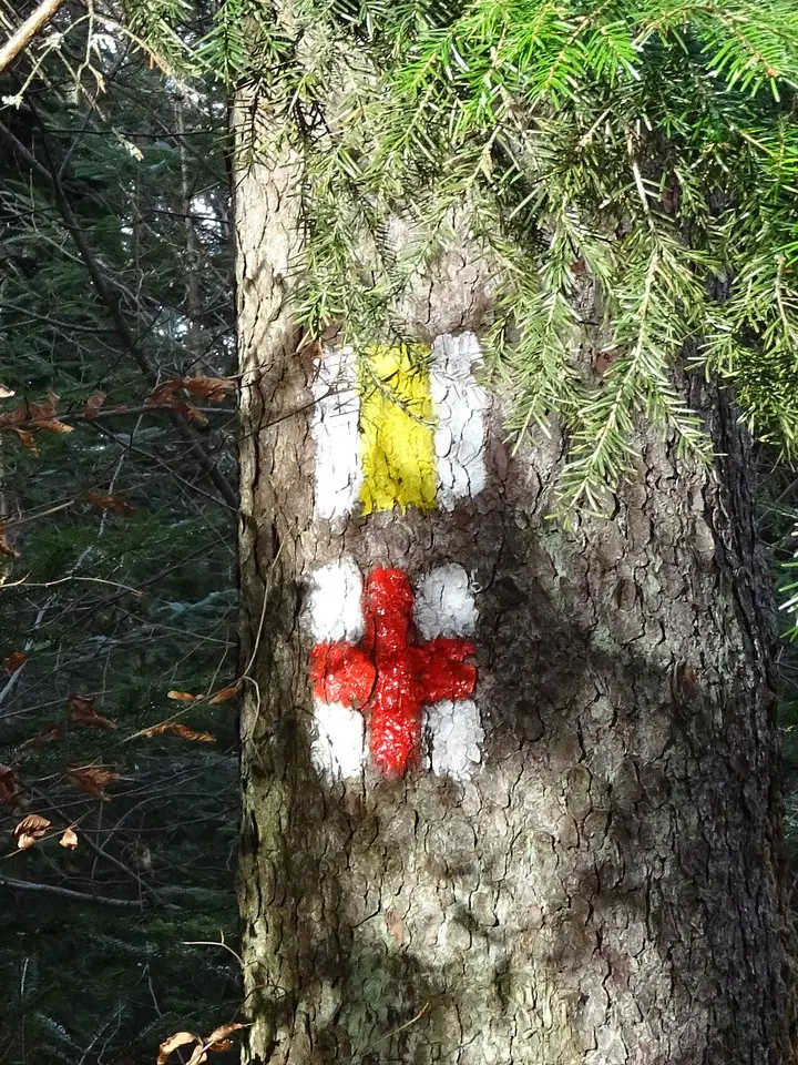
A red cross painted on a beech could mark any of the 141 trails in Romania that carry it. Say where you are and the list shrinks: at Cabana Babele, 141 become one, with its name, its climb and where it ends.
© OpenStreetMap contributors · relief Copernicus GLO-30
1Which mark did you see?across Romania
2Where are you?
You can also tap the map where you saw the mark.
The alphabet of the mountains
Three colours, four shapes, twelve marks
Every trail mark in Romania is built from the same pieces: a stripe, a cross, a triangle or a dot, in red, blue or yellow, always on white. The law draws them to the centimetre.
Drawn after Government Decision 77/2003, Annex 3. Marks are painted facing both directions of travel, 1.5–2 m above the ground, in reflective paint.
Where each mark is painted. Press one to see its trails on the map.
Yellow is painted half as often as red or blue.
Red and blue are painted about equally often: on 601 and 611 trails respectively. Yellow on only 299.
The rule and the paint
Stripes keep to the ridges. Dots make the loops.
The law says the vertical stripe marks the main trails, “as a rule” along a ridge. On the map the rule shows: 64% of stripe trails run higher than the land around them. For crosses, triangles and dots, the share is between 40% and 46%.
How high each trail runs above the land around it
Only stripe trails usually run higher than the land around them.
Each dot is a trail. Above zero, the path runs, by its median, higher than the land around it, as it does on a ridge. Below zero, it runs lower, in a valley or along a slope.
- 10.7 km
- the typical length of a stripe trail. A dot trail: 5.2 km.
- 64%
- of stripe trails run higher than the land around them. Dot trails: 40%.
- 86 of 113
- loops, trails that come back to where they started, are marked with a dot.
The law ties the dot to out-and-back trails, not to loops. On the map, though, almost every loop carries a dot.
The busiest tree
Nine trails on one path
At Stâna de Vale, in the Bihor Mountains, nine trails meet on the same path. On the 367 metres they share, every marked tree should carry nine marks, one under the other.
On 1,536 km of path, more than one kilometre in ten of all marked path, at least two trails run together. Where marks crowd together the map helps most: the tree shows which trails pass, the map tells you where each one goes.
What the map does not know
The map knows where the mark leads. It does not know what the path looks like today.
Marks fade
Paint fades or is redone. A trail can be on the map and hard to follow on the ground, or the other way round. The trails come from OpenStreetMap, extracted on 30 October 2026.
Conditions
Closures, avalanches, snow and washed-out bridges are not on the map. Ask Salvamont, Romania's mountain rescue, or the park authority before you set off.
Some trails are missing
Volunteers draw this map. 72 trails have breaks in their line, and some trails marked on the ground are not drawn at all.
0SALVAMONT (+40 725 826 668) or 112On a phone keypad, the letters SALVAMONT are the digits 725 826 668.Say who you are, what happened, how many of you there are and where. The mark on the tree helps you say which trail you are on.
The number is the one published by Salvamont România.
Sources
Where the trails and the numbers come from
The trails
1,723 hiking routes from OpenStreetMap, in the Geofabrik extract for Romania of 30 October 2026. 1,511 trails carry one of the twelve marks; 212 carry other marks (Hungarian trails, pilgrim ways, European long-distance paths) and are dotted on the map. 851 were drawn from GPS tracks by the Munții Noștri project, which also gave them their codes.
Line and length
Each trail is assembled from its pieces. Its length is the path between its named ends, without branches. For 872 trails the mappers also recorded the distance; for 800, it is within 15% of the line's length.
Places on the way
Huts, peaks and saddles are named OpenStreetMap points within 150 m of the trail. Of the places named in trail descriptions and found on the map, 425 of 478 lie within 300 m of the line.
Height
Copernicus GLO-30, a surface model with 30 m cells, smoothed. Climbs only count steps of at least 10 m. In forest the model catches the treetops, so climbs are approximate.
The ridge
For every point of a trail, the height of the path minus the average of a 1.2 km square around it; the chart shows the median of these along the trail.
The law
The marks, their sizes and the grouping rule come from Government Decision 77/2003, Annex 3 (Official Gazette no. 91, 13 February 2003).
Licences
Trails and places: © OpenStreetMap contributors, ODbL. Relief: Copernicus GLO-30, © DLR e.V. 2010–2014 and © Airbus Defence and Space GmbH 2014–2018, provided under COPERNICUS by the European Union and ESA.