.jpg)

This is a conventional description, not a length recalculated from the OpenStreetMap extract.
Geography
How narrow is the Bosphorus?
From end to end
About 31 km between two seas↗
Between the Black Sea and the Sea of Marmara, the Bosphorus runs about 31 km by conventional geographic description. Follow its bends on the map.
This is a conventional description, not a length recalculated from the OpenStreetMap extract.
Sources for this passage: M10
The 1997 description
The reported average is 1.6 km↗
Alpar and Yüce report an average width of 1.6 km, with descriptions ranging from 0.7 to 3.5 km. These are the study’s geographic descriptions, not a new survey of every point.
The average and range belong to one study description; they do not define every bend.
Sources for this passage: M10
Depth, a separate measure
36 m on average; 110 m maximum↗
Alpar and Yüce give an average depth of 36 m and a maximum of 110 m. These are descriptions in the 1997 study, not a main-channel minimum or a recent point-by-point survey.
The average and maximum do not set the depth at every stretch.
Sources for this passage: M10
Aşiyan–Kandilli
About 700 m↗
Türkiye’s Ministry of Transport characterizes the Aşiyan–Kandilli stretch as about 700 m wide. Keep the attribution: it is the ministry’s characterization, published in 2025.
The ministry characterizes this stretch; the figure is not a new measurement series.
Sources for this passage: M07 M11
The map shows where these reference points sit along the full strait.
The drawing shows the directions; it is not a measured profile to scale.
Hydrography
Water moves in two opposing layers
The exchange
Two layers, two directions↗
In the same channel, two layers move in opposite directions: less-salty surface water heads south toward Marmara; saltier water returns north below it. The study observes that exchange in instrumented sections.
The drawing shows the directions; it is not a measured profile to scale.
Sources for this passage: M08
Surface current
Speed changes from south to north↗
In 2008–09 observations, southward surface flow often exceeded 2.0 m/s in the southern section; in the north it was generally below 0.30 m/s. These are local readings, not constant speeds across the Bosphorus.
Keep the period and place together: north and south do not give the same value.
Sources for this passage: M08
Lower-layer current
Below it, water returns north↗
The same study finds northward flow usually below 0.70 m/s in the south and often reaching 1.00 m/s in the north. Speeds vary with section and depth; these observations are from 2008–09.
A reading from one section does not become the usual speed of the whole strait.
Sources for this passage: M08
The directions can be placed on a map; the speeds stay tied to the sections where they were measured.
This is OSM; the 1453 boats’ route remains a separate schematic.
Present-day geometry
The Bosphorus between the Black Sea and Marmara
Dated extract
The waterway and coasts on one map↗
On the OpenStreetMap map dated 6 October 2026, follow the Bosphorus line between its two coasts; Aşiyan and Kandilli appear as named points. This is dated geometry, not a historical route or a track of a particular ship.
This is OSM; the 1453 boats’ route remains a separate schematic.
Sources for this passage: OSM
Northern end
The waterway opens to the Black Sea↗
Follow the line north to the Black Sea. The coast and waterway come from the same dated extract; their position here says nothing about depth or speed.
This map locates the shores; current speeds come from separate observations.
Sources for this passage: OSM
Two named points
Aşiyan and Kandilli↗
The named Aşiyan and Kandilli points anchor the ministry’s characterization of a stretch about 700 m wide. The points are from OpenStreetMap; the width figure comes from a 2025 ministry release.
Two sources, two roles: mapped locations and a width characterization.
Sources for this passage: OSM M07
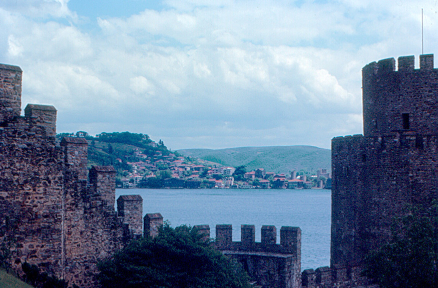
On the European shore, Rumeli Hisarı offers another clue to control of access.
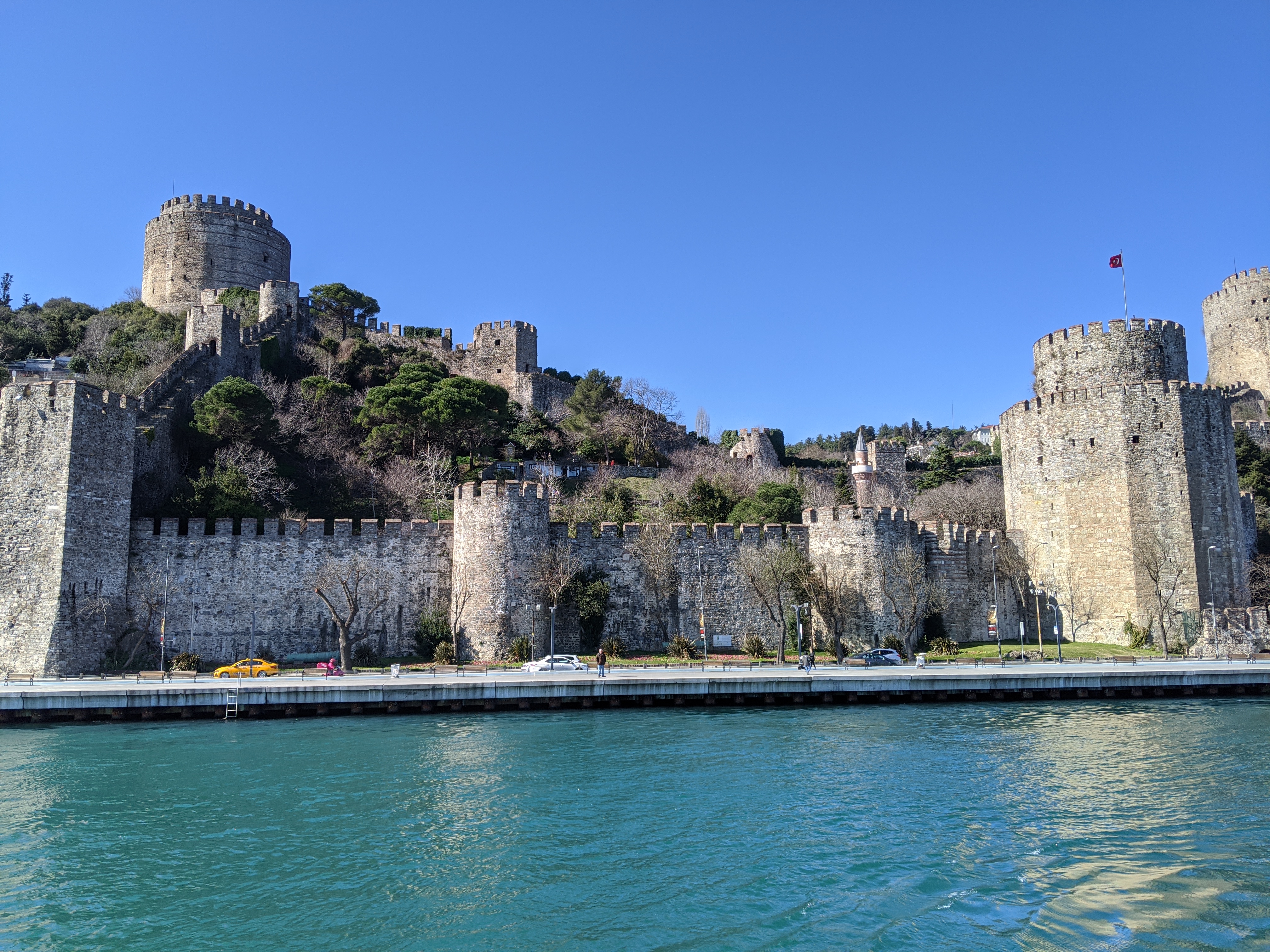
Rumeli Hisarı fortress on the European shore of the Bosphorus.
Mustafa-trit20 · 2020-02-17 · CC BY-SA 4.0 · Wikimedia Commons

Sources for this passage: C03 CULT-RUMELI
The date is attributed to the ministry page; the photograph is a 2020 view.
European shore
Rumeli Hisarı and control of access
Ministry dating
Rumeli Hisarı: 1452↗
On the European shore, the 2020 photograph shows Rumeli Hisarı above the channel. Türkiye’s Ministry of Culture and Tourism dates the fortress to 1452; the image cannot establish its full role in the siege.
The date is attributed to the ministry page; the photograph is a 2020 view.
Sources for this passage: C03 CULT-RUMELI
The institution’s account
Aid from the north↗
The ministry says the fortress was built to prevent aid reaching Byzantium from the north. Keep this as the institution’s explanation; the fortress alone does not explain the course of the siege.
An attributed purpose does not establish the military outcome on its own.
Sources for this passage: CULT-RUMELI
A separate reference
Spring 1453; 29 May↗
A separate ministry page places the siege in spring 1453 and the city’s entry on 29 May. These are calendar reference points; they do not compress the siege’s voices and episodes into one account.
Keep the fortress date, siege period and entry date distinct.
Sources for this passage: CULT-ENTRY
A century later, the accounts move from the fortress to a night of overland transport.
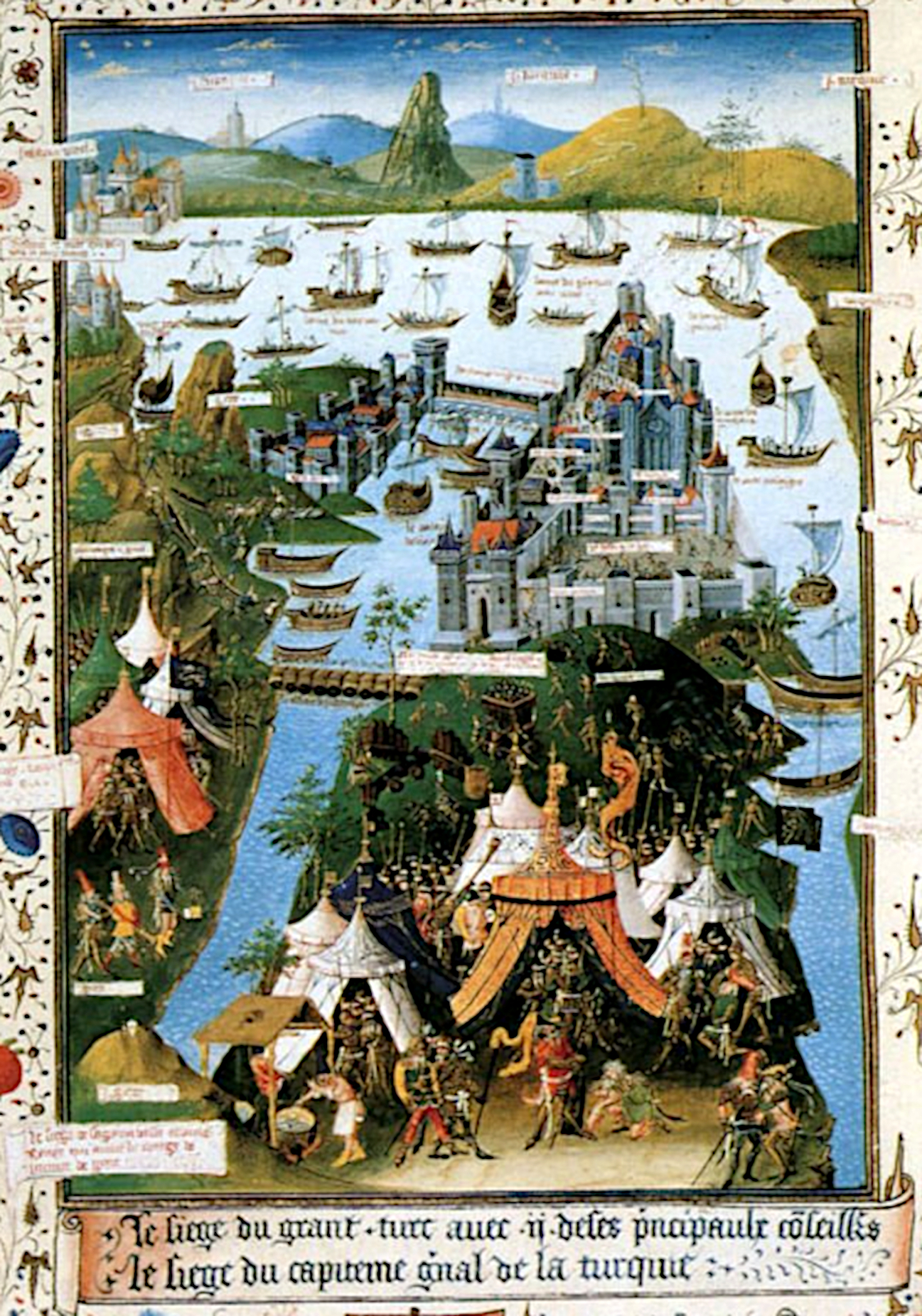
The BnF record identifies the miniature as a manuscript witness to the siege; it is not a contemporary photograph or a neutral image.
Jean Le Tavernier : Miniature "The siege of Constantinople in 1453" - made in Lille in 1455, in manuscript : "Advis directif pour faire le passage d'oultre-mer", translator: Jean Miélot. · Lille, 1455 · Public domain · Wikimedia Commons


This is a portage toward the Golden Horn, not a Bosphorus crossing; the diagram does not use OSM.
Accounts from different positions
What do the sources say about the night of 21–22 April 1453?
Night of 21–22 April
Boats move overland↗
On the night of 21–22 April 1453, the boats’ route leaves the water: the Turkish Historical Society recounts Ottoman boats hauled from Tophane/Boğazkesen, across Galata toward Kasımpaşa and the Golden Horn, around the harbour chain.
This is a portage toward the Golden Horn, not a Bosphorus crossing; the diagram does not use OSM.
Sources for this passage: M12
The chronicles’ counts
67–72 boats↗
The Turkish Historical Society’s account passes on different totals, from 67 to 72, depending on the chronicle cited. Keep the reported range: it is not an independently verified count.
The variation between accounts is part of the number.
Sources for this passage: M12
Three records, three positions
Ottoman court, Venetian witness, manuscript↗
Tursun Beg writes from a court setting shaped by dynastic praise; Nicolò Barbaro offers a Venetian eyewitness perspective. The BnF record identifies the miniature in manuscript Français 9087, folio 207 verso; it is a manuscript object, not a neutral image.
Keep the narrative, eyewitness account and manuscript record distinct.
Sources for this passage: M13 M13-BNF M13-BAR C04
The Convention and modern navigation rules ask for the same care: keep documents with different roles apart.
Here we keep to the dates and Articles 2, 13–14 and 18–21; we do not paraphrase their text.
Rules of passage
The Convention and navigation safety are distinct layers
Montreux Convention
One system, three waters↗
Open the Convention’s timeline at its three dates: signed 20 July 1936, provisionally in force from 15 August, definitive from 9 November. Its scope is the Bosphorus, Sea of Marmara and Dardanelles as one system.
Here we keep to the dates and Articles 2, 13–14 and 18–21; we do not paraphrase their text.
Navigation safety
The traffic scheme has a different timeline↗
Türkiye’s traffic separation scheme began in 1994 and received IMO approval in 1995. This is a navigation-safety measure, kept separate from the Convention text.
A separate regime does not become a Convention article because it uses the same water.
Sources for this passage: M03
Vessel traffic service
Operational from 30 December 2003↗
The vessel traffic service became operational on 30 December 2003. Its operational page lists a 17-nautical-mile VTS area for the Istanbul Strait; this is not the measured length of the Bosphorus.
The operating date and the service area are different measures.
Sources for this passage: M03 M04
Now read the traffic figures as reported passages, each with its year and definition.
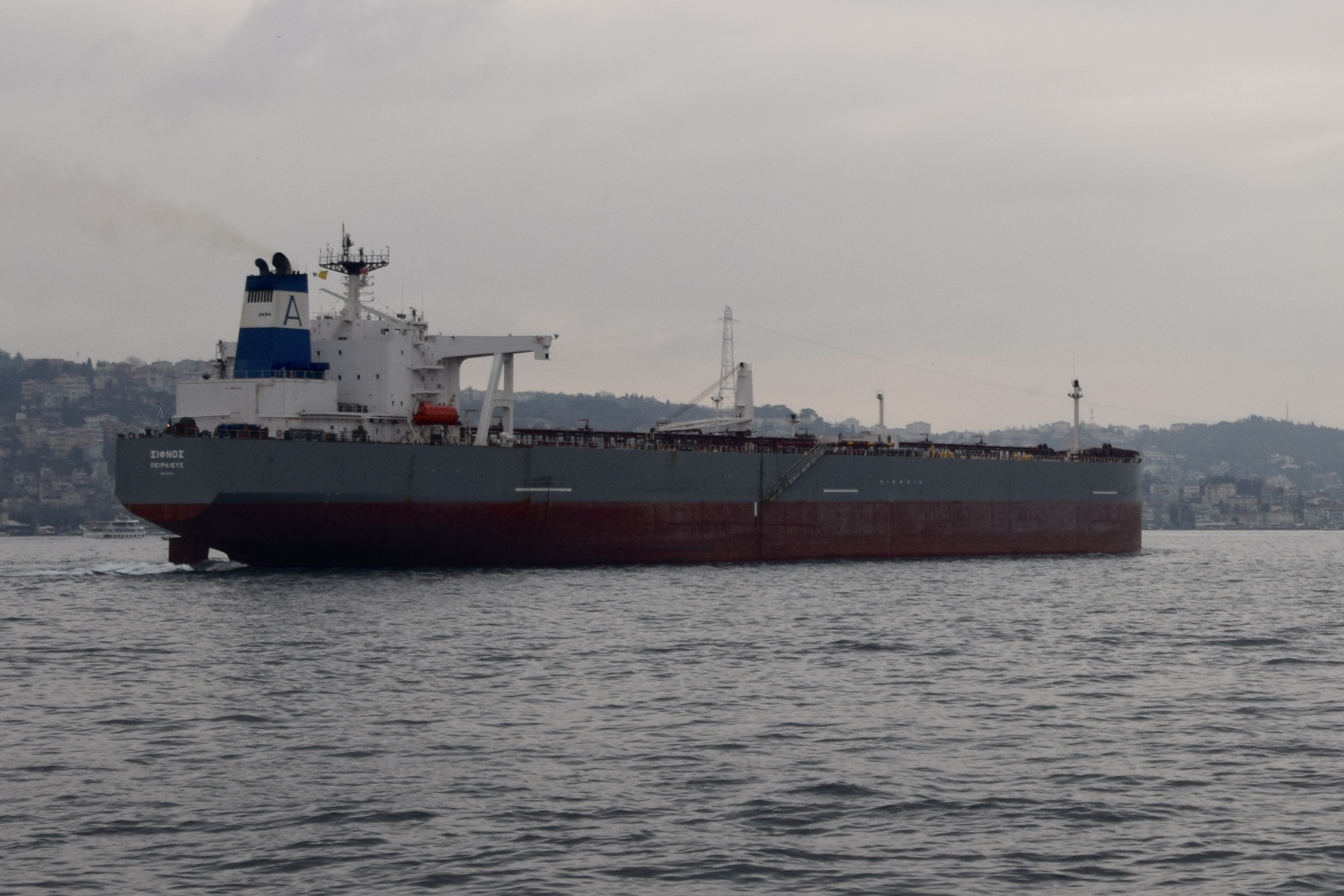
A tanker in the Bosphorus; the photograph does not establish the passage count or cargo category in the ministry table.
Ank Kumar · 2014-12-27 · CC BY-SA 4.0 · Wikimedia Commons
_01.jpg)

Keep the year and count passages, not distinct vessels.
Reported passages
What do the 2024 and 2025 figures count?
A complete calendar year
40,172 passages in 2025↗
Open the ministry’s 2025 tally: 40,172 reported passages through the Istanbul Strait in the calendar year. Each mark is a movement, not a unique ship.
Keep the year and count passages, not distinct vessels.
Sources for this passage: M06
A narrower category
Tankers carrying hazardous cargo↗
A separate Türkiye Ministry of Foreign Affairs table reports 9,554 tankers and 169,782,040 tonnes in the hazardous-cargo category in 2025. The table does not cover every vessel or all cargo.
Do not compare these tonnes with totals defined more broadly.
Sources for this passage: M03
Figure published in 2025
41,363 passages reported for 2024↗
The ministry release dated 7 September 2025 reports 41,363 passages through the Istanbul Strait in 2024.
“2024 value and 2025 partial-year figures are dated records, not a current forecast.”
Sources for this passage: M07
The grain corridor uses different ports, a different period and a different denominator.
These are initiative exports and voyages, not a Bosphorus passage total.
A separate historical corridor
The grain initiative is not current Bosphorus traffic
Through 15 July 2023
32.8 million tonnes; 1,003 voyages↗
Set the Bosphorus tally aside. Through 15 July 2023, the UN reports 32.8 million metric tonnes of food over 1,003 voyages under the Black Sea Grain Initiative, for three Ukrainian ports.
These are initiative exports and voyages, not a Bosphorus passage total.
Sources for this passage: UN-JCC
The end of the interval
The initiative ended on 17 July 2023↗
The UN dates the end of the Black Sea Grain Initiative to 17 July 2023. The 2025 traffic figures belong to a different period and geography.
This is historical corridor context, not a current Bosphorus transit route.
Sources for this passage: UN-FAQ
Closing the records
Keep each count in its own frame↗
Water exchange, navigation and history meet in one strait. Each figure holds its meaning only beside the place, year and category it describes.
Currents are measured by section; passages and voyages count different things.
Sources for this passage: M08 M06 UN-JCC
Leave every number beside the period, route and institution that produced it.
Evidence
Sources and records
Sources and records
The sources below support the measurements, dates and accounts used in this essay.
- M01primary treaty text reproduced in a Turkish MFA reportMontreux Convention — authentic French text
- M02official government summaryTürkiye MFA — implementation of the Montreux Convention
- M03official explanatory note and maritime tableTürkiye MFA — note on the Turkish Straits
- M04operational page of Türkiye’s Coastal Safety DirectorateKıyı Emniyeti — vessel traffic and pilotage services
- M05official landing page for passage-statistics seriesKıyı Emniyeti — official statistics
- M06ministry release, 14 February 2026Türkiye Ministry of Transport — Turkish Straits traffic in 2025
- M07ministry release, 7 September 2025Türkiye Ministry of Transport — eight months of Istanbul Strait passages
- M08peer-reviewed field study, 2011Jarosz et al. — flow variability in the Bosphorus Strait
- M09peer-reviewed field and hydraulics study, 2002Gregg and Özsoy — flow, water masses and hydraulics in the Bosphorus
- M10peer-reviewed field study, 1997Alpar & Yüce — sea-level variations along the Turkish Strait System
- M11peer-reviewed applied study, 2022Bosphorus ship-simulator and navigation study
- M12institutional historical narrative drawing on chroniclesTurkish Historical Society — İ. Hakkı Uzunçarşılı, “İstanbul’un Fethi”
- M13study of a near-contemporary Ottoman court accountTursun Beg — text and context, University of Chicago
- M13-BNFinstitutional manuscript recordBnF Mandragore — Français 9087 manuscript, folio 207 verso
- M13-BARtranslation of a Venetian eyewitness accountNicolò Barbaro — translation of the Venetian diary
- CULT-RUMELIinstitutional fortress history pageTürkiye Ministry of Culture and Tourism — Rumeli Hisarı
- CULT-ENTRYministry digital-library editorial pageTürkiye Ministry of Culture — “Türkler İstanbul’a Giriyor”
- UN-JCCofficial Black Sea Grain Initiative updateUN Joint Coordination Centre — update of 15 July 2023
- UN-FAQUN FAQUnited Nations — Black Sea Grain Initiative FAQ
- OSMOpenStreetMap licensing and attribution pageOpenStreetMap — copyright and attribution
- C01Wikimedia Commons file pageWikimedia Commons — C01 image file page
- C02Wikimedia Commons file pageWikimedia Commons — C02 image file page
- C03Wikimedia Commons file pageWikimedia Commons — C03 image file page
- C04Wikimedia Commons file pageWikimedia Commons — C04 image file page