Valea Saulei and the nursery next doorthe ponds that kept their willows, and the field that lost its trees in one summer
On 27 October 2026 Bucharest's General Council made Valea Saulei the city's third protected natural area. Next to it, on the field to the west, stood the Tei-Toboc tree nursery. Landsat satellites have passed overhead every summer since 1984: the drawing below is made, square by square, from the green they measured.
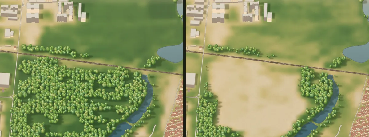
Summer 2014Summer 2016
Summer
1990
Two neighbours
North of Lake Plumbuita, one of the chain of lakes on the Colentina river that crosses north-east Bucharest, two pieces of green lay side by side between the railway to Constanța and Strada Gherghiței.
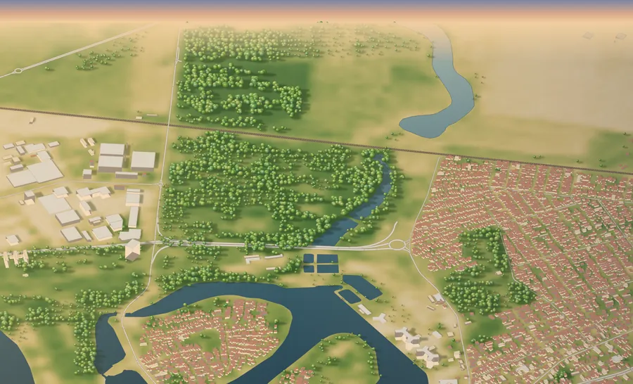
To the west, the Tei-Toboc nursery; in 2010 the newspaper Jurnalul wrote that it was the only nursery Bucharest had left. According to the study by the Bucharest Natural Park Association, it supplied saplings for the city's planting for decades. To the east, according to the same study, two fish ponds dug in 1975 on the Valea Saulei, a stream running down to the Colentina, with willows on their dykes.
2004
Equally green
From 1990 to 2007, in the same satellite passes, the nursery field and the ponds' banks were practically equally green: the average difference between them was zero to two decimal places.
The chart shows, for every summer, how green the two were on the same scale.
Midsummer vegetation index (NDVI), mean of the squares, same satellite passes.
2009
The paperwork
In 2004 the nursery land began to be handed back to private claimants under the 1991 land-restitution law. In 2007 the General Council approved a zoning plan for blocks of 12 to 45 storeys, and in 2009 the investors, who then held 20 of the nursery's 34 hectares, applied for an environmental permit to clear them entirely (România Liberă, HotNews).
The permit was not granted then. In June 2014 Dan Trifu of the Ecocivica association said more than 100,000 mature trees were still standing there.
2015
One summer
The summer of 2014 is the last in which the field looks full of green. In the summer of 2015, 303 squares of 30 metres on the field lost their green at once, about 27 hectares (332 in the whole window). The area of dense green on the field fell from 35 to 5 hectares. The Association's study speaks of losses between 2014 and 2019; the satellite shows most of it happened in a single summer, and another 77 squares within 90 metres of it went out the following summer.
A global map of forest loss made at the University of Maryland from the same imagery also dates the loss of canopy here to 2015. Who removed the trees, and under which permit, does not appear in the sources found.
2019
The banks
The ponds' banks came through the same summer without going out. After 2015 the field had, in the same passes, about 44% of their green in 2016 and 75% in 2025.
On 14 December 2018 the urban section of the A3 motorway opened past the ponds. The banks have had summers with less green (1985, 2003, 2007–2009, 2016–2018), and came back each time.
2025
What is left on the field
The towers were never built. The field has greened up again, with grass and scrub in the Association's photographs: the summer of 2025 shows it greener than in 2016, with no tree canopy back.
According to the Association's study, by Decision 239 of 2023 the Sector 2 council (Bucharest is split into six sectors, each with its own mayor and council) approved drawing up a feasibility study for a 42.7-hectare "Valea Saulei Park" that takes in the former nursery; Buletin de București reported that almost half of the land would have to be expropriated.
27 October 2026 (last summer measured: 2025)
Protected
On 27 October 2026, with 45 votes in favour and one abstention, the General Council declared Valea Saulei a protected natural area of local interest, a category in Romanian law that lets a city protect a site for its landscape and wildlife, at the request of Sector 2 and on the basis of five years of fieldwork by the Bucharest Natural Park Association.
The protected parcels add up to 52,910 square metres, or 5.3 hectares. The outline on the study's map, drawn here, encloses almost 10.7 hectares, water included.
Your square
Every 30-metre square has its own story
Tap anywhere on the drawing: the square under your finger shows its 41 measured summers (2005 is missing). Or pick a summer to see which squares lost their green that year.
Tap the drawing
Squares that went out in a summer
19851995200520152025
The peaks of 1996 and 2000 are mostly land north of the railway, towards Pipera, not the nursery.
The Bucharest Natural Park Association's study, carried out between 2021 and 2025, has a table of 83 rows of birds seen here: 39 stay all year, 18 come only in summer, 6 only in winter, and 20 pass through on migration.
The study's table of protected species has 12 names: the Eurasian otter, the European pond turtle, the sand lizard, the green lizard, the dice snake, the peregrine falcon, the common kingfisher, the little egret, the little bittern, the grey-headed woodpecker, the common noctule bat and the European green toad.
The photographs are the Association's, taken at Valea Saulei.
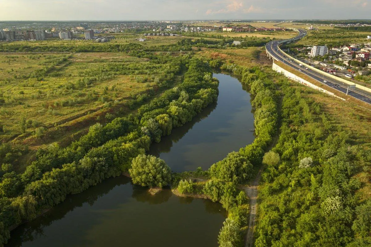
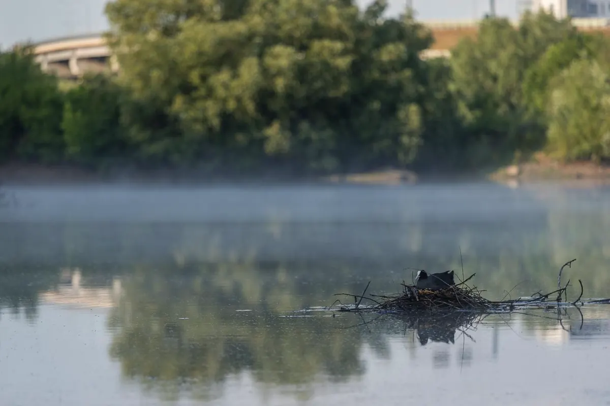
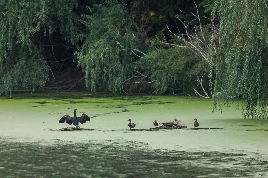
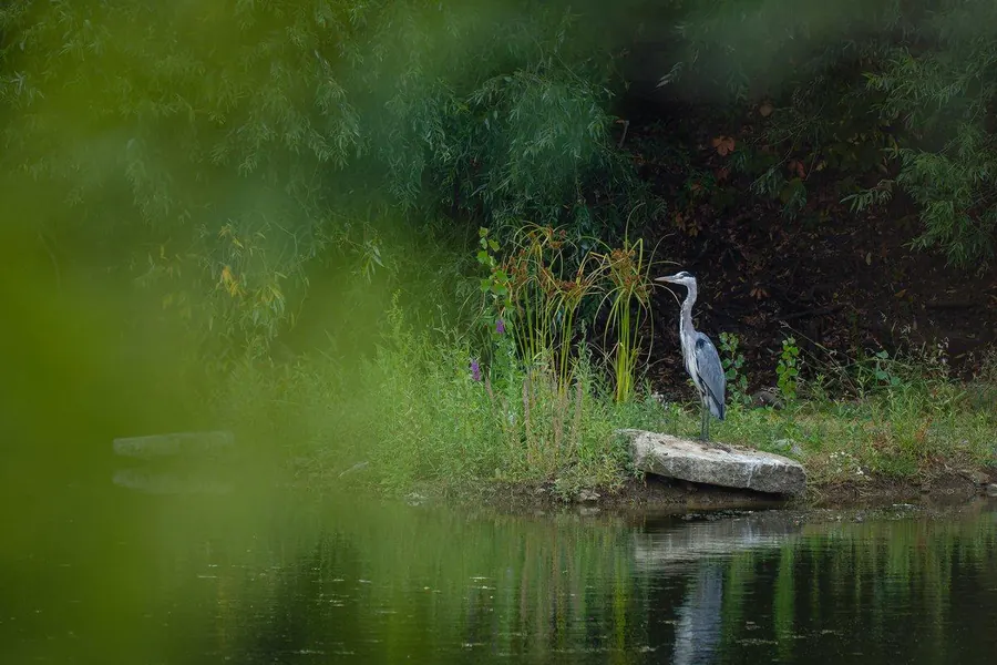
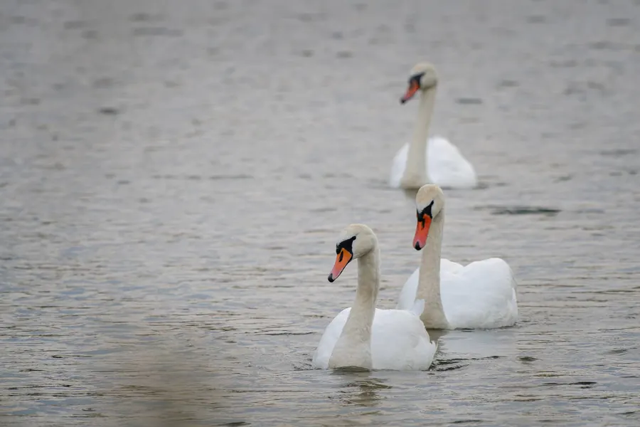
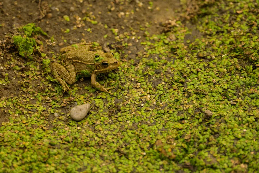
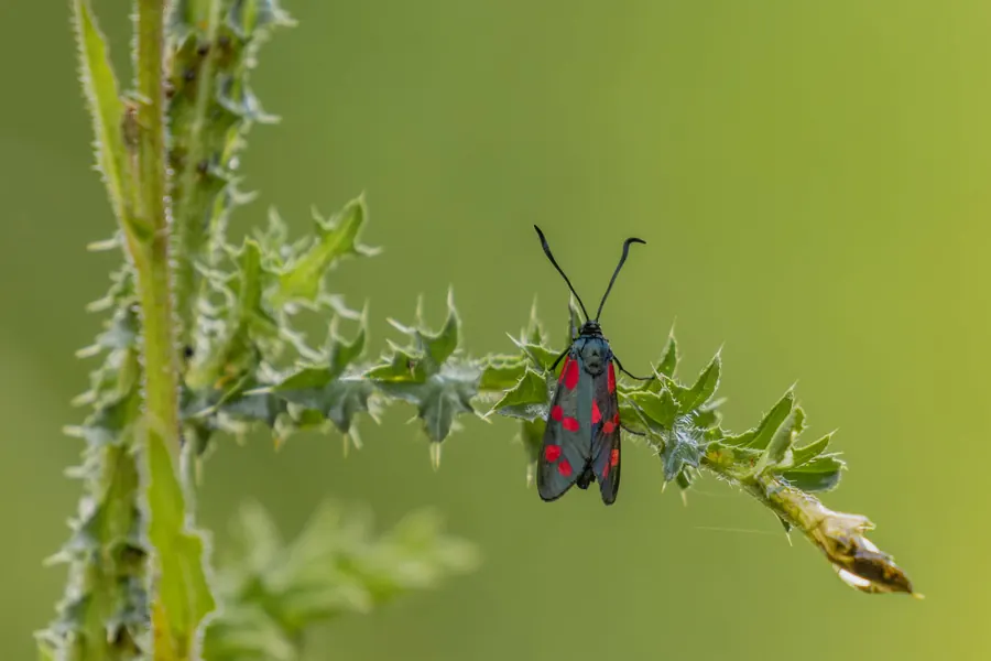
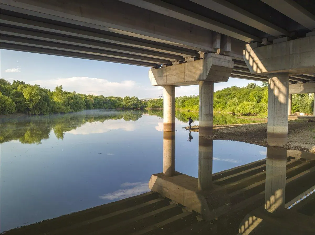
Valea Saulei looking north: the two ponds, the willows on the dykes and, on the right, the A3 motorway. Photo: Daniel Mirlea / APNBA coot on its nest in the morning mist. Photo: Alex Preoteasa / APNBA pygmy cormorant drying its wings beside mallards, on water covered in duckweed. Photo: Alex Preoteasa / APNBA grey heron on the bank of one of the ponds. Photo: Andreea Cârlig / APNBMute swans (Cygnus olor), which stay here all year. Photo: APNBA marsh frog in duckweed. Photo: APNBA burnet moth on a thistle stem, one of the invertebrates on the study's list. Photo: APNBUnder the A3 motorway bridge, at the entrance to the area. Photo: Cătălin Hamzescu / APNB
What next
What the vote changes, and what is still open
Dumping rubbish, lighting fires, feeding wild animals and cutting vegetation are now banned inside the protected area. Sector 2 has to record the status in the land register; a management plan and visiting rules come next.
Access is still unclear. Some reports say the site can be visited from Strada Gherghiței; others that the current path crosses land with no registered right of way and that entering one of the plots from Strada Gherghiței needs written consent. The study describes the only path, beside the railway, as covered in rubble.
The study also lists fire in the reeds, invasive species (tree of heaven, box elder, black locust, ragweed and the pond slider turtle), waste water from upstream and drought among the threats. It proposes extending the area onto a plot by the A3 held by the Interior Ministry through the Bucharest emergency inspectorate, as a screen of trees against the motorway.
The field of the former nursery is not part of the protected area. Its fate depends on the sector's park plan and on the ownership cases.
Method
How the drawing is made
The window is 2.58 by 2.46 km, 7,052 squares of 30 metres on the grid of the Landsat 5, 7, 8 and 9 satellites. For each summer, June to August, the cloud-free passes were kept (315 in all) and each square takes its median vegetation index (NDVI).
The sensors differ slightly. Comparing each with Landsat 7 in the summers they flew together, Landsat 8 reads vegetation 0.034 higher than Landsat 5; the older summers were brought onto the same scale.
The colour of the ground follows the measured green, blended smoothly from one square to the next; picking a summer draws, exactly, the squares that lost their green that summer, and picking a square outlines it. A square with no clear pass in a summer takes the nearest summer's value. Tree crowns appear only where the vegetation stayed moist until late summer (the NDMI index), which separates trees from grass and crops that dry out in August; an approximation, not a count of trees.
Lakes follow the map and the study. Buildings are today's, from OpenStreetMap; each appears from the year its 100-metre square reached half its 2020 built-up surface (JRC Global Human Settlement Layer). The motorway appears from the summer of 2019.
A square "lost its green" in a summer if the mean of the three summers before was at least 0.55 and that of the three summers starting with it at most 0.42. The summer of 2005 is missing (no clear pass); 1989, 1995, 2002, 2012 have fewer than three passes.
"The banks" are the squares inside the study's outline, without the water and a 20-metre strip around it (4.8 ha); "the field" is the rectangle west of the ponds, between the railway and the road to the south (37.3 ha). At 10 metres, Sentinel-2 imagery from 2017–2025 shows the same gap.