
The Berca mud volcanoes
The mud at Berca boils with no fire under it
The bubbling mud at Pâclele is cold. Methane pushes it up from 3,000 metres down. Stand beside a cone, to scale, go down to the reservoir and see where the ground really burns.
Hot or cold?The touch
If you put your hand on the bubbling mud, what would it feel like?
It looks as if it were boiling. Before reading on, choose.
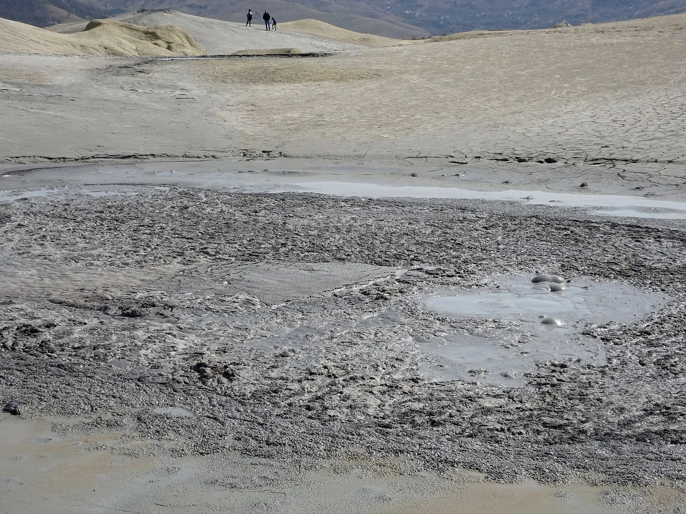
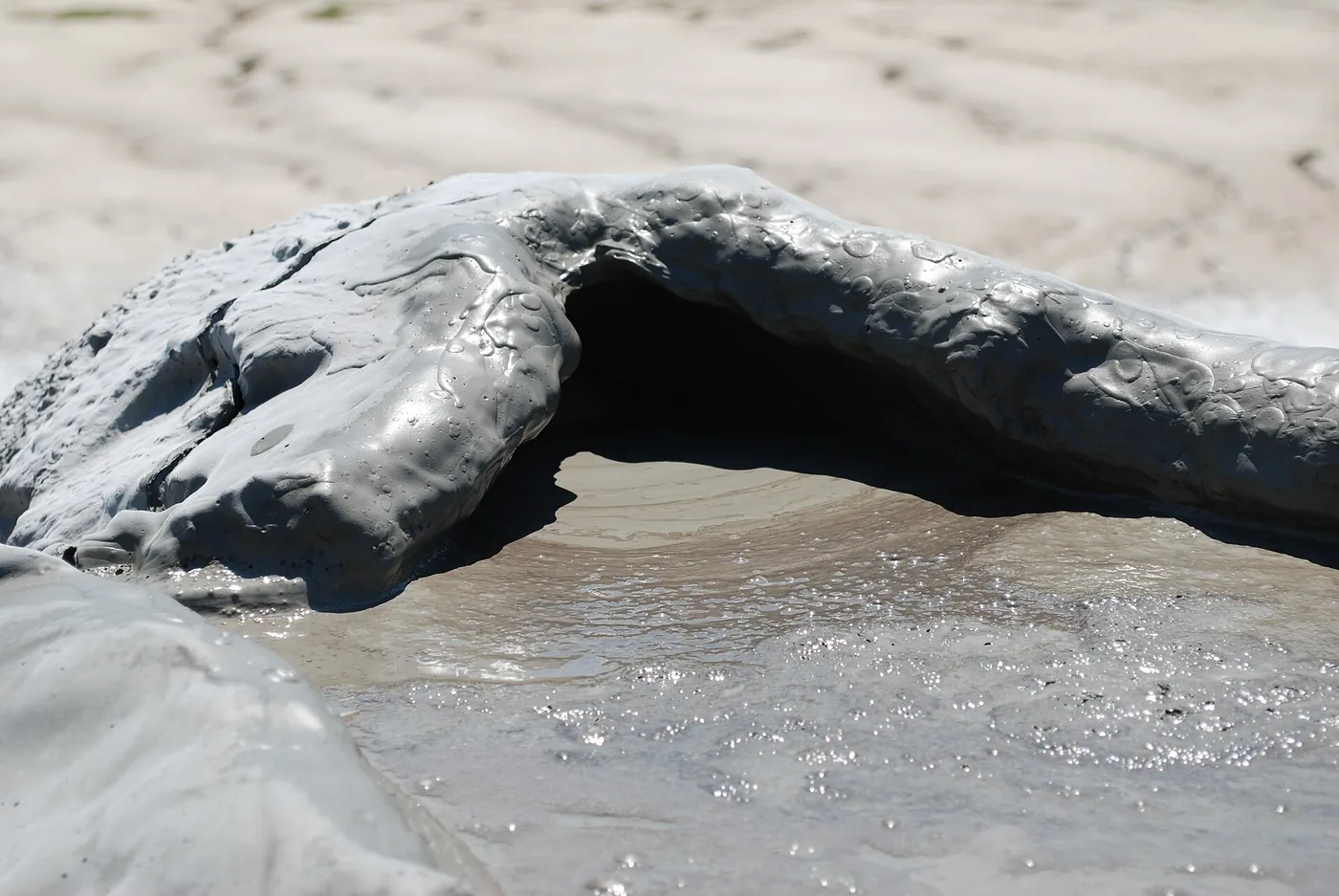
Cold. The mud coming out of mud volcanoes is cold, perhaps slightly warmer than the surrounding ground. That is how the US Geological Survey describes mud volcanoes.
The bubbles come from gas passing through mud, like air through a straw in a thick drink. Heat plays no part.
How cold is cold?
Move from mud to lava step by step. The values are the published ones.
Cold, like the ground. Mean air temperature at Beciu is about 10 degrees; nobody has published a measurement of the mud itself.
The three steps, from cold to hot:
- about 10 °C · The mud at Pâclele Cold, like the ground. Mean air temperature at Beciu is about 10 degrees; nobody has published a measurement of the mud itself.
- 37 °C · You 27 degrees above the mud. You would cool off at a mud cone on a summer day.
- 1,170 °C · Lava at Kīlauea 1,160 degrees above the mud. That is how hot lava is when it leaves the Hawaiian volcano.
Everything that separates a mud cone from a true volcano is the missing heat. Lava is molten rock, brought up from depths where rocks melt. The mud at Pâclele is sediment soaked in salty water, pushed up by gas.
A whole field near Berca is called Fierbători, the boiling ones. The name says what the mud looks like.
How big
How tall is the tallest cone?
Three numbers circulate about the cones at Pâclele. Only one was measured on standing cones.
6 metres. A 2015 study measured over 100 cones and vents at Pâclele; the tallest, extinct ones stood 6 metres high. Older books also say 10 metres, and cones collapse and regrow, so the number depends on the year of measurement.
80 metres is the whole Pâclele Mari hill. Anyone putting that figure on a cone mistakes the hill for the vent.
Stand beside a cone
Pick a cone, set your height and look. You and the cone share one scale.
tallest cone measured
Extinct, measured at Pâclele Mari in 2015.
Five children 1.35 m tall, stacked head to toe, clear 6 metres.
- Height6 m
- Stateextinct
- Measured2015, over 100 structures
- SourceBrustur et al. 2015
Cones are drawn to scale from the published height. The shape is schematic.
Stand beside a cone.
- Fan, 3–4 m Three children 1.35 m tall, stacked head to toe, clear a 3.5-metre fan.
- Record, 6 m Five children 1.35 m tall, stacked head to toe, clear 6 metres.
- From books, 10 m Eight children 1.35 m tall, stacked head to toe, clear 10 metres.
- The hill, 80 m 60 children 1.35 m tall, stacked head to toe, clear 80 metres.
At Beciu, the fourth field, the biggest cones rise about a metre and a half above the plateau, and the small craterless vents stand less than half a metre. Size differs from field to field.
Next to the giants of Azerbaijan, tens and hundreds of metres high, the Pâclele cones are small. Even so, Romania's are the largest in Europe.
The descent
Where the mud comes from: 3,000 metres down
Go down beside the vent to the reservoir the gas rises from.
At the surface
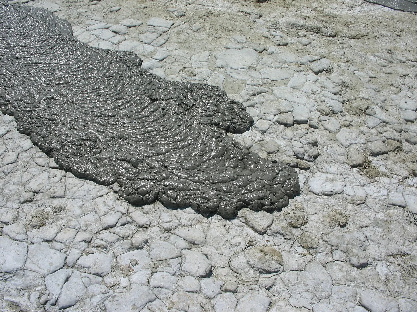
The tallest cone measured stands 6 metres high. Under the dry crust the mud is fluid and flows downhill in grey tongues.
At 20 metres
At Pâclele Mari the mud sheet is 20 metres thick and spreads over 1,000 by 600 metres.
At 3,000 metres
Here, in Miocene-age beds, layers millions of years old, the mud forms. Gas rises along faults, carrying water and slurry, and leaves the surface through vents.
Borehole 2341
The deepest borehole in the area reached 3,330 metres, a kilometre from the reserve. Gas at depth has the same composition as vent gas.
The depth where the mud forms: 3,000 metres.
The four fields sit on the crest of a fold 30 kilometres long, the Berca-Beciu-Arbănași anticline, cut by faults. The faults give the gas its road to the surface.
In 2024 the first deep 3D electrical survey of a mud volcano in the country was made at Pâclele Mici. The map under the plateau is only starting to take shape.
The gas
What comes out of the vents: almost pure methane
Of every hundred gas molecules, over 95 are methane.
- 98.1%methane at Pâclele Mici
- 95.7%methane at Pâclele Mari
- 1,350tonnes of methane a year, all four fields
- 3.7tonnes of methane a day
About 43 grams every second. Mean rate: the yearly total of 1,350 tonnes divided by the seconds in a year.
What do 1,350 tonnes of methane mean?
Methane traps about 30 times more heat than carbon dioxide, kilogram for kilogram over 100 years. Berca's 1,350 tonnes equal about 40,000 tonnes of CO₂: what about 8,700 ordinary cars put out in a year.
The water that comes out with the mud is a brine whose composition did not change between two analyses 25 years apart. A thin film of crude oil sometimes floats on the pools.
On a planetary scale, mud volcanoes are the second natural source of methane after wetlands.
Fire
This gas can burn
The mud is cold, and methane catches fire. In only one place in Romania does the ground burn on its own, and that place is not Pâclele.
In 2001, near Baku, a mud-volcano eruption threw flames almost 300 metres high and buried everything under tonnes of mud. The flames were burning gas.
50 kilometres north of Berca, near the village of Andreiașu, gas leaves dry ground and burns in everlasting fires with metre-high flames. The hard rocks there let no mud form, so only gas and bubbling water come out. The burning ground covers 400 square metres.
At Sărmășel in Transylvania, local people say a borehole blew out in the 1920s and the gas has leaked and burned ever since. The study that repeats the story presents it as the locals' account.
Methane burns. The Pâclele fields are nature reserves: do not light the gas, do not damage the vents, leave no trace.
The map
Four fields on a 30-kilometre fold
Each point is a mud-volcano field. Touch it to see what sets it apart.
The four fields, south to north:
- Fierbători-Berca 45°17′25″ N, 26°41′27″ EThe dry field: pools of muddy water and flat cones. The name means the boiling ones.
- Pâclele Mari 45°20′22″ N, 26°42′28″ EA 22-hectare reserve at 322 metres altitude. The active field gives off 730 tonnes of methane a year, and extinct cones reach 6 metres.
- Pâclele Mici 45°21′31″ N, 26°42′42″ EA 16.5-hectare reserve at 341 metres altitude. Its gas is the richest in methane: 98.1%. The field gives off 383 tonnes a year.
- Beciu 45°23′06″ N, 26°42′58″ EThe new field, grown in recent decades: half a hectare with about 50 active vents, the largest a metre and a half high. It is not a protected area.
Pâclele Mari and Pâclele Mici stand 2.2 kilometres apart. From Fierbători to Beciu, the ends of the system, it is 10.7 kilometres.
The points sit on the coordinates published in the Beciu field study. Towns come from OpenStreetMap, the country outline from Natural Earth.
Names
Pâcle, Fierbători and the Dragon Hill
The place names tell the story ahead of the geologists: haze, boiling and a wounded dragon underground.
Pâclă means, among other things, a mud volcano: a “small volcano erupting gases, salty water, sometimes oil”. The same word also means thick haze. And a fierbător is a place “in which something boils”. Alongside gloduri, bâhle and bolboroși, local people had a word for every kind of bubbling mud.
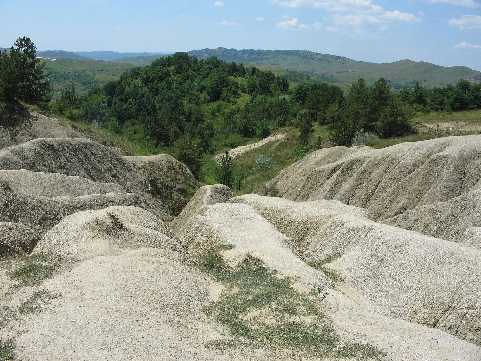
The surrounding hills are called the Dragon's: legend says a wounded dragon lies under them. Odobescu printed the story in 1874, and the hill's name sits on a topographic map from 1790.
Many sites say a Frenchman, H. Cognard, noticed the place in 1868 while looking for oil. The studies say something else: Coquand, 1867. They also credit Grigore Cobălcescu, in 1883, with tying the mud volcanoes to the oil deposits and ruling out any magma involvement.
The place has been protected since 1924. Since 2000 the two Pâclele fields have been reserves of national interest, and since 2022 they have belonged to the Buzău Land UNESCO Geopark.
Game
True or false?
Eight statements about the volcanoes that are not volcanoes. Some correct what many sites print.
The eight statements and their answers:
- True. The gas at Pâclele is almost pure methane. Over 95% of the gas is methane: 98.1% at Pâclele Mici and 95.7% at Pâclele Mari, in the published analyses. Brustur et al. 2015, Geo-Eco-Marina
- False. The mud coming out of the vents is hot. It is cold, perhaps slightly warmer than the surrounding ground. Gas makes the bubbles. USGS Volcano Watch 2005
- True. The mud comes from 3,000 metres down. That is where the mud forms, in Miocene beds, and gas pushes it to the surface along faults. Brustur et al. 2015, Geo-Eco-Marina
- False. The tallest cones are 80 metres high. 80 metres is the whole Pâclele Mari hill. The cones found standing in the 2015 survey were 6 metres at most. Brustur et al. 2015; Baciu et al. 2007
- False. Pâclele Mici is bigger than Pâclele Mari. Mici covers 16.5 hectares and Mari covers 22. The tale of the swapped names no longer fits the measurements. Brustur et al. 2015, Geo-Eco-Marina
- False. A Frenchman called Cognard described the place in 1868. The studies say Coquand, 1867. On many tourist sites both the name and the year came out wrong. Brustur et al. 2015, Geo-Eco-Marina
- True. In Romania there is a place where the ground burns on its own. The everlasting fires at Andreiașu, 50 kilometres north of Berca, burn with metre-high flames fed by dry gas. Baciu et al. 2007, Annals of Geophysics
- True. Romania's mud volcanoes are the largest in Europe. That is what the authors of the 2007 study call them, on the same page that names Romania as the country with Europe's densest methane seeps. Baciu et al. 2007, Annals of Geophysics
Unknowns
Five things the sources do not say
An honest page shows the edges of the map too.
- No source gives a calendar of eruptions at Pâclele: gas is known to escape without pause and small eruptions to come rhythmically, but nobody knows when the next one comes.
- Nobody has counted every cone; “over 100 structures” is the tally of a single study, from 2015.
- Nobody publishes which cone stands tallest today. Cones collapse and regrow, so every figure needs its year.
- Nobody can say when the next violent episode at Berca comes.
- Nobody has published how warm the mud at Pâclele is. “Cold” comes from a general description and the local climate. Nobody has put a thermometer in a vent.
Sources
How we know all this
Figures and dates come from published studies; the list below says what each one supports. Where sources give different values, both are printed with their years. The most important case is cone height: 6 metres measured in 2015, up to 10 metres and more in the older literature.
The car equivalent is worked out like this: 1,350 tonnes of methane a year, times 29.8 (the 100-year warming potential of fossil methane from the sixth IPCC report), divided by 4.6 tonnes of CO₂, what an ordinary car puts out in a year. The result is about 8,700 cars.
The place
- Brustur, Stănescu, Macaleț, Melinte-Dobrinescu (2015). The mud volcanoes from Berca: a significant geological patrimony site of the Buzău Land Geopark (Romania). Geo-Eco-Marina 21. zenodo.org (PDF) — the cones measured in 2015, the gas, the 3,000 m depth, the reserve areas, the history
- Baciu, Caracausi, Etiope, Italiano (2007). Mud volcanoes and methane seeps in Romania: main features and gas flux. Annals of Geophysics 50(4). core.ac.uk (PDF) — the methane flux, the four fields, the Andreiașu fires, the Azerbaijan comparison
- Strat, Kiss, Szabó, Móga (2020). Geomorphological assessment of the Beciu mud volcano terrain, Eastern Carpathians, Romania. Geografia Fisica e Dinamica Quaternaria 43. gfdq.glaciologia.it (PDF) — the Beciu field, the four fields' coordinates, the dragon legend, the absence of any magma link
- Mihai, Gerea, Tataru, Nastase, Grecu (2024). A geophysical investigation of the Pâclele Mici mud volcano in Romania using deep geoelectrical surveys. Applied Sciences 14: 2463. doi:10.3390/app14062463 — the first deep 3D survey, the brine stable for 25 years
The mechanism
- U.S. Geological Survey, Volcano Watch, 13 October 2005: “Here’s the dirty truth about mud volcanoes”. usgs.gov — the mechanism, the cold mud, the 2001 Azerbaijan flames
- U.S. Geological Survey, “How hot is a Hawaiian volcano?” (FAQ page). usgs.gov — 1,170 °C, the temperature of Kīlauea lava
Gas and climate
- Buzău Land UNESCO Global Geopark, Annual Report 2023 (Global Geoparks Network). globalgeoparksnetwork.org (PDF) — the 2022 UNESCO inscription
- U.S. Environmental Protection Agency, “Greenhouse Gas Emissions from a Typical Passenger Vehicle”. epa.gov — 4.6 tonnes of CO₂ a year for a typical car
- Muñoz, Schmidt, Weidema (2024). The indirect global warming potential of methane oxidation in the IPCC’s sixth assessment report. Environmental Research Letters 19: 121002. iopscience.iop.org — the warming potential of fossil methane: 29.8 over 100 years (AR6)
Names
- dexonline, DEX '09, entry pâclă, in Romanian. dexonline.ro — “small volcano erupting gases, salty water, sometimes oil”
- dexonline, MDA2, entry fierbător, in Romanian. dexonline.ro — “in which something boils”
- Welcome to Romania, “Mud volcanoes – Pâclele Mari and Pâclele Mici” (tourist page). welcometoromania.eu — the page whose figures this piece checks: Cognard 1868, 15 and 10 hectares
The map and the drawings
The map points sit on the coordinates published by Strat et al. (2020). Towns come from OpenStreetMap, the outline of Romania from Natural Earth, and the section through the reservoir is a diagram, not a measurement.