Six UNESCO Dacian fortresses, one ticket office. The other five you reach on foot, in half an hour to an hour.
In 1999 UNESCO listed six Dacian fortresses in the Orăștie Mountains, built in the last two centuries before the Roman conquest of AD 106. Only Sarmizegetusa Regia has a car park, opening hours and a ticket. The other five sit on hills between 514 and 1,030 metres, and from the end of the road they take a climb of 63 to 365 metres. What that means on the ground, fortress by fortress, with climb profiles, access, chronology and the state of the walls.
Updated 14 September 2026
Two Sarmizegetusas, 40 kilometres apart
Sarmizegetusa Regia is the Dacian capital, in the mountains at Grădiștea de Munte: this page is about it. Ulpia Traiana Sarmizegetusa is the capital of the Roman province, founded after the conquest on the Hațeg plain, next to a village still called Sarmizegetusa today. They are two different sites, 40 kilometres apart by road, with separate administrations and tickets. Satnav directions for “Sarmizegetusa” usually take you to the Roman one. For the Roman site, see the guide to visitable Roman sites.
Where the six fortresses are
Five fortresses lie in Hunedoara county, in a quadrilateral of some 25 kilometres between Orăștie and Petroșani, with Sarmizegetusa Regia in the middle. The sixth, Căpâlna, is in Alba county, on the Sebeș valley, 35 kilometres to the north-east as the crow flies and more than 100 by road. Click a point to jump to its profile.
Positions from each site's coordinates; towns for orientation. Relief: Copernicus GLO-90. Scale bar: 10 kilometres.
How high they sit and how far you climb from the road
The summit altitude says little about the effort: what matters is where you start. Each fortress's bar begins at the end of the road and ends at the summit. Sarmizegetusa Regia is the highest, at 1,030 metres, but its car park is close to the gate, so its climb is the smallest of the group, 63 metres. Costești-Blidaru sits at 750 metres, with 365 metres to climb from Costești: the biggest climb of the six.
Summit altitude: from the sources in each profile. Road end: from the Copernicus digital terrain model (90 m resolution), via Open-Meteo.
The climb profile, fortress by fortress
All six profiles share one scale: a 2-kilometre line is the same length in every drawing, and 100 metres of climb the same height. At Cetățuie, Blidaru and Piatra Roșie the line follows the OpenStreetMap path, with the altitude read from the terrain model every 25 metres. At Sarmizegetusa Regia, Bănița and Căpâlna the path is not in OpenStreetMap, so the drawing joins the road end to the fortress using the length and ascent published by the administration or the trail guide.
Sarmizegetusa Regia0.8 km length+33 m ascent10–15 min timeschematic from the published length and ascentCostești-Cetățuie2.0 km length+235 m ascentabout 30 min timeOpenStreetMap path, terrain at 90 mBănița0.6 km length+104 m ascentabout 40 min timeschematic from the published length and ascentLuncani-Piatra Roșie1.5 km length+319 m ascent45–60 min timeOpenStreetMap path, terrain at 90 mCăpâlna2.1 km length+302 m ascent45–60 min timeschematic from the published length and ascentCostești-Blidaru2.3 km length+413 m ascentabout 50 min timeOpenStreetMap path, terrain at 90 m
The fortresses
In order of the climb from the road, smallest first. Each profile gives the road, the path, the ticket, the hours, who runs it and what survives of the walls.
Sarmizegetusa Regia
Grădiștea de Munte, Orăștioara de Sus commune, county of Hunedoara · heritage code HD-I-s-A-03190
1,030 m summit+63 m climb from the road10–15 min time
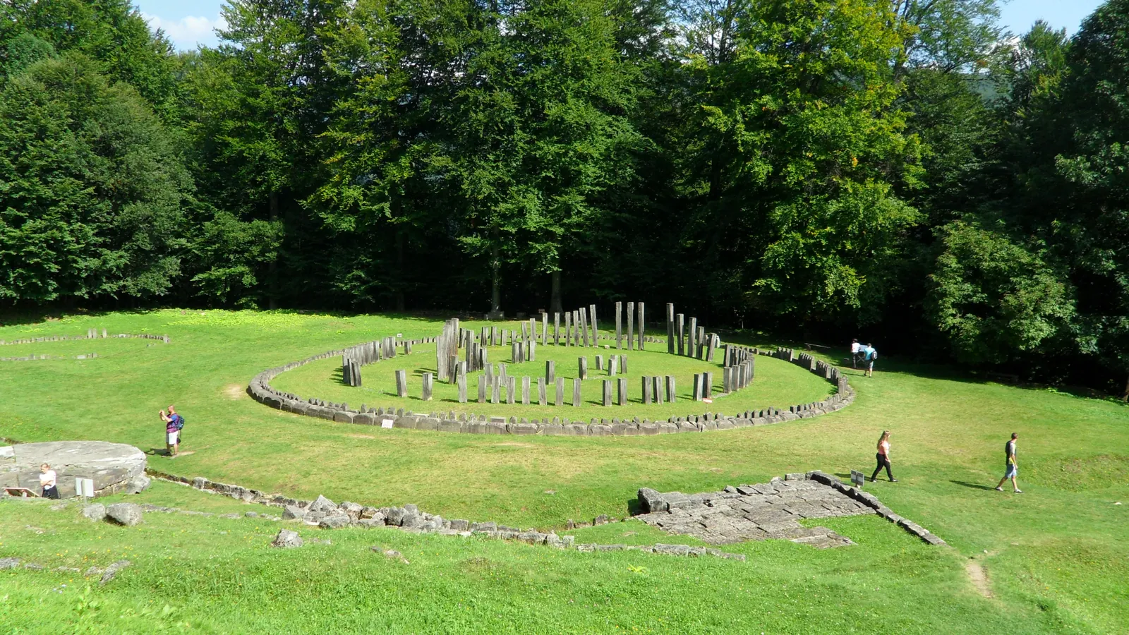
The great circular sanctuary in the sacred area of Sarmizegetusa Regia, with its andesite pillars and the forest behind. Cosmin Ștefănescu, CC BY-SA 3.0 RO, Wikimedia Commons.
The Dacian kingdom's capital and the largest of the six sites: a fortification of about one hectare, the sacred area with seven temples on terraces X and XI, the road paved with limestone slabs, two civilian quarters with workshops, among them the largest metalworking shop known in Dacia. The only site with a ticket office, an audio guide, a car park and marked trails.
By car
Paved all the way to the car park: county road 705A from Orăștie through Costești and Grădiștea de Munte, about 40 km. Free car park; cars go no further.
On foot
An 845 m footpath from the car park to the ticket office, 10–15 minutes through the forest. A gentle climb.
Ticket
30 lei adults, 10 lei pupils, students and pensioners (Hunedoara County Council decision 310/2025, from 1 January 2026). Audio guide 30 lei.
Hours
September 2026: Friday–Sunday 9:00–20:00, closed Monday–Thursday because of the Terrace X works. The schedule changes monthly; check before you travel.
Administered by
Hunedoara County Council, through the Museum of Dacian and Roman Civilisation, Deva
Chronology
A place of worship in the first half of the 1st century BC, the capital under Burebista and Decebalus, destroyed by the Romans in AD 106. First systematic excavations in 1924, under D. M. Teodorescu. Taken over by Hunedoara County Council in 2013; restoration works at Terrace X (EU recovery funds, 11.3 million lei) in 2026.
What survives
The best-kept site: the enclosure wall and temples are cleared, the paths marked, the panels bilingual. In 2026 Terrace X and the great andesite temple are being consolidated, with reduced weekday opening. The old wound is looting: between 1999 and 2001 treasure hunters took at least 24 royal gold bracelets out of the site, of which the state recovered 13 by 2011.
Costești, Orăștioara de Sus commune, county of Hunedoara · heritage code HD-I-s-A-03178
514 m summit+129 m climb from the roadabout 30 min time
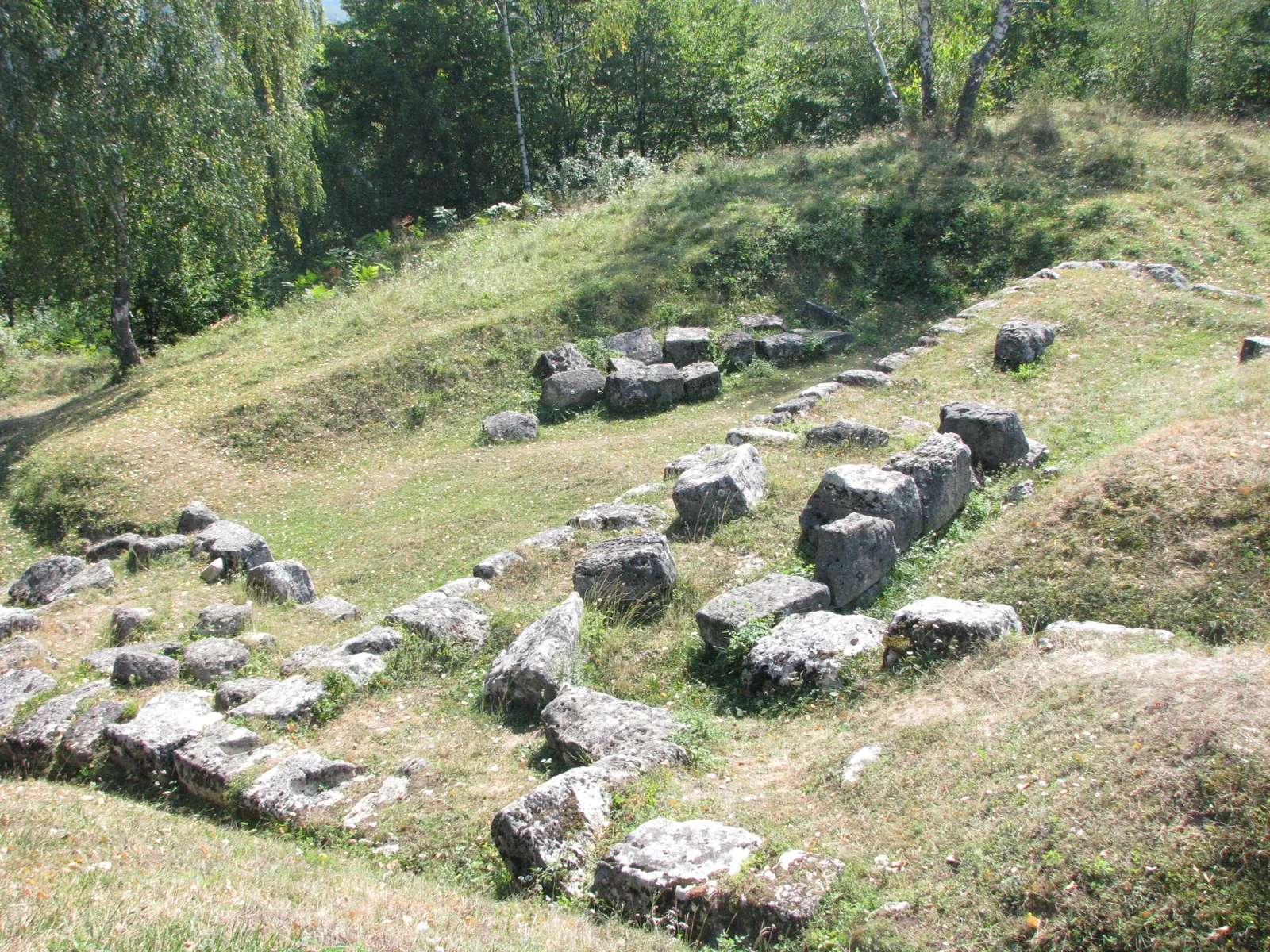
The stone bases of the bastion towers at Costești-Cetățuie, on the plateau meadow. Codrin Bucur (Codrinb), CC BY-SA 3.0 RO, Wikimedia Commons.
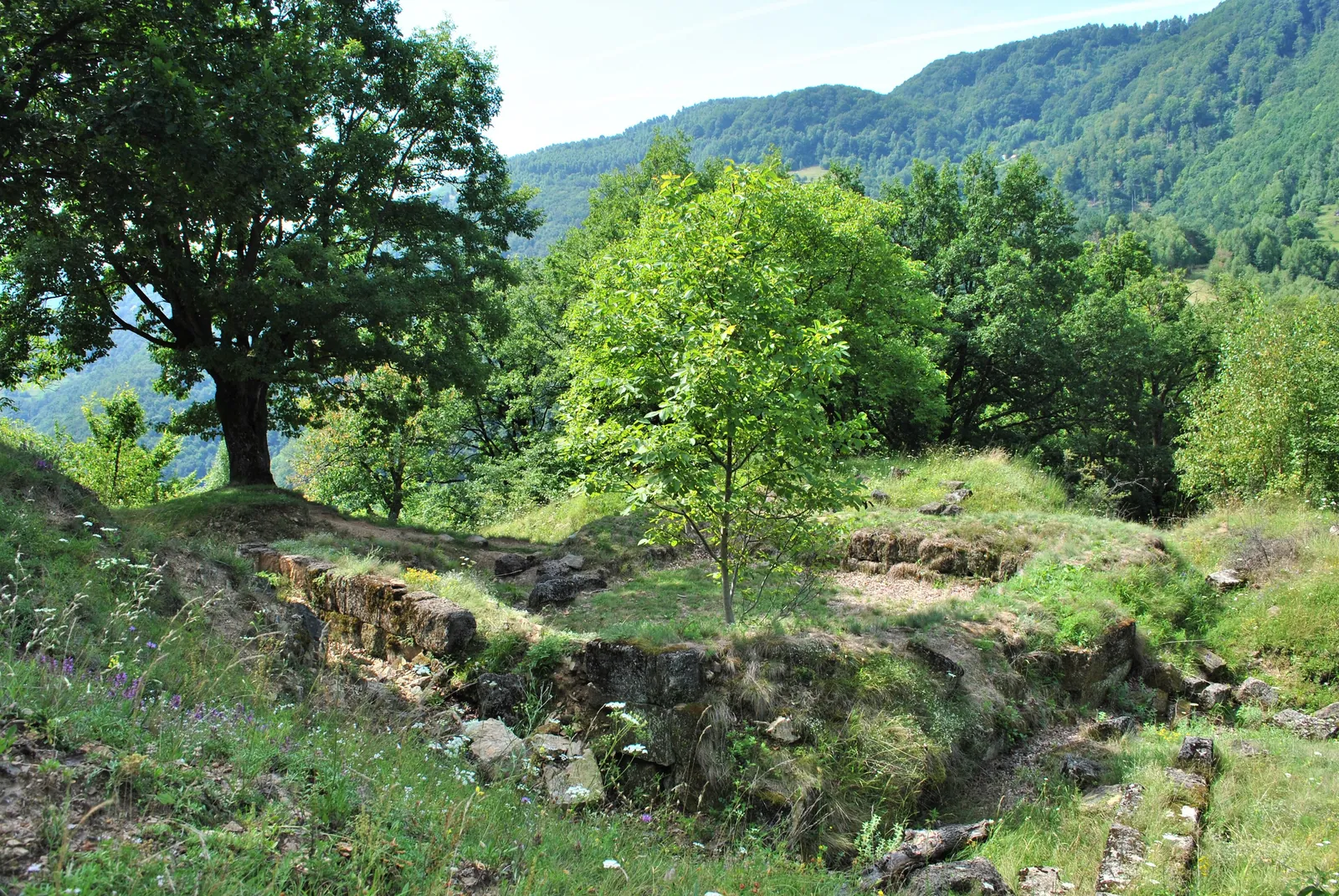
The oldest fortress of the group and probably Burebista's residence: earthen ramparts, a Hellenistic-style stone wall, two tower-houses on the plateau, four column-aligned temples and a monumental limestone staircase. The easiest to reach of the five fortresses without a ticket.
By car
County road 705A from Orăștie, 20 km, to the tourist cabin at Costești, where the asphalt ends. From there a marked gravel road climbs towards Cetățuie hill past the mountain gendarmerie post.
On foot
About 30 minutes on foot from Costești, or 10 minutes by car on the gravel road plus the last stretch on foot. Marking: white square with a yellow cross.
Ticket
No published fee. Hunedoara County Council has designed a ticket office and a guard pavilion at Costești; at the time of writing no official price was found.
Hours
No published opening hours; an open site, with guards.
Administered by
Hunedoara County Council (General Directorate for Monument Administration and Tourism Promotion)
Chronology
The earthen rampart at the end of the 2nd century BC or the start of the 1st century BC; the wall and towers in Burebista's time; destroyed in AD 106. First excavations in 1924 (D. M. Teodorescu), then under C. Daicoviciu. Taken over by Hunedoara County Council in 2020, guarded since 15 December 2021; in 2022, 450,000 lei were allocated to restore the tower-house.
What survives
The stone walls and tower-houses are visible, with their bases preserved; the plateau is kept as meadow. The county funded the restoration of the tower-house in 2022. Information panels at the entrance.
Piatra Cetății (Bolii Hill), Bănița commune, county of Hunedoara · heritage code HD-I-s-A-03156
904 m summit+179 m climb from the roadabout 40 min time
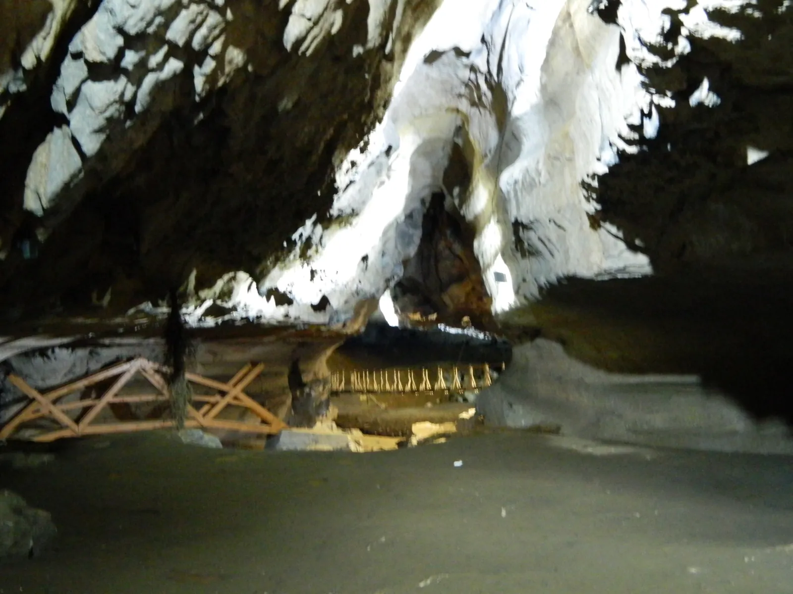
Inside Bolii Cave, with the wooden walkway over the stream; the trail to Bănița fortress starts from the cave's car park. Wikimedia Commons has no freely licensed photograph of the Bănița ruins; the image shows the trail's starting point. mihai moise (Panoramio), CC BY 3.0, Wikimedia Commons.
The eagle's nest of the group: an isolated rock between national road 66 and the Simeria–Petroșani railway, fortified only on its northern slope, the only accessible one, with a 115 m murus dacicus wall, a monumental gate with limestone steps, stepped terraces and an acropolis on top. The only fortress of the group that had no access path until the summer of 2026.
By car
National road 66 Simeria–Petroșani, with parking at Bolii Cave, about 6 km from Petroșani. The themed trail starts here, crosses the Bănița gorge and climbs through the forest.
On foot
The “Bănița Fortress” themed trail: 570 m, about 40 minutes up, 104 m of ascent, moderate difficulty, with ropes on the steep stretches. Opened on 1 August 2026 by the Museum of Dacian and Roman Civilisation, with the commune, the natural park, the forestry agency and the mountain rescue service.
Ticket
No published fee for the trail. A guard and information pavilion is planned.
Hours
No opening hours; an open trail. Mountain footwear recommended, the climb remains steep.
Administered by
Hunedoara County Council, through the Museum of Dacian and Roman Civilisation, Deva
Chronology
Built in Burebista's time, rebuilt under Decebalus, destroyed in AD 106. The railway cut through the settlement at its foot in the 19th century. The only systematic excavations: 1960–1961, Octavian Floca. Taken over by Hunedoara County Council in 2020, guarded since 15 December 2021; a themed trail opened on 1 August 2026.
What survives
The hardest site to read: of the stepped gate, spectacular when uncovered in the 1960s, a few slabs and the ends of the balustrades remain, and the line of the Dacian wall is lost on the steep slope. No excavation for over 60 years. Until 2026, access was along the railway, through a gorge of nearly 500 m.
Luncani, Boșorod commune, county of Hunedoara · heritage code HD-I-s-A-03200
831 m summit+279 m climb from the road45–60 min time
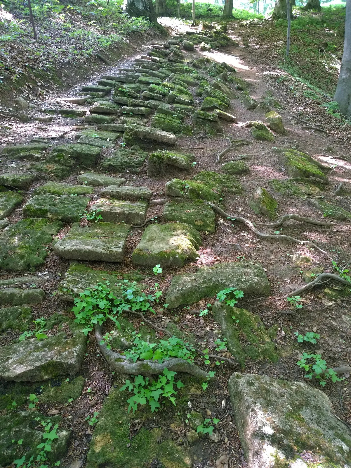
The ancient road paved with moss-covered limestone slabs, climbing towards the entrance of Piatra Roșie fortress. Korinna, CC BY-SA 4.0, Wikimedia Commons.
The fortress guarding the approach to the capital from the Strei valley: a rectangular enclosure of 102 by 45 metres on the plateau at the top of the rock, with five towers, a second enclosure on the eastern slope, a paved road and a sanctuary outside the walls. The least studied of the Hunedoara fortresses after Bănița.
By car
From Călan through Boșorod on county road 668A to Luncani, where the asphalt ends. Then a dirt road up the Alun valley, 3.1 km, to the foot of the hill. In winter, suitably equipped cars only.
On foot
From the foot of the hill, about 600 m of steep path to the saddle, then about 300 m through the forest to the plateau; red-triangle marking. No fence and no ticket office.
Ticket
No fee: access is open, with no ticket office at the time of writing. A guard and information pavilion is planned.
Hours
No opening hours; an open site, with guards.
Administered by
Hunedoara County Council (General Directorate for Monument Administration and Tourism Promotion)
Chronology
In use at least from the second half of the 1st century BC until the Roman conquest of AD 106. Excavated under C. Daicoviciu in 1949, published in 1954; small-scale digs resumed in the early 2000s (I. Glodariu). Taken over by Hunedoara County Council in 2020, guarded since 15 December 2021.
What survives
The enclosure wall and the entrance staircase can be seen, but the blocks sit under moss and leaf litter, and the plateau has no panels showing the fortress plan. The Dacica Foundation has documented the site and its trails; no recent restoration.
Cetății Hill, Căpâlna, Săsciori commune, county of Alba · heritage code AB-I-s-A-00020
673 m summit+296 m climb from the road45–60 min time
The enclosure wall of Căpâlna fortress, its limestone blocks covered by grass and shrubs, under an oak. Ela Vaida, CC BY-SA 4.0, Wikimedia Commons.
The outpost on the Sebeș valley, the only one in Alba county: an enclosure wall with a perimeter of 280 metres, a tower-house 9.5 metres on a side, two towers at the entrance, ditches and ramparts blocking the connecting saddle. It defended the approach to the capital from the north-east.
By car
National road 67C (the Transalpina) from Sebeș, 20 km, to Căpâlna. The path begins at the southern edge of the village, just after the bridge over the Sebeș river.
On foot
2.1 km and 302 m of ascent, 45–60 minutes: through orchards and homesteads, then steeply along the Gărgălău stream, through forest, to the saddle with the information panel. Red-cross marking; rated easy.
Ticket
No fee and no ticket office.
Hours
No opening hours; an open site.
Administered by
Alba County Council
Chronology
Construction began in the mid-1st century BC, under Burebista; burnt in the wars with Rome, in AD 106. Excavated in 1939, 1942 and 1954 (M. Macrea, I. Berciu), then 1965–1967 and 1982–1983 (H. Daicoviciu). Transferred from Săsciori commune to Alba County Council in 2022, for restoration.
What survives
The most degraded of the six: the walls sit under vegetation, with a single face preserved along most of the enclosure, and in 2022 Adevărul wrote that “it is almost no longer possible to see the walls”. The National Heritage Institute put the restoration design out to tender four times, with no bidders the first three; the county took the site over in 2022 precisely to unblock the works.
Costești, Orăștioara de Sus commune, county of Hunedoara · heritage code HD-I-s-A-03181
750 m summit+365 m climb from the roadabout 50 min time
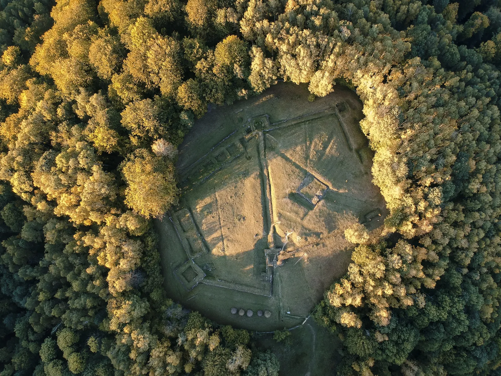
Costești-Blidaru fortress seen from above: the two enclosures with their towers, in a clearing surrounded by forest. Călin Jorza, CC BY-SA 4.0, Wikimedia Commons.
The strongest military fortification of the group: two adjoining enclosures, trapezoidal and pentagonal in plan, six square towers, a tower-house, casemates and a vaulted cistern of nearly 200 cubic metres cut below the north-west tower. Its walls, up to three metres thick, are the best preserved of all the fortresses.
By car
The same road as for Cetățuie: county road 705A to Costești, parking at the tourist cabin. The marked path starts on the left of the road, after the bridge over the Grădiștea river, at the mouth of the Făeragu stream.
On foot
On foot only: about 50 minutes uphill, the first stretch the hardest. Around 400 m of ascent; 4.5 km there and back.
Ticket
No published fee. A guard pavilion with an information point and ticket sales is planned; at the time of writing no official price was found.
Hours
No published opening hours; an open site, with guards.
Administered by
Hunedoara County Council (General Directorate for Monument Administration and Tourism Promotion)
Chronology
The first enclosure at the end of Burebista's reign or just after; the second at the end of the 1st century AD; destroyed in AD 106. D. M. Teodorescu reached it in 1921; systematic excavations from 1953 (C. Daicoviciu). Taken over by Hunedoara County Council in 2020, guarded since 15 December 2021.
What survives
The murus dacicus walls stand several courses high and the plan of the two enclosures is legible from above. No recent restoration; vegetation is kept back, and a marked trail climbs from Costești.
What the six fortresses share and where they part: built in the same century, destroyed in the same year, dug by the same two generations of archaeologists, taken over by the counties only after 2013.
late 2nd century BC
The first earthen rampart at Costești-Cetățuie, the oldest fortification of the group.
mid-1st century BC
Under Burebista the stone walls of Cetățuie, Blidaru, Bănița and Căpâlna go up; Piatra Roșie comes into use in the second half of the century.
1st century AD
Sarmizegetusa Regia becomes the capital and religious centre; Blidaru gets its second enclosure; Bănița is rebuilt under Decebalus.
AD 106
Trajan's second Dacian war. All six fortresses are destroyed or burnt; none is rebuilt.
19th century
The Simeria–Petroșani railway cuts through the settlement at the foot of Bănița; at Grădiștea de Munte the Austrian administration investigates the treasures found by villagers.
1921–1924
D. M. Teodorescu makes the first field surveys at Blidaru and Piatra Roșie (1921) and the first excavations at Cetățuie and Sarmizegetusa Regia (1924).
1939–1961
Excavations by M. Macrea and I. Berciu at Căpâlna (1939–1954), by C. Daicoviciu at Piatra Roșie (1949) and Blidaru (1953), by Octavian Floca at Bănița (1960–1961).
1982–1983
The last large campaigns at Căpâlna, under H. Daicoviciu.
1999
UNESCO inscribes the “Dacian Fortresses of the Orastie Mountains” on the World Heritage List (dossier 906). In the same years, treasure hunters take the gold bracelets out of Sarmizegetusa Regia.
2013
Hunedoara County Council takes over Sarmizegetusa Regia and posts guards.
2020–2022
Hunedoara county takes over the other four Hunedoara fortresses (2020), posts guards from 15 December 2021 and mountain gendarmes from March 2022; Alba county takes over Căpâlna (2022).
2026
Restoration of Terrace X at Sarmizegetusa Regia, with reduced hours; on 1 August the first built trail to Bănița opens.
The six fortresses are one UNESCO site but have had six fates. The table places them on a scale from 1 (cared for, with trails and panels) to 4 (ruins hard to read, no recent intervention), by what can be seen on the spot and when the last work was done.
The best-kept site: the enclosure wall and temples are cleared, the paths marked, the panels bilingual. In 2026 Terrace X and the great andesite temple are being consolidated, with reduced weekday opening. The old wound is looting: between 1999 and 2001 treasure hunters took at least 24 royal gold bracelets out of the site, of which the state recovered 13 by 2011.
2026: consolidation of Terrace X and the great andesite temple (EU recovery funds, 11.3 million lei)
The stone walls and tower-houses are visible, with their bases preserved; the plateau is kept as meadow. The county funded the restoration of the tower-house in 2022. Information panels at the entrance.
The murus dacicus walls stand several courses high and the plan of the two enclosures is legible from above. No recent restoration; vegetation is kept back, and a marked trail climbs from Costești.
The enclosure wall and the entrance staircase can be seen, but the blocks sit under moss and leaf litter, and the plateau has no panels showing the fortress plan. The Dacica Foundation has documented the site and its trails; no recent restoration.
The hardest site to read: of the stepped gate, spectacular when uncovered in the 1960s, a few slabs and the ends of the balustrades remain, and the line of the Dacian wall is lost on the steep slope. No excavation for over 60 years. Until 2026, access was along the railway, through a gorge of nearly 500 m.
1 August 2026: built trail; last excavation in 1961
The most degraded of the six: the walls sit under vegetation, with a single face preserved along most of the enclosure, and in 2022 Adevărul wrote that “it is almost no longer possible to see the walls”. The National Heritage Institute put the restoration design out to tender four times, with no bidders the first three; the county took the site over in 2022 precisely to unblock the works.
2022: taken over by Alba county; restoration design at its fourth tender
The grade is this page's assessment, from the sources in each profile; it is not an official classification.
All sources
How the profiles were computed
The path lengths at Cetățuie, Blidaru and Piatra Roșie are the shortest route on OpenStreetMap's network of paths and forest roads, between the car park or road end and the fortress. The altitude along them is read every 25 metres from the Copernicus GLO-90 digital terrain model, through the Open-Meteo service; at 90-metre resolution rocky summits come out lower than they are, which is why each profile's summit altitude is the one published by the sources and the line shows only the shape of the climb. Climbing times come from each profile's sources; where none existed, the time is estimated from length and ascent and marked as such.