Messina · Reggio Calabria · 28 December 1908
The 1908 Messina earthquake: two cities, an unsettled death toll
Floodwater covers Messina’s quay, with the Palazzata stretching behind it. The earthquake struck at 5:20; a tsunami reached both coasts within minutes. Death-toll estimates differ by area and counting method.

Strait of Messina · 28 December 1908
At 5:20, the earthquake struck both shores.
CPTI15 records 04:20:27 UTC (05:20:27 local time) and estimates the magnitude at Mw 7.10 ± 0.18. Contemporary summaries round the minute to 5:20 or 5:21.
A tsunami followed within minutes and reached both coasts. Reported heights vary from one place to the next.
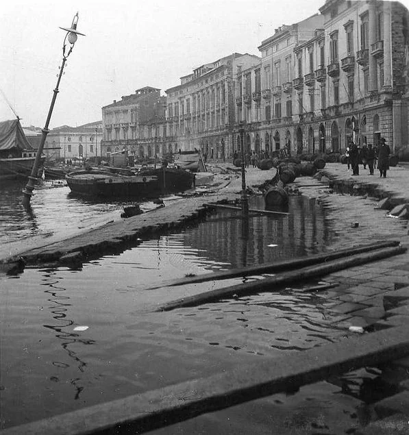
Credit: Luca Comerio; December 1908Commons file: Comerio, Luca (1878-1940) - Il Lungomare dopo il terremoto di Messina (dicembre 1908).jpgLicense: Public domain
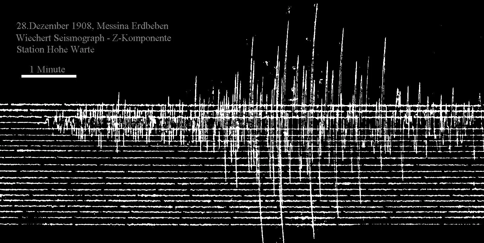
Credit: Unknown author; 28 December 1908Commons file: Messina Seismogramm 1908.jpgLicense: Public domain
Mw is the modern catalogue estimate; instruments in 1908 did not directly measure this modern magnitude scale.
The wave was not uniform
One strait, two coasts and local measurements.
In Messina city, reported waves reached about 3 metres. At some sites south of Pellaro, local run-up reached roughly 12–13 metres.
The source geometry remains debated. Field observations do not support an exact inundation line across both shores. The death toll has a boundary question of its own: the area counted changes the total.
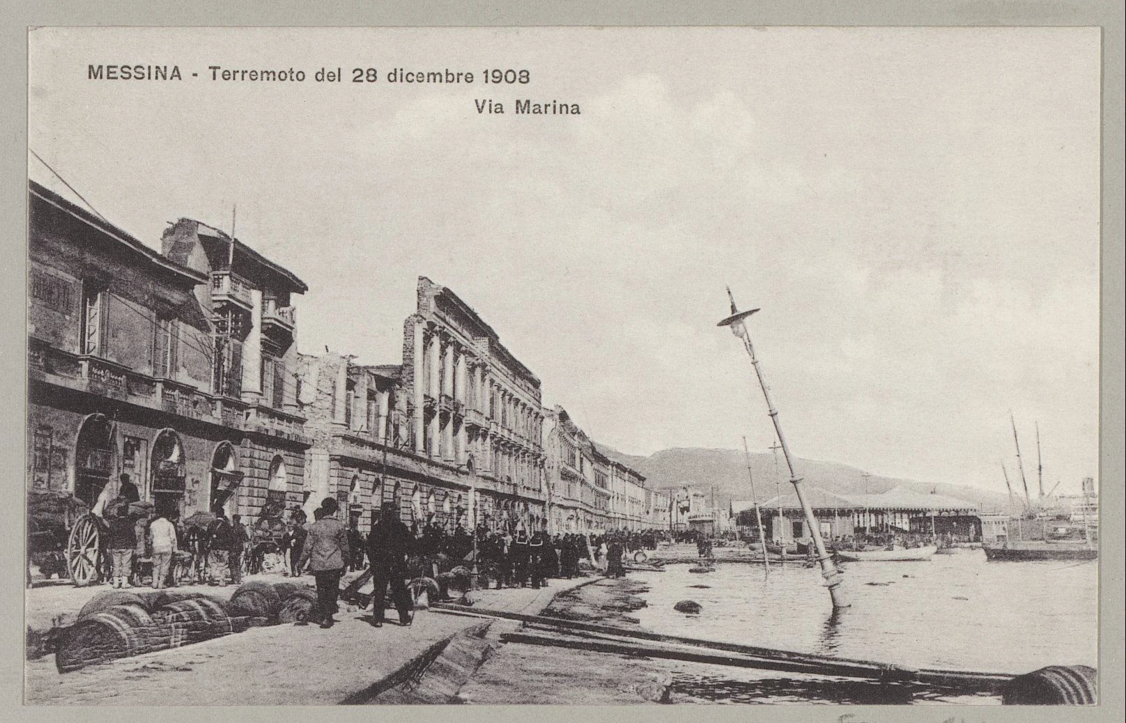
Credit: Rijksmuseum; 28 December 1908Commons file: Kade in Messina met ruïnes van de aardbeving van 28 december 1908 MESSINA - Terremoto del 28 dicembre 1908 Via Marina, RP-F-F01141-CW.jpgLicense: CC0
Who enters the total?
The toll depends on the area and counting method.
About 80,000 is the conventional estimate for the epicentral region, assembled from incomplete records; it is not a complete named register.
A modern demographic study gives an upper bound of 44,491 for the Messina and Reggio Calabria municipalities. It uses a different area and method from the regional estimate; the two figures do not form a shared range.
When the totals stay separate, the rescue chronology shifts attention from area to time.
| Figure | Area counted | Basis of figure | Interpretive limit | Sources |
|---|---|---|---|---|
| about 80,000 | Epicentral region | CFTI’s conventional scholarly synthesis | A regional estimate from damaged records, not a complete named death register. | CFTI — 1908 earthquake dossier |
| 44,491 | Messina and Reggio Calabria city municipalities | 35,193 Messina + 9,298 Reggio: upper bound in a modern census and migration analysis. | Covers two municipalities, not every affected settlement. | Cambridge Journal of Economic History — census-based estimateCambridge Journal of Economic History — estimates and censusesCambridge — migration, census assumptions and municipal upper boundsISTAT — 1911 population census catalogue |
| about 30,000 | Messina municipality | Mario Baratta’s estimate through August 1909 | Estimate for the Messina municipality; the figure is tied to municipal scope. | CFTI — 1908 earthquake dossierMario Baratta (1910) — Messina mortality estimate |
| 65,000 | Messina municipality | Contemporary prefectural estimate from 1909 | An administrative estimate, not a list of individually confirmed deaths. | CFTI — 1908 earthquake dossier |
| 90,000–120,000 | Wider disaster region in frequently cited literature | Traditional range recorded in a modern scholarly review | A different area from the two-municipality estimate of 44,491. | Cambridge Journal of Economic History — estimates and censuses |
| 200,000 or more | First dispatches and reports in the last week of December 1908 | Alarm figures in first-days news reports | Not a validated final count. | Cambridge Journal of Economic History — estimates and censusesAuckland Star, 1 January 1909 — first-week reporting |
Each figure stays tied to its area and method. The two municipalities are not the whole epicentral region; first-week reports are not final counts.
- CFTI — 1908 earthquake dossier
- Cambridge Journal of Economic History — census-based estimate
- Cambridge Journal of Economic History — estimates and censuses
- Mario Baratta (1910) — Messina mortality estimate
- Cambridge — migration, census assumptions and municipal upper bounds
- Auckland Star, 1 January 1909 — first-week reporting
- ISTAT — 1911 population census catalogue
The first hours
Rescue began with local crews and ships already nearby.
Italian sailors were nearby when disaster struck. Ships of the Russian Baltic Fleet were diverted toward Messina and joined rescue, food relief and the evacuation of injured people.
A later local account says Russian sailors carried about 1,300 people to safety. The claim of more than 2,000 remains unverified without a public manifest.
At 14:50, INGV records the first reported government message from the torpedo boat Spica, many hours after the shock. In 1909, shelter records count another urgent need.
The earthquake strikes the strait.
Waves reach both coasts.
Spica sends INGV’s first reported government message.
A relief committee is established.
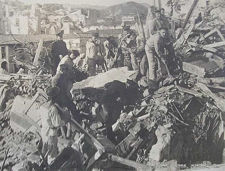
Credit: Unknown author; 1908Commons file: Russian sailors Messina.jpgLicense: Public domain
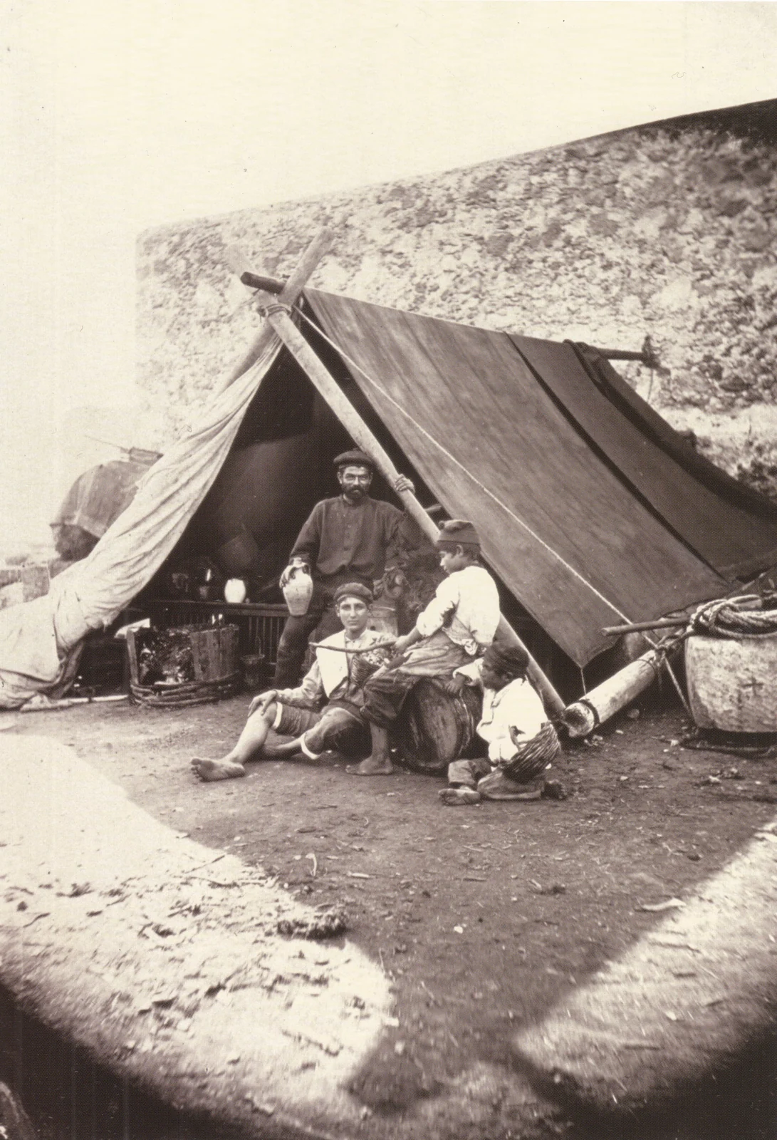
Credit: Wilhelm von Gloeden; 1908Commons file: Gloeden, Wilhelm von (1856-1931) - n. G 0268 - Sopravvissuti al terremoto di Messina, 1908.jpgLicense: Public domain
The roughly 1,300 figure is attributed to a later local account; the Russian total of more than 2,000 remains unverified.
An emergency that lasted
Temporary shelter became a recurring urban problem.
By May 1909, records counted about 33,000 shelters across the Strait region, including about 17,000 in Messina. Inventories from 1910 still count barracks and residents.
Baraccopoli returned in the history of housing and urban politics. Records trace changing sites and generations; they do not establish that the same huts stood unchanged for a century.
In April 1909, Royal Decree no. 193 set technical and health rules for the affected municipalities named in the act. An early Italian seismic-construction regulation, it applied to that defined list.
Reconstruction then took a name and a date: Borzì’s plan, approved on 31 December 1911.
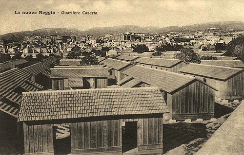
Credit: Unknown author; early 1900sCommons file: Reggio calabria baraccamenti quartiere caserta.jpgLicense: Public domain
Approved plan · 31 December 1911
Messina’s reconstruction followed Luigi Borzì’s approved plan.
The archival catalogue links engineer Luigi Borzì to the plan approved for Messina on 31 December 1911. The rebuilt city followed rules shaped by seismic risk.
Antonio Sant’Elia’s Città Nuova drawings remained a separate, unbuilt vision. They were not the commissioned plan for Messina. The records do not confirm “Autonomia quarter” as a label in Borzì’s plan.
A link still on paper
The modern Strait bridge remains unbuilt on 5 October 2026.
Modern proposals for a bridge across the Strait go back at least to the 1860s. The Roman floating-bridge story is a popular tradition; it does not prove an uninterrupted technical project spanning two millennia.
On 5 October 2026, the bridge had still not been built. Official material described it in design and procedural stages. From Messina’s rebuilding to the promised link over the water, proposals remained on paper.
Status is dated 5 October 2026; project milestones can change after that date.
Following the evidence
Sources and the limits of each comparison.
The INGV catalogue, historical records and demographic studies answer different questions. Each link preserves the area, authorship or status the source can support.
Key sources
- V01INGV CPTI15 — event record
- V02CFTI — 1908 earthquake dossier
- V03CFTI — damage and monuments in Messina
- V04Sicilian Region — Russian sailors in Messina
- V05U.S. Naval History and Heritage Command — NH 1177
- V06Treccani — Messina earthquake
- V07Normattiva — Royal Decree no. 193 of 1909
- V08IGM — catalogue of the historic Messina plan
- V09Stretto di Messina — bridge project status
- V10INGV — history of instruments and seismograms
- V11Cambridge Journal of Economic History — census-based estimate
- V12Billi and colleagues — the 1908 tsunami
- V13Cambridge Journal of Economic History — estimates and censuses
- V14INGV Terremoti — first government message from Spica
- V15CFTI — barracks and residents in the archives
- V16Stretto di Messina — bridge project questions
Further studies and records
- R01INGV CPTI15 — earthquake time and magnitude
- R02Italian Civil Protection — earthquake and tsunami
- R03INGV — tsunami observations at Messina and south of Pellaro
- R04Mario Baratta (1910) — Messina mortality estimate
- R05Cambridge — migration, census assumptions and municipal upper bounds
- R06Genzano civil protection — attributed Russian evacuation estimate
- R07Archivio Centrale dello Stato — relief committee record
- R08Auckland Star, 1 January 1909 — first-week reporting
- R09ISTAT — 1911 population census catalogue
- R10University of Palermo — modern bridge proposal chronology