THE ANNOUNCEMENT
8 December 2020
Two countries, one number, snow included. M02 M03 M04 M05
The joint announcement of 8 December 2020 sealed 8,848.86 m — the snow height, cap and all — and closed decades of parallel numbers. M02 M03 M04 M05
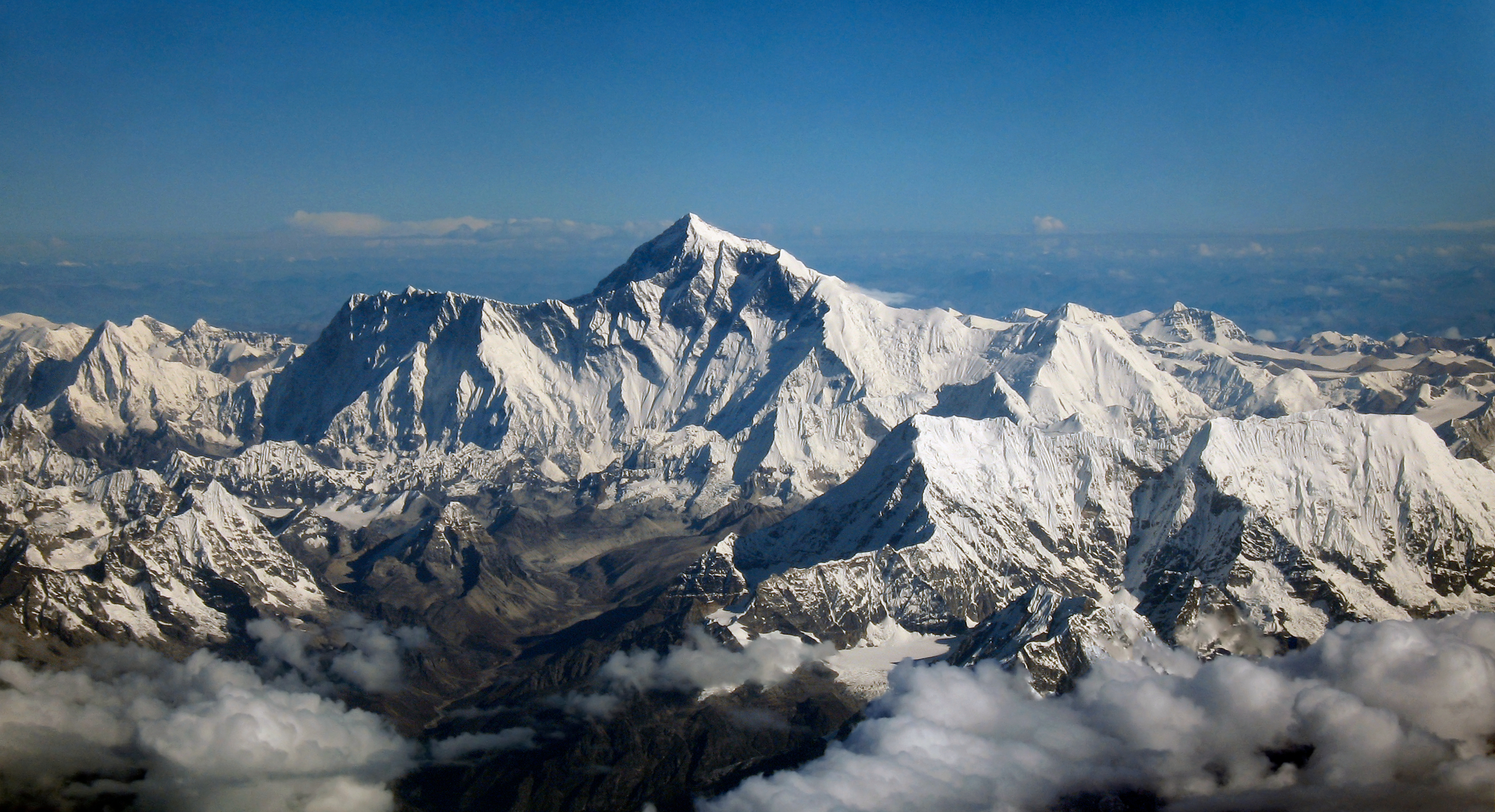
Visual essay · eight chapters · the 2020 joint figure
8,848.86 m of snow, four names on one summit, a mountain growing on a river's push, and a record 492 permits — eight chapters on the joint figure of 8 December 2020. M02 M01 M10 M15
On 27 May 2020 at 11 in the morning, the Chinese team reached the summit and stayed 150 minutes — a record — to plant the beacon that would reset the mountain's number. M03
Chapter 1 · One number, two countries
On 8 December 2020, China and Nepal jointly announced Everest's new height: 8,848.86 m, the snow height, cap and all — via a foreign-ministers videoconference and letters exchanged by presidents Xi Jinping and Bidya Devi Bhandari. M02 M03 M04
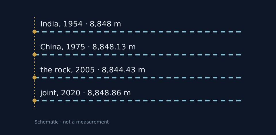
Nepal had used India's 1954 estimate of 8,848 m until then; China had measured 8,848.13 m in 1975 and 8,844.43 m of rock height in 2005. The gap between 2005 and 2020 is not growth but convention: the snow. M03 M08 M01
From India's 8,840.07 m to the two countries' 8,848.86 m — the number grew with every convention. M03
THE ANNOUNCEMENT
Two countries, one number, snow included. M02 M03 M04 M05
The joint announcement of 8 December 2020 sealed 8,848.86 m — the snow height, cap and all — and closed decades of parallel numbers. M02 M03 M04 M05
THE CONVENTION
8,848 m (1954) · 8,848.13 m (1975) · 8,844.43 m rock (2005). M03 M08 M01
Nepal kept India's 8,848 m from 1954; China found 8,848.13 m in 1975 and 8,844.43 m of bare rock in 2005. The two countries even started from different sea levels: the Yellow Sea and the Indian Ocean respectively. M03 M08 M01
THE TEAM
27 May 2020, 11 in the morning: beacon, satellites, radar. M03
The Chinese team set out on 26 May, summited at 11 the next day, and stayed a record 150 minutes with the beacon and radars. A year earlier, in May 2019, a Nepalese team had climbed for the same survey — one surveyor lost the frostbitten tip of a toe. M03
THE GEOID
Peak minus geoid: gravity, leveling, satellites. M06
Height is the distance from the peak to the geoid, and the geoid is never measured directly: it is rebuilt from gravity, leveling, terrain and satellites. That is why the number depends on who measures, and how. M06
Image gallery
Chapter 2 · What you call it
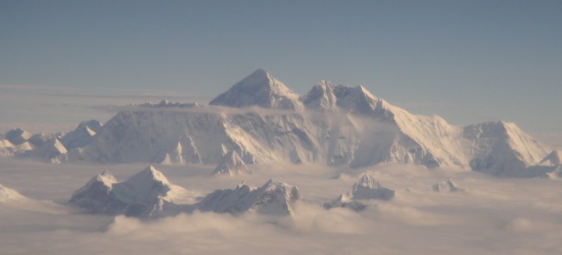
Peak XV became Everest on Andrew Waugh's 1856 proposal, and the Royal Geographical Society adopted the name in 1865 — though Everest himself objected: it could not be pronounced in Hindi. M01 M09
Nepalis call it Sagarmatha (सगरमाथा), Tibetans Chomolungma (ཇོ་མོ་གླང་མ།, “Holy Mother”), and the Chinese shorten it to 珠峰 — and on the map they all sit on one point: node 164979149. M01 M03 M17
The first number ever published, 29,002 ft in 1856, was computed as 29,000 — the two extra feet kept it from looking rounded. M01
THE NAME
Waugh 1856 · RGS 1865 · the namesake's objection. M01 M09
Andrew Waugh proposed in 1856 that Peak XV carry Sir George Everest's name; the Royal Geographical Society made it official in 1865, though Everest objected that his name was unpronounceable in Hindi. M01 M09
THE FIRST NUMBER
Computed 29,000 (8,840 m), published +2 feet. M01
The first published height, in 1856: 29,002 ft, or 8,840 m. The computation had given exactly 29,000, and the two added feet kept the number from looking rounded. M01
THE OTHER NAMES
Usage, not etymology: the glosses have no carrier. M01 M03
Sagarmatha in Nepali, Chomolungma — “Holy Mother” — in Tibetan, and the Chinese short form 珠峰. This essay uses them only as the carriers use them: no dictionary glosses. M01 M03
THE MAP
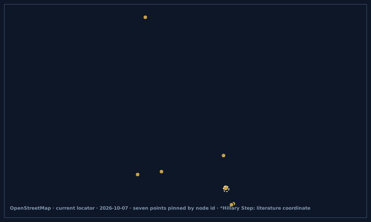
Node 164979149: ZH name, loc_name 珠峰. M17
On the summit's OpenStreetMap node, the name opens with 珠穆朗玛峰, beside ཇོ་མོ་གླང་མ། and सगरमाथा; int_name is Everest, and loc_name — 珠峰, with alt_name 圣母峰. Four names, one point on the map. M17
Image gallery
Chapter 3 · Pushed by a river
In September 2024, a UCL study in Nature Geoscience found the hidden growth engine: Arun river capture drives an isostatic rebound adding as much as about 2 mm a year — and added 15–50 m over the past 89,000 years. M10
The Arun gorge deepens some 75 km away; the numbers here come from the three outlets retelling the study, with the authors' “as much as” kept verbatim. M10
Everest never stands still: it grows a fingernail's pace, pushed from below by a river digging elsewhere. M10
THE RIVER
River capture + isostatic rebound, UCL 2024. M10
When the Arun captured its neighbor's course, its erosion lightened the crust, and the crust rebounded upward under Everest: up to about 2 mm a year, a gift from the river. M10
THE RECORD
The gorge sits ~75 km from the summit. M10
Summed over 89,000 years, the effect adds 15–50 m — from a gorge some 75 km from the summit. The mountain stands taller today because the river digs far away. M10
THE CAVEAT
The retellings differ; the essay keeps UCL's wording. M10
The outlets retelling the study disagree on the river's share, so this essay cites a single phrasing — “as much as about 2 mm a year” — and nothing more precise. M10
Chapter 4 · Camp, icefall, col, step
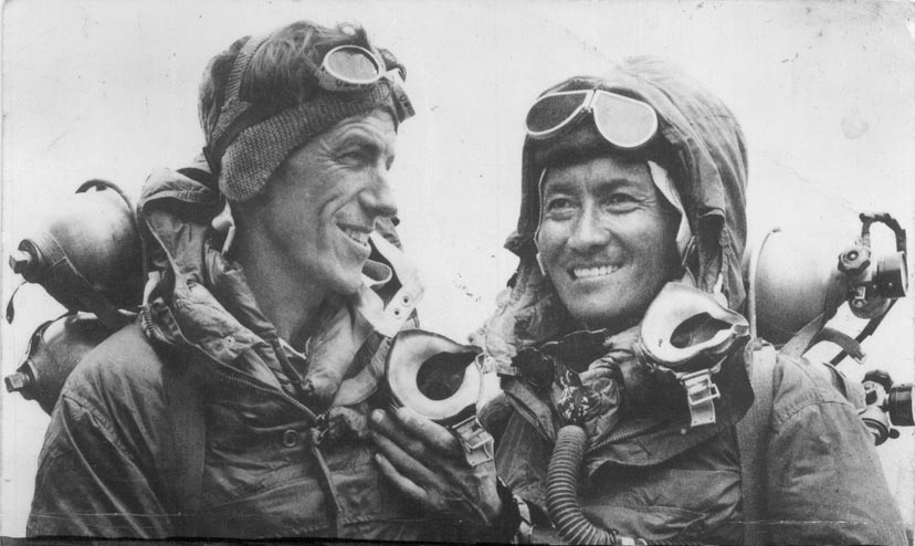
On 29 May 1953 at 11:30 local time, Edmund Hillary and Tenzing Norgay reached the top by the South Col route, on John Hunt's ninth British expedition — after Bourdillon and Evans had turned back some 100 m below. M01
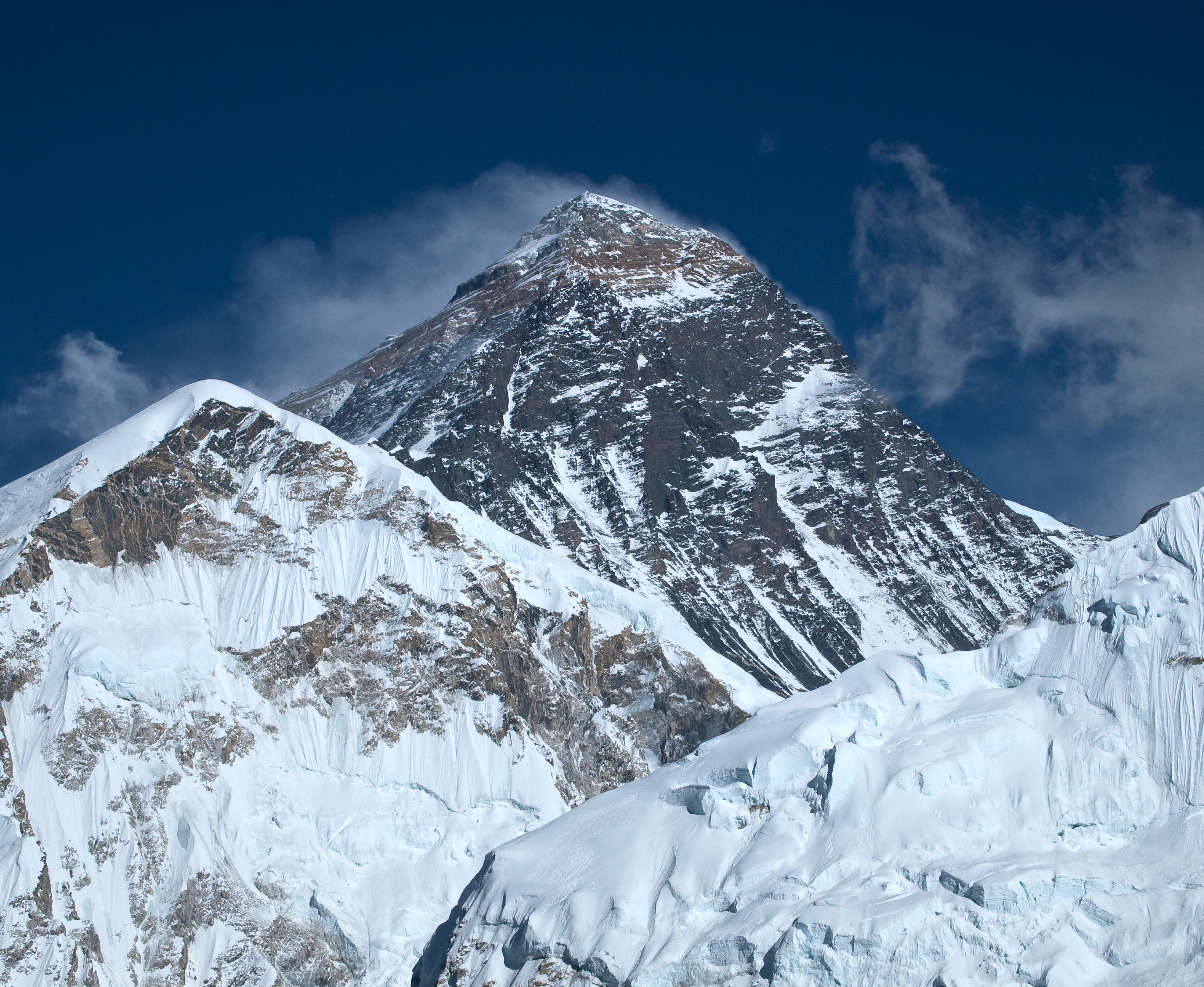
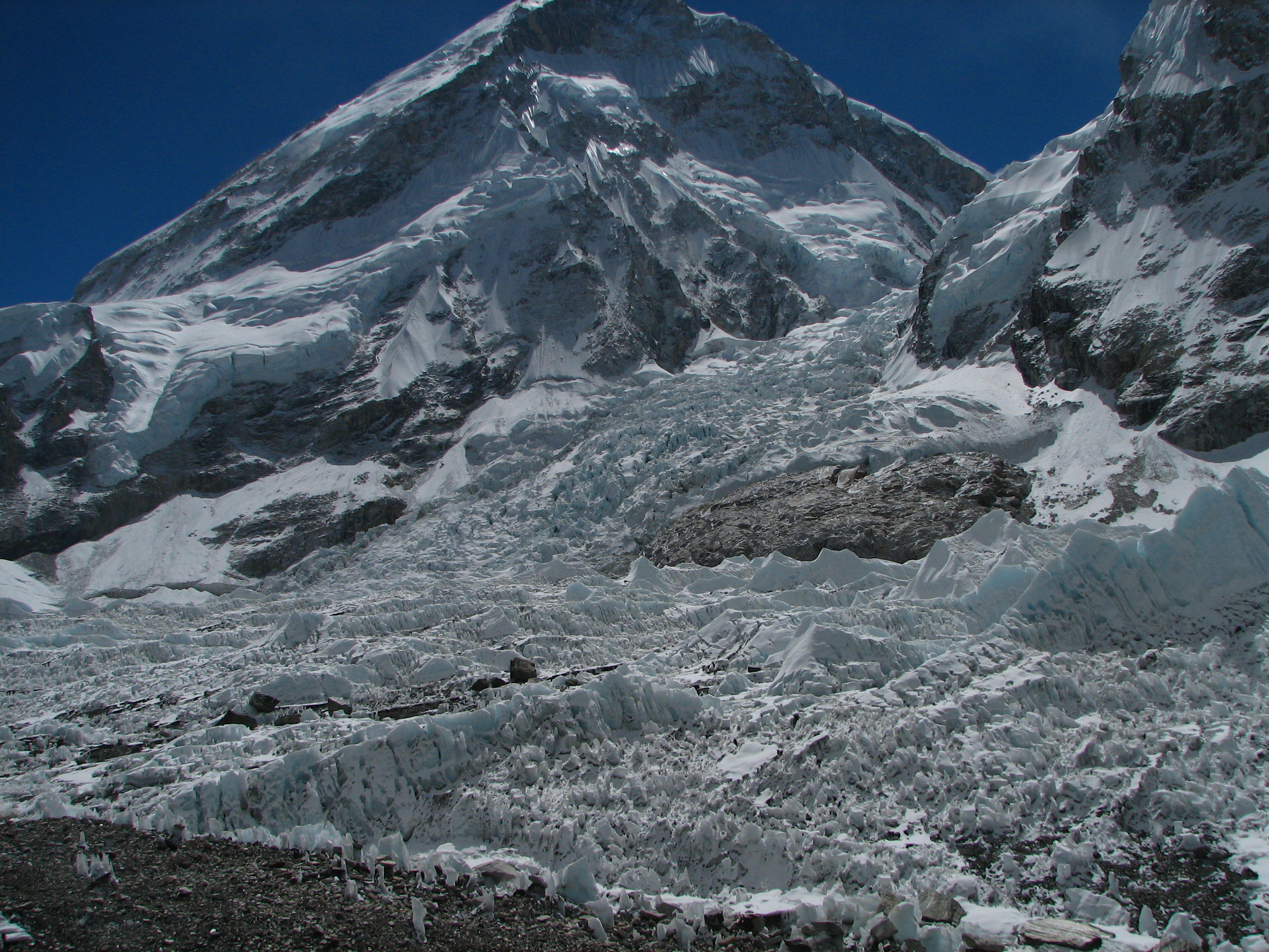
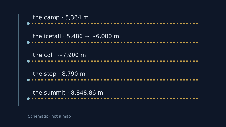
The south route climbs from Base Camp (5,364 m) through the Khumbu Icefall (5,486–~6,000 m) to the South Col (~7,900 m) and the Hillary Step (8,790 m): four marks, one thread. M01 M17
First there were two people at 11:30 in the morning; then came the firsts: no oxygen in 1978, winter in 1980. M01
1953
Hillary + Tenzing, Hunt's ninth expedition. M01
New Zealander Hillary and Sherpa Tenzing Norgay climbed the South Col route on Hunt's expedition; before them, Bourdillon and Evans had stopped some 100 m below the top. M01
THE ROUTE
The camp slides with the glacier. M17 M01
South Base Camp sits at 5,364 m, but it is a camp on a glacier and shifts with it; above it, the Khumbu churns ice from 5,486 toward ~6,000 m below Camp I — and the South Col, ~7,900 m, is the route's upper gate. M17 M01
THE STEP
12 m, the hardest move — until 2015. M11 M17
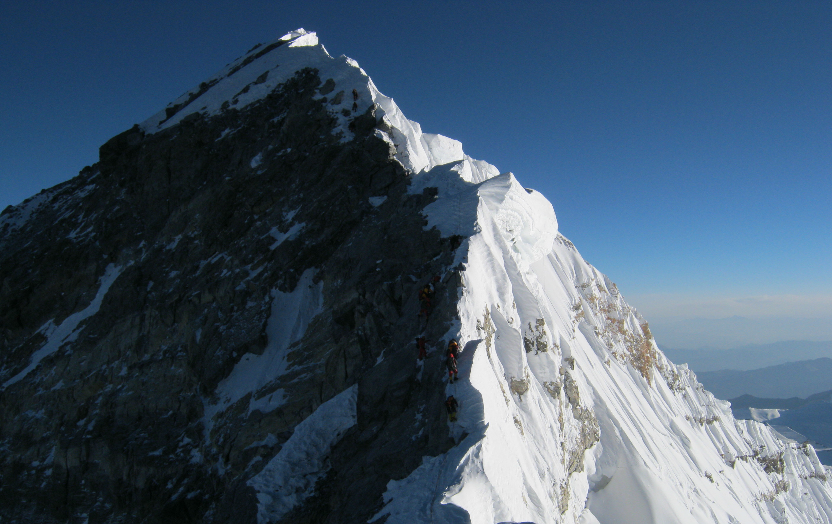
The Hillary Step, a 12 m wall at 8,790 m, was the hardest move on the Nepal route — until the April 2015 earthquake knocked it down. It has no OSM object on the map: coordinates only, 27.9871066, 86.9256306. M11 M17
THE FIRSTS
1978: Messner + Habeler · 1980: Cichy + Wielicki. M01
In 1978, Messner and Habeler climbed first without supplementary oxygen; on 17 February 1980, Cichy and Wielicki signed the first winter ascent, on Zawada's Polish expedition. M01
Image gallery
Chapter 5 · The Rongbuk valley and the surveyors
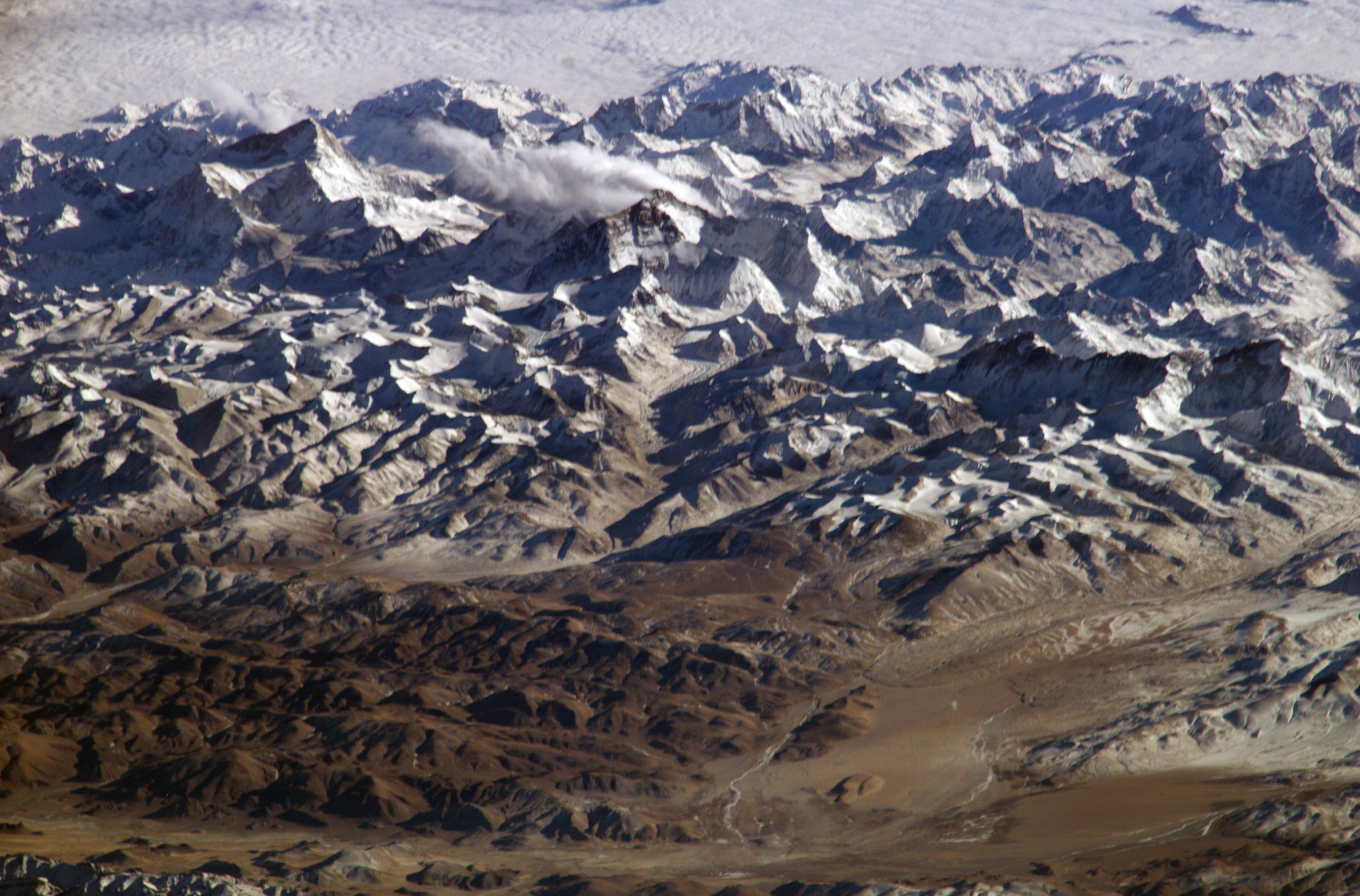
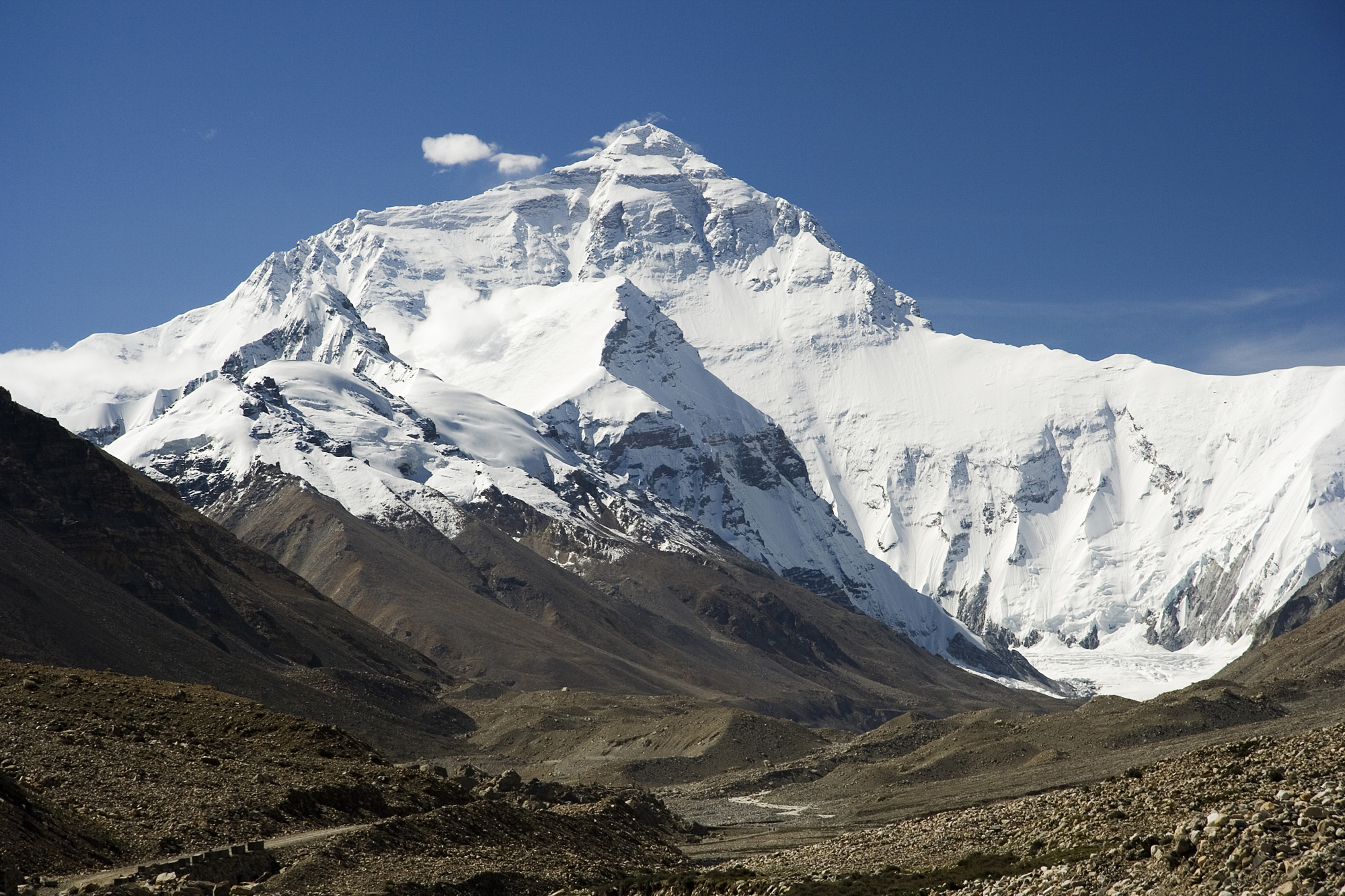
From Tibet, the road climbs the Rongbuk valley to North Base Camp (5,200 m, climbers only) and the North Col (7,042 m), on the North Ridge. M01 M17
On 25 May 1960, Wang Fuzhou, Gonpo and Qu Yinhua signed the first reported North Ridge ascent — “reported”, because the period's sources demand caution. M01
Three surveys from the north — 1975, 2005, 2020 — and since 2019, a core zone closed to tourists. M03 M12
THE VALLEY
EBC-N 5,200 m (climbers) · North Col 7,042 m. M17 M01
North Base Camp (node 11956009447, 5,200 m) is reserved for climbers, per the map's note; above it, the North Col (node 2681946526) stands at 7,042 m. M17 M01
1960
Wang Fuzhou · Gonpo · Qu Yinhua — “reported”. M01
Three Chinese climbers were first up the North Ridge on 25 May 1960, by the accounts of the time. This essay keeps the qualifier “reported”: the period's sources demand caution. M01
THE SURVEYS
With the reserve's core closed since 2019. M03 M12
China's survey lineage — 8,848.13 m in 1975, 8,844.43 m of rock in 2005, the joint figure in 2020 — walks hand in hand with protection: since 2019, ordinary tourists stay out of the 10,312 km² core zone, and climbing permits were unaffected. M03 M12
Image gallery
Chapter 6 · A third of air
On the summit, barometric pressure runs about 253 mmHg — one third of sea level — and the oxygen matches: West's extreme-altitude physiology. M13 M01
The death zone starts right at the South Col, and up high you can stay 2–3 days at most: the body does not acclimatize, it only endures. M01
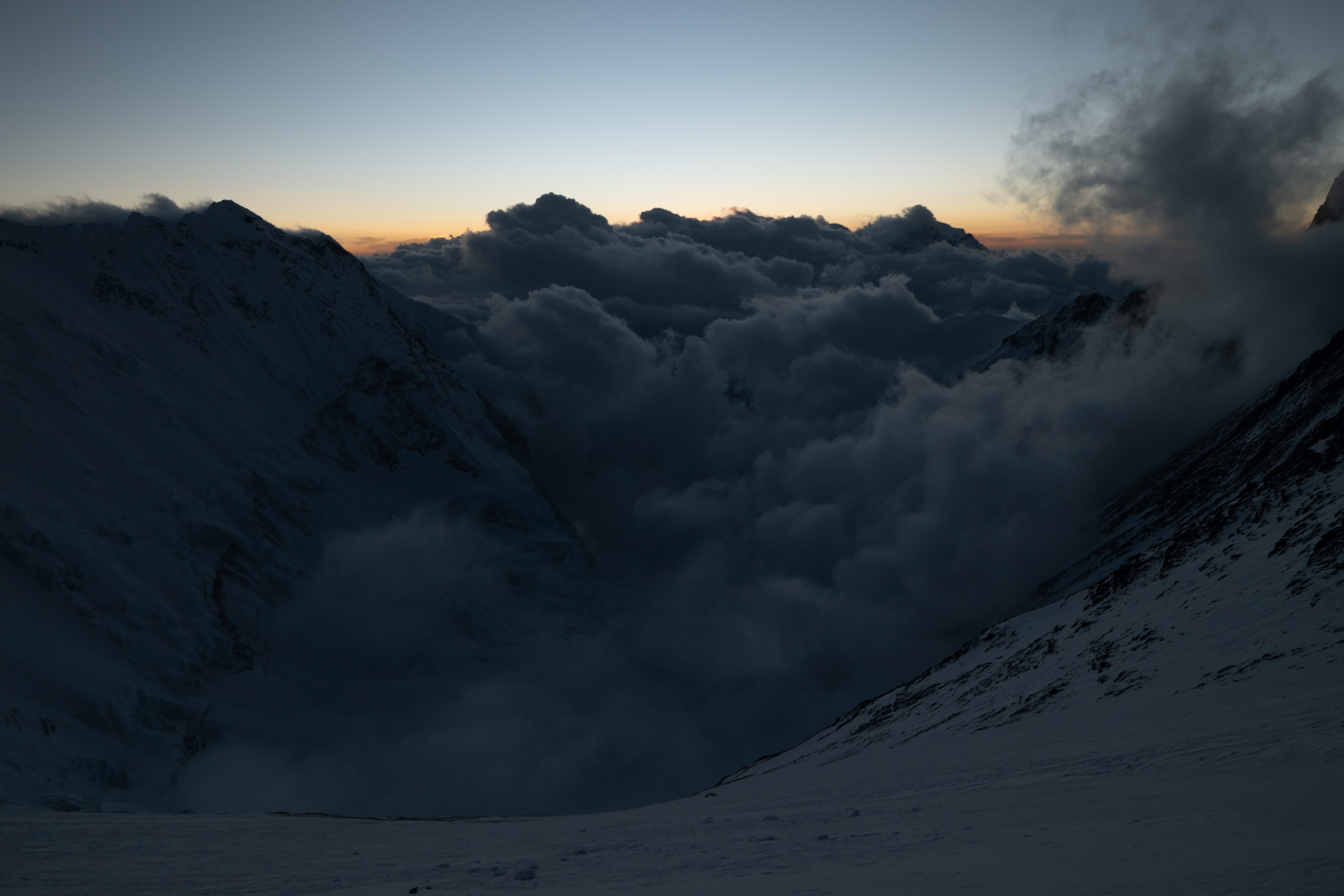
From ~7,900 m up, every breath is a third of a breath. M01 M13
THE THIRD
One third of sea-level pressure. M13 M01
253 mmHg on the summit — one third of the sea-level value — and one third of the oxygen too. The number comes from West's extreme-altitude physiology. M13 M01
THE GATE
The death zone starts at ~7,900 m. M01 M17
Not the summit but the South Col (~7,900 m) is the death zone's gate: the Camp IV tents already stand past the threshold. M01 M17
THE CLOCK
Up high you don't acclimatize, you endure. M01
Summit bids last 2–3 days at most up high: past the gate, time is the priciest gear. M01
Image gallery
Chapter 7 · 1,148 + 33,800 km²
On the Nepalese flank, Sagarmatha National Park — established 1976, 1,148 km² between 2,845 and 8,848 m — is a UNESCO site since 1979 (file 120, criterion vii), bordering the Qomolangma reserve to the north and Makalu-Barun to the east. M14
On the Tibetan flank, the Qomolangma National Nature Reserve — set up in 1988, about 33,800 km² with a 10,312 km² core, from 1,400 m to the summit — closed its core to ordinary tourists in 2019. M03 M12
One mountain, two administrations, a single vulnerable ecosystem. M12 M14
THE SOUTH
1,148 km² · UNESCO 1979, file 120/vii. M14
The Nepalese park: 1,148 km² between 2,845 and 8,848 m, inscribed by UNESCO in 1979, at the third session, under criterion vii — bordered by Qomolangma to the north and Makalu-Barun to the east. M14
THE NORTH
33,800 km² · 10,312 km² core. M03 M12
The Tibetan reserve: about 33,800 km² from above 1,400 m to the summit, with a 10,312 km² core — established in 1988. M03 M12
THE RULE
2019: no ordinary tourists, climbers welcome. M12
Since 2019, ordinary tourists stay out of the 10,312 km² core; whoever holds a climbing permit climbs on — the rule protects the mountain, it doesn't close it. M12
Image gallery
Chapter 8 · 478 → 492
In spring 2026, Nepal issued a record 492 Everest permits — permits for foreign climbers, on the Nepal side — after the 478 record of 2023, announced Tourism Department spokesman Himal Gautam via AFP. M15 M16
The fee was $11,000 per climber in 2024, and Nepal's court demanded a permit cap without naming its number; on the north side, the answer was the 2019 core rule. M16 M12
In 2019, the summit queue kept teams waiting hours in the freezing cold, oxygen running low. M16
THE RECORD
Foreigners, Nepal side, spring season. M15 M16
492 permits in spring 2026, after 478 in 2023 — both records in their day, both for foreign climbers on the Nepal side. M15 M16
THE PRICE
Court-ordered cap, number unspecified. M16
In 2024 the fee ran $11,000 per climber; the court asked the mountain to have a maximum number of permits, but the verdict's summary never said which. M16
THE QUEUE
Hours in the cold, queuing for the top. M16
In 2019, a human traffic jam kept climbers queuing for the summit for hours, freezing, oxygen running low — the image that led to the cap. M16
Sources and limits
Annotations retain the status in the source ledger.
tertiary encyclopedia · official-link-unverified
state information office · official-link-unverified
http://english.scio.gov.cn/topnews/2020-12/09/content_76993991.htm
state information office feature · official-link-unverified
http://english.scio.gov.cn/m/in-depth/2020-12/24/content_77046507.htm
state wire via regional mirror · official-link-unverified
http://english.anhuinews.com/newscenter/sci/202012/t20201209_5005158.html
academy newsletter · official-link-unverified
http://newsletter.cas.cn/wap/Hot_Issue/202012/t20201230_4559940.html
state wire video page · official-link-unverified
https://english.www.gov.cn/news/videos/202012/10/content_WS5fd17893c6d0f72576941a2f.html
news wire via science press · official-link-unverified
https://phys.org/news/2020-12-china-nepal-everest-bit-higher.html · https://phys.org/news/2020-12-mount-everest-height.html
tertiary encyclopedia · official-link-unverified
science press on walled primary · official-link-unverified
https://phys.org/news/2024-09-river-mount-everest-peak.html · https://scitechdaily.com/mount-everest-ascending-scientists-discover-hidden-growth-engine/ · https://www.earth.com/earth-science/what-is-making-mount-everest-grow-taller/
tertiary encyclopedia · official-link-unverified
state wire · official-link-unverified
http://english.scio.gov.cn/m/chinavoices/2019-02/15/content_74467694.htm · http://english.scio.gov.cn/chinavoices/2019-01/10/content_74358617.htm
physiology review PDF · official-link-unverified
https://pulmonary.ucsd.edu/research/labs-centers/west/_files/extreme-altitude-compressed.pdf
tertiary encyclopedia · official-link-unverified
news wire via national press · official-link-unverified
news wire via science press · official-link-unverified
https://phys.org/news/2024-05-nepal-court-limit-everest-climbing.html
OpenStreetMap records · official-link-unverified
https://www.openstreetmap.org/node/164979149 · https://www.openstreetmap.org/node/2540248530 · https://www.openstreetmap.org/node/576713400 · https://www.openstreetmap.org/node/5225912921 · https://www.openstreetmap.org/node/11956009447 · https://www.openstreetmap.org/node/4880806687 · https://www.openstreetmap.org/node/2681946526
Commons original · official-link-unverified
https://commons.wikimedia.org/wiki/File:Mount_Everest_as_seen_from_Drukair2_PLW_edit.jpg
Commons original · official-link-unverified
Commons original · official-link-unverified
Commons original · official-link-unverified
https://commons.wikimedia.org/wiki/File:Aerial_photograph_of_Mount_Everest_in_1935.jpg
Commons original · official-link-unverified
https://commons.wikimedia.org/wiki/File:Hillary_Step_near_Everest_top.jpg
Commons original · official-link-unverified
https://commons.wikimedia.org/wiki/File:Edmund_Hillary_and_Tenzing_Norgay.jpg
Commons original · official-link-unverified
https://commons.wikimedia.org/wiki/File:Mount_Everest%2C_Nepal%2C_Himalayas.jpg
Commons original · official-link-unverified
Commons original · official-link-unverified
Commons original · official-link-unverified
https://commons.wikimedia.org/wiki/File:Mt_Everest_aerial_2005.jpg


%2C_Mount_Everest.jpg)
.jpg)
