Chapter 5 · Atmosphere and climateLesson 5.3
Climate zones and types: from equatorial to polar, and how to recognise them on a climate graph
How can 12 temperatures and 12 precipitation figures tell you what type of climate a city has?
Before you read: what do you think?
How many degrees separate the highest and lowest temperatures ever measured in Romania?
See the answer
83 degrees. The records are 44.5 °C at Ion Sion, in the Bărăgan plain (10 August 1951), and −38.5 °C at Bod, near Brașov (25 January 1942). Such a difference between summer and winter is a sign of a continental climate.
On 25 January 1942, the thermometer fell to −38.5 °C at Bod, near Brașov. On 10 August 1951, it rose to 44.5 °C at Ion Sion, in the Bărăgan plain. Romania’s two records are 83 degrees apart, and such a difference between winter and summer is a sign of a continental climate.
The climate graph: a place’s climate in one picture
Of a city’s 12 temperatures, two tell you the most: those of the warmest and coldest months. In Bucharest they are 23.4 °C in July and −0.9 °C in January. Such a large difference points to a continental climate. Of the 12 precipitation figures, what matters is the total and the season in which rain falls.
A climate graph shows the average temperature as a line and the amount of precipitation as bars for each of the 12 months. The figures are averages over many years.
Read the line first. If the warmest months are June, July and August, the place is in the northern hemisphere; if they are December, January and February, it is in the southern hemisphere. The annual temperature range is the difference between the average temperature of the warmest month and that of the coldest. A range of a few degrees points to an equatorial climate, one of about 10 °C to an oceanic climate, and one above 20 °C to a continental climate.
Now read the bars. Add them to find the annual total and look at when rain falls: all year, in just one season, in summer or in winter. Tall bars in every month and an almost flat line mean an equatorial climate. Almost non-existent bars mean desert. A rainless summer and a rainy winter mean a Mediterranean climate.
For the curious
The temperature scale, in degrees Celsius, is on one side of the graph; the precipitation scale, in millimetres, is on the other.
The hot zone: warm all year, with rainfall making the difference
A climate zone is a belt of the planet that receives roughly the same amount of solar radiation. Within it, one climate type differs from another mainly in its precipitation and the contrast between seasons. The hot zone stretches on either side of the Equator, beyond the tropics. Here the average temperature is above 18 °C in every month.
The equatorial climate is hot and wet all year: the temperature barely changes from month to month, rain falls almost daily and more than 1,500 mm falls each year. It is found in Amazonia, the Congo basin and Indonesia. The subequatorial climate has two seasons, one rainy and one dry; it is the climate of the savannas of Africa and South America.
The tropical wet climate, or monsoon climate, has one season of very heavy rain brought by the summer monsoon and one dry season. It is the climate of India and South-East Asia. The tropical dry climate, or desert climate, lies around the tropics, where air descends and clouds struggle to form: the Sahara and Arabia. Rain is very rare, days are scorching and nights cold.
For the curious
The Kalahari Desert and central Australia also have a tropical dry climate.
The temperate zones: four seasons and four climate types
The two temperate zones lie between the tropics and the polar circles. The subtropical climate, or Mediterranean climate, has hot, dry summers and mild, rainy winters. It occurs mainly around the Mediterranean Sea.
The temperate oceanic climate is found on coasts swept by westerly winds, as in Western Europe: cool summers, mild winters and rain in every month. The temperate continental climate is found in the interiors of continents, as in Eastern Europe, Siberia or the plains of central North America: warm summers, freezing winters and little precipitation, falling mainly in summer. Between them lies the transitional temperate climate of Central Europe, where oceanic air arrives weakened and winters are colder than on the Atlantic coast.
For the curious
The Mediterranean climate is also found far from the Mediterranean Sea: in California, central Chile, southern Africa and south-western Australia.
The cold zones and mountain climate
Towards the poles, the Sun’s rays strike at a very low angle, and in the cold zones no month has an average temperature above 10 °C. In the subpolar climate of northern Canada, Scandinavia and Siberia, winter is long and freezing, while summer lasts two to three months and stays cold. In the polar climate of Antarctica and Greenland, the severe cold lasts all year. Precipitation is low and falls as snow.
The mountain climate occurs on high mountains in every zone. Temperature falls with altitude, precipitation increases up to a certain height, and vegetation forms belts.
For the curious
Because temperature falls with altitude, the summits of high mountains can remain snow-covered even in summer.
Worked example
Bucharest’s climate graph
At Bucharest-Filaret station, the average monthly temperatures for 1961–2024 are, from January to December: −0.9; 1.4; 6.2; 12.1; 17.4; 21.4; 23.4; 23.0; 18.1; 12.0; 6.2 and 1.0 °C. Monthly precipitation is: 42.9; 35.3; 41.8; 47.8; 69.6; 75.9; 58.9; 51.1; 49.6; 44.3; 48.3 and 46.6 mm.
The warmest month is July, so the city is in the northern hemisphere. The annual temperature range is 23.4 − (−0.9) = 24.3 °C. Total precipitation is 612.1 mm a year. Rain falls in every month, most in June (75.9 mm) and least in February (35.3 mm).
Four seasons, a range above 20 °C, a winter month averaging below 0 °C and the most rain in early summer: the graph shows a temperate continental climate.
In Romania
A transitional temperate continental climate
Romania lies halfway between the Equator and the North Pole, and between oceanic western Europe and continental eastern Europe. Its climate is transitional temperate continental. In January, the average temperature is −2 … 0 °C in the south and west of the country and −4 … −2 °C in Moldavia, while precipitation is higher in the western half than in the eastern half. Less than 20 mm falls in the Danube Delta in January.
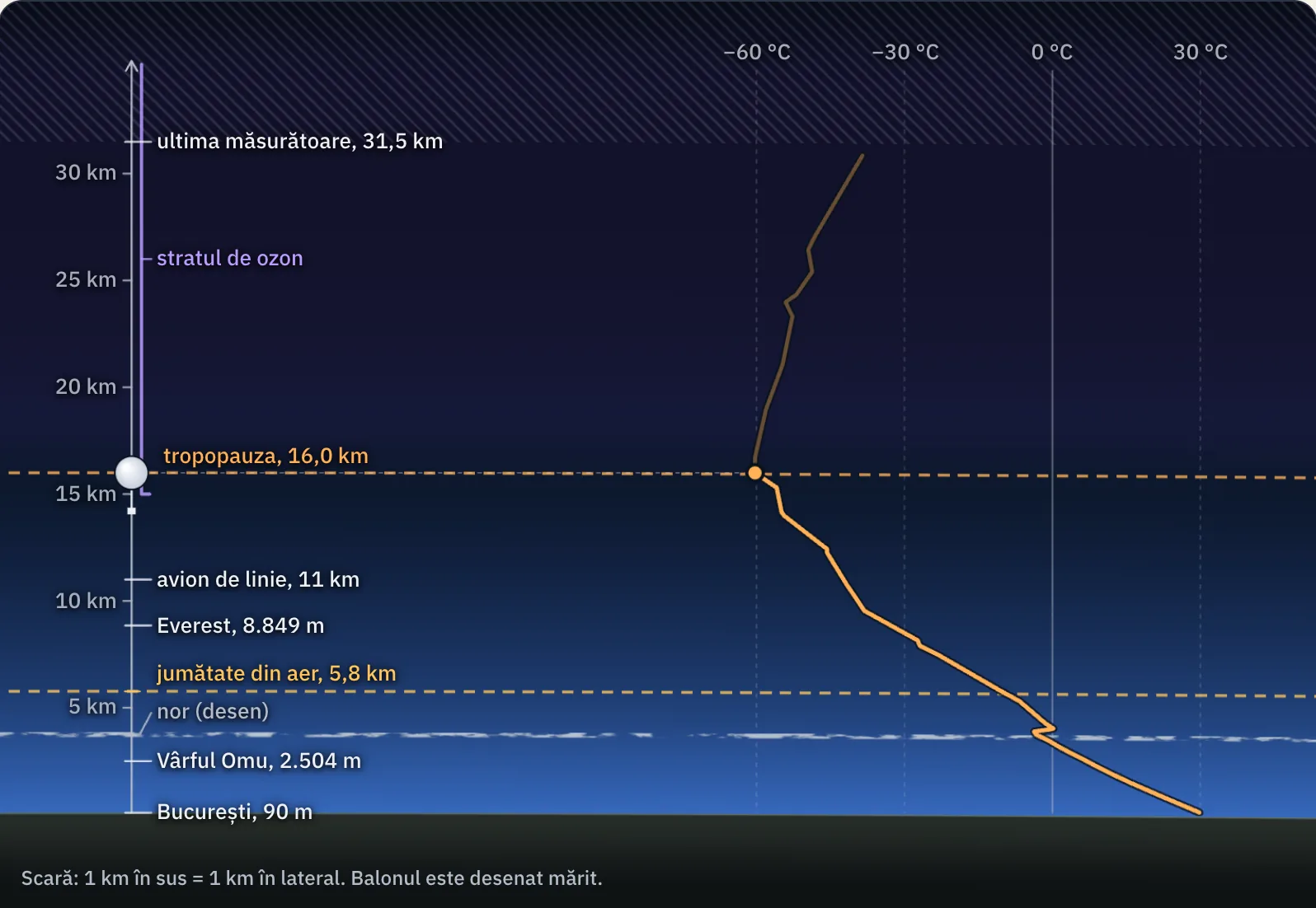
The Carpathians add a mountain climate. At Vârful Omu, a mountain summit, at 2,504 m, the warmest month averages just 6.4 °C, and 991 mm of precipitation falls in a year, compared with 432 mm at Constanța.
The country’s records show how great the extremes can be: 44.5 °C at Ion Sion, in Brăila county, on 10 August 1951, and −38.5 °C at Bod, in Brașov county, on 25 January 1942.
In brief
- The hot zone has four climate types: equatorial (hot and rainy all year), subequatorial (one rainy season and one dry season), tropical wet or monsoon, and tropical dry or desert.
- The temperate zones have subtropical or Mediterranean climate (dry summers, rainy winters), temperate oceanic, temperate continental and transitional temperate climates.
- The cold zones have subpolar and polar climates; mountain climate occurs on high mountains in every zone.
- A climate graph shows average monthly temperatures as a line and monthly precipitation as bars.
- The annual temperature range is the difference between the average temperature of the warmest month and that of the coldest.
- Romania has a transitional temperate continental climate; its records are 44.5 °C (Ion Sion, 10 August 1951) and −38.5 °C (Bod, 25 January 1942).
Common mistakes
WrongThe annual temperature range is the difference between the highest and lowest temperatures ever recorded.
RightIt is calculated from monthly averages: the warmest month minus the coldest. In Bucharest it is 24.3 °C, while the difference between Romania’s absolute records is 83 degrees.
WrongIt rains heavily everywhere in the hot zone.
RightAll climates in the hot zone have high temperatures, but precipitation varies greatly: the equatorial climate is rainy all year, while the tropical dry climate is the climate of deserts.
WrongIn a Mediterranean climate, rain falls in summer, when it is warm.
RightMediterranean summers are dry. Rain falls in winter, which is mild.
Test yourself
Six questions. For the first five you see the explanation at once, with the paragraph of the lesson that supports it; for the ones with a written answer you compare with a good answer.
Which climate type has hot, dry summers and mild, rainy winters?
Answer
c) Subtropical. Summer drought and winter rain are signs of a Mediterranean climate.
A climate graph has an almost flat temperature line at 26 °C and tall precipitation bars in every month. What climate does it show?
Answer
a) Equatorial. A nearly constant temperature and rain in every month are features of an equatorial climate. A monsoon climate would have a dry season.
On a climate graph, the warmest months are December, January and February. What does that tell you?
Answer
b) The place is in the southern hemisphere. The seasons are reversed in the two hemispheres: southern summer lasts from December to February.
What type of climate does Romania have?
Answer
d) Transitional temperate continental. Romania lies between oceanic western Europe and continental eastern Europe, so its climate is a transition between the two.
In a city, the warmest month has an average temperature of 22 °C and the coldest averages −3 °C. What is the annual temperature range? Give your answer in degrees Celsius.
°CAnswer
25 °C. 22 − (−3) = 25 °C. Subtracting a negative value makes the difference larger.
A city’s climate graph shows: the warmest month, July, at 25 °C; the coldest month, January, at 10 °C; 15 mm of precipitation in July and 110 mm in December. What type of climate does the city have, and how did you recognise it?
A good answer
The city has a subtropical (Mediterranean) climate and is in the northern hemisphere, because the warmest month is July. Winter is mild, at 10 °C in January, and the annual temperature range is 15 °C. The decisive clue is the pattern of rainfall: summer is dry and most precipitation falls in winter.
A complete answer names the climate type and hemisphere and gives at least two pieces of evidence from the graph: the mild winter and the dry summer with winter rain.
Terms
- climate zone
- A belt of the planet that receives roughly the same amount of solar radiation: hot, temperate or cold.
- climate type
- A climate with a particular pattern of temperature and precipitation, such as equatorial, Mediterranean or temperate continental.
- climate graph
- A graph showing a place’s average monthly temperatures (line) and average monthly precipitation (bars).
- annual temperature range
- The difference between the average temperature of the warmest month and that of the coldest.
- temperate continental climate
- The climate of continental interiors, with warm summers, freezing winters and little precipitation, falling mainly in summer.
- mountain climate
- The climate of high mountains, where temperature falls with altitude and vegetation forms belts.
Sources and link to the programme
- ANM – Caracterizare climatologică multianuală 1961–2024, ianuarie (celelalte luni au pagini cu aceeași adresă, terminate în _02 … _12) – Romania’s absolute minimum, −38.5 °C at Bod, 25 January 1942; January averages by region; monthly averages at Bucharest-Filaret, Constanța and Vârful Omu (table 2 for each month)
- ANM – Caracterizare climatologică multianuală 1961–2024, august – absolute maximum, 44.5 °C at Ion Sion, Brăila county, 10 August 1951; August average at Vârful Omu
- ANM – Caracterizare climatologică multianuală 1961–2024, iulie – July average at Bucharest-Filaret (23.4 °C)
- UCAR Center for Science Education – The troposphere – air cools with altitude, so high summits can retain snow in summer
- NOAA JetStream – Climate zones – thresholds of 18 °C (tropical climates), 1,500 mm a year and 10 °C (polar climates) in the Köppen classification
- NOAA NCEI – GHCN-Daily, lista stațiilor – altitude of Vârful Omu station, 2,504 m
From the programme: “Climate zones and types” (common core). Programme competences covered: 1.3, 2.3, 3.3.