Chapter 8 · Earth’s environmentsLesson 8.2
Natural environments of the warm zone: equatorial forest, savanna, monsoon environment and tropical desert
Manaus and Cairo are warm all year. Why does dense forest grow in Manaus, while almost nothing grows in Cairo?
Before you read: what do you think?
Equatorial forest is the densest forest on Earth. What is the soil it grows in like?
See the answer
Poor in humus. Poor in humus. Rainfall of over 2,000 mm a year washes nutrients out of the soil. That is why cleared land quickly loses its fertility.
Manaus, in the heart of Amazonia, receives 2,323 mm of rain a year. Cairo, on the edge of the Sahara, receives 28 mm, 83 times less. Both cities are warm in every month of the year.
The heat is the same; water makes the difference
Manaus receives 2,323 mm of rain a year, Cairo 28 mm, and both are warm in every month. Between the two tropics, the Sun rises high in the sky all year and no month is cold. The natural environments here differ in their water: how much rain falls and in which months. From the Equator towards the tropics, rain becomes scarcer and falls mostly in a single season. The environments follow the same sequence on every continent: equatorial forest, savanna, desert. This arrangement in bands parallel to the Equator is called latitudinal zonation. In South and Southeast Asia, the monsoon changes the sequence.
| Place | Environment | Coldest month | Warmest month | Precipitation |
|---|---|---|---|---|
| Manaus | equatorial forest | 27 °C | 28 °C | 2,323 mm a year |
| Bamako | savanna | 25.1 °C | 32.4 °C | 991 mm a year |
| Mumbai | monsoon | 23.7 °C | 29.9 °C | June–September: 2,196 mm |
| Cairo | tropical desert | 14 °C | 28 °C | 28 mm a year |
| Athens | Mediterranean | 8.9 °C | 27.2 °C | 414 mm a year |
| Bucharest | temperate continental | −1 °C | 22.6 °C | 594 mm a year |
| Yakutsk | coniferous forest (taiga) | −40.9 °C | 18.3 °C | 240 mm a year |
| Tiksi | tundra | −32.4 °C | 7.1 °C | 323 mm a year |
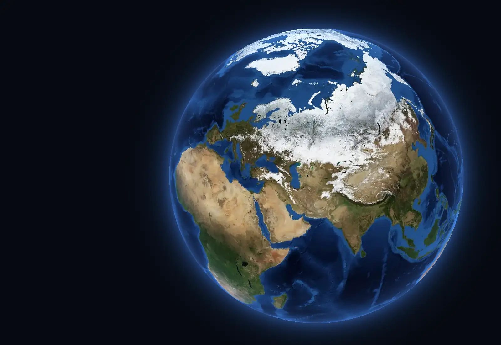
Photograph and measurements. The surface is the NASA Blue Marble mosaic of each month, made of cloud-free images from 2004; the whole globe is shown in daylight. The colours of the environments are the classes of the Köppen–Geiger map for 1991–2020, with cells of 0.1° (Beck et al., 2023, CC BY 4.0), regrouped as follows: Af – equatorial forest; Am, Cwa, Cwb, Cwc – monsoon; Aw, BSh – savanna; BWh – tropical desert; Csa, Csb, Csc – Mediterranean; Cfa – temperate transitional, with hot summers; Cfb, Cfc – temperate oceanic; Dsa, Dsb, Dwa, Dwb, Dfa, Dfb – temperate continental: forests and wooded steppe; BSk – temperate continental: steppe; BWk – temperate continental: desert; Dsc, Dsd, Dwc, Dwd, Dfc, Dfd – coniferous forest (taiga); ET – tundra; on high mountains, alpine belt; EF – polar, with permanent ice. Köppen classes are climate types, while the environments taught at school are broader groups; the mountain environment has no class of its own, and on the ground the boundaries are gradual. The climate graphs use the monthly means published by meteorological services through the WMO and by NASA Earth Observatory, for different periods, written under each.
Equatorial forest: rain every month
It occupies Amazonia, the Congo river basin and the Indonesian archipelago, on either side of the Equator. In Manaus, the average temperature in every month is 27–28 °C, and rainfall totals 2,323 mm a year; equatorial forest generally receives over 2,000 mm. There are no seasons. The great rivers, the Amazon and the Congo, have a high flow all year.
Equatorial forest is evergreen, dense and layered: the crowns of tall trees block the light, and lianas climb towards it, and epiphytes (plants that grow on other plants, such as orchids) grow higher up. The soils, called lateritic soils, are red and poor in humus because rain washes away nutrients; after clearing, they quickly lose their fertility.
For the curious
Animals live mainly in the canopy: monkeys, parrots, snakes and insects.
Few people live here, and they practise shifting cultivation, while plantations and pastures advance into the forest.
Savanna: a wet season and a dry season
Savanna surrounds the equatorial forest in Africa, South America and northern Australia. The climate is subequatorial, with two seasons. Bamako, in Mali, receives 991 mm a year, but 85% of it falls between June and September; from November to March, just 9 mm falls in total.
Savanna is an expanse of tall grasses with scattered drought-resistant trees, such as acacias and baobabs; gallery forests grow along rivers. Large herbivores (antelopes, zebras, giraffes and elephants) and their predators live here.
For the curious
Savanna rivers, such as the Niger, rise in the rainy season and fall sharply in the dry season.
In South America, savanna has local names: llanos in Venezuela, campos in Brazil.
The typical soils are red savanna soils. People raise cattle and grow millet, sorghum, groundnuts and cotton in the rainy season.
The monsoon environment: rain arrives with the summer wind
The monsoon is a wind that changes direction from one season to another. In summer it blows from the ocean towards the land and brings very heavy rain; in winter it blows from the land and the weather is dry. The monsoon environment covers India, Bangladesh, Indochina and southern China. In Mumbai, almost 2,200 mm of rain falls from June to September, and just 21 mm from December to April.
Monsoon forests shed their leaves in the dry season. Rice is grown on the alluvial soils of plains and deltas. The monsoon environment feeds some of the densest populations on Earth, and a delayed monsoon means a poor harvest.
For the curious
The great rivers of the monsoon environment (the Ganges, Brahmaputra and Mekong) flood in summer.
Teak and bamboo grow in monsoon forests, where tigers and Asian elephants live.
Tropical desert: around 250 mm a year or less
Hot deserts lie around the tropics: the Sahara, Arabia, the Kalahari, the Namib, the Atacama and the deserts of Australia. There, air sinks and warms, making it hard for clouds to form. A desert receives around 250 mm of precipitation a year or less; Cairo receives 28 mm. Without clouds or water vapour, the day's heat escapes quickly at night: daytime temperatures often rise above 38 °C, while in some deserts they fall to −4 °C at night.
Only deserts crossed by great rivers from rainy regions, such as the Nile, have permanent rivers. The other valleys, called wadis, carry water only after rare rains. The surface is covered by sand (erg), gravel or bare rock (hamada). Plants are xerophytes, adapted to dryness by deep roots, small leaves or stems that store water. People live in oases, where groundwater reaches the surface, or as nomadic herders.
For the curious
Along the coasts of the Namib and Atacama, cold ocean currents make the climate even drier.
Animals such as dromedaries, snakes and rodents come out mainly at night.
Worked example
Identify the environment from 12 months of rainfall
You have monthly rainfall figures for three cities and know that all three are warm all year. First, add the monthly figures to find the annual total. Next, look at how that total is distributed across the months.
Manaus: 2,323 mm a year, and even the driest month, August, has 68 mm. It rains heavily every month, so the environment is equatorial. Cairo: 28 mm a year, well below 250 mm, so the environment is desert.
Bamako: 991 mm a year. From June to September, 132 + 224 + 290 + 196 = 842 mm falls. Divide: 842 ÷ 991 = 0.85, so 85% of the year's rain falls in four months. A high total concentrated in one season means a subequatorial climate and savanna. The annual total alone would not have told you that: Brest, in western France, receives 1,145 mm, but it rains there in every month.
In Romania
Desert-hot days, but no warm-zone environment
The highest temperature measured in Romania is 44.5 °C, recorded on 10 August 1951 at Ion Sion, in Bărăgan, a plain. On such a day, the air on the Romanian Plain is as hot as in a tropical desert.
An environment, however, is defined by what happens in every month, year after year. Romania lies around 45° north, far from the tropics, and in Bucharest the January average falls to −0.9 °C. No warm-zone environment has a month with an average below zero degrees.
The dryness does not reach the desert threshold either. Bucharest receives an average of 612 mm a year, and Constanța, in Dobrogea, a region where rain is scarce, receives 432 mm. Both figures are well above the 250 mm of deserts. The sands of southern Oltenia, a region of Romania, are degraded land in a temperate climate and have none of the features of a tropical desert.
In brief
- Warm-zone environments have high temperatures all year and differ in the amount of rain and the months in which it falls; from the Equator towards the tropics, equatorial forest, savanna and desert follow one another (latitudinal zonation).
- Equatorial forest environment (Amazonia, Congo basin, Indonesia): 27–28 °C all year, over 2,000 mm of rain, layered evergreen forest, lateritic soils poor in humus, great rivers with high flow all year.
- Savanna environment (Africa, South America, northern Australia): subequatorial climate with a wet season and a dry season, tall grasses with scattered trees, gallery forests, large herbivores.
- Monsoon environment (South and Southeast Asia): the summer monsoon brings very heavy rain from the ocean, while the winter monsoon is dry; monsoon forests, rice crops, very dense population.
- Tropical desert environment (Sahara, Arabia, Kalahari, Atacama, Australia): around 250 mm a year or less, large differences between day and night, wadis, xerophytes, people in oases.
Common mistakes
WrongAll warm environments are alike because they have high temperatures.
RightTemperatures are similar, but rainfall differs enormously: 2,323 mm a year in Manaus and 28 mm in Cairo. Water determines whether the environment is forest, savanna or desert.
WrongEquatorial forest is so rich because its soil is very fertile.
RightLateritic soil is poor in humus because rain washes it. Most nutrients are in living plants, which is why cleared land quickly loses its fertility.
WrongA desert means sand dunes.
RightDunes (the erg) cover only part of the deserts. Large areas are gravel or bare rock (hamada).
Test yourself
Six questions. For the first five you see the explanation at once, with the paragraph of the lesson that supports it; for the ones with a written answer you compare with a good answer.
What is the main difference between the natural environments of the warm zone?
Answer
c) The amount and distribution of rain. All have high temperatures all year. The amount of water and its distribution across the months differ.
What is a monsoon?
Answer
a) A wind that changes direction with the season. In summer the monsoon blows from the ocean and brings rain; in winter it blows from the land and is dry.
Why does cleared land in equatorial forest quickly lose its fertility?
Answer
b) Because rain washes the soil, which is poor in humus. Most of the forest’s nutrients are held in living plants. Without the forest, daily rain quickly washes away the little humus that remains.
What is a wadi?
Answer
d) A dry valley that carries water only after rain. A wadi is a valley that is usually dry. A place where groundwater reaches the surface is an oasis.
A city in the savanna receives 1,200 mm of rain a year, of which 960 mm falls in the four months of the rainy season. What percentage of the annual rain falls in the rainy season?
%Answer
80 %. 960 ÷ 1,200 = 0.80, or 80%.
Two cities have the same average temperature, 27 °C, and both receive 1,000 mm of rain a year. In the first, it rains every month; in the second, it rains only from June to September. What natural vegetation would you expect near each, and why?
A good answer
Near the first city, where plants have water all year, evergreen forest grows. Near the second, plants must withstand eight months without rain, so savanna appears, with grasses that dry out in the dry season and scattered drought-resistant trees. The annual total is the same, but the distribution of rain across the months determines the environment.
A complete answer connects vegetation to the distribution of rain across the months and names the dry season as a limiting factor; the annual total and temperature alone do not explain the difference.
Terms
- latitudinal zonation
- The arrangement of natural environments in bands parallel to the Equator, following one another from the Equator towards the poles.
- equatorial forest
- Dense, layered evergreen forest in warm regions with heavy rain in every month.
- savanna
- Vegetation of tall grasses with scattered trees, found in warm regions with a wet season and a dry season.
- monsoon
- A wind that changes direction from one season to another: in summer it blows from the ocean and brings rain, and in winter it blows from the land.
- xerophytes
- Plants adapted to dryness by deep roots, small leaves or stems that store water.
- wadi
- A desert valley that carries water only after rare rains.
- oasis
- A place in the desert where groundwater reaches the surface, allowing vegetation, crops and settlements.
Sources and link to the programme
- NASA Earth Observatory – Biome: Rainforest – Manaus, 1970–2000: 27–28 °C in every month, 2,323 mm a year, August 68 mm; equatorial forest receives over 2,000 mm; lianas, orchids
- Live Science – How can deserts form next to oceans? – the cold Humboldt and Benguela currents cool the air along the coasts of the Atacama and Namib and prevent rain (popular science source)
- NASA – Biome: Desert – Cairo, 28 mm a year; deserts receive around 250 mm a year; around 38 °C by day, and in some deserts down to −4 °C at night
- WMO World Weather Information Service – Bamako – monthly rainfall 1950–2000: 991.3 mm a year, 842.3 mm from June to September, 9.1 mm from November to March
- WMO World Weather Information Service – Mumbai – monthly rainfall 1951–2000: 2,195.6 mm from June to September; 20.8 mm from December to April
- ANM – Caracterizare climatologică multianuală 1961–2024, ianuarie – București-Filaret: January average −0.9 °C; Constanța 1.3 °C; sum of the 12 monthly average rainfall figures (pages cc_1961_2024_01 … _12): București-Filaret 612.1 mm, Constanța 431.9 mm
- WMO World Weather Information Service – Brest – Brest 1971–2000: 1,144.7 mm a year, rain in every month
- G4Media – Temperatura maximă absolută a lunii august în România: 44,5 grade (date ANM) – 44.5 °C at Ion Sion, 10 August 1951
- Administrația Națională de Meteorologie – Clima României – Dobrogea’s Black Sea climatic influence, with scarce rain
From the programme: “Terrestrial natural environments” (common core). Programme competences covered: 1.2, 4.1.