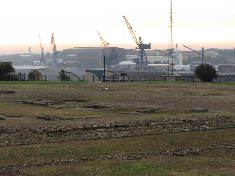

The urban east: Segedunum
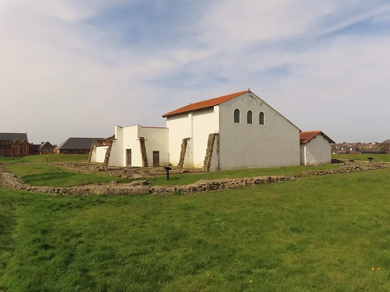
The most completely excavated fort, with original Wall and a full-scale reconstruction — 3 minutes from the Metro. Here the Wall is a city story, not a wilderness one.
§ Interactive guide · Rome's northern English frontier
From Wallsend to the Solway, 73 miles of Wall, ditch, Vallum, forts and turrets — but not all alike. The ribbon below is the whole Wall at a glance: the real elevation crest, every stop in its place, the car-free route beside it.
§ The instrument · profile, map, panel
The crest below is the real elevation, east to west. Its marks are forts, milecastles, turrets, museums and stations — each at its distance along the Wall. Pick a mark, search a name, or walk the arrow keys.
Loading the ribbon…
The interactive ribbon could not load.
Every place is listed below, with the same information.
No mark passes the filters.
Widen the filters to see the ribbon again.
The upper ruler counts Roman miles (I–LXXX), the lower kilometres. Small ticks are the nominal 1.48 km grid; solid marks are verified positions. The full method is at the end of the page.
§ Four contrasts
The crags between Housesteads and Cawfields draw the most visitors. But the Wall starts in a shipyard and ends in an estuary — with a live dig in between. Four stops that rescale the whole frontier:
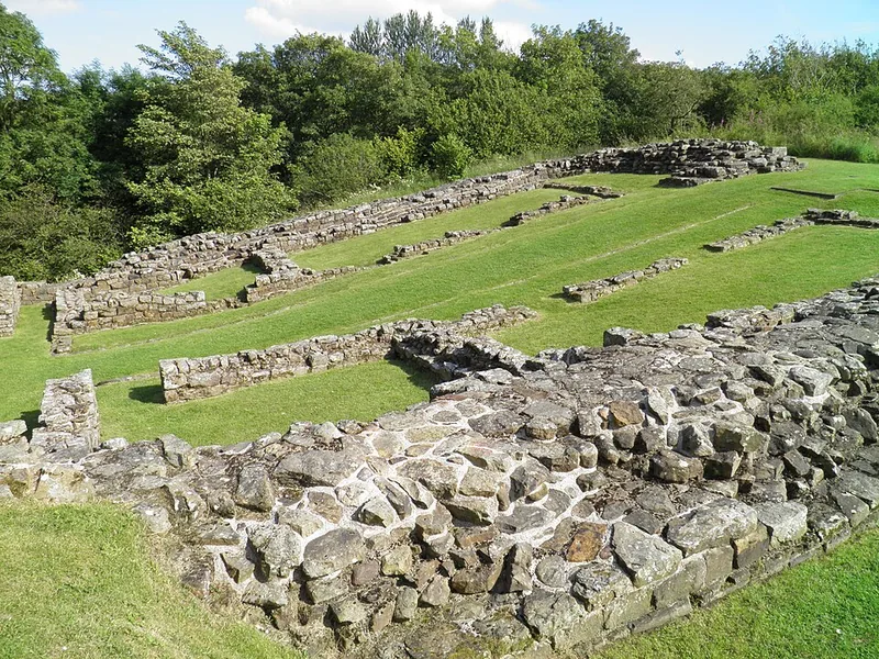
The most completely excavated fort, with original Wall and a full-scale reconstruction — 3 minutes from the Metro. Here the Wall is a city story, not a wilderness one.
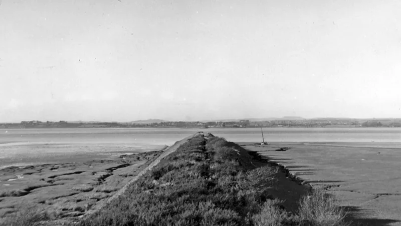
At the Solway end no high wall survives. What survives is villages, churches of Roman stone and estuary light — plus the end of the 84-mile trail.
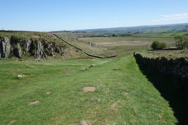
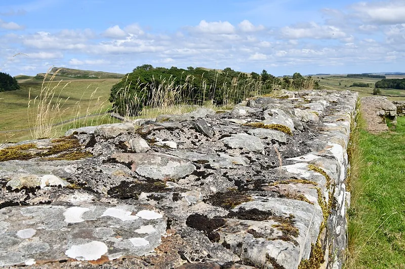
The Wall on the dolerite edge, Sycamore Gap steps away. The loveliest and busiest stretch: come early or save it for last.
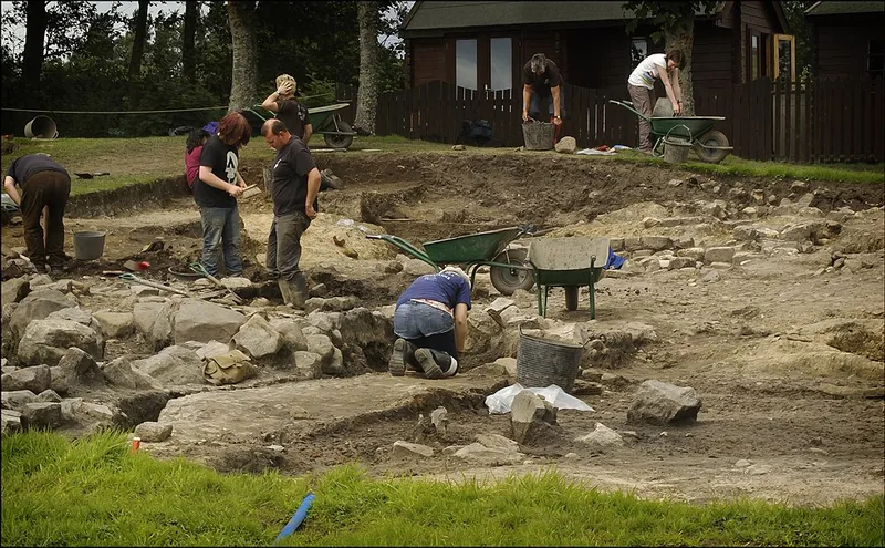
South of the Wall, one of the few places where the frontier is still dug every year. Its writing tablets are ‘Britain’s Top Treasure’.
§ 16 forts, east to west
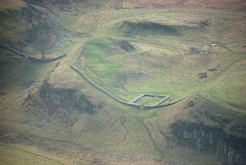
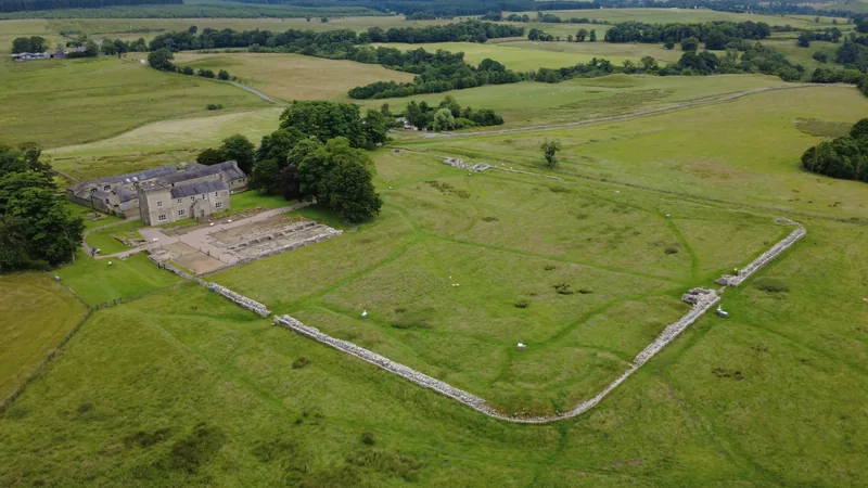
All 16 forts on the Wall line, in order, with what remains of each, what the ground is like and how to reach them without a car. Four hold major remains (Segedunum, Chesters, Housesteads, Birdoswald); the rest run from earthworks to nothing visible. The status label tells the truth briefly.
See on the ribbon →Source: Hadrian's Wall Country · North East Museums
See on the ribbon →Source: National Heritage List for England 1010976
See on the ribbon →Source: Heritage Gateway · Historic England Research Records
Six places off the Wall line without which the frontier makes no sense: two on the Stanegate (Vindolanda, Corbridge), one supply fort (Arbeia) and three outposts (Maryport, Ravenglass, Bewcastle).
§ Index
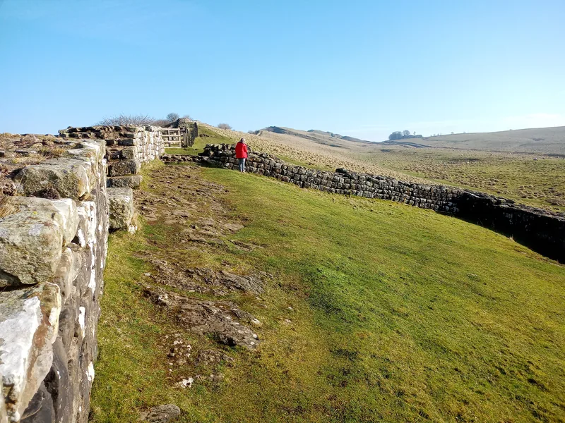
Of the 80 milecastles, numbered 1 to 80 from east to west, seven have verified positions and remains described by official sources (solid outline). The rest sit on the nominal 1.48 km grid (dashed outline) — an index, not a survey. Touch a number to see it on the ribbon.
§ Four days
Four days built only from links verified in September 2026: train, Metro and three bus routes. Timetables change — each day says what to check before leaving.
Source: Go North East
Source: Cumberland Council
Source: Cumberland Council
Source: National Rail
Source: North East Museums
Source: Vindolanda Trust
Source: English Heritage
§ Honesty
On the ribbon, solid means visible, hollow means buried or nominal. But the map alone cannot separate some essentials. Reconstructions (the Segedunum Wall, the Arbeia buildings) show how it once looked; original stone shows what survived. Reburied digs (a routine conservation practice) are invisible though their positions are certain. Private land hides whole forts (Rudchester, Castlesteads). And the west, from Banks to the Solway, is largely invisible: the turf wall leaves no masonry, and villages sit on forts.
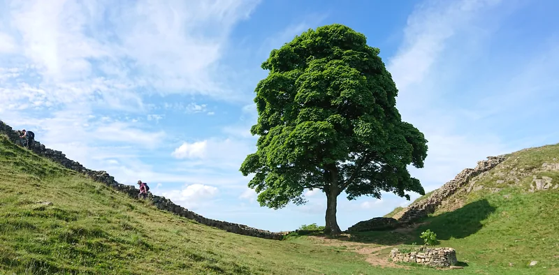
Sycamore Gap deserves a word of its own. The roughly 200-year-old sycamore, one of the Wall’s most photographed symbols, was felled by vandals in September 2023. The National Trust has fenced the stump, from which 25 shoots grow, given away 49 saplings (‘Trees of Hope’) and displays a length of trunk at The Sill. Our photograph is from 2018 and stays dated as such.
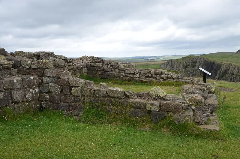
The best habit on the Wall: read the panel before the stones. Two heaps of stone — turrets 51A and 51B near Birdoswald — proved the turf wall ran all the way to the coast. Without the story, they are only stones.
§ Method and sources
The Wall was organised in 80 Roman miles, but its length in modern miles depends on definition: who measures what. Every published figure we found, side by side:
| Source | Figure | What it measures |
|---|---|---|
| English Heritage | 73 miles (117.5 km) | The Wall, Wallsend–Bowness |
| English Heritage (original design) | 80 Roman miles | Wallsend–Burgh-by-Sands, at about 1.48 km to the mile |
| UNESCO, summary | 118 km | Hadrian’s Wall |
| UNESCO, statement of value | 130 km + 36 km | Tyne mouth–Solway, plus the coastal defence |
| National Heritage List for England | 70 miles | Boilerplate in the listing texts |
| Hadrian's Wall Country | 73 miles (117 km) | The Wall, Bowness–Wallsend |
| National Trails (the Path) | 84 miles (135 km) | The walking trail, longer than the Wall |
| Our route line | 114.6 km (71.2 miles) | 45 route points, cumulative ellipsoidal distance |
A Roman mile is about 1.48 km (English Heritage); 80 Roman miles make about 118.4 km. Our line runs about 2.5% short of the published 117.5 km because straight chords cut the Wall’s bends — and verified milecastles fall systematically up to 2 km east of the nominal grid, by exactly that percentage. The grid is an index, not a survey; nominal mile 80 overshooting Bowness is shown on the ribbon, not hidden.
The 16 forts are the standard count (English Heritage, the heritage list): Segedunum to Maia, excluding the Stanegate forts, the outposts and the coastal ports. We keep those separate, on the same page.
The elevation profile is derived from Terrarium elevation tiles (SRTM data, public domain), sampled at about 200 metres and lightly smoothed; cross-checking against independent SRTM gives ±5 metres. The ribbon’s highest point is about 322 metres (smoothed) while the Winshields trig point stands at 345 metres: the difference comes from smoothing and from SRTM understating sharp peaks.
Route geometry and positions marked ‘OSM’ come from OpenStreetMap, © OpenStreetMap contributors, ODbL licence. Verified fort points also use Roman Inscriptions of Britain, and milecastle 39 is triangulated with Pleiades (3 metres apart). Photographs are from Wikimedia Commons, with author and licence on each image, stored locally.
Transport and opening hours were checked on 14 September 2026 and they change: bus AD122 became the 122 in July 2026, the train timetable runs to 3 October 2026 and the HW1 to 3 January 2027. Every transport claim links the live operator; check the timetable before leaving.
Accessibility is reported only from the managing bodies’ statements (English Heritage, the National Trust, the Vindolanda Trust, North East Museums), separated into terrain, surface, steps, parking, toilets and transport. Where the body is silent, we say the information is unpublished.
_to_Annan_(Dumfries-shire),_1951_-_geograph.org.uk_-_5199536.jpg)

.jpg)


,_Hadrians_Wall_(8751180924).jpg)
_Roman_Fort,_Hadrians_Wall,_From_the_air_south_west_of_the_site,_2026-07-01.png)
,_next_to_Hadrian’s_Wall_UK.jpg)

_04.jpg)