Khartoum · Aswan · delta

The Nile: one river, several measures

From the equatorial headwaters and the Ethiopian flood pulse to the Aswan dam and water diplomacy: the Nile is measured in conventions, not in one number. M01 M05 M10 M11 M26

From space, the delta looks like a green fan over the desert. Down on the river, every measure — length, discharge, level — depends on the convention chosen. M10 M26

≈6,650 kmcommonly quoted estimate · conventional length M01
84 km³/yrDongola/Aswan inflow · naturalized 1890–1995 mean M05
65 / 35Blue / White of the Khartoum subtotal · calculated from the FAO table M05
2 branchesRosetta west · Damietta east · modern principal distributaries M10
The Nile Delta seen from the International Space Station, toward the Mediterranean
The Nile Delta toward the Mediterranean Sea, photographed from the International Space Station on 22 March 2025, from 261 miles up. A modern image, not a whole-river map. M26NASA Johnson Space Center · Taken · Public domain

LENGTH

The wrong question gets a wrong number

“Which is the longest river in the world?” sounds like a question with an answer. The Nile answers with a question back: where do you start measuring, and where do you stop? M01 M03

Three figures, three conventions: none is “the true length”. M01 M02 M03

THE COMMON ESTIMATE

About 6,650 km, the most quoted number

National Geographic: “Nile River … about 6,650 kilometers”. M01

About 6,650 km is a commonly quoted estimate, not a newly measured length. The same page says plainly that the beginning is hard to pinpoint — and a beginning that is hard to pinpoint makes any total provisional. M01

THE NBI CONVENTION

6,695 km on the basin maps

NBI: “the longest river in the world at 6,695 km”. M02

The Nile Basin Initiative maps the river at 6,695 km, with a drainage basin of 3,176,541 km². That is the institutional figure of the NBI maps — another convention, not the resolution of the dispute. M02

THE ENDPOINT RULE

A farther source moves the ranking

2007: the Brazilian team claimed 6,800 km for the Amazon. M03

The endpoint rule is the farthest point of continuously flowing water that can travel to the river's mouth. The 2007 Amazon team's 6,800 km was a then-unpublished claim after a farther-source choice. Without a named source and an endpoint rule, no ranking can be declared. M03

HEADWATERS

Two beginnings, each with its convention

The Nile begins twice: once long and gentle, from equatorial Africa's heart, and once short and violent, from the Ethiopian plateau. The basin that gathers them spans about 3.2–3.3 million km² and touches 11 countries — ten NBI partners plus Eritrea as observer. M04 M07

Victoria is the convention; Rwanda is the distance; Tana is the pulse. M04 M07 M08

WHITE NILE · THE CONVENTION

Lake Victoria, the accepted source

Since the 1800s, Victoria is the White Nile's “source”. M07

Lake Victoria is the conventional White Nile source, accepted as such since about the mid-1800s. But the farthest headwater path reaches southern Rwanda, through the Kagera system — “source” depends on the convention you choose. M07

BLUE NILE · THE PULSE

Lake Tana, where the flood begins

The Blue Nile begins at Lake Tana in Ethiopia. M07

The Blue Nile begins at Lake Tana in Ethiopia. NASA sums up the division of labor: the White Nile “reaches deeper into the heart of Africa” while the Blue Nile “delivers more water”. M07

THE CONFLUENCE

At Khartoum, two rivers become one

White Nile west, Blue Nile east. M08

The White Nile (western branch) and Blue Nile (eastern branch) converge at Khartoum and continue to flow northward as the Great Nile. The orientation is geographic, not a surveyed confluence coordinate. M08

Photographs and maps · credit and date on every image

Current Nile locator, with the White and Blue reaches, the Khartoum confluence, the reservoir, the dam and the delta outlets.
OpenStreetMap geometry from the dated 2026-10-06 extract. Locator, not a nautical chart. The river trunk is assembled from small per-chapter bbox geometries; the Khartoum confluence and the branch outlets are geometry-derived, not named OSM points. The reservoir polygon covers Lake Nasser and Lake Nubia together. · © OpenStreetMap contributors · ODbL 1.0 M25
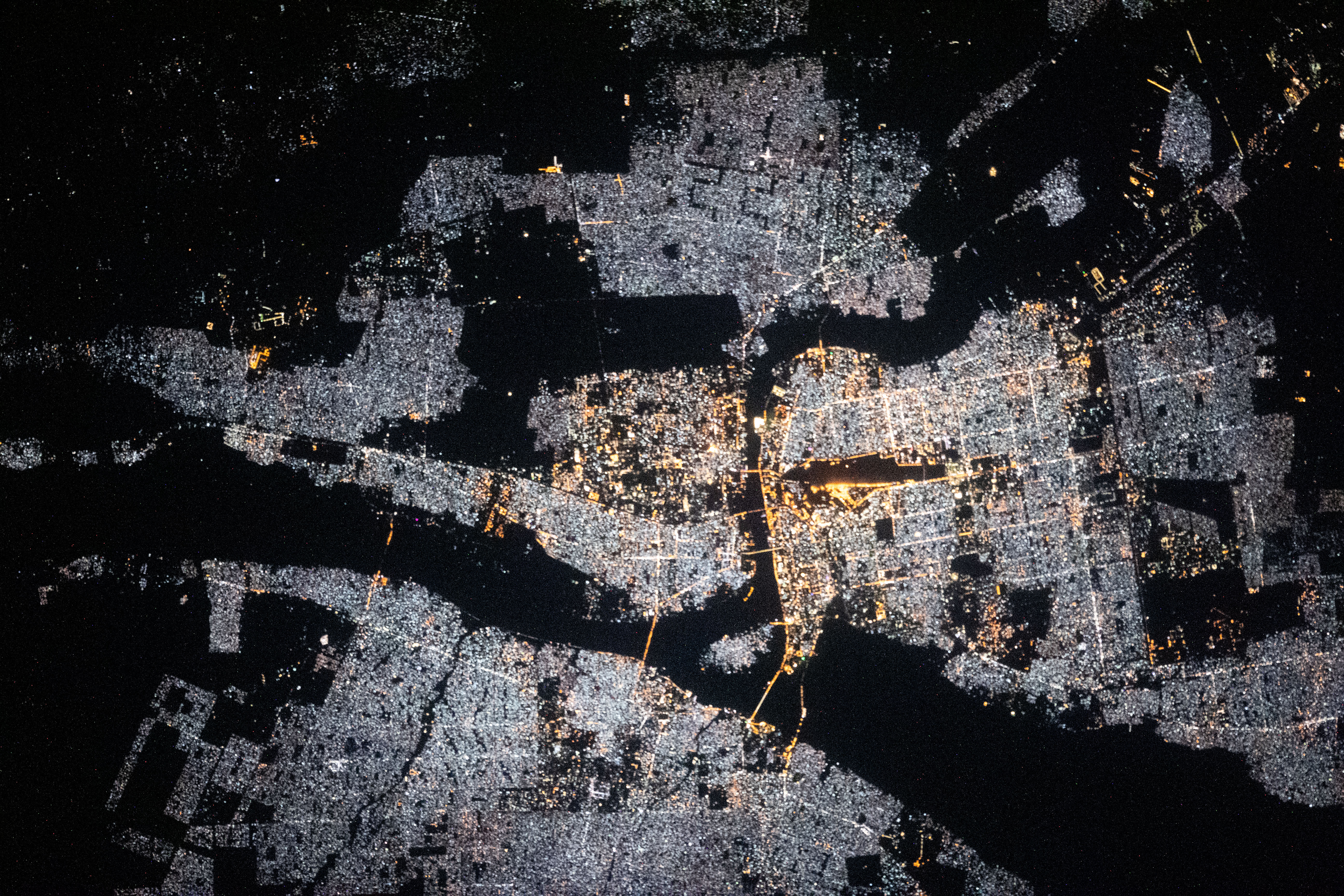
Nighttime Khartoum between the Nile, Blue Nile and White Nile
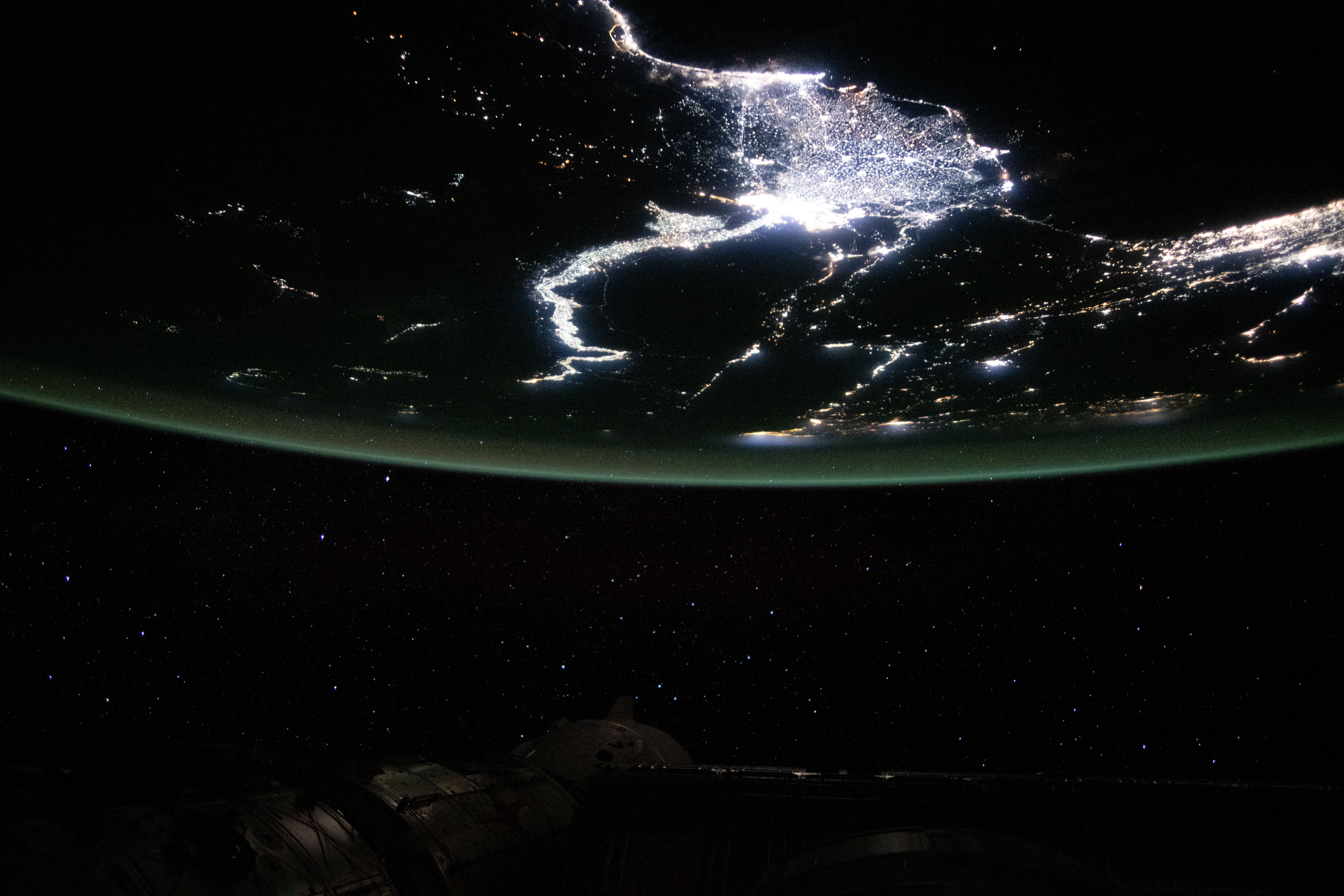
Nighttime Khartoum between the Nile, Blue Nile and White Nile, from the International Space Station (11 November 2020). A locator image; the darkness verifies neither water color nor the exact confluence point. M30NASA Johnson Space Center / VIV · Taken · Public domain
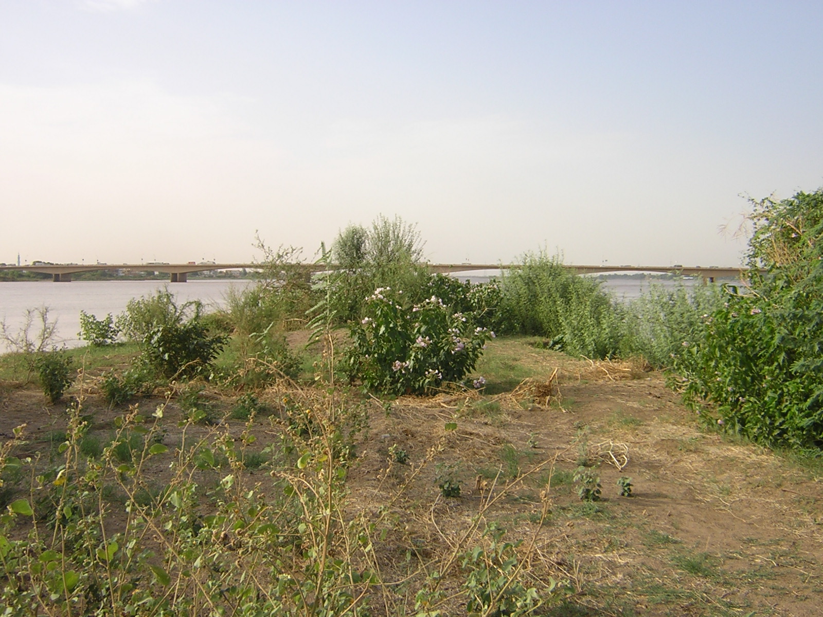
The White–Blue Nile confluence, seen from Tuti Island
The White–Blue Nile confluence seen from Tuti Island, Khartoum (3 August 2009). A dated image, with no implications for current water conditions. M31Petr Adam Dohnálek · 3 Aug 2009 · CC BY-SA 3.0 cz
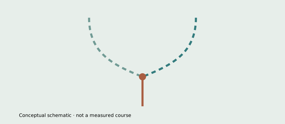
The two-headwater fork is a conceptual schematic, drawn separately from OSM geometry; it is not a measured course.
The two-headwater fork is a conceptual schematic, drawn separately from OSM geometry; it is not a measured course. M07

HYDROLOGY

How much water? Depends on the station and the years

The Nile's serious discharges come from long naturalized series — reconstructed without dams. The FAO table gives annual means at key stations, each with its period: reference figures, not today's readings. M05

84 at the inflow, 48 with 26 at Khartoum — all with their years. M05 M06

DONGOLA/ASWAN INFLOW

About 84 km³ a year at the inflow

84.1 km³/yr at Dongola, the 1890–1995 mean. M05

A Dongola/Aswan inflow of about 84 km³/yr is a naturalized 1890–1995 annual mean, not a current gauge reading. About 2,665 m³/s is calculated from 84.1 km³/yr as an annual mean — a conversion, not a direct measurement. M05

KHARTOUM · TWO TRIBUTARIES

48.3 with 26.0: near two-thirds, one-third

Blue 1900–1995, White at Mogren 1911–1995. M05

Blue 48.3 and White 26.0 km³/yr are about 65% and 35% of that two-river Khartoum subtotal only (74.3 km³/yr). The percentages are calculated on the naturalized table, not treaty shares. M05

JULY–OCTOBER

The flood comes from Ethiopia, not from the south

A sharp August peak; the White Nile runs even. M06

The Blue Nile flood runs July–October with a very sharp peak flow in late August; the White Nile shows no comparable flood. The Khartoum field study spans 1968–1970 and has no White Nile discharge-rate data for July–October — velocities in m/s do not translate into discharge. M06

Photographs and maps · credit and date on every image

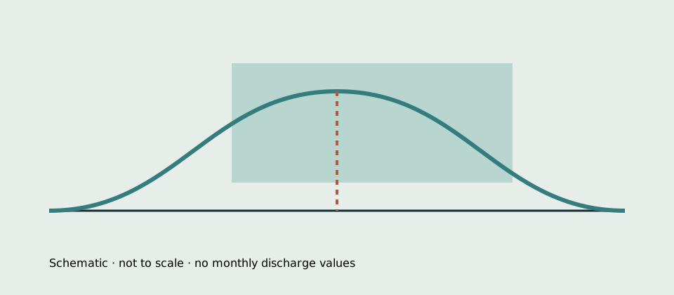
Schematic seasonal band: the July–October Blue flood with an August peak against the even White Nile.
Schematic, not to scale; no monthly discharge values. M06

THE COURSE

Six cataracts, then two branches

Between Khartoum and the sea, the Nile passes two narrowings of the story: the rocky rapids counted by the old geographers and the modern delta fork. This page's locator shows current OSM geometry — a locator, not a nautical chart and never a river-length measurement. M09 M10 M25

The old count: six. The new split: two. M09 M10 M25

KHARTOUM–ASWAN

Six traditionally numbered cataracts

2nd–6th between Khartoum and Wadi Halfa. M09

Between Khartoum and Wadi Halfa run six traditional numbered cataracts: the 2nd through the 6th, with the First at Aswan, lower down the river. This is the traditional set from the 1911 reference, not every rapid of the modern river. M09

THE DELTA

Two principal distributaries

Damietta to the east and Rosetta to the west. M10

As many as seven branches once flowed through the delta; its waters are now concentrated in two principal distributaries: Damietta to the east and Rosetta to the west. “Two” does not erase the delta's canals, drains and lagoons. M10

THE LOCATOR

An orientation map, not a navigation chart

OSM geometry from a dated extract. M25

The locator joins per-chapter small-bbox river reaches with the reservoir polygon and the dam line. It is community orientation geometry: it establishes no lengths, discharges, flood seasons or navigation. M25

Photographs and maps · credit and date on every image

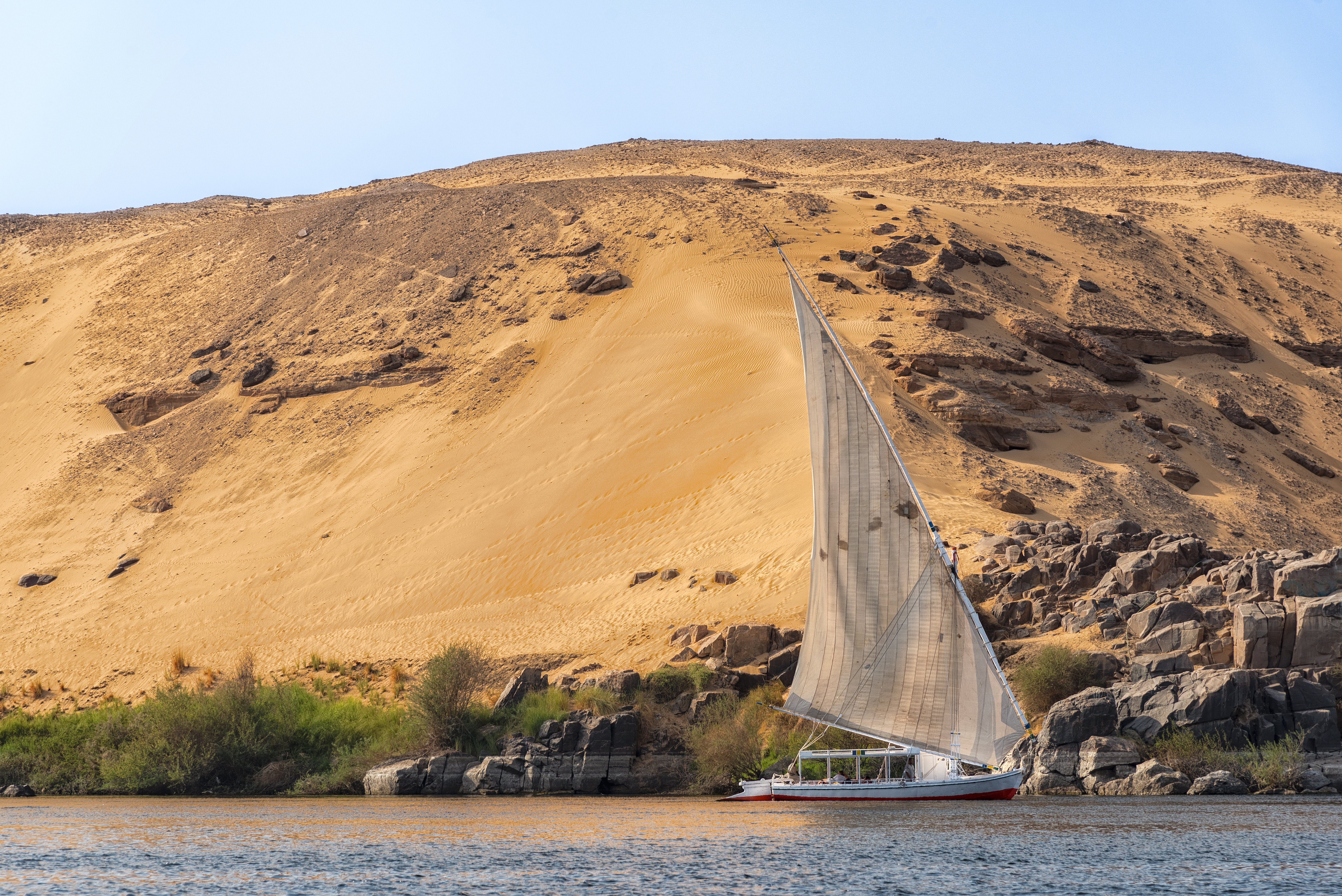
An open-decked felucca on the Nile near Aswan
An open-decked felucca on the Nile near Aswan (24 September 2023). A modern boat scene, not an antiquity-era vessel. M28Mustang Joe · Taken · CC0
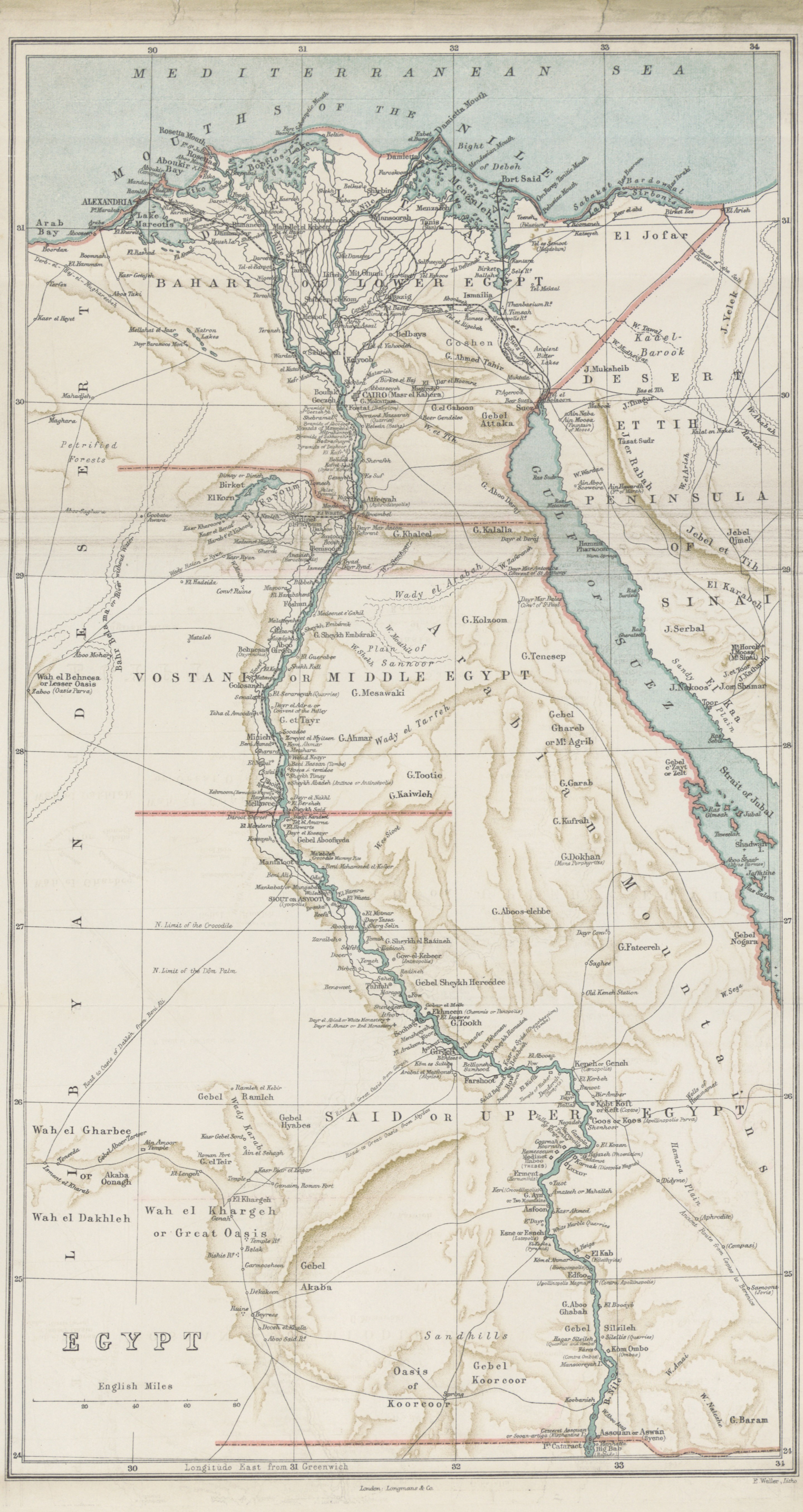
The 1877 period regional map of Egypt and the Nile
The period regional map “Egypt and Nile river” (engraved by E. Weller, 1877). A period schematic reproduction, not modern basin boundaries and not a source measurement. M32Engraved by E. Weller · 1877 · Public domain

REGULATION

Since 1970, the flood runs on schedule

The Aswan High Dam cut the millennial inundation cycle and replaced it with a reservoir of levels and volumes. Its figures do not mix: every volume keeps its level and its scope. M11 M12

169 by design, 132.5 and 156.9 at the 180 level. M11 M12 M13

1960–1970

A decade of works, a regulated river

The project was started in 1960 and completed in 1970. M11

The project was started in 1960 and completed in 1970. Since that year, the Nile below Aswan is no longer the river of the annual flood but the river of scheduled releases. M11

THE 183 M LEVEL

169 km³: gross design storage

Maximum impounded level: 183 m. M11

169 km³ is gross design storage at 183 m — the maximum impounded level, with dead, regular and flood-protection volumes. It is the capacity on the drawing board, not the lake's ordinary active storage. M11

THE 180 M LEVEL

132.5 and 156.9: two volumes, one level

The FAO 1995 table: Nasser vs. the entire reservoir. M12

132.5 km³ is Lake Nasser volume at 180 m (5,238 km²), and 156.9 km³ is the entire reservoir at 180 m (6,216 km²), with Sudanese Lake Nubia. Level and scope are never dropped from the reading. M12

BEFORE THE DAM

110 million tons of silt a year

NASA's estimate of the earlier annual flood. M13

Before the dam, an estimated 110 million tons of silt was deposited by the annual flood — an estimate, not a current sediment rate. NASA describes the attributed effects: fertilizer needs, erosion and saltwater intrusion where the Nile meets the Mediterranean. M13

Photographs and maps · credit and date on every image

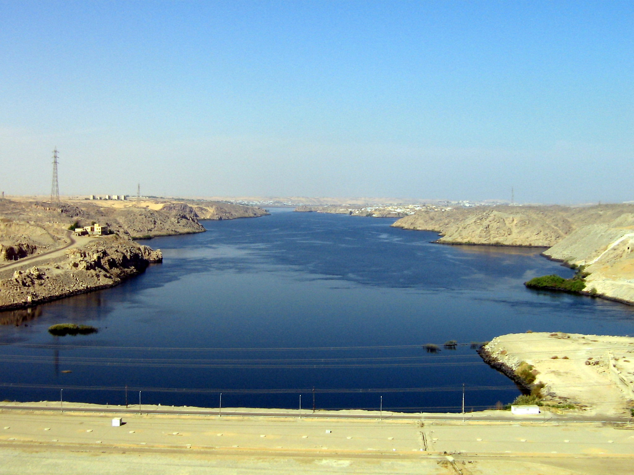
The Aswan High Dam, seen from the dam wall
The Aswan High Dam photographed from the dam wall on 30 November 2007. A modern finished dam, not construction-period imagery. M27Jordan Busson · 30 Nov 2007 · CC BY 3.0
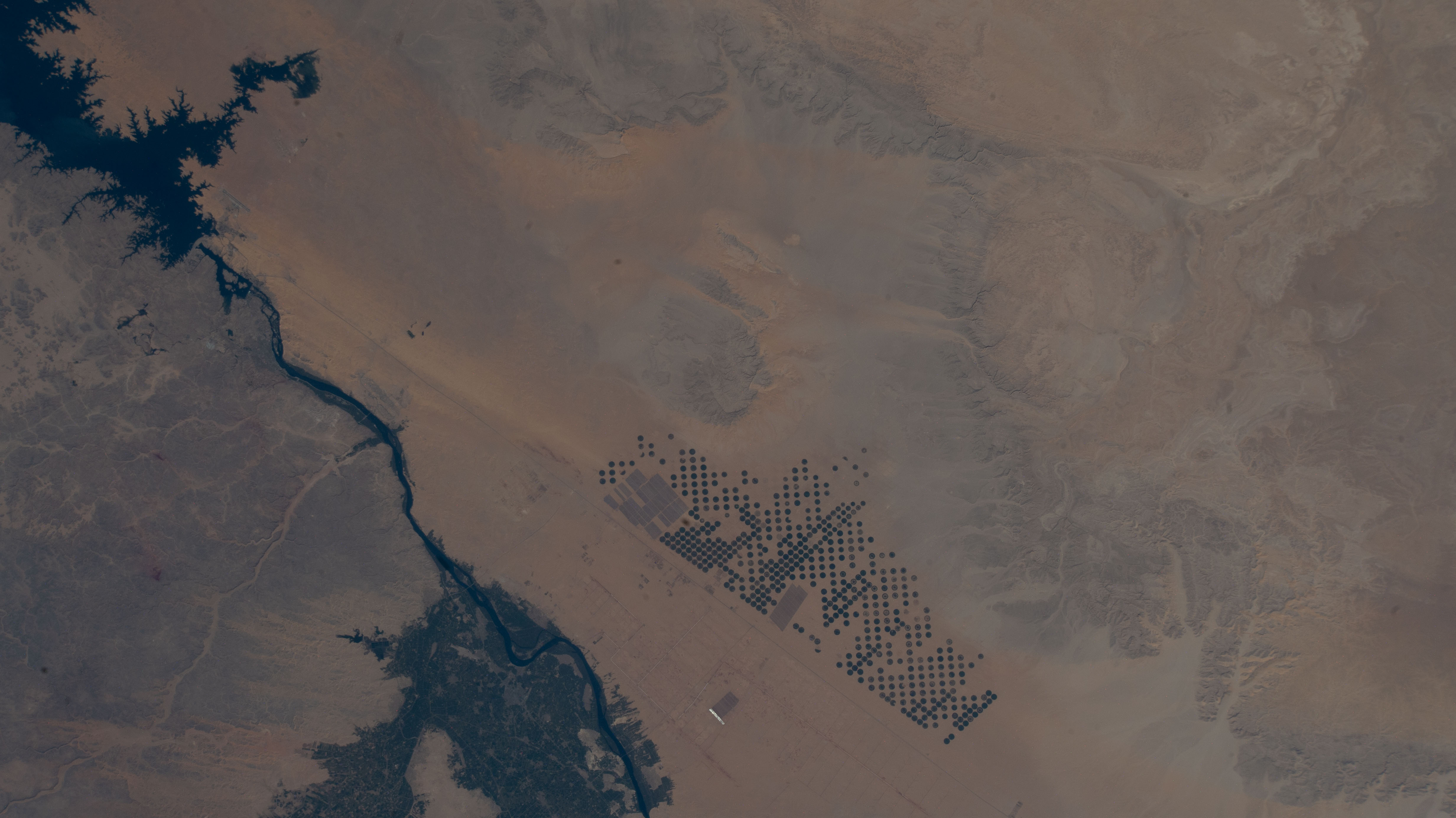
The Nile turning into Lake Nasser at the High Dam, with irrigated fields
The Nile turning into Lake Nasser at the Aswan High Dam, with circular irrigation fields (16 February 2026). A modern view of the regulated reach, not the whole Nile. M33NASA Johnson Space Center · Taken · Public domain

TREATIES

Two papers that never meet

Nile water is divided on paper twice, in two different legal worlds: a 1959 bilateral deal and a basin framework in force since 2024. The second does not rewrite the first. M17 M18 M19 M20

The 1959 shares live inside the 1959 calculation. M17 M18 M19 M20

CAIRO, 8 NOVEMBER 1959

55.5 with 18.5 — inside the treaty's math

From about 84 minus 10 of storage losses. M17 M18

The treaty starts from about 84 billion m³/yr at Aswan and subtracts storage losses of about 10: 55.5 remains for the United Arab Republic and 18.5 for Sudan. These are bilateral shares inside the treaty's assumptions — not a basin-wide deal and not measured flows today. The authentic text is the Arabic one. M17 M18

13 OCTOBER 2024

The basin framework enters into force

Confirmed by the African Union as depositary. M19

Entry into force on 13 October 2024 was confirmed by the African Union as depositary, after South Sudan joined; Egypt and Sudan had not ratified at that time. The framework does not revise the 1959 bilateral quotas — they are separate legal tracks. M19

AUGUST 2026

The Commission transition, still in consultation

NBI reports from World Water Week. M20

Nile Basin countries continue consultations on the future of NBI and the transition towards a Nile River Basin Commission. That is a consultation state of August 2026 — the Commission is not presented as established or operational. M20

GERD

The dam rewriting diplomacy

The Grand Ethiopian Renaissance Dam gathers three kinds of fact on one construction site: official announcements, one dated event and opposing government positions. This page keeps them separate and attributed. M14 M15 M16 M24

Announcement, inauguration, positions — three different things. M14 M15 M16 M24

10 SEPTEMBER 2023

“Fourth and final” filling, announced

The Ethiopian premier's announcement, via ENA. M14

Prime Minister Abiy Ahmed announced the successful filling of the fourth and final round of the GERD. “Fourth/final” belongs to the announcement — not an independent gauge reading, and later annual inflows are not excluded. M14

9 SEPTEMBER 2025

The inauguration: an event, not a verdict

“Ethiopia officially inaugurated the dam”. M15

Ethiopia officially inaugurated the dam on 9 September 2025, marking the completion of a multi-phase, multi-year build. The date is an event; political and legal assessments belong to attributed positions. M15

JAN–OCT 2026

Three positions, three different months

A welcome, “no permission”, El Alamein. M16

In January, Egypt and Sudan welcomed the offer to resume U.S. mediation efforts — an offer received, not proof that mediation resumed. In August, the Ethiopian minister said the country does not need permission from anyone to develop its water resources. In October, the four-party El Alamein declaration rejected unilateral measures that adversely affect the existing water uses of the Nile's two downstream countries. Opposing positions, no outcome predicted. M16

2 SEPTEMBER 2026

The China–Egypt communiqué names the Nile

A primary lifeline and a legitimate right to water. M24

China affirmed support for Egypt's Nile water rights and its “legitimate right to safeguard its water and food security”. The communiqué does not name GERD, creates no sharing rules and appoints no mediator. M24
ANTIQUITY

An old river, checked words

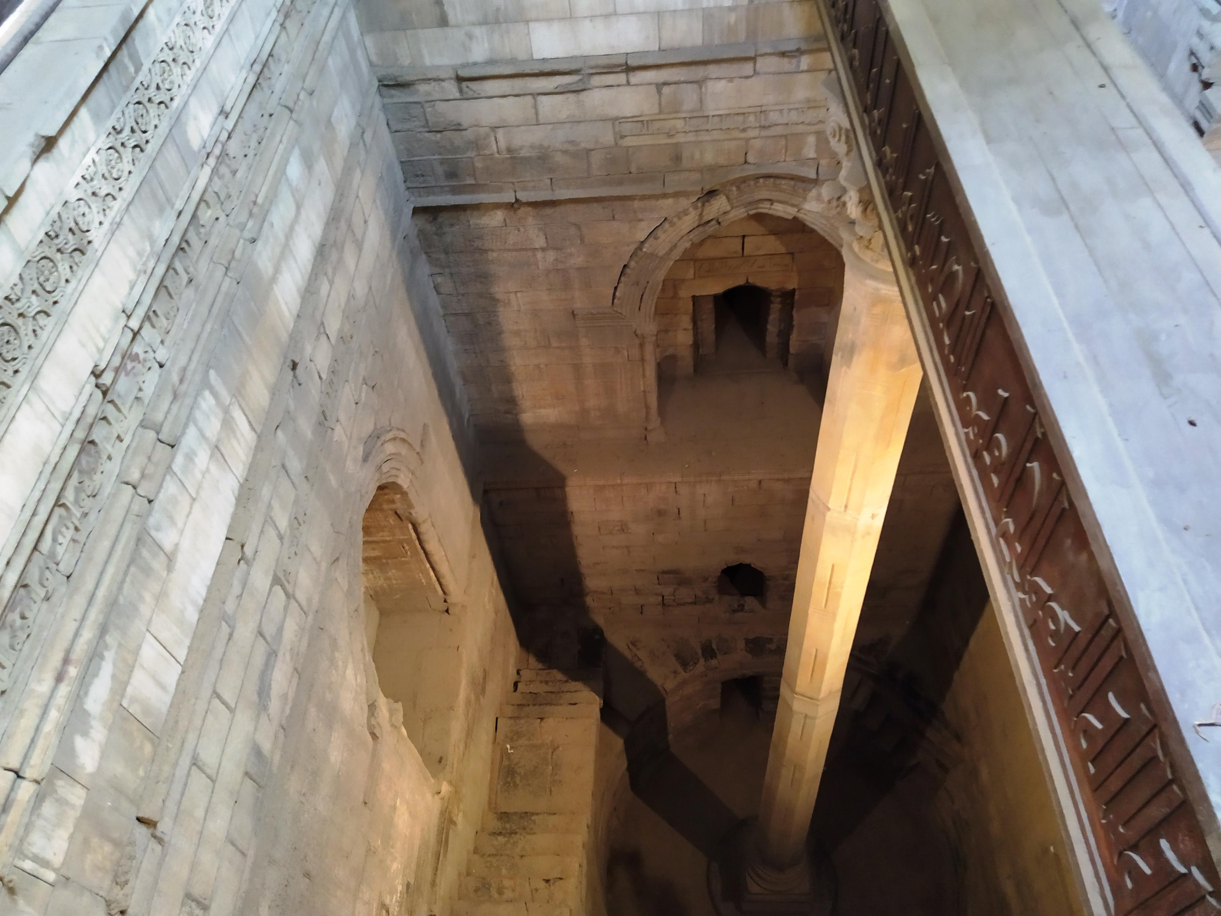
The Nile is as old as the written world, but old words are checked like new figures: what the text says exactly, and what the museum label says. M21 M22 M23

“Of the river”, not “of the Nile”. Medieval, not Pharaonic. M21 M22 M23

HERODOTUS, BOOK II

“The gift of the river” — it says “river”

II.5: “the gift of the river”. M21

Herodotus writes that the Egypt of the Greeks is “an acquired country, the gift of the river” — the English text says “river”, not “Nile”; the famous formula is a later paraphrase. In II.19 the river rises “for an hundred days from the summer solstice” — an ancient account, not modern hydrology. M21

247 AH / 861 AD

The Roda nilometer has measured for a millennium

Built by order of al-Mutawakkil. M22

The Roda Nilometer was built by order of al-Mutawakkil in 247 AH/861 AD and measured flood levels for dykes, canals and taxation. It is a surviving medieval instrument — never Pharaonic. M22

JUNE–OCTOBER

The historical inundation calendar

Peak in July–September, abating in October. M23

Floodwaters reached their peak in July–September and abated in October, and the Egyptian calendar called the season “Flood (June–September/October)”. This is the historical, pre-dam seasonal frame — not a present-day regulated forecast. M23

Photographs and maps · credit and date on every image

The Roda Island nilometer in Cairo, in modern condition
The Roda Island nilometer in Cairo in modern condition (16 July 2019). A surviving medieval monument, never Pharaonic. M29Radosław Botev · 16 Jul 2019 · CC BY 3.0 pl

Sources for this passage

Sources and limits

Annotations retain the status in the source ledger.

  1. M01 · National Geographic Education — the commonly quoted length

    general educational summary · official-link-unverified

    https://education.nationalgeographic.org/resource/understanding-rivers/

  2. M02 · NBI — mapped length and basin

    institutional map-page description · official-link-unverified

    https://nilebasin.org/en/media-center/maps/major-subbasins

  3. M03 · The 2007 Amazon claim and the endpoint rule

    dated claim report + method explainer · official-link-unverified

    https://www.nationalgeographic.com/science/article/amazon-longer-than-nile-river · https://unvis.it/www.britannica.com/story/how-long-is-the-amazon-river

  4. M04 · NBI — the basin and its 11 countries

    current institutional page · official-link-unverified

    https://nilebasin.org/nile-basin

  5. M05 · FAO (2011) — mean annual flow at key stations

    institutional technical report · official-link-unverified

    https://openknowledge.fao.org/handle/20.500.14283/AN530E

  6. M06 · The Blue flood season at Khartoum

    seasonal description + 1968–1970 field study · official-link-unverified

    https://documents1.worldbank.org/curated/en/892931468116645785/pdf/multi0page.pdf · https://link.springer.com/article/10.1007/BF00025772

  7. M07 · Headwater conventions: Victoria, Kagera, Tana

    history account + ministry geography page · official-link-unverified

    https://science.nasa.gov/earth/earth-observatory/quest-for-the-source-of-the-nile-7236/ · https://www.mwri.gov.eg/?page_id=6823

  8. M08 · NASA — the Khartoum confluence

    image interpretation · official-link-unverified

    https://science.nasa.gov/photojournal/nile-river-fluctuations-near-khartoum-sudan/

  9. M09 · 1911 Britannica — the six cataracts

    dated 1911 reference · official-link-unverified

    https://en.wikisource.org/wiki/1911_Encyclop%C3%A6dia_Britannica/Nile

  10. M10 · Britannica — the two modern delta branches

    general geography summary · official-link-unverified

    https://unvis.it/www.britannica.com/place/Egypt

  11. M11 · The High Dam: chronology and design storage

    project chronology + design description · official-link-unverified

    https://eol.jsc.nasa.gov/Collections/EarthObservatory/articles/AswanHighDam.htm · https://www.mwri.gov.eg/?lang=en&page_id=33310

  12. M12 · FAO 1995 — Lake Nasser at the 180 m level

    dated report table · official-link-unverified

    https://www.fao.org/4/ad795b/AD795B15.htm

  13. M13 · NASA — flood silt and delta effects

    NASA commentary on a 2001 image · official-link-unverified

    https://eol.jsc.nasa.gov/Collections/EarthFromSpace/printinfo.pl?PHOTO=STS102-303-17

  14. M14 · ENA 2023 — the GERD filling announcement

    official report of an announcement · official-link-unverified

    https://www.ena.et/web/eng/w/eng_3317937

  15. M15 · The GERD inauguration, 9 September 2025

    industry analysis · official-link-unverified

    https://www.waterpowermagazine.com/analysis/grand-ethiopian-renaissance-dam-how-africas-largest-hydropower-project-is-powering-ethiopias-future/

  16. M16 · The 2026 positions: mediation, permission, El Alamein

    dated diplomacy snapshots · official-link-unverified

    https://srnnews.com/egypt-and-sudan-welcome-trumps-offer-to-mediate-nile-river-dam-dispute/ · https://www.amn.gov.et/en/ethiopia-does-not-need-permission-to-develop-its-nile-resources/ · https://mesobjournal.com/post/el-alamein-egypt-eritrea-sudan-somalia-declaration

  17. M17 · UN — the 1959 bilateral agreement

    treaty registry metadata · official-link-unverified

    https://treaties.un.org/Pages/showDetails.aspx?objid=0800000280132f7f

  18. M18 · The 1959 bilateral shares in translation

    treaty text translation · official-link-unverified

    https://internationalwaterlaw.org/documents/regionaldocs/uar_sudan.html

  19. M19 · CFA entry into force, October 2024

    legal/institutional record · official-link-unverified

    https://nilebasin.org/sites/default/files/2024-10/Announcement%20of%20the%20Entry%20into%20force%20of%20the%20CFA%20%20on%2013%20October%202024.pdf

  20. M20 · NBI 2026 — the transition consultations

    institutional update · official-link-unverified

    https://nilebasin.org/content/what-nbi-and-its-development-partners-discussed-stockholm-world-water-week-and-19-action

  21. M21 · Herodotus II.5 and II.19 on the river

    ancient text in translation · official-link-unverified

    https://en.wikisource.org/wiki/The_History_of_Herodotus_(Rawlinson)/Book_2 · https://penelope.uchicago.edu/Thayer/E/Roman/Texts/Herodotus/2A%2A.html

  22. M22 · The medieval Roda Nilometer

    ministry monument description · official-link-unverified

    https://egymonuments.gov.eg/monuments/rawda-island-nilometer/

  23. M23 · The historical inundation farm calendar

    museum education guide · official-link-unverified

    https://lsa.umich.edu/content/dam/kelsey-assets/kelsey-documents/education/teacher-resource-guides/EDU_curriculum_AEgypt_webready.pdf

  24. M24 · The China–Egypt joint communiqué, 2 September 2026

    primary communiqué + press corroboration · official-link-unverified

    https://www.mfa.gov.cn/zyxw/202609/t20260902_12015037.shtml · https://www.krps.org/2026-09-03/chinas-xi-visits-egypt-for-the-first-time-in-a-decade

  25. M25 · The verified OSM objects of the Nile

    OpenStreetMap records · official-link-unverified

    https://www.openstreetmap.org/relation/50793 · https://www.openstreetmap.org/relation/50790 · https://www.openstreetmap.org/relation/1657491 · https://www.openstreetmap.org/relation/13985343 · https://www.openstreetmap.org/way/5047035 · https://www.openstreetmap.org/relation/9283265 · https://www.openstreetmap.org/relation/9283262

  26. M26 · Commons V01: the Nile Delta (ISS)

    Commons original, file page reviewed · official-link-unverified

    https://commons.wikimedia.org/wiki/File:Egypt%27s_Nile_Delta_region_(iss072e905240).jpg

  27. M27 · Commons V02: the Aswan High Dam

    Commons original, file page reviewed · official-link-unverified

    https://commons.wikimedia.org/wiki/File:Aswan_High_Dam.jpg

  28. M28 · Commons V03: felucca on the Nile

    Commons original, file page reviewed · official-link-unverified

    https://commons.wikimedia.org/wiki/File:Felucca_on_the_Nile_(53709847874).jpg

  29. M29 · Commons V04: the Rhoda nilometer

    Commons original, file page reviewed · official-link-unverified

    https://commons.wikimedia.org/wiki/File:Nilometer_Rhoda_Island_Cairo_Egypt_(2).jpg

  30. M30 · Commons V05: Khartoum at night (ISS)

    Commons original, file page reviewed · official-link-unverified

    https://commons.wikimedia.org/wiki/File:Iss064e004061_(Nov_11,_2020)_---_This_nighttime_shot_from_the_International_Space_Station_shows_Khartoum,_the_capital_of_Sudan,_surrounded_by_the_Nile,_Blue_Nile_and_White_Nile_Rivers.jpg

  31. M31 · Commons V06: the Nile confluence (Khartoum)

    Commons original, file page reviewed · official-link-unverified

    https://commons.wikimedia.org/wiki/File:Confluence_of_Nile_(Khartoum)_001.jpg

  32. M32 · Commons V07: Egypt and the Nile, the 1877 map

    Commons original, file page reviewed · official-link-unverified

    https://commons.wikimedia.org/wiki/File:Egypt_and_Nile_rver_1877.jpg

  33. M33 · Commons V08: the Nile into Lake Nasser (ISS)

    Commons original, file page reviewed · official-link-unverified

    https://commons.wikimedia.org/wiki/File:Egypt%E2%80%99s_Nile_River_turns_into_Lake_Nasser_at_the_Aswan_High_Dam_(iss074e0315952).jpg