The Danube between Romania and Serbia
Fishers and farmers at the Iron Gates
Did more people arrive from elsewhere when farming began? Make a guess, then use the map to see what teeth, bones and DNA can tell us.
Before seeing the dates, what would you expect?
The records below include dates, locations and sources for each site.
Follow the evidence ↓01 · c. 9500–7400 BC
A river could keep people in one place
The Danube provided carp, catfish and sturgeon. Fast currents and irregularities in the riverbed helped fishing. Sites occupied small terraces and deposits at the mouths of side valleys, between the gorge’s slopes.
This geography explains the resources available. A riverside position alone does not establish how much someone moved.
02 · c. 7400–6200 BC
Objects travelled. But did people?
Marine shells reached the gorges from coasts over 400 kilometres away. They establish connections and exchange; an object can pass through many hands. Teeth answer a different question: did a person grow up in an area with the same geological signature?
In the 2013 study, only three of 69 securely dated Late Mesolithic burials have values outside the regional range.
03 · c. 6200–6000/5950 BC
More newcomers appear at Lepenski Vir
Strontium signatures become more varied after about 6200 BC. At Lepenski Vir, the 2013 study classifies five people from phase I–II as having grown up in a different geological area.
People associated with the arrival of farming were not necessarily the least mobile. “From elsewhere” does not tell us how many kilometres they travelled.
04 · c. 6000/5950–5500 BC
Change differed from one site to another
At Lepenski Vir, the 2013 study identifies another seven people with nonlocal values in phase III. Ajmana lies downstream in a more open landscape suitable for farming; one chronological attribution in its sample was later revised.
The phases select samples in the study’s table. A faded point does not mean an entire community disappeared.
05 · A map you can check
Choose the place that interests you
Tap a map point or choose its name from the list. Each record explains the samples, what the dates refer to and how securely the site is located. Cuina Turcului and Climente II are very close together; the list keeps them separately selectable.
Return to all sites and play the timeline to follow the phases again without scrolling.
Complementary evidence
Three kinds of evidence, three questions
A tooth can preserve a childhood origin without recording where someone lived in every year. Bones and DNA add different information.
Strontium: did they grow up here?
The enamel isotope ratio is compared with a regional baseline. Borić and Price use values below 0.7085 or above 0.7100 for nonlocal cases. Complex geology and fish consumption make the comparison harder.
Diet: what resources did they use?
Bone isotopes indicate the importance of aquatic resources in the diet. At Vlasac, starch in dental calculus was attributed to domesticated cereals even before 6200 BC. The research does not establish that those cereals were grown at the site.
DNA: who were they related to?
Brami and colleagues in 2022 identify women, men and children at Lepenski Vir with ancestry related to early Aegean farmers. They consider the arrival of families likely, but samples are few and do not establish whether entire families moved together. Genetic ancestry does not establish an exact childhood location.
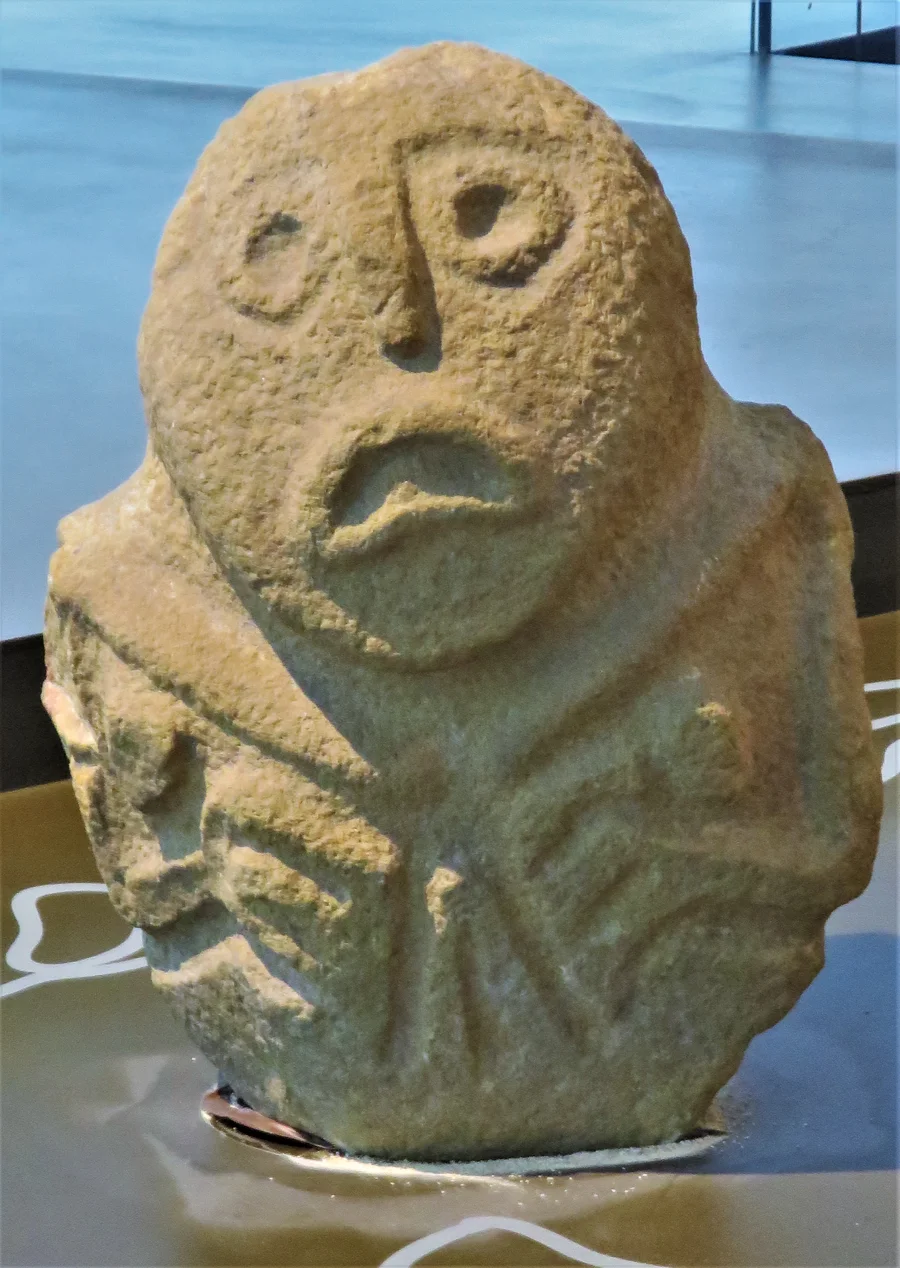
Photo: Beko / Wikimedia Commons, CC BY-SA 4.0. Cropped and converted to WebP. Wikimedia Commons · CC BY-SA 4.0
.jpg)
What we know about each place
The nine sites appear in Table 1 of the 2013 study. Ranges are phases assigned to samples or archaeological levels, not foundation dates or evidence of continuous occupation. Markers are equal in size: they do not compare populations.
Padina
Early and Middle Mesolithic (c. 9500–7400 BC) · Late Mesolithic (c. 7400–6200 BC) · The transition (c. 6200–6000/5950 BC)
Samples in the 2013 study belong to the Early and Late Mesolithic and the transition. The 2022 genetic reanalysis includes people here with ancestry related to early Aegean farmers.
Location: Coordinate rounded to a minute; approximate original site location. Orientation radius on the map: 1000 m. Individual year: unknown.
Borić & Price, PNAS (2013) · Brami et al., Journal of World Prehistory (2022) · Radović et al. (2014), arhiva UCL
Lepenski Vir
Early and Middle Mesolithic (c. 9500–7400 BC) · The transition (c. 6200–6000/5950 BC) · Early and Middle Neolithic (c. 6000/5950–5500 BC)
After about 6200 BC, the 2013 study identifies five people raised in a different geological area in phase I–II and seven in phase III. Later DNA analysis supports the arrival of women, men and children related to early Aegean farmers.
Location: Original Danube terrace location; coordinate rounded to a minute. This is not the entrance to today’s museum. Orientation radius on the map: 1000 m. Individual year: unknown.
Borić & Price, PNAS (2013) · Brami et al., Journal of World Prehistory (2022) · Borić et al., Scientific Reports (2018)
Vlasac
Early and Middle Mesolithic (c. 9500–7400 BC) · Late Mesolithic (c. 7400–6200 BC)
In the Late Mesolithic sample, burials 32 and 49 have strontium values outside the regional range. At Vlasac, dental calculus preserves starch attributed to domesticated cereals before 6200 BC. This indicates consumption or processing, and does not establish cultivation at the site.
Location: Coordinate rounded to a minute, for the archaeological site. Orientation radius on the map: 1000 m. Individual year: unknown.
Borić & Price, PNAS (2013) · Cristiani et al., PNAS (2016) · Radović et al. (2014), arhiva UCL
Hajdučka Vodenica
Late Mesolithic (c. 7400–6200 BC) · The transition (c. 6200–6000/5950 BC)
An isolated skull, number 11, is one of the three nonlocal cases identified by the 2013 study among 69 securely dated Late Mesolithic burials. The table also includes transition-period samples.
Location: Published minute-resolution coordinate, not an excavation survey. Orientation radius on the map: 1000 m. Individual year: unknown.
Borić & Price, PNAS (2013) · Radović et al. (2014), arhiva UCL
Ajmana
Early and Middle Neolithic (c. 6000/5950–5500 BC)
The downstream site is classified as Early Neolithic in the 2013 table. The paper counts three people with nonlocal values, but the ERC BIRTH catalogue assigns one of them, 2/81, to the Iron Age. We therefore do not use the total of three as a secure Neolithic result.
Location: Approximate location near Mala Vrbica, opposite Șimian; the exact excavation position remains unknown. Orientation radius on the map: 1000 m. Individual year: unknown.
Borić & Price, PNAS (2013) · ERC BIRTH, catalogul siturilor · Roland de Beauclair, catalogul siturilor (2015)
Icoana
Late Mesolithic (c. 7400–6200 BC)
The 2013 study’s table includes a single person assigned to the Late Mesolithic. A sample this small cannot describe the mobility of a whole community.
Location: Location from archaeological catalogue entry 207; the original site at the foot of Ciucaru Mic. Orientation radius on the map: 300 m. Individual year: unknown.
Borić & Price, PNAS (2013) · Luca et al., catalogul siturilor (2011), intrarea 207
Schela Cladovei
Late Mesolithic (c. 7400–6200 BC)
The samples included in the 2013 table are assigned to the Late Mesolithic. Near Drobeta-Turnu Severin, Romania, the site extends along the low Danube terrace; the point represents an archaeological area, not a house or a grave.
Location: Approximate Getty TGN point; the national register describes a strip about one kilometre long. Orientation radius on the map: 1000 m. Individual year: unknown.
Borić & Price, PNAS (2013) · Repertoriul arheologic național, 109817.01 · Getty TGN 7030205
Cuina Turcului
Epipalaeolithic (c. 13,500–9300 BC)
The two samples in the 2013 table are assigned to the Epipalaeolithic, before the Mesolithic sequence followed here. About 13,500–9300 BC dates levels in the two shelters, not the year of each tooth.
Location: Rock shelter in the Ciucaru Mare massif, very close to Climente II. Orientation radius on the map: 150 m. Individual year: unknown.
Borić & Price, PNAS (2013) · Materiale și cercetări arheologice (2016)
Climente II
Epipalaeolithic (c. 13,500–9300 BC)
The 2013 table includes one Epipalaeolithic sample. The cave and Cuina Turcului are separate sites very close together; the place list lets you select each one.
Location: Cave in the same massif as Cuina Turcului; approximate position. Orientation radius on the map: 150 m. Individual year: unknown.
Borić & Price, PNAS (2013) · Quaternary International (2016)
What could change the answer
The comparison concerns burials and chronological phases, not occupations or the whole population. “Fishers” and “farmers” are broad historical descriptions here; newcomers could continue fishing. Someone with a local signature could travel and return. We cannot calculate how many kilometres they covered.
Years are calibrated calendar dates BC. Fish can introduce older carbon into the body, making a radiocarbon date appear too early; researchers apply a correction for this effect.
At Lepenski Vir, the 2022 research distinguishes early occupation from resettlement around 6200 BC after a gap of at least a thousand years. A large range between two samples does not establish that the site was inhabited throughout.
The 2013 paper reports measurements from 153 people, while the numbers in Table 1 add up to 152. We preserve the discrepancy rather than invent a missing person. At Ajmana, burial 2/81 is later assigned to the Iron Age in the ERC BIRTH catalogue; the original total of three nonlocal cases is not used here as a secure Neolithic result.
Borić & Price, PNAS (2013) · Brami et al., Journal of World Prehistory (2022) · ERC BIRTH, catalogul siturilor
Sources and the base map
- Borić & Price, PNAS (2013)
Table 1; chronology, strontium and methods sections. Sample phases, the nonlocal criterion and the comparison results.
- Brami et al., Journal of World Prehistory (2022)
Reanalysis of DNA, isotopes and archaeology at Lepenski Vir; incoming families, the occupation hiatus and limits of the farming evidence.
- Cristiani et al., PNAS (2016)
Site descriptions, samples and the identification of starch in dental calculus at Vlasac and Lepenski Vir.
- Radović et al. (2014), arhiva UCL
Published coordinates, rounded to a minute, for Padina, Lepenski Vir, Vlasac and Hajdučka Vodenica.
- Materiale și cercetări arheologice (2016)
The location of the Cuina Turcului rock shelter.
- Quaternary International (2016)
Climente II: the published coordinate and Epipalaeolithic context.
- Luca et al., catalogul siturilor (2011), intrarea 207
Page 111, entry 207: Icoana site coordinates and the 1967–1969 excavations.
- Repertoriul arheologic național, 109817.01
Schela Cladovei: its extent along the low terrace. Approximate point from Getty TGN 7030205.
- ERC BIRTH, catalogul siturilor
Ajmana: burials 7 and 15 are assigned to the Early Neolithic and 2/81 to the Iron Age.
- Roland de Beauclair, catalogul siturilor (2015)
Ajmana, near Mala Vrbica, opposite Șimian island. Approximate marker, with one kilometre of positional uncertainty.
- Borić et al., Scientific Reports (2018)
Introduction: coordinates of Lepenski Vir, 44°33′ N, 22°01′ E.
- Getty TGN 7030205
Approximate Schela Cladovei coordinate: 22.643° E, 44.616° N.
- OpenStreetMap · ODbL 1.0
Danube and present reservoir geometry, cropped from objects 89652 and 1570331.
Present-day relief: Copernicus GLO-30, © DLR e.V. 2010–2014 and © Airbus Defence and Space GmbH 2014–2018, provided under the EU and ESA Copernicus programme. Danube and present reservoir: © OpenStreetMap contributors, ODbL; objects 89652 and 1570331. Relief was cropped and shaded; it does not reconstruct prehistoric banks. Coordinates use the same projection as the map. Orientation radii are editorial choices, not measured positional errors; the exact error remains unknown. Map geography data.
Sources accessed 14 October 2026. English translation and adaptation: Marius Comper.