Sulina, 1856 – 1939
What was Europe doing at Sulina?
In 1856 the Treaty of Paris planted seven powers at the Sulina mouth with a two-year mandate. They stayed 82 years, flew their own flag, and took the bar from 9 to 24 feet of water.
The Commission in four chapters
The Sulina mouth, 1856–1902
Five moments from the 82-year war on the alluvium: the same mouth drawn at 9, 19, 20.5 and 24 feet of water, then as the straight 34-mile channel of 1902. Pick an era and watch the jetties grow.
Every depth below is a sounding from the Britannica surveys of 1902 and 1911; the drawing is schematic, a reading of the figures, not a navigation chart.
1856 – The wild seaboard
9 ft (2.7 m)
A bar of 9 feet, wrecks for landmarks, 2,000 vessels a year loading from lighters in the roadstead.
1861 – The piers
19 ft (5.8 m)
North pier 4,631 feet, south 3,000: the bar drops to 19 feet and the St George scheme dies.
1876 – The long jetty
20.5 ft (6.2 m)
The south jetty faces the north-pier lighthouse: 20.5 feet, constant for 15 years without dredging.
1894 – The parallel piers
24 ft (7.3 m)
Two inner piers narrow the river to 500 feet: a 24-foot channel 5,200 feet long to open sea.
1902 – The straight channel
24 ft (7.3 m)
The cuttings end: 34 straight miles at 18 feet from Sulina to St George's Chatal.
Schematic drawing from the Britannica figures; depths in feet with metric equivalents.
Chapter I
The treaty
1856 – 1865 · 1856–1865, two years that lasted
- Chapter
- 1856 – 1865
- The treaty
- 30 March 1856
- First session
- 4 November 1856, Galatz
- Mandate
- two years, kept 82
On 30 March 1856 the Treaty of Paris ended the Crimean War and planted an experiment at the Danube mouths: a European Commission to clear the bars below Isatcha, given two years and then to be dissolved. It met first on 4 November 1856 at Galatz, with seven powers at the table and Moldova watching in a consultative seat.
The English delegate took the executive, the Frenchman the administration, and the engineers went to work with borrowed Turkish money. By 1860 traffic paid for a tariff of its own, and in 1866 the Commission borrowed on the open market at 10 per cent, pledging the tolls – a joint agent of the nations acting like a state with a treasury.

Nobody dissolved anything. The Public Act of 2 November 1865 put the Commission under international law and extended its life by five years; what was meant to last two lasted 82. The same treaty that redrew the Black Sea had created Europe's first working piece of international government.
designate and to cause to be executed the Works necessary below Isatcha, to clear the mouths of the Danube, as well as the neighbouring parts of the Sea, from the sands and other impediments which obstruct them ...
Treaty of Paris, Article XVI
Meanwhile The upriver sister body, the International Commission, drew up an act in November 1857 that nobody accepted; it waited until after 1918.
The treaty, from the diplomat’s side · Permits and timetables on today’s river
Chapter II
The engineers
1858 – 1902 · 1858–1902, the war on the alluvium
- Chapter
- 1858 – 1902
- The piers
- 1858–1861, 4,631 and 3,000 feet
- The bar
- 9 feet in 1856, 24 in 1900
- The branch
- 45 miles cut to 34 by 1902
Two years were spent arguing over Kilia, Sulina and St George; a Paris technical commission chose St George and its 17-foot sluiced canal, and in December 1858 six of the seven delegates voted for it. Then money and politics spoke, and the Commission simply made the provisional Sulina works permanent: two piers begun in 1858 and finished in 1861, the north 4,631 feet long, the south 3,000.
The bar answered at once, from 9 feet of water to 19. A new lighthouse rose at the north pier head in 1865; in 1876 the south jetty was prolonged to face it, and the depth reached 20.5 feet and stayed there from 1879 to 1895 without any dredging. In 1894 two parallel piers narrowed the river to 500 feet, and a channel 5,200 feet long at 24 feet deep, 300 feet wide between the piers and 600 outside, carried ships to open sea.

Upstream the branch gave the same fight: 45 miles from St George's Chatal to the sea, eleven bends under 1,000 feet of radius, ten shifting shoals of 8 to 13 feet. Cuttings and training walls took it to 11 feet in 1865, 13 in 1871, 15 in 1886, and the last cutting, begun in 1898 and due in 1902, left 34 straight miles at 18 feet. Hartley directed everything until 1872; the Dane Charles Kuhl executed the works after him.
The entrance to the Sulina branch was a wild open seaboard strewn with wrecks, the hulls and masts of which, sticking out of the submerged sandbanks, gave to mariners the only guide where the deepest channel was to be found.
Charles Hartley, 1873
Meanwhile In 1855, 36 of 2,928 vessels were wrecked; in 1865, only 7 of 2,676.
Chapter III
The enclave
1865 – 1914 · 1865–1914, a state without territory
- Chapter
- 1865 – 1914
- The Act
- 2 November 1865
- The flag
- five strips, C.E.D. in white
- Braila
- 1883, 11 miles above Galatz
The Public Act of 2 November 1865 made the Commission untouchable: its officers, works and funds stood under the protection of international law, and either annex could be changed by a majority vote that bound every member at once. It flew its own flag, ran a hospital for seamen of all countries, and answered to no territorial master.
London in 1871 added twelve years and extended neutrality to the staff; Berlin in 1878 admitted Romania as a free country and stretched the jurisdiction 26 miles, from Isatcha to Galatz, in complete independence of the territorial authority. London in 1883 pushed it 11 miles further, to Braila, and prolonged the Commission for 21 years, to 24 April 1904, then tacitly for three years at a time.

The flag told the story in cloth: five parallel strips, red, white, blue, white and red, the blue double height, bearing C.E.D. in white. Sulina stopped being a village of about 1,000 souls and became a wired, lit city with a cemetery the writer Jean Bart called, in 1899, the Living Cemetery.
composed of five parallel strips ... arranged in the following order of colour: red, white, blue, white, and red, the blue strip having a height double that of each of the other strips, and bearing in white the letters 'C.E.D.'
Treaty of Galatz, 1881, Article VIII
Meanwhile Between 1861 and 1881, 111 seagoing vessels were wrecked at the mouths; between 1909 and 1929, only 5.
Chapter IV
The ending
1918 – 1939 · 1918–1939, Sinaia
- Chapter
- 1918 – 1939
- The Court
- 1926, lost on all counts
- Sinaia
- 18 August 1938, in force May 1939
- Belgrade
- 18 August 1948
The Commission worked on through the first two years of the war, Allies and Central Powers still meeting together, until the Treaty of Bucharest of 7 May 1918 turned it into a Commission of the Mouth for river states only. The victors undid that: the convention signed 23 July 1921 restored the European Commission over the mouths and finally gave the upriver International Commission a permanent statute.
Romania had wanted the mouths since 1881, when King Carol demanded control by Romanian officials alone; overruled in 1919 and 1921, it lost on all counts before the Permanent Court in 1926, which gave the Commission the whole maritime Danube. A League inquiry under Walker Hines reported in August 1925 that the fleet carried 25% more tonnage than before the war but traffic was only 56% of normal.

The end came as a bargain, not a verdict: the Sinaia Agreement of 18 August 1938 entered into force in May 1939 and handed the Lower Danube to a Romanian administration. A committee of experts had found Sulina almost impassable in 1938; the Vienna Arrangement swept the administration away in 1940, and the Belgrade Convention of 18 August 1948 put the river under riparian commissions only.
Without territorial possessions, it is nevertheless a distinct international entity, possessing sovereignty over the broad waters of the Danube.
Glen A. Blackburn, 1930
Meanwhile The Danube Commission that succeeded it sits at Budapest since 1954.
Run the Commission
Four decisions the Commission actually faced, on a budget that never stretched. Choose, then check against the engineers.
-
1
The choice
1858: six of seven delegates voted the St George canal. Hartley's provisional Sulina piers already scour 19 feet. The Commission:
What happened
The Sulina piers: begun in 1858, finished in 1861, they took the bar from 9 to 19 feet and buried the canal scheme.
-
2
The money
1866: the chest is empty after the Austro-Prussian war. The Commission:
What happened
The bonds: Turkish loans came irregularly, so the Commission pledged its tolls at 10 per cent and emerged completely solvent.
-
3
The jetty
1876: the 19-foot bar throttles the new steamers. The Commission:
What happened
The jetty: prolonged in 1876, it held 20.5 feet from 1879 to 1895 with no dredging at all.
-
4
The depth
1894: steamers keep growing past the 20-foot bar. The Commission:
What happened
The parallel piers: the 500-foot narrows gave a 24-foot channel 5,200 feet long, and dredging became the exception.
Answer a card to begin.
Four plates of Sulina
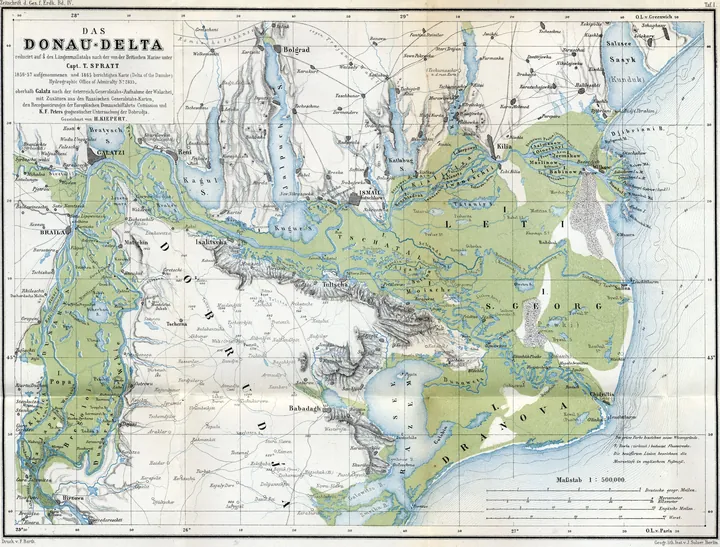
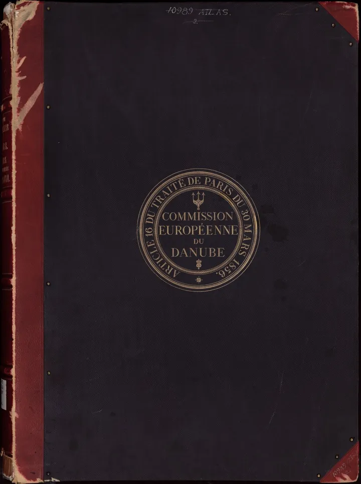
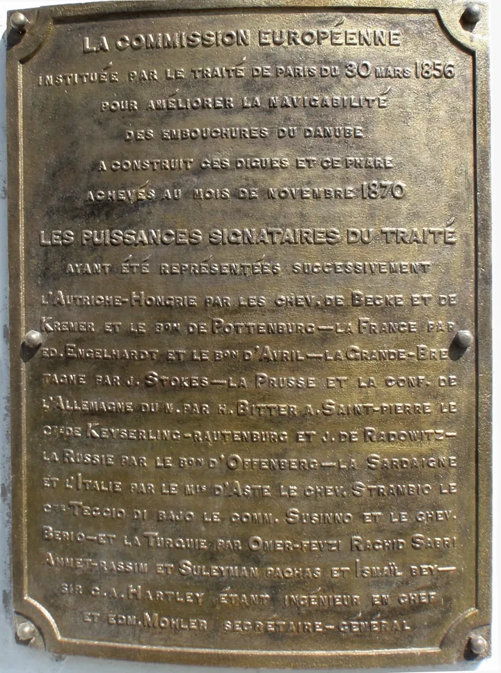
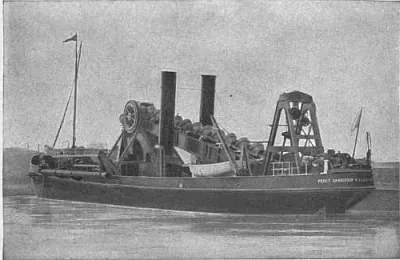
Four images, in the order of the story: the mouths, the engineers' chart, the lighthouse plaque, the dredger.
Plate 1867The three mouths
The three mouths Heinrich Kiepert, 1867 · Wikimedia Commons - The Danube mouths in 1867, drawn by Heinrich Kiepert.
- Chilia, Sulina and St George: the Commission's whole jurisdiction.
- The Sulina branch, in the middle, became the navigable one.
Plate 1887The seal
The seal European Commission of the Danube, 1887 · Wikimedia Commons - The seal of the Commission on its atlas cover, 1887.
- The Treaty of Paris, 1856, article 16: the mandate in gold.
- A trident over the monogram: the enclave signed like a state.
Plate 1870The plaque
The plaque Trygve W. Nodeland, 2010 · Wikimedia Commons - The Commission plaque on the Sulina lighthouse.
- Raised in 1869, completed in November 1870.
- Photographed in 2010; the enclave signed its work.
Plate 1894The dredger
The dredger Encyclopaedia Britannica, 1911 · Wikimedia Commons - Percy Sanderson, twin-screw hopper-dredger of 1,320 tons.
- Built in 1894 by Wm. Simons of Renfrew for the Commission.
- Engraved for the Britannica of 1911: the silt war illustrated.
Images via Wikimedia Commons (public domain, or CC BY-SA with credit). Dates are plate references.
The Commission in six numbers
Every figure below comes from the cited histories and surveys. The years are the Commission's spine, 1856 to 1939.
- 1,856
- the Treaty of Paris plants the Commission
- 1,861
- the piers take the bar to 19 feet
- 1,865
- the Public Act shields the Commission
- 1,883
- the jurisdiction reaches Braila
- 1,902
- the cuttings end, 34 straight miles
- 1,939
- Sinaia takes effect, Romania takes over
Four things people get wrong
Sulina was just Romanian
False: for 82 years the mouths answered to seven powers under their own C.E.D. flag, and Romania sat as a full member only after 1878. Romanian control begins in May 1939, with Sinaia – not in 1856.
The works took two years
False: two years was the mandate in Article XVIII. The piers alone took 1858–1861, the cuttings ran to 1902, and the bar needed tending for the whole 82 years.
Romania always controlled the mouths
False: Bucharest lost on all counts before the Permanent Court in 1926, which gave the Commission the whole maritime Danube. Control came by agreement in 1938–1939, not by right.
The Commission left nothing behind
False: a bar deepened from 9 to 24 feet, wrecks cut from 36 in 1855 to 7 in 1865, the 1870 lighthouse with its plaque, and the Living Cemetery of 1899 – plus the convention system that still governs the river.
Sources and methods
The institutions follow the two Commission histories, English and Romanian, cross-checked date by date; every depth, length, tonnage and sum comes from the Encyclopaedia Britannica of 1902 and 1911, both public domain. Feet stay feet, with metric equivalents shown as arithmetic.
Day-dates are New Style throughout; city names follow the period – Galatz and Ibraila in the sources, Galati and Braila today. The same Treaty of Paris is told from the diplomat's side in a sister page on this site.
What the sources dispute stays out: no death year for Hartley, no 249 km claim, no modern soundings, no copyrighted memoir passages. The drawings are schematic readings of the figures, never presented as charts.
The treaty
The engineers
- The entrance: 9 feet (1856), 19 (1871), 20.5 (1876, unchanged 1879–1895), a 5,200-foot channel at 24 feet (1894)
- The 1858–1861 piers (north 4,631, south 3,000 feet), 9 to 19 feet; the 1865 lighthouse; 36 wrecks (1855) and 7 (1865); Hartley 1873
- The 45-mile branch, 11 feet (1865), 15 (1886), 34 straight miles at 18 feet (1902); 450,000 and 1,800,000 tons; Hartley–Kühl
The enclave
The ending
Images
- Heinrich Kiepert, 1867 · Wikimedia Commons
- European Commission of the Danube, 1887 · Wikimedia Commons
- Trygve W. Nodeland, 2010 · Wikimedia Commons
- Encyclopaedia Britannica, 1911 · Wikimedia Commons