
Barcelona · Tower of Jesus Christ, 2026
From where the cross on the Sagrada Família can be seen
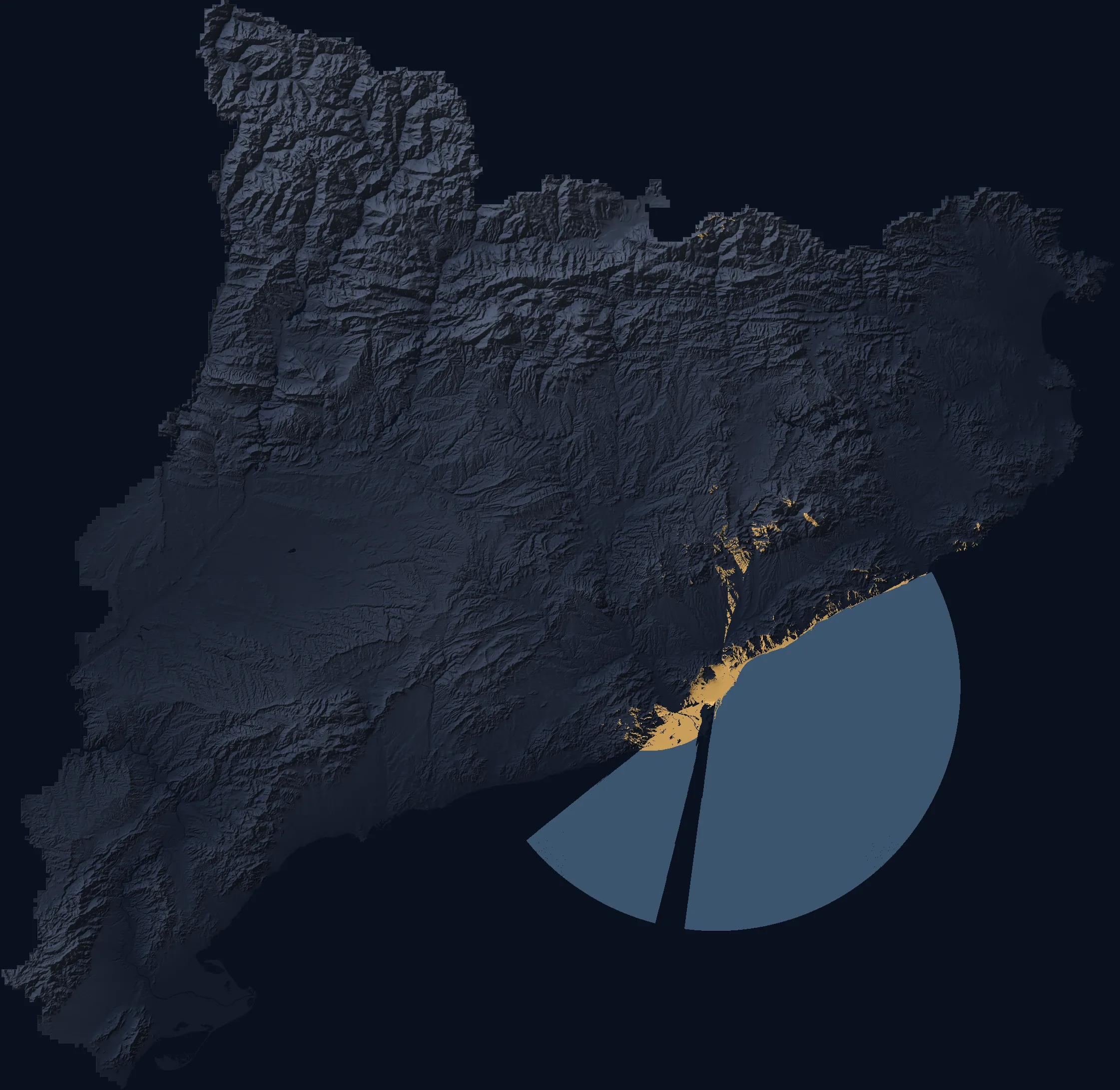
Since 20 February 2026 a 17-metre cross has crowned the Tower of Jesus Christ, 207.6 metres above the sea. The map shows Barcelona as the cross sees it: lit wherever no building or hill stands between the ground and the whole cross. Within 3 km, buildings hide it from about 88.7% of the ground at street level; from the rooftops it shows from two-fifths of their area.
Find your spot or tap the map. The story follows below.
At street level, buildings hide it#
Within 3 km of the basilica lie 14.3 km² of open ground: streets, squares, parks and courtyards. From only 11.3% of it does nothing solid stand between a person standing up and the whole cross, from its foot, 190.6 metres above the sea, to its tip. Buildings or terrain hide it from the other 88.7%. Counting trees as well, 2.3% is left.
Distance matters less than one might think. Even within a kilometre of the tower the cross shows from only 18.9% of the ground; between 2 and 3 km, from 9.6%. What hides it is the 20–25-metre roofline of the Eixample, Barcelona’s 19th-century grid district, which stands close to the viewer and closes off the sky.
From the rooftops: two-fifths of the roof area#
With the eye at standing height above each roof, the whole cross is in sight from 39.7% of the roof area within 3 km of the tower: 3.5 times as often as from the street. Within a kilometre, from 65.3%; between 2 and 3 km, from 30.5%.
Roofs in this radius stand a median 20.3 metres above the street, and an eye needs to be a median 25.5 metres above the ground to clear everything in the way. The rooftop figures come from the same model that passed the street-level photo test; there were too few photographs taken from roofs to test them as well.
The streets that keep it in view#
On the map, light leaves the basilica in straight rays. They are the long streets that run past it: along long stretches of them, the cross appears at the end of the street. On Carrer de la Marina no building is in the way along 88% of the street’s length, on Carrer de Provença along 84%, on Carrer de Mallorca along 80%, on Carrer de Sardenya along 79%. These are the four streets around the basilica’s block.
On Avinguda de Gaudí, the pedestrian avenue that joins the basilica to the Sant Pau hospital, no building is in the way along 94% of its length. In all, within 3 km, no building hides the whole cross along 52.2 of the 630.1 km of street. Many of these streets are lined with plane trees, which can hide it too.
What the last 35 metres changed#
Until late 2021 the basilica’s highest point was the top of the Passion façade bell towers, 147 metres above the sea. On today’s buildings, that point would show from 31.2 km of street in the 3 km radius. The star on Mary’s tower raised it to 173 metres: 44.3 km.
The Tower of Jesus Christ passed Mary’s tower at the end of 2024, and since February 2026 the tip of the cross has stood at 207.6 metres. At street level, no building now hides the tip along 58.4 km, 32% more than in 2023. The button on the map steps through the four heights, all on the same city, the one surveyed in 2021–2023.
Hills, viewpoints, beaches#
Barcelona is ringed by hills, and they win. The whole cross can be seen from 27 of the 33 viewpoints in OpenStreetMap, and from 23 of 34 named hills: Turó de la Rovira with its civil-war bunkers, the Turó de les Tres Creus in Park Güell, Carmel, Putxet, Creueta del Coll, Montjuïc. The list below the map has them all.
Beaches are low and backed by hotels and flats, so it depends on the stretch: on Platja del Bogatell no building is in the way from 23.1% of the sand, on Barceloneta from 12.4%; on Nova Mar Bella, buildings block it from the whole beach. The promenade’s trees can hide it as well. From the paid deck of Torre Glòries, 125 metres up, the line to the cross passes far above every building.
From the mountains: Montseny yes, Montserrat no#
Beyond the city, terrain alone decides. On Catalonia’s terrain model, with the Earth’s curve and the bending of light in air, the cross can be seen from the Montseny ridge: Turó de l’Home, 46.8 km away, has it in a straight line. Montserrat does not. From Sant Jeroni, the massif’s summit, the line to the cross runs into the Collserola hills 5.1 km short of the basilica, 83 metres below their crest, however much the light bends.
La Mola, in Sant Llorenç del Munt, is on the edge: the line clears a wooded hill by only 9 metres, and the trees can take that margin. Over the sea, on very clear days, the line reaches Mallorca, 185 km away. There, though, the cross would span 19 seconds of arc, a third of what the eye can tell apart.
At sea, Montjuïc casts a shadow#
On the water the cross shows out to the horizon, some 59 km, from the height of a boat. With one exception: a narrow strip to the south in which Montjuïc stands between the sea and the basilica. On the straight line through the hilltop the cross stays hidden all the way to the horizon. The page on the Sagrada Família and Montjuïc explains why hill and tower are nearly the same height.
How sure this is#
The map gives three answers. Buildings or terrain hide it is the firm one. In 140 street photographs picked at random, each with its compass pointed at the basilica and labelled without knowing what the model said, all 60 that the model put in this class did not show the basilica; earlier, in photographs from Wikimedia Commons, 32 of 32.
Nothing solid in the way means no building and no hill stands between viewer and cross; a tree, an awning or a van beside the viewer can still hide it. Trees in the way stays uncertain: in the photographs, 4 showed the basilica and 8 did not. The surface model was flown in 2021–2023; anything built since is missing.