Chapter 1 · Maps and coordinatesLesson 1.2
Geographical coordinates: latitude, longitude and measuring distances on the globe
How far does Romania stretch from north to south if you know only the latitudes of its two endpoints?
Before you read: what do you think?
Travel exactly one degree of longitude east, once at the Equator and once in Romania. Where have you covered more kilometres?
See the answer
At the Equator, by more than 30 km. At the Equator. Parallels get smaller towards the poles, so the same 360 degrees are spread over an ever shorter circle: one degree of longitude is 111 km at the Equator and approximately 79 km at 45° latitude.
Romania’s northernmost point is at Horodiștea, in Botoșani county, at 48°15′ north. Its southernmost point is at Zimnicea, in Teleorman county, at 43°37′ north. These two values give the country’s north–south extent without a map: approximately 514 km.
Latitude: how far you are from the Equator
The two values for Horodiștea and Zimnicea, 48°15′ and 43°37′, show how far each place is from the Equator. The larger the value, the farther north the place is. Subtract one value from the other and convert the degrees to kilometres to find the country’s extent.
The Equator is the circle halfway between the two poles. It divides Earth into the northern and southern hemispheres. Parallels are circles parallel to the Equator, becoming smaller towards the poles.
Latitude is the distance of a point from the Equator, measured in degrees, from 0° at the Equator to 90° at the poles. The hemisphere is always given alongside the value: north (N) or south (S) latitude. All points on the same parallel have the same latitude.
Meridians and longitude
Meridians are semicircles joining the North Pole to the South Pole. Unlike parallels, they are all the same length. The 0° meridian is called the prime meridian or Greenwich meridian, because it passes through the astronomical observatory at Greenwich, near London.
Longitude is the distance of a point from the prime meridian, measured in degrees, from 0° to 180° east (E) or west (W). The prime meridian and the 180° meridian divide Earth into the eastern and western hemispheres.
For the curious
The Greenwich meridian was chosen as the prime meridian in 1884 at an international conference in Washington; until then, countries used different prime meridians.
Two coordinates for any point
Parallels and meridians form a grid. Every point on the globe lies where a parallel and a meridian meet, and its latitude and longitude are its geographical coordinates. Latitude comes first, followed by longitude.
A degree is divided into 60 minutes (′), and a minute into 60 seconds (″). These are units of angle, unrelated to time. For calculations, minutes are converted to decimal degrees: 45°30′ means 45 degrees and 30/60 of a degree, or 45.5°.
Without the letters N, S, E and W, coordinates are incomplete. The pair “45°, 25°” fits four different points on the globe, one for each combination of hemispheres.
How many kilometres in a degree?
One degree of latitude is approximately 111 km everywhere. The value comes from dividing Earth’s circumference, approximately 40,000 km, by 360 degrees.
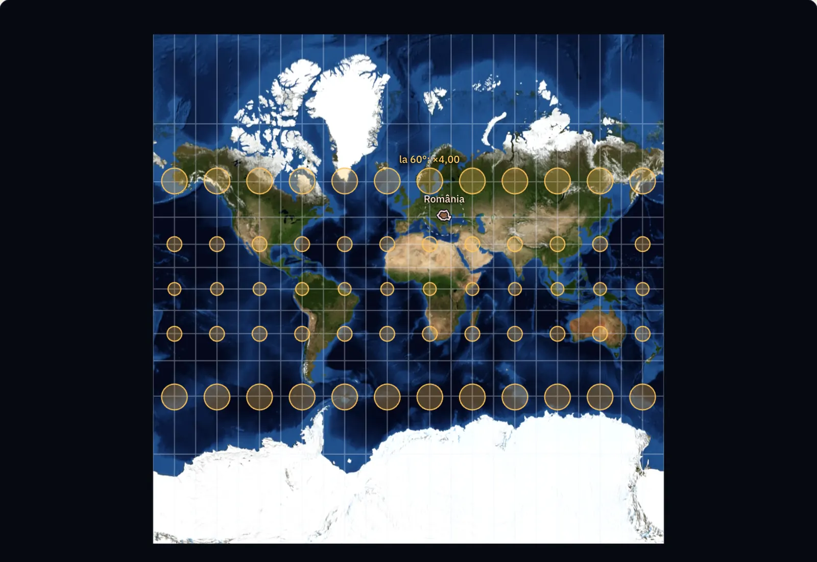
One degree of longitude is 111 km only at the Equator. Parallels get smaller towards the poles, so the same 360 degrees are spread over an ever shorter circle: at 45° latitude, one degree of longitude is approximately 79 km, at 60° it is approximately 56 km, and at the poles the meridians meet at a point.
This gives the calculation rule: the distance between two points on the same meridian is their difference in latitude, in degrees, multiplied by 111 km.
For the curious
One minute of latitude is approximately 1.85 km, and one second approximately 31 m.
Cardinal points and finding your bearings
The four cardinal points are north, south, east and west. Between them lie the intercardinal points: north-east, south-east, south-west and north-west. Meridians show the north–south direction, and parallels the east–west direction. On most maps, north is at the top.
In the field, north can be found with a compass or, at night, by the Pole Star. At Romania’s latitude, the Sun is in the south at noon, and shadows fall towards the north.
Worked example
Romania’s north–south extent
The latitude of the northern point is 48°15′ N, and that of the southern point is 43°37′ N. Both are in the northern hemisphere, so subtract the values: 48°15′ − 43°37′ = 4°38′.
Convert the minutes to decimal degrees: 38′ means 38/60 = 0.63°. The difference in latitude is 4.63°.
Each degree of latitude is approximately 111 km: 4.63 × 111 = 514 km. The result is the north–south distance between the parallel through Horodiștea and the parallel through Zimnicea. The two places are on different meridians, so the straight line between them is a little longer, and the road distance is longer still.
In Romania
Four extreme points and the 45° parallel
Romania’s extreme points are: to the north, Horodiștea (Botoșani county), at 48°15′ north latitude; to the south, Zimnicea (Teleorman county), at 43°37′ north latitude; to the east, Sulina (Tulcea county), at 29°41′ east longitude; to the west, Beba Veche (Timiș county), at 20°15′ east longitude. The country spans 4°38′ of latitude and 9°26′ of longitude.
Romania lies in the northern and eastern hemispheres. The parallel of 45° north, halfway between the Equator and the North Pole, crosses the country, as does the meridian of 25° east. The point at 46° N, 25° E, north of Făgăraș, is the centre of the projection used to make official Romanian maps.
Earth rotates through 360° in 24 hours, or one degree every four minutes. Sulina and Beba Veche are 9°26′ of longitude apart, so solar noon comes approximately 38 minutes earlier in Sulina than in Beba Veche.
Your place
What are the coordinates of your place, and how far is it from the Equator, the North Pole and the Greenwich meridian?
In brief
- Latitude is distance in degrees from the Equator (0°–90°, north or south); longitude is distance in degrees from the Greenwich meridian (0°–180°, east or west).
- Parallels are circles parallel to the Equator, becoming smaller towards the poles; meridians are equal semicircles joining the poles.
- A point’s geographical coordinates are its latitude and longitude; a degree has 60 minutes, and a minute has 60 seconds.
- One degree of latitude is approximately 111 km anywhere on the globe; one degree of longitude is 111 km at the Equator and decreases towards the poles.
- The distance between two points on the same meridian is the difference in latitude, in degrees, multiplied by 111 km.
- Romania stretches from 43°37′ to 48°15′ north latitude and from 20°15′ to 29°41′ east longitude; its extreme points are Horodiștea, Zimnicea, Sulina and Beba Veche.
Common mistakes
Wrong46°15′ written as a decimal is 46.15°.
RightA degree has 60 minutes, so 15′ is 15/60 = 0.25 of a degree. 46°15′ means 46.25°.
WrongA degree of latitude and a degree of longitude are both 111 km everywhere.
RightThe value of 111 km is correct for latitude. A degree of longitude is 111 km only at the Equator; at the 45° parallel, which crosses Romania, it is approximately 79 km.
WrongMeridians are parallel lines, as they appear on a world map.
RightOn the globe, meridians approach each other towards the poles and meet there. They appear parallel only on some maps, because of the projection.
Test yourself
Six questions. For the first five you see the explanation at once, with the paragraph of the lesson that supports it; for the ones with a written answer you compare with a good answer.
Two cities have coordinates 45° N, 10° E and 45° N, 21° E. What do they have in common?
Answer
b) They are on the same parallel. They have the same latitude, 45° N, so they are on the same parallel. Their longitudes differ, so they are on different meridians.
Write the latitude 46°15′ N in decimal degrees.
°Answer
46.25 °. 15′ = 15/60 = 0.25°, so 46°15′ = 46.25°. Writing 46.15° is wrong.
Two places are on the same meridian, one at 44° N and the other at 47°30′ N. What is the distance between them in kilometres?
kmAnswer
388.5 km. The difference in latitude is 3°30′ = 3.5°. 3.5 × 111 km = 388.5 km.
Why is a degree of longitude fewer kilometres at 60° latitude than at the Equator?
Answer
c) Because the 60° parallel is a shorter circle than the Equator. Every parallel has 360 degrees, but parallels are ever smaller circles towards the poles, so each degree covers a shorter distance.
Which is Romania’s easternmost point?
Answer
a) Sulina. Sulina has the country’s greatest east longitude, 29°41′. Beba Veche is the western point, Horodiștea the northern and Zimnicea the southern.
A friend sends you a meeting place as “45, 25”, with no other symbols. Why is that not enough to find it? What else should your friend write?
A good answer
The hemispheres and the order of the coordinates are missing. 45° could be north or south latitude, and 25° east or west longitude, so there are four possible points; also, you cannot tell which number is the latitude. The complete form is 45° N, 25° E, with latitude first. A meeting place also needs minutes and seconds, because one degree of latitude is approximately 111 km.
A complete answer names the hemispheres (N/S, E/W), the latitude–longitude order and the need for minutes and seconds for precision.
Terms
- Equator
- The circle halfway between the two poles, dividing Earth into the northern and southern hemispheres; its latitude is 0°.
- parallel
- A circle on the globe parallel to the Equator; all its points have the same latitude.
- meridian
- A semicircle joining the North Pole to the South Pole; all its points have the same longitude.
- latitude
- The distance of a point from the Equator, measured in degrees (0°–90°), north or south.
- longitude
- The distance of a point from the Greenwich meridian, measured in degrees (0°–180°), east or west.
- geographical coordinates
- The latitude and longitude of a point, which give its position on the globe.
- cardinal points
- The four main directions for orientation: north, south, east and west.
Sources and link to the programme
- NOAA – What is latitude? – definition of latitude; one degree of latitude ≈ 111 km, one second ≈ 30.7 m; division into minutes and seconds
- NOAA – What is longitude? – definition of longitude; meridians meet at the poles; prime meridian chosen in 1884 in Washington
- Royal Museums Greenwich – What is the Prime Meridian and why is it in Greenwich? – International Meridian Conference of 1884; different national meridians before that date
- Wikipedia (en) – Geography of Romania – extreme points: Horodiștea 48°15′ N, Zimnicea 43°37′ N, Beba Veche 20°15′ E, Sulina 29°41′ E
- Wikipedia (ro) – Proiecția Stereografică 1970 – centre of Romania’s official projection at 46° N, 25° E, north of Făgăraș
- NOAA GML – General Solar Position Calculations – the time of solar noon depends on longitude; sunrise also depends on latitude and date
From the programme: “Orientation on the globe: geographical coordinates and measuring terrestrial space” (common core). Programme competences covered: 1.1, 3.2, 4.5.