One Berlin plot, three buildings: reconstructed palace façades around a new museum
A Prussian palace was demolished, an East German palace was built and later demolished, and Baroque façades returned around a new museum. Five documented moments follow the different buildings that occupied one Berlin site.
Berlin, Germany: a royal residence, Palast der Republik (“Palace of the Republic”) and the Humboldt Forum occupied this site in turn; their footprints did not coincide.
This plan shows central Berlin today. The violet marker locates Schlossplatz; it is not the footprint of a historic building. The Spree, Lustgarten, Berlin Cathedral and Unter den Linden stay in view in every state.
State shown:16 December 2020 / 20 July 2021
SpreeLustgartenBerlin CathedralUnter den LindenSchlossplatz · site locator
Context plan; historic building outlines are omitted. OSM extract: 2026-10-04
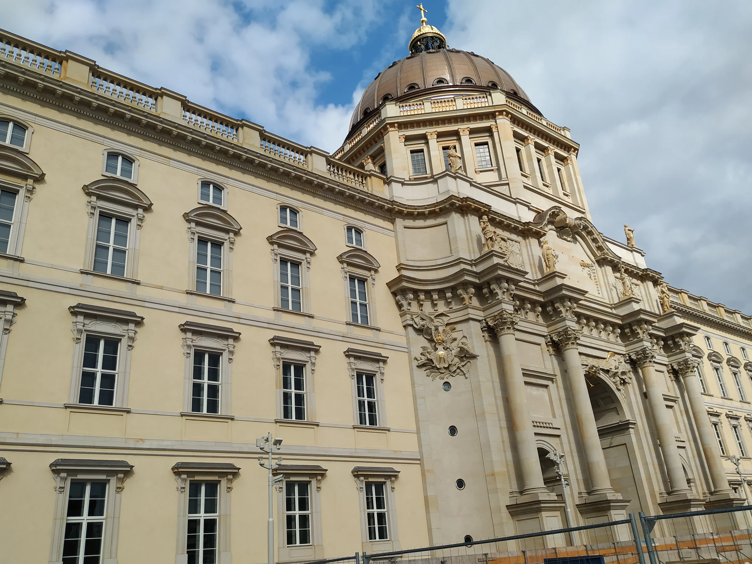
Photograph dated 19 July 2021, one day before the public opening.
In 2002 the Bundestag approved a museum use plan and reconstructed Baroque façades; the competition jury selected Franco Stella’s design in 2008. The Forum opened digitally on 16 December 2020, then to the public on 20 July 2021. [V05][V05.1][V06][V06.1][V06.2]
“Came back” describes reconstructed Baroque façades around a new museum. The interior is new, and the Spree-facing side follows Stella’s modern design. In 2018, the first exhibits were moved into the building.
What the evidence showsPhotograph dated the day before the public opening; the two opening events have separate dates.
All five states, their chronology and image provenance are also available in the table and gallery below.
State shown
Plan
Choose a dated state
What the evidence shows
c. 1900
Royal residence around 1900
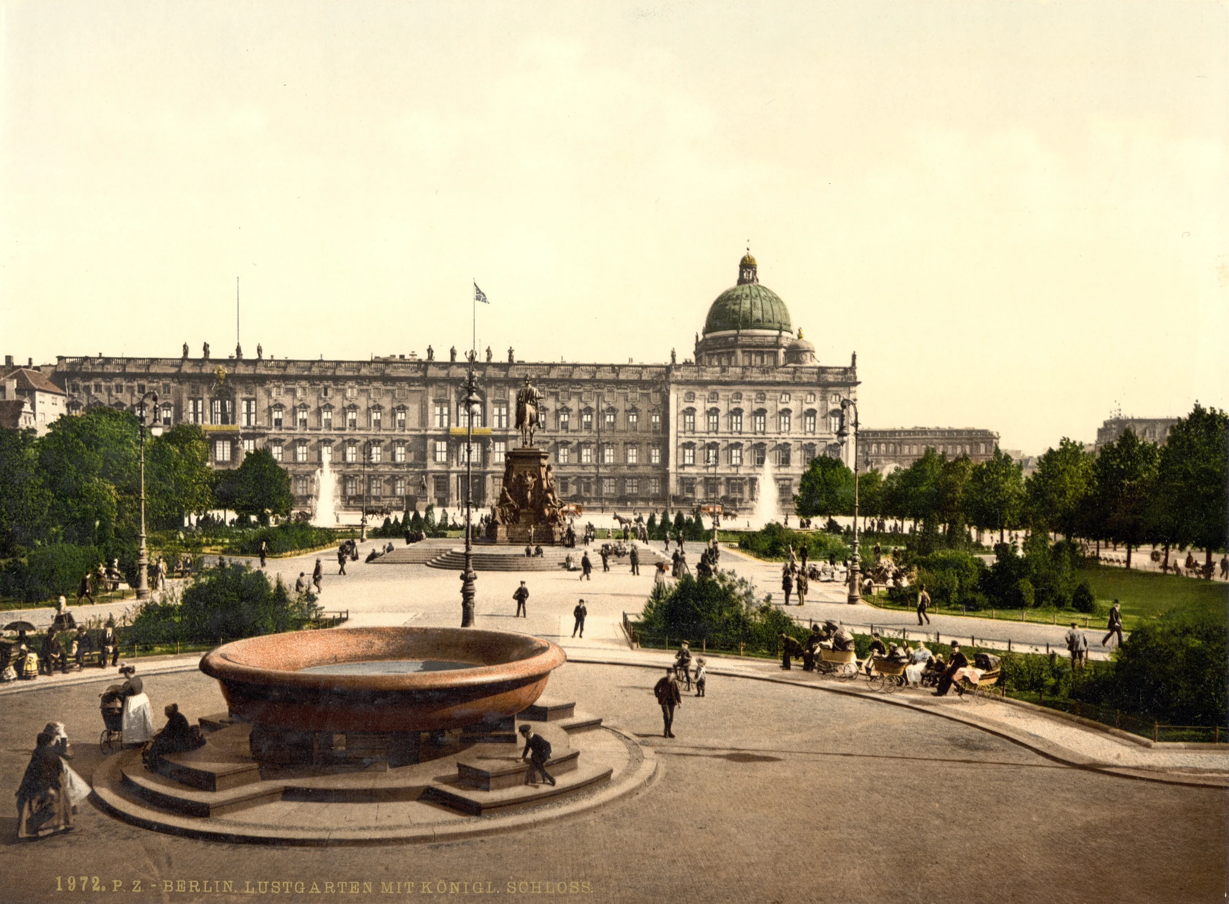
In 1701, King Frederick I of Prussia commissioned Andreas Schlüter and later Eosander to turn his residence into a representative Baroque palace; Berlin’s planning account describes the palace as anchoring the westward Unter den Linden axis. [V01.1][V01.4][V04.2][V08]
Dated photograph; see its file record and credit.
7 September–December 1950
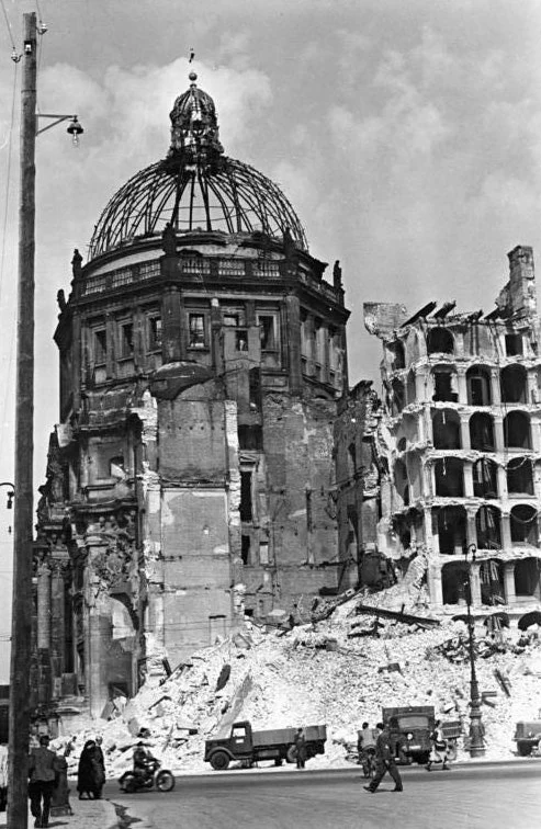
The palace is demolished
Berlin.de attributes the 7 September blast to Walter Ulbricht’s order and records mass protests; the Stiftung Humboldt Forum dates demolition from September through December and also places it at Ulbricht’s initiative. These sources do not reproduce the authorities’ exact justification. [V01.1][V01.2]
Photograph dated during demolition; it does not show the explosion.
23 April 1976
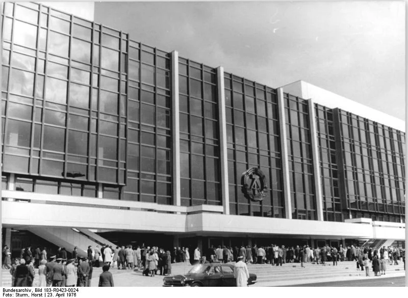
Palast der Republik opens
The SED Politburo approved the project in March 1973; it opened on 23 April 1976 after 32 months of construction (Bundesarchiv). [V02.4][V07]
Dated construction, opening and later photographs; their dates differ from the state represented.
early 2006–December 2008 / Senate measure through 2009
Palast der Republik is dismantled
The Bundestag decided on demolition in 2003, after its 2002 vote for reconstructed Baroque façades; the Stiftung Humboldt Forum places that decision in the plan to reshape the historic centre. The Berliner reports that asbestos removal had ended by 2003 and that dismantling continued. [V02.1][V02.3][V04][V04.1][V04.2][V05]
Photographs dated June 2007 and October 2008; records give different end scopes.
16 December 2020 / 20 July 2021
The Humboldt Forum opens in two stages
In 2002 the Bundestag approved a museum use plan and reconstructed Baroque façades; the competition jury selected Franco Stella’s design in 2008. The Forum opened digitally on 16 December 2020, then to the public on 20 July 2021. [V05][V05.1][V06][V06.1][V06.2]
Photograph dated the day before the public opening; the two opening events have separate dates.
Dated Commons photographs and the TU Berlin drawing · 12 photographs + 1 drawing
The Commons date field gives 1890–1905; its file description says 1890–1900. Neither gives an exact day.
Commons file date: between 1890 and 1905
Berlin Stadtschloss um 1900.jpg Unknown author · This image is available from the United States Library of Congress's Prints and Photographs division · under the digital ID ppmsca.00333. · This tag does not indicate the copyright status of the attached work. A normal copyright tag is still required. See Commons:Licensing. · Public domain
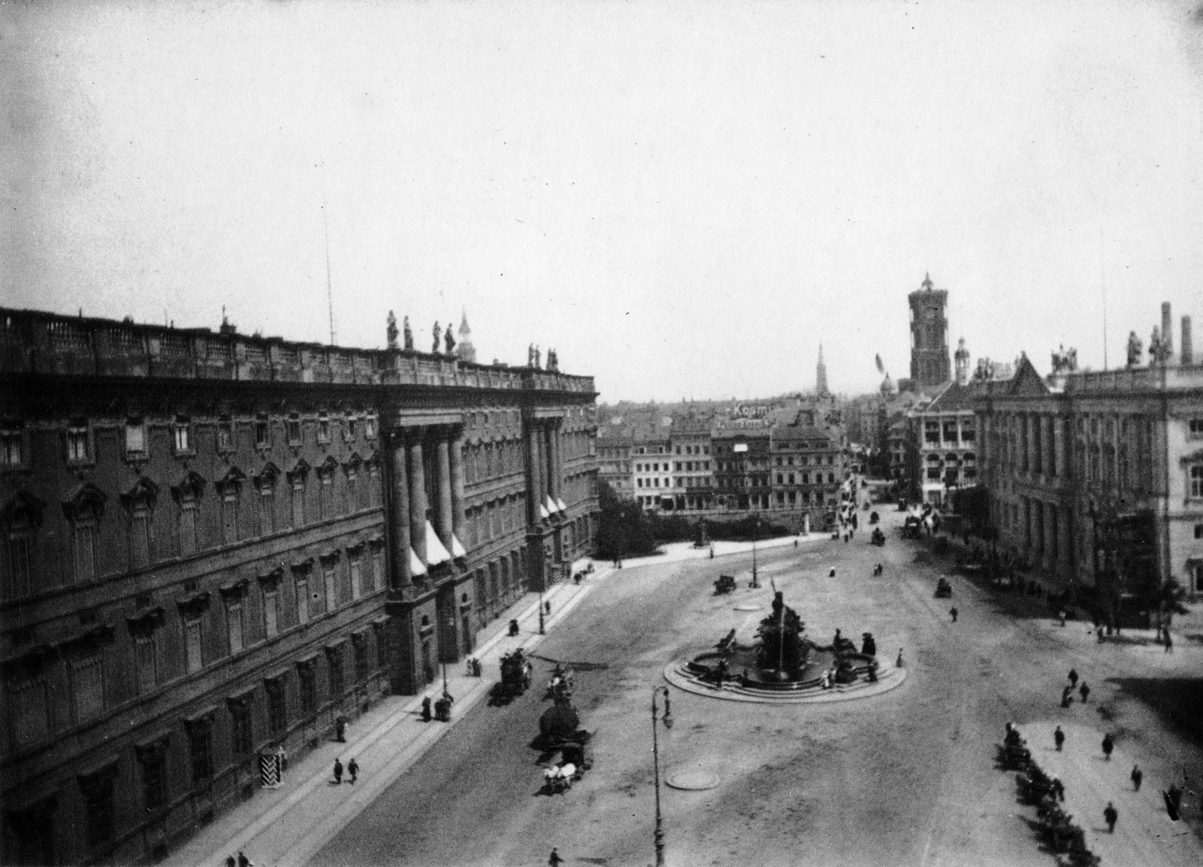
A contextual view of the square, dated around 1900; the Commons record credits photographer Heinrich Zille.
Commons file date: circa 1900
Schloßplatz, Berlin 1900.jpg Heinrich Zille · Private collection · Scanned from Janos Frecot & Helmut Geisert: Berlin in frühen Photographien 1857–1913. Schirmer/Mosel, Munich 1984. ISBN 3-88814-984-3. · Public domain
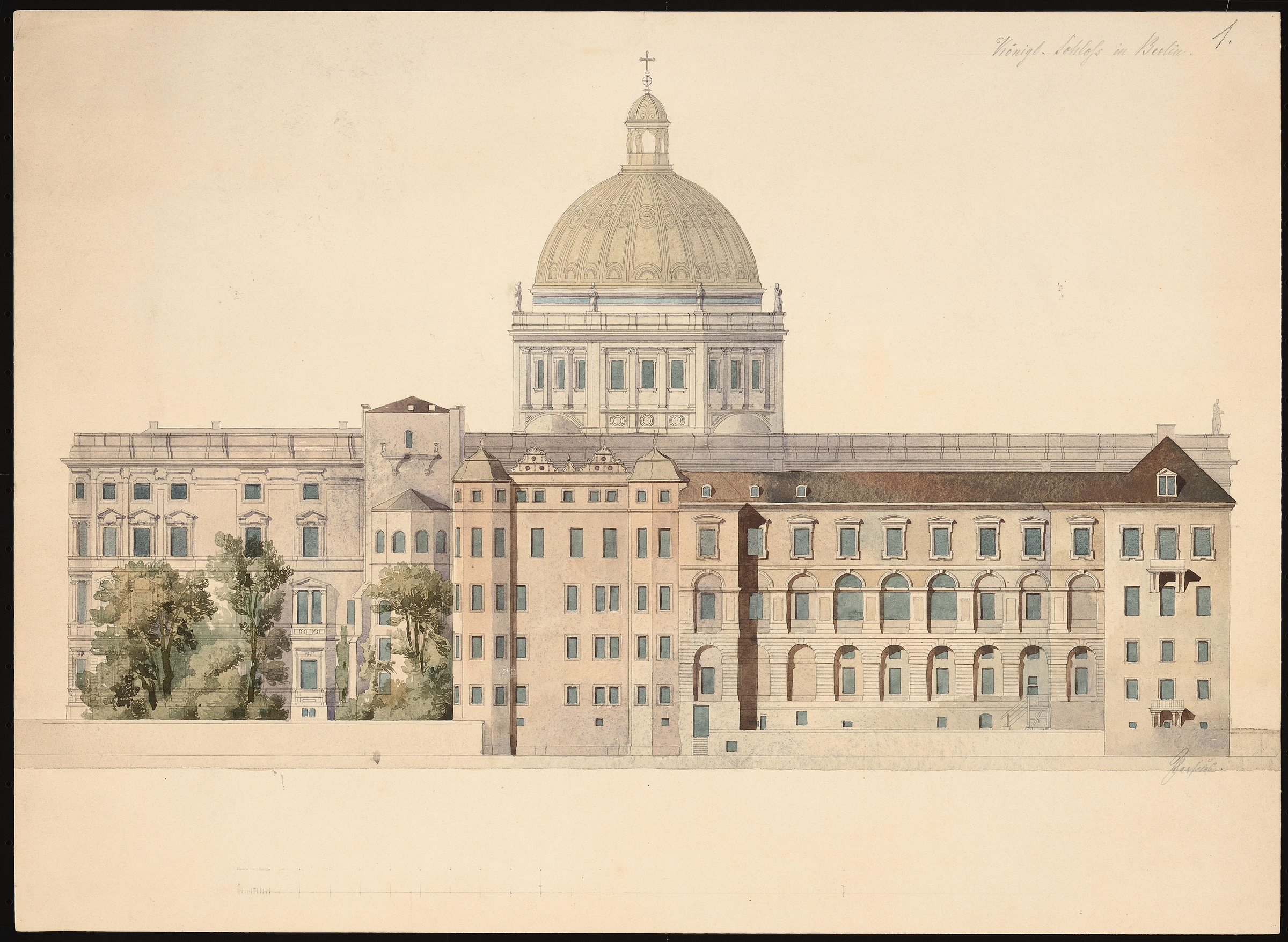
Ernst Ludwig Reinhold Persius drawing of the Berlin palace’s east façade, c. 1880–90.
Photograph dated 19 September 1950, twelve days after the 7 September blast; it shows the ruin, not the explosion.
Commons file date: 19 September 1950
Bundesarchiv Bild 183-07964-0001, Berlin, Berliner Schloss, Ruine.jpg Unknown author · This image was provided to Wikimedia Commons by the German Federal Archive (Deutsches Bundesarchiv) as part of a cooperation project. The German Federal Archive guarantees an authentic representation only using the originals (negative and/or positive), resp. the digitalization of the originals as provided by the Digital Image Archive. · CC BY-SA 3.0 de
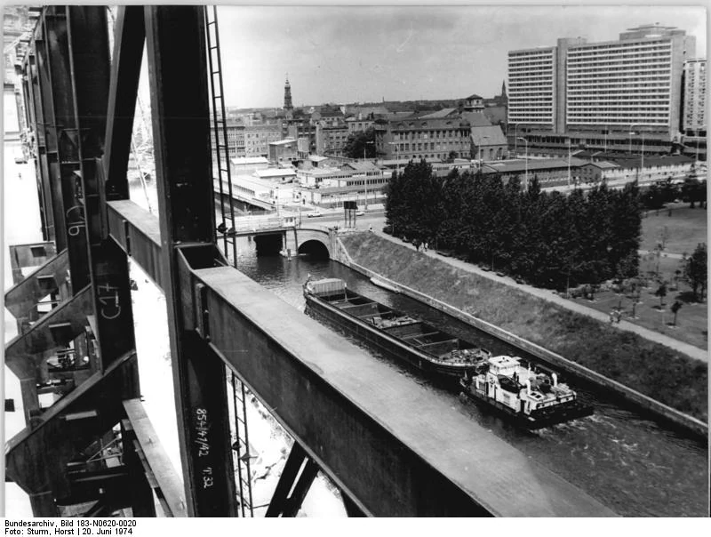
The construction site beside the Spree, 20 June 1974.
Commons file date: 20 June 1974
Bundesarchiv Bild 183-N0620-0020, Berlin, Spree, Baustelle Palast der Republik.jpg Horst Sturm · This image was provided to Wikimedia Commons by the German Federal Archive (Deutsches Bundesarchiv) as part of a cooperation project. The German Federal Archive guarantees an authentic representation only using the originals (negative and/or positive), resp. the digitalization of the originals as provided by the Digital Image Archive. · CC BY-SA 3.0 de
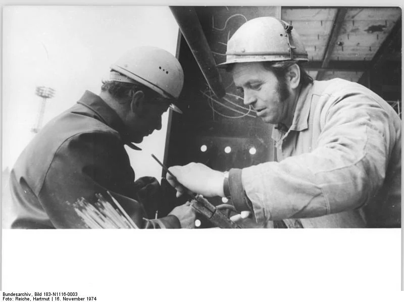
Construction workers, 16 November 1974.
Commons file date: 16 November 1974
Bundesarchiv Bild 183-N1116-0003, Berlin, Palast der Republik, Bau.jpg Hartmut Reiche · This image was provided to Wikimedia Commons by the German Federal Archive (Deutsches Bundesarchiv) as part of a cooperation project. The German Federal Archive guarantees an authentic representation only using the originals (negative and/or positive), resp. the digitalization of the originals as provided by the Digital Image Archive. · CC BY-SA 3.0 de
Exterior photographed on the opening day, 23 April 1976.
Commons file date: 23 April 1976
Bundesarchiv Bild 183-R0423-0024, Berlin, Palast der Republik, Haupteingang.jpg Horst Sturm · This image was provided to Wikimedia Commons by the German Federal Archive (Deutsches Bundesarchiv) as part of a cooperation project. The German Federal Archive guarantees an authentic representation only using the originals (negative and/or positive), resp. the digitalization of the originals as provided by the Digital Image Archive. · CC BY-SA 3.0 de
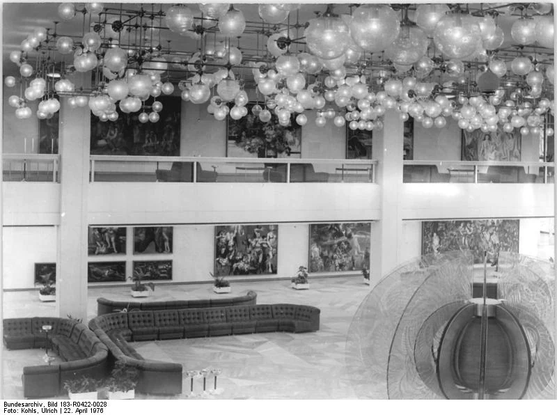
Interior photographed the day before opening, 22 April 1976.
Commons file date: 22 April 1976
Bundesarchiv Bild 183-R0422-0028, Berlin, Palast der Republik, Foyer.jpg Ulrich Kohls · This image was provided to Wikimedia Commons by the German Federal Archive (Deutsches Bundesarchiv) as part of a cooperation project. The German Federal Archive guarantees an authentic representation only using the originals (negative and/or positive), resp. the digitalization of the originals as provided by the Digital Image Archive. · CC BY-SA 3.0 de
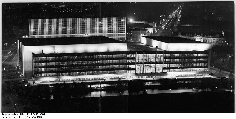
Night view, 15 May 1976.
Commons file date: 15 May 1976
Bundesarchiv Bild 183-R0515-0008, Berlin, Palast der Republik, Nacht.jpg Ulrich Kohls · This image was provided to Wikimedia Commons by the German Federal Archive (Deutsches Bundesarchiv) as part of a cooperation project. The German Federal Archive guarantees an authentic representation only using the originals (negative and/or positive), resp. the digitalization of the originals as provided by the Digital Image Archive. · CC BY-SA 3.0 de
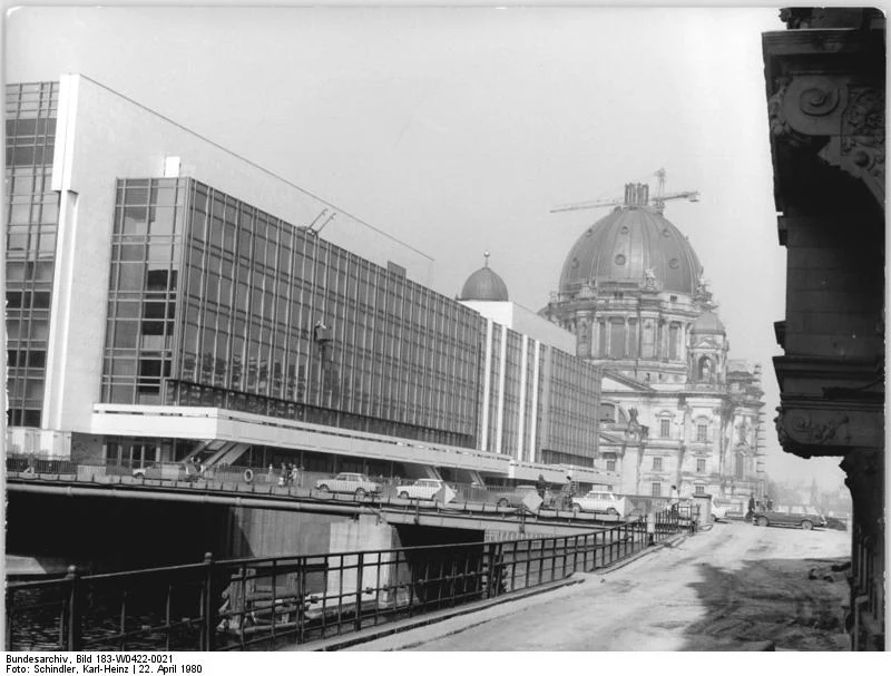
View with Berlin Cathedral, 22 April 1980.
Commons file date: 22 April 1980
Bundesarchiv Bild 183-W0422-0021, Berlin, Palast der Republik, Berliner Dom.jpg Schindler, Karl-Heinz · This image was provided to Wikimedia Commons by the German Federal Archive (Deutsches Bundesarchiv) as part of a cooperation project. The German Federal Archive guarantees an authentic representation only using the originals (negative and/or positive), resp. the digitalization of the originals as provided by the Digital Image Archive. · CC BY-SA 3.0 de
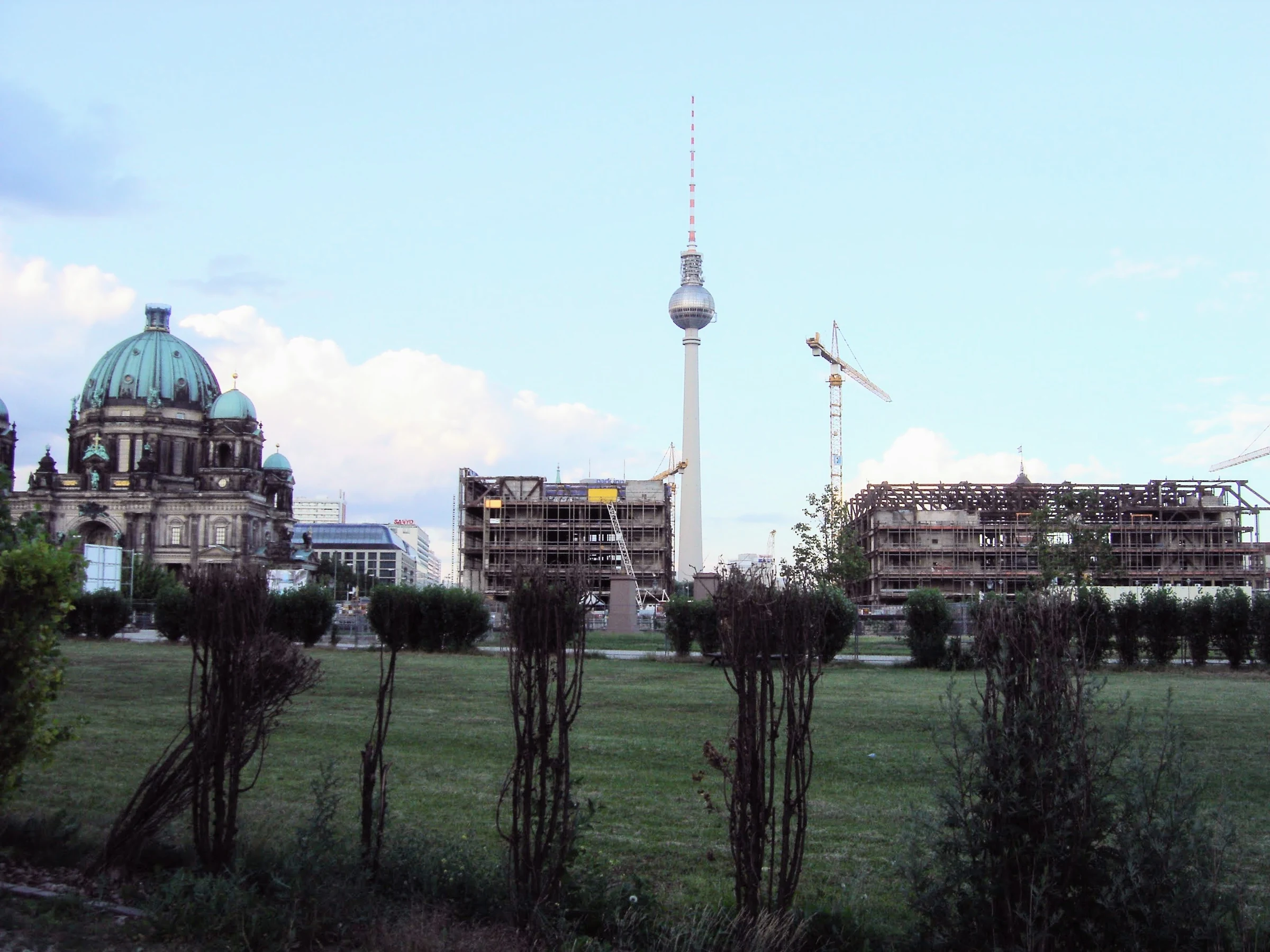
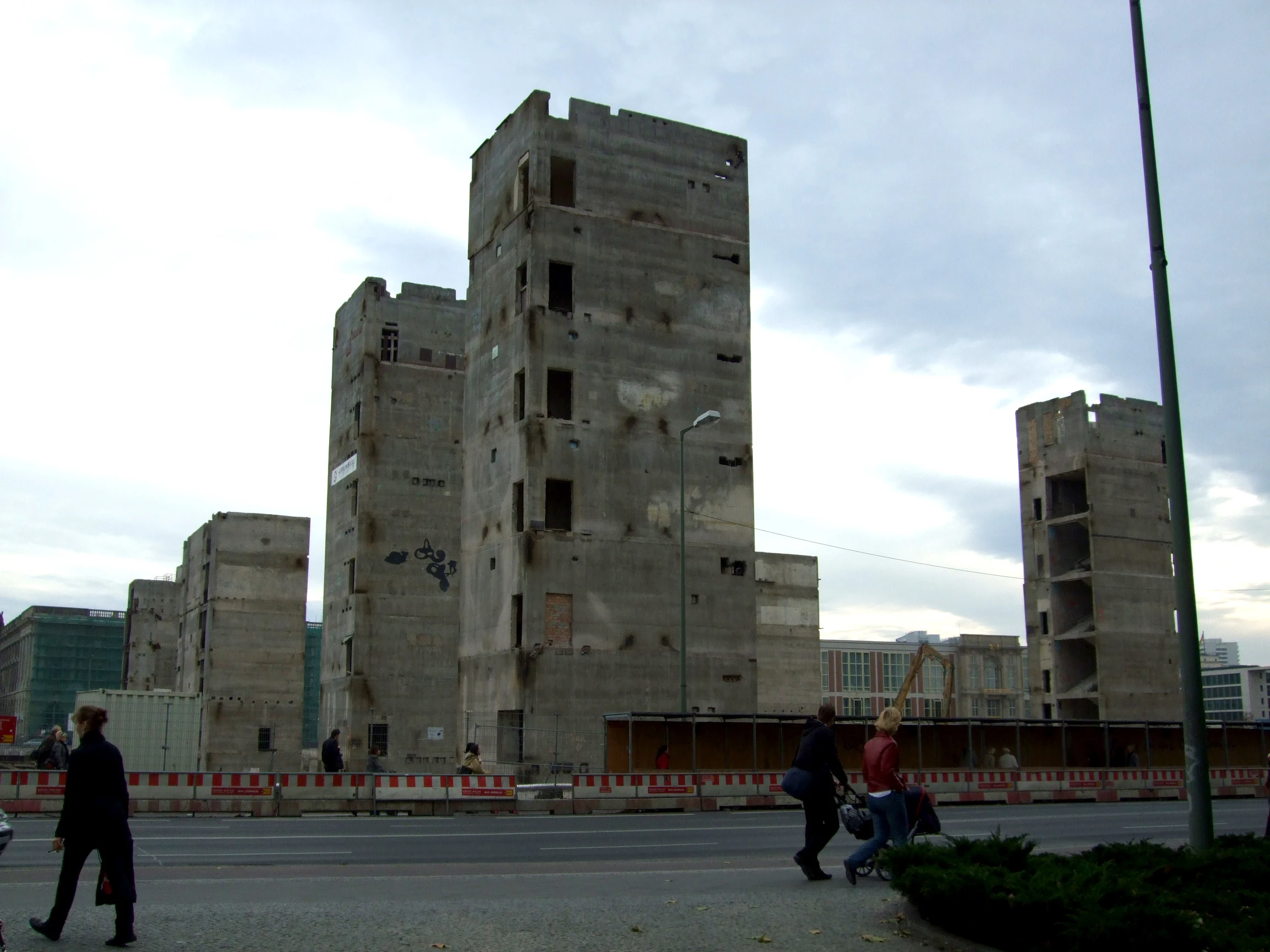
Dismantling in progress, 16 June 2007; photographed from Schinkelplatz.
Dates and reasons stay attached to the institution or publication that reported them.
1950 · an order and protests
Berlin.de says Walter Ulbricht ordered the 7 September blast “despite massive protests from the population”. The Stiftung Humboldt Forum attributes the demolition to Ulbricht’s initiative and dates it from September through December. The sources checked here do not reproduce an exact official justification. [V01.2][V01.1]
1990–2006 · asbestos removal, then demolition
The Stiftung Humboldt Forum links the 1990 closure to asbestos contamination and records the 2003 parliamentary decision to demolish. The Berliner reports that asbestos removal was complete by 2003 and that the carcinogen was no longer there. Both accounts remain attributed; this page does not select one motive. [V01.1][V02.3]
December 2008 or March 2009?
The Stiftung Humboldt Forum, GHDI and Berlin.de place the building’s dismantling by December 2008. A Berlin Senate table dated 11 March 2009 lists “Demolition of the Palace of the Republic (incl. asbestos remediation)” as a measure ending in 2009. A Berlin planning document gives January 2009 in one section and 2006–March 2009 in another. The records use different scopes and date references, so we keep them side by side. [V01.1][V01.2][V02.1][V04][V04.1][V04.2]
The Bundestag’s recorded vote on 4 July 2002: 380 votes for reconstructing the Baroque façades, 133 for an open competition, 62 against both alternatives, six abstentions and eight invalid ballots. The protocol says the first option had to exceed the other option plus the votes against; it won the required majority in the first round. In 2008, the jury unanimously selected architect Franco Stella. Reconstructed façades now frame a new museum; the building structure and interiors are modern. [V05][V05.1][V06]
In Bucharest, Romania’s capital, the Palace of Parliament remained the seat of Parliament; the Chamber of Deputies decided to move there in 1993, after the Uranus district was demolished and the building was constructed. In Berlin after reunification, Palast der Republik was demolished and Baroque façades were rebuilt around a new museum. The comparison is limited to the later choice: whether to retain or remove a political building. [V09]
Each photograph’s date comes from its Commons file record; the file page and licence are linked beside the image. The drawing and the photographs have separate rights routes.
Berlin Senate, 2009 measure table11 March 2009 Senate table: “Demolition of the Palace of the Republic (incl. asbestos remediation)”, a measure ending in 2009. · V04.1
This flat plan shows current geography. Historic building outlines are left off: the sources describe partial relationships between the sites but do not provide comparable footprints for each period. [V01.1][V04][OSM]