THE CORRIDOR’S ENDPOINTS
Conventional length: an interval
IMO: 930 km; Clarksons: about 800 km. M02
Keep the wording “about 800–930 km”: the chosen conventional endpoints change the measure. It is not one settled length. M02
Sumatra · passage · Singapore gateway
Between Sumatra and the Malay Peninsula, Malacca reads as a long corridor with a narrow southern gateway. VTS reports, energy flows and port totals measure different systems. M02 M03 M05 M07 M19
The photograph shows cargo ships off the city of Melaka. Farther south, the story reaches Phillips Channel in the Singapore Strait. M02 M03 M19

GEOGRAPHY
Here, the chosen endpoints matter: the sources do not settle on one length. M02
Length, conventional width and a vessel’s draft are three different measures. M02 M03 M04
THE CORRIDOR’S ENDPOINTS
IMO: 930 km; Clarksons: about 800 km. M02
Keep the wording “about 800–930 km”: the chosen conventional endpoints change the measure. It is not one settled length. M02
SOUTHERN GATEWAY
About 2.8 km at the narrowest point. M03
Clarksons gives the conventional width of the strait at its narrowest point: Phillips Channel, in the Singapore Strait. This is not a new survey of the navigable channel. M03
VESSEL DRAFT CLASS · 1998
“Deep draught vessel” means a draft of at least 15 m. M04
The 1998 notice uses “deep draught vessel” for ships drawing at least 15 m. That is a vessel draft class; this page makes no claim about a current minimum channel depth. M04
Photographs and maps · date and credit with each image

PORT AND HISTORY
In Malacca, the beginning comes through remembered tradition; later dates mark a capture, Johor’s participation and a treaty signature. M13 M14 M15 M16
Tradition, capture and treaty signature belong to different layers of the timeline. M13 M14 M15 M16
REMEMBERED TRADITION
The estimate around 1400 remains disputed. M13
Sejarah Melayu carries a later account of the sultanate’s origin. The estimate around 1400 belongs to that tradition; the exact date and early rulers remain disputed. M13
24 AUGUST 1511
24 August 1511 is the capture date. M14
The Portuguese Navy Museum dates the capture of Malacca to 24 August 1511. Any drawn attack line remains schematic: the available sources do not verify an exact sailed route. M14
1641 · 17 MARCH 1824
Dutch victory with Johor in 1641; treaty signed in 1824. M15 M16
In 1641, Dutch forces displaced the Portuguese with Johor’s participation. The Anglo-Dutch treaty was signed on 17 March 1824; its signature date is not its implementation date. M15 M16
Photographs and maps · date and credit with each image


REPORTED INCIDENTS
When the reporting geography changes, the series changes too. The figures stay in their own lanes. M11 M12
IMB notes under-reporting; its explanation for the 2005 fall is not independent causal proof. M11 M12
MALACCA STRAIT · 2004–2005
IMB’s explanation for the drop is not a demonstrated cause. M12
The IMB reporting for 2005 shows 38 attacks in the Malacca Strait in 2004 and 12 in 2005. IMB attributed the drop to increased patrols by littoral states; that is the organisation’s explanation, not independent causal proof. M12
MALACCA AND SINGAPORE · 2024–2025
Malacca: 1 and 1. Singapore: 43 and 80. M11
The Malacca Straits series records one incident in 2024 and one in 2025; the separate Singapore Straits series reports 43 in 2024 and 80 in 2025. Do not move Singapore’s 80 into Malacca. M11
WHAT THE SERIES MEASURES
IMB counts reported piracy and armed-robbery incidents. M11
The IMB series covers reported piracy and armed-robbery incidents, not a complete census. The organisation notes under-reporting. M11
Photographs and maps · date and credit with each image

WHAT COUNTS
A scoped total does not become a universal total through repetition. M05 M06
KLANG VTS · 2024
Ships >300 GT · One Fathom Bank–Iyu Kecil. M05
The Nippon Maritime Center compilation reports 94,301 transits in 2024, for ships over 300 GT reporting to Klang VTS; the counted stretch is One Fathom Bank–Iyu Kecil. M05
TWO VTS SYSTEMS
Its area and reporting categories differ. M05 M06
STRAITREP has its own coverage and vessel categories. Do not use the Singapore system to change the definition of the Klang VTS reporting series. M05 M06
THE COUNT’S LIMIT
It is the reported-transit series for a defined stretch. M05 M06
This is not an all-vessel total for the wider Malacca–Singapore system; it does not automatically include vessels outside the threshold and reporting area. M05 M06
ENERGY AND CHINA
The EIA estimate for the first half of 2025 keeps the commodity, unit and denominator in view. M07
First the flows; then the question each percentage answers. M07
MALACCA · 1H25 · OIL
29% of global maritime oil flows, according to EIA. M07
EIA estimates 23.2 million barrels of oil a day through Malacca in the first half of 2025. The 29% is the share of global maritime oil flows. M07
MALACCA · 1H25 · LNG
Gas keeps its own unit. M07
For LNG, EIA’s estimate is 9.2 Bcf/d in the same half of 2025. Oil barrels and gas cubic feet are not added into one total. M07
CHINA · MALACCA · 1H25
China accounted for 48% of import volumes passing through Malacca. M07
In EIA’s first-half 2025 estimate, China accounted for 48% of import volumes passing through Malacca. This does not mean 48% of all China’s imports pass through the strait. M07
PORTS AND UNITS
Ports offer another view: container throughput over a calendar year. M17
All three ports use the same unit and period; their totals do not measure strait transits. M05 M17
SINGAPORE · 2025
Port throughput in calendar year 2025. M17
The Port of Singapore reported 44.66 million TEU for calendar year 2025. TEU measures container capacity; the figure is not a ship count. M17
PORT KLANG · 2025
Westports and Northport, combined. M17
Port Klang reported 15.14 million TEU in 2025, combining Westports and Northport. TEU is not cargo weight, and this total does not measure Malacca transits. M17
PORT OF TANJUNG PELEPAS · 2025
The operator’s figure for calendar year 2025. M17
The Port of Tanjung Pelepas reported 14,028,375 TEU in 2025. It is annual container throughput, not the number of ships that passed through the strait. M17
Photographs and maps · date and credit with each image

POLICY AND RESILIENCE
The documents give a dated frame for strategic passages and resilient corridors; neither names Malacca. M10
Keep official policy language at the scale the documents use. M10
PLANNING · 12 MARCH 2026
Energy cooperation and strategic-passage security. M10
China’s 15th Five-Year Plan was approved on 12 March 2026. It calls for international energy-resource cooperation and strategic-passage security; it does not name Malacca. M10
TRANSPORT POLICY · 2026
Issued 30 June; published 24 July 2026. M10
The MOT/NDRC policy was issued on 30 June and published on 24 July 2026. It speaks of resilient international transport corridors and maritime safety. M10
SCOPE OF THE CLAIM
This is not a declared Malacca-specific policy. M10
Neither the Five-Year Plan nor the MOT/NDRC policy names Malacca. This page uses them only as context for language about strategic passages and corridor resilience. M10
PASSAGE AND ROUTES
Law governs passage; geography also leaves alternative routes, with different constraints. M01 M07 M08
A legal regime is not a guarantee that a sea route cannot be physically closed. M01 M07 M08 M14 M18
UNCLOS · ARTICLES 38 AND 44
Duties not to impede passage do not mean physical impossibility. M01
“The artery the world cannot close” is a metaphor. UNCLOS sets a transit-passage regime for qualifying straits; Articles 38 and 44 say passage shall not be impeded. M01
SUNDA · LOMBOK · PIPELINE
Detours and the Myanmar pipeline are not equivalent replacements. M07 M08
Regional alternatives and longer detours exist, with different constraints. The Myanmar pipeline is a partial alternative; it does not show that Malacca has been bypassed at large scale. M07 M08
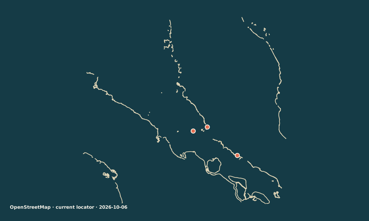
CURRENT LOCATOR · HISTORICAL SCHEMATIC
Dated locator geometry; no soundings and no 1511 track. M04 M14 M18
The locator uses parent-verified, dated OpenStreetMap geometry. OSM is not a nautical chart; the cross-section stays qualitative, and the 1511 route is an uncertain schematic drawn separately. M04 M14 M18
Sources for this passage
Annotations retain the status in the source ledger.
treaty text · official-link-unverified
https://www.un.org/depts/los/convention_agreements/texts/unclos/part3.htm
institutional summary and industry analysis · official-link-unverified
https://www.imo.org/en/mediacentre/hottopics/pages/faq-safety-of-straits-used-for-international-navigation-.aspx · https://www.clarksons.com/home/glossary/s/what-is-the-strait-of-malacca/
maritime industry analysis · official-link-unverified
https://www.clarksons.com/home/glossary/s/what-is-the-strait-of-malacca/
primary operational notice · official-link-unverified
secondary institutional compilation of Malaysian Marine Department data · official-link-unverified
https://www.nikkaibo.or.jp/pdf/R06_01.pdf · https://www.nikkaibo.or.jp/pdf/R05_01.pdf
official reporting-system description · official-link-unverified
https://www.mpa.gov.sg/port-marine-ops/operations/vessel-traffic-information-system
government analysis based on tracked flows · official-link-unverified
https://www.eia.gov/international/content/analysis/special_topics/World_Oil_Transit_Chokepoints/
government analysis · official-link-unverified
official national plan and sector policy; neither names Malacca · official-link-unverified
https://www.moe.gov.cn/jyb_xwfb/xw_zt/moe_357/2026/2026_zt03/yw/202603/t20260314_1430877.html · https://www.cqrd.gov.cn/web/article/1481955850634850304/web/content_1481955850634850304.html · https://xxgk.mot.gov.cn/jigou/zcyjs/202607/t20260724_4210365.html
primary annual incident-monitoring report · official-link-unverified
https://www.icc-ccs.org/wp-content/uploads/2026/01/2025-Jan-Dec-IMB-Piracy-and-Armed-Robbery-Report.pdf · https://icc-ccs.org/maritime-piracy-dropped-in-2024-but-crew-safety-remains-at-risk/
release reproducing IMB annual reporting · official-link-unverified
UNESCO record on a later chronicle and academic study · official-link-unverified
https://media.unesco.org/sites/default/files/webform/mow001/malaysia_sejarah_melayu.pdf · https://www.cambridge.org/core/journals/journal-of-southeast-asian-history/article/abs/malaccas-early-kings-and-the-reception-of-islam/1386B1531F19978DF48670510B7598DA
institutional chronology · official-link-unverified
https://cultura.marinha.pt/pt/museumarinha_web/multimedia_web/Paginas/efemeride-tomada-malaca-24ago20.aspx · https://www.muziumnegara.gov.my/en/node/101
secondary historical synthesis + date check · official-link-unverified
https://www.GlobalSecurity.org/military/world/malaysia/history-dutch.htm · https://en.wikipedia.org/wiki/Siege_of_Malacca_(1640%E2%80%931641)
transcription of treaty text · official-link-unverified
annual port authority and operator figures · official-link-unverified
https://www.mpa.gov.sg/media-centre/details/singapore-posts-record-port-performance-in-2025-and-develops-future-readiness-through-industry-collaborations-for-2026 · https://www.ptp.com.my/media-hub/news/port-klang-ptp-set-new-container-handling-records · https://www.mmcports.com.my/port-of-tanjung-pelepas-closes-2025-breaking-14-million-teus-in-25th-anniversary-year/
collaborative map, used only for current geometry and attribution · official-link-unverified
unreviewed file page · official-link-unverified
https://commons.wikimedia.org/wiki/File:Ships_in_the_Malacca_Strait.jpg
unreviewed file page · official-link-unverified
https://commons.wikimedia.org/wiki/File:Portuguese_Malacca_map.png
file page candidate for a modern building, not a period image · official-link-unverified
https://commons.wikimedia.org/wiki/File:A_Famosa_Fortress_Melaka.jpg
file page candidate for a modern building, not a period image · official-link-unverified
https://commons.wikimedia.org/wiki/File:Stadthuys_Melaka.jpg
unreviewed file page · official-link-unverified
https://commons.wikimedia.org/wiki/File:A_Piratical_Proa_in_Full_Chase.jpg
unreviewed file page · official-link-unverified
https://commons.wikimedia.org/wiki/File:TanjongPagarContainerTerminal-Singapore-20091113.jpg


