A map with a single question
Why were Wallachia’s medieval market towns where they are?
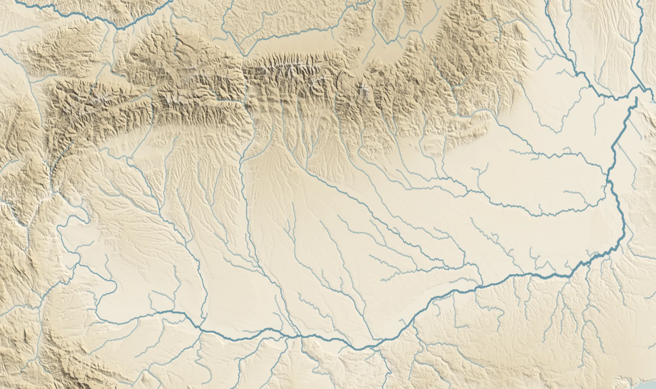
Drop three marks where you think merchants would have gathered in Wallachia, in southern Romania. Then follow the places named in the records and test the mountain crossings, the Danube, customs and princely power.
Filled: written year · hollow: proposed or disputed dating.
Where would merchants gather?#
At the foot of a mountain crossing, beside a ford, close to the ruler’s court? Place three marks on the relief. For now, the towns are hidden.
Tap the map three times. Tap a mark to remove it.
Drop three marks.
The records place them one by one#
Start the timeline. Each dot appears at the earliest record selected for that place: customs, a boundary, a mill or an act issued there. This is not a timeline of foundations.
A hollow dot marks editorial or disputed dating. A date range enters at its beginning; the full range stays in the detail panel.
A market town did not have to be in the mountains#
Of the 20 selected places, 18 can be placed approximately on the map. Some follow valleys descending from the Carpathians; others lie by the Danube. This is not a census of every medieval market town.
Each point represents a present-day locality or identified site, rather than a surveyed medieval town boundary. Tap a point to see what its source establishes.
How your guesses compare
A few working hypotheses, tried one by one
Do the mountain crossings explain them?#
Câmpulung and the Brăila road are named in the 1368 trade privilege. The 1413 privilege names Rucăr and Dâmbovița, while its fish tariff also includes Târgșor and Târgoviște. Șerban Papacostea examines these texts in his 2018 study, pages 428–430.
The crossings connect Transylvanian centres with the lands south of the mountains. The symbols indicate crossing areas and known customs places; they do not trace a surveyed medieval road.
The texts establish trading connections. They do not establish that every town originated because of a crossing.
Did the Danube bring people and goods together?#
Brăila enters the 1368 privilege through the road bearing its name. At Calafat, a 1424 act confirms customs, and the 1480 act explicitly connects them with a market. At Floci, a 1467 act names fishing waters, fish customs, a town councillor and officials (DRH B I, nos. 53, 172 and 131).
These records concern exchange and the administration of revenues. They provide no calculation of boats, trade volume or population.
The river explains part of the distribution through functions documented at particular places.
Did the ruler’s presence make a town?#
Selected acts were issued at Argeș in 1369, Giurgiu in 1409, Târgoviște in 1418, Gherghița in 1453 and Bucharest in 1459. A square marks this evidence: the chancery worked there on the act’s date (DRH B I, nos. 3, 35, 42, 110 and 118).
Laurențiu Rădvan describes relations between princely power and urban communities in his study of Wallachian town estates, pages 163–165. Town estates and property held by townspeople had different arrangements. An act issued in a place cannot replace this evidence about its community.
The court is a connection to examine, rather than an urban foundation certificate.
Did a customs post already mean a town?#
For Slatina, the sources used place the customs reference in 1368 or 1369. Its dot stays hollow and the difference is explained in the inventory. At Calafat, 56 calendar years separate the customs confirmation in 1424 from the 1480 wording that associates it with a market.
Dan II’s 1431 order addresses market towns and customs places together. Its list does not entitle us to declare every customs post a town. Nor do we know when a place’s function changed between two acts.
Read the function named by the act, as well as the place-name.
Did they gather around salt and mills?#
The 1388 charter for Cozia names a mill at Râmnic and one within the bounds of Pitești. A 1421 act includes a salt mine at Ocna de Sus. For Târgul Jiului, an act dated by the editors to 1429–1430 confirms mills (DRH B I, nos. 9, 49 and 64).
These are geographically located economic activities. We have no comparable production totals, workforce counts or complete map of mills and salt mines. Ocna de Sus uses its historical identification with the Ocnele Mari area; both location precision and urban status remain limited.
Resources offer a possible explanation. This selection cannot measure their importance.
Where are the towns that are no longer towns?#
Today’s town names are not a sufficient list. Floci, Târgșor and Gherghița appear in the 1431 act. Romania’s archaeological register records the Floci site at Piua Petrii (93655.02) and medieval town houses at Gherghița (133438.01).
A map made only from present-day towns would lose these comparisons. For the Săcuieni market town and Târgul Gilort, we do not fix an exact point: reading the document and identifying the site are separate checks.
Disappearance from the present-day urban network does not erase the medieval evidence.
Or do we see the places the records preserved?#
Many records come from grants to monasteries: mills, customs, vineyards and land. On pages 164–165 of his study of town estates, Rădvan notes that evidence before the late sixteenth century is scarce and largely preserved through such grants.
A place may be older than its selected record. A surviving series of acts may make one town more visible than another. An absent dot does not establish an absence of trade.
Keep the distribution of documents distinct from the distribution of people.
How well can we compare the evidence?#
The rings compare the checked records selected for this page: their count or the span from earliest to latest. They do not count every surviving act for each town. Total documentary coverage remains unknown for every place.
A single selected record does not mean a town is poorly documented across every archive. A long span does not establish continuous activity. A question mark means identification or direct reading is incomplete; the detail panel explains why.
Change the measure, filter verification status and choose a place. In the inventory, “View records and sources” opens each record and its precise reference.
In 1431, a list puts them in one network#
Argeș, Câmpulung, Târgoviște, Târgșor, Săcuieni, Gherghița, Brăila, Buzău and Floci are named together in the same princely instruction. It concerns trade with Brașov and customs collection, rather than describing a state boundary (DRH B I, no. 69).
The connections between places are better documented than the precise courses of the roads. The map therefore keeps the rivers and relief without joining towns by lines that would resemble surveyed routes.
Later in the records does not mean later on the ground#
Pitești was named through its bounds in 1388. DRH’s editors date the act with explicit town wording to 1 April 1510–1511; Sacerdoțeanu uses 1510. The records’ years are 122–123 years apart. They do not tell us when the settlement became a town.
The opening question therefore has several local answers: crossing, market, revenue, resource and power. None of these connections explains every place on its own.
How much does the source change the year on the map?#
A mill, a customs post, an act issued in a place and explicit town wording establish different things. The chart compares them without turning the gap into the time a town took to form.
- Râmnicu Vâlcea: 1388–1389 · mill → explicit town. Evidence
- Calafat: 1424–1480 · customs → customs with market. Evidence
- Pitești: 1388–1511 · bounds → explicit town, 1510–1511. Evidence
- Gherghița: 1431–1453 · towns list → act issued here. Evidence
- Orașul de Floci: 1431–1467 · towns list → town councillor. Evidence
earlier evidence of a different kindrecord used in the timeline
All 20 selected places#
The complete selected inventory. Each row explains what its evidence establishes, how it is dated and where to check it. Naming a place does not automatically establish urban status.
| Place | Timeline record | Evidence type | Edition | Selected records through 1550 | On the map |
|---|---|---|---|---|---|
| Câmpulung A passage copied into a 1618 charter says Nicolae Alexandru gave Bădești village to the church at Câmpulung. The DRH editors consider the earlier act authentic in substance while identifying later additions about Radu Negru in the copy. | 1351–1352, text transmitted in 1618 | grant known through a later copy | DRH B I, document 2, printed pp. 10–11 (scan pp. 70–71). | At least 2 verified records 15–17 years between mentions 1351–1352, text transmitted in 1618 — 20 January 1368 The count covers the records selected here. Total documentary coverage is unknown. View records and sources | yes, approximate site |
| Slatina Guțică uses 1368, while Papacostea distinguishes a 1369 privilege exempting the Slatina customs. The source difference is retained; the reference establishes customs, without dating the town’s formation. | 1368–1369, disputed dating | customs reference | Guțică 2011; Papacostea 2018, p. 430, nota 47 | Verification incomplete The consulted sources use different years for the customs reference: 1368 and 1369. The count covers the records selected here. Total documentary coverage is unknown. View records and sources | yes, approximate site |
| Brăila The 1368 privilege names the Brăila road. It connects the place with Danube trade, without measuring the traffic through its port. | 20 January 1368 | trade privilege | Papacostea 2018, pp. 428–430, notele 39, 42–43 | At least 2 verified records 62–63 years between mentions 20 January 1368 — after 30 January 1431 The count covers the records selected here. Total documentary coverage is unknown. View records and sources | yes, approximate site |
| Curtea de Argeș Vladislav’s charter closes with the dateline Datum in Argyas. It shows the place being used as a charter-issuing location but does not explicitly call it a town. | 25 November 1369 | act issued in the locality | DRH B I, document 3, printed pp. 12–13 (scan pp. 72–73). | At least 2 verified records 2–3 years between mentions 25 November 1369 — 16 July 1372 The count covers the records selected here. Total documentary coverage is unknown. View records and sources | yes, approximate site |
| Rușii de Vede Academic research identifies Russenart in the pilgrims’ account of 1385 with Roșiorii de Vede. This project checked the modern study, rather than the travel account’s manuscript. | 1385 | travel account, cited in scholarship | Ecaterina Țântăreanu, BCMI 2011, articolul despre biserica Sf. Spiridon | Verification incomplete The medieval account was checked through an academic study, without directly reading its manuscript. The count covers the records selected here. Total documentary coverage is unknown. View records and sources | yes, approximate site |
| Pitești The Cozia charter grants a mill within the bounds of Pitești. Aurelian Sacerdoțeanu identifies this as the earliest documentary mention of the name, while distinguishing the boundary reference from an explicit urban-status statement. | 20 May 1388 | bounds and mill | DRH B I, document 9, printed pp. 26–28 (scan pp. 86–88); Sacerdoțeanu (1971), pp. 198–199. | At least 2 verified records 121–123 years between mentions 20 May 1388 — 1 April 1510–1511 (DRH dating) The count covers the records selected here. Total documentary coverage is unknown. View records and sources | yes, approximate site |
| Râmnicu Vâlcea Mircea the Elder’s charter for Cozia mentions a mill at Râmnic. The place-name appears here without an explicit designation as a town. | 20 May 1388 | mill, then explicit town wording | DRH B I, document 9, printed p. 27 (scan p. 87). | At least 2 verified records 0–1 years between mentions 20 May 1388 — 4 September 1389 The count covers the records selected here. Total documentary coverage is unknown. View records and sources | yes, approximate site |
| Giurgiu The place is written in the charter’s 1409 dating clause. It establishes the presence of the princely chancery at Giurgiu; it is no census of inhabitants or boats. | 11 May 1409 | act issued in the town | DRH B I, no. 35, p. 75 | One verified record A single attestation 11 May 1409 The count covers the records selected here. Total documentary coverage is unknown. View records and sources | yes, approximate site |
| Târgșor Târgșor appears in the 1413 fish tariff and the 1431 order. The point represents the site at Târgșoru Vechi, rather than present-day Ploiești. | 1413 | trade privilege | Papacostea 2018, p. 430, nota 51 | At least 2 verified records 17–18 years between mentions 1413 — after 30 January 1431 The count covers the records selected here. Total documentary coverage is unknown. View records and sources | yes, approximate site |
| Târgoviște The 1413 tariff concerns trade. The 1418 act records the ruler’s presence, and the 1424 act names households in the town. They establish three different things about one place. | 1413 | trade privilege | Papacostea 2018, p. 430, nota 51 | At least 3 verified records 10–11 years between mentions 1413 — 28 February 1424 The count covers the records selected here. Total documentary coverage is unknown. View records and sources | yes, approximate site |
| Ocna de Sus / Ocnele Mari Radu Prasnaglava renews his father’s grants to Cozia, including a salt mine at Ocna de Sus. Scholarship on salt production identifies the area with Ocnele Mari, but the charter neither names the modern town nor establishes urban status. | 19 June 1421 | salt mine, historical identification | DRH B I, document 49, printed pp. 98–99 (scan pp. 158–159); Doina Ciobanu, ‘Exploatarea sării în evul mediu în Țara Românească’ for the identification. | Verification incomplete Identification with the Ocnele Mari area is historical; the charter fixes neither the medieval settlement site nor urban status. The count covers the records selected here. Total documentary coverage is unknown. View records and sources | yes, approximate site |
| Calafat Dan II confirms Tismana’s earlier endowments, including the toll at Calafat. The wording indicates that the customs point already existed, but it does not call the place a town. | 5 August 1424 | customs, then customs with a market | DRH B I, document 53, printed pp. 104–107 (scan pp. 164–167). | At least 2 verified records 55–56 years between mentions 5 August 1424 — 3 April 1480 The count covers the records selected here. Total documentary coverage is unknown. View records and sources | yes, approximate site |
| Târgu Jiu Dan II confirms the mills at Târgul Jiului, built by priest Agaton with his brothers’ labor. DRH dates the charter between 20 March 1429 and 9 April 1430; the often-repeated date 24 March 1426 is not the date used in this edition. | 20 March 1429 – 9 April 1430 | mills at the market town | DRH B I, document 64, printed pp. 123–124 (scan pp. 183–184); Gabriel Croitoru, ‘Orașele din Oltenia’, Arhivele Olteniei 29 (2015), pp. 101–111, for the earlier ambiguous 1406 reference and later urban evidence. | One verified record A single attestation 20 March 1429 – 9 April 1430 The count covers the records selected here. Total documentary coverage is unknown. View records and sources | yes, approximate site |
| Gherghița DRH’s editors date the order after 30 January 1431. Later acts were issued here. Romania’s archaeological record identifies medieval town houses at the site called La Târg. | after 30 January 1431 | trade privilege | DRH B I, no. 69, p. 130 | At least 3 verified records 39–40 years between mentions after 30 January 1431 — 25 January 1471 The count covers the records selected here. Total documentary coverage is unknown. View records and sources | yes, approximate site |
| Buzău The inhabitants of Buzău are named in the order concerning trade with Brașov. Its timeline date is editorial, rather than a day written in the act. | after 30 January 1431 | trade privilege | DRH B I, no. 69, p. 130 | One verified record A single attestation after 30 January 1431 The count covers the records selected here. Total documentary coverage is unknown. View records and sources | yes, approximate site |
| Orașul de Floci The inhabitants of Floci appear in the 1431 order. A town councillor and officials are named in 1467. The site at Piua Petrii near Giurgeni is recorded in Romania’s archaeological register as 93655.02. | after 30 January 1431 | trade privilege | DRH B I, no. 69, p. 130 | At least 2 verified records 35–36 years between mentions after 30 January 1431 — 15 January 1467 The count covers the records selected here. Total documentary coverage is unknown. View records and sources | yes, approximate site |
| The Săcuieni market town The act names the Săcuieni inhabitants, but the text read does not establish an identification of the medieval place with Vălenii de Munte. It stays in the inventory without a map point. | after 30 January 1431 | trade privilege | DRH B I, no. 69, p. 130 | Verification incomplete The text read does not establish identification with a present-day locality. The count covers the records selected here. Total documentary coverage is unknown. View records and sources | no: site not identified |
| Bucharest Vlad the Impaler’s charter names the fortress of Bucharest in 1459. A fortress reference alone provides no population, urban extent or founding year. | 20 September 1459 | act issued in the fortress | DRH B I, no. 118, p. 203 | At least 2 verified records 4–5 years between mentions 20 September 1459 — 10 July 1464 The count covers the records selected here. Total documentary coverage is unknown. View records and sources | yes, approximate site |
| Craiova A charter of Basarab Laiotă lists jupan Neagoe de la Craiova among its witnesses. The place-name appears as a person’s origin, but the charter does not explicitly call Craiova a town. | 1 June 1475 | origin of a witness | DRH B I, document 148, printed pp. 243–246 (scan pp. 303–306); the witness formula is on p. 245. | One verified record A single attestation 1 June 1475 The count covers the records selected here. Total documentary coverage is unknown. View records and sources | yes, approximate site |
| Târgul Gilort In 1484, the charter explicitly names Târgul Gilort but lists it among the villages held by Bran and his brothers. The name suggests a market function; it should not automatically be treated as proof of settled urban status. | 24 April 1484 | market name among villages | DRH B I, document 192, printed pp. 310–311 (scan pp. 370–371); Croitoru (2015) and Rădvan (1963) discuss its market function and uncertain urban rank. | One verified record A single attestation 24 April 1484 The count covers the records selected here. Total documentary coverage is unknown. View records and sources | no: site not identified |
What we do not know#
- Mention in an act does not establish a town’s founding year.
- There is no exhaustive audit of every reference for each place. “One record” describes this page’s selection.
- The Săcuieni town site and exact point of Târgul Gilort remain unfixed. Identifying Ocna de Sus with the Ocnele Mari area is historical interpretation, rather than a coordinate written in the charter.
- Comparable population, traffic and production figures are unavailable. The towns cannot be ranked by economic importance.
How the map was made, and the sources#
The selection covers places connected with medieval Wallachian market towns. Its records come from critical editions, academic studies and archaeological entries. We claim neither completeness nor urban status from every reference.
The timeline runs from 1350 to 1550. A proposed range enters at its first possible year. Câmpulung enters through a text dated to 1351–1352 and transmitted in a later copy; it is not presented as a surviving contemporary original.
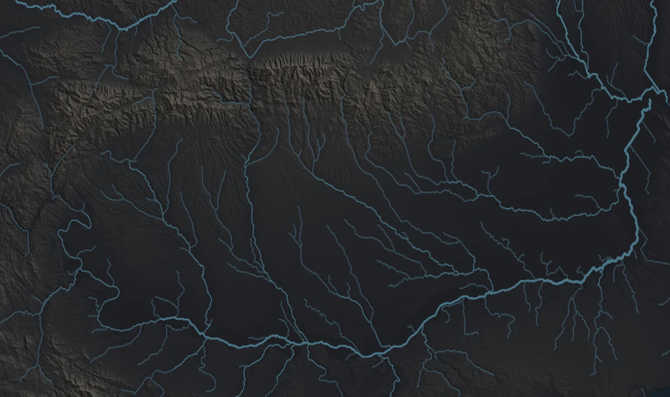
Approximate coordinates represent the present-day locality or archaeological site, following the downloadable inventory’s sources. Coordinates remain unknown for Săcuieni and Târgul Gilort. Relief and rivers provide geographical context; exact medieval road courses remain unknown.
A record count is the number of distinct selected records for one place; the same order is counted once for that place. Spans use conservative bounds in completed years; the chronology chart compares calendar years. The total surviving act count is unknown and stored as missing data.
- Documenta Romaniae Historica, B. Țara Românească, I (1966), II (1972). Texts, translations and notes of the critical edition. Inventory links point to scan pages. Source
- Șerban Papacostea, “Trade Routes and State-Building”, Revista istorică XXIX (2018), 5–6, pp. 417–474. Trade privileges and customs: pp. 428–430. Source
- Laurențiu Rădvan, „Moșiile orașelor din Țara Românească în secolele XIV–XVI”, Cercetări Istorice XXI–XXIII (2002–2004), pp. 163–184. Property arrangements and archival limitations: pp. 163–165. Source
- Aurelian Sacerdoțeanu, „Începuturile orașului Pitești”, Argesis 3 (1971), pp. 197–200. The 1388 and 1510 references. Source
- Laurențiu Guțică, „Slatina în evul mediu”, Muzeul Oltului 1 (2011). Its 1368 dating is compared with Papacostea’s 1369. Source
- Ecaterina Țântăreanu, study of St Spiridon church in Roșiorii de Vede, Buletinul Comisiei Monumentelor Istorice (2011): the identification of Russenart. Source
- Romania’s National Archaeological Record: Floci, 93655.02; Gherghița, 133438.01. Source
- Relief: NOAA NCEI global model at 15 arc-seconds. Rivers and relief images are identical to the reference project. Source