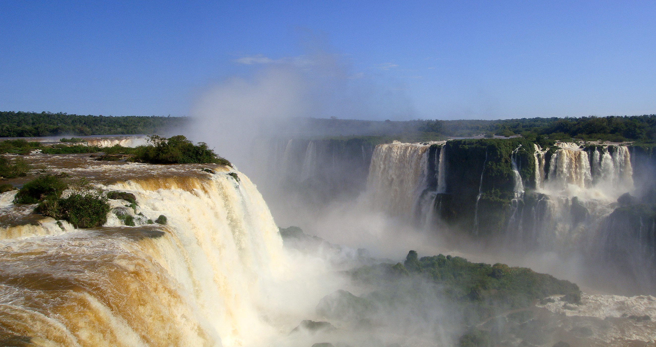
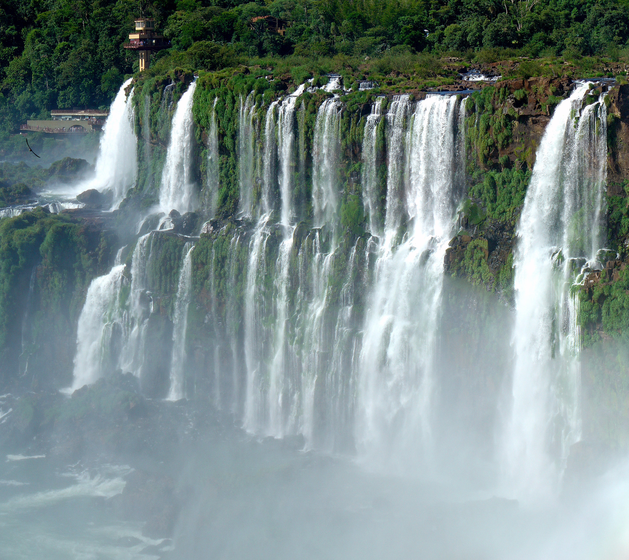
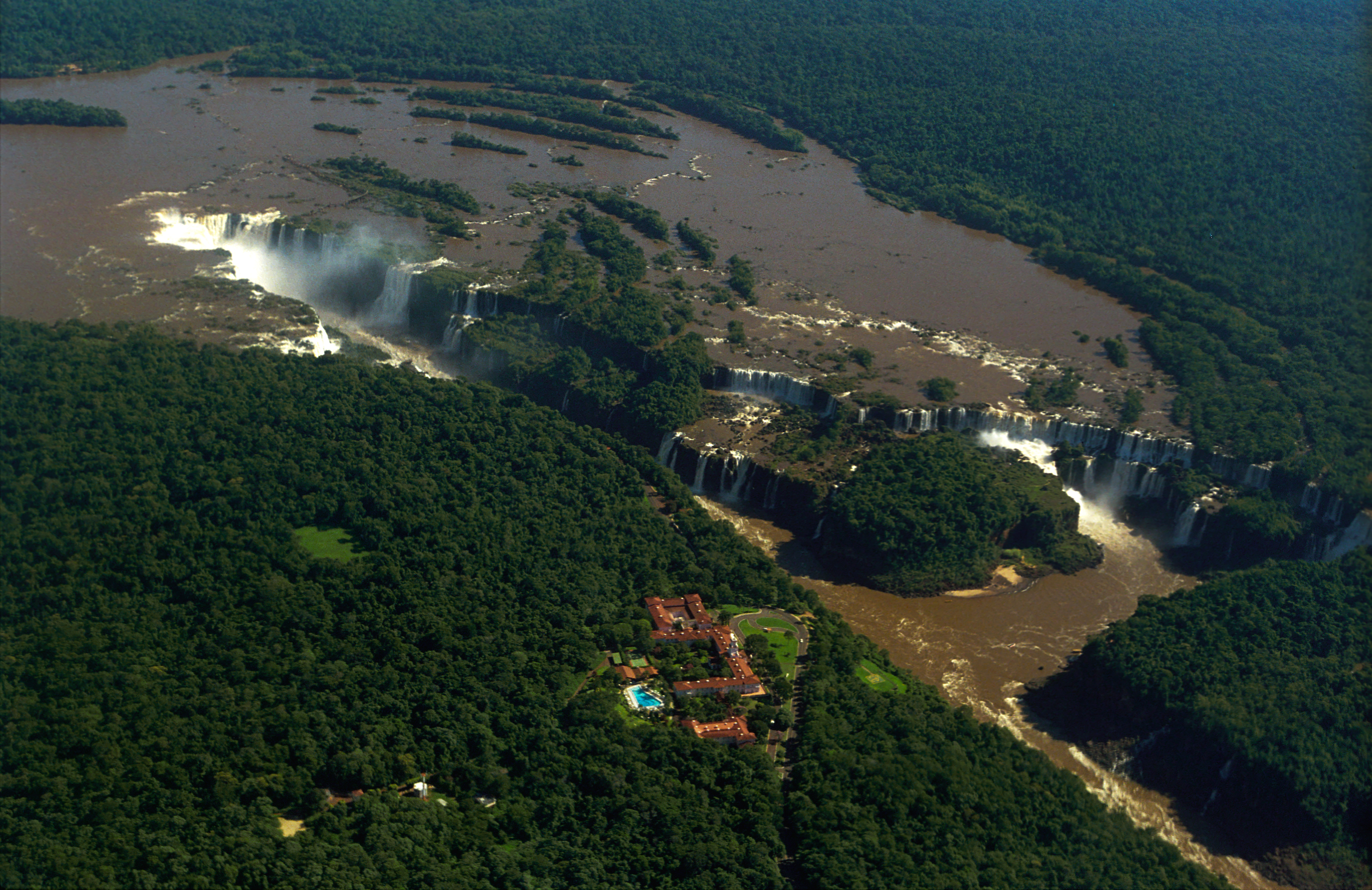
Iguazu Falls seen from the Brazilian side, 2018

Visual essay · eight chapters · Britannica figures

Iguazu: the big water — 2.7 km of falls on Britannica figures

275 throats along 2.7 km of lip, one Throat drinking half the river, five dams upstream and a visa-free day — eight chapters on Britannica figures, datum footnote in full view. M01

In October 2023 the river passed at 24.2 million litres per second — 16 times normal, the second-highest flow ever recorded. M05

Down the falls
2.7 kmsystem lip, Britannica M01
275nominal falls; 150–300 by level M01
1,756 m³/smean flow, Britannica M01
46.3M L/sthe Jun 2014 record M05
The hero frame (2018, Bernard Gagnon): the 4,175 px CC BY-SA 4.0 view that opens this essay — spectacle, not a survey. M12Bernard Gagnon · 22 Nov 2018 · CC BY-SA 4.0

Chapter 1 · A system, not a waterfall

2.7 km of falling water

Between Argentina and Brazil, the Iguaçu River breaks along 2.7 km of lip into hundreds of 60–82 m falls, the longest 82 m. The name comes from Guaraní/Tupi: y (“water”) + ûasú (“big”) — the big water — and the carrier calls the whole “the largest waterfall system in the world.” M01

The system sits at 25°41′12″S 54°26′41″W, and its lip retreats 1.4–2.1 cm a year through headwater erosion. Every figure in this essay comes from Britannica via M01; where carriers differ, the datum footnote keeps them all in view. M01

275 throats counted, 150 to 300 with the water — and a datum footnote hiding nothing. M01

THE EDGE

2.7 km of lip

The Britannica figure, with its 60–82 m falls. M01

2.7 km of edge, with individual falls of 60–82 m and a longest drop of 82 m — the anchor of this essay. The rest is datum and level variation, kept in view at the last mark. M01

THE COUNT

275, nominal

The count depends on the water: 150–300 by level. M01

275 falls is the nominal figure; by water level, the same lip counts between 150 and 300 throats. Here 275 stays the label, and the 150–300 range always stands beside it. M01

THE SPLIT

80/20 on jumps

Argentina takes ~80% of the jumps; Brazil ~20%. M01

Argentina holds about 80% of the jumps, Brazil about 20% — though over 95% of the basin is Brazilian. The border between them runs straight through the Devil's Throat. M01

DATUM FOOTNOTE

Why the figures differ: they are not errors

The essay standardizes on Britannica and notes every variant. M01 M05

Mean flow is 1,756 m³/s on Britannica; the park spokesman speaks, via AFP, of a “normal” of 1.5M L/s. Different conventions — here the figure is always the Britannica one, with the variant beside it. M01 M05

Image gallery

Current Iguazu Falls locator, with the river, the id-pinned Throat, the falls and the two bank towns.
OpenStreetMap geometry from the dated 2026-10-07 extract. Locator, not a nautical chart. River linework is merged member-way geometry from one bbox pull; the Garganta cliff way is pinned by id; the falls, the throat and the two towns are verified OSM point records. Figures never come from OSM tags. · © OpenStreetMap contributors · ODbL 1.0 M11
Panorama of Iguazu Falls, 2009
The 2009 panorama (Mariordo): a CC BY-SA 4.0 sweep of the curtain. M15Mariordo · 6 Sep 2009 · CC BY-SA 4.0
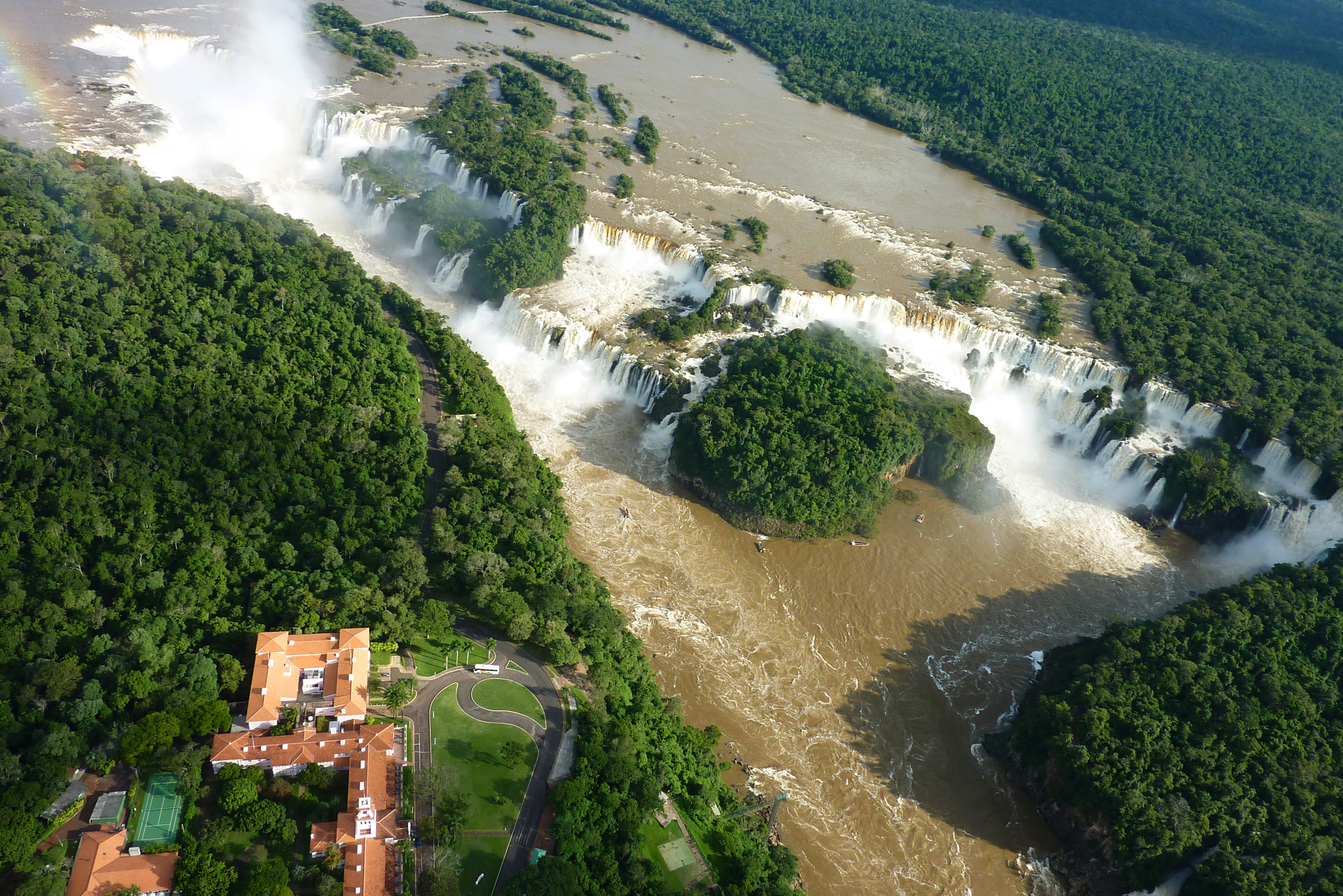
Iguazu Falls from a helicopter, 2010
The 2010 helicopter view (chensiyuan): 2010 comes from the file description — no machine date, upload 15 May 2010 — in a CC BY-SA 4.0 aerial. M21chensiyuan · CC BY-SA 4.0

Chapter 2 · The Devil's Throat

Half the river through a single throat

Garganta del Diablo, the Devil's Throat, takes about half the river's flow and throws it into an 80–90 m wide, 70–80 m deep canyon. It is the piece that makes Iguazu a system: the other 2.7 km are the curtain, the Throat is the voice. M01

The Argentina–Brazil border runs through the Throat, and cliff way 551980154 pins it to the map. Its name changes by bank — but all three live in the OSM tags. M01 M11

80–90 m wide, 70–80 m deep — and a border running through the middle of the water. M01

THE HALF

About half the river

One throat drinks half the Iguaçu. M01

The Devil's Throat takes about half the river's flow; the rest divides across the curtain's hundreds of throats. That is why every system figure reads with the Throat in mind. M01

THE CANYON

80–90 m by 70–80 m

The Throat canyon's width and depth. M01

The Throat canyon measures 80–90 m wide and 70–80 m deep. It is the only system piece with both dimensions cited — the rest of the curtain measures in length and count. M01

THE BORDER

A border through the middle of the water

Argentina–Brazil runs through the Throat. M01

The Argentina–Brazil border runs straight through the Devil's Throat: the same water, two countries, one roar. The 80/20 curtain split is negotiated around this line. M01

THE NAMES

Three names, one throat

Spanish, Portuguese, English — from OSM tags. M11

Garganta del Diablo in Spanish, Garganta do Diabo in Portuguese, Devil's Throat in English: all three live in the tags of node 446408446. The Spanish names resolve on the map; the English “Devils Throat” does not — the essay carries it in prose. M11

Image gallery

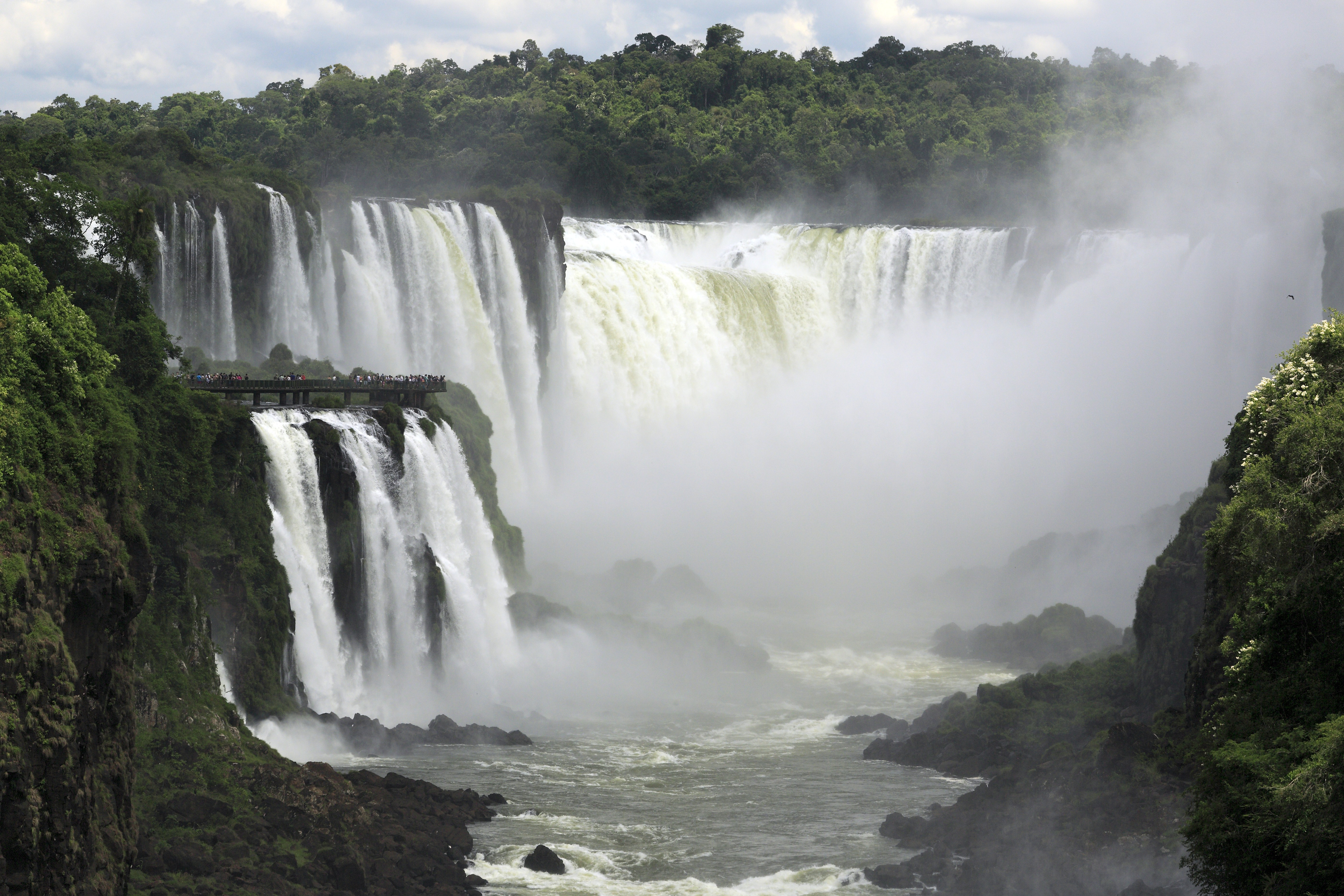
The Devil's Throat, the great U-shaped chasm, 2020
The Throat (2020, Falk2): the CC BY-SA 4.0 frame of the chasm that takes half the river. M13Falk2 · 31 Jan 2020 · CC BY-SA 4.0
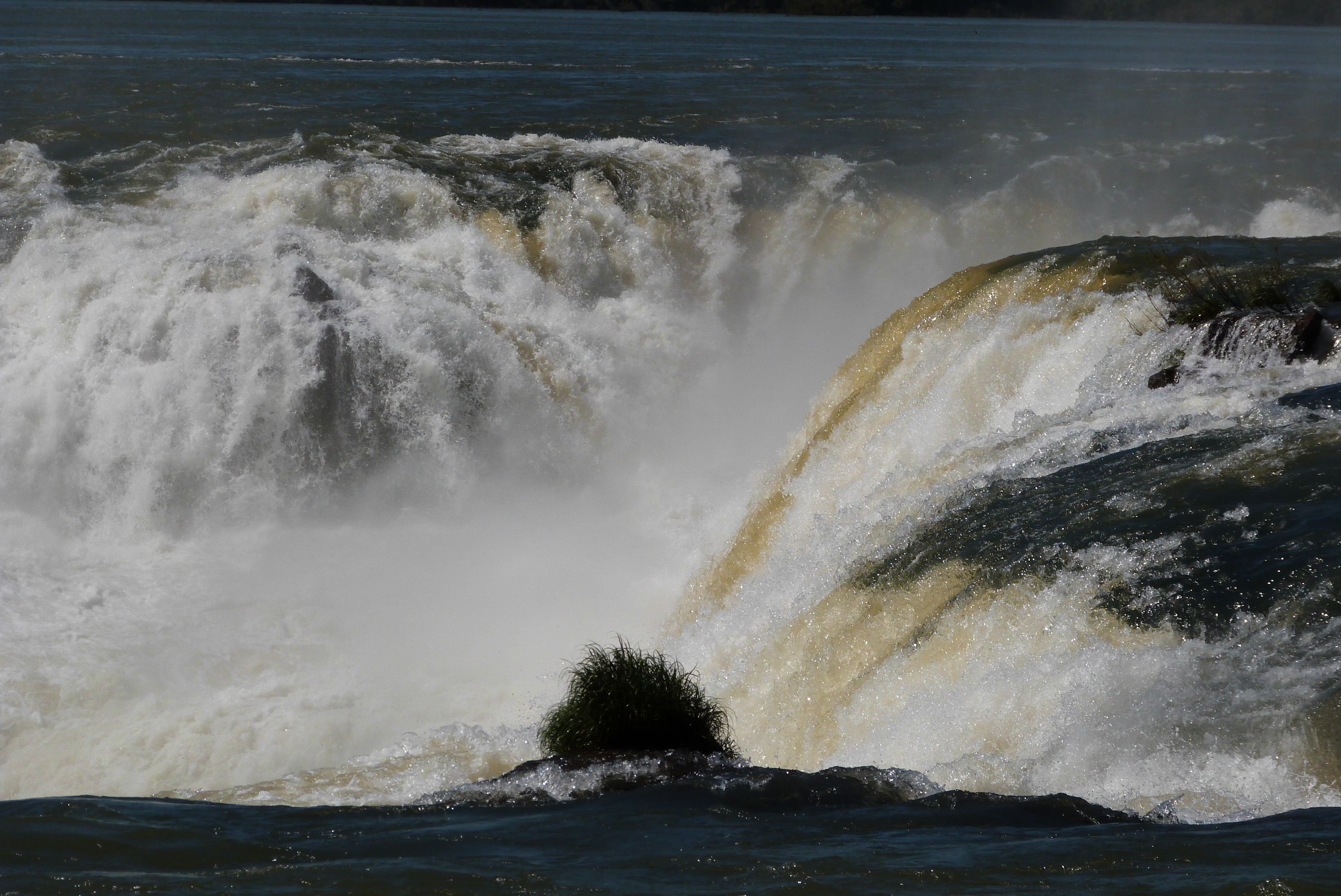
The mouth of the Devil's Throat, 2013
The mouth of the Throat (2013, MIKEMDP): a CC BY-SA 4.0 view from the Argentine side. M14MIKEMDP · 29 Aug 2013 · CC BY-SA 4.0
The walkway to the top of the falls on the Brazilian side, 2015
The Brazilian walkway (2015, Murray Foubister): the 8,688 px CC BY-SA 2.0 frame of the path to the lip. M17Murray Foubister · 30 Nov 2015 · CC BY-SA 2.0

Chapter 3 · 300 ↔ 46,300

From 300 to 46,300

In the summer of 2006, drought drew the river down to 300 m³/s into early December. The park spokesman's invoked “normal” is 1.5M L/s — 1,500 m³/s, below the Britannica mean of 1,756. M01 M05

In October 2023, storms pushed the flow to 24.2M L/s — 24,200 m³/s, 16 times normal, the second-highest flow on record, behind the 46.3M L/s record of June 2014. The figures come from the park operator, Urbia, via AFP. M05

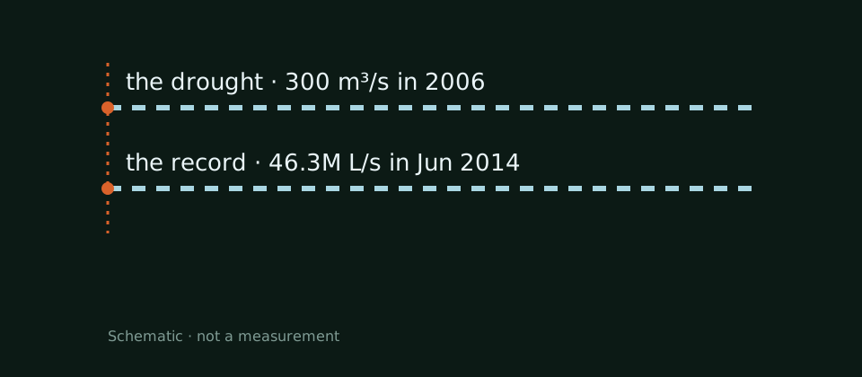
The 2006 drought and the June 2014 record — the same river, two worlds. M01 M05

DROUGHT

300 m³/s in 2006

The summer drought, into early December. M01

300 m³/s — that was all the Iguaçu had left in the summer 2006 drought, into early December. It is the system's cited floor, the gauge's bottom mark. M01

NORMAL

1.5M L/s, “normal”

The spokesman's convention, via AFP. M05

The “normal” of 1.5M L/s is the park spokesman's convention, quoted by AFP — not the Britannica mean of 1,756 m³/s. Against it, the October 2023 flood measured 16 times. M05

OCTOBER 2023

24.2M L/s, 16 times over

The second-highest flow, apud Urbia via AFP. M05

24.2M L/s — 24,200 m³/s — in October 2023: 16 times normal and the second-highest flow ever recorded. The figures come from the park operator, Urbia, via AFP. M05

RECORD

46.3M L/s in June 2014

The absolute record: 46,300 m³/s. M05

46.3M L/s — 46,300 m³/s — in June 2014: the highest flow ever recorded at Iguazu. Between the 300 floor and this ceiling fits the whole story of the moods. M05

Image gallery

Panorama of the falls in December 2007
December 2007 (Martin St-Amant): a CC BY 3.0 panorama from another river year. M16Martin St-Amant · 23 Dec 2007 · CC BY 3.0
Moods schematic: 300 m³/s drought in 2006, 46.3M L/s record in Jun 2014.
The moods and dams diagrams are conceptual drawings, not measurements and not maps. M01

Chapter 4 · Five dams upstream

Wilderness with sluices

Five dams work upstream of the falls: Foz do Areia, Salto Segredo, Salto Santiago, Salto Osorio and Salto Caxias. Their rhythm is no longer the seasons' but the sluices'. M06

The first dam from the falls is José Richa (Salto Caxias): 1,240 MW poured between 1995 and 1999 by Copel, in a 67 m high, 1,100 m long gravity dam. M04

Every time the gates open in Brazil, the level at the falls moves — in the park chief's words. M06

THE FIVE

Five dams upstream

Foz do Areia → Salto Caxias. M06

Foz do Areia, Salto Segredo, Salto Santiago, Salto Osorio, Salto Caxias: five dams operating upstream of the falls, on the March 2009 IPS wire. Every sluice move of theirs reads at the Throat. M06

THE SLUICE

In Costras's words

The park chief, Daniel Costras, via IPS. M06

“Every time they open or close the sluice gates in Brazil, the level of the water in the falls drops or rises…” — Daniel Costras, the park chief. The sentence's tail, with the seasons' old rhythm, was not re-read at build and stays out. M06

THE FIRST

José Richa, 1,240 MW

The first dam upstream, 1995–99. M04

José Richa (Salto Caxias) is the first dam upstream of the falls: 1,240 MW built between 1995 and 1999. The other four sit higher, on the same wire. M04

THE DAM

67 m by 1,100 m

Roller-compacted gravity, Copel. M04

The José Richa dam: 67 m high, 1,100 m long, roller-compacted-concrete (RCC) gravity, operated by Copel. Its dimensions are the only dam dimensions cited in this essay. M04
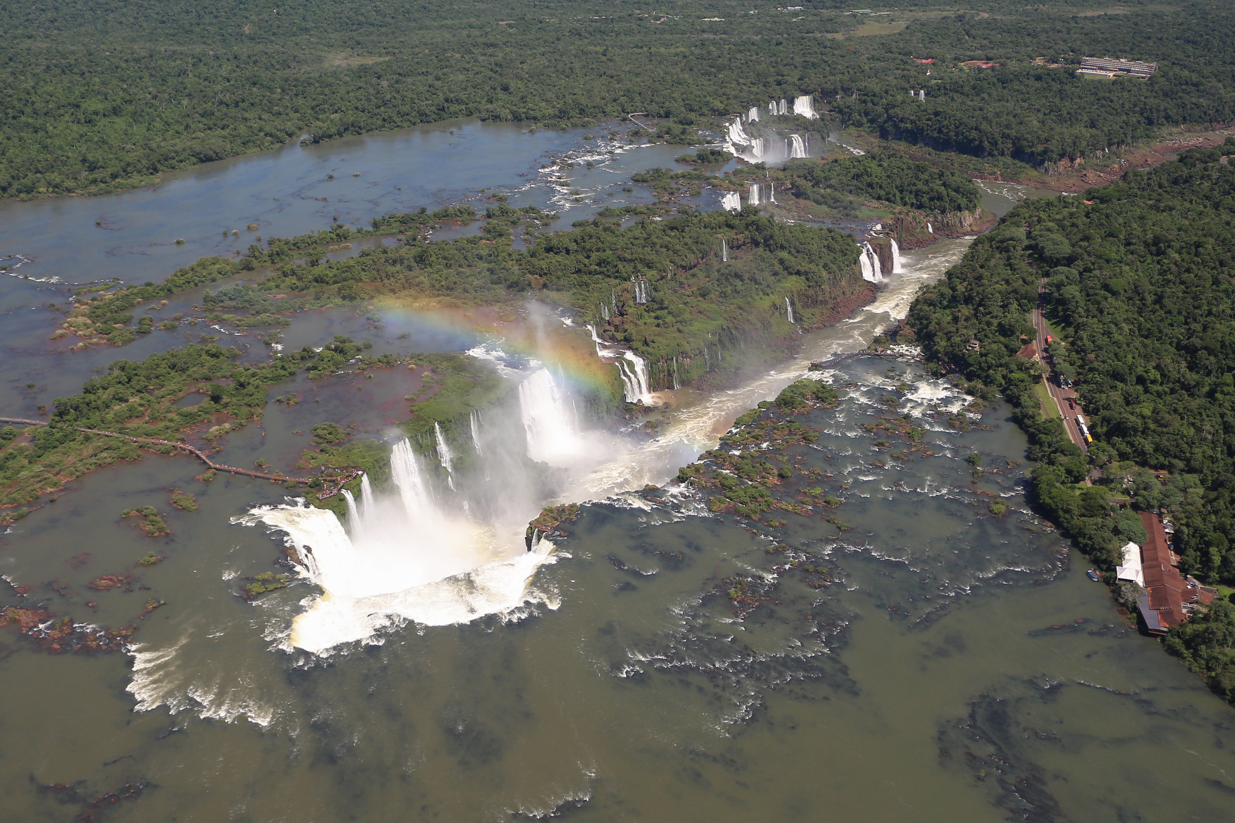
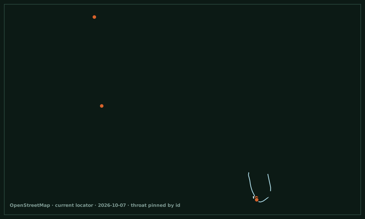
Image gallery

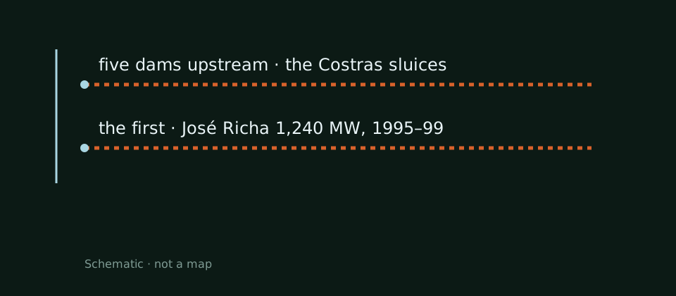
Dams schematic: five dams upstream, the first José Richa 1,240 MW.
The moods and dams diagrams are conceptual drawings, not measurements and not maps. M06

Chapter 5 · Deities, conquistadors, one sigh

Naipí, Cabeza de Vaca and “Poor Niagara!”

The Guaraní legend says a deity split the river in anger: the beautiful Naipí and her mortal lover, Tarobá, met their end in the falls. The first European to see them was Álvar Núñez Cabeza de Vaca, in 1541. M01

The protection campaign began with Rebouças in 1876, four years after Yellowstone; the Argentine park was born in 1934, on 677 km², and the Brazilian one on 10 January 1939, by Vargas's Decreto-Lei 1.035. World Heritage followed: 1984 for Argentina (WHS 303), 1986 for Brazil. M01 M02 M03

From Guaraní legend to two national parks and one famous sigh — with its “reportedly” attached. M01

LEGEND

Naipí and Tarobá

The deity, the beauty, the mortal lover. M01

A deity, the beautiful Naipí and her mortal lover, Tarobá: the Guaraní legend makes the falls a punishment of love. It is the essay's only figureless story. M01

1541 · 1876

The conquistador and the engineer

Cabeza de Vaca, then Rebouças. M01

Álvar Núñez Cabeza de Vaca, the first European at the falls, in 1541. Rebouças and the protection campaign, in 1876 — four years after Yellowstone. M01

THE PARKS

1934 and 1939

677 Argentine km²; Decreto-Lei 1.035. M01 M02 M03

Iguazú National Park (Argentina): 1934, 677 km², World Heritage 303 since 1984. Iguaçu National Park (Brazil): 10 January 1939, Decreto-Lei 1.035 signed by Vargas, World Heritage since 1986. M01 M02 M03

THE SIGH

“Poor Niagara!”

Eleanor Roosevelt — reportedly. M01

“Poor Niagara!” Eleanor Roosevelt reportedly exclaimed before the falls. “Reportedly”: the qualifier is part of the quote, not a footnote. M01

Image gallery

Iguazu Falls in January 2000
January 2000 (Jerzystrzelecki): a CC BY 3.0 view from the turn of the century — captioned honestly as 2000, not today. M20Jerzystrzelecki · 2000 · CC BY 3.0

Chapter 6 · What lives in the spray

Swifts from behind the water

Great dusky swifts nest on cliff faces directly behind the curtains of falling water and fly in large groups through the mist. The Macaulay page is bot-walled and never cited. M07

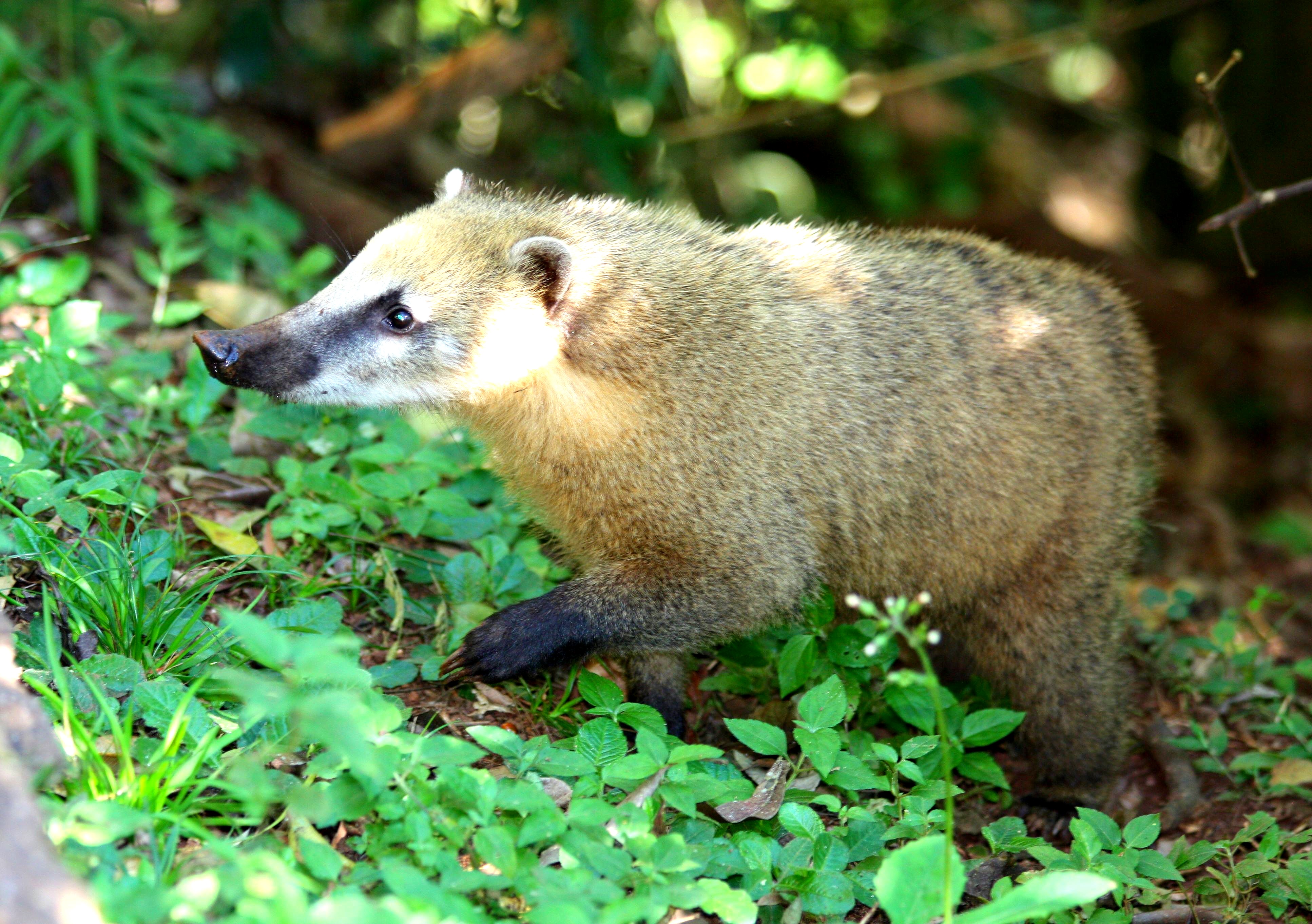
Coatis — white-nosed — are the park's most conspicuous mammals, habituated to people. Around the park, the carrier also documents the jaguar Green Corridor — named here without figures, because the figure is fragile. M07

Nests on rock, behind the curtain — and the most conspicuous mammals, habituated to people. M07

THE SWIFTS

Nests behind the water

Great dusky swifts, via internationalparks. M07

“Nesting on cliff faces directly behind the curtains of cascading water… flying in large groups through the mist” — nests on rock behind the water, flight in great flocks through the mist. M07

COATIS

The most conspicuous mammals

Habituated to people. M07

“Most conspicuous mammals… habituated” — coatis are the park's most conspicuous mammals and have grown used to people. Two frames show them up close: dany13 (2013) and Falk2 (2020). M07

THE CORRIDOR

The Green Corridor, without figures

The jaguar is named, not counted. M07

The jaguar Green Corridor around the park is documented by the carrier — but the crash figure is fragile and stays out of this essay. Here the corridor is named, not counted. M07

Image gallery

A white-nosed coati near the falls, 2013
The coati (2013, dany13): a CC BY 2.0 portrait of the park's most conspicuous mammal. M18dany13 · 7 Sep 2013 · CC BY 2.0
South American coatis, 2020
Coatis (2020, Falk2): a CC BY-SA 4.0 group, habituated to people. M19Falk2 · 31 Jan 2020 · CC BY-SA 4.0

Chapter 7 · One confluence, three countries

Where three flags meet

Below the falls, the lower Iguazu runs to the Paraná canyon, a short distance downstream of Itaipú — which appears here only as a landmark, without figures. At the Paraná confluence meet three borders: Argentina, Brazil and Paraguay. M01

Three towns guard the waters: Foz do Iguaçu (Brazil), Puerto Iguazú (Argentina) and Ciudad del Este (Paraguay) — all with airports. Two of them are pinned on the essay map by OSM id. M01

Below the falls, the Iguazu joins the Paraná — and at the confluence stand Argentina, Brazil and Paraguay. M01

CONFLUENCE

Iguazu into Paraná

The Paraná canyon, below Itaipú. M01

The lower Iguazu joins the Paraná canyon a short distance downstream of Itaipú. The Argentina–Brazil–Paraguay triple border sits right at the confluence. M01

THE TOWNS

Three towns, three airports

Foz, Puerto Iguazú, Ciudad del Este. M01

Foz do Iguaçu, Puerto Iguazú and Ciudad del Este — the Brazilian, Argentine and Paraguayan banks — each with its airport. The Paraguayan town lives only in prose: the essay map pins two banks. M01

THE BANKS

Two pinned banks

Relations 297473 and 3201757. M11

Foz do Iguaçu is relation 297473, Puerto Iguazú is relation 3201757: two verified administrative boundaries, their centres on the essay map. Locator geometry — never figures. M11

Chapter 8 · The Chinese thread

The visa-free day: 11 May 2026

From 11 May 2026, Brazil admits ordinary Chinese passports visa-free — for tourism, business, transit, art and sport — on the Xinhua announcement of 8 May 2026, via People's Daily. The second half of the details is snippet-only and stays out. M08

Brazil and Argentina team up to attract Chinese tourists: “we have the Iguazu Waterfalls, another marvel.” As early as 2021, a People's Daily interview showed Argentina wooing the “strategic” Chinese market — with Iguazu among the wonders. M09 M10

Brazil waives visas for ordinary Chinese passports — and Iguazu is the “another marvel” in the offer. M08 M09

11 MAY 2026

Visa-free from 11 May

Ordinary Chinese passports, via Xinhua. M08

From 11 May 2026: visa-free for ordinary Chinese passports — tourism, business, transit, art, sport. The Xinhua announcement of 8 May 2026, via People's Daily. M08

THE TEAM

“Another marvel”

Brazil + Argentina for Chinese tourists. M09

“Brazil and Argentina team up to attract Chinese tourists” — and the offer sounds like this: “we have the Iguazu Waterfalls, another marvel.” The Great Wall on one side, Iguazu on the other. M09

STRATEGIC MARKET

“Strategic” since 2021

The People's Daily interview. M10

As early as 2021, Argentina was wooing the “strategic” Chinese market, with Iguazu among the wonders invoked in the People's Daily interview. The 2026 thread has roots. M10

Sources and limits

Sources and limits

Annotations retain the status in the source ledger.

  1. M01 · EN Wikipedia — Iguazu Falls (dimensions anchor, Throat, people, towns)

    tertiary encyclopedia · official-link-unverified

    https://en.wikipedia.org/wiki/Iguazu_Falls

  2. M02 · Iguaçu National Park — official site (Brazilian park, 1939)

    official park site · official-link-unverified

    https://cataratasdoiguacu.com.br/

  3. M03 · EN Wikipedia — Iguazú National Park (Argentine park, 1934)

    tertiary summary with cited provenance · official-link-unverified

    https://en.wikipedia.org/wiki/Iguaz%C3%BA_National_Park

  4. M04 · EN Wikipedia — José Richa plant (first upstream, 1,240 MW)

    tertiary summary with cited provenance · official-link-unverified

    https://en.wikipedia.org/wiki/Jos%C3%A9_Richa_Hydroelectric_Plant

  5. M05 · AFP via phys.org — the 2023 flood and the 2014 record

    news wire apud park operator · official-link-unverified

    https://phys.org/news/2023-11-storms-iguazu-falls-decade-high.html

  6. M06 · IPS via globalissues — the five upstream dams (2009)

    news wire · official-link-unverified

    https://www.globalissues.org/news/2009/03/30/1066

  7. M07 · internationalparks — Iguaçu (swifts, coatis)

    conservation parks guide · official-link-unverified

    https://www.internationalparks.org/brazil/Igua%C3%A7u

  8. M08 · People's Daily/Xinhua, 8 May 2026 — visa-free from 11 May 2026

    state wire via People's Daily · official-link-unverified

    http://en.people.cn/n3/2026/0508/c90000-20453958.html

  9. M09 · SCIO mirror of Xinhua Silk Road — Brazil and Argentina team up

    official mirror of state wire · official-link-unverified

    http://english.scio.gov.cn/2017-11/09/content_41866967.htm

  10. M10 · People's Daily, 2021 — the strategic Chinese market

    state press interview · official-link-unverified

    http://en.people.cn/n3/2021/0316/c90000-9829302.html

  11. M11 · OpenStreetMap — Garganta, Falls, river and towns (pinned ids)

    OpenStreetMap records · official-link-unverified

    https://www.openstreetmap.org/way/551980154 · https://www.openstreetmap.org/node/446408446 · https://www.openstreetmap.org/node/361426109 · https://www.openstreetmap.org/relation/2394867 · https://www.openstreetmap.org/relation/297473 · https://www.openstreetmap.org/relation/3201757

  12. M12 · Commons V01 — Gagnon falls, hero (2018)

    Commons original · official-link-unverified

    https://commons.wikimedia.org/wiki/File:Iguaz%C3%BA_Falls_01.jpg

  13. M13 · Commons V02 — Falk2 Garganta (2020)

    Commons original · official-link-unverified

    https://commons.wikimedia.org/wiki/File:J37_873_Garganta_del_Diablo.jpg

  14. M14 · Commons V03 — MIKEMDP Boca (2013)

    Commons original · official-link-unverified

    https://commons.wikimedia.org/wiki/File:Boca_de_la_Garganta_del_Diablo_en_Cataratas_del_Iguaz%C3%BA_01.jpg

  15. M15 · Commons V04 — Mariordo panorama (2009)

    Commons original · official-link-unverified

    https://commons.wikimedia.org/wiki/File:Iguazu_Falls_Panorama_2009.jpg

  16. M16 · Commons V05 — St-Amant 2007 panorama

    Commons original · official-link-unverified

    https://commons.wikimedia.org/wiki/File:Iguazu_D%C3%A9cembre_2007_-_Panorama_8.jpg

  17. M17 · Commons V06 — Foubister walkway (2015)

    Commons original · official-link-unverified

    https://commons.wikimedia.org/wiki/File:Iguassu_Falls,_Brazil-Argentina_-_walkway_to_the_top_of_the_falls_on_the_Brazilian_side_-_(24748952481).jpg

  18. M18 · Commons V07 — dany13 coati (2013)

    Commons original · official-link-unverified

    https://commons.wikimedia.org/wiki/File:Brazil_Parana_Iguassu_Falls_Coati_Nasua_Narica_Coati_%C3%A0_Nez_Blanc_White_Nosed_Coati_(17075653260).jpg

  19. M19 · Commons V08 — Falk2 coatis (2020)

    Commons original · official-link-unverified

    https://commons.wikimedia.org/wiki/File:J37_899_S%C3%BCdamerikanische_Nasenb%C3%A4ren.jpg

  20. M20 · Commons V09 — Jerzystrzelecki 2000 view

    Commons original · official-link-unverified

    https://commons.wikimedia.org/wiki/File:Iguazu_Falls(js)04.jpg

  21. M21 · Commons V10 — chensiyuan 2010 aerial

    Commons original · official-link-unverified

    https://commons.wikimedia.org/wiki/File:1_iguazu_falls_aerial_2010.jpg