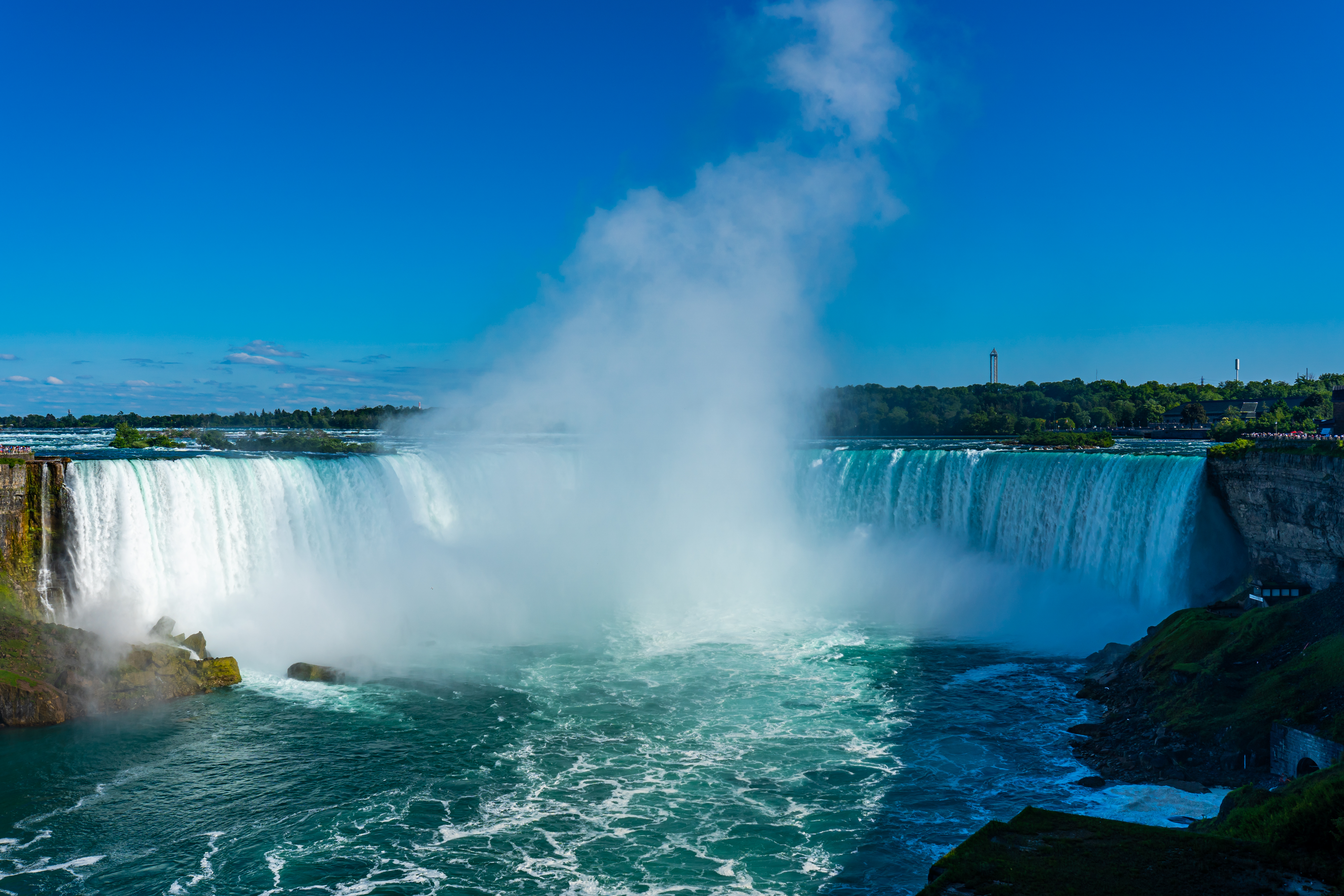
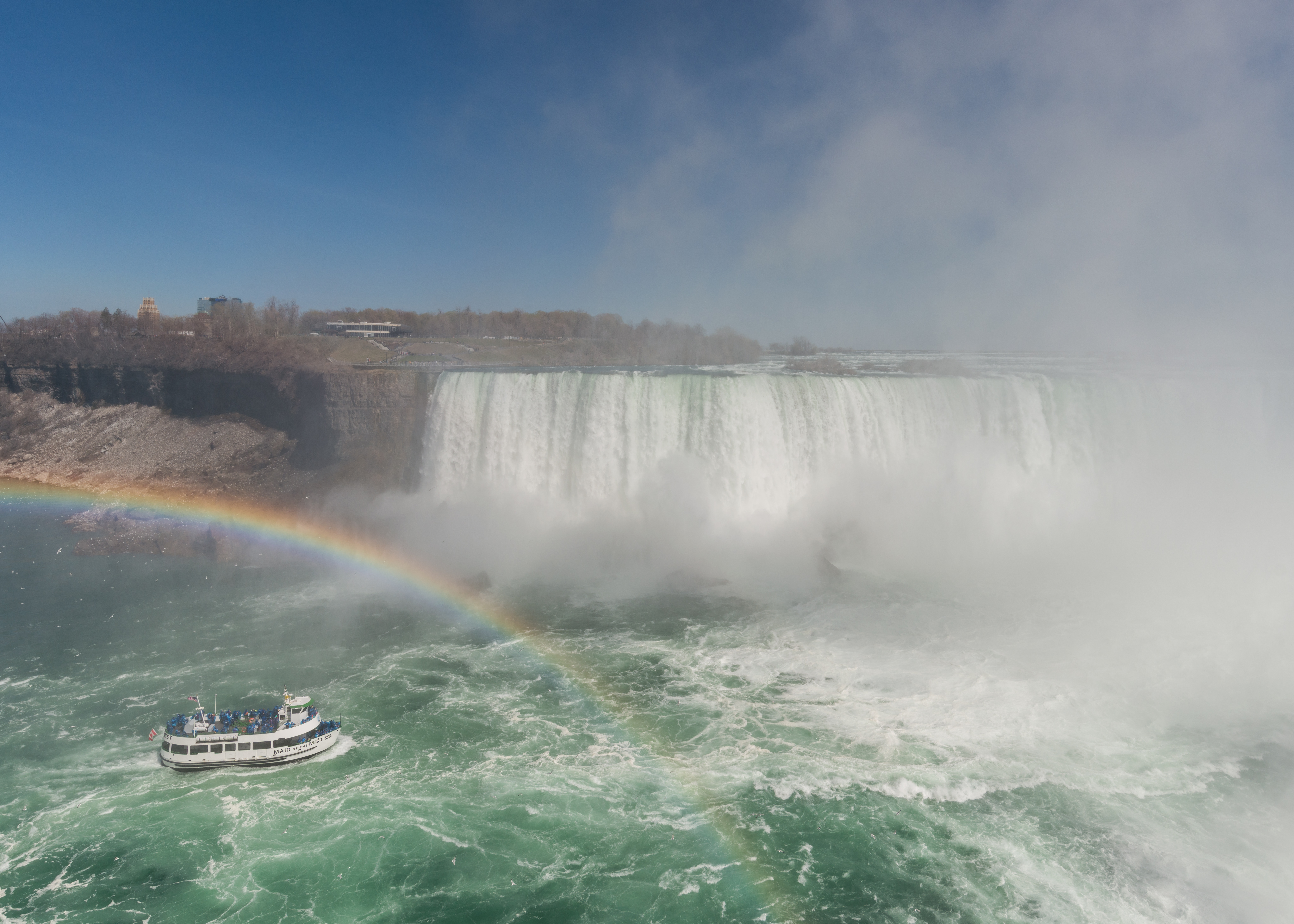
Horseshoe Falls under a rainbow, wide panorama, 2023

A visual essay · eight chapters · Niagara Parks figures

Niagara: the waterfall that moves, and that a treaty can turn down

Three falls on the Canada–US border — the 57 m Horseshoe, the American and the Bridal Veil — held by a 1950 treaty at 100,000 cubic feet per second by day and 50,000 by night, retreating 0.1 m a year today after carving 11 km of gorge in 12,000 years. M01 M02 M03

In 1969 the American Falls ran dry for five months — and the plan that could silence them again has waited, unfunded, since 2016. M12 M09

Down the curtain
57 mHorseshoe drop · Niagara Parks, 2026; see the datum note M01
100,000 cfsminimum day flow, tourist season · 1950 treaty M01 M02
0.1 m/yrcurrent Horseshoe recession · was ~1 m/yr M02
Jun 12–Nov 25, 1969American Falls dewatered · 27,800-ton dam M12
The rainbow panorama (2023, Rhododendrites): the 9,407 px CC BY-SA 4.0 frame that opens this essay — spectacle, not a survey. M20Rhododendrites · 25 May 2023 · CC BY-SA 4.0

Chapter 1 · Three falls, two countries

Three falls, one border

Niagara is not one waterfall but three: Horseshoe, at 57 m of drop and about 670 m of crest on the official Niagara Parks figures, swallows about 90% of the flow; the American, with its roughly 260 m crest, drops 21–34 m to the talus and 57 m to the river; the Bridal Veil, the smallest, at about 55 m of drop and ~15 m of crest, flows with the American side. M01 M02 M03 M04 M05

The American and the Veil lie wholly within the United States; Horseshoe — often called the Canadian Falls — straddles the border between Ontario and New York State. M30

Three crests drawn on OpenStreetMap as such: Horseshoe (way 56539663), American (217355188) and Veil (515298933), joined by river relation 2245991. M19

THE HORSESHOE

Horseshoe: 57 m, 670 m, 90%

Official Niagara Parks figures, with their year and convention. M01 M02 M19 M30

57 m average drop (188 ft), about 670 m of crest (2,200 ft), a 35 m deep plunge pool — and about 90% of the total flow, the remainder after the American side. The Canadian end of the crest is at Table Rock, Ontario. M01 M02 M19 M30

THE AMERICAN SIDE

American: two heights, one talus

21–34 m to the talus, 57 m to the river — two datums, not an error. M01 M02 M05

From its roughly 260 m crest (850 ft), the water drops 21–34 m onto the boulder pile at its foot, then about as much again to the river: 57 m in all. The American takes 10–20% of the flow, Horseshoe the rest. M01 M02 M05

THE SMALLEST

Bridal Veil: 55 m between two islands

Between Luna and Goat Islands, on the American side. M02 M03 M04

About 55 m of drop and ~15 m of crest, between Luna and Goat Islands — the smallest of the three, flowing with the American side, which takes 10–20% of the flow. M02 M03 M04

THE DATUM NOTE

Why the figures differ: they are not errors

This essay standardizes on Niagara Parks and notes every variant. M01 M04

Horseshoe reads as 51 m or 57 m depending on the source, and its crest as 670 m or 823 m; the American crest as 260 or 286 m. Different datums and conventions — here the figure is always the Niagara Parks one, with the variant beside it. M01 M04
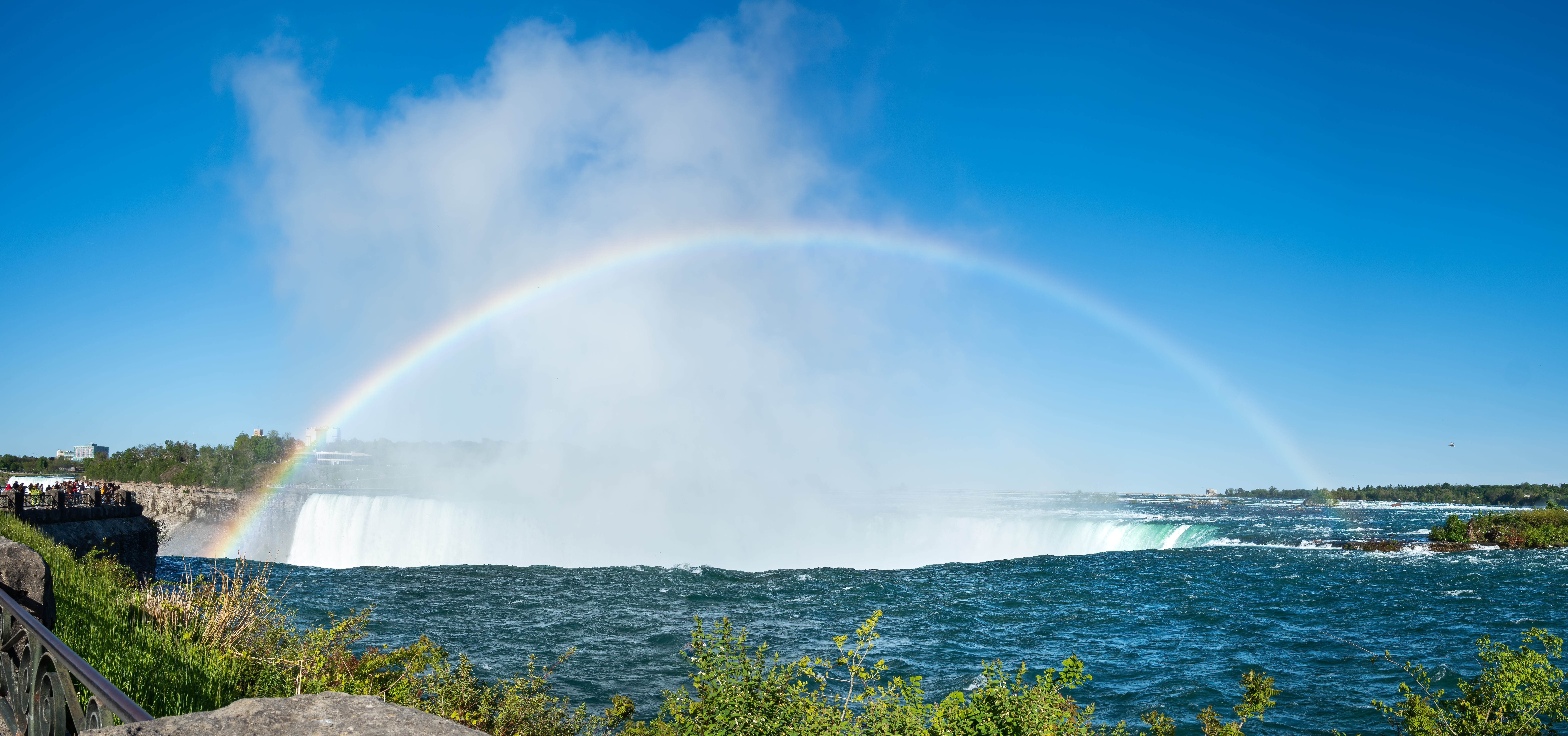
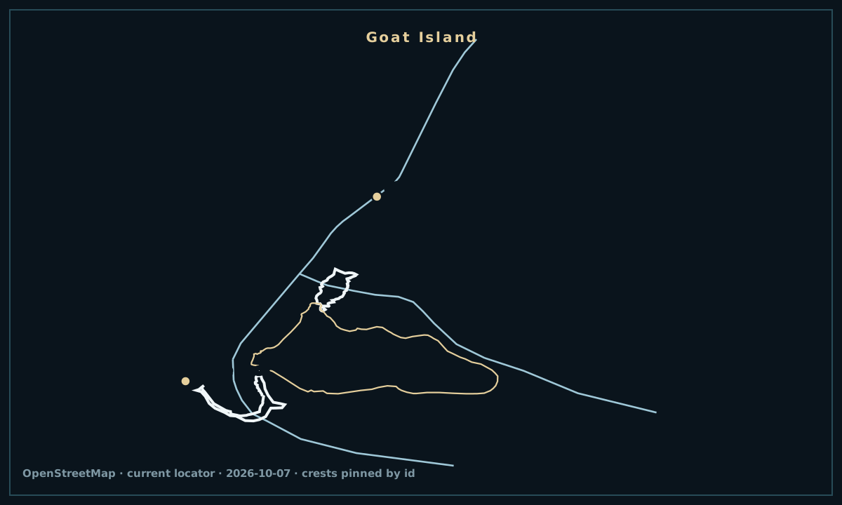
Photo gallery

Current Niagara Falls locator, with the river, the three crests, Goat Island, Rainbow Bridge and Table Rock.
OpenStreetMap geometry from the dated 2026-10-07 extract. Locator, not a nautical chart. River linework is merged member-way geometry from one bbox pull; crest and island lines are pinned OSM ways; bridge and Table Rock labels are verified OSM centres. Prospect Point is explicit coords, never an OSM lookup. Figures never come from OSM tags. · © OpenStreetMap contributors · ODbL 1.0 M19
Horseshoe Falls close up, blue water pouring over the crest, 2021
The Horseshoe close (2021, Maksimsokolov): blue water over the crest, CC BY-SA 4.0 — the curtain at full treaty flow. M21Maksimsokolov · 12 Jun 2021 · CC BY-SA 4.0
All three Niagara Falls from Skylon Tower, wide 2002 capture
The Skylon breadth (2002 capture, Rftblr): all three falls in one 12,288 px CC BY-SA 4.0 panorama — fine for geography, not for today claims. M28Robert F. Tobler · 28 May 2002 · CC BY-SA 4.0

Chapter 2 · The 1950 tap

The treaty that holds the curtain whole

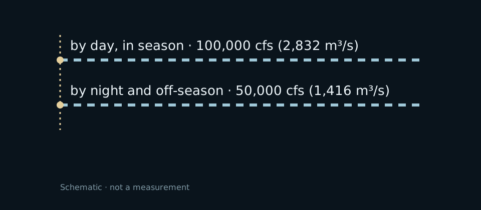
The 1950 Niagara Treaty, administered through the Board of Control under the International Joint Commission, requires at least 100,000 cfs (2,832 m³/s) over the falls by day in tourist season (Apr 1–Oct 31) and 50,000 cfs (1,416 m³/s) by night and off-season; the rest goes to power. The natural, undiverted flow would be about 202,000 cfs. M01 M02 M07

The doctrine is the “unbroken curtain of water”: the Chippawa–Grass Island Pool control structure, with the 1954 International Control Works, levels the water over the crest. At tourist peak about 168,000 m³ a minute goes over. M01 M02

After 10 p.m. the falls visibly thin — the same treaty that keeps them full by day empties them toward the turbines by night. M01 M02

BY DAY, IN SEASON

100,000 cfs over the crest

Treaty minimum, April 1–October 31, daytime. M01 M02

100,000 cubic feet per second — 2,832 m³/s — over the crest, every tourist-season day. The rest, up to the natural flow of about 202,000 cfs, is diverted to power. M01 M02

BY NIGHT AND OFF-SEASON

50,000 cfs: the falls at half

Treaty minimum outside visiting hours. M01 M02

By night and off-season the minimum falls to 50,000 cfs (1,416 m³/s) — and the difference from the natural flow goes to the turbines. That is why they look thinner after 10 p.m. M01 M02

THE UNBROKEN CURTAIN

The tap from 1954

The International Control Works level the curtain. M01 M02

The Chippawa–Grass Island Pool structure, with the International Control Works completed in 1954, holds the level and spreads the water evenly over the Horseshoe crest. M01 M02

Photo gallery

Aerial view of both falls and the gorge, 2023
The aerial (2023, Barryread): both falls and the gorge in one CC BY-SA 4.0 frame — geography, not a flow measurement. M23Barryread · 31 Oct 2023 · CC BY-SA 4.0
Treaty-tap schematic: 100,000 cfs by day, 50,000 cfs by night.
The treaty-tap and recession diagrams are conceptual drawings — 100,000 cfs by day and 0.1 m a year are dated marks, not averages. M01

Chapter 3 · The walking waterfall

11 kilometres in 12,000 years

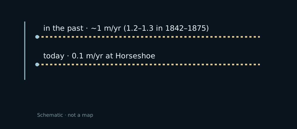
The falls retreat upstream as the water eats the crest: the historic average pace was about 1–1.2 m a year, and the total from Queenston–Lewiston is about 11 km in about 12,000 years. In 1842–1875, 1.2–1.3 m/yr were measured. M02 M06

Treaty diversion plus the Horseshoe crest reshaping slowed everything: the current rate is about 0.1 m/yr at Horseshoe (0.01–0.1 m/yr at the American). At that pace, the 32 km to Lake Erie mean about 50,000 years. M02 M06

Engineering beat geology by an order of magnitude: from a metre a year to a decimetre. M02

THE OLD PACE

~1 m a year, for millennia

The historic average; 1.2–1.3 m/yr in 1842–1875. M02 M06

Before diversion, the crest ate about a metre of gorge a year — 1.2–1.3 m/yr measured between 1842 and 1875 (Gilbert 1907, IJC 1953). The total: about 11 km from Queenston–Lewiston. M02 M06

TODAY'S PACE

0.1 m a year: ten times slower

Horseshoe today; American 0.01–0.1 m/yr. M02

After treaty diversion and crest reshaping, Horseshoe retreats about 0.1 m a year. With 32 km to Lake Erie, the arithmetic gives about 50,000 years. M02

HOW IT STOPPED

The 1950 treaty + the reshaped crest

Diversion and fill to even the curtain. M02

Treaty diversion, the 1954 Control Works and the Horseshoe crest reshaping with fill evened the curtain and cut erosion to a tenth. M02

Photo gallery

Recession schematic: ~1 m/yr in the past, 0.1 m/yr today.
The treaty-tap and recession diagrams are conceptual drawings — 100,000 cfs by day and 0.1 m a year are dated marks, not averages. M02

Chapter 4 · The river-machine

The river that lights New York

The Robert Moses plant at Lewiston, New York (NYPA, 1961, built after the 1956 Schoellkopf collapse), holds about 2.4–2.6 GW across 13 turbines — about 10% of New York State electricity, the state's largest producer. M08 M09

On the Canadian shore, Sir Adam Beck I + II + pump (Ontario, OPG) add up to about 2,000 MW (Beck 1 about 450 + Beck 2 about 1,500 + the 174 MW pump). Together, both shores mean about 4.4 GW. The Ontario-grid share has no citable carrier — it is not claimed here. M08

The $1.1–1.2 billion, 15-year “Next Generation Niagara” modernization is the river's active works site. M09

THE AMERICAN SHORE

Moses: ~2.5 GW, ~10% of New York

Lewiston, NYPA, 1961 — 13 turbines. M08

About 2.4–2.6 GW and about 10% of New York State electricity, the state's largest producer — built after Schoellkopf collapsed in 1956. M08

THE CANADIAN SHORE

Beck I + II: about 2,000 MW

Ontario, OPG — about 4.4 GW on both shores. M08

Beck 1 about 450 MW, Beck 2 about 1,500 MW, the pump 174 MW: about 2,000 MW together, about 4.4 GW with the American shore. The Ontario-grid share is not citable — this essay does not claim it. M08

THE ACTIVE WORKS

$1.1 billion for the next generation

A 15-year modernization, underway. M09

The $1.1–1.2 billion “Next Generation Niagara” programme modernizes the Moses plant over 15 years — the river's real works story, not the dewatering planned since 2016. M09

Photo gallery

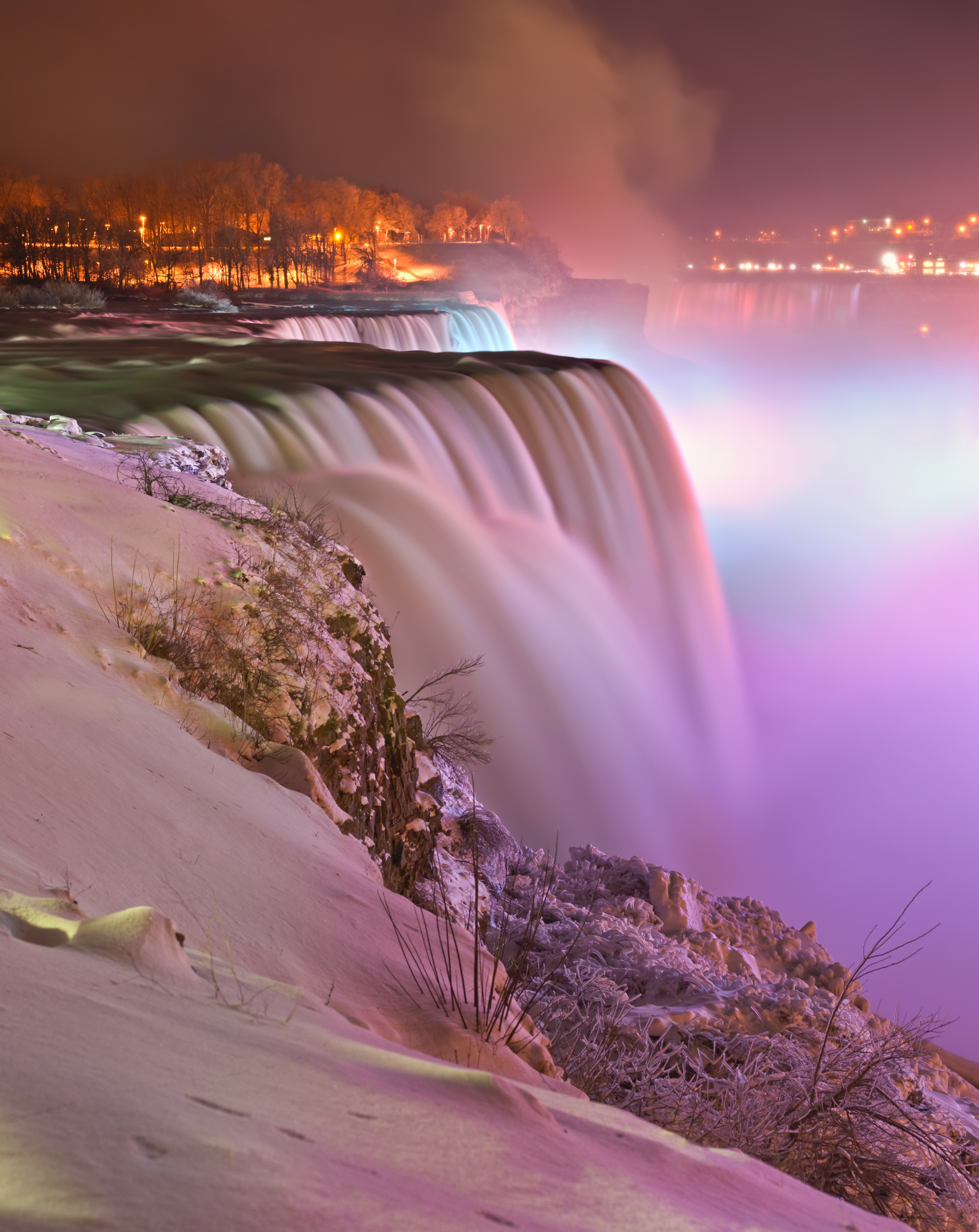
Niagara Falls illuminated at night in winter, seen from Prospect Point, 2012
The night illumination (2012, Paolostefano1412): winter falls lit from Prospect Point, portrait CC BY-SA 3.0 frame — light, not flow. M25Paolo Costa Baldi · 11 Feb 2012 · CC BY-SA 3.0

Chapter 5 · The barrel and the wire

Those who defied the curtain

Annie Edson Taylor, a 63-year-old schoolteacher, first survived a barrel trip over Horseshoe on October 24, 1901, her own birthday. Blondin (Jean François Gravelet) had already crossed on a wire in 1859, before about 25,000 spectators, and repeated it with stunts. M10

Nik Wallenda first walked a wire over Horseshoe on June 15, 2012, on a 550 m cable from Goat/Luna Island (USA) to Table Rock (Canada), sanctioned by both governments. M10 M11

The 1901 barrel, the 1859 wire, the 2012 wire: three ways across the same curtain. M10 M11

OCT 24, 1901

Annie Taylor, 63, in a barrel

The first barrel survival, on her birthday. M10

Schoolteacher Annie Edson Taylor, 63, went over Horseshoe in a barrel on October 24, 1901 — her own birthday — and survived first. M10

1859

Blondin: first on the wire

About 25,000 spectators; he repeated with stunts. M10

Jean François Gravelet, known as Blondin, first crossed on a wire in 1859, before about 25,000 spectators — then repeated it with all kinds of stunts. M10

JUN 15, 2012

Wallenda: 550 m over Horseshoe

From Goat/Luna to Table Rock, with two approvals. M10 M11

Nik Wallenda first walked a wire over Horseshoe on June 15, 2012: 550 m of cable from the USA into Canada, between Goat/Luna Island and Table Rock, sanctioned by both governments. M10 M11

Chapter 6 · When the water stopped

1969: five months without the American

The US Army Corps of Engineers raised in about 3 days a dam of about 180 m (600 ft) from some 27,800 tons of rock and earth; the American and the Veil ran dry from June 12 to November 25, 1969, while engineers drilled the exposed cliff and talus. Horseshoe never stopped for a moment. M12 M15

The talus stayed and the water returned. And the story of a new dewatering — tied since 2016 to rehabilitating the Goat Island stone bridges — is still, in September 2026, unfunded and undated: “may go silent again”, never dated works. M12 M13 M14

Many 2016-vintage articles say “going dry soon” — they are stale. The dewatering never recurred; it waits on state money. M12 M13

JUN 12–NOV 25, 1969

The 27,800-ton dam

600 ft of rock in about 3 days; the cliff drilled. M12 M15

About 27,800 tons of rock and earth raised in about 3 days stopped the American and the Veil from June 12 to November 25, 1969, while engineers drilled the exposed cliff. Horseshoe never paused. M12 M15

WHAT STAYED

The talus was left in place

The water returned over the boulders. M12 M14

After the drilling, the engineers left the talus where it was: the water returned over the boulder pile, and the American looks the same today. M12 M14

SINCE 2016, UNDATED

“May go silent again”

Goat Island bridge rehab: unfunded, Sept 2026. M12 M13

Rehabilitating the two 115-year-old stone bridges on Goat Island, which would partly dewater the American again, is “waiting for state funding and has no date” (September 2026) — and the dewatering “has not yet occurred” (March 2026). M12 M13

Photo gallery

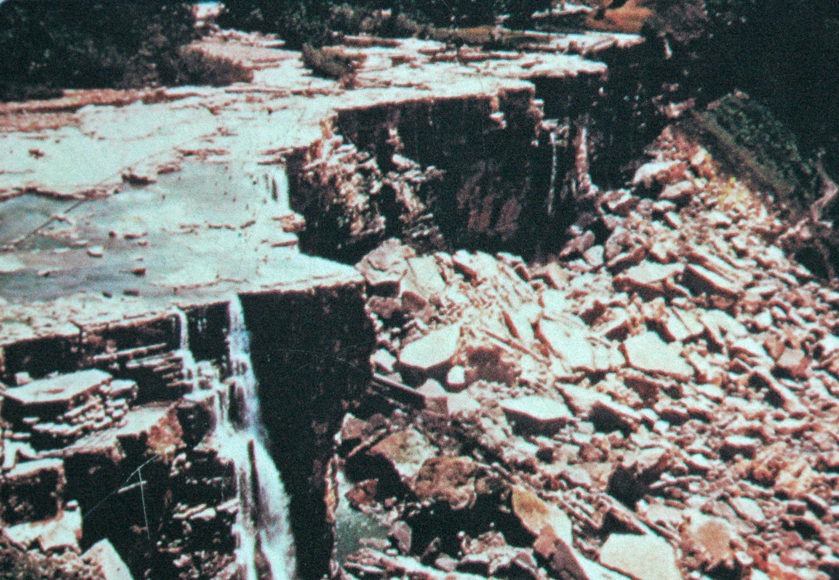
Dewatered American Falls in 1969, exposed cliff and talus
The dry falls (1969 view, James St. John via Flickr): a captioned 1969 view of the dewatered cliff, CC BY 2.0 — a period view, not a re-enactment. M24James St. John · 13 Jun 2007 · CC BY 2.0

Chapter 7 · Blue and red ponchos

The boats under the curtain

Maid of the Mist began as a cross-river ferry in 1846 and has carried sightseers since 1854; in 2026 it is in its 180th season and departs from the American shore only, in blue ponchos. M16 M17

Hornblower Niagara Cruises won the Ontario concession in 2013 and has sailed since 2014 with 700-passenger catamarans (red ponchos), from the Canadian shore. M16 M17

Blue from the USA, red from Canada: two fleets, one curtain of water. M16

SINCE 1846

Maid of the Mist: the ferry turned legend

Sightseeing since 1854; 180th season in 2026. M16 M17

A cross-river ferry from 1846, a sightseeing cruise from 1854: Maid of the Mist reached its 180th season in 2026, departing from the US shore only. M16 M17

SINCE 2014

Hornblower: the red catamarans

Ontario concession won in 2013. M16 M17

Hornblower won the Ontario concession in 2013 and has sailed since 2014 with 700-passenger catamarans, in red ponchos, from the Canadian shore. M16 M17

SEASON 180

Two shores, two colours

Blue USA, red Canada — the same curtain. M16

In 2026: blue ponchos on the Maid, on the American shore, and red on Hornblower, on the Canadian shore — two fleets under one curtain. M16

Photo gallery

Maid of the Mist VII approaching Horseshoe Falls, 2017
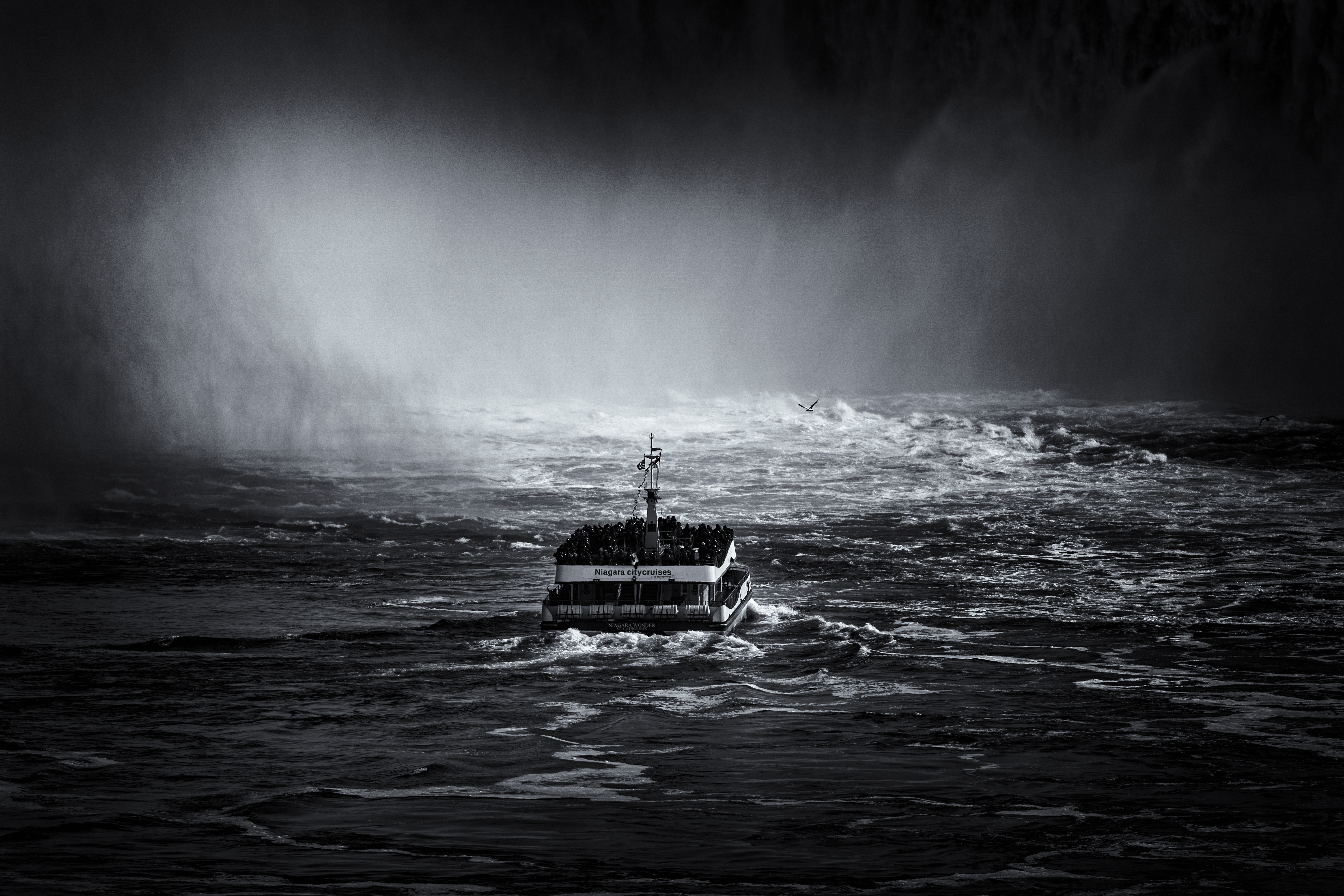
The Maid (2017, DXR): Maid of the Mist VII at Horseshoe, CC BY-SA 4.0 — the US-side boat in blue ponchos. M26DXR · Taken · CC BY-SA 4.0
Hornblower Niagara catamaran approaching Horseshoe Falls, 2021
The Hornblower (2021, Maksimsokolov): the Canadian-side catamaran at Horseshoe, CC BY-SA 4.0 — red ponchos since 2014. M27Maksim Sokolov (maxergon.com) · 4 Jul 2021 · CC BY-SA 4.0

Chapter 8 · The bridge that killed

The winter that never stops the water

The falls never fully freeze — water flows under the ice; the American still chokes on upstream jams. On February 4, 1912 the gorge ice bridge broke and 3 people died; the public has been banned from the ice ever since. M18

Since 1964, the floating ice boom on Lake Erie stops the floes: Horseshoe will never jam again. A famous 19th-century stoppage, when the mills supposedly halted and people walked the dry riverbed, has no verified dossier carrier — it is not claimed here. M18

The Burrell/Hecock memorial at the lookout keeps the 1912 lesson: the ice is for looking, not for walking. M18

FEB 4, 1912

The ice bridge broke: 3 dead

Since then, the public is banned from the ice. M18

On February 4, 1912 the gorge ice bridge broke under people: 3 dead. The Burrell/Hecock memorial at the lookout remembers; the ice became forbidden. M18

SINCE 1964

The ice boom on Erie

Horseshoe will never jam again. M18

The floating boom installed in 1964 on Lake Erie stops the floes before the falls: Horseshoe will never jam again. M18

THE BROKEN MYTH

Never fully frozen

Water flows under the ice; only the American chokes. M18

However spectacular winter looks, water flows under the ice: the falls never fully freeze. Only the American still chokes on upstream jams. M18

Photo gallery

American and Bridal Veil Falls in winter, talus boulders and ice, 2020
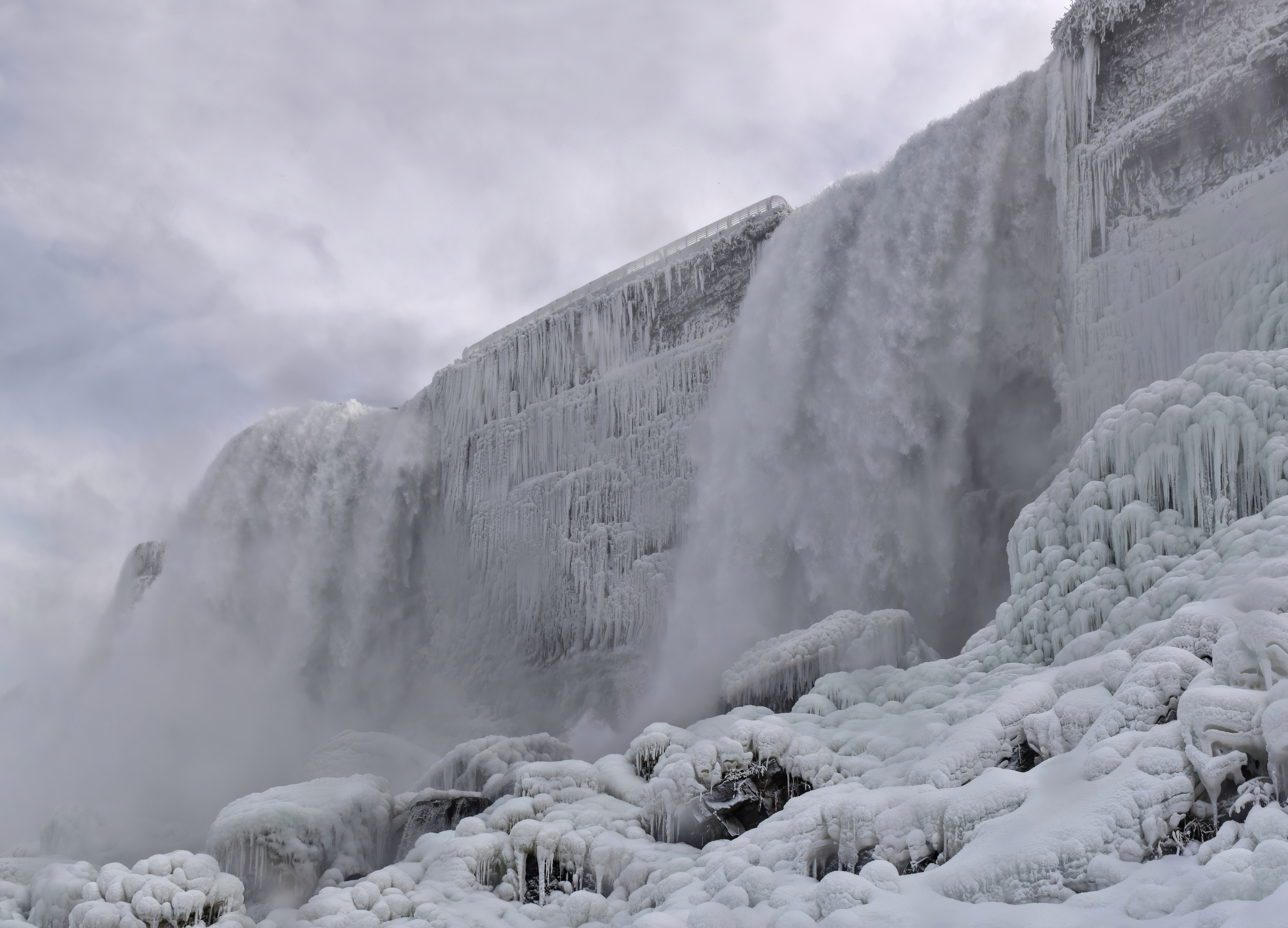
The American side in winter (2020, The Cosmonaut): talus boulders and ice under the crest, CC BY-SA 2.5 ca — the two-height datum made visible. M22The Cosmonaut , editing by Wilfredor · Taken · CC BY-SA 2.5 ca
Horseshoe Falls water and ice formations in winter, 2013
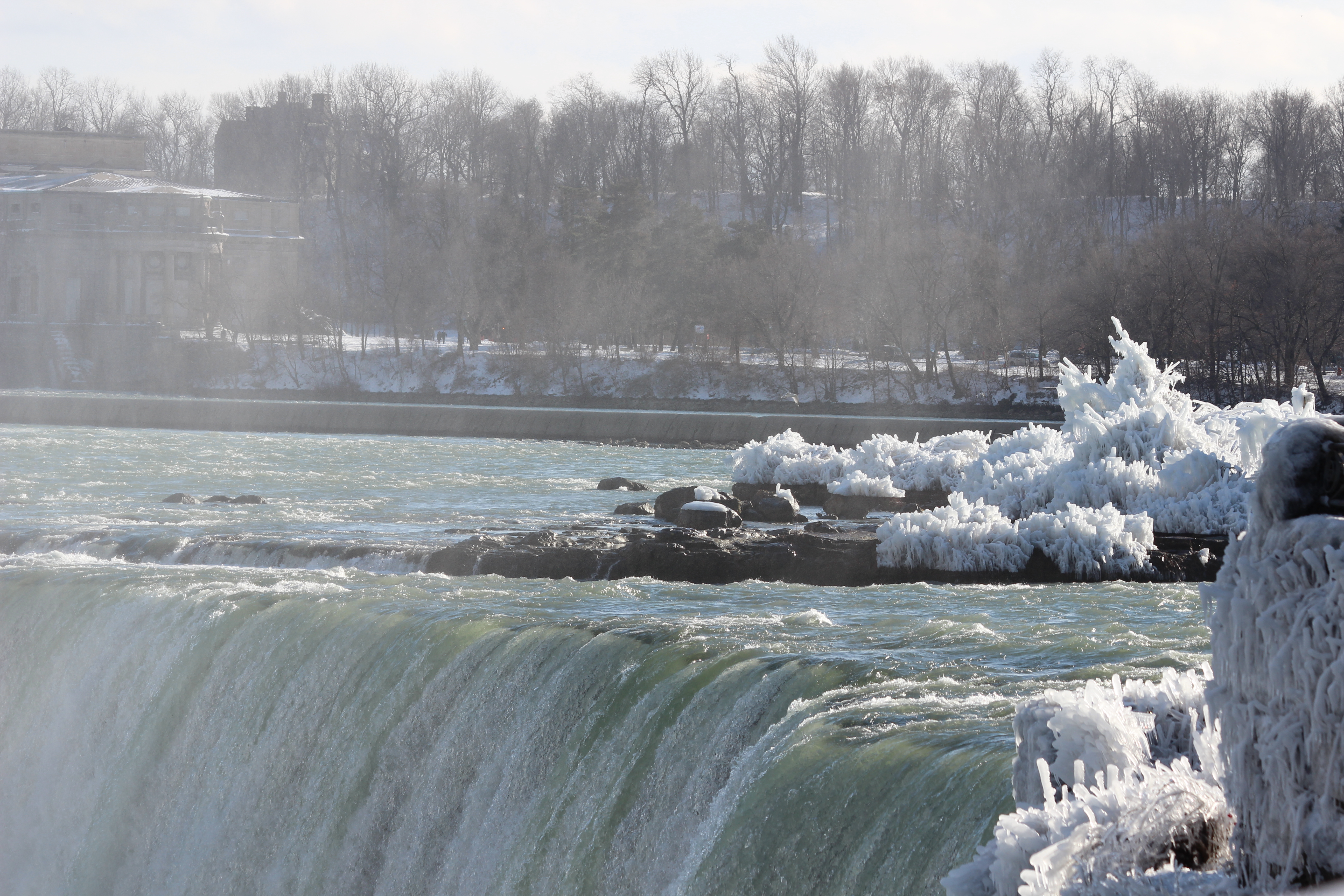
Water and ice (2013, Crefollet/Daymonday): winter formations at Horseshoe, CC0 — the falls never fully freeze. M29Daymonday · 1 Jan 2013 · CC0

Sources and limits

Sources and limits

Annotations retain the status in the source ledger.

  1. M01 · Niagara Parks — falls geology, facts and figures (official dimensions + treaty flows)

    official facts page · official-link-unverified

    https://www.niagaraparks.com/visit-niagara-parks/plan-your-visit/niagara-falls-geology-facts-figures/

  2. M02 · IJC — Niagara Falls is moving (recession + flow split)

    treaty-body page (IJC) · official-link-unverified

    https://www.ijc.org/en/niagara-falls-moving

  3. M03 · Wikipedia — Bridal Veil Falls (Niagara Falls)

    tertiary encyclopedia · official-link-unverified

    https://en.wikipedia.org/wiki/Bridal_Veil_Falls_(Niagara_Falls)

  4. M04 · Live Science — Niagara Falls facts

    science popularization magazine · official-link-unverified

    https://www.livescience.com/59099-niagara-falls-facts.html

  5. M05 · niagaratours.net — American Falls dimensions

    tour-operator page, well sourced · official-link-unverified

    https://niagaratours.net/attractions/usa/american-falls/

  6. M06 · niagarafrontier.com — origins, period-by-period recession rates

    regional history archive (rate table) · official-link-unverified

    https://www.niagarafrontier.com/origins.html

  7. M07 · IJC legacy report — Niagara treaty flows (re-verify at build if cited)

    historic IJC report (PDF, snippet-verified) · official-link-unverified

    https://legacyfiles.ijc.org/publications/niagara103_e.pdf

  8. M08 · EN Wikipedia — Robert Moses Niagara Power Plant

    tertiary summary with cited provenance · official-link-unverified

    https://en.wikipedia.org/wiki/Robert_Moses_Niagara_Power_Plant

  9. M09 · NS Energy Business — NYPA Next Generation Niagara upgrade

    energy-industry news · official-link-unverified

    https://www.nsenergybusiness.com/news/nypa-upgrade-niagara-power-project/

  10. M10 · WNY Heritage — daredevils of Niagara Falls

    regional heritage magazine · official-link-unverified

    https://wnyh.myshopify.com/blogs/news/daredevils-of-niagara-falls

  11. M11 · EN Wikipedia — Nik Wallenda

    tertiary summary with cited provenance · official-link-unverified

    https://en.wikipedia.org/wiki/Nik_Wallenda

  12. M12 · niagaratours.net — 1969, the year Niagara Falls was dewatered

    tour-operator page (1969 account + 2026 status) · official-link-unverified

    https://niagaratours.net/1969-the-year-when-niagara-falls-was-dewatered/

  13. M13 · citizendailypost.com — when was Niagara last turned off (corroboration only)

    content-farm FAQ — corroboration only · official-link-unverified

    https://www.citizendailypost.com/faq/when-was-the-last-time-niagara-falls-was-turned-off

  14. M14 · Clifton Hill — historic photos of Niagara Falls dry

    tour-operator blog (period photos) · official-link-unverified

    https://www.cliftonhill.com/falls_blog/historic-photos-of-niagara-falls-dry/

  15. M15 · Gizmodo — it is surprisingly easy to turn off Niagara Falls

    technology/culture magazine · official-link-unverified

    https://gizmodo.com/its-surprisingly-easy-to-turn-off-niagara-falls-1755006653

  16. M16 · airlinktours.ca — Niagara Falls boat tour guide

    tour-operator guide · official-link-unverified

    https://airlinktours.ca/niagara-falls-boat-tour-guide/

  17. M17 · Clifton Hill — voyage history of Niagara Falls boat tours

    tour-operator blog (cruise history) · official-link-unverified

    https://www.cliftonhill.com/falls_blog/voyage-history-niagara-falls-boat-tours/

  18. M18 · hhhistory.com — the 1912 Niagara Falls ice bridge

    local-history blog · official-link-unverified

    https://www.hhhistory.com/2015/02/the-1912-niagara-falls-ice-bridge.html

  19. M19 · OSM — three crest ways + Goat Island + river relation + bridge + Table Rock

    OpenStreetMap records · official-link-unverified

    https://www.openstreetmap.org/way/56539663 · https://www.openstreetmap.org/way/217355188 · https://www.openstreetmap.org/way/515298933 · https://www.openstreetmap.org/way/3743454 · https://www.openstreetmap.org/relation/2245991 · https://www.openstreetmap.org/relation/14629795 · https://www.openstreetmap.org/way/420548287

  20. M20 · Commons V01 — rainbow over Horseshoe Falls (hero)

    Commons original · official-link-unverified

    https://commons.wikimedia.org/wiki/File:Rainbow_over_horseshoe_falls_(52877p).jpg

  21. M21 · Commons V02 — Horseshoe Falls close, blue water

    Commons original · official-link-unverified

    https://commons.wikimedia.org/wiki/File:Horseshoe_Falls_(Niagara_Falls).jpg

  22. M22 · Commons V03 — American and Bridal Veil Falls in winter

    Commons original · official-link-unverified

    https://commons.wikimedia.org/wiki/File:American_and_Bridal_Veil_Falls_winter.jpg

  23. M23 · Commons V04 — aerial of both falls and gorge

    Commons original · official-link-unverified

    https://commons.wikimedia.org/wiki/File:Niagara_Falls_Aerial_Photo.jpg

  24. M24 · Commons V05 — dewatered American Falls, 1969 view

    Commons original · official-link-unverified

    https://commons.wikimedia.org/wiki/File:Dewatered_American_Falls_(1969)_(Niagara_Falls,_northwest_of_Buffalo,_New_York_State,_USA)_(19936707609).jpg

  25. M25 · Commons V06 — night illumination from Prospect Point

    Commons original · official-link-unverified

    https://commons.wikimedia.org/wiki/File:Niagara_falls_-_Winter_-_Prospect_point_view_at_night.jpg

  26. M26 · Commons V07 — Maid of the Mist VII at Horseshoe

    Commons original · official-link-unverified

    https://commons.wikimedia.org/wiki/File:Maid_of_the_Mist_VII_approaching_the_Horseshoe_Falls,_West_view_20170418_1.jpg

  27. M27 · Commons V08 — Hornblower catamaran at Horseshoe

    Commons original · official-link-unverified

    https://commons.wikimedia.org/wiki/File:Hornblower_Niagara_Cruise_approaching_Horseshoe_Falls.jpg

  28. M28 · Commons V09 — all three falls from Skylon Tower (2002 capture)

    Commons original · official-link-unverified

    https://commons.wikimedia.org/wiki/File:Niagara_Falls_USA_Canada_from_Skylon_Tower_on_2002-05-28.png

  29. M29 · Commons V10 — Horseshoe winter ice formations

    Commons original · official-link-unverified

    https://commons.wikimedia.org/wiki/File:Niagara_Falls_water_and_ice_winter.jpg

  30. M30 · Wikipedia — Niagara Falls (straddle + three-falls split)

    tertiary encyclopedia · official-link-unverified

    https://en.wikipedia.org/wiki/Niagara_Falls