At the shore: only the near water
At eye height, 1.7 metres, the horizon over water closes at 5 kilometres. From this point only the near shore of Razim shows; the rest of the lagoon, the spit and the sea stay below the horizon line.
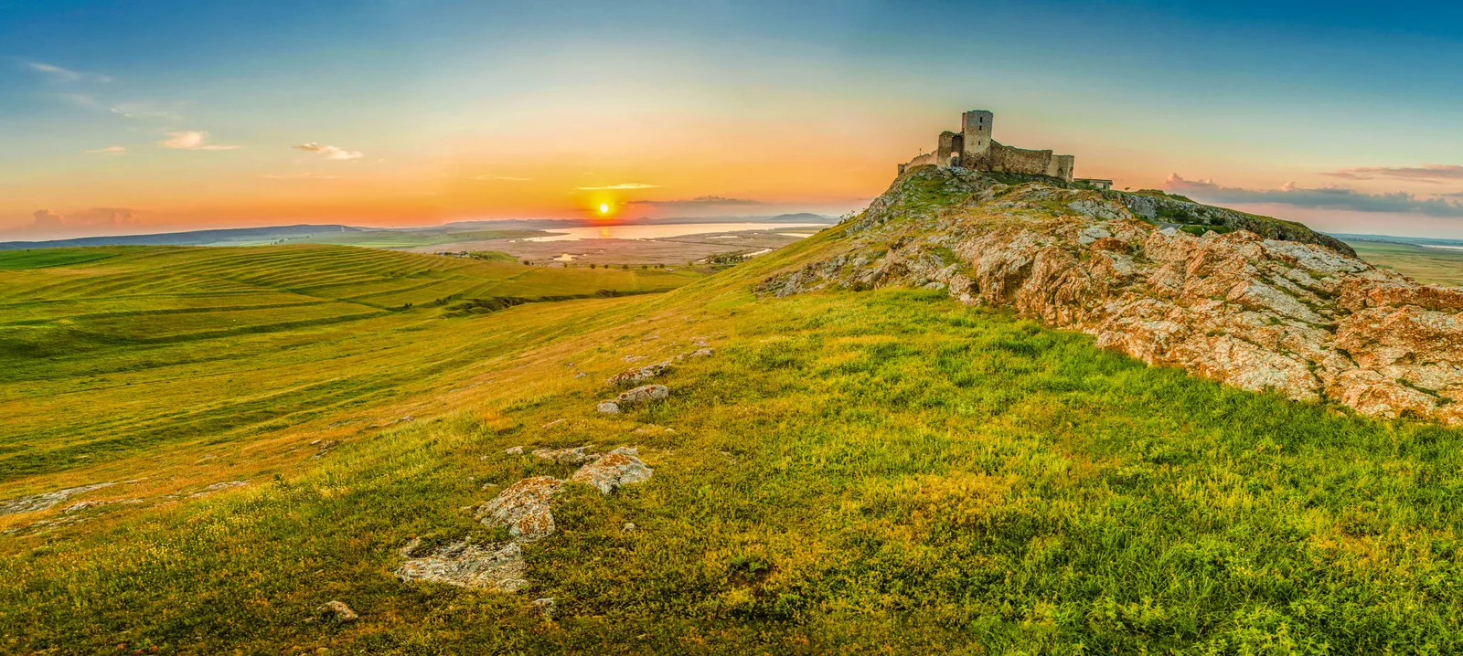
The walls rise some 99 metres above the lagoon, in Romania's Dobrogea. From them, the watch saw the lagoon water for 25 kilometres and, south-eastward, the open sea past the spit — though the fortress never stood on the seashore.
From the shore to the wall ↓
The climb
Four stops between the shore and the wall, on the lagoon-facing slope. Each panorama is computed on the real terrain, from eye height at that point.
The panorama changes at each stop.
At eye height, 1.7 metres, the horizon over water closes at 5 kilometres. From this point only the near shore of Razim shows; the rest of the lagoon, the spit and the sea stay below the horizon line.
From 52 metres, the horizon jumps to 27.5 kilometres. The north basin and the far shore of the lagoon come into view; the sea — water and masts — stays under the horizon.
From 82 metres, the horizon passes 34.6 kilometres. The middle of the lagoon opens, and to the south-east the sea water shows for 29 kilometres. The bay of Babadag and the eastern sea water stay hidden.
From the wall, 107 metres above the sea, the horizon runs to some 40 kilometres. The bay of Babadag appears behind, at 3 kilometres, and south-eastward, past the spit, the stripe of the sea shows. The watch starts here.
The watch
The panorama is computed on the real terrain, from 107 metres. Drag it through a full turn; each marked water says how far it lies and by how many metres it clears the line of the hills — or by how many it falls under it. Back to the climb
Tap the water for the trial ship.
Pick a point on the water, and the instrument says whether the watch would see a 12-metre sail there. Great ships, with taller masts, showed from farther.
The water at the foot of the hill, 3 kilometres away. It clears the line of the hills by 18 metres.
3 km · 110°
The northern arm of the lagoon, 7 kilometres away. The whole reach showed from the wall.
7 km · 52°
The middle of the lagoon, 10 kilometres away — the middle of the crossing, under the wall's eyes.
10 km · 118°
The far shore of the lagoon, 25 kilometres away — the water shows all the way across.
25 km · 116°
The eastern bay of Lake Babadag, 3 kilometres away, behind the wall. It shows from the crest — from lower down, the hill hides it.
3 km · 290°
The nearest sea water, 26 kilometres south-east, past the sand strip. Its stripe shows over the spit only from the wall walk.
26 km · 132°
Eastward, the seashore lies 62 kilometres away — the water falls 35 metres under the line of the hills, the masthead 23.
62 km · 90°
Towards the Danube mouths, the seashore lies 65 kilometres away — the water dips just under the horizon and not even a 12-metre sail shows.
65 km · 78°
Towards the open south-east, the water shows to 29 kilometres, and sails show farther still.
29 km · 121°
The mouth through which the lagoon breathed to the sea until the 1970s, 24 kilometres away, hides behind the Doloșman hills — the water 134 metres under the line of the hills, the masthead 122.
24 km · 148°
The builders
The fortress was built in the second half of the 14th century, for military purposes, very probably by the Genoese merchants, holders of the Black Sea navigation monopoly — so the museum in Tulcea, which keeps it, presents it. The plan is an irregular polygon following the folds of the land; walls and bastions stand 5–10 m high at some points.
The Genoese hypothesis comes from the building technique and the archaeology: by the finds, the only ones with an interest in raising a sea-facing fortress here, to control navigation, were the merchants of Genoa. Coins found in the fortress attest Byzantine, Genoese, Tatar, Moldavian and Turkish presences.
The settlement below existed from the turn of the 14th century; the fortress walls rose in its second half. In the time of Mircea the Old, prince of Wallachia (the Romanian principality south of the Carpathians), the fortress entered Wallachia's defensive system. Its first written mention, from the 15th century, finds it as Yeni-Sale, in the chronicle of Sükrüllah; the Byzantine name handed down for it is Heracleea.
The enclosure has four corner towers and two buttresses. The great tower, trapezoidal in plan, guards the monumental gate; the west-south-west curtain, over 100 metres long, has been lost almost entirely, probably collapsed into the ravine. Inside stands a stone cistern, the fortress's water reserve, and the second enclosure, barely guessed today, stands in a 2.7-hectare archaeological reserve.
Digging began in 1938–39, with Grigore Avachian; after the war came Ion Barnea and I. T. Dragomir, who found the second enclosure, then the teams of 1976 and 1991–99. The fortress was abandoned at the end of the 15th century, as Turkish rule advanced north of the Danube mouths — and, the museum says, as the sand spits formed that separate Lake Razim from the Black Sea.
The shore
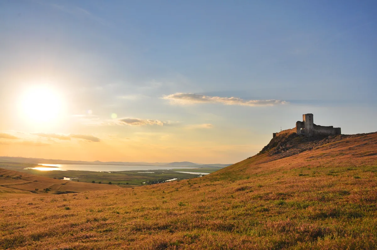
Of the spits separating the Razim–Sinoe complex from the sea, the young one — the Saele–Chituc ridge — was deposited over six centuries, between 650 and 1230, and the city of Histria lost its outlet to the sea with it. The lagoon's other great spits are thousands of years older. When the walls of Enisala rose, in the second half of the 14th century, the water at the foot of the hill had long been a lagoon. By the spits' chronology, then, the fortress never stood on the seashore.
But that lagoon was not today's closed lake. Gura Portiței — the ancient entrance of the Halmyris bay from the Black Sea — stayed open from antiquity into the 1970s: a 2nd-century wreck, with a cargo estimated at over 1,000 amphorae, lies right before it. The link with the sea closed only in the 1970s, and the water turned fresh afterwards.
Meanwhile the lagoon kept building new chambers: young ridges, later than 1500, link the Chituc, Lupilor and Zmeica spits. The sands in the museum's sentence belong to this late reshaping, inside the lagoon — not to the Saele–Chituc ridge, finished a century before the walls.
On the map, the mouth is marked in its two states: open until the 1970s, closed today. The watch did not see it: the Doloșman hills hid it.
The morning
The fortress stands 2 km from the village of Enisala, in Tulcea county, on its limestone hill. Whoever climbs on a clear morning finds on the wall a view like the one the Genoese merchants — very probably — raised walls for: the stripe of the sea over the spit, south-eastward; the Doloșman hills, hiding the lagoon's mouth, southward; the bay of Babadag, behind.
The Razim below, at 41,500 hectares, is the country's largest natural lake — watched from above, from a fortress that never touched the sea.
Method
The panorama is computed with the same engine that gives the figures in the text: rays traced over the terrain model, with the Earth's curvature and refraction. Each verdict was checked at three refractions (0.07, 0.13, 0.17); the text admits only verdicts on which all three agree.
The sentry's eye stands at 107 metres: the hilltop, 99 metres measured on near-7-metre terrain tiles, plus the eye (1.7 metres) and the wall walk (6 metres, an assumption — the walls stand between 5 and 10 metres). The verdicts hold all the way from the foot of the wall to the crest — except the nearest stripe of the sea, which shows only from the wall walk.
The trial ship carries a 12-metre sail, a modest mast; great ships showed from farther. The model knows only today's terrain: reeds, trees and buildings are not in it, and the 14th-century shoreline is drawn nowhere — the sources give the state of the mouth, not the line of the shore.
The shoreline and the lakes come from OpenStreetMap; the Razim figures (largest natural lake) match the sister page about lakes. Every calculation stays on the reader's device.
The Tulcea Eco-Museum Research Institute (dating, the Genoese hypothesis, the abandonment); the Princeton Enisala dossier by Ingrid Petcu Levei (phases, coins, old names); the CIMEC description of the enclosure, towers, cistern and digs.
Bivolaru et al., 2021, on the Saele–Chituc ridges (650–1230); Giosan et al., 2006, on the lagoon's young ridges; Lemke, Nuțu et al., 2024, on Gura Portiței and the 2nd-century wreck; the GAL Razim R7 tourist route (the mouth's closure in the 1970s).
The horizon engine (same functions in the page and the figures); Mapzen/AWS terrain tiles; OpenStreetMap shorelines; Wikimedia Commons images, each credited at its frame.