Chapter 4 · LandformsLesson 4.1
Major landforms of Earth: from Everest to the Mariana Trench
If Everest and the bottom of the Mariana Trench are almost 20 km apart vertically, why does Earth look smooth from space?
Before you read: what do you think?
How high would Mount Everest be on a school globe 30 cm across?
See the answer
About 0.2 mm. About 0.2 mm. On a globe that size, each kilometre corresponds to 0.0235 mm, and Everest is 8.849 km high. That is why Earth looks smooth from space, even though almost 20 km separate Everest from the bottom of the Mariana Trench.
Mount Everest rises 8,849 m above sea level. The Mariana Trench in the Pacific Ocean descends to about 10,935 m below it. The two points are almost 20 km apart vertically, yet on a school globe 30 cm across the whole difference would be less than half a millimetre thick.
Two major levels: continents and ocean basins
Seen from space, Earth looks smooth because its uneven features are tiny compared with the size of the planet: the almost 20 km between Everest and the bottom of the Mariana Trench are small beside a radius of 6,371 km. All the raised areas, level surfaces and hollows of Earth’s crust make up its relief. The height of a point above sea level is its altitude; below sea level, depth is measured.
The planet’s largest landforms are the continents and ocean basins. The ocean covers over 70% of Earth’s surface and has an average depth of 3,682 m.
The hypsographic curve is a graph showing how much of Earth’s surface lies at each altitude and depth. It shows two broad levels. The first is low land, between 0 and 1,000 m altitude, where most of the continents lie. The second is the ocean floor, between 3,000 and 6,000 m deep. Very high mountains and very deep trenches occupy only the narrow ends of the curve.
For the curious
The difference between the two levels comes from the crust: continental crust is thick and made of lighter rocks; oceanic crust is thin and made of denser rocks, so it sits lower.
On the continents: mountains, plateaux, hills and plains
Mountains are the highest landforms, usually above 1,000 m. They have ridges and peaks, steep slopes and deep valleys.
Plateaux are extensive level or gently rolling surfaces, high above sea level and cut by deep valleys. Their altitude varies greatly, from 200–300 m to over 4,000 m: the Tibetan Plateau averages over 4,500 m and is the highest plateau on Earth.
Hills generally lie between 200–300 m and 1,000 m, with rounded summits and gentler slopes than mountains. Plains are low landforms, usually below 200–300 m, with flat surfaces and shallow valleys. Between higher landforms lie depressions, lower places surrounded by mountains or hills.
Altitude thresholds are guides. A plateau and a mountain can be at the same altitude; their appearance distinguishes them: a level surface on the plateau, ridges and steep slopes on the mountain.
For the curious
Mountains usually form chains: the Himalayas, Andes, Alps and Carpathians.
In Romania, the conventional threshold for calling a landform a mountain is about 800 m.
Under the ocean: shelf, continental slope, abyssal plains, ridges and trenches
The continent continues underwater as the continental shelf, a very gently sloping surface covered by shallow water, generally down to 200 m. From here the seabed drops quickly down the continental slope.
At the foot of the slope begin the abyssal plains, almost flat expanses usually between 3,000 and 6,000 m deep. They are the most extensive landform on the planet.
Mid-ocean ridges run through the middle of the oceans. These chains of underwater volcanic mountains measure almost 65,000 km end to end. Here tectonic plates move apart and oceanic crust forms. Ocean trenches are long, narrow troughs more than 6,000 m deep, at the edges of oceans where one tectonic plate slides beneath another. The deepest is the Mariana Trench.
For the curious
The edge of the shelf lies at an average depth of about 140 m; from there the seabed begins to drop steeply.
Where people live
Most people live on plains and low hills, where the land is easy to farm and build on and roads are relatively easy to make. High mountains have steep slopes, a cold climate and thin soils, so they are sparsely populated; they do, however, provide water, timber, ores and pasture.
For the curious
The shelf matters too, although it is underwater: most fishing takes place here, and oil and natural gas are extracted here.
Worked example
Everest’s height on a 30 cm globe
Earth’s mean radius is 6,371 km. A globe 30 cm across has a radius of 15 cm, or 150 mm. Each real kilometre corresponds to 150 mm ÷ 6,371 = 0.0235 mm on the globe.
Everest is 8.849 km high, so on the globe it would measure 8.849 × 0.0235 = 0.21 mm. The Mariana Trench is 10.935 km deep, so it would be a scratch 10.935 × 0.0235 = 0.26 mm deep. Together they make 0.47 mm, the thickness of a few sheets of paper.
To find the height of a landform on a globe, divide the globe’s radius by Earth’s radius and multiply the result by the real altitude. That is why relief maps and atlas profiles greatly exaggerate the vertical scale: drawn to the true scale, the landforms would be invisible.
In Romania
Three almost equal levels
Romania’s relief is divided almost equally among three levels: 31% mountains, 36% hills and plateaux, 33% plains and floodplains. The highest point is Vârful Moldoveanu, a peak in the Făgăraș Mountains, at 2,544 m; the lowest is the Black Sea coast, at 0 m.
The relief levels are arranged in almost concentric rings. The Carpathians form an arc around the Transylvanian Depression. Outside them come the Subcarpathians and the plateaux (Moldavian, Getic and Dobrogea), then the plains: the Romanian Plain in the south and the Western Plain. The Danube Delta is the lowest and youngest region in the country.
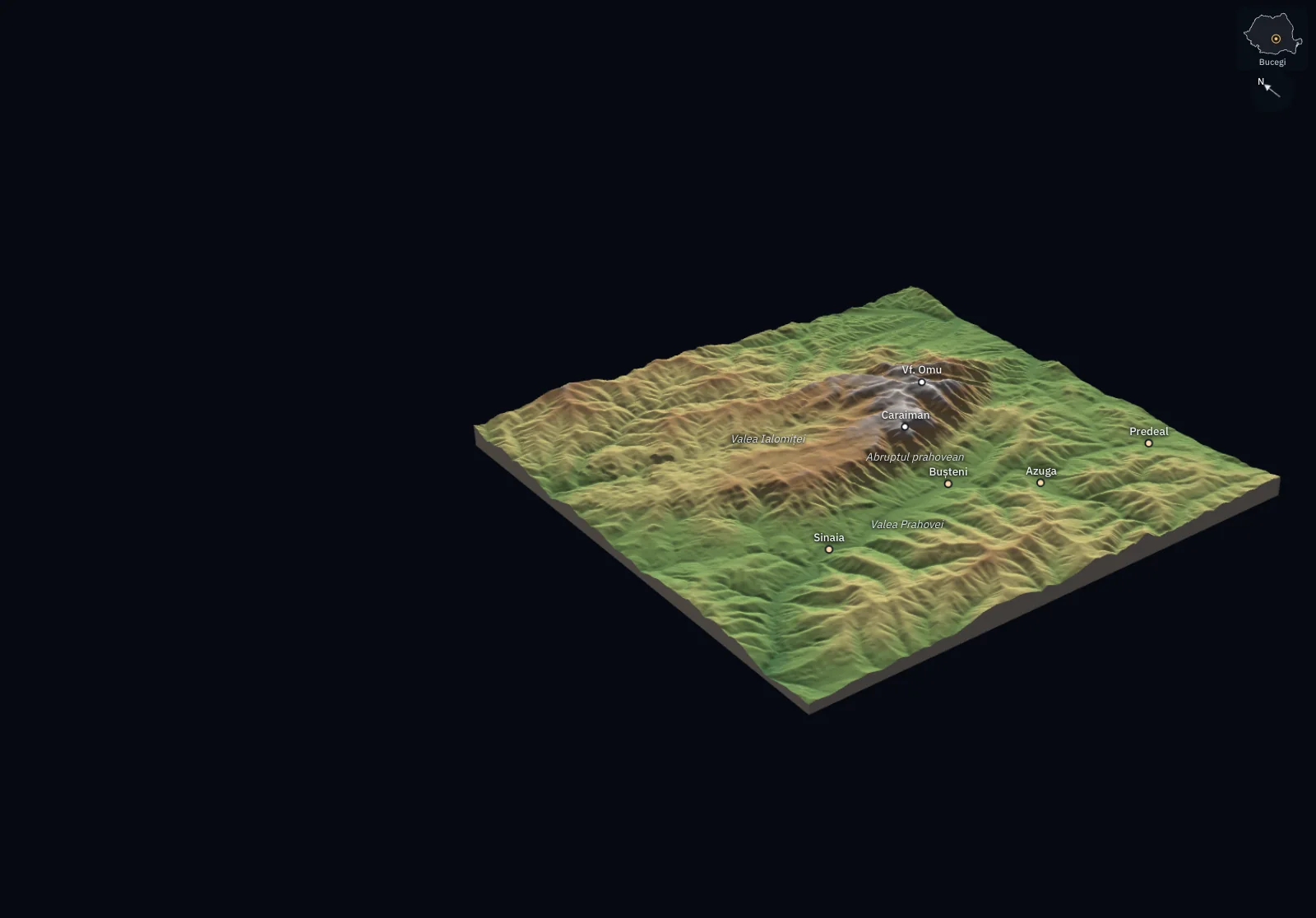
The Romanian Carpathians are mountains of medium height: their average altitude is 840 m, and ridges above 2,000 m occur mainly in the Southern Carpathians. This arrangement means that almost every county has farmland, pasture, forests and water within reach.
In brief
- Relief is the whole range of forms on the surface of Earth’s crust; the largest are continents and ocean basins.
- The hypsographic curve shows how much of Earth’s surface lies at each altitude and depth; it has two broad levels: land between 0 and 1,000 m and ocean floor between 3,000 and 6,000 m deep.
- The major continental landforms are mountains (above 1,000 m, steep slopes), plateaux (high, level surfaces), hills (between 200–300 m and 1,000 m, rounded summits) and plains (below 200–300 m, level).
- Ocean basin relief includes the continental shelf (down to about 200 m), the continental slope, abyssal plains (3,000–6,000 m), ridges and trenches (deeper than 6,000 m).
- Mount Everest is 8,849 m high, the Mariana Trench reaches about 10,935 m deep, and ocean ridges together are almost 65,000 km long.
- In Romania, relief is proportionate (31% mountains, 36% hills and plateaux, 33% plains), and the maximum altitude is 2,544 m at Vârful Moldoveanu.
Common mistakes
WrongA place at high altitude must have steep slopes.
RightAltitude and slope are different measurements. The Tibetan Plateau averages over 4,500 m and has extensive, almost level surfaces.
WrongThe ocean floor is flat, and its deepest point is in the middle.
RightRidges, chains of underwater mountains, run through the middle of oceans. Trenches, the deepest places, lie at their edges.
WrongAny landform above 1,000 m is a mountain.
RightThe thresholds are guides. An extensive, level surface at 1,500 m is a plateau; a mountain has ridges, steep slopes and deep valleys.
Test yourself
Six questions. For the first five you see the explanation at once, with the paragraph of the lesson that supports it; for the ones with a written answer you compare with a good answer.
What does the hypsographic curve show?
Answer
b) How much of the planet’s surface lies at each altitude and depth. The hypsographic curve graphs the distribution of the planet’s surface by altitude and depth.
A research vessel measures a long, narrow trough 8,000 m deep at the edge of the Pacific Ocean. What landform is it?
Answer
a) A trench. Trenches are narrow troughs deeper than 6,000 m at the edges of oceans. Abyssal plains are flat and usually stop at 6,000 m.
A region has an almost level surface, lies at 1,400 m altitude and is cut by a few deep valleys. What is it?
Answer
c) A plateau. A high, level surface and deep valleys are signs of a plateau. Altitude alone does not decide the type of landform.
What is the correct order of landforms from the coast towards the open ocean?
Answer
d) Shelf, continental slope, abyssal plain. The shelf extends the continent under shallow water, the slope drops steeply, and the abyssal plain begins at its foot.
On a globe with a radius of 300 mm, how many millimetres high would Everest (8.849 km) be? Earth’s radius is 6,371 km.
mmAnswer
0.42 mm. 300 mm ÷ 6,371 = 0.0471 mm per kilometre; 8.849 × 0.0471 = 0.42 mm.
The Bărăgan Plain and the Tibetan Plateau both have extensive, level surfaces. Explain why one is a plain and the other a plateau, and say which is better suited to agriculture and why.
A good answer
Bărăgan is a plain because it is low and has shallow valleys. Tibet also has level surfaces, but averages over 4,500 m, so it is a plateau. Bărăgan is better suited to agriculture: at low altitude it is warmer and plants have time to grow, while above 4,000 m it is cold almost all year.
A complete answer distinguishes the two landforms by altitude, identifies their shared level surface and links altitude to climate and land use.
Terms
- relief
- All the forms (raised areas, level surfaces and hollows) on the surface of Earth’s crust.
- altitude
- The height of a point on land measured relative to sea level.
- hypsographic curve
- A graph showing how much of Earth’s surface lies at each altitude and depth.
- plateau
- A landform with an extensive, level or gently rolling surface at altitude, cut by deep valleys.
- continental shelf
- The gently sloping extension of a continent beneath shallow water, to about 200 m deep.
- abyssal plain
- An almost flat expanse of ocean floor, usually between 3,000 and 6,000 m deep.
- mid-ocean ridge
- A chain of underwater volcanic mountains formed where tectonic plates move apart.
- ocean trench
- A long, narrow trough in the ocean floor, deeper than 6,000 m, where one tectonic plate slides beneath another.
Sources and link to the programme
- BBC News – Mt Everest grows by nearly a metre to new height – Everest’s altitude announced by Nepal and China in 2020: 8,848.86 m
- NOAA National Ocean Service – How deep is the ocean? – mean ocean depth (3,682 m) and depth of the Mariana Trench at Challenger Deep (about 10,935 m)
- NOAA National Ocean Service – How much water is in the ocean? – the ocean covers over 70% of the planet’s surface
- NOAA National Ocean Service – What is the mid-ocean ridge? – length of the ridge system, almost 65,000 km
- Wikipedia – Abyssal plain – abyssal plains, between 3,000 and 6,000 m deep, the most extensive landform
- Wikipedia – Continental shelf – shelf edge, at an average depth of about 140 m
- Wikipedia – Hypsometry – the hypsographic curve and its two levels, linked to the different densities of continental and oceanic crust
- NASA – Earth Fact Sheet – Earth’s mean radius, 6,371 km
- Wikipedia – Tibetan Plateau – mean altitude of the Tibetan Plateau, over 4,500 m
- Institutul Național de Statistică – România în cifre 2017 (copie arhivată) – proportions of relief levels in Romania (31% mountains, 36% hills and plateaux, 33% plains and floodplains), their concentric arrangement, Vârful Moldoveanu 2,544 m
- Wikipedia – Relieful României – mean altitude of the Romanian Carpathians (840 m)
From the programme: “Major landforms of Earth” (common core). Programme competences covered: 1.1, 2.2.