Barcelona · Eixample · 1859–2026
Barcelona planned gardens inside its blocks. It put a roof on them.
In 1859 the engineer Ildefons Cerdà drew a new city of identical blocks, built along their edges with open middles. Spain's cadastre now shows, building by building, what became of them: across 470 of the grid's blocks, 73.8% of the ground is built at street level. From the first floor up, only 54.7%. The difference is built a single storey high, and four fifths of it stands inside the block, more than 15 metres from the street.
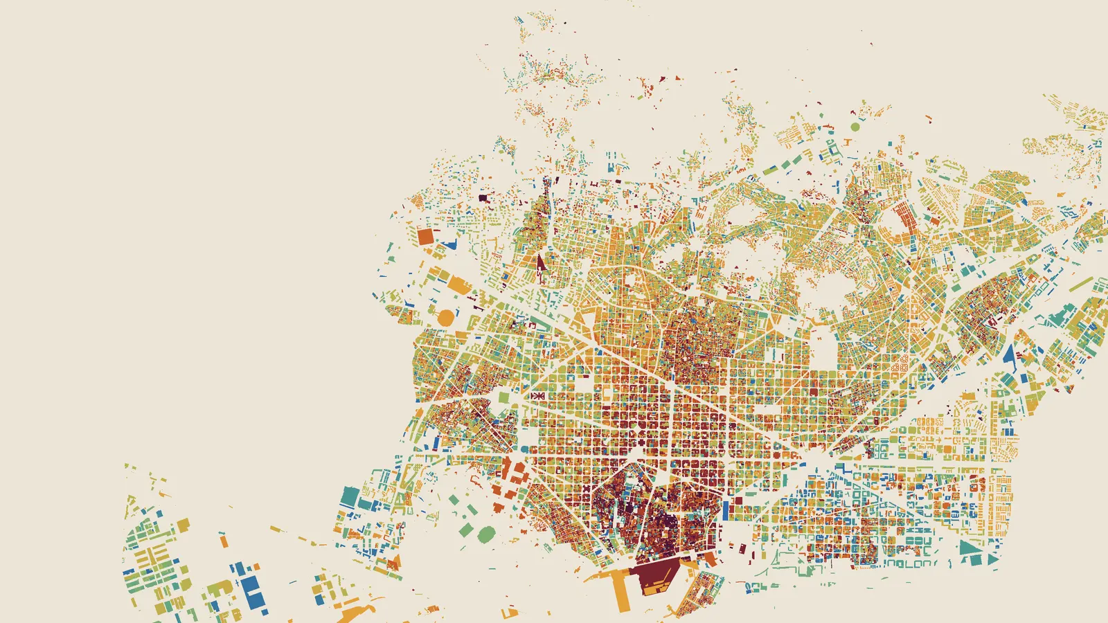
A city of identical blocks, built only along their edges
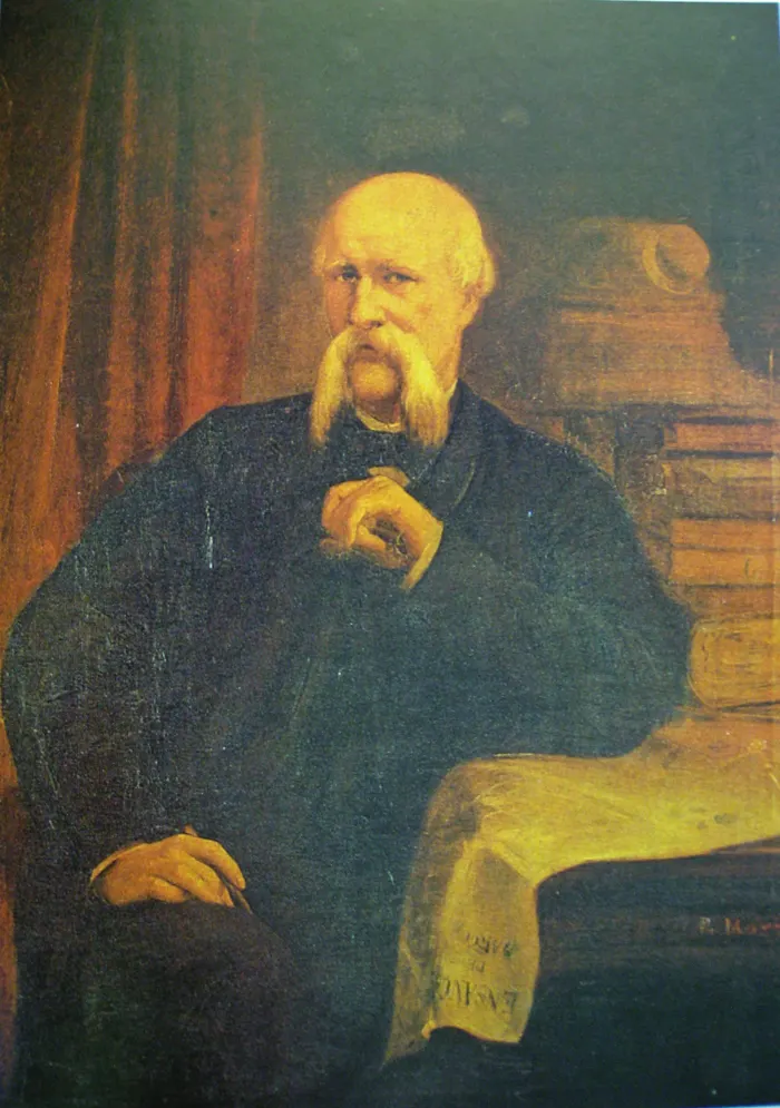
Barcelona began pulling down its medieval walls in 1854. On the open ground between the city and the villages around it, Gràcia, Sants, Sant Martí, Ildefons Cerdà drew a grid of straight streets and identical blocks, about 113 metres a side, with their corners cut off.
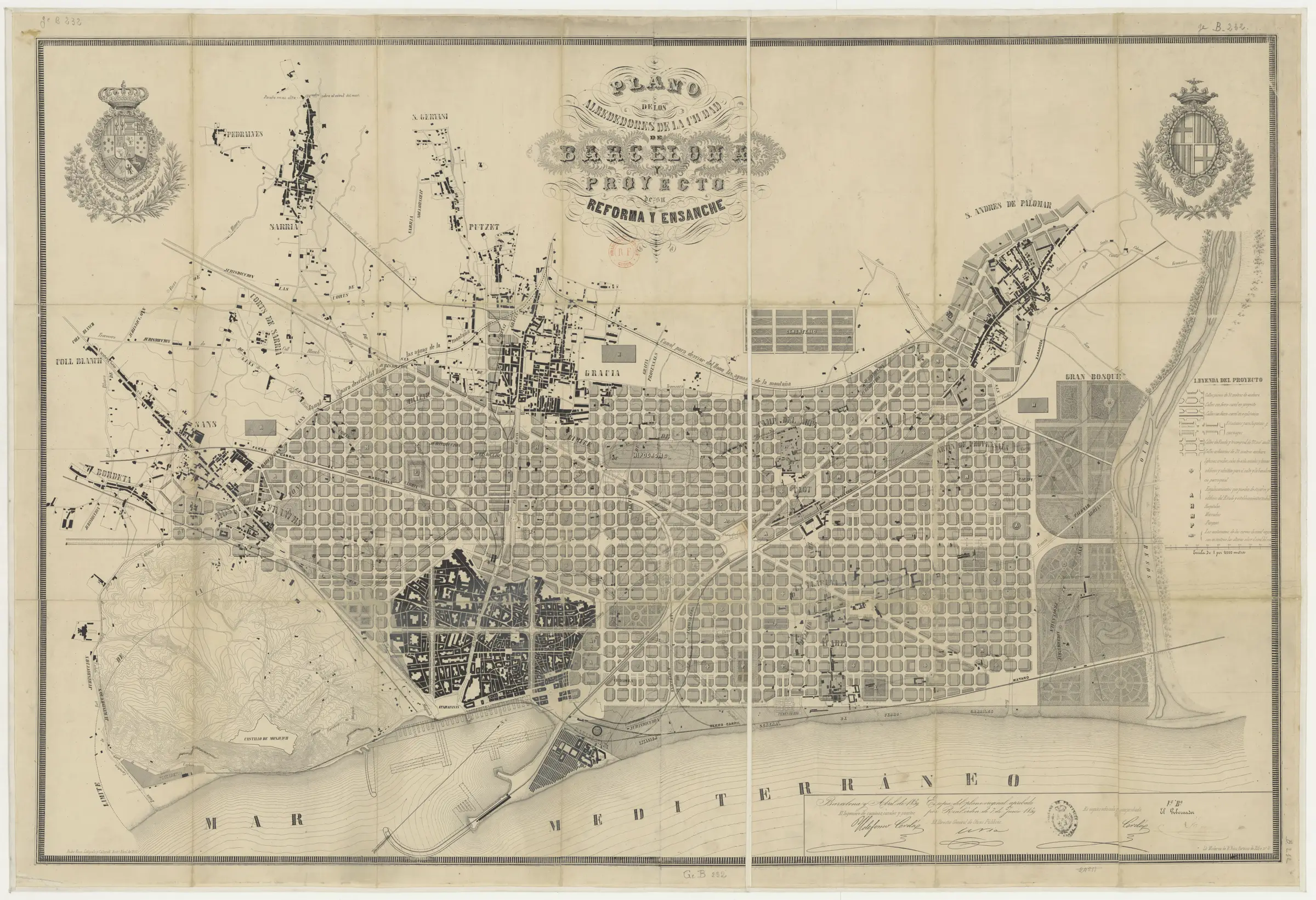
Madrid approved his plan by a royal order of 7 June 1859, with changes written into the order: buildings in the new district were not to exceed “16 metres in any case”, and there were to be more large blocks and more parks, the parks “especially in the zone where building is shown most condensed”. The city council had run its own competition, won in October 1859 by the architect Antoni Rovira i Trias. A royal decree of 31 May 1860 let owners build to Cerdà's plan; the minister's exposition that accompanied it described the council's competition as held “without favourable result”.
On the plan signed in April 1859, buildings occupy strips along the edges of the blocks, usually on two opposite sides, sometimes three. The middle of every block stays open.
)_-_btv1b532454437.jpg)
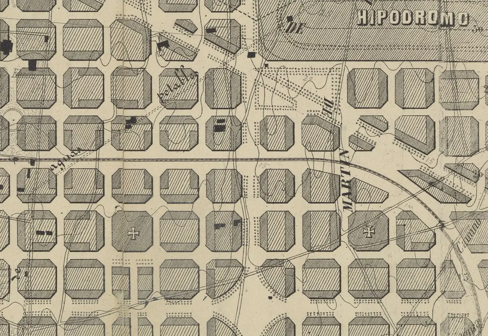
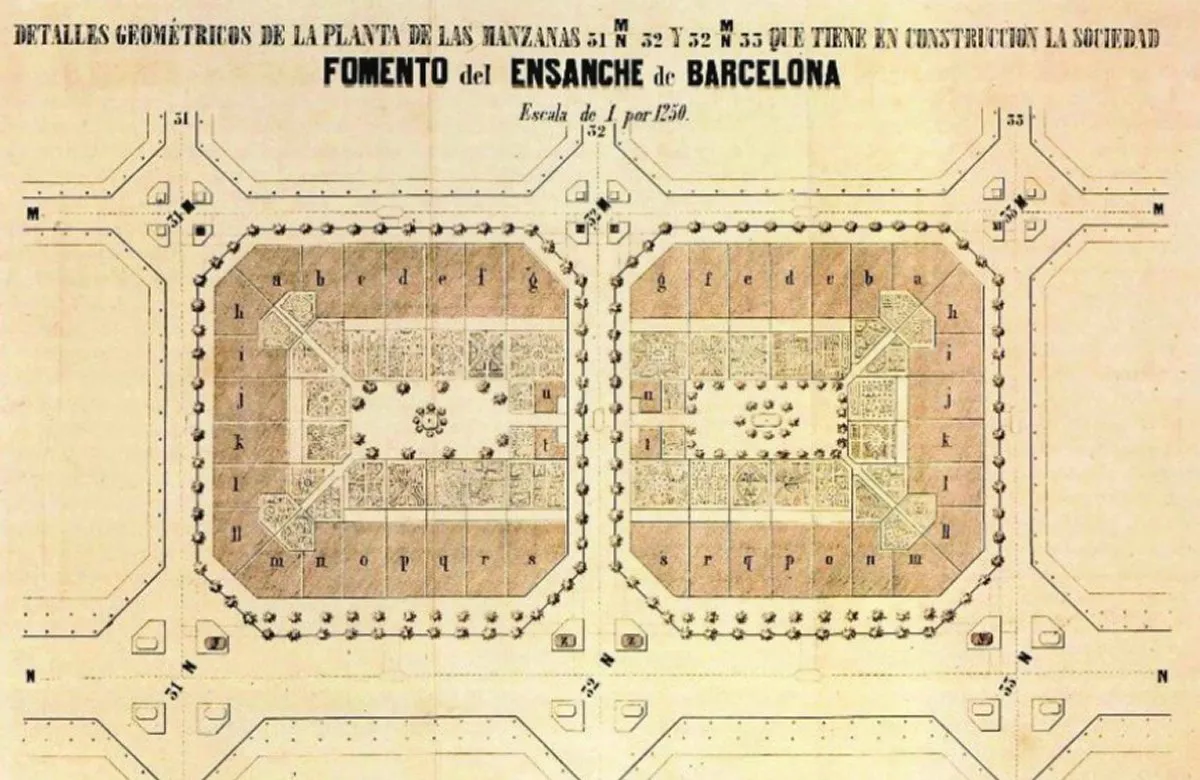

Blocks under construction by 1863 already looked different. A drawing of that year, titled “geometric details of the plan of the blocks […] that the Fomento del Ensanche de Barcelona company has under construction”, shows two blocks closed on all four sides, with a garden with paths in the middle.
Four years to a closed perimeter
- 1859 The plan: buildings in strips along the edges, the middle open.
- 1863 Blocks under construction: the perimeter closed on all four sides, the garden still in the middle.
- 1891 The ordinances: the garden may be built on, one storey high.
Cutting the city at the first floor
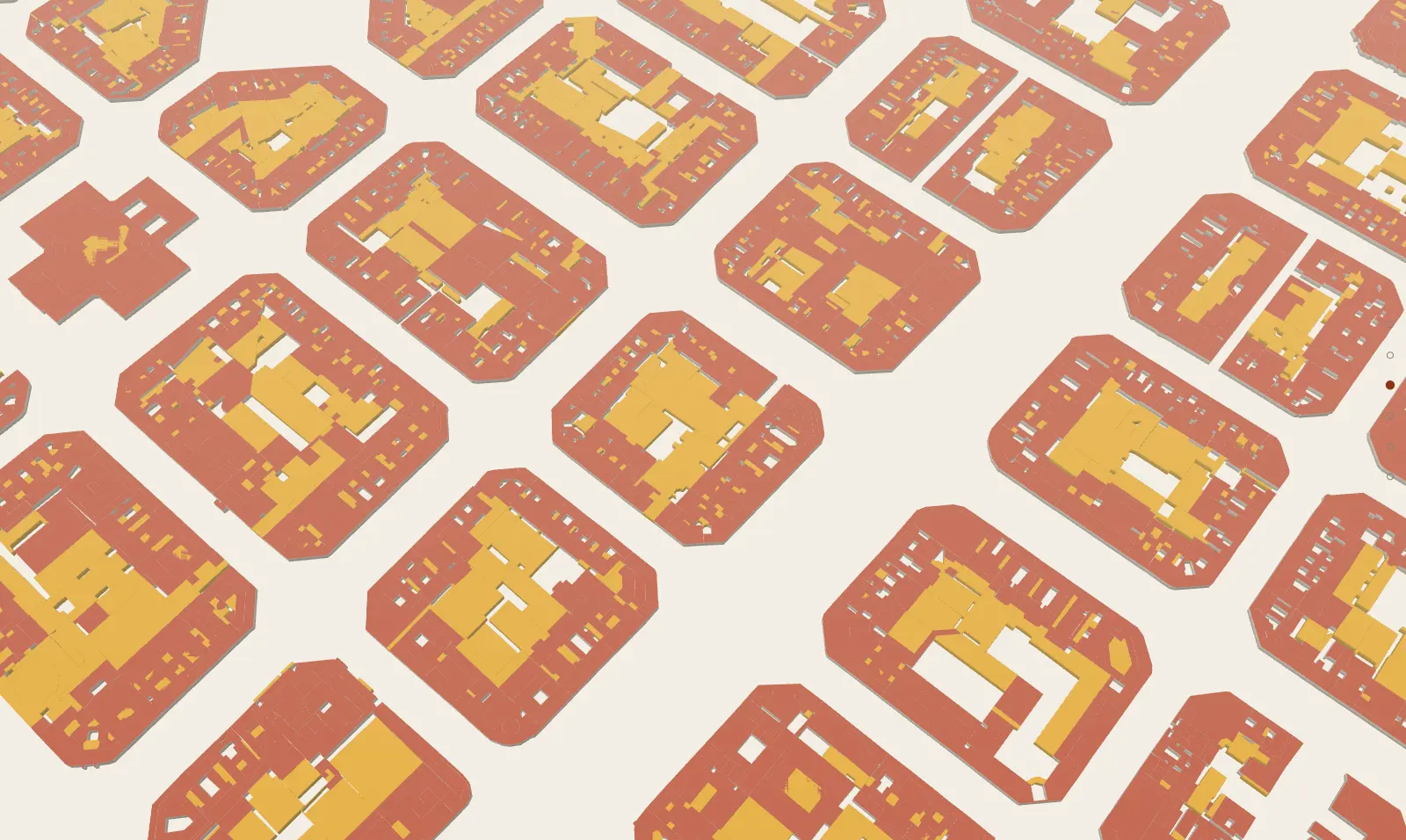
Spain's cadastre publishes every building in Barcelona with its exact footprint and the number of storeys of each of its parts: 319,559 parts in the August 2026 release. Raised to their height, the parts around Cerdà's grid look like this.
Seen in section, a typical block keeps its courtyard only from the first floor up: at ground level most of the middle is built. Four blocks in five look like this: in 375 of the 470, built cover falls by more than 10 percentage points between the ground floor and the first floor.
Drag to turn. Tap a block to see its profile.
buildingsingle storeycontinues higherselected block
1860 2026
The grid in 2026
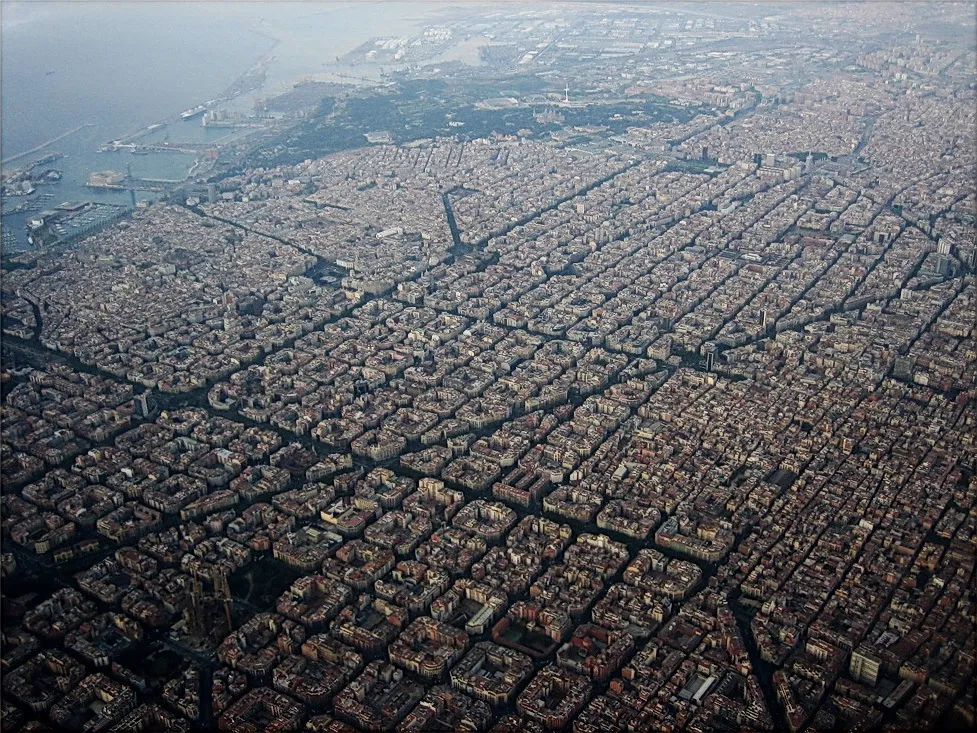
These are 470 of Cerdà's blocks, the ones regular enough to measure one by one, with everything built on them. From above you see a continuous wall of façades, six to ten storeys high.
The Casa Batlló block
On Passeig de Gràcia, the block of Casa Batlló and Casa Amatller. From the street, nothing shows what is in the middle.
Cutting everything above the ground floor
Red marks the buildings that rise higher. Everything else stops at the ground floor. The middle of the block is not empty: it is almost full.
The courtyard has a roof
Yellow is built on a single storey. At ground level 90% of the block is covered. At the first floor, 58%. The courtyard in Cerdà's plan exists, but only from the first floor up.
The whole grid
Across the 470 blocks: 73.8% built at ground level, 54.7% at the first floor. Of the footprint built at ground level, 25.8% stops at the ground floor.
When it was built
Colour shows the cadastral year. A third of today's floor area, 34%, stands in buildings dated 1960–1979. Only 4.4% is in buildings older than 1900.
Where the gardens came back
Green: the 41 grid blocks where the city's register lists a public interior garden. The other 429 have no entry in the register.
Pick a block
Tap any block to see its profile, floor by floor. The controls below cut the city at any floor or stop it in any year.
How much of the block is built, from the ground up
The gap between the first two bars, 19 percentage points, is 110 hectares of building footprint that stops at the ground floor. Above it the grid rises as a block: 69% of the footprint of buildings taller than the ground floor has six to ten storeys.
The cadastre dates a third of today's floor area to 1960–1979
By cadastral year, today's buildings on the grid are younger than their façades suggest. Those with a cadastral year between 1960 and 1979 hold 34% of the floor area; those dated 1900–1919 hold 14%.
How the block filled up, rule by rule
The courtyard was not lost at once. Each set of rules let a little more be built.
- 1859
The royal order approving Cerdà's plan caps buildings at 16 metres and asks for more parks.
- 1863
The first blocks under construction, by the Fomento del Ensanche company, are already closed on all four sides, with the garden in the middle.
- 1891
The municipal ordinances allow building on 73.6% of the area of each block larger than 10,000 m² (80% on smaller ones). On the rest, in the interior, they admit “only covered constructions under a single roof”, at most 4.40 metres high. The ordinances expressly allow a roof over the courtyard. Footnotes refer these articles to a mayoral edict printed on page XXXV of the same edition, a page missing from the digitised copy.
- 1932
New ordinances allow 23 metres on streets 20–30 metres wide: ground floor and six storeys. A doctoral thesis from the Polytechnic University of Catalonia also dates to this ordinance the right to build the courtyard up to 5.5 metres.
- 1942–1975
The so-called “congestive” ordinances. A 2021 study attributes the 5.5-metre courtyard to them rather than to the 1932 ordinance.
- 1947
On streets 20–30 metres wide, height reaches 24.40 metres: ground floor and six storeys.
- 1976
On standard 20-metre streets, the Metropolitan General Plan lowers the height to 20.75 metres.
- 1987
The city begins recovering block interiors as public gardens.

The gardens coming back
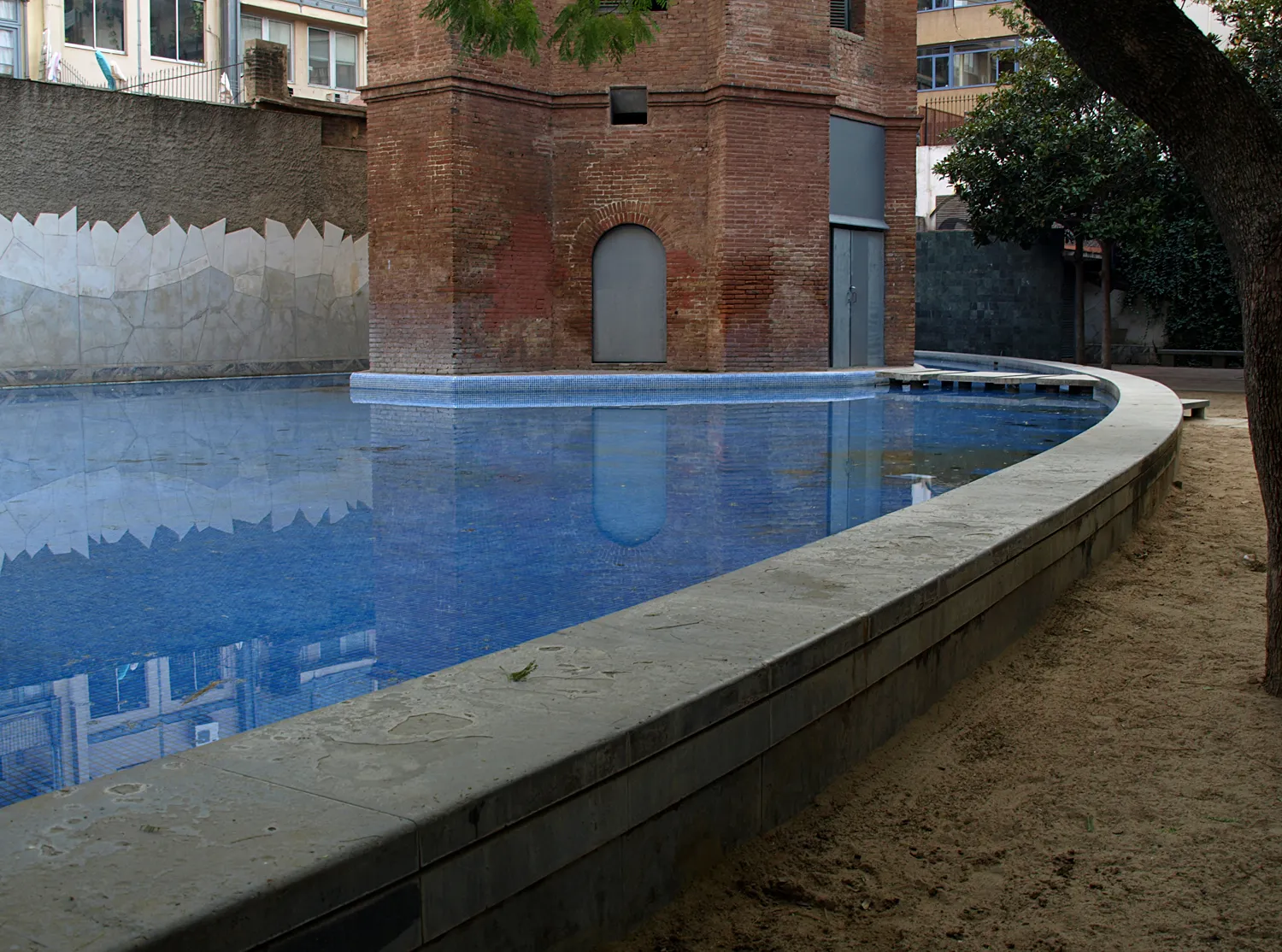
Since 1987 the city has been recovering block interiors and opening them as public gardens. The Eixample district's own page counts 45, with three more on the way, and states the aim: a green space less than 200 metres from every home.
The city's official register of interior-block gardens, with coordinates, holds 59 records citywide. Placed on the same grid, 43 of them fall in 41 of the 470 blocks measured here; the rest are in Eixample blocks not measured here or in other districts. In the 41 blocks with a public garden, median ground cover is 77%; in the others, 83%. This compares today's geometry; it does not measure what recovery changed before and after.
Single-storey building footprints cover 110 hectares of the analysed grid, about twice the 54.8 hectares of urban green space the city counts for the whole Eixample district in 2022. They are buildings, not empty yards: only some stand where the plan left the courtyard open, and only some could ever become gardens.
One block interior, seen in depth: Marina 155.
How this was measured
The buildings come from the Spanish cadastre's INSPIRE dataset for Barcelona, August 2026 release: 69,911 buildings citywide, split into 319,559 parts, each with its number of storeys above ground, ground floor included. The 470 blocks analysed contain 10,094 buildings and 46,930 parts. Floors below ground are not counted.
The blocks are the cadastre's “manzana” polygons, in ETRS89 / UTM zone 31N, in metres; polygons larger than 4 hectares are excluded first. A grid with a 134-metre pitch, rotated 44.35 degrees, is fitted to the regular blocks; each polygon goes to the cell containing its centroid, and the polygons of a cell are joined. A cell counts as a Cerdà block if its minimum bounding rectangle is oriented at 42.5–46.5 degrees with sides between 85 and 175 metres, its area is 8,000–21,000 m², and it fills at least 88% of that rectangle. That leaves 470 blocks (55 joined from several polygons), covering 577 hectares. Blocks cut by the Diagonal and many in Poblenou, where the shapes are irregular, are left out. A typical block measures 114 metres a side.
Built at a level means the union of every part that reaches at least that level, clipped to the block outline; light wells inside a part stay open. The footprint that stops at the ground floor is the ground covered at ground level minus the ground covered at the first floor. “More than 15 metres from the street” means inside the block outline shrunk by 15 metres in every direction, corners included: 86.9 of the 110 hectares (79.0%). The three-dimensional view uses 3.4 metres per storey for drawing only.
The year is the cadastre's “dateOfConstruction” field, which takes the date of the oldest unit recorded in the building. It is useful for periodising today's building stock, not for dating historical fabric precisely: some values may reflect reconstruction, several buildings grouped in one record or other recording conventions, and some are round estimates (6,465 buildings carry exactly 1900, 4,411 exactly 1936). Santa Maria del Mar, a fourteenth-century church, receives 1834. On well-known buildings the year fits: Casa Milà 1910 (built 1906–1912), Palau de la Música 1908 (1905–1908), Torre Glòries 2004.
The 470 blocks, with every value derived here, can be downloaded: CSV · GeoJSON.
Sources
- Gaceta de Madrid, 17.6.1859, núm. 168: Real orden de 7 de junio de 1859: boe.es/datos/pdfs/BOE//1859/168/A00001-00001.pdf
- Gaceta de Madrid, 1.6.1860, núm. 153: Real decreto de 31 de mayo de 1860: boe.es/datos/pdfs/BOE//1860/153/A00001-00001.pdf
- Ordenanzas municipales de la ciudad de Barcelona, 1891, arts. 161–165 (Arxiu Municipal, BCNROC): bcnroc.ajuntament.barcelona.cat/jspui/bitstream/11703/96468/…
- Zaar, M.-H. & García Ávila, M. (2021), Anales de Geografía de la Universidad Complutense 41(2), pp. 509–531: revistas.ucm.es/index.php/AGUC/es/article/download/79347/456…
- Ajuntament de Barcelona, Districte de l'Eixample: Interiors d'illa: ajuntament.barcelona.cat/eixample/ca/coneixeu-el-districte/i…
- Dirección General del Catastro: INSPIRE Buildings, Barcelona (08900), agosto 2026: catastro.hacienda.gob.es/INSPIRE/buildings/08/ES.SDGC.bu.ato…
- Dirección General del Catastro: INSPIRE Cadastral Parcels (manzanas), Barcelona: catastro.hacienda.gob.es/INSPIRE/CadastralParcels/08/ES.SDGC…
- Dirección General del Catastro: Conjuntos de datos INSPIRE (definición de dateOfConstruction): catastro.hacienda.gob.es/webinspire/documentos/Conjuntos%20d…
- Viquipèdia: Pla Cerdà (mides de l'illa, concurs de 1859): ca.wikipedia.org/wiki/Pla_Cerd%C3%A0
- Dos Santos Sá, M. (2012), tesi doctoral, UPC: ordenança de 1932 (pati fins a 5,5 m, 23 m d'alçada): upcommons.upc.edu/bitstreams/a2a4443e-4b99-4cf4-b31f-3041176…
- Alhussin (UB), transcripció de les ordenances de 1932, 1942 i 1947 (art. 372): diposit.ub.edu/server/api/core/bitstreams/617d59a0-ad76-4c4b…
- Open Data BCN: Jardins d'interior d'illa (coordenades): opendata-ajuntament.barcelona.cat/data/dataset/616810d8-a7a8…
- Ajuntament de Barcelona, Portal de dades: superfície de verd urbà per districte, 2022: portaldades.ajuntament.barcelona.cat/es/estad%C3%ADsticas/bl…
- Arxiu Municipal de Barcelona: L'enderroc de les muralles, 1843–1854: ajuntament.barcelona.cat/arxiumunicipal/arxiucontemporani/ca…
Images
- Ildefons Cerdà, 1859 · public domain · Bibliothèque nationale de France / Wikimedia Commons
- Ildefons Cerdà, 1863 · public domain · Wikimedia Commons
- Ramon Martí i Alsina, 1878 · public domain · Wikimedia Commons
- Alhzeiia, 2007 · CC BY-SA 2.0 · Wikimedia Commons
- Mutari, 2008 · public domain · Wikimedia Commons

