BUCHAREST · 23 MARCH 1847
The Great Fire of 1847
On Easter Sunday a child fires a pistol in the courtyard of the Drugănescu house, by Saint Dumitru church. The austru wind carries the spark across the shingle roofs and, for three days and three nights, the commercial heart of the town burns: 1,850 buildings, 12 churches, 20,000 people homeless. Surveyors measured the burn at 158,730 square fathoms and drew it on a plan — we laid that plan over today's map.
In short: the fire started at noon on Strada Franceză and spread east from the Drugănescu house area to beyond Lucaci and Ceauș Radu. Georgescu describes the extent as a “triangular zone with its apex at the house in question”. Manuc's Inn survived, Bărăția burned first, and the town rebuilt itself under three new building circuits. Below you can look up your street and see whether yours burned.
See the burn map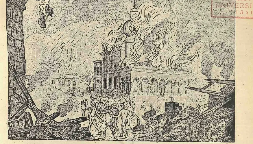
The burn map
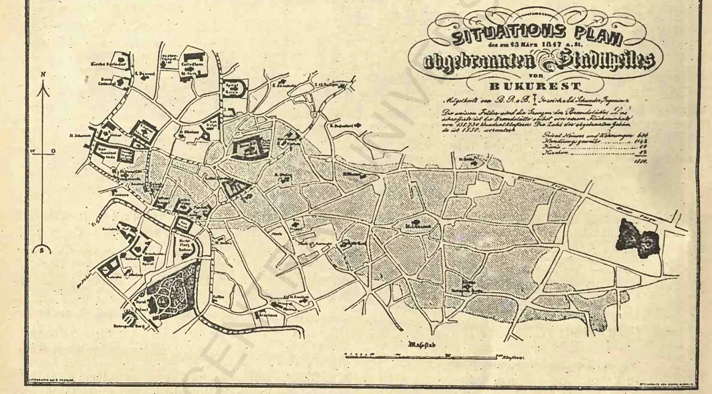
The red patch is the burn surveyed by Borroczyn and Schweder in the days after the fire, laid over today's streets: 62 points picked off the plan's hatching. The star is the spark — the Drugănescu house by Saint Dumitru. The “1847 plan” button lays the plan reproduction underneath.
The red outline follows the plan's hatching; the georeferencing error is under 100 m.
- Burned zone (after the 1847 plan)
- Place with verdict
- Your street
The spark
Easter noon, Strada Franceză: a pistol shot fired by a child in the courtyard of the Drugănescu house, by Saint Dumitru. The star marks the spot — the house the fire was about to start from.
The Sunday
The austru pushes the fire east across Lipscani, Bărăția, Saint Gheorghe. By evening, Crutzescu writes, Strada Franceză is “a river of fire”. The red patch is everything the surveyor measured: from Saint Dumitru to past Ceauș Radu.
The places
Eleven places with verdicts: Bărăția burned first, Saint Dumitru never caught — “though round about it the fire still burned” — and Manuc's Inn stands on the southern edge. Green dots survived, red ones burned.
The plan
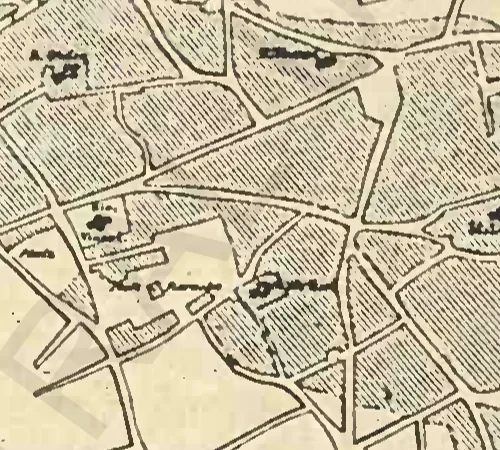
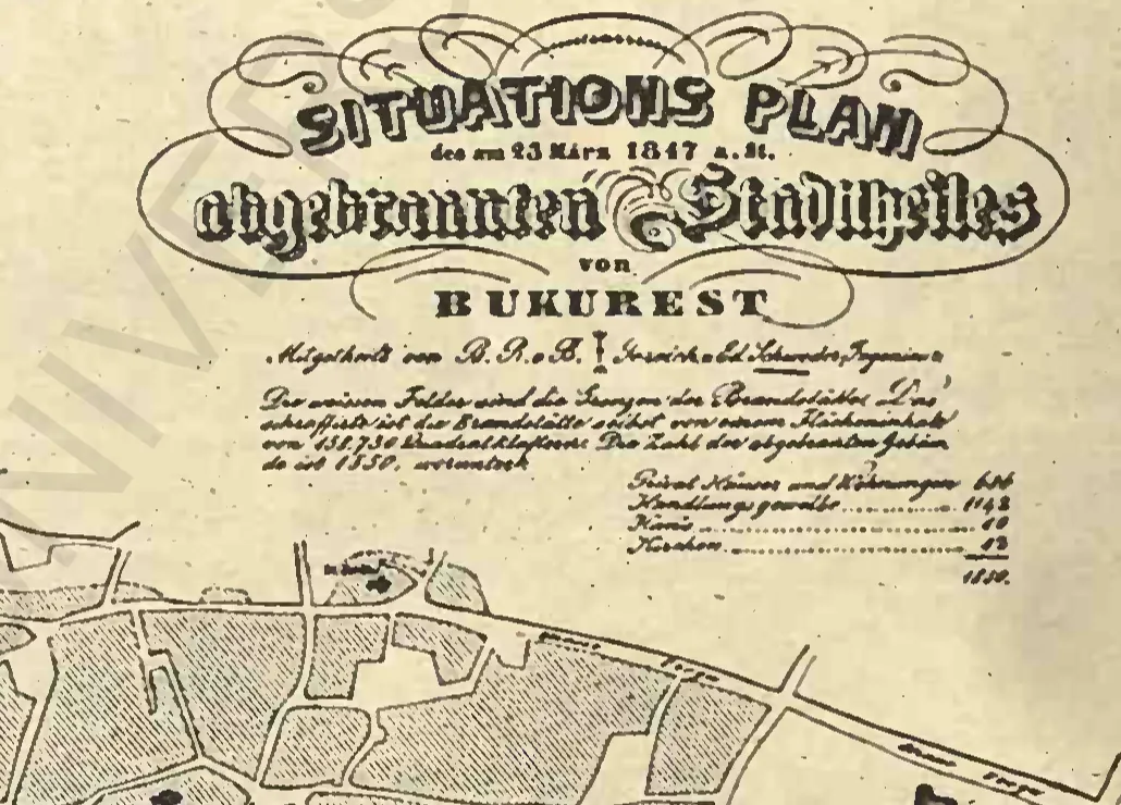
The Situations Plan — the burn drawn by Major Borroczyn with Edward Schweder, lithographed by Weiner. Its hatching is the source of the red polygon; its cartouche figures, 686 + 1,142 + 10 + 12, are the official toll.
The polygon is the burn the surveyors measured in April 1847, not a reconstruction: 66.9 gross hectares, streets and squares included. The dots give each place's verdict — masonry buildings inside often survived, as Mântuleasa church did amid the embers.
Why a whole town burned in a day
Three things burned Bucharest in 1847: timber, crowding, and wind.
The town was wood and shingle: houses with timber ceilings, shops leaning on one another, shingle roofs that caught sparks like tinder. In the commercial centre — Lipscani, Bărăția, Saint Gheorghe — the shops and houses stood “very crowded”, Georgescu writes; the fire leapt from roof to roof without touching the ground.
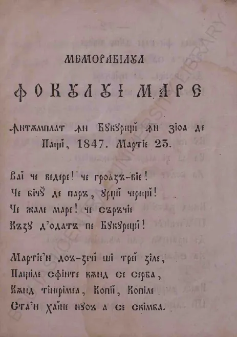
The wind was called the austru: the “stormy breath of the austru”, in the Vestitorul's words, fed the fire from its first hour. Pann, who saw the fire, shows it swelling “with dread” and flinging flames across nine houses at once. Its direction drew the map: east and north, in two bands — one “to Delea, eastward”, one marching “dreadfully north”.
And firefighting meant buckets and hand pumps: the tulumbagii and the garrison soldiers stopped the ruin from swallowing the whole town, but in the outlying quarters, with houses scattered across wide yards, the fire mostly stopped by itself, “having no more fodder”. Only decades later would the Fire Watchtower rise.
The three days, in turn
The spark, the wind, and the ashes: three chapters from the Vestitor, Pann, Georgescu, and Severeanu.
The spark: a pistol fired at Easter
The house of the Drugănescu lady, Strada Franceză, by Saint Dumitru — and the children's custom of firing pistols on feast days.
The fire broke out “at one hour past noon”, the Vestitorul românesc writes, from the house of the Drugănescu lady, by the Buzău diocese metoh at Saint Dumitru church. In C. Mano's account a pistol shot fired by the Drugănescu boy set the house alight; firing gunshots at Easter was the local children's custom. Crutzescu keeps the family version: the 11-year-old boy, Costache, had made a pistol from a large key filled with gunpowder — it went off by the drawing-room windows, the curtain caught, from the curtain the timber ceiling, and soon the whole house was burning.
The hours do not agree, and we leave them disagreeing: the eleven-o'clock toaca called the midday service, the alarm — the bells — sounded at 12, and the Vestitorul sets the outbreak “at one hour past noon”. Three hours from three mouths: the service, the alarm, and the fire turning great. What is certain is that the wind was already blowing a gale when the shingle caught.
The wind: three days and three nights
The austru spreads the fire east — Vergu, Lucaci, Udricani — and the town burns until nothing is left to burn.
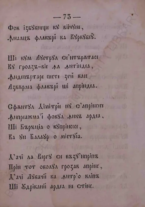
By Sunday evening the whole centre was alight: “Strada Franceză is a river of fire seizing the quarter, then the neighbouring quarters”, Crutzescu writes. Pann strings the advance in verse: “And Bărăția it seized, and swallowed it like a dragon. Thence to Vergu it was seen hastening, through the whole circuit dreadfully ablaze, thence Lucaci in a trice, and Udricani burned unquenched.” The first church devoured was Bărăția; Saint Dumitru, where it all began, “never caught — though round about it the fire still burned”.
The fire lasted “three days and three nights” and died out by itself at the town's edge, where scattered houses gave it no fodder. 1,850 buildings burned — 686 houses, 1,142 shops, 10 inns, and 12 churches — and 20,000 people were left homeless. Fifteen died, all named in the Vestitor: Agatia with Maria and her two children (Stelea church), dragoman Balotă with Ana, 8-year-old Irina and Dumitru (Papazoglu Inn), priest's wife Ioana (Old Saint Gheorghe), the shoemaker's journeyman Ioan, the cook Catinca with Manda, Ilinca and an unknown woman (Lucaci quarter) and the innkeeper Stan (Ceauș Radu quarter).
The fire's southern line passes by Manuc's Inn: the masonry inn stands to this day, and Strada Franceză burned only on its left side. Colțea in the north and Stavropoleos in the west likewise sit on the margin — the austru pushed the fire east, not back toward Podul Mogoșoaiei.
Agatia · Maria + 2 children · Balotă · Ana · Irina (8) · Dumitru · Ioana · Ioan · Catinca · Manda · Ilinca · one unknown · Stan
After: circuits, alignments, and injustice
The town rebuilds under three circuits with new rules — and the money reaches the mighty first.
Relief came slowly and was shared crookedly. Prince Bibescu opened the list with 6,000 gold coins, the authorities were assessed 2,200,000 lei, and 3,560 people subscribed 3,489,370 lei; in the end the 1848 Catalogue counts 2,887 victims aided with 3,195,759 lei. But the grants “ranged from 4,000 lei down to 150”, Georgescu writes — and a kila of wheat cost 115 lei. Some had their awards raised through connections, from 300 to 3,500; a few poor craftsmen never came to collect their money, “far too little”, giving their refusal “the character of a protest against the partial spirit in which the sharing had been done”.
Meanwhile the Council divided the burned town into three circuits, with building rules per circuit — the decision traces them by landmarks, “from Podul Mogoșoaiei, behind Crețulescu church, to the bridge over the Dâmbovița, along the water, through Piața Mare and by Hagi-Moșu, back again”, so we give it verbally, as written. In the First Circuit gunpowder shops, smithies, coppersmiths, lime-kilns, and spirit stores vanished altogether; in the Second, half-timbering was pardoned only “after solid construction, with all timber buried in masonry”; wood and shingle stayed free only in the Third. The streets kept their direction but were widened by alignment — and the Saint Gheorghe Nou and Pușcăriei squares were drawn after Baron Borroczyn's plan.
That same Borroczyn — the officer who had surveyed the burn — would raise between 1847 and 1852 the first systematic plan of the capital, the Museum's “wonderful plan” in three sheets. You will meet it again at The causeways of Bucharest, as the 1852 Borroczyn plan: first he drew the burned town, then the whole town.
Did your street burn?
Type your street and number: the page has pre-measured, for 4,878 streets and 113,584 addresses, which fall inside the burn polygon — 722 of today's addresses are inside. The verdict is the zone's, not the building's: masonry houses inside often survived.
At Strada Covaci in the burned zone
19 of 19 numbers in the burned zone. The verdict is the zone's: masonry buildings inside often survived.
Numbers on the street
Points are from OpenStreetMap (September 2026); the polygon is the burn surveyed in April 1847. “On the margin” means within 100 m of the fire line, outside. If your number is missing, write to us.
Seven streets, seven verdicts
- Strada Covaci — wholly burned: 19 of 19 numbers in the burned zone, in the heart of the burned market.
- Strada Lipscani — half burned: 28 of 55 numbers in the burned zone — “from Picollo onward”.
- Strada Traian — burned at its end: 6 numbers in the burned zone, from 106 up, toward Călărași.
- Strada Bărăției — 7 numbers in the burned zone, around the church that burned first.
- Strada Franceză — on the margin: only its left side burned; no present-day number falls in the polygon.
- Calea Moșilor — outside: the fire never reached the Outer Fair road.
- Calea Victoriei — outside: the austru pushed the fire east, not toward Mogoșoaiei.
Method: what we measured and what we left out
We took the burn plan — Borroczyn and Schweder, the Weiner lithograph as reproduced by Severeanu in 1932 — and picked its hatching outline by hand, 62 points on grid strips, after an automatic trace failed. Then we laid the plan over today's map with 13 witness churches, checked one by one on images: the mean error is 41 m, the worst, at junctions, 96 m. The red outline is thus the surveyor's line, not ours — we only laid it over today's streets.
The finest check is the arithmetic: our polygon gives 66.9 gross hectares, streets and squares included, while the surveyors' 158,730 square klafters give some 57 hectares of parcels — the gap of about 15% corresponds to the streets and squares. Georgescu describes the burn as a “triangular zone with its apex at the house in question”; the polygon here follows the plan's hatching rather than reconstructing that triangle separately.
What we left out: the First Circuit's boundary, which the Council gives by landmarks (“behind Crețulescu church… through Piața Mare”), so we give it verbally, not drawn; the Paris reckonings in francs, where the fire arrived only as two lines of news via Vienna; Marin's plan of the burned sector, cited but unseen by us; and the exact year the yards returned — the losses were reckoned in lei, piastres, and gold coins, and we left each in its source's currency.
| Private houses and dwellings | 686 |
| Shops | 1,142 |
| Inns | 10 |
| Churches | 12 |
| Burned buildings, total | 1,850 |
| Surveyed extent | 158,730 square fathoms |
| People homeless | 20,000 |
| Dead (all named) | 15 |
| Damages | over 100 million lei |
| Final relief | 2,887 people · 3,195,759 lei |
Figures from the plan's cartouche (686 + 1,142 + 10 + 12 = 1,850) and from Georgescu, after the Vestitor and the 1848 Catalogue.
Quiz: how much of the fire do you remember?
Seven questions from the page. Miss one, learn; get them all, brag at dinner.
Questions
When was the fire, on today's calendar?
23 March 1847 old style — 4 April new style. It fell on Easter Sunday and lasted three days and three nights, to 26 March (7 April).
How many people died?
Fifteen, all named in Vestitorul românesc no. 27: four at Stelea church, four at Papazoglu Inn, the rest at Old Saint Gheorghe, in the Lucaci and Ceauș Radu quarters, and in innkeeper Stan's cellar. The first news said 13, then 15 were found.
Why did only part of my street burn?
Because the fire line cut the streets diagonally: Lipscani burned “from Picollo onward”, Strada Franceză only on its left side. Look up the exact number above — the verdict goes by address, not by street.
How did Manuc's Inn survive?
It is masonry, and the fire line passes beside it, on the burn's southern margin. The masonry churches inside the zone often escaped the flames; the page's verdict concerns the zone, not the building.
What is the austru?
The southerly wind, which pushed the fire east and north. The Vestitorul calls it the “stormy breath of the austru”; Pann shows it flinging flames across nine houses.
What has this to do with the river under the city?
The man who drew the burn, Baron Borroczyn, then raised the first systematic plan of the capital (1847–1852) — the same 1852 Borroczyn plan quoted by The causeways of Bucharest, this page's sister together with The river under the city.
See also
The causeways of Bucharest
the same Borroczyn five years on: the 1852 plan and seven boulevards of beams. ↗
The river under the city
the water that quenched and the water that floated beams: the 1871 riverbed, the canal and the box. ↗
Gumelnița
what lies under Bucharest 6,000 years back: tells, radiocarbon dates and the first clay city. ↗
Sources and reading
History
- Georgescu, F. — “The great fire of March 1847”, BMIM VII/1969
- Severeanu, G. — “Bucharest under the great fire of 1847”, Urbanismul III/1932
- Crutzescu, Gh. — Podul Mogoșoaiei: the story of a street (1986): Costache, the “river of fire”
- Giurescu, C. — History of Bucharest (1966): the wooden town, the inns
Witnesses
- Pann, A. — Memorabilul focului mare (1854), BCU Iași scan I-26.150
- L'Illustration No. 218, 24 April 1847: the news via Vienna (two lines)