Bucharest · a map + your address
The river under the city
150 years ago the Dâmbovița snaked through Bucharest in wide loops, with mills, marshes and floods. We laid the 1871 plan over today's city and measured, street by street, where the water ran.
In short: the river was rebuilt three times — the stone canal of 1880–1885, the concrete cover slab of 1934–1936 and the double river of 1985–1988, with wastewater flowing beneath clean water. Below you can look up any address and see what was on it in 1871.
Start the clock
The river clock: 1775 – today
Drag the years or scroll the story. The map shows four documented states: the winding 1871 riverbed, the 1911 canal, the 1936 cover slab and today's double river.
The “1871 plan” button lays the original scan over the map.
- 1871 riverbed (traced course)
- Today's canal
- Box underneath (schematic)
- Old arm at Văcărești
1775
The first ditch
After the 1774 floods, Alexandru Ipsilanti orders the first ditch: a wooden dam at Lungulețu and an 8 km canal carrying high waters to the Ciorogârla. Specialists call it Romania's first hydrotechnical work — but it guarded only the upper Dâmbovița, not the city.
1831
The weirs are cut
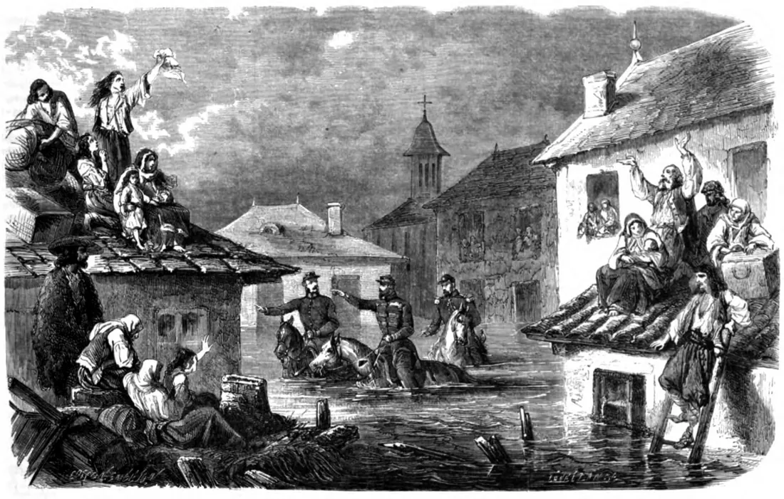
Mills pressed the water toward the banks and rubbish choked the ditches: the city drowned in 1801, 1804 and 1814, and people climbed on roofs with what they could grab. In 1831 the outhouses, stables and kiosks on the banks are ordered cut, mills included — a first step toward reducing flood risk.
1865
The flood that decided the canal
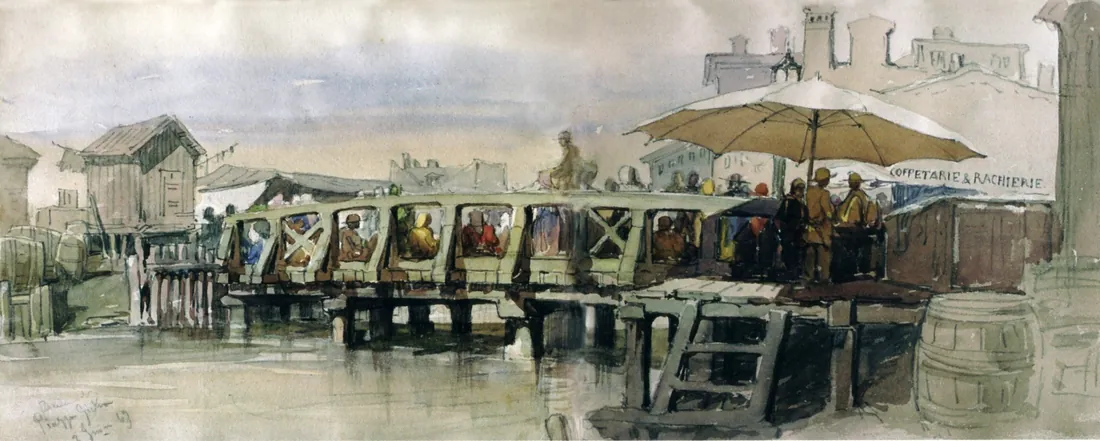
The devastating floods of 1862–1865 make Cuza order the rectification and channelling. In 1862 he visits the Tabaci victims with Davila. After 1864–1865 the Arcuda canal is dug, in 1868 the bed is cleaned, and in 1870–1872 the wooden bridges are replaced with metal ones.
1885
The canal
Between 1880 and 1885 the French engineer Alexandre Boisguerin cuts the loops: the bed is deepened by 6 m, floored with oak on piles, walled below, given two waterfalls, and above it the 20 m splais are born — paved and tree-lined on both sides. The minor bed carries 8 m³/s, the major 220 m³/s.
1936
The river vanishes under a slab
Between 1934 and 1936 the central course is covered with a 610 m concrete slab, from the Senate bridge to the Șerban Vodă bridge — to hide the dirty river from passers-by. Between the Abator and Ciurel 8,438 m of silt are dredged, and in 1942 a new rectification starts toward Roșu.
1988
Two rivers, one above the other
Between 1985 and 1988, over 10.4 km from Lacul Morii to Vitan-Bârzești, the bed becomes a stepped clean-water basin, and beneath it the wastewater collector box is poured: 12 main and 11 secondary collectors, 17,238 m in plan, draining by gravity to the Glina plant. Practically two superposed rivers.
2026
Find your street
Today 25 km of canal cross the city, and the 1871 meanders survive only in plans and, here and there, in street layouts. Scroll to Your street, type your address and see what flowed under it — indicative, with the method's limits stated openly.
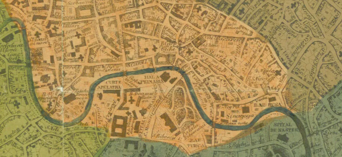
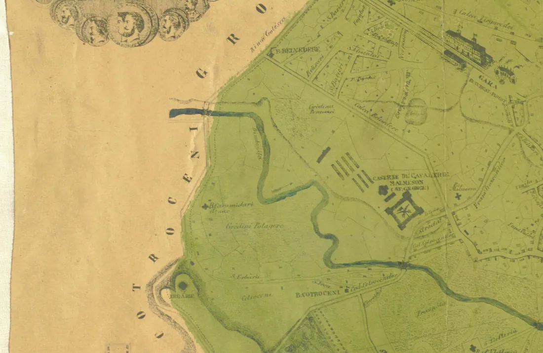
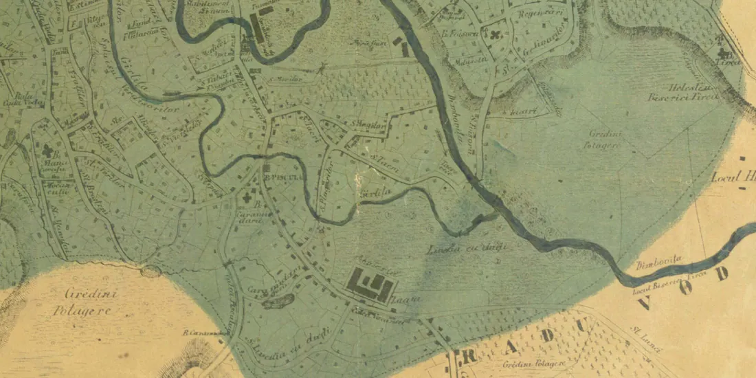
For years before 1880 the map shows the 1871 course — the riverbed from before the great canal, after Pappasoglu's plan. Each state is detailed below, in its chapter.
Why did the Dâmbovița flood the city?
A small river, with many loops, in a city that threw all its filth into it and squeezed mills and shops right into its bed.
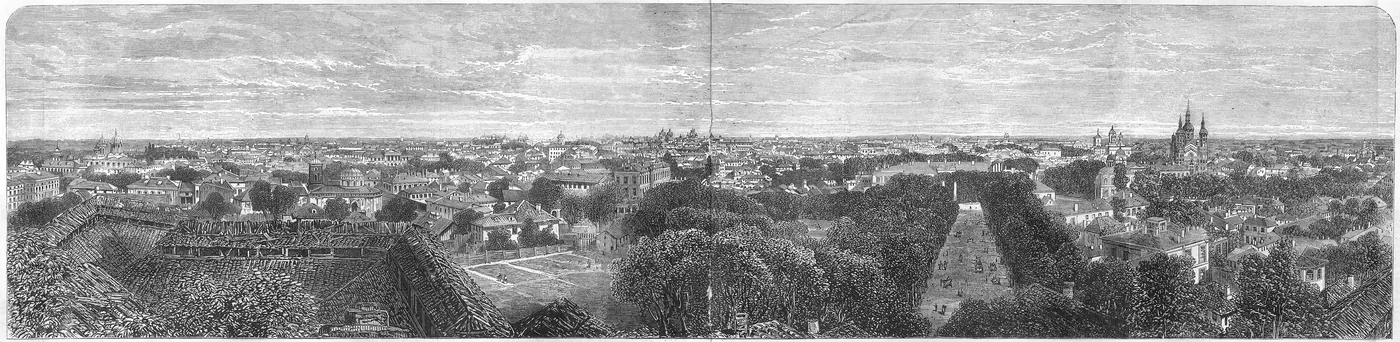
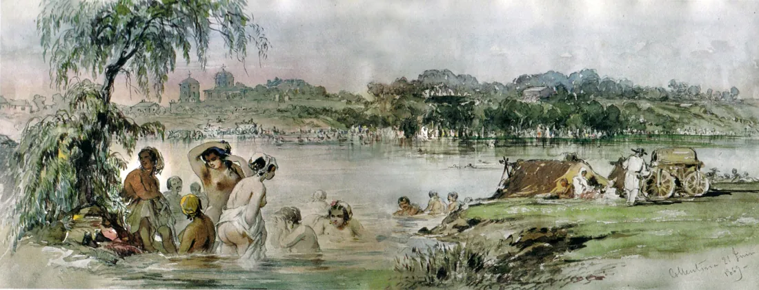
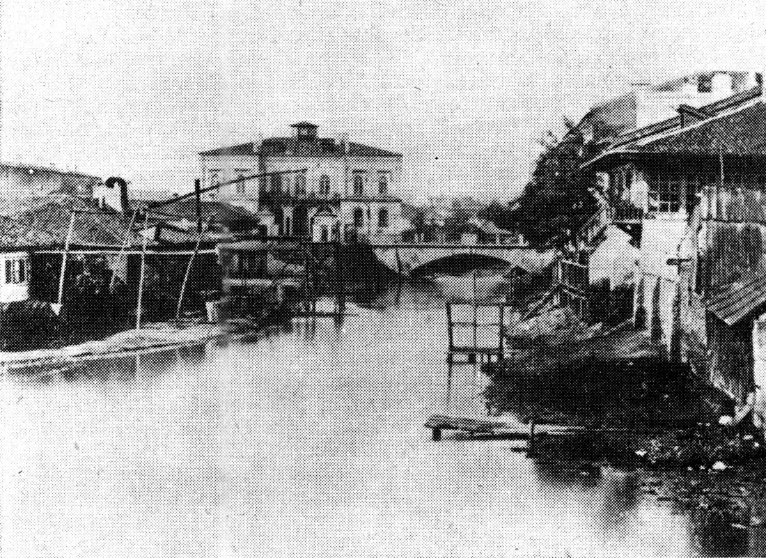
Inside the city the Dâmbovița made many meanders, which braked the water and silted the bed. Mills, vegetable gardens, improvised bridges and commercial buildings crowded the banks and strangled the course — and since the city had no sewerage, the river had become the collector of all household and industrial residues.
After the 1774 deluge, Alexandru Ipsilanti starts the first works in 1775: a wooden dam at Lungulețu and an 8 km derivation canal to the Ciorogârla, described by Sulzer in a work published in 1782. The Ipsilanti ditch is considered by specialists Romania's first hydrotechnical work — but it tamed only the upper Dâmbovița.
People threw rubbish into the ditches, and the waters broke out again: 1801, 1804, 1814. With no human victims, nobody took the floods seriously — when the water rose, Bucharesters climbed on roofs with what they could grab. Mills pressed the water surface toward the banks, and in 1831 the outhouses, stables and kiosks on the banks were ordered cut, mills included.
Plague and cholera epidemics were frequent until the second half of the 19th century, amid poor hygiene and no sanitary system; one contemporary blamed cholera on “the unhealthiness of the breathed air and bad water”. Only after the devastating floods of 1862–1865 did Cuza order the river rectified and channelled.
Then came the years of small works: after 1864–1865 the Arcuda canal is dug, in 1868 the bed is cleaned with small rectifications between Foișor and Manolache commune, in 1871 the campaign pushes hard upstream from Foișor, and in 1870–1872 the main wooden bridges are replaced with metal ones. Rectification inside the city had run since 1850, removing 182 properties on the left and 192 on the right.
Floods did not vanish after the canal either: in 1893, at 125 m³/s, the dikes broke upstream of Conțești, and in July 1975 the highest known discharge was recorded, 650 m³/s. The small river still knows anger.
When and how was the Dâmbovița channelled?
Five years of works led by French engineers cut the loops, walled the banks and invented the splais — the wide tree-lined pavements on both banks.
The real rectification starts in 1879–1880: the bed is deepened by 6 m, floored with oak on beams and piles, walled below and grassed above, with two waterfalls — at Grozăvești, with an electric plant, and at Vitan — holding the levels. The 1880–1885 works are carried out by the French engineer Alexandre Boisguerin.
The canal's figures, after the engineers of the time: the minor bed carries 8 m³/s, the major up to splai level 220 m³/s, and the splais run 20 m each, paved and tree-lined on both sides. From a wild river, the Dâmbovița becomes a city axis.
In 1885 the Brezoaiele hydro node moves the river onto the Ipsilanti derivation: high waters leave for the Ciorogârla, while small and medium flows go through a 10 m³/s canal to Arcuda, for drinking water. In 1900 the Grozăvești fall is removed and the bed is arranged upstream to Ciurel.
Modern drinking water is born alongside: the 1879 project, filtering the Dâmbovița, finishes in 1884 (Culmann and Ziegler), and from 1888 the Arcuda station sends water through the 15.5 km aqueduct to Grozăvești. The river became first a canal, then a drinking-water source.
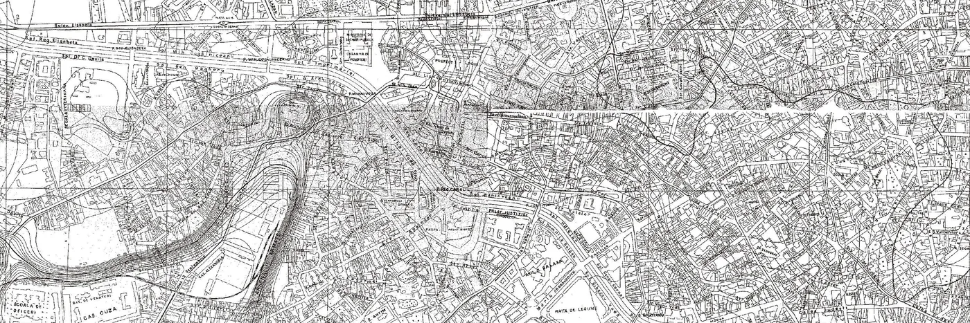
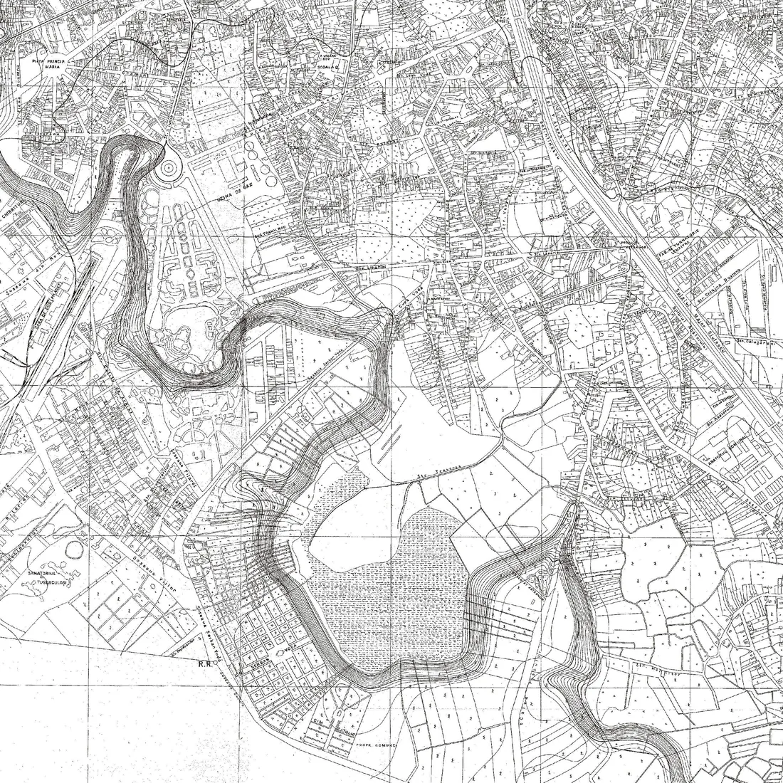
Compare the two plans: in 1871 the river loops deep past Curtea Veche and snakes toward Văcărești; in 1911 the canal cuts straight through the centre, and meanders survive only west and south, outside the channelled reach.
What hidden waters does Bucharest hold?
The Dâmbovița was not the city's only water: a famous pond became a garden, and to the north a string of 15 lakes was born from marshes, from 1933 on.
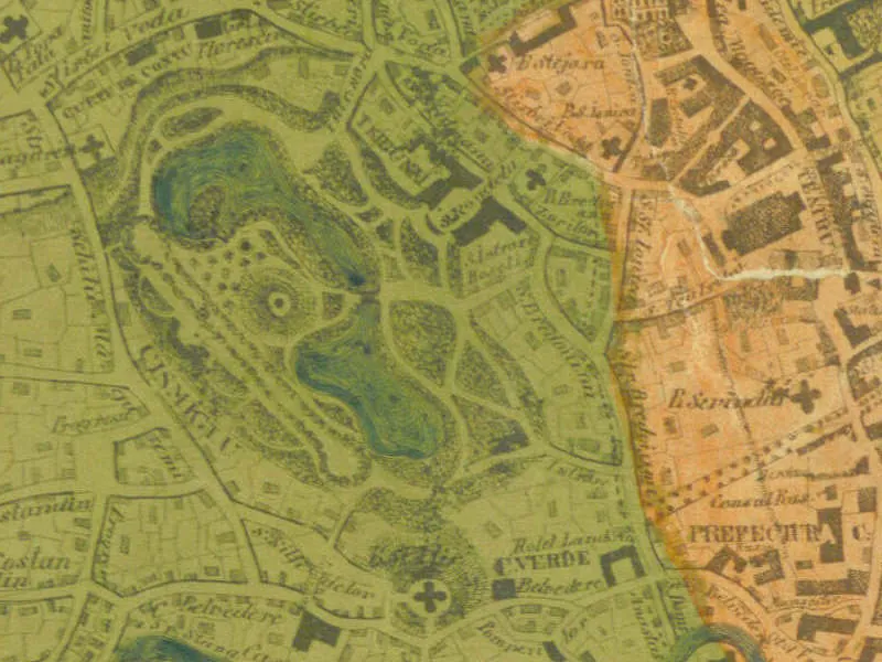
Cișmigiu park sits on a vast pond: the 1791 Austrian plan shows marshy ground, and the pond — “merchant Dura's”, donated between 1671 and 1691 to the Sărindar monastery — linked through a ditch to the Dâmbovița floods. The garden's name comes from Dumitru Suilgi Bașa, the “great Cișmigiu”, who walled here one of the two fountains ordered by Ipsilanti.
In 1830 Kiseleff orders Baron Borroczyn to drain the pond and make a public garden. An 1840 report finds Cișmigiu's water below the Dâmbovița level — in rains the river drained into the pond — and proposes regulating the river and deepening the ditch. In May 1844 the pond is surveyed (Râmniceanu), Bibescu calls in Meyer, creator of the Kiseleff garden, and a commission finds the pond princely land except for “Fântâna Boului”. Princely order no. 71, of 15 February 1845, seals the garden; the lake cleaning starts in 1859.
Filimon, quoted after a modern work (Vătămanu, 1973), paints the pre-1843 pond in strong colours: endless water, rot, frogs, “venomous reptiles”, epidemic vapours — and an island with a tavern of vices in the middle. Take the picture as literature, not as minutes.
To the north, the Colentina earned its lake chain only in the 20th century: in 1933 works start on the Buftea reservoir, Herăstrău lake — the most representative — finishes in 1936, when Floreasca and Băneasa begin, and by 1970 all landscaped lakes look as today. Downstream of the Buftea dam run 15 lakes: Flămânzeni, Buciumeni, Mogoșoaia, Chitila, Străulești, Grivița, Băneasa, Herăstrău, Floreasca, Tei, Plumbuita, Fundeni, Pantelimon I, Pantelimon II and Cernica.
And south of the old city, on the river's meadow, lay Ochiul Boului and Tătarului lakes — gone today. Bucharest's water map is far richer than the concrete canal suggests.
Why is the Dâmbovița covered at Unirii?
Ceaușescu was not the first to hide the river under concrete: the centre was covered back in 1936, so the dirty water would no longer be seen.
Between 1930 and 1932 the silt is dredged between the Abator and Ciurel, over 8,438 m. Then, between 1934 and 1936, the central course is covered with concrete slabs between the former Senate bridge and Piața Unirii — 610 m of unseen river, poured “to hide it from passers-by”.
In 1942 a new rectification starts between the Ciurel dam and Roșu commune, continued after 1944, draining Ciurel, Crângași and Roșu. Also in the century's first half, 6 main collectors join on the right bank and 18 on the left, all over 150 cm wide.
There were grander dreams too: one project wanted a navigable Dâmbovița, linked to the Bucharest–Danube canal, with the bed widened to 50–60 m and a lake at Ciurel. It stayed on paper.
What flows beneath the Dâmbovița?
Since 1988 two practically superposed rivers run through Bucharest: above, a clean-water basin; below, a wastewater box to Glina.
After 1975 — less green space, more stormwater, and the metro changing the groundwater drainage — the complex 1985–1988 arrangement was imposed: a stepped artificial basin for the primenire flow and part of the floods, plus the collector box beneath the clean-water basin.
The system's figures, from July 1985, over 10.4 km from Lacul Morii to Vitan-Bârzești: the basin runs 20–60 m wide and 1.5–4.5 m deep and transits 55–120 m³/s; the box gathers 12 main and 11 secondary collectors, 17,238 m in plan and 44,632 m developed, to the Glina treatment plant, draining by gravity. In heavy rains the box carries 20 to 80 m³/s.
The level is held by six hydro nodes with flap gates: Grozăvești, Eroilor bridge, Piața Națiunilor Unite, Mărășești bridge, Mihai Bravu and Vitan-Bârzești. The upstream shield is Lacul Morii: 19 million m³ total volume, 220 ha, 15 million m³ permanent retention.
Defence runs in several lines: Ilfov reservoirs, the Brezoaiele node, the 1.8 km Bolovani derivation for 50 m³/s, the non-permanent Dragomirești and the Giulești polder — 295 ha and 5.64 million m³, partly filled by the Sector 6 mayoralty, hence unusable. And the Văcărești lake at the south intake, meant for microclimate and leisure, was never filled: unfinished works and studies showing it would flood basements by raising the water table.
Do not mix them up: another, upstream Văcărești belongs to the defence scheme with reservoir and polder. The city one, at the south intake, stayed an empty plan — a nature park today.
What flowed under your street?
Type your street and number: the page has pre-measured, for 4,878 streets and 113,584 addresses, the distance to the traced 1871 riverbed course — indicative, with its limits stated openly.
At Piața Unirii in the traced riverbed band
Computed distance to the course traced from the 1871 plan: about 4 m. The plan and its fit carry an uncertainty of hundreds of metres.
Numbers on the street
Distances are measured to the course traced from the 1871 plan (79 points), fitted over the city with an uncertainty of hundreds of metres. The plan's fit was checked on control points; that statistic is not an error margin for each address. Addresses come from OpenStreetMap; if your number is missing, write to us.
Four places where the old riverbed still shows
- Piața Unirii — sits on the central loop: the square's middle lands about 4 m from the traced 1871 course.
- Strada Halelor — hugs the old riverbed: the street's centre stands 37 m from the 1871 course, and all 7 indexed numbers lie within 120 m.
- Bulevardul Cantemir — follows the approximate old riverbed course south for about 750 m, with dozens of addresses hugging it.
- Calea Văcărești — cuts the old southern meanders repeatedly, over 2 km of nearby course.
How we laid the 1871 plan over the city
We started from two peer-reviewed engineering histories (ASTR 2012 and PESD 2008), two studies from the Bucharest City Museum journal (Cișmigiu; fires–epidemics–floods) and a study on the Colentina's anthropic lakes. The river history on this page is only what these sources say; the full list, with quotes, is in the Sources section below.
The old course comes from the 1871 Pappasoglu plan (public domain, Wikimedia Commons scan): we traced it by hand with 79 points, following the river band at full resolution, then fitted the sheet over the city with an affine transform on 12 control points — churches and buildings that never moved (Antim, the Patriarchate, Colțea, Domnița Bălașa, Radu Vodă, Slobozia, Manu Cavafu, Cărămidarii de Sus, Foișor, Cotroceni palace, Filaret station).
We measured the error honestly, dropping each point from the fit in turn: median 114 m, maximum 199 m. Every course point inherits the error of its nearest control, grown with distance. That is why lookup results are indicative: the old plan and its fit allow no exact address-level measurement. The 1911 plan (1:5,000, Army Geographic Service) served as witness: its canal sits on the same alignment as today's, checked at Eroilor, Unirii and Mihai Bravu.
What we could not prove stayed out: the oft-repeated crediting of the channelling plans to Grigore Cerchez has no solid source we could find (ASTR puts the 1880–1885 works on the Frenchman Alexandre Boisguerin), nobody gives the mills' number, the 1865 flood's victims turned up in no reliable source, and the Dâmbovicioara — the tributary encyclopaedias mention — is absent from the 1871 sheet where indicated.
Today's addresses and canal geometry are OpenStreetMap (© OpenStreetMap contributors, ODbL licence); church coordinates, Nominatim. Lookup sends nothing anywhere: distances are precomputed at build, the browser only displays them.
| C2-Caramidari | 196.0 |
| C4-Palace | 84.0 |
| C5-Antim | 97.0 |
| C6-Mitropolia | 92.0 |
| C7-Coltea | 199.0 |
| C10-DomnitaBalasa | 69.0 |
| C11-SfAp | 198.0 |
| C12-RaduVoda | 99.0 |
| C13-Slobozia | 128.0 |
| C14-ManuCavafu | 120.0 |
| C15-Filaret | 109.0 |
| C20-Foisor | 176.0 |
Read it like this: dropped from the fit, each point is found that many metres from its true place.
Quiz: how much of the river's story stuck?
Seven questions from the page's data. Every answer shows its proving sentence.
Frequent questions
Where did the Dâmbovița flow before channelling?
Through the centre, in a deep loop past Curtea Veche and today's Piața Unirii, then south past Radu Vodă, Tabaci and Văcărești, exiting east. The map at the top shows the 1871 course traced from Pappasoglu's plan.
When was the Dâmbovița channelled?
Between 1880 and 1885, after the devastating floods of 1862–1865, on works initiated under Cuza. The bed was deepened by 6 m, walled and oak-floored, and above it the 20 m splais were born.
Why is the Dâmbovița covered in the centre?
The central course was covered between 1934 and 1936 with a 610 m concrete slab, from the Senate bridge to the Șerban Vodă bridge, to hide the dirty river from passers-by. Beneath runs today's wastewater box.
What is the box under the Dâmbovița?
The wastewater collector poured in 1985–1988 beneath the clean-water basin: 12 main and 11 secondary collectors, 17,238 m in plan, draining by gravity to the Glina treatment plant. In heavy rains it carries 20 to 80 m³/s.
How many lakes does the Colentina chain hold?
15 lakes downstream of Buftea dam — Flămânzeni, Buciumeni, Mogoșoaia, Chitila, Străulești, Grivița, Băneasa, Herăstrău, Floreasca, Tei, Plumbuita, Fundeni, Pantelimon I, Pantelimon II and Cernica — landscaped from 1933.
Can I look up my street on the map?
Yes: the “What flowed under your street?” form knows 4,878 streets and 113,584 Bucharest addresses and shows the distance to the traced 1871 riverbed course. Results are indicative: the old plan allows no exact address-level measurement.
See also
Your street's air
same address index, different subject: how clean your street's air is, live. ↗
Gumelnița
what lies under Bucharest 6,000 years back: tells, radiocarbon dates and the first clay city. ↗
The Bucharest metro
the network under the city — including how the metro changed groundwater drainage. ↗
Bucharest in order
the city's timeline game: put events back in their time. ↗
Sources and reading
Engineering
- Stematiu, D. & Teodorescu, D. — “The Dâmbovița in Bucharest: the flood-defence system”, ASTR 2012
- Radu, M. — “Bucharest, a vulnerable city to the Dâmbovița river floods”, PESD 2/2008, pp. 365–376
History
- Lepăr, A. — “Fires, epidemics and floods in Bucharest, first half of the 19th c.”, BMIM XXX/2016
- Roșu, L. — “Cișmigiu in the first half of the 19th century”, BMIM XII/1997
- Stan, M. — “Anthropic lakes in Bucharest”, Journal of Urban Landscape (the Colentina chain since 1933)
Plans
- Maj. D. Pappasoglu — Plan of Bucharest, 1871 (scan, public domain)
- Army Geographic Service — Plan of Bucharest, official edition 1911, 1:5,000 (public domain)