BUCHAREST · A MAP + YOUR STREET
The causeways of Bucharest
Calea Victoriei was Podul Mogoșoaiei: oak beams over mud. So were Moșilor, Șerban Vodă, Rahovei, Griviței and Călărașilor — seven of today's boulevards, six wooden roads and one earthen, from the 16th–18th centuries. (Plevnei never had a beam.) We laid them on a map: pick a causeway, drag the years, and watch the names change.
In short: Bucharest paved its streets with beams — that is why they were called “poduri”, causeways. Five were princely; the sixth — the Earthen Causeway — was never planked at all, and the seventh is the small Vergu causeway. In the autumn of 1878, after the War of Independence, nearly all lost their old names within a single month. Below you can look up your street and see which fossil you stand on.
See the fossil map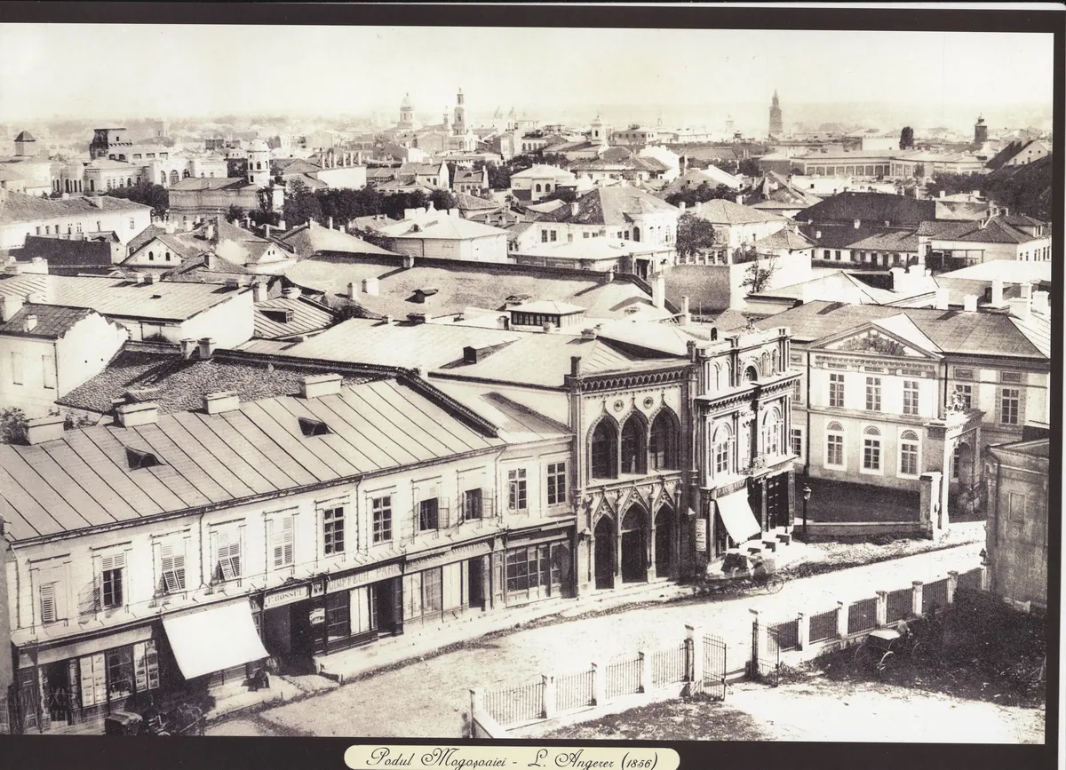
The map of the seven fossils
Seven coloured lines over today's city: the geometry is today's; the historic courses are suggested by the names and the 1871 sheet. Drag the years and watch the causeways change names: Beilicului, Caliței, Vergului appear and vanish. The “1871 plan” button lays the original scan underneath.
The name buttons isolate each causeway; change the years from the slider or the story.
- Causeway (name of the chosen era)
- Your street
1700
Mogoșoaiei is eight years old. Four causeways with attested names, two roads still nameless on the map, and Vergului does not exist yet.
1800
Calicilor becomes Caliței; in everyday speech, Șerban-Vodă is Beilicului.
1871
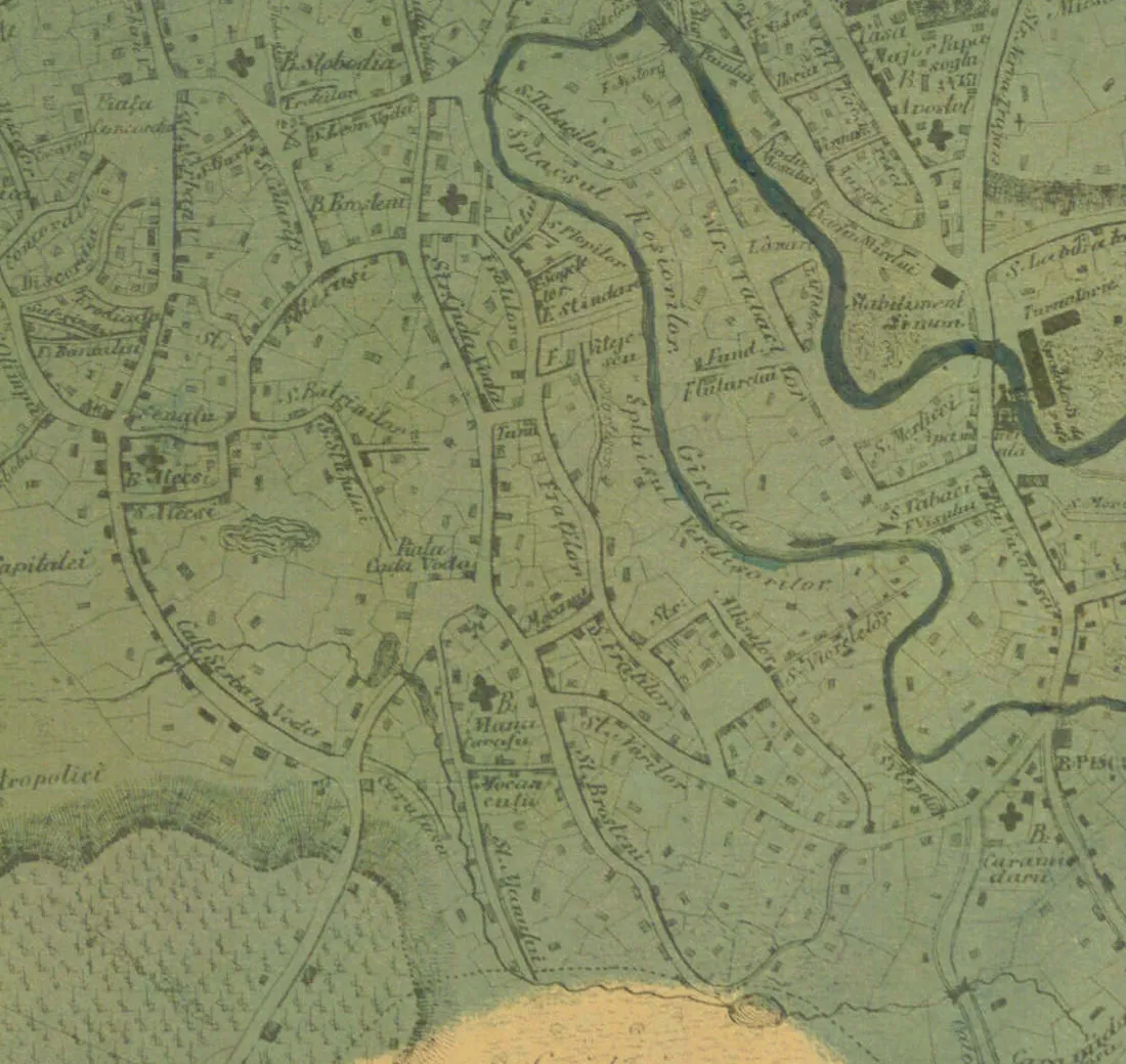
The Pappasoglu sheet: Moșilor, Craiovei, Șerban Vodă — “pod” is rarely heard.
1878
The autumn of victory: within a month, Victoriei, Griviței, Plevnei, Rahovei, Călărași.
2026
Today: seven boulevards on seven fossils. Type your street below.
The geometry is today's (OpenStreetMap): the lines show the present boulevards, not courses surveyed in 1700. What changes with the years are the names — plus two latecomer causeways (Mogoșoaiei in 1692, Vergului attested in 1764).
Why are they called “poduri”?
They were not bridges over water. They were whole streets paved with wood — the medieval Bucharest pavement.
The oldest mention dates to 1574: the Frenchman Pierre Lescalopier passes through Bucharest and writes that “the paving of the town is of tree trunks”. The craft had its own vocabulary: the “podine”, broad planks laid crosswise, and the “urși”, the beams binding them at the ends. Their upkeep was watched by the “podinari”, officers of rank.
The beams usually came by water, floated down the Dâmbovița, and entire villages in Dâmbovița and Vlașca counties owed transport and mounting duty, repaid with tax breaks. Nothing was thrown away: on 6 March 1784 the prince orders the planks and beams taken up from Podul Mogoșoaiei, “which is being rebuilt”, to extend the footway between Podul Calicilor and Saint Ecaterina monastery.
That “pod” meant a paved road is proved by an oxymoron: the Podul de Pământ had no planks or beams, only beaten earth mixed with gravel and rubble — it took the name by assimilation. The stone age came late: only in 1864 did the paving of Podul Mogoșoaiei with sandstone and granite, brought all the way from Scotland, begin; the works dragged on through lawsuits and finished in 1872.
The seven fossils, in turn
Each of today's boulevards keeps the course of a plank road. We take them from the oldest to the youngest.
Drumul Târgoviștei, today Calea Griviței
Ulița cea Mare running on toward the old capital — the town's first artery, mentioned in 1589.
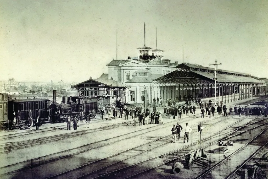
In the early centuries the main artery started at the “upper gate”, crossed the whole commercial centre — the axis the guild streets answered to — and ran on as the “Târgoviște road”, toward the capital that had preceded Bucharest. Its first mention dates to 5 June 1589, when Mihnea Turcitul grants Jipa the great porter a plot “on the great street, by my princely court”.
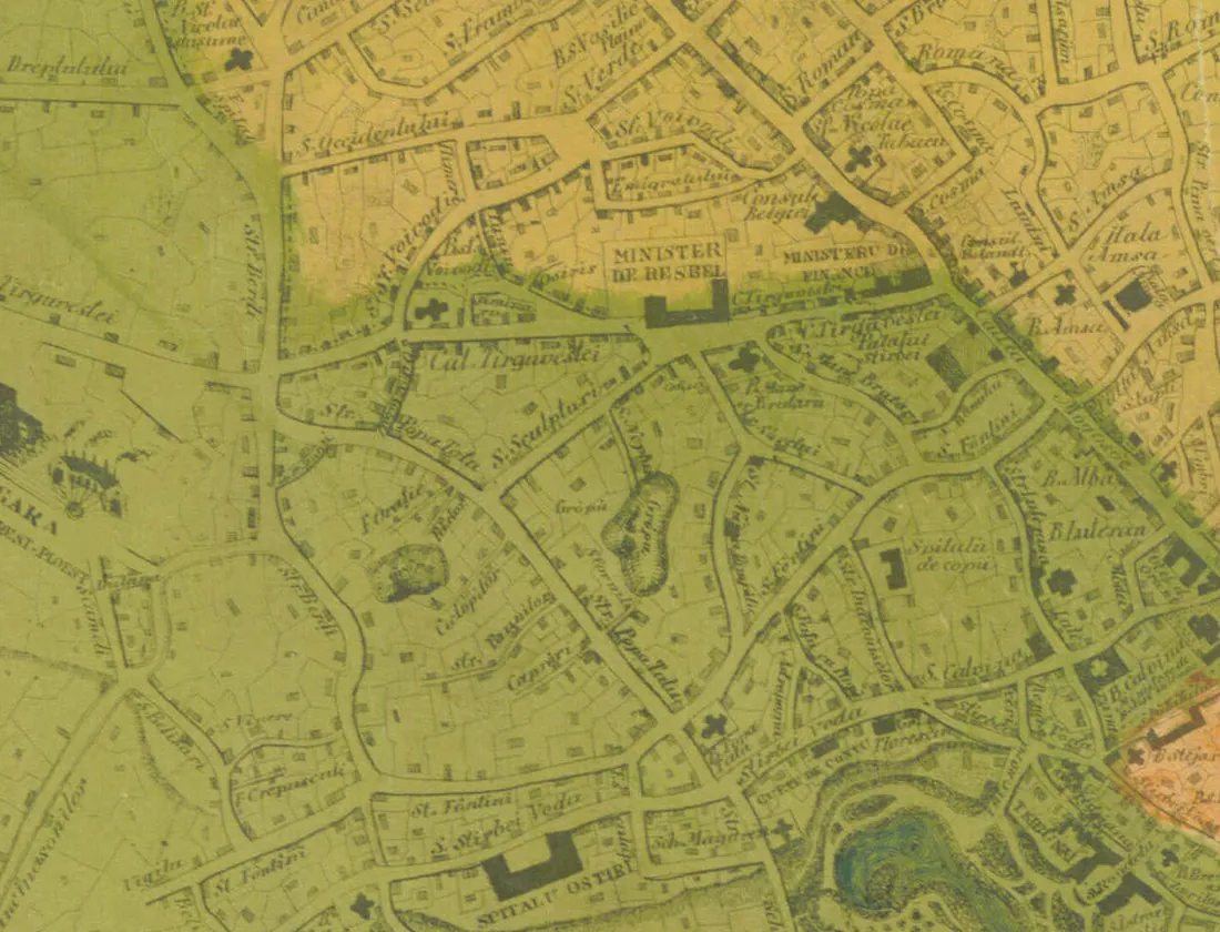
The road later shifted its course westward: a boundary charter of 17 April 1681 mentions the “Old Târgoviște Road”, as opposed to the new one. On the 1871 sheet you read it as “Cal. Tirgovistei”, passing the station; in the autumn of 1878 the decision says “strada Griviței” — today's Calea Griviței.
Podul Șerban-Vodă, today Calea Șerban Vodă
The great road to the Danube — in Giurescu's view, older than the town, which it helped to found.
The Great Causeway likewise started at the Princely Court, crossed the Dâmbovița and headed for the Danube, forking by the future Bellu cemetery: the main branch toward Giurgiu, the lesser toward Oltenița. Two unpublished charters, of 1714 and 1727, prove that “the Great Causeway” and “Șerban-Vodă's Causeway” are one. Which Șerban? In Giurescu's reading, Radu Șerban: the bridge over the Dâmbovița carrying the road had been built by him too — we know it from the charter dated 3 March 1631.
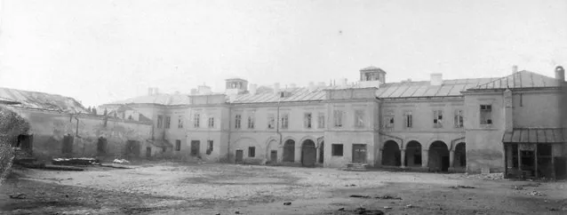
In the second half of the 18th century the road changes its name to Podul Beilicului, after the houses where Turkish envoys were lodged, built in 1776 by Alexandru Ipsilanti near the Dâmbovița. Later still, on the river's right bank, on the same causeway, stood a roomy Turkish caravanserai with mosque, bath and garden — where Evliya Çelebi probably lodged in 1659. On the 1871 sheet the road is Calea Șerban Vodă again.
Podul Calicilor, today Calea Rahovei
The road of beggars' hovels, later renamed after a noblewoman with a similar name.
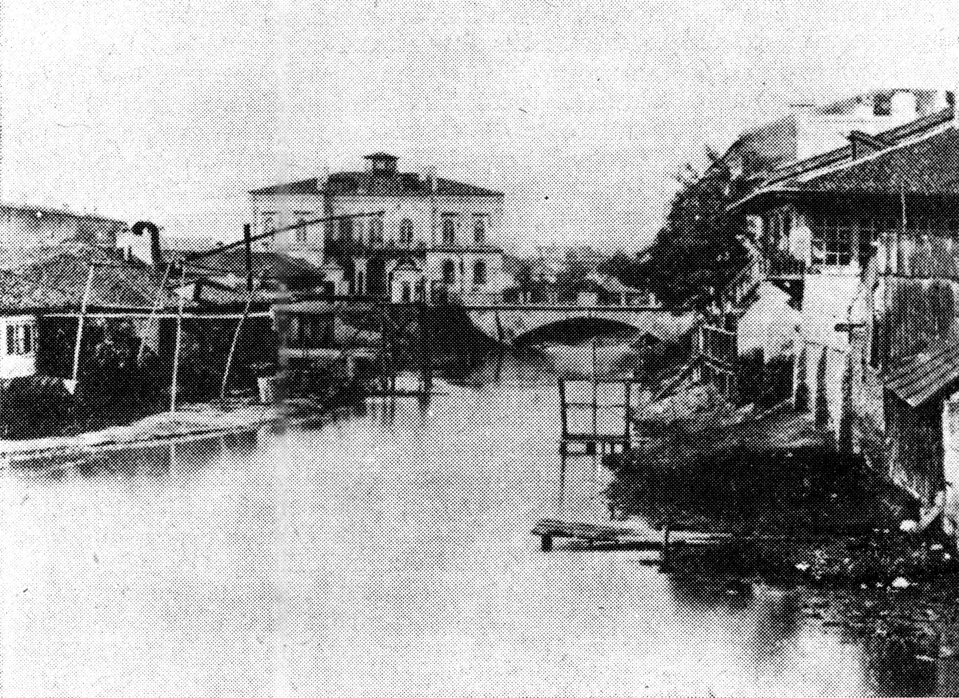
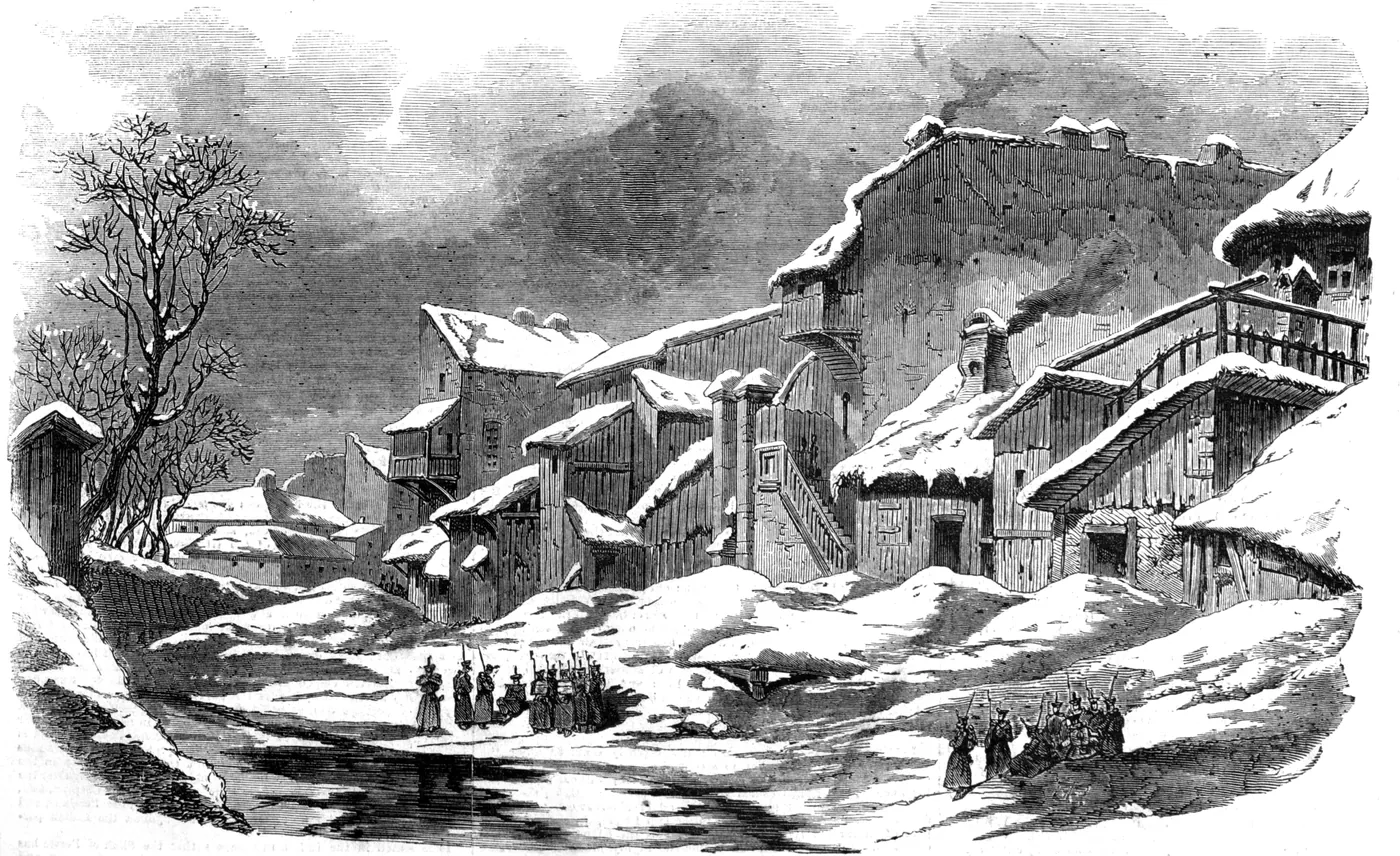
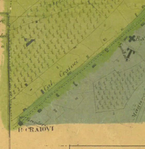
The “calici” were at first infirm beggars — later, by extension, poor folk in general — who in the early centuries kept their hovels and small houses along this road, on the Dâmbovița's right bank. A charter of Matei Basarab, of 1639, mentions the “beggars' quarter”; the causeway itself is documented in the 18th century. It was also called the “Măgurele road” and the “Craiova road” — on the 1871 sheet you read it as “Cal. Craiovei”.
After 1800 the boyars and well-off townsfolk tired of the old name, “mocked by the other Bucharestans”: seizing on a noblewoman named Calița who lived on the spot, in the house long held by the Hospitals Board, they substituted her name. “Podul Calicilor, which is the true name”, Giurescu writes. Since 1878: Calea Rahovei.
Podul Târgului de Afară, today Calea Moșilor
The road to the Tuesday-and-Friday fair — the condemned walked it too, on their way to the gallows.
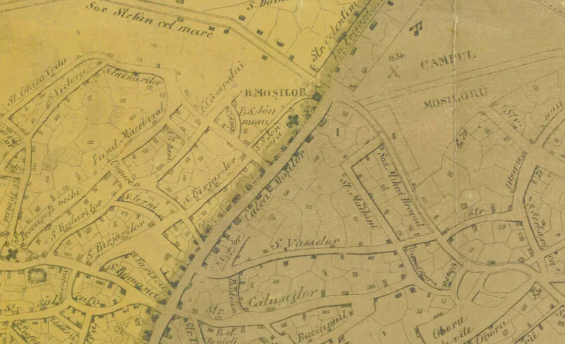
The causeway likewise started at the Princely Court and led to the Outer Fair: the two traditional market days, Tuesday and Friday, plus the “Moși” fair at the end of May. The fair moved with the town — in the 17th century it stood past Sibilelor church, early in the next by Olari church — and on 18 March 1769 a deed sells a plot “on the great causeway that climbs from the princely court and goes to the Outer Fair”.
The same causeway carried, in an ox cart with the sentence hung round their necks, those condemned to death: so rode in 1693 Staicu Merișanul, hanged “on market day, in the middle of the fairground”, and in 1826 Ghiță Cuțui, “at the head of the causeway”. On the 1852 Borroczyn plan the road is still the Outer Fair Causeway; on the 1871 sheet it is already Calea Moșilor.
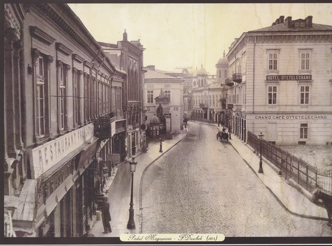
Podul Mogoșoaiei, today Calea Victoriei
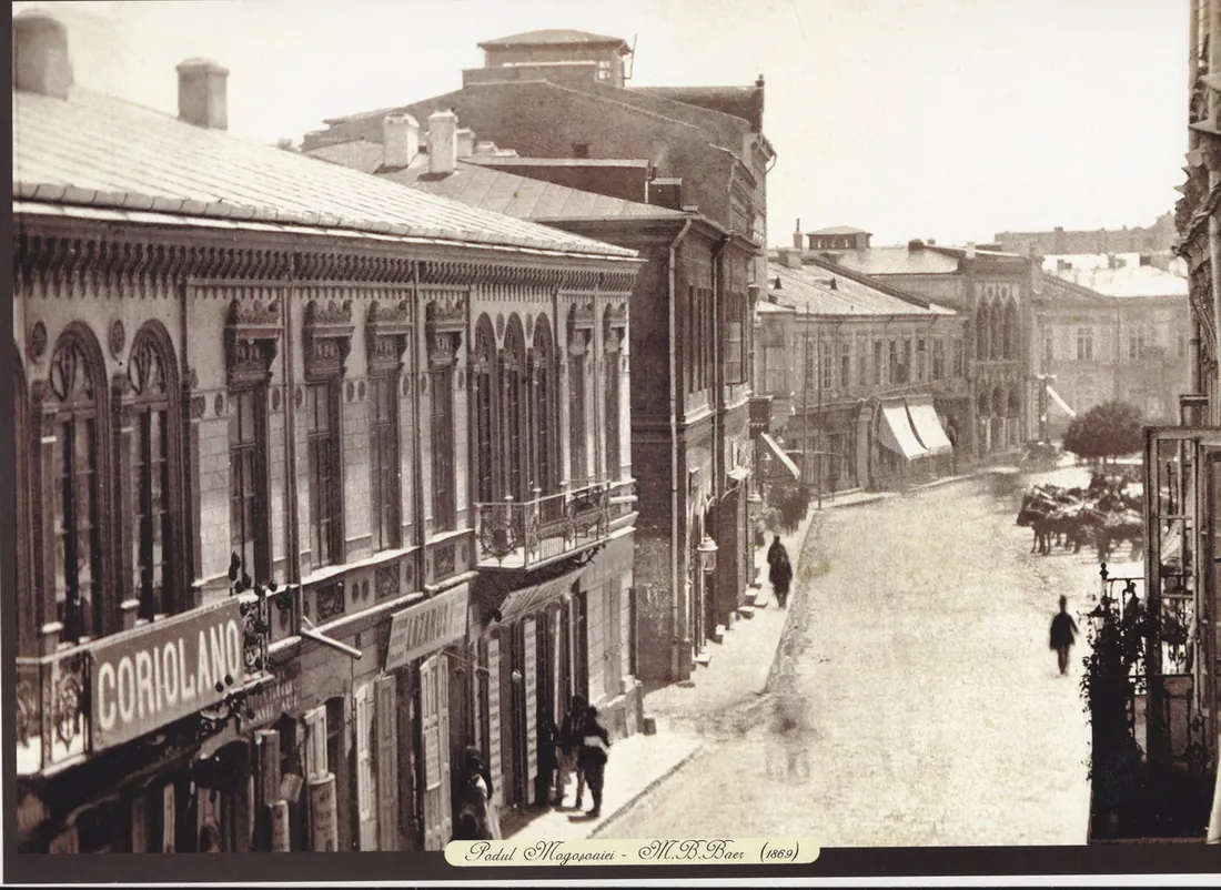
Brâncoveanu's new road, of 1692 — and the town's street no. 1 for a century and a half.
In 1692 Constantin Brâncoveanu cuts himself “a straighter, shorter road” to his Mogoșoaia estate: from the palace gate, through Scorțar quarter, over the estate confiscated from Bălăceanu and Șerban Cantacuzino's property, heading north — Mogoșoaia being the first stop on the old road to Târgoviște. At first it was called “the great street coming from Sărindar”; some said “the Brașov causeway”.
The road follows the hill crest — that is why the streets crossing it westward run downhill to the Athenaeum — and it cuts through properties: in Mucenic's reading, Bucharest's first act of urbanism, which reoriented the heads of Lipscani, Doamnei and Franceză streets. Around 1800 it becomes the town's street no. 1 and stays so until World War II. Pappazoglu's legend of serdar Mogoș is disproved by the documents. Since 1878: Calea Victoriei.
Podul de Pământ, today Calea Plevnei
The poor relation: the only “causeway” without a stick of timber — and the only one with no period portrait found.
The sixth great causeway was never paved at all: no planks, no beams, only beaten earth with gravel and rubble. It took the name by assimilation with the other five, which were true “princely causeways”. A census of 1798 counts its parish: 73 houses along the first half of today's Calea Plevnei. It was also called Belvedere street.
By the late 19th century people called the inward stretch Belvedere street, after the palace; that is the name the autumn 1878 decision baptises “strada Plevna” — today's Calea Plevnei. We found no period photograph or engraving of the Earthen Causeway — if you have one, write to us.
Podul Vergului, today Calea Călărașilor
A small causeway with a masterless name: attested in 1764, paved only to Lucaci.
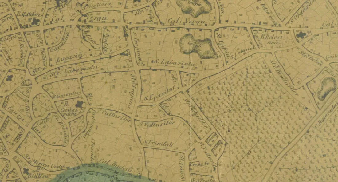
Among the town's minor causeways — the Stelea monastery one (1628), Cilibiu's — the Vergu causeway is the one that survived as a boulevard. An unpublished boundary charter of 10 March 1764 mentions “the great street of the Vergu causeway”, and the Ernst plan of 1791 shows it paved only to Lucaci church: the “causeway head”, where the planks ended.
Who was Vergu? None of the sources we checked ties the causeway's name to a person — we leave it so, question mark in view, as we left everything else we could not prove. On the 1871 sheet you read it as “Cal. Vergu”; in 1878 the decision says “Călărașilor” — today's Calea Călărașilor.
The autumn the causeways vanished
A war won, an army marching into town, and a month in which the map loses half its great names.
On 20 September 1878 the Communal Council resolves to rename streets after the battles of the War of Independence — deadline: 8 October, the day of the army's triumphal entry into Bucharest. The list, word for word: “Calea Mogoșoaiei becomes calea Victoriei”, “Strada Târgoviște becomes strada Griviței”, “Strada Belvedere becomes strada Plevna”, “Calea Craiovei becomes cale Rahovei”, “Calea Vergului becomes Călărașilor”. Today's forms — Calea Griviței, Calea Plevnei — settled later. With them: strada Germană → Smârdan, the Herăstrău road → Dorobanți, Strada Spirii → 13 Septembrie, Strada Filaret → 11 Iunie.
The wave did not stop there: Șonțu, Giurescu, Ene, Mărăcineanu followed — officers fallen in the war, turned into streets. And six years on, one last fossil: Victoriei street loses its name by royal decree 2282 of 13 August 1884 and becomes Corabia, then Clemenceau. You can find it today by Calea Victoriei: Clemenceau is the street that has been three other things.
Which causeway are you on?
Type your street and number: the page has pre-measured, for 4,878 streets and 113,584 addresses, the distance to the nearest of the seven causeways — indicative, with its limits stated openly.
At Strada Lipscani on the causeway's trace
Nearest causeway: Podul Mogoșoaiei, about 35 m away. The courses are today's, from OpenStreetMap; distances are indicative.
Numbers on the street
Distances are measured to today's courses of the seven fossil boulevards, from OpenStreetMap: Victoriei, Moșilor, Șerban Vodă, Rahovei, Griviței, Plevnei, Călărașilor. Addresses come from OpenStreetMap too; if your number is missing, write to us.
Seven streets, seven fossils
- Strada Lipscani — stands on Podul Mogoșoaiei: it starts right at Calea Victoriei, nearest number 35 m off.
- Strada Olari — stands on Podul Târgului de Afară: the fair moved beside it in the early 18th century; nearest number 39 m off.
- Bulevardul Mărășești — stands on Podul Șerban-Vodă: nearest number 27 m off.
- Bulevardul Libertății — stands on Podul Calicilor: nearest number 13 m off.
- Strada Buzești — stands on Drumul Târgoviștei: nearest number 30 m off.
- Piața Mihail Kogălniceanu — stands on Podul de Pământ: nearest number 12 m off.
- Strada Traian — stands on Podul Vergului: nearest number 37 m off.
Method: what we measured and what we left out
The seven causeway courses are today's geometries of the fossil boulevards, from OpenStreetMap (September 2026): for each of the 113,584 addresses we computed the distance to the nearest course. The bands are conventional: within 60 m “on the trace”, within 200 m “near the trace”, else “far”. They are not error bars — they are reading thresholds.
The old witness is the 1871 Pappasoglu sheet (public domain): every label quoted — “Cal. Tirgovistei”, “Cal. Craiovei”, “Calea Serban Voda”, “Cal. Vergu”, “Calea Mosilor” — we read ourselves off the scan. The 1871 sheet is a late witness of the old courses; the coloured lines on the map use today's OpenStreetMap geometries and do not reconstruct courses surveyed in 1700.
What we left out: the etymology of the Vergu name (none of our sources gives one); the year of the return from Beilicului to Șerban Vodă (the 1871 sheet already shows it returned, but the year is missing); the minor causeways (Stelea, Cilibiu); rails and trams; the Dâmbovicioara, mentioned by Giurescu as crossing Podul Calicilor by Sfântul Ilie street — quoted, with no geometry of its own.
| Ulița cea Mare | 1589 |
| Drumul Târgoviștei | 1681 |
| Podul Mogoșoaiei | 1692 |
| Podul Târgului de Afară | 1769 (the fair: 17th c.) |
| Podul Șerban-Vodă | 1631–1714 |
| Podul Calicilor | 18th c. |
| Podul de Pământ | 1798 (73 houses) |
| Podul Vergului | 1764 |
| Podul Beilicului | after 1776 |
| Podul Caliței | after 1800 |
Years from documents, after Stănculescu (BMIM XIV) and Giurescu. Where the year is a window, we show it so.
Quiz: how much of the seven do you remember?
Seven questions from the page. Miss one, learn; get them all, brag at dinner.
Questions
What does “pod” actually mean in street names?
A road paved with wood: “podine” (broad planks) over “urși” (beams). The oldest mention dates to 1574, when Lescalopier writes that Bucharest's paving is of tree trunks.
Why is Calea Victoriei called that?
Since the autumn of 1878: the Communal Council renamed streets after the battles of the War of Independence, and Calea Mogoșoaiei received the Victory name before the army entered town on 8 October.
Where was the Outer Fair?
It moved with the town: in the 17th century past Sibilelor church, early in the next by Olari church, and its trade gradually reached Obor — today's Moșilor fairground.
Can I look up my street on the map?
Yes: the “Which causeway are you on?” form knows 4,878 streets and 113,584 Bucharest addresses and shows the nearest of the seven causeways. Results are indicative: the 60 and 200 metre thresholds are for reading, not error bars.
Why does the Vergu causeway get no name story?
Because we found none verified: neither Giurescu nor the toponymy studies tie the causeway's name to a person. We put the attestation (1764) and the witnesses (Ernst 1791, the 1871 sheet), and the question mark stayed on the page.
What has this to do with the river under the city?
The causeways crossed the Dâmbovița and followed its flood-safe hills — and their beams came floated down that very river. The river, end to end, lives here: the sister page The river under the city.
See also
The river under the city
the river the beams floated down: the 1871 riverbed, the canal and the box, with your own address lookup. ↗
Your street's air
same address index, different subject: how clean your street's air is, live. ↗
Gumelnița
what lies under Bucharest 6,000 years back: tells, radiocarbon dates and the first clay city. ↗
Sources and reading
History
- Giurescu, C. — History of Bucharest (1966): the six causeways, attestations, renamings
- Mucenic, C. — “The Outer Fair–Moșilor–Obor”, BMIM XIX/2005
- Dorojan, C. — “Was there another Victoriei street?”, BMIM XXV/2011
- Stan, A. — “The outer fair at the head of Podul Mogoșoaiei”, BMIM VII/1969
- Burlacu, I. & Ștefăniță, R. — “Calea Dorobanților”, BMIM XVI/2002 (the 1878 mechanism)
- Crutzescu, Gh. — Podul Mogoșoaiei: the story of a street (1986)
Toponymy
- Stănculescu, F. — “How Bucharest street names appeared and evolved”, BMIM XIV/2000
- Rezeanu, A. — “Urban toponymy: Bucharest thoroughfares (I)”, Limba română LI/2002