The name
Popești—
VărădiaArcidaua ×3
Vărădia
An inscription from Balchik names Argedava. The dig at Popești uncovered a Getic fortress. The sheet below sets them against each other — together with the rival candidacy.
Skip to the sheet: the two candidacies, row by row
No ruling unlocks anything; the sheet stays open either way.
At Balchik, on the Black Sea coast, a marble plaque was found, broken and worn. The Greek city of Dionysopolis used it to honour Acornion, son of Dionysios, for a lifetime of service: embassies, priesthoods, his own money. The plaque is in Sofia today. Of the whole text, a single line lit a century-long fuse: line 6, where a journey ends “at Argedauon, at the father [of him?]”.
The rest of the stone, with the editors' restorations, reads clearly. King Burebista had just become “the first and greatest of the kings in Thrace”, holding both banks of the river — the Danube. Acornion had entered “the first and greatest friendship” with him, and the king had sent him as envoy to Gnaeus Pompeius, met in Macedonia near Heraclea Lyncestis. That gives the date: about 48 BC, the year of Pompey's Macedonian campaign. Strabo, a generation later, gave the people 40,000 men under arms — against 200,000 men in the old days.
The stone gives the other end of the string too: Acornion had served his city since the wintering of Gaius Antonius at Dionysopolis, in the winter of 62–61 BC. Between the two datable anchors lie 13 years — but the road to Argedava is older than both, by ten years or more, and no one can date it. The career holds; the question is who received him at the end of the first road.
[— — — εἰ]ς̣ Ἀργέδαυ̣ον πρὸς τὸν πατέρα α[ὐτοῦ(?)]
“[long journey …] …to Argedauon, to the father [of him(?)] […]” — square brackets mark the editors' additions.
…ς̣ · Ἀργέδαυ̣ον · πρὸς τὸν πατέρα · α…
That is all that survives: one letter ς̣ (a word's end — or the name's start), Argedauon (upsilon uncertain), “to the father”, an alpha. Who travelled, whose father, what Argedauon was — in the gap.
The stone's Argedava resembles Ptolemy's Argidava in the Geography — a town of Dacia set, in his system, at 46°30′ longitude and 45°15′ latitude, between Aizisis and Tibiscum, in the Banat cluster. Müller noted on page 449 that Ptolemy's Argidava is the Tabula Peutingeriana's Arcidava and the Ravenna geographer's Arcidaba. On the road map the station still reads: Arcidaua, then XII, Centu Putea, XII, Berzouia — stages of 12 Roman miles each on the Lederata–Tibiscum road.
But the name has a second life. The same Ptolemy lists, on the Hierasus far to the east, a Zargidava — and at Brad, in Bacău county, archaeologists dig a fortress the old sheets call by the same name. The doublet proves that a similar name could stand in two places without either being “the other one”. Tying the Balchik stone to the Banat rests on resemblance, not on any word of the stone.
Then there is the letter before the name. Two shafts show on the stone; some took them for a sigma, others for a zeta, most for the end of the previous word. Hence Sargedava and Zargedava — readings Ion Horațiu Crișan weighed and left open, concluding that the line-6 place-name is “uncertain”. Most read Argedava; the certainty is not in the stone.
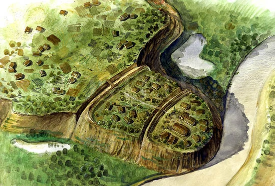
At Popești, “La Nucet”, a triangular promontory breaks off the right terrace of the Argeș: 1,200 metres long, about 600 metres at the base, cut in three by ditches. On the northern segment, height 93, an irregular trapezium 160 × 120 metres, ringed on three sides by cliffs about 15 metres above the floodplain. Here Radu Vulpe dug: in 1954, 80 days and 800 m² (about 1,300 m³ of soil); in 1955, on the acropolis: 44 days, 450 m² with about 1,000 m³ of soil.
The defence bank proved a crafted work: river gravel, crossed timbers, clay cakes fired in place to scorching, yellow clay beaten with ash, gravel again, green marl. The crest's palisade was assumed, traceless — the crest is eroded everywhere. And in the south-eastern corner rose the walls of a timber-and-clay “palace”: 815 m² dug between 1956 and 1958 — less than the real complex, running north and south beyond the digs; only westward was the edge seemingly reached. Up to six habitation levels, two with coherent remains: the old phase, perhaps from the early second century, and the rich phase, with the basilica-like hall, perhaps from the mid-first — Vulpe's working dates; Crișan puts the whole palace in the early first century.
The small finds tell the rest: in 1955, 7 coins, all second-to-first century — among them two tetradrachms of Thasos, a drachm of Dyrrhachium and a republican denarius; stamps on Rhodian and Koan amphorae; Getic Delian-type bowls; an Egyptian Bes glass amulet. The national register keeps the site today as “Argedava at Popești – Nucet”, 49 ha, five Latène layers with three ditches — and shows it gnawed by the cemetery, by new houses and by omission from the town plan.
Vasile Pârvan left the door open both ways: in the Getica, Argedava is either the Banat's Arcidava or a fortress on the like-named river — the Argeș, “Arge-sis, Arge-dava”. Burebista's “leading city” was, “very probably”, south or south-west of the Carpathians. Pârvan wrote in 1926 and died in 1927; by Vulpe’s account, digging at Popești began in 1932.
Radu Vulpe shut the Banat door: Argedava can only stand in the Getic east, the only Daco-Pontic road; the Banat Arcidava comes from another stem (Arc-, not Arge-), and Ptolemy's Ἀργίδαυα may be a copyist's slip (via Crișan). Constantin Daicoviciu's — Argedava on the upper Argeș — he did not exclude from the start, but he knew of no suitable fortress there, so he came down to the plain, to Popești, on the right bank (also via Crișan). The identification struck him as “very probable” — a hypothesis, by his own word, “without peremptory proof”.
Hadrian Daicoviciu cut the knot another way: the stone's father is probably not Burebista's father — the decree tells the career in order, and Burebista enters only at line 22. As for the ancient Argeș, *Argesis is “wholly a modern reconstruction”: Herodotus calls it Ordessos — and so, on his father's proposed reading of Polybius, does Polybius. What remains is that Argedava “may be sought, then, anywhere on Dacian territory” — and that, “even supposing it stood on the Argeș, we cannot take it for Burebista's residence”. And Crișan, on the quarrel between plain and Transylvania as the cradle of the power, concluded that neither camp has “incontestable arguments”.
The name — Popești: no ancient text. Vărădia: Arcidaua (Tabula, segm. VI), Ἀργίδαυα (Ptolemy III.8.4: 46°30′/45°15′), Arcidaba (Ravenna). The row goes to Vărădia.
The road — Balchik–Popești: 203 km; Balchik–Vărădia: 562 km (2.76 times as far); Popești–Vărădia: 362 km. Straight lines, not roads.
The dig — Popești: palace (815 m² dug), 7 coins (1955), Hellenistic imports. Vărădia: 174×154 m camp, Cohors I Vindelicorum, baths. Both dig; neither has the written proof.
The scholars — Popești: Vulpe (“very probable”, a hypothesis). Vărădia: Patsch (“ohne Zweifel”, via Crișan), Müller (the name equation, p. 449). In the middle: Pârvan, both Daicovicius, Crișan.
The silence — “capital”: —. “residence”: —. “father of Burebista”: —. The stone is silent; the sheet shows the gap.
Pick a row to read it alone; the whole sheet stays underneath.
Vărădia
2.76×
both dig
hypotheses
silence
Five rows, two columns: Popești and Vărădia.
What holds, in short. Popești: fortress, time, place — no ancient name. Vărădia: the name and the road — but no stone.
The figures come from their sheets: the stone after Mihailov's edition, the name after Müller and the Tabula, the digs after Vulpe and the Princeton encyclopedia, the distances crow-flies distances on open Nominatim coordinates.
Five rows. In each, the same question put to both: what is written, what was dug, who says so.
Row 1 · The name
No ancient text names Popești. The Banat name, by contrast, reads in three places: Arcidaua on the Tabula Peutingeriana, Ἀργίδαυα in Ptolemy, Arcidaba in Ravenna. On this row the sheet rules for Vărădia — on resemblance of names, not on the Balchik stone.
Row 2 · The road
As the crow flies, Balchik to Popești is 203 kilometres; to Vărădia, 562 — 2.76 times as far. Ancient roads were no straight lines, but the measure says something: one is near, the other nearly three times farther.
Row 3 · The dig
At Popești: 815 square metres dug of the palace, the 7 coins of 1955, stamped amphorae, Delian bowls. At Vărădia: the stone camp 174 × 154 metres, with Cohors I Vindelicorum and civil baths. Each dig proves its own place; neither has turned up an inscription saying Argedava.
Row 4 · The scholars
Vulpe for Popești — “very probable”, but a hypothesis. Pârvan in the middle — Banat or Argeș. Constantin Daicoviciu for the upper Argeș (via FHDR and Crișan). Hadrian Daicoviciu for anywhere in Dacia. Patsch for Vărădia — “ohne Zweifel” (via Crișan). The sheet reconciles nobody; it sets everyone in view.
The sum · What holds
For Popești: a large Getic fortress, rightly placed and timed — without the ancient name. For Vărădia: the ancient name, on the road, in the right place — without the link to the stone. Below, the verdict is the reader's.
Row 5 · The silence
No “capital”. No “residence”. No “father of Burebista”. Not a word that the king was ever at Argedauon. All of it was added later — some by scholars, with a question mark beside it; others without. None of it is on the stone.
The sheet stands open above. Here the reader rules — and the ruling draws its road on the map, from the reader's town to the chosen fortress.
Choose a town; the distance to each site is calculated in the page.
The map shows Romania with the two sites; on ruling, the road line and the distance.
The site visits hard and reads easy: a terrace-end above the Argeș, with the village riding on it.
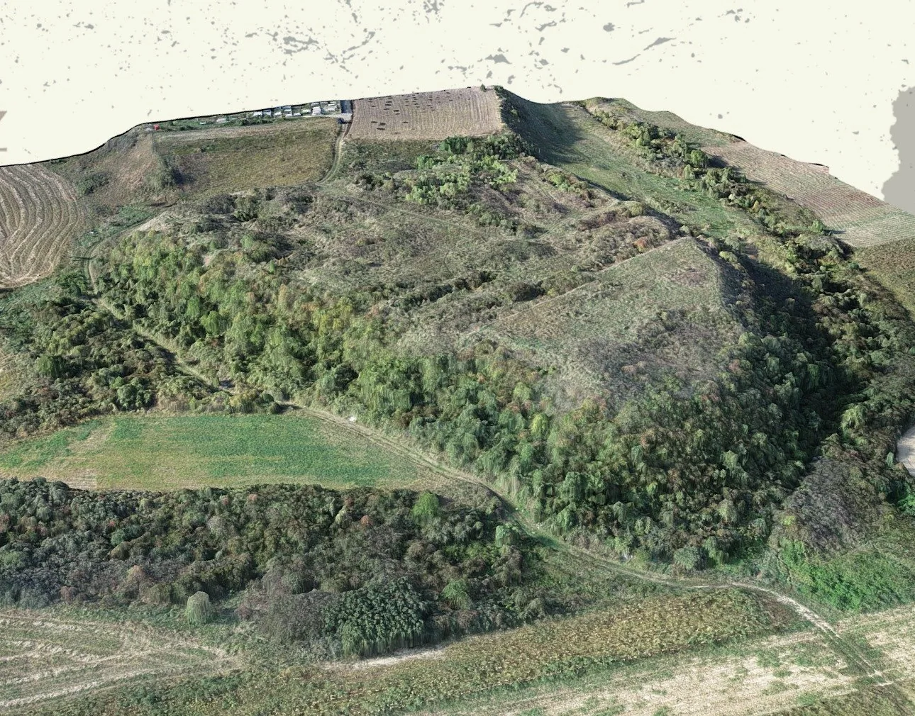
The promontory's northern end, height 93: pasture today, archaeology right under the turf. The register notes off-roaders ploughing it illegally. From the cliff the Argeș floodplain shows, about 15 metres below.
Three defence ditches cut the promontory across; on the southern one, Vulpe's burnt bank. Villagers filled stretches for their plots. Their trace still reads from the Popești–Novaci road.
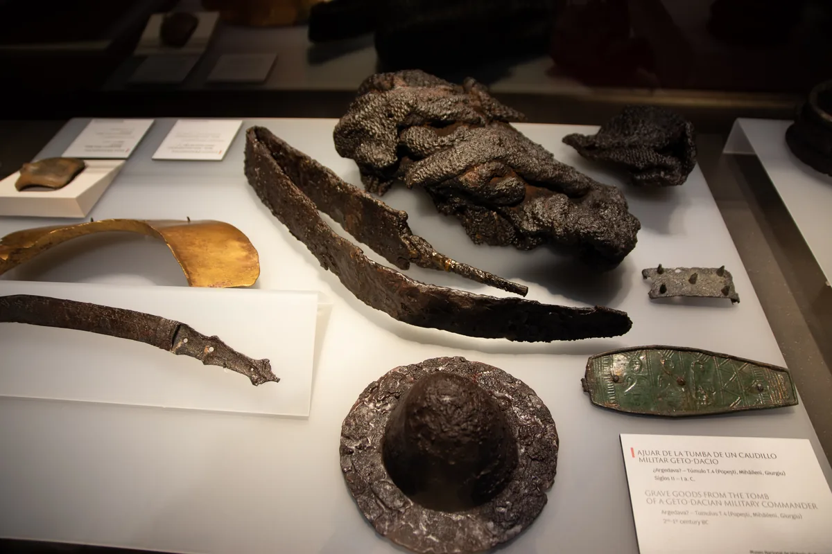
1.5 km south, between Popești and Novaci: 10 tumuli, 4 dug systematically. The T.4 commander's arms, mail and ornaments sit in museum cases, far from their hill.
Before the trip: the site is an archaeological reserve on paper only — the Mihăilești town plan omits it, the monuments list wrongly squeezes it to Nucet alone, and building permits carry, under these conditions, no preventive-digging requirement. Every new pit inside the site's bounds goes through the layer the register calls Argedava.
To keep for the visit: climb Nucet, look towards the Argeș and ask what a Greek envoy from Balchik would have seen. Then ask in the village about the ditches — the old people know them by name.
The stone gives no capitals; it gives a road, a nameless father and a rising king. The rest — Popești or Vărădia, the upper Argeș or Dobrogea — is a century of people reading the same broken plaque and never agreed. The sheet stays open: the next written testimony, as Vulpe said, may come any time, out of any dig.
More on the site: The Atlas of Romanian History (the dispute, in one sentence) · Sarmizegetusa: myths (the capital move, as background) · The oldest ruins (the Brad Zargidava) · The UNESCO map (the Vărădia components) · Dacian fortresses (the fortification neighbour).