The city in words
The twelve stops, in the order of the flight. Each says how it is known.
How to read the city
- Drawn on the planwhere the houses, trees, river and black walls are; each single house, its height and roof are assumed
- Still standsbuildings that exist today, in colour: the churches, Manuc’s Inn, Hanul cu Tei, Hanul Gabroveni, the Suțu and Știrbei palaces (the last three much altered since)
- Gonebuildings drawn in black that no longer exist: plain lime, no ornament
- Todaythe present buildings, pale and plain, and the Dâmbovița’s present channel, a blue line
1 Drawn on the plan
Mitropolie Hill: where the city was measured from

The 1852 plan calls itself “ridikat”, surveyed on the ground. Major Borroczyn’s team had worked from 1844 to 1846 and levelled the whole city from a single stone: the slab in the middle of the entrance gate to the Metropolitan church.
Note H of the plan gives its height: 409 palme, 7 degete and 9 linii above the Black Sea, about 80 metres. From here the ground falls north, to the river and the market.
2 Drawn on the plan
The Dâmbovița, winding through the city
On the plan the river enters from the west by the Cotroceni mills and leaves to the east, towards Vitan, after 16.4 kilometres of loops. A straight line between the two ends is 8.5 kilometres: the water took nearly twice the distance.
The bed is drawn with two thin lines, and the mills stand right on it. Today’s canal was dug between 1880 and 1883, to Grigore Cerchez’s design. Pull the handle towards “today” to see where it runs now, among today’s buildings.
Sources
- Rudolf Artur Borroczyn, Plan of Bucharest, 1852 (four sheets). Scan: “Ion Mincu” University of Architecture and Urbanism, ITCP department
- The Dâmbovița with its meanders (mariuscomper.uk)
- Guide to the State Archives, Bucharest, vol. I (1976): the Dâmbovița canal, 1880–1883 (Grigore Cerchez, A. Boisquerin)
- OpenStreetMap: today’s Dâmbovița channel and today’s churches (ODbL)
3 Still stands
Curtea Veche and the market around it
Here the plan is at its blackest: houses wall to wall, shops, inns. The church of the Old Court, from 1558–1559, is the oldest in the city still in its original form; it stands today.
Five years before the 1852 edition, the fire of 23 March 1847 had burned exactly this centre: 1,850 buildings by the official count, among them 1,142 shops and 10 inns. The plan shows the rebuilt city.
Sources
- Rudolf Artur Borroczyn, Plan of Bucharest, 1852 (four sheets). Scan: “Ion Mincu” University of Architecture and Urbanism, ITCP department
- The churches of Bucharest (mariuscomper.uk)
- Florian Georgescu, in București. Materiale de istorie și muzeografie VII (1969), pp. 58–59: the toll of the 1847 fire
- The Great Fire of Bucharest, 1847 (mariuscomper.uk)
- București. Materiale de istorie și muzeografie III (1965), pp. 55–56: the three building zones after the 1847 fire
4 Gone, raised from the plan
The inns, drawn in black
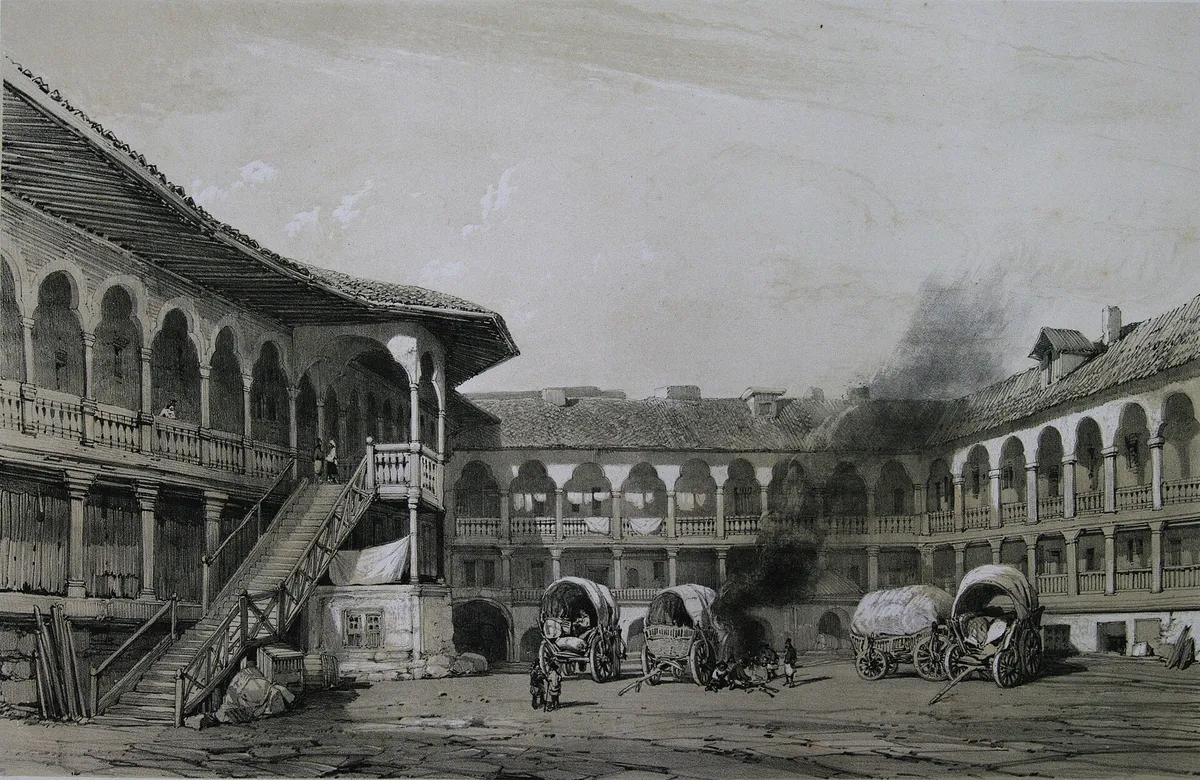
Note I of the plan says that churches, monasteries and public buildings are marked in black. The great inns appear that way: thick rings of walls around a courtyard.
None of those around the Old Court still stands as it was. Hanul Șerban Vodă was pulled down in 1883; the old National Bank palace stands on its site. Hanul Constantin Vodă, across the road from today’s CEC Palace, was demolished after 1852. Here they are raised from the plan with no ornament: plain lime, as much as the drawing shows.
Sources
- Rudolf Artur Borroczyn, Plan of Bucharest, 1852 (four sheets). Scan: “Ion Mincu” University of Architecture and Urbanism, ITCP department
- Borroczyn, plan surveyed and levelled 1844–1846, sheet 8 (notes), 1915 copy. UAUIM
- National Archaeological Record: the Hanul Șerban Vodă site, Bucharest
- Tudor Martin, in Cercetări numismatice XXVIII (2022), pp. 127–139: Hanul Constantin Vodă
5 Still stands
Colțea and Saint Sava, at the edge of the market
Colțea church, from 1695–1702, still stands beside the hospital of the same name. Its neighbour, Saint Sava monastery, home of the princely school, was pulled down in 1869.
Between the church and Palatul Suțu stood Colțea Tower, built in 1714–1715 (other sources: 1709–1714) and pulled down from 3 August 1888. No measurement of its 1852 height was found; here it is an estimate after an 1842 print.
Buildings that still stand are in colour: render, brick, tin. Those that are gone are plain lime.
6 Drawn on the plan
The public garden, still ponds
The plan writes “Public garden” over a place with ponds, drawn as shorelines one inside another. Wilhelm Meyer’s works had begun in 1846; Cișmigiu Garden was officially opened in 1860.
7 Gone, raised from the plan
Mihai Vodă Hill
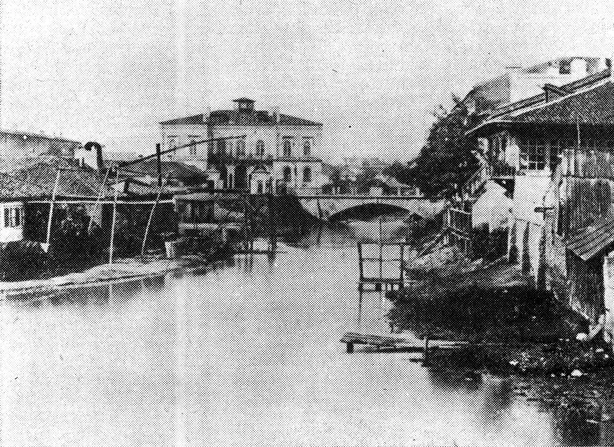
The monastery stood on a hill, and the plan draws the slope with hachures. The 1846 heights put its yard some 8 metres above the river flats.
In 1985 the church was moved 289 metres and lowered 6.2 metres, and the hill was levelled for the Civic Centre. Pull the handle towards “today”: the ground drops where the hill was.
8 Drawn on the plan
The Burnt Court, on Spirii Hill
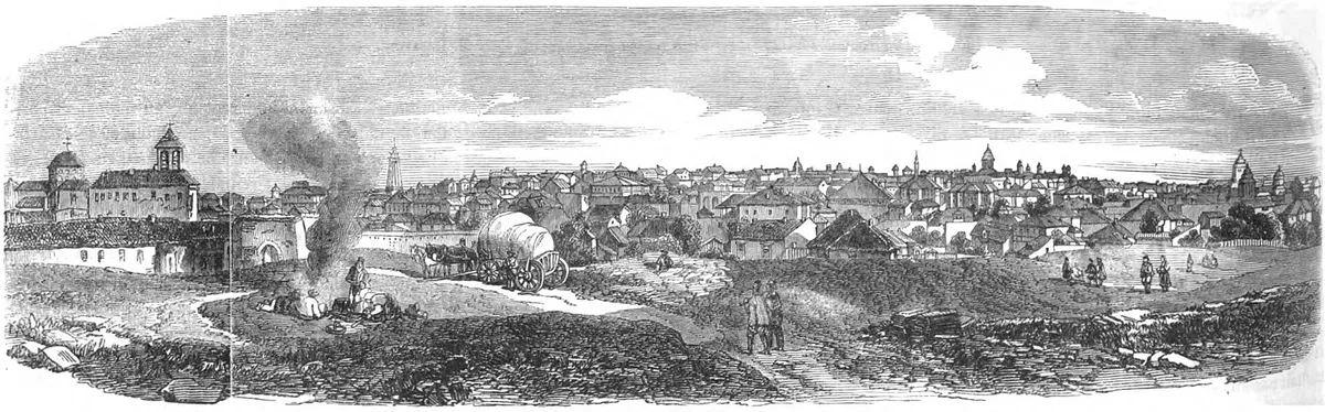
The plan writes “Kurtea Arsă”, the Burnt Court, over an empty place on the hill. It was Alexandru Ipsilanti’s New Court, burned out in December 1812.
Today the Senate Gardens, beside the Palace of Parliament, cover part of it.
9 Still stands
Podul Mogoșoaiei, heading north
The great street to the north, today’s Calea Victoriei, was called Podul Mogoșoaiei. Kretzulescu church, from 1720–1722, still stands on its edge.
This street can be walked step by step, on the sheet of the 1846 plan, on another page.
10 Drawn on the plan
The Vlădica loop, among orchards
To the west the city thins out into orchards. Every tree here stands where the plan draws one. The river makes a tight loop beside the old Saint Eleftherios church, from 1741–1744, which still stands.
11 Drawn on the plan
The mills and Tirca’s pond
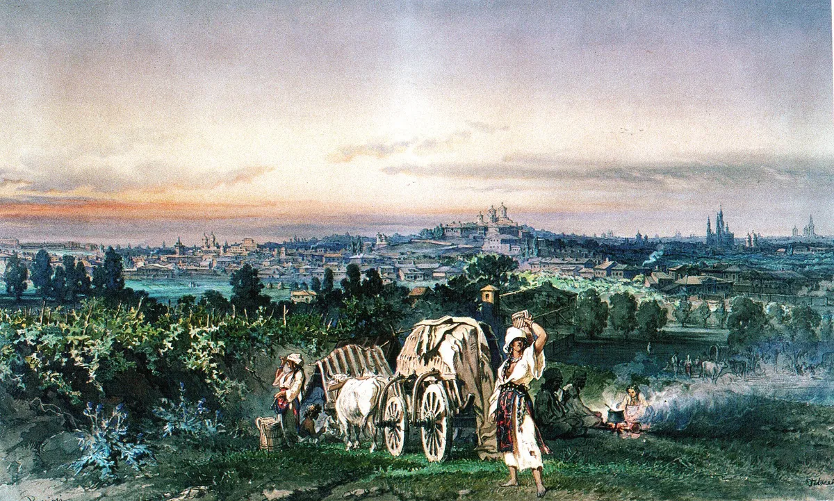
To the south-east the river passes mills the plan names one by one, and a large pond, “Eleșteul lui Tirca”. An inventory published by the Bucharest Museum counts 49 mills on the Dâmbovița before 1862, along a stretch that runs beyond the city as well.
12 Drawn on the plan
From above, the city turns back into the plan
Seen from above, everything raised returns to the paper it came from. The plan has five colours in its legend: red, green, yellow, black and blue, the five “colours” into which the city was divided. None of them shows on the scanned copy.
At the census of 1859–1860, Bucharest had 121,734 inhabitants and 23,459 buildings.
Sources
- Rudolf Artur Borroczyn, Plan of Bucharest, 1852 (four sheets). Scan: “Ion Mincu” University of Architecture and Urbanism, ITCP department
- Architecture archive: the Borroczyn plan (National Archives, Ilfov 338) and the five “colours”
- București. Materiale de istorie și muzeografie XIX (2005), p. 73: the 1859–1860 census
- Revista de istorie XXXVII, no. 1 (1984), p. 51, table 2: the buildings of Bucharest in 1860
How exact the reconstruction is
The 1852 plan has four sheets, scanned by the “Ion Mincu” University of Architecture as a black-and-white copy. The sheets were joined edge to edge and fitted to today’s map on 26 churches that still stand where they stood. Leaving each out in turn, a church lands a median 19 metres from its place today; the farthest, 64 metres.
The houses are placed automatically where the plan draws buildings: hatched for private houses, black for churches, monasteries and public buildings, as the plan’s notes say. Each single house, its length, height and roof are assumed; most have one storey. How many houses are raised depends on how they are placed, not on a count from the plan.
The black buildings on the plan are raised from their outlines, with hipped roofs. Churches that still stand take their length and orientation from OpenStreetMap and, where published, their dimensions, number of towers and columned porch; the tower shapes are schematic. Inns and palaces that still stand take the outline of today’s building. Colțea Tower is raised after Doussault’s 1842 print; its height is assumed. Trees stand where the plan draws trees.
After the 1847 fire, the city centre (“Ocolul I”, between the throne palace on Ulița Mogoșoaiei and the palace below the Mitropolie) allowed only masonry houses of one or two storeys, roofed with clay tiles (olane) or sheet iron; the outskirts were allowed shingle roofs and plank fences. The source does not give the exact perimeter; here the central zone is an approximation between the two palaces. Inside it most roofs are clay tile or sheet iron; a few shingle roofs are a choice of the reconstruction, not a documented fact. The 1860 census found 1,327 two-storey and 58 three-storey buildings out of about 23,400; those proportions, denser towards the centre, set how many storeyed houses are raised here.
The Dâmbovița’s bed was followed on the plan by hand, point by point, along its whole length. The width of the water is as drawn, about 8 metres. The water level is assumed.
The relief comes from the Copernicus GLO-30 model, smoothed, and in the centre, where they could be read, from the heights of the 1846 plan. The Mitropolie and Mihai Vodă hills are those of the heights; elsewhere the ground is today’s.
The street search takes today’s streets from OpenStreetMap and reads the 1852 plan in a circle of about 20 metres around the middle of the street: houses, buildings drawn in black, gardens, open ground or the river bed. The markers on lost buildings come from this site’s pages on the inns and churches of Bucharest, with their dates and what stands on their site today; they sit at today’s site, which can be a few dozen metres from the drawing on the plan.
Fences stand on the plan’s lines between yards or gardens and the lane: planks (uluci) on the outskirts and walls in the centre, as the rules after the 1847 fire required; each single fence is assumed. Today’s street names come from OpenStreetMap.
Today’s buildings come from OpenStreetMap. Their height is the one on the map where it is given (height or number of storeys, for about 7,600 buildings); for the rest it is assumed from the footprint. Churches that still stand are the coloured ones, not the map’s.
The light is that of a late-summer evening, with the sun low in the west-north-west; it was chosen, not computed for a given day. The chimney smoke is an illustration.
Sources
The plan and its notes are the main source. Facts about buildings, inns and the river come from the works below.
- Borroczyn, plan surveyed and levelled 1844–1846, sheet 8 (notes), 1915 copy. UAUIM
- The heights of 1846 on the Borroczyn plan (mariuscomper.uk)
- Rudolf Artur Borroczyn, Plan of Bucharest, 1852 (four sheets). Scan: “Ion Mincu” University of Architecture and Urbanism, ITCP department
- The Dâmbovița with its meanders (mariuscomper.uk)
- Guide to the State Archives, Bucharest, vol. I (1976): the Dâmbovița canal, 1880–1883 (Grigore Cerchez, A. Boisquerin)
- OpenStreetMap: today’s Dâmbovița channel and today’s churches (ODbL)
- The churches of Bucharest (mariuscomper.uk)
- Florian Georgescu, in București. Materiale de istorie și muzeografie VII (1969), pp. 58–59: the toll of the 1847 fire
- The Great Fire of Bucharest, 1847 (mariuscomper.uk)
- București. Materiale de istorie și muzeografie III (1965), pp. 55–56: the three building zones after the 1847 fire
- National Archaeological Record: the Hanul Șerban Vodă site, Bucharest
- Tudor Martin, in Cercetări numismatice XXVIII (2022), pp. 127–139: Hanul Constantin Vodă
- Buletinul Monumentelor Istorice XXXIX, no. 3 (1970): the excavation of Colțea Tower
- Bucharest Municipal Archives, Yearbook II (1998): the opening of Cișmigiu Garden
- Mihai Vodă Monastery: history
- Nicolae Stoicescu, Bibliographic repertory of the feudal monuments of Bucharest (1961): Curtea Nouă (Curtea Arsă)
- Podul Mogoșoaiei in 1852, on sheet 39 of the plan (mariuscomper.uk)
- București. Materiale de istorie și muzeografie VI (1968): the mills on the Dâmbovița
- Architecture archive: the Borroczyn plan (National Archives, Ilfov 338) and the five “colours”
- București. Materiale de istorie și muzeografie XIX (2005), p. 73: the 1859–1860 census
- Revista de istorie XXXVII, no. 1 (1984), p. 51, table 2: the buildings of Bucharest in 1860
- Copernicus GLO-30 digital surface model (ESA)
- București. Materiale de istorie și muzeografie XXIV (2010), p. 11: the buildings of Bucharest in the 1860 census