Marius Comper.
Today's Timișoara with the fortress from the 1853 plan The fortress outline from the 1853 plan and the 300- and 500-Klafter lines (about 569 and 948 m) over today's streets and buildings; today's car-free zone in the Cetate; the Bega; 40 city landmarks. fortress walls, 1853569 m948 m · no building until 1868 FabricIosefinElisabetinPiața Unirii (Union Square)Piața Victoriei (Victory Square)Parcul Central (Scudier Park)Parcul Rozelor (Rose Park)West UniversityPiața TraianGara de Nord (main station)

Timișoara atlas

Timișoara atlas: the city kept at a distance by its own fortress

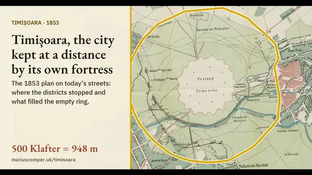
Until 1868 no one could build within 500 Klafter (948 m) of the fortifications of Timișoara, in western Romania. On today’s map the circle still shows: the old parks round the centre lie inside it and Fortress Boulevard runs along its edge.

What the map shows

The fortress plan and the 40 anchors come from the Timișoara atlas.

Timișoara, the city kept at a distance by its own fortress: the 500-Klafter circle on today’s map

Until 1868 building was forbidden within 500 Klafter (948 m) of the fortifications of Timișoara, in western Romania. The city plan of 1853 and the star-shaped fortress of 1788, laid on today’s streets, show the circle: the suburbs of the time stop at it, the old parks round the centre lie inside it, and Fortress Boulevard still runs along its edge. For any street the page gives its distance from the wall and what was drawn there in 1853.
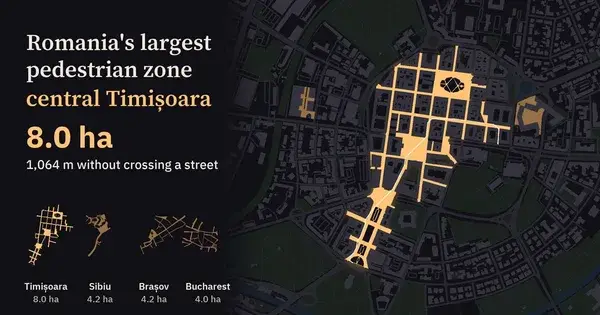
The lit zone: 8 hectares of car-free streets and squares, the largest in Romania.

Romania's largest pedestrian zone: central Timișoara, 8 hectares without cars

Every pedestrian centre in Romania measured the same way from OpenStreetMap and drawn at the same scale: Timișoara's zone covers 8 ha with a 1,064 m walk and no street with traffic, nearly twice Sibiu, Brașov or Bucharest's old town. Pick your town and lay Timișoara (or Venice) over it; plus 169 European centres and what is claimed about them against what the measurement shows. In Romanian and English.

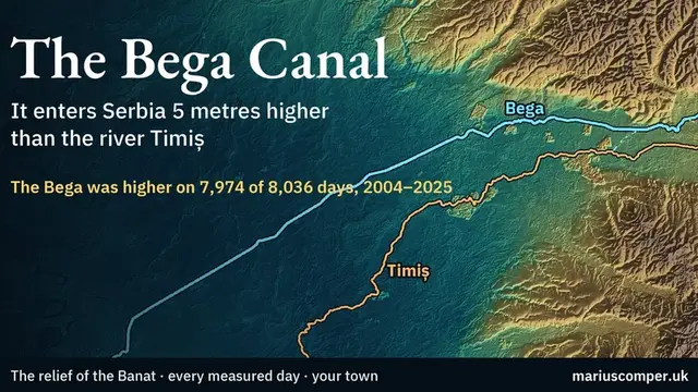
The Bega, the canalised river that runs past the Cetate.

01

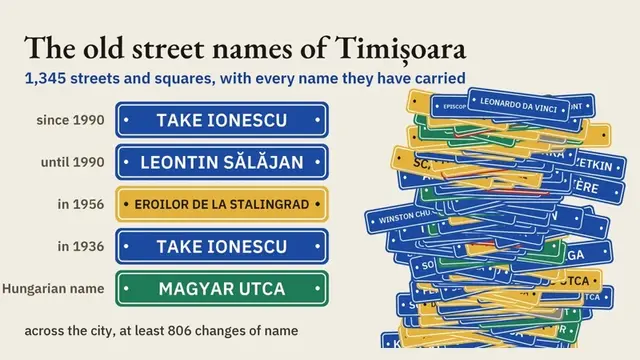
One street, many names

The project finds at least 806 name changes across 1,345 streets, from Hungarian names before 1919 to today. Search a street and follow its recorded forms.

Timișoara, the city kept at a distance by its own fortress: the 500-Klafter circle on today’s map

Until 1868 building was forbidden within 500 Klafter (948 m) of the fortifications of Timișoara, in western Romania. The city plan of 1853 and the star-shaped fortress of 1788, laid on today’s streets, show the circle: the suburbs of the time stop at it, the old parks round the centre lie inside it, and Fortress Boulevard still runs along its edge. For any street the page gives its distance from the wall and what was drawn there in 1853.
02

A mother tongue does not say everything

Censuses from 1869 to 2021 place language, nationality and religion in separate columns. The answer changes when you read them together.

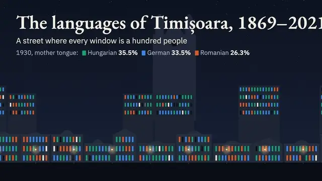
The languages of Timișoara, 1869–2021: what its people told the census

Timișoara, in western Romania, as a street at night, one lit window for every hundred residents. Ask the city its mother tongue, nationality and faith and the same windows answer differently; in 1910 its 6,728 Jews appear only when language is set beside religion. Every census from 1869 to 2021. In Romanian and English.

03

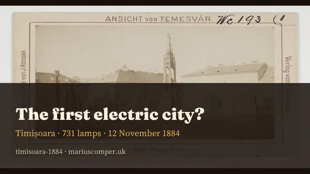
The night 731 lamps came on

On 12 November 1884, 731 incandescent lamps and 59 kilometres of cable made public lighting measurable. The phrase “Europe’s first electric city” needs an asterisk.

04

A city is also a connection

The Bega connects the city to a water system that crosses into Serbia; the train connects it with Bucharest through a changing route and timetable. Banat projects are labelled separately from city projects.

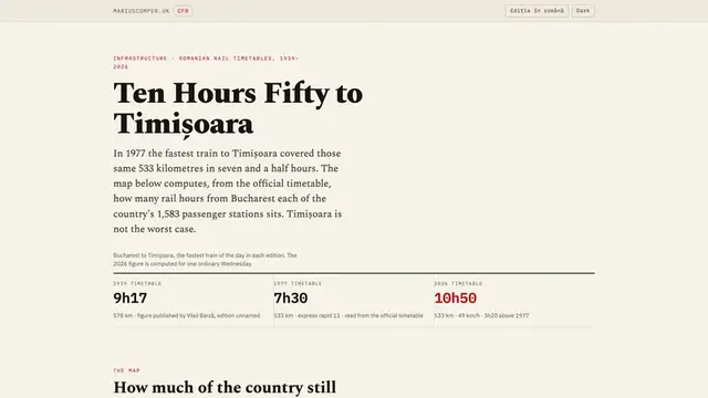
Ten Hours Fifty to Timișoara

All 1,583 Romanian passenger stations coloured by how long the train takes from Bucharest, next to the 1939, 1948 and 1977 timetables and the state of the lines that explains the difference.

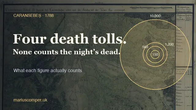
Caransebeș 1788: how many died the night an army fired on its own ranks?

On the night of 20–21 September 1788, Emperor Joseph II's army fired on its own soldiers on the march to Caransebeș, in the Banat (now western Romania). Reports from the following days confirm the panic; four death tolls circulate, and none counts the night's dead. The page shows what each one actually counts.

Timișoara atlas · 10 projects

The complete collection

Search titles, descriptions and topic terms, or choose a theme.

About the collection

This collection brings together relevant projects from the site’s library. Each entry has a title, a description and a link to its available edition. The complete projects carry their sources and evidence limits.

Reviewed · Collection as text

Sources