mariuscomper.uk Română

Atlas · 100 places never repeated anywhere

100 places in Romania you won't find anywhere else in the world

From a toxic subterranean cave sealed for five million years to perpetual mountain flames, chalk-hewn monasteries, and Europe's only heliothermal lake: an atlas of Romania's singular phenomena and absolute rarities you can actually visit.

sites on the map
100
thematic pillars
6
counties drawn
42
To the map
Costești trovants: schematic cross-section

The map

Map of the 100 rarities

Each pin leads to the full record: coordinates, the proof of singularity, and the way there.

Black Sea AlbaAradArgeșBacăuBihorBistrița-NăsăudBotoșaniBrașovBrăilaBucureștiBuzăuCaraș-SeverinClujConstanțaCovasnaCălărașiDoljDâmbovițaGalațiGiurgiuGorjHarghitaHunedoaraIalomițaIașiIlfovMaramureșMehedințiMureșNeamțOltPrahovaSatu MareSibiuSuceavaSălajTeleormanTimișTulceaVasluiVranceaVâlcea Danube Mureș Olt Siret Prut Someș Argeș Tisza

42 counties · 100 places · river courses are schematic.

Showing 100 of 100 places

5,500,000

years of total isolation

Movile Cave, near Mangalia

The Scărișoara glacier, with its 4,000-year archive, would fit into that span more than a thousand times over.

The countdown

Ten places that cannot wait

From mud that boils cold to the cave sealed for millions of years: ten stops, from ten to one. Each entry leads to the full record.

  1. Mud Volcanoes of Berca (Pâclele Mari & Mici)

    Buzău · #19

    Dozens of cold mud cones bubbling non-stop across 30 bare hectares.

  2. Turda Salt Mine

    Cluj · #08

    A lake with an island 120 metres underground, in a mine cut by chisel, never blasted.

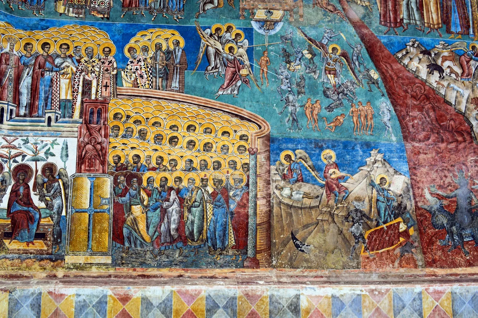
  3. Voroneț Monastery & The Last Judgment

    Suceava · #88

    The Last Judgement in a blue whose recipe was never found again anywhere.

  4. Săpânța-Peri Wooden Monastery

    Maramureș · #54

    78 metres of timber joined without a single iron nail: the tallest wooden church on Earth.

  5. The Merry Cemetery of Săpânța

    Maramureș · #53

    Blue crosses telling the lives of the dead in verse, with no solemnity.

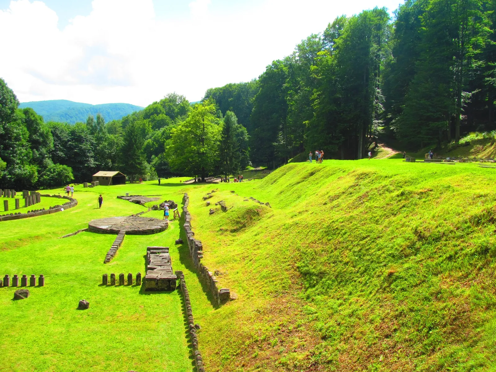
  6. Sarmizegetusa Regia & Great Circular Sanctuary

    Hunedoara · #71

    The Dacian andesite calendar, hidden at 1,200 metres up in old-growth forest.

  7. Hațeg Country Dinosaur Geopark (Sânpetru & Tuștea)

    Hunedoara · #34

    Six-metre titanosaurs and fossilised egg nests on a tropical island 70 million years ago.

  8. Bear Lake (Lacul Ursu)

    Mureș · #25

    Europe's only heliothermal lake: the sun heats its deep water to 40 degrees.

  9. Scărișoara Ice Cave

    Alba · #03

    Over 100,000 cubic metres of millennia-old ice in a Bihor shaft.

  10. Movile Cave

    Constanța · #01

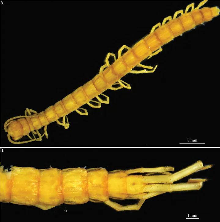
    51 species in a cave sealed for 5.5 million years; 35 exist nowhere else.

Catalog

The 100 places

Subterranean and karst depths

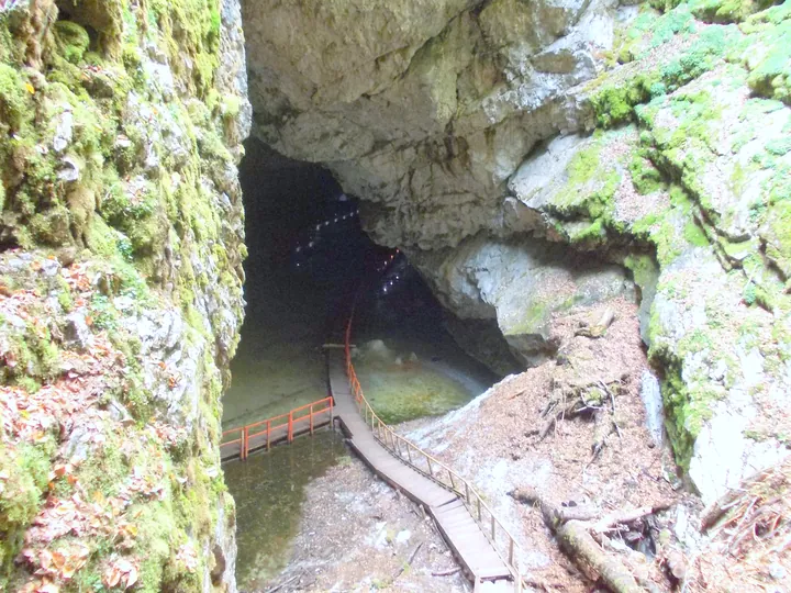
Near Mangalia sits a cave whose air is toxic to humans, where 35 species live on pure chemistry without a ray of sunlight. At Chișcău you walk among 140 cave bear skeletons undisturbed for 15,000 years. At Scărișoara you stand on millennia-old ice, and at Vârtop you see the petrified footprint of a Neanderthal youth. Eighteen places where the surface stays above.

#02

Bears' Cave

Bihor · Crișana and Apuseni

The most intact Ice Age speleological cemetery, preserving over 140 complete cave bear skeletons trapped in situ 15,000 years ago.

Accidentally uncovered in 1975 during quarry blasting in Chișcău, the cave had remained hermetically sealed since the late Pleistocene. The remains belong to Ursus spelaeus, which went extinct at the close of the Ice Age. The Bone Gallery preserves intact skulls and articulated skeletons embedded directly in cave sediments and calcite.

Visitor guide

Open year-round with guided tours (Tuesday through Sunday). The developed 847-meter trail features illuminated walkways through the Emil Racoviță Gallery, Candles Gallery, and Bone Gallery.

Underground 46.5539°N, 22.5694°E
#04

Focul Viu Ice Cave

Bihor · Crișana and Apuseni

Underground ice cave where midday sunlight pierces a vaulted chimney, setting giant ice stalagmites ablaze with a fiery golden glow.

Located in the Bihor Mountains on the Galbena Valley at 1,165 m altitude, the cave holds a 25,000 m³ fossil ice block. A high natural chimney punctures the main chamber's vault. Around noon, direct sun shafts strike the translucent ice spires, creating the visual phenomenon of golden fire burning upon ice.

Visitor guide

Accessible via marked hiking trails from the Padiș Plateau (yellow dot marker). Visitors observe the ice hall and stalagmites from a wooden viewing balcony above the abyss.

Underground 46.5744°N, 22.7058°E
#05

Vârtop Cave (The Marvelous Cave)

Alba · Crișana and Apuseni

The speleological site where Romania's first petrified Neanderthal footprints were discovered, preserved in 62,000-year-old calcite layers.

Inside the Hall of Steps in 1974, anthropologists uncovered three fossilized human footprints pressed into clay and shielded under thin calcite crusts. Dated to approximately 62,000 years ago, one clear impression belonging to a Neanderthal youth was preserved for study at the Speleology Institute in Cluj-Napoca.

Visitor guide

Accessible through authorized local guides starting from Casa de Piatră village (Arieșeni commune). Helmets and headlamps are provided; galleries display an exceptional concentration of pristine draperies and columns.

Underground 46.5056°N, 22.7111°E
#06

Cetățile Ponorului Karst Complex

Bihor · Crișana and Apuseni

The most monumental karst phenomenon in the Carpathians: a 76-meter-high rock portal and three giant sinkholes traversed by a subterranean river.

Carved by the collapse of a colossal cave vault, the complex consists of three vertical limestone sinkholes plunging up to 300 meters. Its centerpiece is the 76-meter portal, Romania's tallest natural stone arch, swallowing a rushing river into a 2-kilometer underground cavern featuring 14 subterranean lakes and cascades.

Visitor guide

Marked loop trail (blue dot) rated intermediate to demanding, starting from Padiș or Cetățile Ponorului Lodge. Equipped with fixed cables and ladders along rocky ledges.

Underground 46.5647°N, 22.7036°E
#07

Meledic 6S Salt Cave

Buzău · Muntenia

One of the longest caves carved into solid rock salt in the world (3,121 m), surpassed globally only by Israel's Malham Cave.

The Meledic karst plateau rests upon a 1 km² diapiric salt dome blanketed by thin soil and clays. Infiltrating rainwater dissolved the pure halite, carving labyrinthine corridors with translucent salt stalactites that grow exponentially faster than limestone speleothems.

Visitor guide

The Meledic Plateau and Lacul Mare (a freshwater lake resting atop the salt dome) are open to hikers. Entering the active salt cave requires caution due to soft salt formations and unmonitored vaults.

Underground 45.4958°N, 26.6022°E
#09

Slănic Prahova Salt Mine (Unirea Chamber)

Prahova · Muntenia

Europe's largest salt mine by excavated volume: 14 trapezoidal chambers reaching 54 meters in height, totaling 2.9 million cubic meters without pillars.

Reaching 208 meters below ground, the Unirea Mine was opened in 1938. Its ceilings are carved at an exact 60-degree angle to withstand overburden pressure, creating natural cathedral acoustics and a therapeutic microclimate used for halotherapy.

Visitor guide

Accessible via underground transport minibuses from downtown Slănic. Open Wednesday through Sunday; interior temperature remains steady at 12°C.

Underground 45.2344°N, 25.9419°E
#10

Cacica Salt Mine

Suceava · Moldavia and Bukovina

Subterranean sanctuary hand-hewn into solid salt rock by Polish miners in 1803: salt altar chapel, underground ballroom, and an artificial brine lake.

Opened under Habsburg rule, the mine contains Saint Barbara Chapel (21 meters deep, adorned with salt crystal chandeliers), the Ballroom (37 meters deep with salt-carved viewing balconies), and an artificial brine pool at 42 meters where miners once paddled small wooden rafts.

Visitor guide

Open daily for visitors. Access is entirely pedestrian via two-century-old original oak staircases descending into the salt depths.

Underground 47.6361°N, 25.9011°E
#11

Topolnița Cave

Mehedinți · Oltenia

Romania's second-longest cave system (24.5 km), pierced by four multi-tiered rock portals and the Giants' Hall, one of the vastest subterranean chambers in Europe.

Located in the Mehedinți Plateau, the cave is carved by the Topolnița river across multiple hydrogeological levels. The Giants' Hall spans colossal dimensions, harboring stalagmites exceeding 10 meters, dense calcite forests, and vital colonies of horseshoe bats.

Visitor guide

Surface hiking trails allow visitors to view the monumental rock portals (Gura Prosacului and Coada Fetei). The wild subterranean interior opens to the public during the annual August speleology festival or by speleological permit.

Underground 44.7892°N, 22.5856°E
#12

Călugări Intermittent Karst Spring

Bihor · Crișana and Apuseni

A rare intermittent siphon karst spring: groundwater erupts and abruptly ceases at rhythmic intervals like a subterranean hydrologic clock.

Nestled in the Codru-Moma Mountains, the spring operates via an underground dual-chamber reservoir connected by an arched siphon tube. As water fills the upper chamber, the siphon primes automatically, discharging a torrent for 15–20 minutes before abruptly falling dry until the cycle resets.

Visitor guide

Accessible via county road DJ763 from Vașcău towards Călugări Monastery. In dry summers intervals lengthen; during spring runoff cycles reliably pulse every 30 to 40 minutes.

Underground 46.4719°N, 22.3831°E
#13

Polovragi Cave

Gorj · Oltenia

Geto-Dacian sacred cavern in the Olteț Gorges, preserving 'Zalmoxis' Throne' and soot frescoes drawn by medieval ascetic monks.

Hollowed out by the Olteț river through Mesozoic limestone, the cave extends over 10 explored kilometers. Folklore ties it to Dacian deity Zalmoxis and archaic herbal healers. Several soot drawings depicting Death with a scythe survive, drawn by 17th-century hermit monks.

Visitor guide

Open for visitors along an 800-meter electrically lit path. Accessible from national road DN67 along the dramatic limestone gorge road of Cheile Oltețului.

Underground 45.1917°N, 23.8242°E
#14

Muierilor Cave (Women's Cave)

Gorj · Oltenia

Romania's first electrified show cave, historic wartime sanctuary for local families, and discovery site of a 30,000-year-old anatomically modern human skull.

Spanning four subterranean tiers across 7 km of passages, the cavern shielded women, children, and the elderly during foreign raids while men fought outside. In the 1950s, a 30,000-year-old complete female Homo sapiens skull was discovered here, yielding crucial prehistoric mitochondrial DNA.

Visitor guide

Open daily in Baia de Fier along a 573-meter walkway crossing the limestone massif from north to south portals.

Underground 45.1919°N, 23.7547°E
#15

Veterani Cave in the Danube Gorges

Mehedinți · Oltenia

A cliff-perched underground military redoubt accessible only by water: transformed into an artillery bastion that held off 4,000 Ottoman troops in 1692.

Used as an ancient Dacian shrine and Roman river outpost, the cave was transformed into a fortress in 1692 by Austrian field marshal Federico Veterani. With cannon batteries pointed directly at the Danube, the cave fortress resisted massive Ottoman sieges.

Visitor guide

Accessible exclusively by tourist boat from Dubova or Eșelnița. Boats dock at a floating pier below the cliff face, leading up wooden stairs into the historic cave chamber.

Underground 44.5961°N, 22.2594°E
#16

Peștera cu Oase (Cave with Bones)

Caraș-Severin · Banat

Discovery site of the earliest modern human in Europe with a direct Neanderthal ancestor (Oase 1, ~40,000 BP, carrying 6–9% Neanderthal DNA).

Discovered in 2002 by Romanian speleologists near Anina, the cave yielded the lower jaw of a young adult (Oase 1). Genomic sequencing led by the Max Planck Institute proved this individual had a Neanderthal ancestor just four to six generations earlier, delivering the definitive proof of modern human-Neanderthal interbreeding in Europe.

Visitor guide

The cave is sealed to preserve fragile sediment layers. Visitors can hike the surrounding Miniș Gorges and visit the Anina museum center which houses exact replicas of the fossilized remains.

Underground 45.0211°N, 21.8028°E
#17

Șesuri Vertical Cave Shaft

Alba · Crișana and Apuseni

The deepest vertical cave shaft in the Apuseni Mountains (-220 m), plunging through an underground ice waterfall and sheer limestone cliffs.

Located near Scărișoara Glacier, this vertical pit functions as a profound cold-air trap. Speleological descents traverse a 30-meter subterranean cascade and cavernous halls where multi-year ice dams cling to fluted limestone walls.

Visitor guide

An extreme vertical caving destination restricted to technical speleology teams with alpine gear. Hikers can follow the surface trail from Ocoale hamlet to peer into the yawning chasm from a safe perimeter.

Underground 46.4958°N, 22.8022°E
#18

Bolii Cave

Hunedoara · Transylvania

The only cave in Romania completely traversed from end to end by a subterranean river through a natural tunnel with symphonic concert acoustics.

Nestled near Petroșani at the foot of the Retezat range, the cave was hollowed out by the Jupâneasa stream over 466 continuous meters. With vaults soaring up to 45 meters, it served in medieval times as a natural covered highway for trading caravans traversing the Vâlcan pass.

Visitor guide

Fully accessible and illuminated with suspended wooden footbridges spanning the underground river bends. Open daily; hosts periodic classical chamber concerts.

Underground 45.4528°N, 23.3644°E

Volcanoes, fossils and geological anomalies

At Berca cold mud bubbles up from 3,000 metres down. On the slope at Lopatari flames burn straight out of the rock, and at Sovata the sun heats the deep salt water to 40 degrees. At Tuștea dinosaur eggs have sat in the nest for 70 million years. Eighteen places where the ground breaks the mould.

#20

Living Fires of Lopătari (Terca)

Buzău · Muntenia

Perpetual natural flames flickering directly out of rocky mountain soil, fueled continuously by hydrocarbon gas emissions ignited by ground friction.

Perched on an 800-meter slope in the Buzău Mountains, this phenomenon is produced by methane seeping through tectonic fractures. Flames flicker between 20 cm and 1 meter high. When extinguished by heavy downpours, the gas continues to hiss and reignites through solar heat or friction sparks.

Visitor guide

Accessible from Terca village (Lopătari commune), followed by a 30-minute uphill hike on marked trail. Best experienced at twilight or night for maximum contrast.

Geology 45.5342°N, 26.5492°E
#21

Living Fires of Andreiașu de Jos

Vrancea · Moldavia and Bukovina

Romania's most extensive natural flame field (over 400 m² of continuous open-air fires releasing 50 tons of burning gas annually).

Located in the Vrancea Subcarpathians along the Milcov River, this plateau is crisscrossed by deep faults linked to the Vrancea seismic zone. Methane over 95% purity seeps through fractures, producing blue-and-gold flames that have burned continuously for recorded centuries.

Visitor guide

Geological reserve equipped with stone stairs and an observation pavilion. Directly accessible via county road DJ205M from Focșani.

Geology 45.7486°N, 26.8322°E
#22

Lake Sfânta Ana

Harghita · Transylvania

The only intact volcanic crater lake (maar) in Central and Eastern Europe, filled with water of near-distilled purity entirely fed by rain.

Formed inside the crater of the Ciomatu volcanic complex, which last erupted roughly 30,000 years ago. Sitting at 946 m altitude with a maximum depth of 6.4 meters, it possesses neither inlet nor outlet streams and is nourished exclusively by atmospheric precipitation.

Visitor guide

Strictly protected nature reserve. Vehicles park at the caldera rim; visitors descend to the lakeshore on foot or via electric shuttle. Swimming is prohibited to preserve water oligotrophy.

Geology 46.1264°N, 25.8886°E
#23

Mohos Peat Bog

Harghita · Transylvania

Twin volcanic crater transformed into an oligotrophic peat bog 10 meters deep, sheltering carnivorous sundew plants and Ice Age tundra relicts.

Occupying the older caldera of Mount Ciomatu, the bog spans 80 hectares. Beneath cushions of Sphagnum moss lies a 10-meter-thick peat layer saturated with acidic water. It shelters carnivorous Drosera rotundifolia (round-leaved sundew) and dwarf birch species surviving since the Pleistocene glaciation.

Visitor guide

Visits are strictly guided along an elevated wooden boardwalk over the fragile peat. Access begins from the main parking area shared with Lake Sfânta Ana.

Geology 46.1367°N, 25.9014°E
#24

Pucioasa Sulfur Cave Mofette (Torja)

Covasna · Transylvania

Europe's largest natural mofette: a volcanic cavern discharging 3,000 m³ of pure CO₂ and sulfur daily, marked by a visible boundary called 'the death line'.

Perched on Mount Pucioasa at 1,052 m altitude near Balvanyos, the cavern was historically used for sulfur extraction. Heavy CO₂ gas settles in dense layers along the floor. Yellow sulfur crystals on the walls demarcate the exact surface of the lethal, oxygen-deprived gas layer.

Visitor guide

Accessible via a 20-minute hiking trail from Băile Balvanyos. Visitors can take standing dry CO₂ therapeutic gas baths; bending below the marked yellow wall line is strictly prohibited.

Geology 46.1219°N, 25.9619°E
#26

Detunata Goală & Flocoasă Basalt Pillars

Alba · Crișana and Apuseni

Hexagonal prismatic columns of volcanic basalt soaring like a stone pipe organ at 1,258 m, ringing with a thunderous clatter when rocks dislodge.

Perched in the Metaliferi Mountains near Bucium, these two volcanic necks stand as monuments to Neogene Carpathian volcanism. Detunata Goală's bare eastern face reveals colossal black basalt pillars up to 1.5 meters wide surrounded by ringing scree fields.

Visitor guide

Accessible via a marked hiking trail (red triangle) from Bucium-Șasa village or Fefeleaga lodge (roughly 1-hour moderate ascent).

Geology 46.2694°N, 23.1978°E
#27

Râpa Roșie (The Red Ravine Badlands)

Alba · Transylvania

A dramatic 100-meter-high amphitheater of red clay and sandstone towers ('The Mini-Canyon of Transylvania'), continuously exposing Cretaceous dinosaur fossils.

Spanning 800 meters north of Sebeș, the reserve features a labyrinth of fluted earth columns, pyramids, and red gullies eroded into Oligocene continental sediments. Geological strata here famously yielded the near-complete holotype of the raptor Balaur bondoc.

Visitor guide

Accessible from Sebeș via an unpaved road across agricultural land (3 km). Exploring the base is unrestricted; surfaces turn slick during rain.

Geology 45.9875°N, 23.5931°E
#28

God's Bridge at Ponoarele

Mehedinți · Oltenia

One of only three natural stone arches in the world open to road traffic: a 30-meter-long, 13-meter-high limestone span formed by cave roof collapse.

The natural bridge is a monolithic limestone arch 9 meters wide and 4 meters thick carrying asphalt road DJ670. Below the arch lies the portal of Ponoarele Cave, flanked by the Cleopatra limestone pavement and the ephemeral Zăton karst lake.

Visitor guide

Free, permanent open access in central Ponoarele village. Visitors can drive across the top span and follow short walking paths under the monumental arch.

Geology 44.9739°N, 22.7667°E
#29

Museum of Trovants in Costești

Vâlcea · Oltenia

'Living stones': bizarre spherical sandstone concretions with concentric carbonate cementing that weather out of sandy cliffs in extraterrestrial shapes.

Located along national road DN67, these trovants originated 6 million years ago within Miocene marine sand beds through localized carbonate precipitation. Their dimensions range from small pebbles to colossal sculptural boulders exceeding 4 meters and weighing several tons.

Visitor guide

Open-air reserve with free admission located right off national road DN67 between Râmnicu Vâlcea and Târgu Jiu. Open year-round.

Geology 45.1542°N, 24.0625°E
#30

Babele of Ulmet (Bozioru Trovants)

Buzău · Muntenia

Colossal saucer-shaped and spherical sandstone concretions balancing precariously on a sandy mountain crest in the Buzău Mountains.

Perched on a ridge above Ulmet village, these bizarre geological shapes were weathered out of deep sand strata by wind and rainfall. Their remarkable spherical and saucer-like geometries have inspired countless local folklore tales.

Visitor guide

Accessible from Bozioru commune to Ulmet village, followed by a 30 to 45-minute uphill hike on marked footpaths.

Geology 45.3975°N, 26.4719°E
#31

Dragons' Garden (Grădina Zmeilor)

Sălaj · Transylvania

A geological sandstone labyrinth of needle pinnacles and towers shaped by weathering, folklore's petrified giants of Almaș.

Spanning 3 hectares on Încheieturi Hill, the reserve showcases coarse Oligocene sandstones and conglomerates. Centuries of rotational landslips and rainwater runoff sculpted towering monoliths up to 12 meters high with dramatic folkloric names.

Visitor guide

Equipped with timber walkways, stairs, safety railings, and interpretive signage. Located 10 km from Jibou, easily reached from national road DN1G.

Geology 47.1986°N, 23.3014°E
#32

Salt Mountain & Baia Baciului

Prahova · Muntenia

A surface diapiric salt cliff hollowed out by rain into miniature canyons, knife-sharp halite karst needles, and collapsed brine dolines.

Declared a natural geological monument, the salt mountain exposed after the collapse of an old extraction vault (Grota Miresei). Its white cliffs showcase sharp fluted lapiez carved into halite by rainwater, a rare karst phenomenon in temperate zones.

Visitor guide

Located in central Slănic Prahova at the Baia Baciului complex. Visitors can observe the fluted salt walls and swim in the hyper-saline lake below.

Geology 45.2389°N, 25.9389°E
#33

Racoș Extinct Volcano & Basalt Columns

Brașov · Transylvania

Romania's youngest volcanic complex (active roughly 10,000 years ago), featuring a Martian-red scoria crater, an emerald quarry lake, and polygonal basalt organs.

The Racoș complex clusters three striking geological monuments: the red-and-black scoria cone of the Quaternary volcano, the Emerald Lake nestled in a quarry crater, and the Basalt Columns (15-meter-high polygonal vertical stone prisms).

Visitor guide

Accessible from Racoș village via paved approach roads. Trails are equipped with informational panels and walking paths.

Geology 46.0278°N, 25.5342°E
#35

Blue Lake of Baia Sprie

Maramureș · Maramureș

Europe's only lake that dramatically shifts color from emerald green to deep cobalt blue depending on sun angle and dissolved copper ions.

Created in 1920 by the collapse of a historic polymetallic mine shaft (Domnișoara Mine), the lake holds elevated concentrations of dissolved copper and iron ions. Solar refraction creates brilliant turquoise and cobalt hues unmatched in natural mountain tarns.

Visitor guide

Accessible via a marked trail from downtown Baia Sprie (a gentle 30-40 minute woodland hike through oak groves).

Geology 47.6719°N, 23.7083°E
#36

Red Lake (Lacul Roșu) & The Petrified Forest

Harghita · Transylvania

Romania's largest natural barrier lake, created by an 1837 mountain landslide: drowned spruce trunks still stand vertically out of the emerald water.

Following relentless storms in 1837, a massive flank of Mount Ucigașul collapsed, damming the Bicaz river gorge. The dense spruce forest was drowned; cold mineralized waters preserved the submerged stumps, which protrude like petrified masts above the surface.

Visitor guide

Located along national road DN12C between Transylvania and Moldavia. Rowboats are available for hire to navigate between the submerged tree trunks.

Geology 46.7906°N, 25.7892°E

Primeval forests, glacial relicts and living sanctuaries

In Letea, 500-year-old oaks stand entwined with 25-metre lianas on sea sand. At the end of March thousands of pelicans return from Africa to the floating reed islets of Roșca-Buhaiova. At Ochiul Beiului you count the trout on the white limestone bed, and the Piatra Craiului pink grows on a single mountain in the world. Sixteen living sanctuaries.

#37

Letea Subtropical Forest

Tulcea · Dobruja
Letea Subtropical Forest
Letea Subtropical Forest — Tulcea. Source: Wikimedia Commons / Danube Delta Biosphere Reserve, CC BY-SA 4.0

The northernmost subtropical-type jungle in Europe, flourishing across maritime sand dunes with Mediterranean lianas and herds of wild horses.

Romania's oldest natural reserve (established in 1938), Letea thrives in parallel strips called 'hasmacuri' between sea sand dunes. It shelters 500-year-old pedunculate oaks entwined with Greek lianas (Periploca graeca reaching 25 m in length), wild ash, and free-roaming horses.

Visitor guide

Accessible exclusively with licensed guides from Letea village using certified off-road vehicles along authorized park trails.

Living nature 45.2833°N, 29.5333°E
#38

Caraorman Forest

Tulcea · Dobruja

The Danube Delta's 'Black Forest': 400-year-old weeping oaks ('The Kneeling Oak'), 25-meter lianas, and shifting sand dunes soaring 10 meters high.

In Turkish, Caraorman translates as 'Black Forest', named after dense oak canopies that plunge the forest floor into deep shadow. Its symbol is the Kneeling Oak, an ancient tree whose sprawling branches curved down to the sandy soil to form natural arch supports.

Visitor guide

Accessible by boat from Crișan to Caraorman village, followed by local off-road transport to the protected oak grove with an authorized guide.

Living nature 45.0667°N, 29.3833°E
#39

Hoia-Baciu Forest

Cluj · Transylvania

A bizarre forest of oaks warped in uniform spirals and sickle curves, harboring 'The Round Meadow', where no trees grow despite fertile soil.

Bordering Cluj-Napoca, the forest gained global fame in 1968 after unusual disc-shaped aerial phenomena were photographed above the Round Meadow. Many oak trees grow in synchronized spiral curvatures unexplained by forestry science, creating an eerie landscape.

Visitor guide

Easily accessible on foot or mountain bike from the Grigorescu neighborhood in Cluj-Napoca. Features marked trails and evening guided tours.

Living nature 46.7725°N, 23.5189°E
#40

Roșca-Buhaiova Pelican Colony

Tulcea · Dobruja

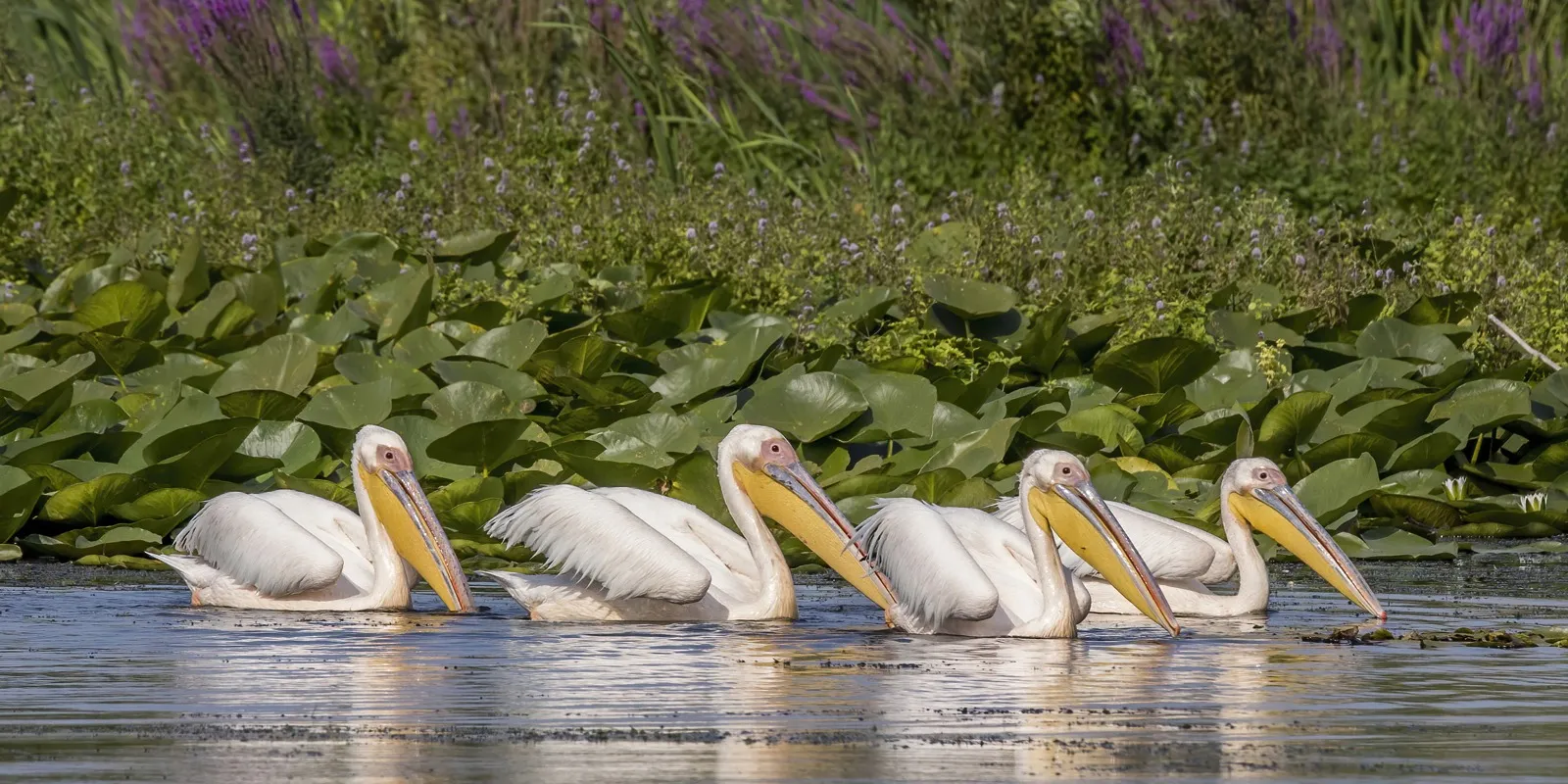
Europe's largest breeding colony of the great white pelican (*Pelecanus onocrotalus*), with over 5,000 pairs nesting on floating reed islands.

Located in the northern Danube Delta in a sanctuary of floating reed islets (plauri) inaccessible by foot. Migrating from Africa each March, pelicans nest on dense vegetation mats. Their synchronized flock flights represent one of the world's premier avian spectacles.

Visitor guide

The nesting core is a strictly protected reserve barred to motorized vessels. Observation takes place from a respectful distance along authorized perimeter waterways like Roșca Canal.

Living nature 45.3833°N, 29.4167°E
#41

Popina Island in Lake Razim

Tulcea · Dobruja

A 47-meter solitary Triassic limestone cliff rising out of Lake Razim: the only mainland nesting site for common shelducks and home to giant venomous centipedes.

Covering 98 hectares, Popina is an isolated erosional remnant of 200-million-year-old Triassic limestone. The barren crag shelters the rare steppe viper, Europe's largest venomous centipede (*Scolopendra cingulata*), and rare steppe spiders.

Visitor guide

Strict scientific reserve where landing is forbidden to protect fragile nesting colonies. Accessible for boat tours from Jurilovca or Sarichioi marinas.

Living nature 44.9667°N, 28.9667°E
#42

Bigăr Waterfall & Karst Spring

Caraș-Severin · Banat

A dome-shaped mossy tufa cliff situated exactly on the 45th Parallel, celebrated among the world's most visually unique waterfalls.

Nourished by a powerful underground spring emerging from Bigăr Cave, mineral-rich water drapes over a 7-meter-tall rounded tufa bell directly into the Miniș river. Despite a natural partial rock detachment in 2021, active calcite precipitation is rebuilding the cascade.

Visitor guide

Located immediately alongside national road DN57B between Oravița and Bozovici, equipped with wooden platforms, walkways, and paths leading to the cave spring.

Living nature 45.0036°N, 21.9594°E
#43

Ochiul Beiului & Beușnița Waterfalls

Caraș-Severin · Banat

A phosphorescent turquoise karst pool that never freezes, fed by deep underground aquifers at a constant temperature in Cheile Nerei National Park.

Measuring 20 meters across and 3.6 meters deep, the spring-fed pool is so transparent that native trout can be counted resting on the white limestone bed. Its water remains at a steady 4–8°C winter and summer, preventing any ice formation.

Visitor guide

Accessible via a gentle 1-hour walk from the Valea Bei trout farm, or via a longer 4-hour scenic hike from Potoc village through the Nera Gorges.

Living nature 44.9358°N, 21.7856°E
#44

Steppe Peonies of Zau de Câmpie

Mureș · Transylvania

The only sanctuary inside the Carpathian Arc preserving the wild steppe peony (*Paeonia tenuifolia*), a post-glacial relict with needle foliage and crimson blooms.

This 3.5-hectare botanical reserve shelters over 50,000 individual steppe peonies. The plant stands out for its fine, fern-like dissected foliage and intense ruby petals. The blooming period lasts only 7 to 14 days in late April and early May.

Visitor guide

Open during the flowering season (late April to early May). Located just off the Luduș – Zau de Câmpie county road.

Living nature 46.6111°N, 24.1333°E
#45

Dumbrava Vadului (Daffodil Meadow)

Brașov · Transylvania

Europe's most expansive natural daffodil meadow: nearly 400 hectares of open oak woodland where millions of wild narcissus carpet the ground in May.

Nestled in the Făgăraș country near Vad village, the clearing protects Narcissus angustifolius. Wet acidic soil and cold air pooling in the depression enabled this vast population to thrive alongside rare marsh orchids and butterflies.

Visitor guide

Best visited in mid-May during peak bloom. Accessible 3 km off national road DN1 near Vad. Picking wildflowers is strictly prohibited by law.

Living nature 45.7958°N, 25.1764°E
#46

Piatra Craiului Ridge & Endemic Dianthus

Brașov · Transylvania

The sharpest pure limestone saw-tooth ridge in the Carpathians (25 km long, over 2,200 m), the world's exclusive habitat of *Dianthus callizonus*.

Piatra Craiului stands as a monolithic blade of Jurassic limestone rising sheer above neighboring valleys. Its floral crown is *Dianthus callizonus* (the King's Dianthus), which blooms strictly along rocky ledges on this single mountain massif.

Visitor guide

Traversing the high knife-edge ridge (red dot trail) is a challenging alpine scramble equipped with fixed cables for seasoned hikers. Lower canyon trails from Zărnești are accessible to all.

Living nature 45.5347°N, 25.2289°E
#47

Lakes Bucura & Zănoaga (Retezat Glacial Heart)

Hunedoara · Transylvania

The glacial heart of the Carpathians: Bucura is Romania's largest alpine tarn (8.9 ha), while neighboring Zănoaga is the deepest in the Carpathians (29 m).

Retezat National Park, established in 1935 by Emil Racoviță, preserves 80 glacial tarns gouged by Pleistocene glaciers into granite cirques. Deep, crystal-pure waters mirror Peleaga Peak (2,509 m) amid undisturbed dwarf pine stands.

Visitor guide

Mountain trail access from Poiana Pelegii (a 2 to 3-hour hike) or Cârnic. Camping in tents is permitted in designated lakeside zones next to the mountain rescue post.

Living nature 45.3586°N, 22.8756°E
#48

Cheile Dobrogei & Jurassic Fossil Coral Atolls

Constanța · Dobruja

Fossilized Jurassic coral reefs: rounded limestone atolls formed at the bottom of the ancient Tethys Ocean 180 million years ago, riddled with prehistoric caves.

The Casimcea River incised a dramatic defile through Jurassic bioherm reefs. The rounded limestone crags preserve fossilized corals, sponges, and marine mollusks. Cave shelters in the canyon yielded Neanderthal tools and late Pleistocene mammoth remains.

Visitor guide

Directly accessible along county road DJ222 between Târgușor and Grădina. Unrestricted walking access through the canyon floor and upper limestone rim.

Living nature 44.4986°N, 28.4514°E
#49

Dragoș Vodă Bison Reserve & Neamț Primeval Woods

Neamț · Moldavia and Bukovina

Key European rewilding sanctuary for the European bison (*Bison bonasus*), Europe's largest land mammal, successfully returned to the wild in the Neamț wilderness.

Hunted to extinction in Romania by the late 18th century, the European bison was reintroduced through conservation breeding. The Vânători-Neamț Park manages a thriving herd roaming in full wilderness across the surrounding Carpathian old-growth forests.

Visitor guide

Features acclimation enclosures, elevated wildlife viewing towers, lakes, and an interpretive center. Located just off national road DN15B near Târgu Neamț.

Living nature 47.2144°N, 26.2486°E
#50

Lake Techirghiol & Living Sapropelic Mud

Constanța · Dobruja

Romania's most hyper-saline natural lagoon (80–90 g/l salinity), where microscopic *Artemia salina* crustaceans produce mineral-rich therapeutic sapropelic mud.

Separated from the Black Sea by a narrow sandbar, the lagoon has water so dense that swimmers float effortlessly. Anaerobic decomposition of *Artemia salina* shrimp creates pitch-black sapropelic mud world-renowned for musculoskeletal and rheumatologic therapies.

Visitor guide

Open year-round with municipal mud-bathing beaches in Techirghiol and Eforie Nord. The Techirghiol Balneal Sanatorium provides clinical therapeutic applications.

Living nature 44.0539°N, 28.6189°E
#51

Turda Gorges (Cheile Turzii)

Cluj · Transylvania

A sheer 300-meter-deep limestone canyon sheltering over 1,000 rare plant species, where steppe and alpine flora thrive on opposite vertical canyon faces.

Incised through limestone by the Hășdate stream over nearly 3 kilometers, the canyon exhibits remarkable microclimatic partitioning: its north-facing shadow wall shelters alpine relicts, while the sunny south-facing face supports sub-Mediterranean and steppe species.

Visitor guide

Gentle, marked footpath along the gorge riverbed crossing four suspended footbridges. Accessible from Cheia village or Turda.

Living nature 46.5639°N, 23.6806°E
#52

Vârghiș Gorges & Bat Sanctuary

Covasna · Transylvania

A pristine limestone gorge harboring 120 documented caves, home to Transylvania's largest bat hibernation colonies and ancient natural defensive redoubts.

The Vârghiș stream carved a 4-kilometer canyon through the Perșani Mountains. The Great Cave of Merești spans 1,527 meters and shelters thousands of bats across 19 species protected under European conservation directives.

Visitor guide

Developed trail with wooden footbridges and cable handrails crossing the stream. Accessible from Vârghiș (Covasna) or Merești (Harghita).

Living nature 46.2119°N, 25.5458°E

Extreme vernacular and sacred marvels

At Săpânța the dead tell their lives in verse, on blue crosses. At Dârjiu each family's bacon hangs on numbered nails and is cut on Wednesdays. At Rudăria 22 mills grind with the horizontal wheel, and Ineleț is reached only by ladders pinned to the rock. Eighteen buildings and villages like nothing else.

#55

Șurdești Wooden Church (UNESCO)

Maramureș · Maramureș
Șurdești Wooden Church (UNESCO)
Șurdești Wooden Church (UNESCO) — Maramureș. Source: Wikimedia Commons / Cezar Suceveanu, CC BY-SA 3.0

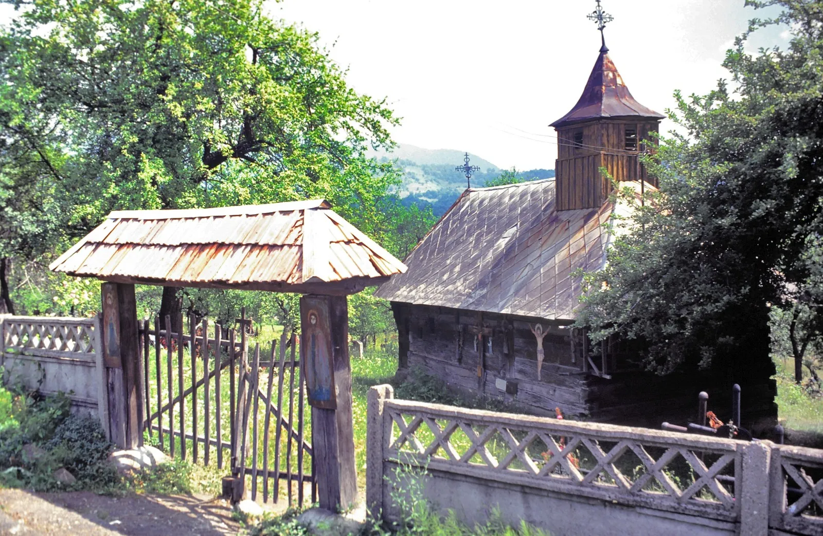
A UNESCO timber masterpiece of Transylvanian wooden Gothic: raised in 1721 with a 54-meter spire and a double-eaved shingle roof designed to withstand earthquakes.

Dedicated to the Archangels Michael and Gabriel, it stood for centuries as the world's tallest oak construction. The tower's timber frame weathered severe earthquakes and winds for over 300 years, housing 1783 interior frescoes painted on linen canvas glued to logs.

Visitor guide

Open for visitors in Șurdești village (Șișești commune). Guided access is provided by the local custodian on site.

Architecture 47.5972°N, 23.7639°E
#56

Poienile Izei Wooden Church

Maramureș · Maramureș

A 1604 UNESCO church preserving vivid post-Byzantine Last Judgment frescoes: grotesque demons torturing sinners for specific village vices.

Painted in 1794 by iconographer Radu Munteanu, the vestibule walls depict vivid apocalyptic scenes: the dishonest miller is crushed under millstones turned by horned devils, the liar is hanged by his tongue, and the witch is scourged by demons.

Visitor guide

Open for visitors in Poienile Izei village. The historic church remains an active house of worship; tours are arranged with parish guardians.

Architecture 47.6989°N, 24.1136°E
#57

Dârjiu Fortified Church (The Lard Fortress)

Harghita · Transylvania

A unique UNESCO fortress church where the village's smoked lard and grain are kept in medieval bastions, accessed strictly on Wednesday mornings.

The local community has preserved this communal storage custom unbroken since the Middle Ages: each family's smoked bacon hangs on personal numbered pegs inside defensive bastion towers. The church also holds rare 1419 wall frescoes depicting the Legend of Saint Ladislaus.

Visitor guide

Open daily for heritage visits. The traditional lard-cutting ritual may be observed on Wednesday mornings at 7:00 AM when the church bell tolls.

Architecture 46.2028°N, 25.1986°E
#58

Saint Nicholas Church of Densuș

Hunedoara · Transylvania

Romania's most enigmatic medieval stone church: raised in the 13th century entirely from repurposed Roman pagan altars, columns, and gravestones.

Erected from marble blocks, sewer conduits, and carved pagan gravestones hauled from the nearby Roman capital Ulpia Traiana Sarmizegetusa. Four central interior pillars consist of inverted Roman altar pedestals, and a 15th-century fresco depicts Christ wearing traditional Romanian peasant dress.

Visitor guide

Open to visitors in Densuș village near Hațeg. A Grade A historic monument with regular liturgy and on-site heritage reception.

Architecture 45.5806°N, 22.8056°E
#59

Watermills of Rudăria (Eftimie Murgu)

Caraș-Severin · Banat

The largest historic watermill complex in Southeastern Europe: 22 wooden mills with horizontal flutter wheels still grinding flour along the Rudărica gorge.

Scattered over 3 kilometers along the wild Rudărica gorge, these 18th-century timber mills operate via horizontal carved spoon-wheels driven directly by channeled water jets. They are owned communally by ancestral family clans who take turns grinding maize and wheat.

Visitor guide

Easily reached along paved road in Eftimie Murgu village. Visitors can watch stone-ground milling in action and buy fresh cornmeal from local millers.

Architecture 44.9014°N, 22.0986°E
#60

Prejmer Fortified Church (The 272-Room Citadel)

Brașov · Transylvania

Europe's most formidable peasant refuge fortress: a 5-meter-thick circular curtain wall holding 272 family refuge chambers on 4 tiers, armed with 'The Death Organ'.

Begun by the Teutonic Knights in 1218 and completed by Transylvanian Saxons, Prejmer survived over 50 sieges without falling to direct assault. Inside the 14-meter-tall curtain wall, 272 wooden cell-rooms provided designated emergency quarters for every village household.

Visitor guide

Open daily as a UNESCO monument. Visitors can climb into the multi-tiered family cell rooms, walk the crenelated battlement galleries, and view the multi-barrel firearm mechanism.

Architecture 45.7219°N, 25.7739°E
#61

Corbii de Piatră Rupestral Monastery

Argeș · Muntenia

A 14th-century rock-hewn monastery carved entirely inside a 30-meter vertical sandstone cliff, unique for having two functional altars inside a single nave.

First formally chartered in 1512 by Prince Neagoe Basarab, the church was carved out of an ancient prehistoric sandstone cave. It features twin functional altars side by side within a single nave, a design anomaly in Orthodox architecture, along with Wallachia's oldest surviving mural frescoes.

Visitor guide

Open daily in Jgheaburi village (Corbi commune). The nearby 'Mama Uța' traditional blue timber cottage can also be visited.

Architecture 45.2719°N, 24.8167°E
#62

Cetățuia Negru Vodă Cliffside Hermitage

Argeș · Muntenia

'The Meteora of Romania': a cliff-perched hermitage standing on an 881-meter conglomerate pinnacle above the Dâmbovița valley, reached via a penitential forest path.

The cave sanctuary dates to the 13th century and is traditionally associated with founder Negru Vodă. Perched high on a razor conglomerate ridge, it features a cave church, the dramatic Summit Cross of Wishes overlooking the gorge, and hermit cells carved into the cliffs.

Visitor guide

Accessible off national road DN72A in Cetățeni village. A steep, scenic 45-minute pilgrimage climb through beech woods with stone steps and handrails.

Architecture 45.2189°N, 25.1839°E
#63

Șinca Veche Cave Monastery (The Wishing Temple)

Brașov · Transylvania

An underground cavern church hollowed into sandstone with a chimney open to the sky, blending mysterious pre-Christian motifs with early Christian altars.

Carved into soft sandstone on Pleșu Hill, its origins remain a subject of active historical debate (dating from Dacian sacred sanctuaries to medieval orthodox refuges). The nave ceiling opens into a 10-meter natural rock chimney admitting direct sunlight onto carved altar niches.

Visitor guide

Open daily on the edge of Șinca Veche village near Făgăraș. Features landscaped stone approach paths, a botanical garden, and a modern convent.

Architecture 45.7486°N, 25.1611°E
#64

Murfatlar Chalk Cave Monastery

Constanța · Dobruja

A 9th–11th century monastic complex carved into a chalk cliff: chapels incised with Viking runes, Glagolitic and Cyrillic script, and horse petroglyphs.

Unearthed in 1957 in a chalk quarry near Murfatlar, the complex holds six rock-cut chapels, cells, and catacombs hollowed out of chalk cliffs. The soft stone walls preserve over 200 archaic graffiti and petroglyphs, including Viking runic markings, dragons, and multi-lingual inscriptions.

Visitor guide

Enclosed in a protective shelter due to chalk friability. Visits require advance booking through the National History and Archaeology Museum in Constanța.

Architecture 44.1756°N, 28.4089°E
#65

Alun Marble Village & Church

Hunedoara · Transylvania

A village in Ținutul Pădurenilor where the main roadway, cottage foundations, and unique church are constructed entirely of raw white marble.

Perched on a mountain plateau in the Pădureni region, Alun sits above historic marble deposits worked since antiquity. Villagers paved several kilometers of the mountain road with thick marble slabs, and erected an extraordinary church built entirely of hand-chiseled white marble.

Visitor guide

Now nearly deserted (under 5 residents), offering an atmospheric ghost village ambiance. Reached via unpaved mountain roads from Ghelari (high clearance vehicle advised).

Architecture 45.7167°N, 22.7500°E
#66

Ineleț & Scărișoara Cliff-Ladder Hamlets

Caraș-Severin · Banat

Isolated Carpathian hamlets perched on limestone cliffs, accessible exclusively by climbing near-vertical wooden ladders bolted to sheer rock faces.

Perched above 800 m in the Cerna Mountains, Ineleț and Scărișoara remain completely disconnected from the road network. The primary access route from the valley crosses a vertical limestone cliff via four consecutive hand-made acacia ladders bolted into the bedrock.

Visitor guide

Trailhead starts on national road DN67D (20 km from Băile Herculane), crossing a suspension footbridge over the Cerna river. A 1.5-hour hike; not suitable for those with acrophobia.

Architecture 44.9722°N, 22.3956°E
#67

Geamăna Submerged Village

Alba · Crișana and Apuseni

An apocalyptic landscape where an entire 400-home village was drowned under mining tailings: only a lonely church steeple protrudes above turquoise and orange sludge.

In 1977, the village of Geamăna was condemned to make way for the tailings reservoir of the Roșia Poieni copper pit. Over decades, millions of tons of heavy metal sludge submerged orchards, homes, and the cemetery, leaving only the church steeple emerging above acidic waters.

Visitor guide

Reached via an unpaved mountain road from Lupșa commune in the Apuseni range. Walking directly onto the mud banks is dangerous and strictly prohibited.

Architecture 46.3314°N, 23.2089°E
#68

Măldărești Fortified Tower-Houses (Culele)

Vâlcea · Oltenia

Semi-feudal boyar fortified tower houses unique to Wallachia: thick defensive masonry, musket loopholes, drawbridge trapdoors, and top-floor arcaded loggias.

Built in the 18th and 19th centuries to shield regional Wallachian nobility from Ottoman raiders and brigands. Cula Greceanu is the oldest intact survivor, featuring whitewashed defense walls, musket ports, trapdoors, and exquisite Brâncovenesc-style arcaded open loggias.

Visitor guide

Museum complex open Tuesday through Sunday in Măldărești (4 km from Horezu). Includes Cula Greceanu, Cula Duca, and the historic I.G. Duca residence.

Architecture 45.1219°N, 24.0042°E
#69

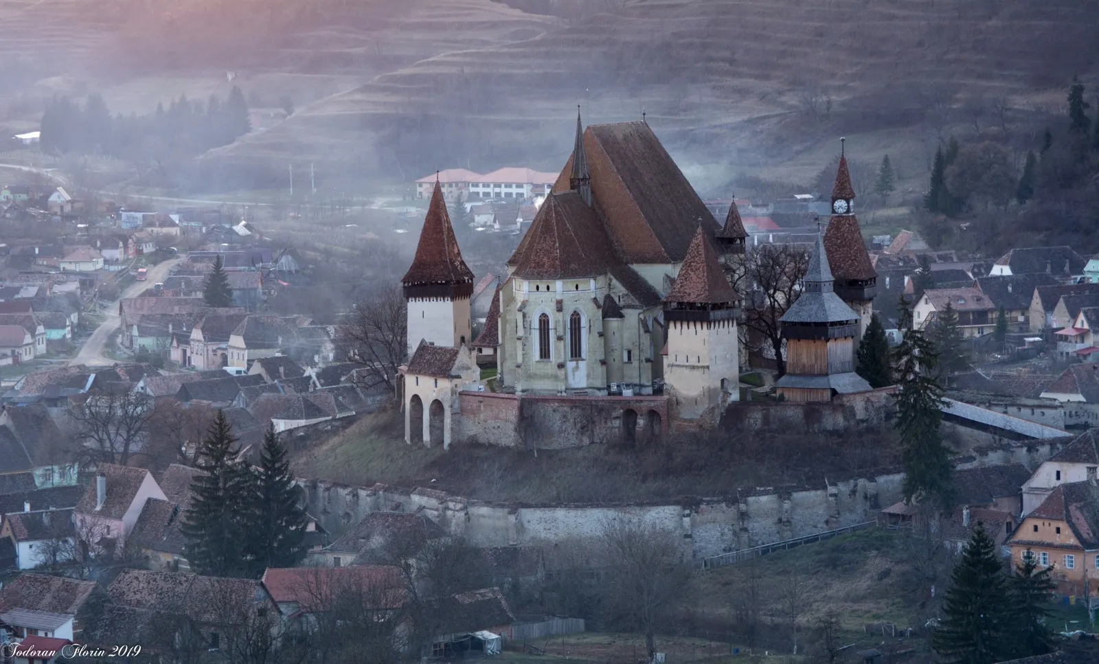
Matrimonial Prison of Biertan Fortress

Sibiu · Transylvania
Matrimonial Prison of Biertan Fortress
Matrimonial Prison of Biertan Fortress — Sibiu. Source: Wikimedia Commons / Andrei Dragos, CC BY-SA 4.0

The medieval tower room where Saxon couples seeking divorce were locked together for weeks with a single spoon, one plate, and one single bed.

In the Saxon bishopric citadel of Biertan (a UNESCO World Heritage Site), spouses seeking divorce were locked in a small bastion room to reconcile before separation was granted. Over three centuries of village records, only one couple proceeded with divorce.

Visitor guide

Open daily inside the Biertan fortress church complex. Visitors can view the matrimonial prison cell, the winged polyptych altarpiece, and the 19-bolt sacristy lock door.

Architecture 46.1356°N, 24.5219°E
#70

Dintr-un Lemn Monastery (The Single-Oak Church)

Vâlcea · Oltenia

A 16th-century timber church raised entirely from the wood of a single colossal ancient oak tree, housing a revered miraculous icon of the Virgin Mary.

Documented in 1653 by Syrian traveler Paul of Aleppo, legend recounts that a monk discovered an icon inside a hollow ancient oak and built the chapel entirely from that felled giant. Measuring 13 by 5 meters, the church stands surrounded by surviving monumental centuries-old oak groves.

Visitor guide

Open daily in Frâncești commune (Vâlcea county). The complex features the original oak church, a 17th-century masonry church, and a park of ancient oaks.

Architecture 45.0319°N, 24.1839°E

Hidden fortresses, megalithic mysteries and titan engineering

At Sarmizegetusa you walk on the andesite of the Dacian calendar. At Cernavodă you cross the bridge Saligny tested by sitting in a boat beneath it while 15 locomotives passed overhead. Between Oravița and Anina the train still climbs at 20 kilometres an hour through 14 tunnels cut by chisel. Sixteen traces of ambition.

#72

Costești-Blidaru Dacian Fortress

Hunedoara · Transylvania

The most sophisticated defensive fortress of the Dacians: double-faced limestone block walls (*murus dacicus*), casemates, and a vaulted water cistern.

Perched on a 705-meter plateau, Blidaru integrated Hellenistic fortification engineering to withstand Roman siege machinery. Its vaulted subterranean cistern, fed via ceramic pipelines from distant mountain springs, survived intact with its masonry arches unbroken.

Visitor guide

Pedestrian access via a marked mountain trail from Costești village (a 1-hour moderate forest climb). Site entry is open to the public.

History and engineering 45.6667°N, 23.1611°E
#73

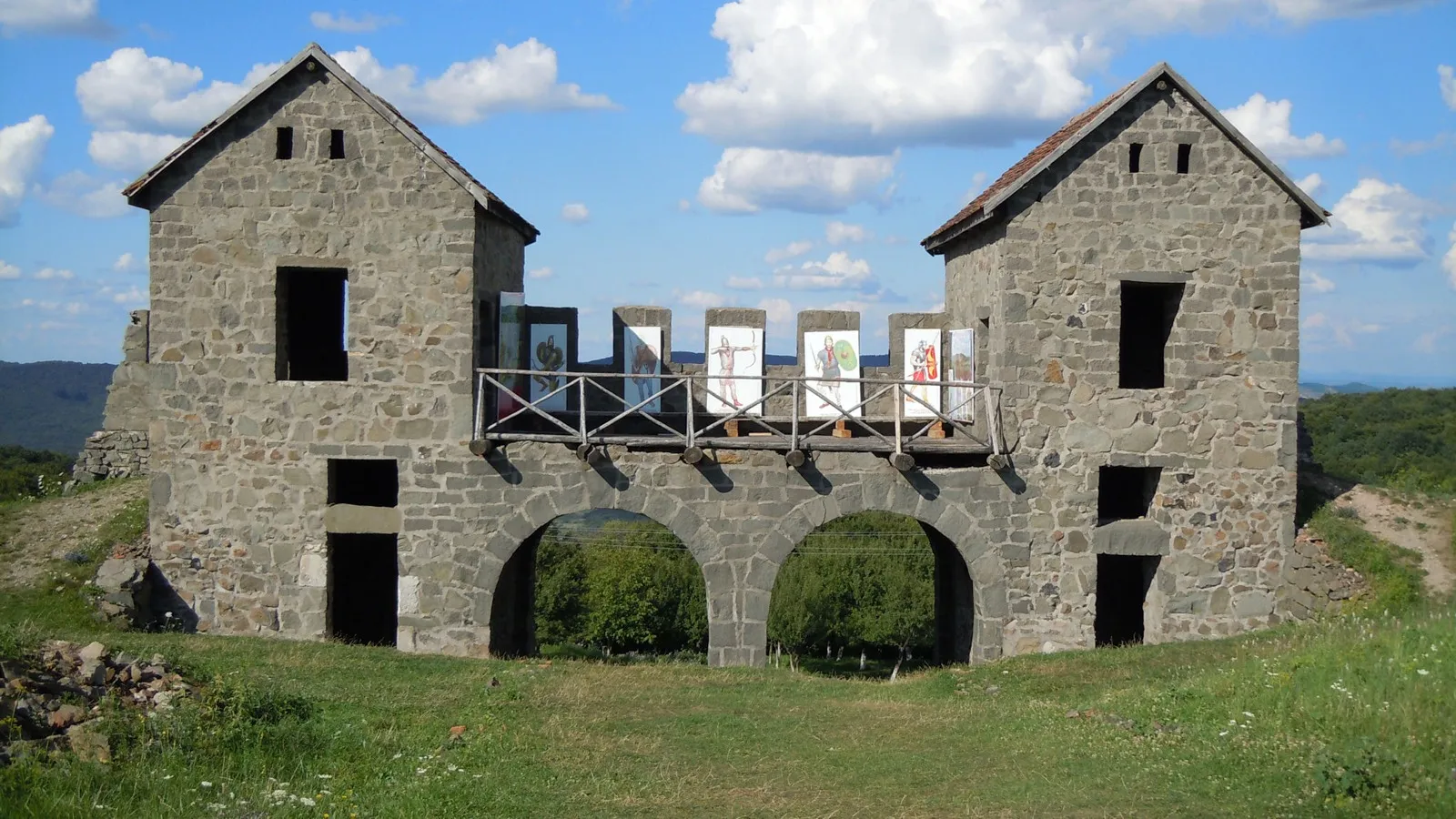
Porolissum Roman Fort & Praetorian Gate

Sălaj · Transylvania

The northernmost fortified military stronghold of the Roman Empire in Dacia, featuring the monumental reconstructed Praetorian Gate and stone amphitheater.

Founded in 106 AD by Emperor Trajan to secure the Meseș mountain pass against barbarian incursions. The archaeological park spans tens of hectares, boasting a legionary stone fortress with reconstructed gates, baths, a 5,000-seat amphitheater, and imperial customs posts.

Visitor guide

Open-air archaeological park open daily in Moigrad-Porolissum near Zalău. Equipped with walking paths and an on-site interpretive museum center.

History and engineering 47.1786°N, 23.1569°E
#74

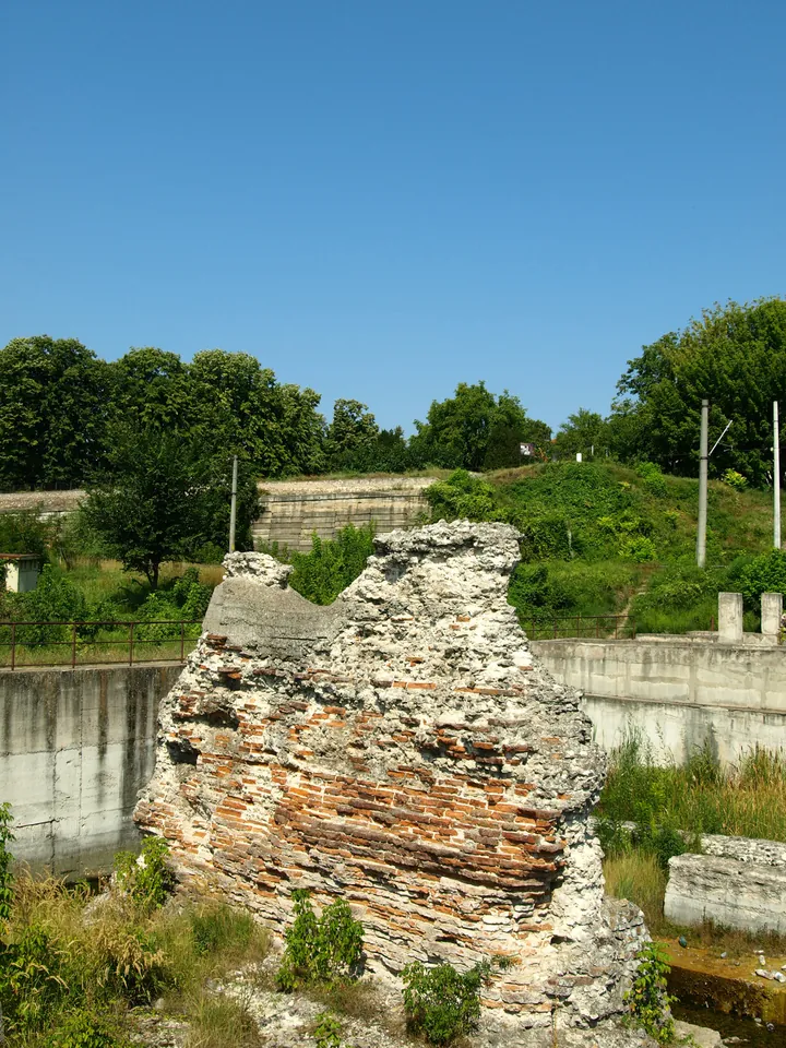
Trajan's Bridge Remains at Drobeta

Mehedinți · Oltenia
Trajan's Bridge Remains at Drobeta
Trajan's Bridge Remains at Drobeta — Mehedinți. Source: Wikimedia Commons / Mircea83, CC BY-SA 3.0

The monumental pier ruins of the Danube bridge built by Apollodorus of Damascus in 105 AD (1,135 m long), the ancient world's longest stone-pier bridge.

Erected in just two years across the Danube to funnel Trajan's legions into Dacia, it was hailed as a wonder of ancient civil engineering: 20 massive masonry piers sunk using pozzolanic underwater cement, spanned by monumental wooden arches leaping 38 meters each.

Visitor guide

The surviving northern bank pier is preserved inside the Iron Gates Region Museum grounds in Drobeta-Turnu Severin, alongside the excavated Roman garrison fort.

History and engineering 44.6247°N, 22.6672°E
#75

Roșia Montană Roman Gold Galleries

Alba · Crișana and Apuseni

Over 7 km of 2nd-century Roman underground gold galleries cut with pickaxes into volcanic dacite, where celebrated Roman wax tablets were uncovered.

Inscribed on the UNESCO World Heritage List, Alburnus Maior preserves the most extensive ancient underground gold mining network known in the Roman world. Galleries feature precise trapezoidal profiles, carved steps, and hydraulic drainage water-wheel chambers.

Visitor guide

The Gold Mining Museum in Roșia Montană offers guided descents into authentic 2nd-century Roman underground galleries in Cârnic Massif (157 stairs).

History and engineering 46.3056°N, 23.1289°E
#76

Transfăgărășan Alpine Highway & Lake Bâlea

Sibiu · Transylvania

Legendary high-altitude highway blasting through the Făgăraș Alps at 2,042 m, featuring 28 viaducts and Romania's longest road tunnel (884 m).

Engineered between 1970 and 1974 as a strategic military road across the Făgăraș massif, requiring millions of tons of blasted rock. The Bâlea Tunnel pierces the main crest at 2,042 meters, connecting Wallachia and Transylvania beside the glacial tarn Bâlea.

Visitor guide

Open to road vehicles between Bâlea Waterfall and Piscu Negru from late June to late October. During winter snow closure, Lake Bâlea is reachable via cable car.

History and engineering 45.6044°N, 24.6167°E
#77

Transalpina Highway (DN67C) — Urdele Pass

Gorj · Oltenia

The highest paved road in Romania and across the entire Carpathian mountain range, summiting at 2,145 meters in the windswept Urdele Pass.

Known historically as the Devil's Path or King's Road, this transhumance shepherd route was inaugurated in the 1930s by King Carol II. Paved modernly, it sweeps across the high alpine crests of the Parâng range, climbing far above the timberline.

Visitor guide

Open to motor vehicles during warm months (typically June through October), spanning 148 scenic kilometers between Novaci (Gorj) and Sebeș (Alba).

History and engineering 45.3486°N, 23.6556°E
#78

Oravița–Anina Mountain Railway ('Banat Semmering')

Caraș-Severin · Banat

Romania's oldest mountain railway (opened in 1863): 14 tunnels and 10 stone viaducts hand-hewn into karst rock over a 338-meter climb, active today.

Engineered to transport coal from Anina mines to Danube steam barges, the 33-km route climbs through dramatic limestone canyons. The Gârliște Tunnel (660 m long) was bored by hand with chisels and hammers. The vintage passenger train still runs daily at an average speed of 20 km/h.

Visitor guide

Active daily passenger service operated by CFR with vintage cars featuring original wooden bench seating between Oravița and Anina stations.

History and engineering 45.0389°N, 21.7167°E
#79

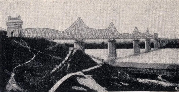
Anghel Saligny Bridge at Cernavodă

Constanța · Dobruja
Anghel Saligny Bridge at Cernavodă
Anghel Saligny Bridge at Cernavodă — Constanța. Source: Wikimedia Commons / Cezar Suceveanu, CC BY-SA 3.0

Europe's longest bridge complex upon completion in 1895 (4,088 m across the Danube and marshes), an engineering triumph designed by Anghel Saligny.

Connecting mainland Romania to the Black Sea coast at Constanța, the bridge was built using pioneering cantilever steel truss spans and novel Siemens-Martin steel. During initial load testing, engineer Anghel Saligny famously positioned his boat beneath the central span as 15 heavy steam locomotives crossed simultaneously.

Visitor guide

An industrial heritage monument visible from national road DN22C and the Danube waterfront in Cernavodă, guarded by monumental bronze infantrymen statues by French sculptor Léon Pilet.

History and engineering 44.3389°N, 28.0236°E
#80

Corvin Castle (Hunyadi Castle)

Hunedoara · Transylvania

One of the largest and most authentic Gothic chivalric castles in Europe: drawbridge suspended over a river chasm, Knights' Hall, and Capistrano Tower.

Raised in the 15th century by John Hunyadi on a rocky promontory above the Zlaști river, it blends flamboyant Gothic fortification with Renaissance palace additions. It features the Knights' Hall with ribbed cross-vaults on octagonal marble piers and a 30-meter well hewn into solid rock.

Visitor guide

Open daily in Hunedoara. Access is across the iconic wooden bridge spanning the river gorge on tall stone piers.

History and engineering 45.7494°N, 22.8883°E
#81

Poenari Citadel (The True Eyrie of Vlad the Impaler)

Argeș · Muntenia

The authentic mountain stronghold of Vlad the Impaler, perched atop an 850-meter razor cliff reached by climbing 1,480 concrete steps through the forest.

Unlike Bran Castle, Poenari was directly rebuilt and garrisoned by Vlad the Impaler in the 15th century as a mountain redoubt. Anchored into the precipitous rock above the Argeș river canyon, its walls provided an impregnable vantage point controlling the mountain pass.

Visitor guide

Accessible off the Transfăgărășan (DN7C) near Vidraru Dam. Reached via 1,480 concrete steps through dense woods equipped with safety railings.

History and engineering 45.3539°N, 24.6356°E
#82

Alba Carolina Vauban Star Fortress

Alba · Transylvania

Romania's largest Vauban star fortress (110 hectares), boasting 7 pointed bastions, monumental baroque gates, and three superimposed historical defensive strata.

Engineered between 1715 and 1738 under Habsburg Emperor Charles VI, the fortress spans a 7-pointed star layout with brick curtains and deep dry moats. The ground encompasses two millennia of military architecture: the Roman Legio XIII Gemina camp, medieval Bălgrad, and the baroque bastion complex.

Visitor guide

Fully restored and pedestrianized, open year-round. Features daily ceremonial changing of the guard in historic 18th-century Austrian uniforms with artillery salutes.

History and engineering 45.0686°N, 23.5714°E
#83

Mărășești WWI Battle Mausoleum

Vrancea · Moldavia and Bukovina

Colossal stone battle monument honoring the decisive 1917 WWI defense ('They shall not pass'), holding the crypts of 5,073 soldiers and the Chapel of Glory.

Constructed from Deva andesite stone between 1923 and 1938, designed by George Cristinel and Constantin Pomponiu. Reaching 30 meters high, the rotunda holds 154 individual burial crypts, 9 communal ossuaries, General Eremia Grigorescu's tomb, and monumental stone friezes.

Visitor guide

Open Tuesday through Sunday along European route E85 north of Focșani. Admission includes the subterranean crypts, upper chapel, and WWI military museum.

History and engineering 45.8719°N, 27.2089°E
#84

Constanța Sea Casino (Art Nouveau Landmark)

Constanța · Dobruja

A maritime Art Nouveau masterpiece designed by Daniel Renard on the Black Sea cliff, with seashell-arched windows and nautical stained glass.

Inaugurated in 1910 in the presence of King Carol I, the casino was built on an artificial terrace jutting into the Black Sea, requiring breakwater stone foundations. Its undulating facade is adorned with maritime motifs—dolphins, rams' heads, scallop-shell bays, and floral ironwork.

Visitor guide

Fully restored to its original splendor. The waterfront promenade is open 24/7, while the opulent interior hosts cultural exhibits and public tours.

History and engineering 44.1706°N, 28.6636°E
#85

Heroes' Cross on Caraiman Peak

Prahova · Muntenia

The tallest summit cross in the world located above 2,200 meters (Guinness World Records: 39.3 m high), perched on the rim of the Bucegi abyss.

Erected between 1926 and 1928 by Queen Marie and King Ferdinand to honor fallen WWI soldiers. The monumental lattice steel structure was hot-riveted on site, every steel beam hauled up steep bridle paths by ox carts, pack mules, and primitive funiculars.

Visitor guide

Accessible from Bușteni via the Babele cable car, followed by an easy 1-hour plateau hike (red cross marker). Illuminated by night, visible across the Prahova Valley.

History and engineering 45.4161°N, 25.4975°E
#86

Danube–Black Sea Canal & Straja Monument

Constanța · Dobruja

A 64-km shipping canal cut through Dobruja's limestone (300 million m³ of earth and rock blasted), guarded by the 38-meter Straja steel angel colossus.

Inaugurated in 1984, the canal shortens the shipping route to the Black Sea by 400 kilometers, requiring earth-moving volumes surpassing the Suez and Panama canals. Overlooking the channel at Straja stands the 38-meter stainless steel Youth Monument winged colossus.

Visitor guide

The giant navigation locks at Cernavodă and Agigea are visible from highway crossings. The Straja monument can be visited along the canal service road.

History and engineering 44.1139°N, 28.4361°E

Singular relics, unique collections and memory

At Târgu Jiu 15 brass-clad cast-iron modules climb skywards without end. At Voroneț the blue has held for almost 500 years. At Alba Iulia a gospel book from the 800s is written in gold on purple vellum, and at Brad a gold lizard sits exactly as it came out of the mine. Fourteen objects and places of memory.

#87

Brâncuși Sculptural Ensemble at Târgu Jiu

Gorj · Oltenia
Brâncuși Sculptural Ensemble at Târgu Jiu
Brâncuși Sculptural Ensemble at Târgu Jiu — Gorj. Source: Wikimedia Commons / Horia Vârlan, CC BY 2.0

The only monumental open-air public ensemble created by Constantin Brâncuși: The Table of Silence, The Gate of the Kiss, and Endless Column (29.3 m).

Inscribed on the UNESCO World Heritage List in 2024, this 1.5-kilometer spiritual axis crosses Târgu Jiu from the Jiu riverbank to the eastern park. The Endless Column consists of 15 brass-clad cast iron rhomboidal modules and two half-modules, symbolizing an endless ladder to the heavens.

Visitor guide

Free, unrestricted access 24/7 across Târgu Jiu's municipal parks: Central Park (Table of Silence & Gate of the Kiss) and Column Park (Endless Column).

Relics and memory 45.0378°N, 23.2856°E
#89

Sucevița Monastery (The Ladder of Virtues)

Suceava · Moldavia and Bukovina
Sucevița Monastery (The Ladder of Virtues)
Sucevița Monastery (The Ladder of Virtues) — Suceava. Source: Wikimedia Commons / Cezar Suceveanu, CC BY-SA 3.0

The best-preserved painted monastery in Bukovina, wrapped in formidable castle ramparts and the monumental 'Ladder of Virtues' exterior fresco.

Erected at the close of the 16th century by the Movilă boyar dynasty, Sucevița was the last Bukovinian monastery painted externally. Its northern facade displays the monumental Ladder of Virtues: 30 rungs climbed by righteous souls while demons drag faltering sinners into the abyss.

Visitor guide

Open daily in Sucevița village. The monastery museum displays rare gold-thread embroidered liturgical tapestries and 16th-century illuminated manuscripts.

Relics and memory 47.7783°N, 25.7125°E
#90

Monastery of the Three Holy Hierarchs (Iași)

Iași · Moldavia and Bukovina

A 1639 stone lace marvel whose exterior facades are completely covered in over 30 distinct carved geometric friezes without a single inch of bare masonry.

Built by Prince Vasile Lupu, the church is celebrated worldwide for its exterior stone lace envelope carved from limestone blocks. It seamlessly weaves Gothic tracery, Byzantine palmettes, Persian rosettes, and Caucasian geometric bands, originally gilded in gold leaf.

Visitor guide

Open daily along Ștefan cel Mare Boulevard in central Iași. Houses the royal crypts of Prince Vasile Lupu, scholar Dimitrie Cantemir, and union founder Alexandru Ioan Cuza.

Relics and memory 47.1647°N, 27.5856°E
#91

Curtea de Argeș Cathedral & Royal Necropolis

Argeș · Muntenia

A 1517 architectural masterpiece of Prince Neagoe Basarab and royal necropolis of Romania, famous for its spiraling fluted cupolas and stone filigree.

Enshrined in folklore through the legend of Master Manole, the cathedral was consecrated in 1517 before the Ecumenical Patriarch of Constantinople. The twin smaller cupolas twist in opposing rotational spirals, accented by carved limestone ropes and Moorish rosettes.

Visitor guide

Open daily in Curtea de Argeș. Serves as the burial resting place of Romanian monarchs Carol I, Ferdinand I, and Michael I, alongside Queens Elisabeth and Marie.

Relics and memory 45.1567°N, 24.6756°E
#92

Batthyányeum Library & Codex Aureus

Alba · Transylvania

Romania's most precious manuscript archive: holding the *Codex Aureus* (8th-century Carolingian Gospel penned in gold ink on purple vellum) and an intact 1792 observatory.

Founded in 1798 by Bishop Ignác Batthyány within a former Trinitarian monastery, the library preserves over 1,650 incunabula. Its crowning treasure is the primary volume of the Lorsch Gospels (*Codex Aureus*), scripted in pure liquid gold on imperial purple-stained vellum for Charlemagne.

Visitor guide

A high-security heritage institution operated by the National Library of Romania. Public admissions take place via scheduled educational tours and heritage open days.

Relics and memory 45.0672°N, 23.5739°E
#93

The Gold Museum of Brad

Hunedoara · Transylvania

Europe's only native gold museum and one of three globally: over 1,300 specimens of unrefined gold naturally crystallized into leaves, feathers, trees, and lizards.

Established in 1896 at the Barza mine in the Apuseni Gold Quadrilateral. The collection features raw, unrefined native gold nuggets crystallized into astonishing natural sculptures—including a golden 'lizard' worth millions, a golden 'map of Romania', and rare telluride crystals.

Visitor guide

Open Tuesday through Sunday in downtown Brad. Admission includes access to specialized geological exhibits and historic mining tool galleries.

Relics and memory 46.1289°N, 22.7889°E
#94

The Amber Museum of Colți

Buzău · Muntenia

Romania's only amber museum: showcasing rumanite (Buzău amber renowned for deep ruby to fluorescent green tones) and a record 3.45-kg amber nugget.

Colți village is internationally renowned for 'rumanite', a rare fossil amber formed from Tertiary conifer resin 40–60 million years ago. Rumanite is prized for its high UV fluorescence and unmatched palette of over 160 color variations, spanning translucent cognac, deep ruby, and emerald-green.

Visitor guide

Modernized museum open Wednesday through Sunday in Colți village. Reached via scenic mountain road DJ102F off highway DN10 from Pătârlagele.

Relics and memory 45.3856°N, 26.3889°E
#95

Iulia Hasdeu Spiritist Castle (Câmpina)

Prahova · Muntenia

'The Spiritist Temple' designed by polymath Bogdan Petriceicu Hasdeu following mediumistic séances with his genius daughter who died at age 19.

Constructed between 1893 and 1896 following the tragic loss of prodigy poet Iulia Hasdeu (the first Romanian woman enrolled at the Sorbonne). Built according to automatic writing transcripts, the architecture revolves around symbolic numbers 3 and 7: three stone crenelated towers, 7 steps per flight, a séance darkroom, and Casciani's life-sized Christ statue.

Visitor guide

Open Tuesday through Sunday in Câmpina. Exhibits include Iulia's original manuscripts, her piano, parallel alignment mirrors, and the intact séance chamber.

Relics and memory 45.1292°N, 25.7289°E
#96

Sighet Memorial Museum of Communism Victims

Maramureș · Maramureș

The former Stalinist prison where Romania's pre-communist leadership was systematically starved, now the world's first museum memorializing victims of communism.

Founded in 1993 by writers Ana Blandiana and Romulus Rusan within the grim walls of Sighet prison. Here, interwar prime ministers (Iuliu Maniu), historians (Gheorghe Brătianu), and underground resistance fighters were imprisoned and starved. Every prison cell is now a documentary exhibition room.

Visitor guide

Open daily in Sighetu Marmației. Highlights include the punishment cells, the 'Cortège of the Sacrificed' bronze statues in the courtyard, and the Poor People's Cemetery.

Relics and memory 47.9281°N, 23.8906°E
#97

Pitești Prison Memorial ('The Pitești Experiment')

Argeș · Muntenia

Site of the most harrowing brainwashing and torture experiment in the Soviet bloc (1949–1952), where prisoners were coerced into becoming their comrades' torturers.

Described by historian François Furet as 'one of the most terrible dehumanization experiments of the 20th century'. Dissident students endured unrelenting physical torture and psychological dismantling until forced to renounce their families, faiths, and to actively torture fellow prisoners.

Visitor guide

Open Thursday through Sunday in Pitești. Guided educational tours lead visitors through authentic cells, interrogation chambers, and the commemorative chapel.

Relics and memory 44.8611°N, 24.8739°E
#98

Constanța Roman Mosaic Edifice

Constanța · Dobruja

A 4th-century AD Roman commercial port complex preserving over 850 m² of original polychrome geometric mosaic pavement, one of the largest in the Mediterranean.

Discovered in 1959 below Ovidiu Square, the structure connected the upper city of ancient Tomis to its harbor quays. The surviving 850 m² mosaic carpet incorporates polychrome marble and ceramic tesserae depicting meanders, ivy ribbons, and wave crests atop 11 vaulted Roman vaulted storage crypts.

Visitor guide

Enclosed museum pavilion situated in Ovidiu Square, Constanța. Open Wednesday through Sunday with elevated catwalks suspended over the intact Roman floor.

Relics and memory 44.1736°N, 28.6586°E
#99

Valea Vaserului Steam Forestry Railway (Mocănița)

Maramureș · Maramureș

Europe's last functioning steam-powered narrow-gauge forestry railway: snaking 60 km along a roadless river canyon into the wild Maramureș Mountains.

Built in 1932 on a 760-mm narrow gauge along the roadless Vaser canyon, this railway operates continuously for both timber haulage and passenger journeys. Authentic steam locomotives burn firewood and draw water directly from mountain streams along the route.

Visitor guide

Passenger excursions depart daily from Vișeu de Sus station between spring and autumn and over holidays. Standard tourist runs travel 21.6 km to Paltin station.

Relics and memory 47.7139°N, 24.4444°E
#100

Sulina Old Lighthouse & Cosmopolitan Maritime Cemetery

Tulcea · Dobruja

Headquarters of Europe's first supranational institution (European Commission of the Danube, 1856) and a unique cosmopolitan cemetery where pirates and princesses lie side by side.

In the 19th century, Sulina operated as an extraterritorial free port ('Europolis') administered by the European Commission of the Danube. The 1870 lighthouse preserves historical maritime artifacts. Its Maritime Cemetery is extraordinary: hosting Christian, Muslim, and Jewish tombs of pirates, admirals, and princesses from 20 nations.

Visitor guide

Sulina is reachable exclusively by passenger boat from Tulcea. The Old Lighthouse functions as a museum; the Maritime Cemetery lies 1.5 km west toward the beach.

Relics and memory 45.1558°N, 29.6639°E

Routes

Three roads through the atlas

Each road links places from the records below, in the order you meet them on the ground.

Apuseni: three days below ground and above it

You start in the Turda salt mine and climb towards the Padiș plateau, through gorges, underground glaciers and a cave with Neanderthal footprints.

Day 1 — Salt and gorges

  1. Turda Salt Mine — You descend 120 metres to the lake with an island in the Terezia chamber.
  2. Turda Gorges (Cheile Turzii) — Alpine relicts grow on one wall of the canyon, steppe plants on the other.

Day 2 — Millennia-old ice

  1. Scărișoara Ice Cave — The 100,000-cubic-metre ice block is seen from the platform above the shaft.
  2. Focul Viu Ice Cave — At noon the sun enters through the shaft and lights up the ice columns.
  3. Vârtop Cave (The Marvelous Cave) — The petrified 62,000-year-old footprints of a Neanderthal youth were found here.

Day 3 — The portal and the bones

  1. Cetățile Ponorului Karst Complex — The 76-metre portal is the tallest in Romania; the river runs through a 2-kilometre gallery.
  2. Bears' Cave — The Bone Gallery keeps over 140 complete skeletons, untouched since the Pleistocene.

Dobruja: from the poisoned cave to the delta

You begin at Mangalia, where an entire world lives without sun, and end among the delta's sand dunes, between 500-year-old oaks.

Day 1 — The deep coast

  1. Movile Cave — The interior is a strict scientific reserve; visitors see the Constanța exhibition and the surface site.
  2. Murfatlar Chalk Cave Monastery — Churches from the 9th–11th centuries cut into chalk and covered with runes and horsemen.
  3. Constanța Roman Mosaic Edifice — Over 850 square metres of original Roman mosaic, 100 metres long.

Day 2 — Salt and old stone

  1. Lake Techirghiol & Living Sapropelic Mud — The water is so dense the body floats effortlessly; black mud forms on the bottom.
  2. Cheile Dobrogei & Jurassic Fossil Coral Atolls — Jurassic coral atolls, 180 million years old, with Palaeolithic caves.

Day 3 — The delta

  1. Letea Subtropical Forest — The country's oldest reserve: centuries-old oaks entwined with lianas on sand dunes.
  2. Caraorman Forest — The Kneeling Oak drove its branches into the ground and rooted again.
  3. Sulina Old Lighthouse & Cosmopolitan Maritime Cemetery — The 1870 lighthouse and the cemetery where sailors from 20 nations rest side by side.

Maramureș and Bukovina: timber and colour

Three days among the tallest wooden churches in the world and the bluest painted walls in Europe.

Day 1 — Săpânța

  1. The Merry Cemetery of Săpânța — Over 800 painted crosses tell each person's trade and death in verse.
  2. Săpânța-Peri Wooden Monastery — The 78-metre spire is raised only with dovetail joints and wooden nails.

Day 2 — Old timber

  1. Șurdești Wooden Church (UNESCO) — The 54-metre tower, from 1721, has withstood earthquakes for over 300 years.
  2. Poienile Izei Wooden Church — The 1794 frescoes punish sinners with penalties tailored to village life.
  3. Valea Vaserului Steam Forestry Railway (Mocănița) — Europe's last working steam forestry railway climbs 60 kilometres up the Vaser valley.

Day 3 — The blue of Bukovina

  1. Voroneț Monastery & The Last Judgment — The west wall, painted in full in 1547, has not a single window.
  2. Sucevița Monastery (The Ladder of Virtues) — On the north front, the Ladder of Virtues counts 30 steps to heaven.
  3. Cacica Salt Mine — A salt chapel 21 metres down, a ballroom at 37, a brine lake at 42.

Game

How many of the 100 have you ticked?

Tick the places you have reached. Your list stays saved here, between visits.

0 of 100

→
→
→
→
→
→
→
→
→
→
→
→
→
→
→
→
→
→
→
→
→
→
→
→
→
→
→
→
→
→
→
→
→
→
→
→
→
→
→
→
→
→
→
→
→
→
→
→
→
→
→
→
→
→
→
→
→
→
→
→
→
→
→
→
→
→
→
→
→
→
→
→
→
→
→
→
→
→
→
→
→
→
→
→
→
→
→
→
→
→
→
→
→
→
→
→
→
→
→
→

Myths

Five questions with verified answers

Each answer rests on the atlas records and the source ledger; where the evidence runs out, the verdict says so.

Do the trovants really grow?

Verdict: They do not grow like living things

The Costești trovants are sandstone concretions formed about 6 million years ago, as groundwater cemented the sands with calcium carbonate; the blocks reach over 4 metres. The impression that they appear after rain comes from erosion: water washes the sand away and uncovers the blocks, just as wind and rain excavated the shapes at Ulmet.

Records 29–30 (Costești, Ulmet)

Is Lake Ursu heated by a thermal spring?

Verdict: No; the sun heats it

The deep water reaches 35–40°C through a solar greenhouse effect: the thin layer of fresh water at the surface never mixes with the dense salt water below and traps the sun's heat. That is why bathing is allowed only at certain hours of the day, so the layers are not stirred.

Record 25 (Lake Ursu); SOURCES.md, Lake Ursu

Do the mud volcanoes erupt lava?

Verdict: No; the cones are cold

The Berca cones are cold: natural gas rising from 3,000 metres down carries mud to the surface, where the air dries it into cones up to 6 metres tall. The 30 hectares stay bare of vegetation, furrowed by erosion gullies.

Record 19 (Mud Volcanoes)

Does the air in the Pucioasa cave kill instantly?

Verdict: Only below the marked line

The cave breathes out about 3,000 m³ of CO₂ and hydrogen sulphide a day; the gas, heavier than air, settles on the cave floor, and the yellow sulphur crystals mark the lethal level, the 'line of death'. The danger is real only below the line marked on the walls, which visitors must strictly respect.

Record 24 (Pucioasa cave); SOURCES.md, Pucioasa mofette

Is the Hoia-Baciu forest haunted?

Verdict: Disputed: the observations are real, the explanations are not

The oaks bend at the trunk with no clear forestry explanation, and in the Round Glade trees refuse to grow. In 1968 unusual light phenomena were photographed above the glade. Beyond these recorded observations, the forest remains a subject for documentaries, not for conclusions.

Record 39 (Hoia-Baciu)

Methodology and selection criteria

This catalog compiles exactly 100 geographic, speleological, biological, historical, and architectural sites in Romania that present scientifically documented global or European singularity. Standard commercial tourist spots without verifiable unique traits have been deliberately excluded.

Each site is accessible for public visits or via designated perimeter observation routes. Coordinates are validated against ANCPI and OpenStreetMap records, and boundary geometry uses official geoBoundaries layers (CC BY 4.0). Complete sources and claim checks are documented in the project reference ledger.

  • Speleology and karst: Romanian Academy 'Emil Racoviță' Speleological Institute.
  • Paleontology and geology: UNESCO Țara Hațegului Geopark and Romanian Academy publications.
  • Ecology and reserves: Danube Delta Biosphere Reserve Authority, Retezat, Piatra Craiului, and Cheile Nerei National Parks.
  • Architectural and archaeological heritage: National Heritage Institute (INP), Historical Monuments Register, and UNESCO World Heritage Centre.
  • Cartography: geoBoundaries ROU ADM0/ADM1, ANCPI, and OpenStreetMap 2026.